
High Above Klausen

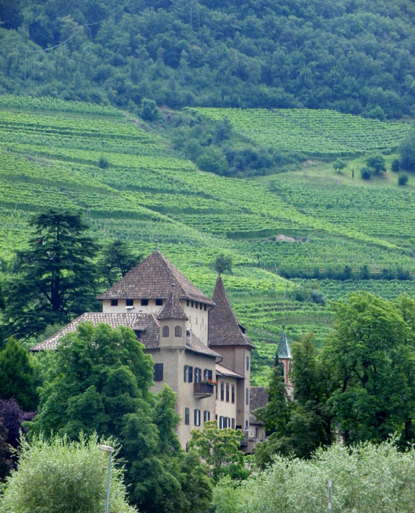
Kloster Saebens from Below

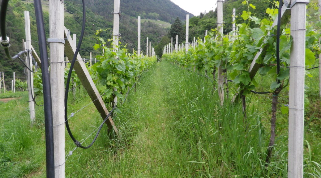
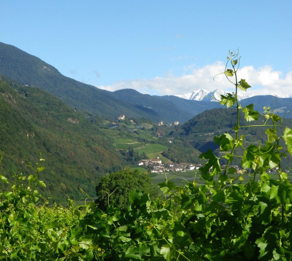
Vineyards on a Nearby Slope

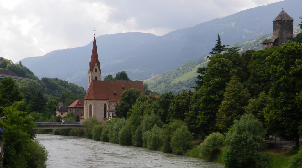
Eisack River, Sudetirol, Italy

Detail: Kloster Saebens

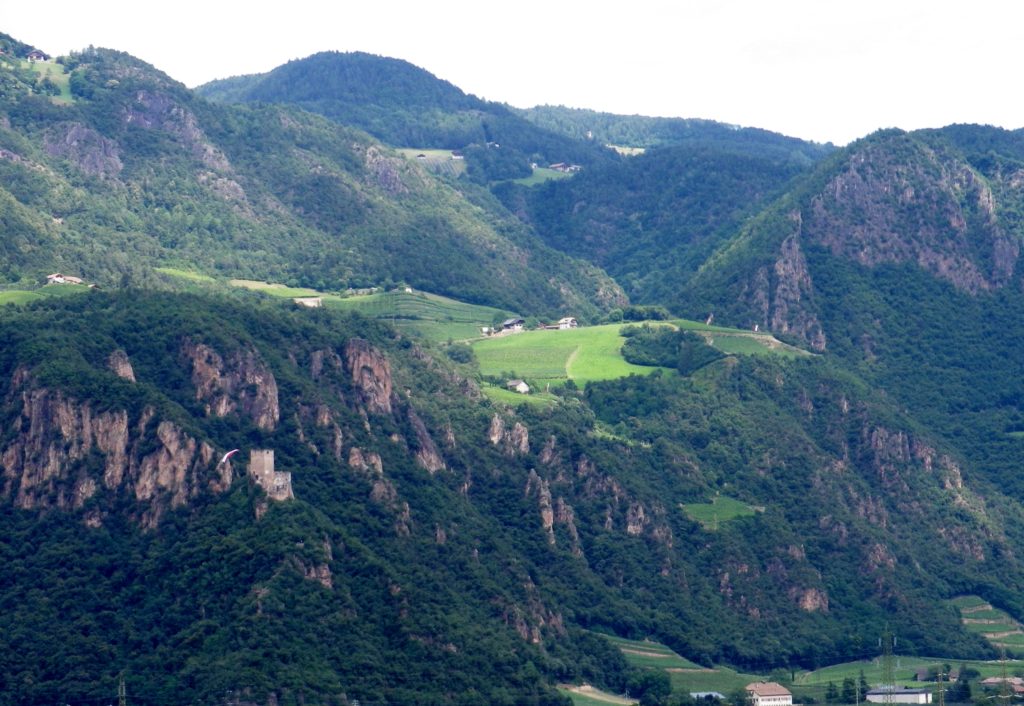
Narrow Valley and Steep Mountains by Klausen
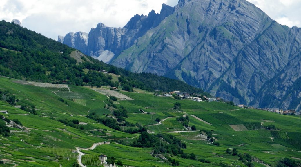
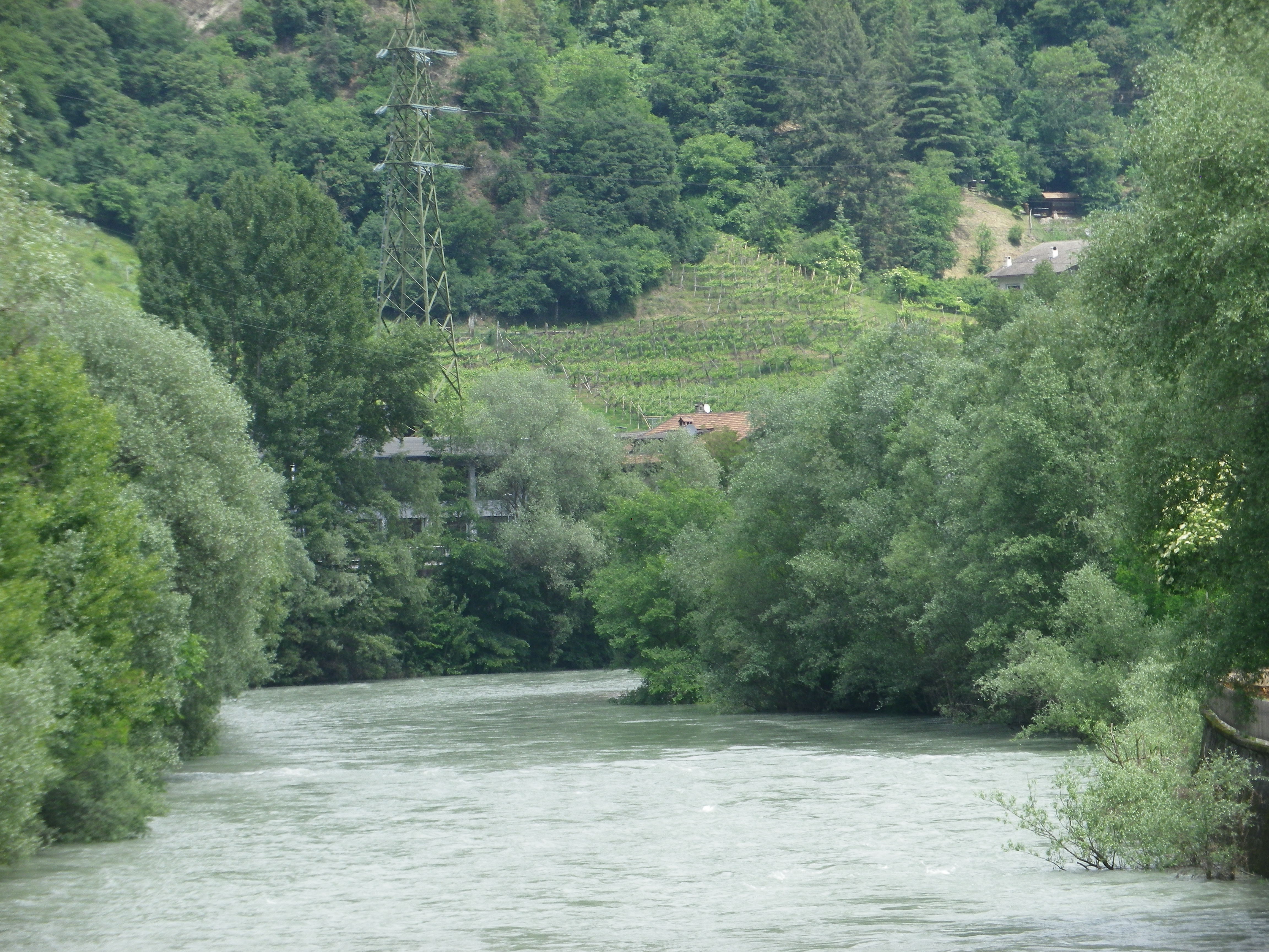
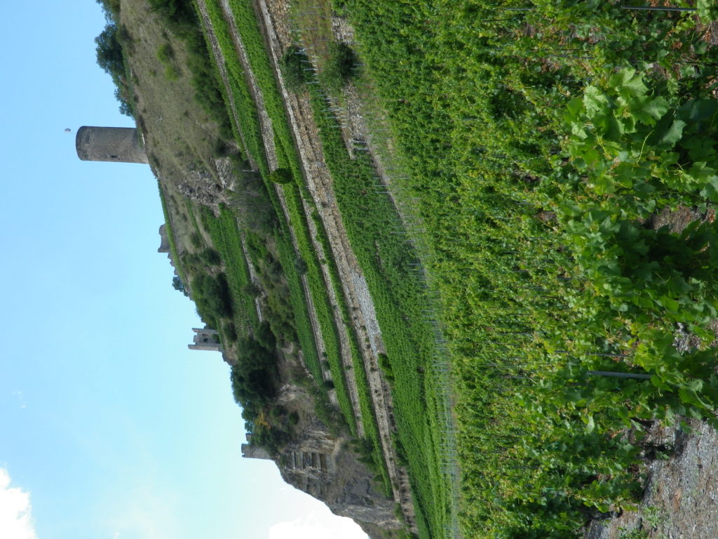
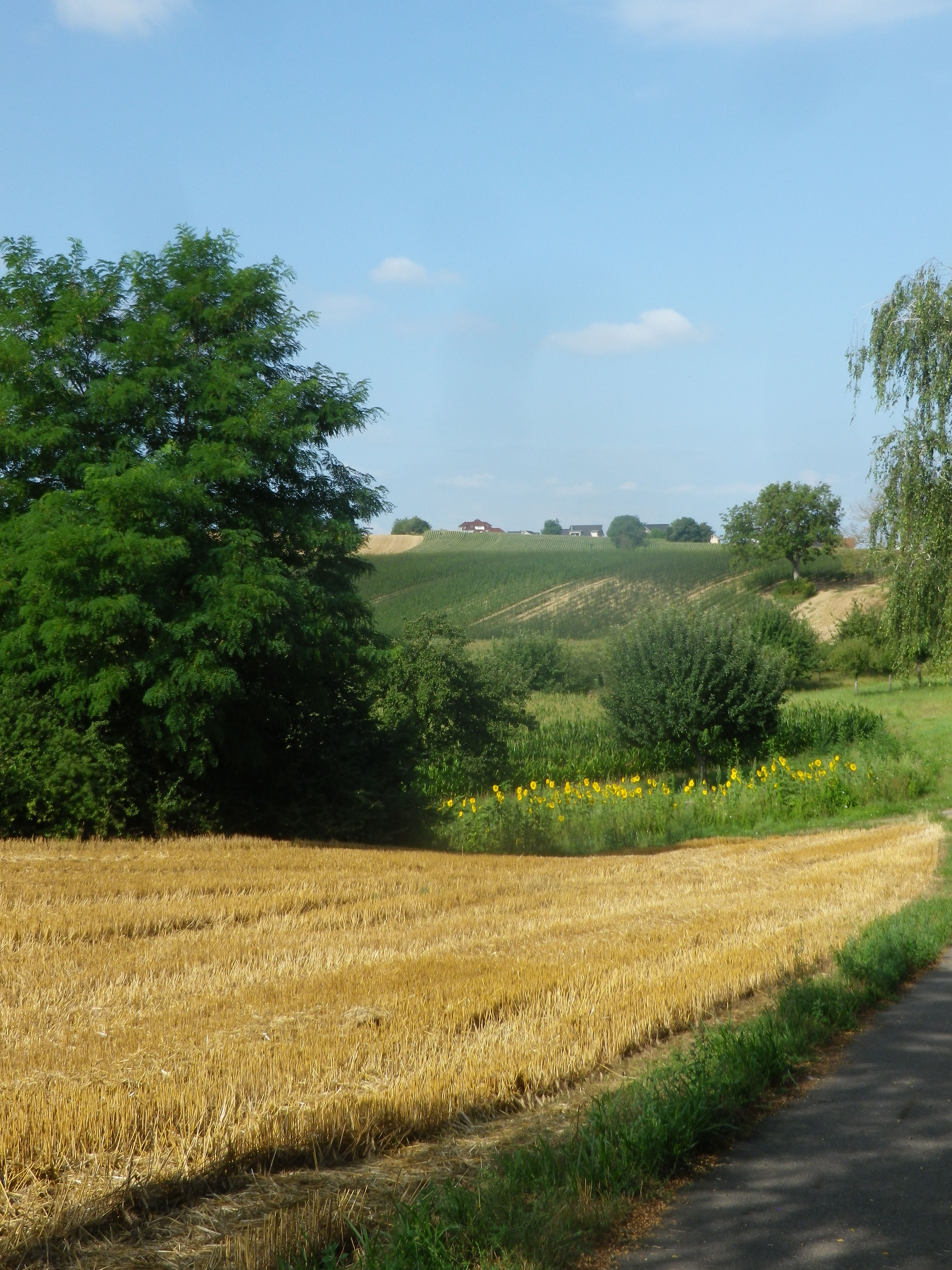
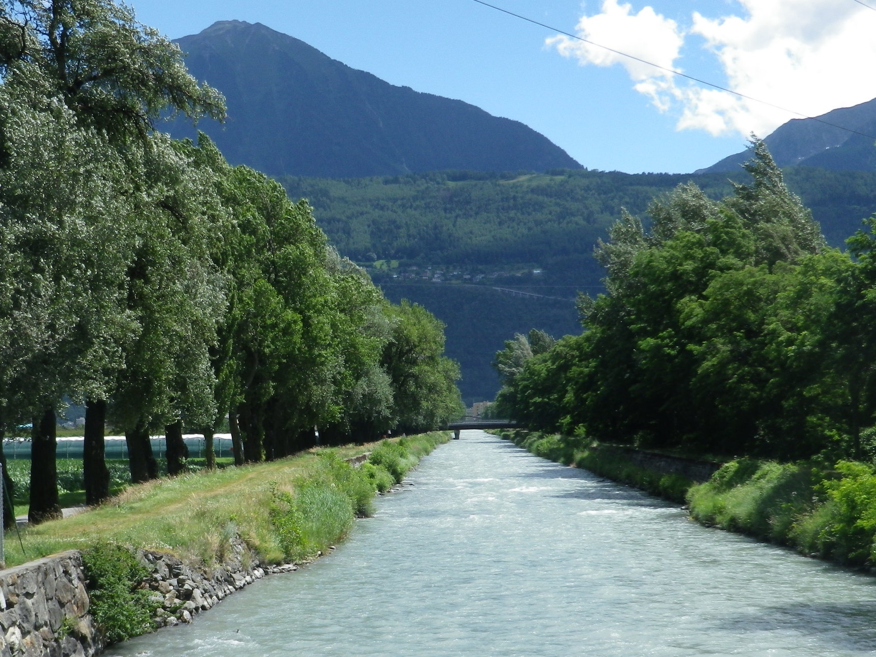
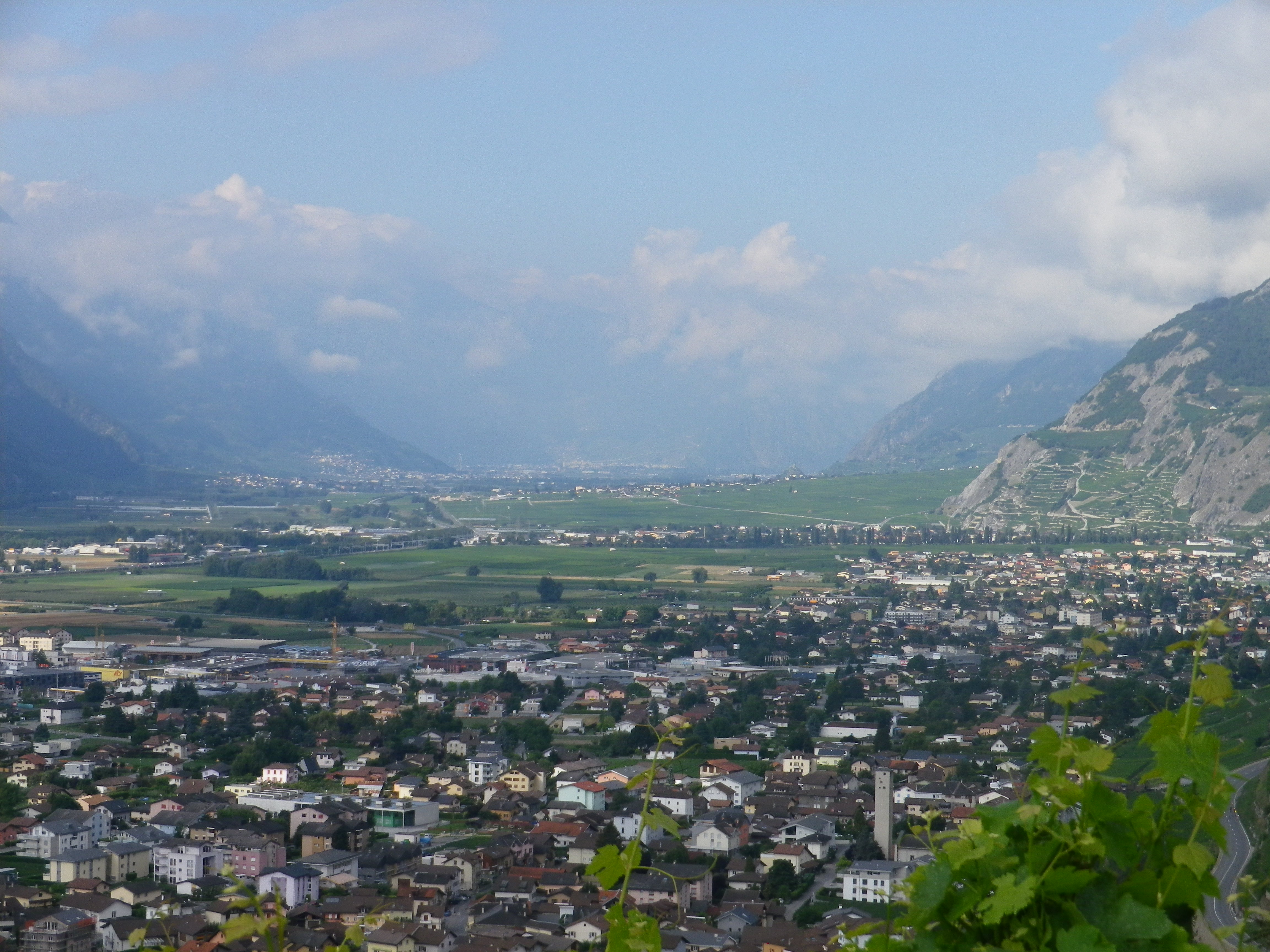
The town of Klausen, known as Chiusa in Italian, lies at the bottom of a river valley. The Eisack River runs from near the Austrian border to Bozen, where it joins the Etsch River. During its southward flow, it runs along the west bank of Klausen, surrounded by some of the most impressive Dolomite peaks in this area. But, key in this description is the “bottom of the Eisack river valley.” Therefore, most hikes in this area will experience some serious ascents at some point.
What I Learned
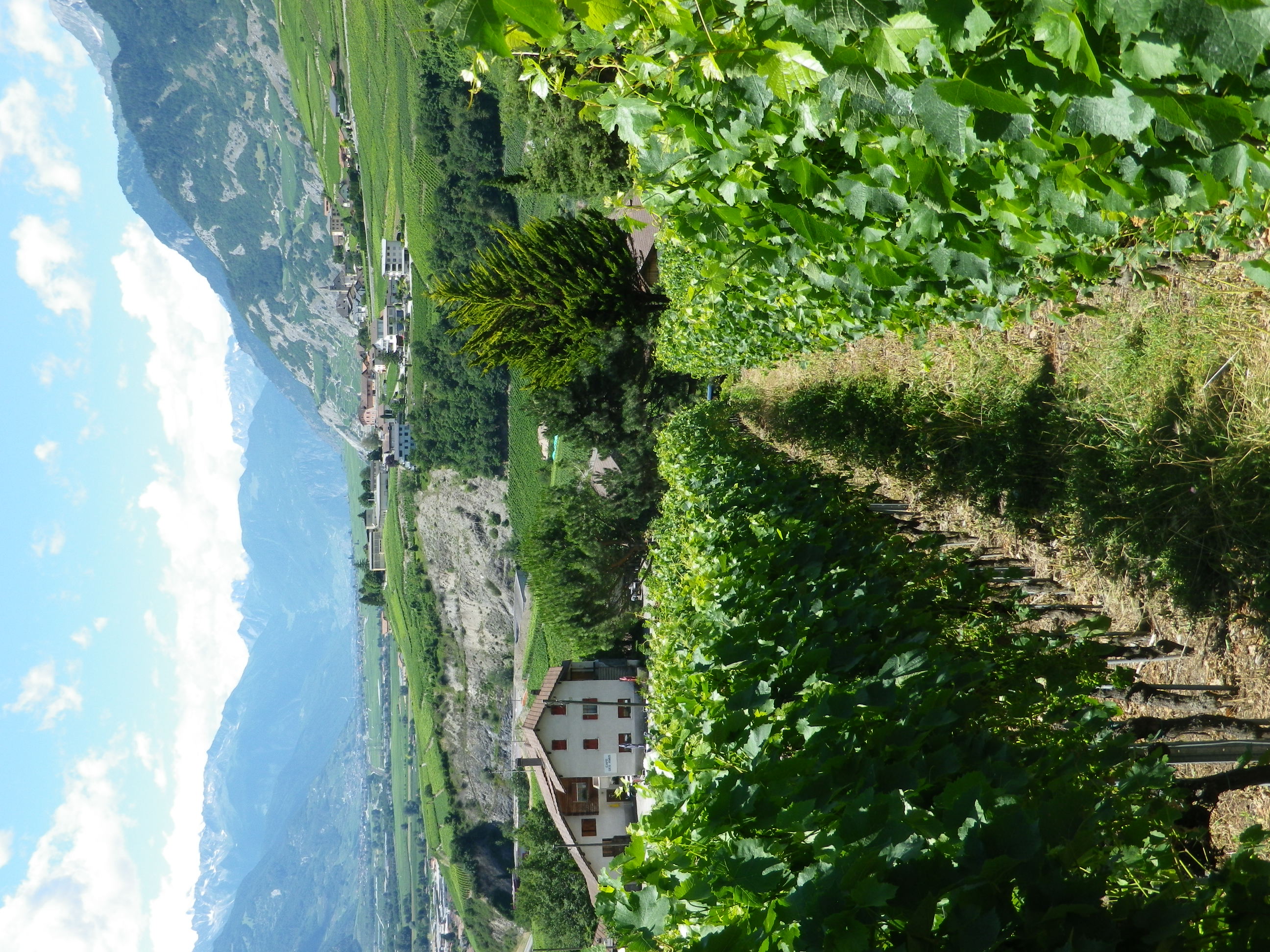
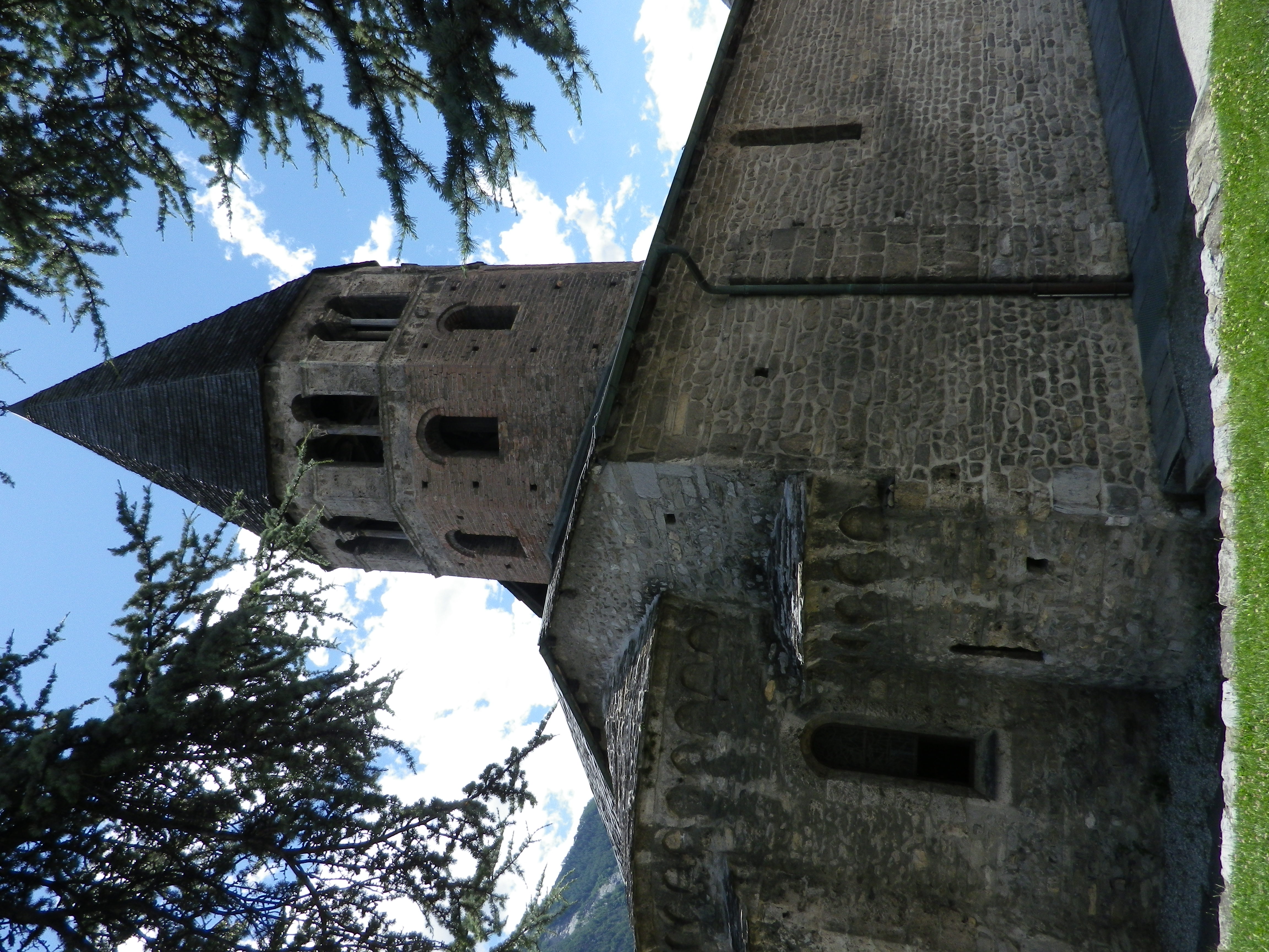
Welcome to Italy – although culturally and linguistically, you are in a Germanic cultural sphere. (This area was controlled by Austria for hundreds of years after the fall of the Roman Empire, until the end of World War I.) The wine region of the Suedtirol (Alto Adige, as the Italians further south call it), is one of the great wine regions in Italy. It has a number of districts, and this one, the Eisacktal wine district is particularly interesting. Its vineyards lie on very steep slopes following along the narrow Eisack (Isarco) River valley as it flows south from its source near the Italian-Austrian border. This district has less than 400 hectares devoted to vineyards, on mostly south-facing slopes, most of the way to Bozen (Bolzano), where the Eisack joins the Etsch (Adige) River. However, some of the best are around Klausen (Chiusa), on the slopes south (and below) Saebens, an ancient monastery.
While there are some red wines, about 90% of the wine from here is white wine. White grapes do particularly well in this district’s relatively cool weather. Sylvaner (yes, sometimes with a Y in this area), Veltliner, Mueller-Thurgau, Kerner and Gewuerztraminer are the main white varietals. The resulting wines are crisp, fruit forward, and deliciously refreshing.
Trail Name: Saebener Rundweg
Trail Type: Very short-distance circuit; well-maintained with hard (paved or packed earth) surfaces, with some cobblestones; mostly good marking for this itinerary.
Length:
Total – 3.0 kilometers/miles
Convenient to: Bozen (Bolzano), Brixen (Bressanone), Italy
Marking:
White over red horizontal bars
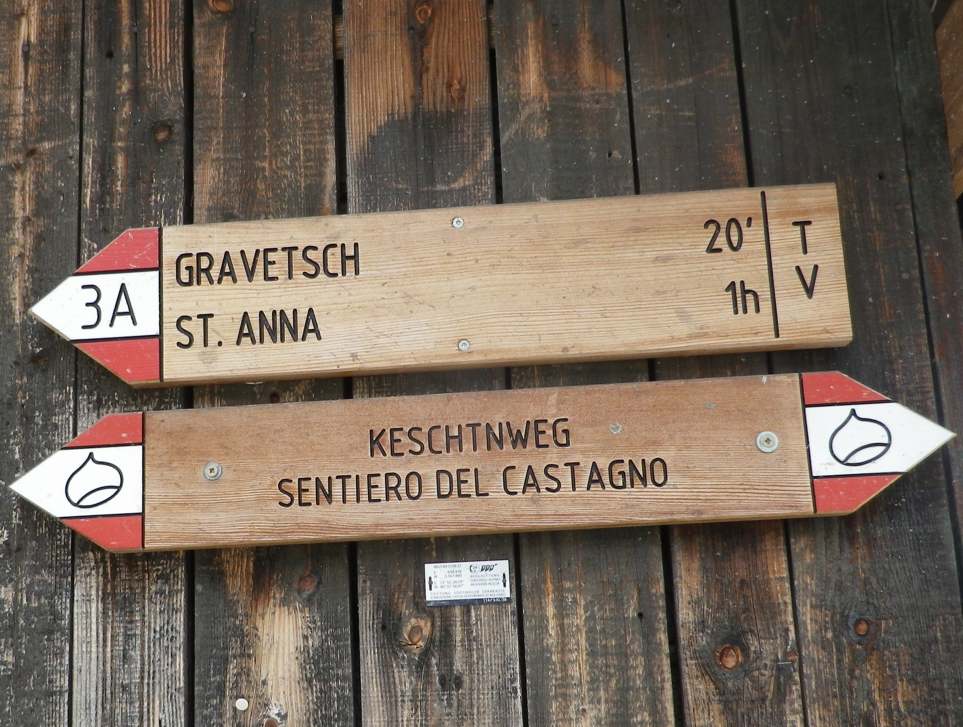
Follows written signs for “Keschtnweg” and Saebener Rundweg
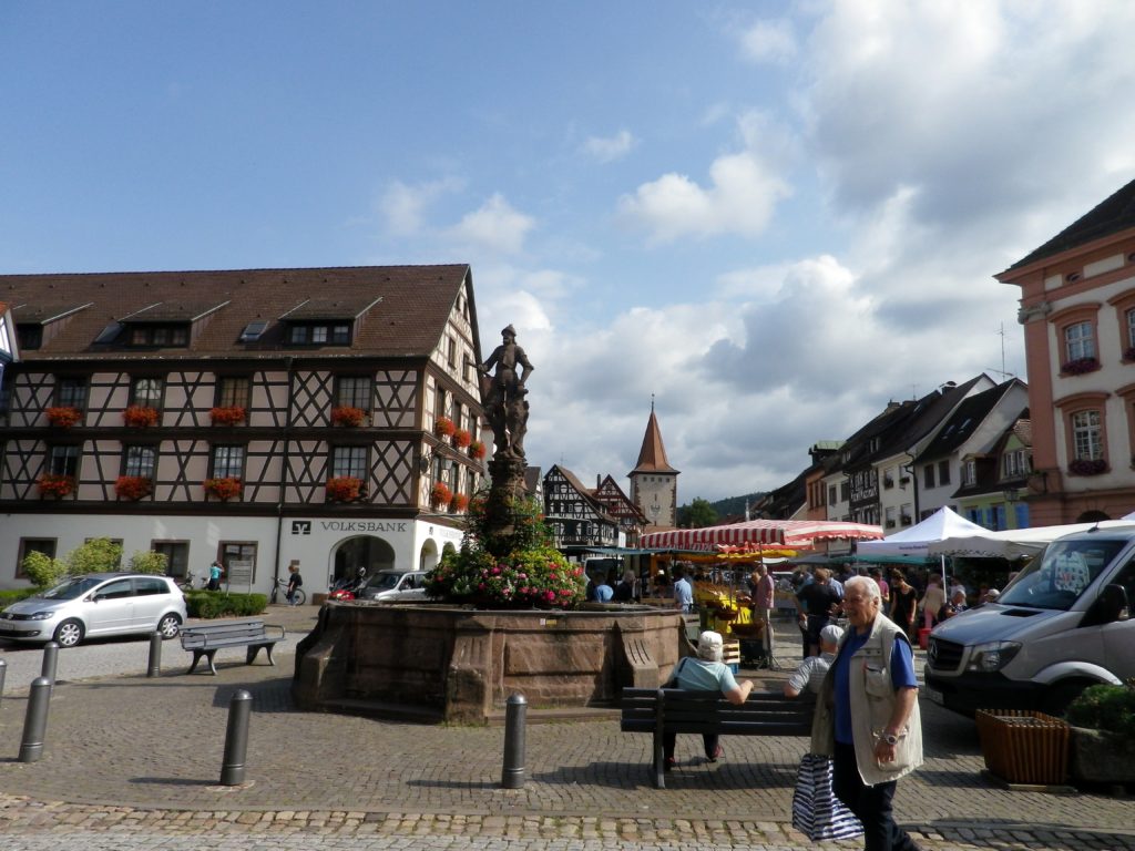
Like last month, the pandemic has left me without many cycling options for 2021. Therefore, I would like to take the time this month to note some of my favorite cycling itineraries passing through vineyard areas in Europe, in the hopes that someday soon, we can all get out there again to enjoy outdoor and wine tasting adventures with friends!
No boundaries! See great wine producing districts on both sides of the Rhine.
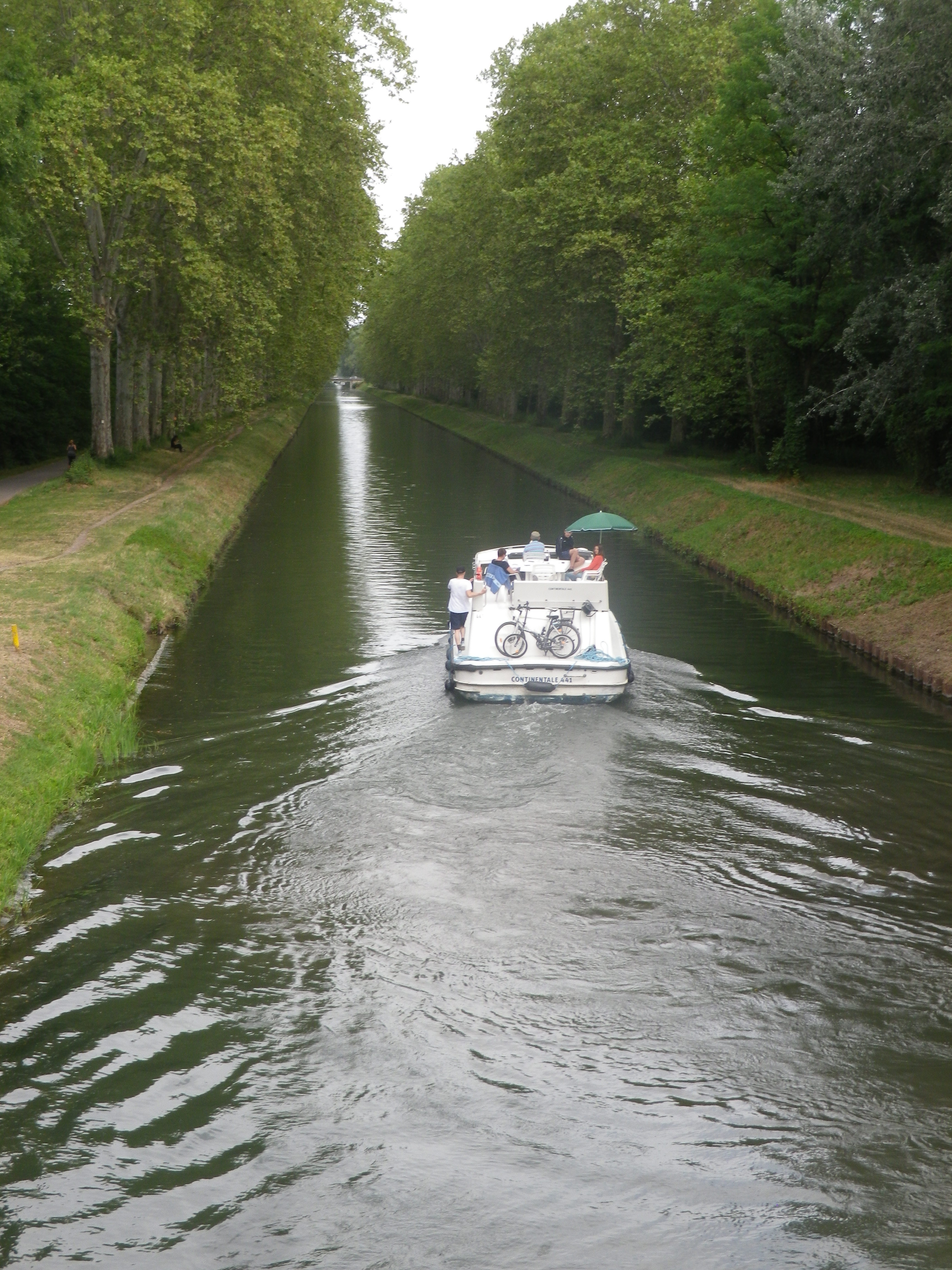
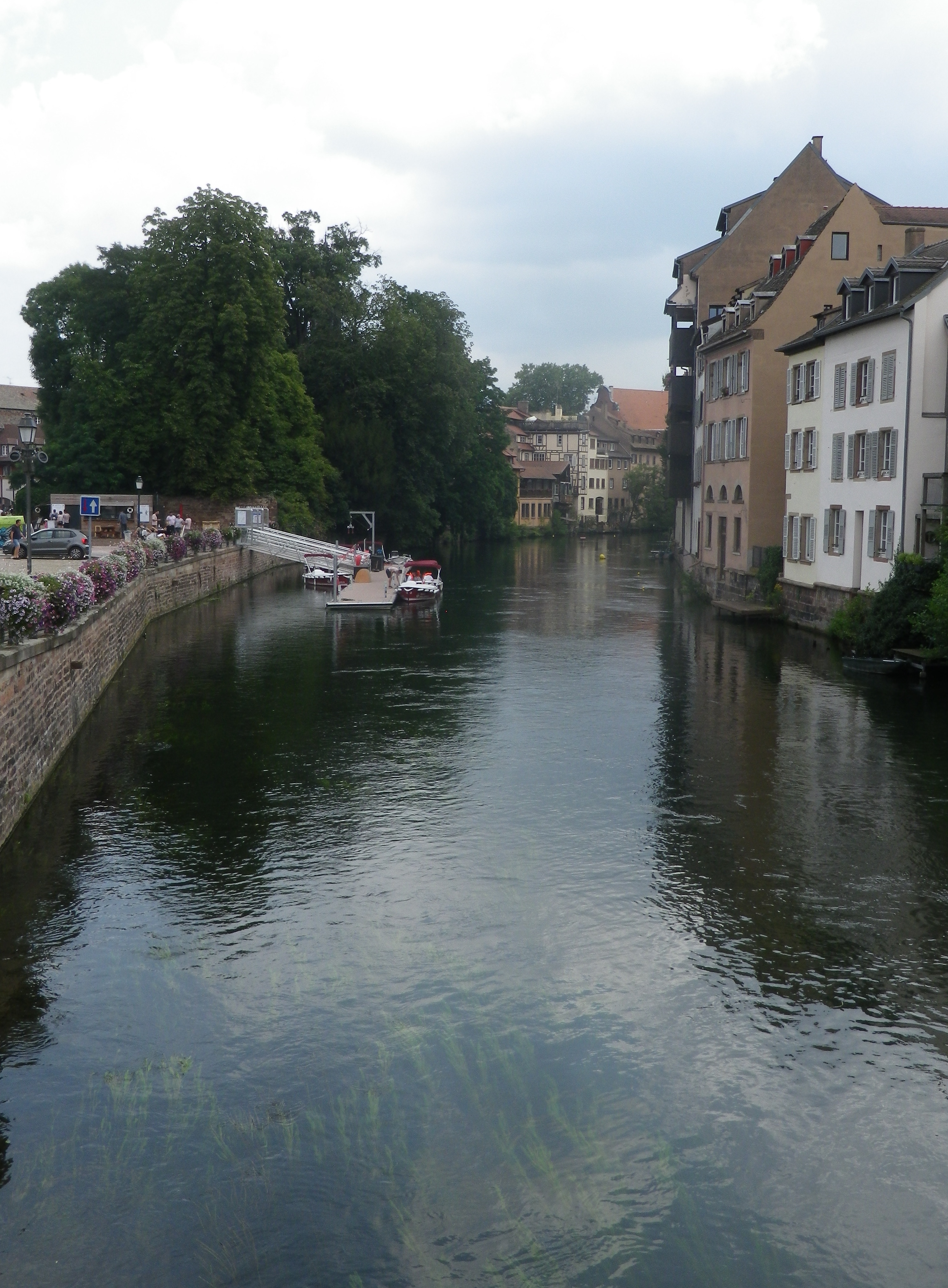
The Activity: Cycling a 235-kilometer-long circuit, the Romanik und Wein/Style Roman et Vin
Why this one: This cycling itinerary offers great diversity: From Black Forest Mountains to the Vosges Mountains, through bucolic fields, woods, and vineyards of course, through hamlets, picturesque villages and the city of Strasbourg, passing from easy, to moderate, to more challenging cycling segments. Cyclists will discover quiet, charming, unspoiled locations in which to take a break, and enjoy the atmosphere. Then comes Strasbourg, with its almost overwhelming sights and opportunities for food, wine, cultural events and people-watching from numerous cafes. Finally, while there is some street riding (although very little of it through Strasbourg as this itinerary passes through the city’s extensive pedestrian zones), much of this itinerary is vehicle-free, using agricultural access lanes, bike paths and even canal tow paths, repurposed and maintained (!) for bicycles.
Caveats: I did not cycle the segment between Wasselonne and Hagenau because this area has no vineyards and it had the most street-riding along the whole itinerary. Therefore, I cannot address any issues there. Most cyclists would require at least three days to complete this circuit, cycling at least 78 kilometers/48 miles a day.
Winning Wine Discovery: Two very different wine cultures and both are delicious!
From East to West:
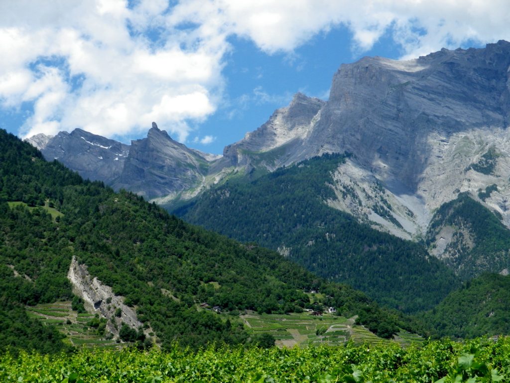
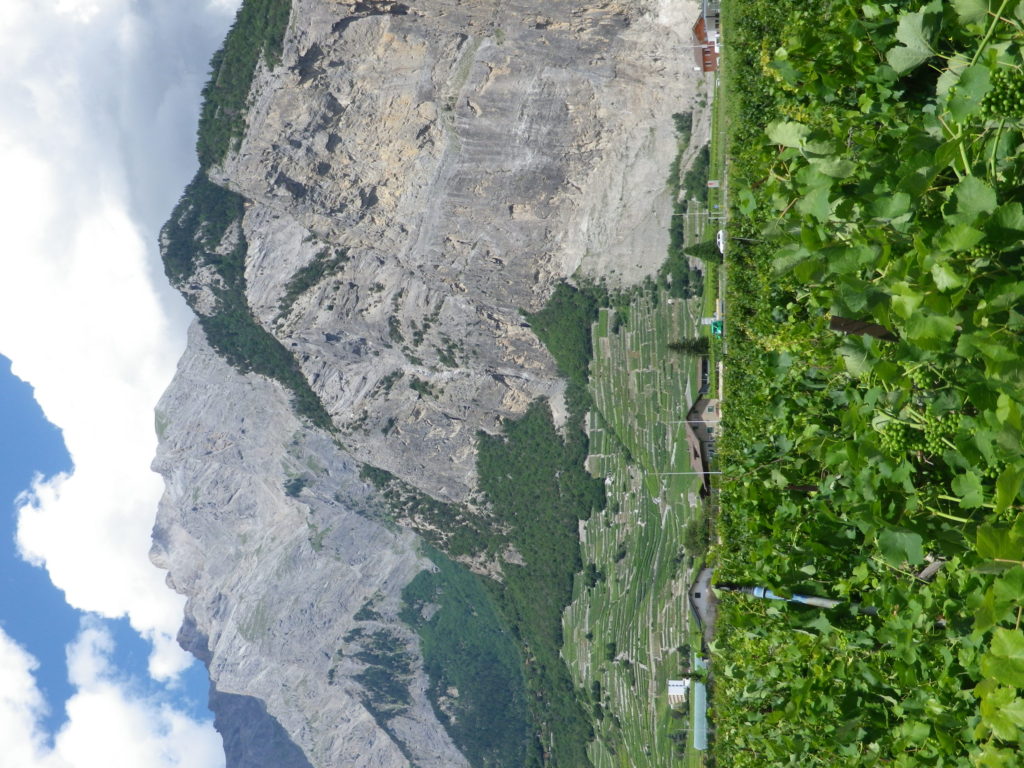
The Activity: Cycling the 82-kilometer-long Chemin du Vignoble trail from Martigny to Leuk
Why this One: The Alpine scenery is spectacular, no doubt about it. The mountainsides rise dramatically all around, the blue-green Rhone River pours through the valley between them, and cyclists pedal along, enjoying the beauty of it all.
Caveats: This route is listed as difficult, and two days are suggested to complete it. (Sion is the suggested intermediary point.) However, if you reverse the itinerary (from Leuk to Martigny), it is much easier, as it follows the river valley downhill, vice uphill. Mind, there will still be some inclines, but except for the long uphill segment between St Leonard and Grimisuat, they were not show stoppers.
Winning Wine Discovery: Arvine, also known as Petit Arvine, is a white grape varietal indigenous to the Valais region, and very rarely found elsewhere. It is nicely crisp, with unique mineral and citrus flavors. All combined to form a memorable palate of tangy, salty, and slightly sweet (due to ripe, white stone fruit flavors), making a uniquely delicious wine.
The Activity: Cycling the Weinradroute Nord/Itinerario Nord/Vino e Bici circuit
Why this One: Set in the beautiful Dolomites in the well-regarded Suedtirol/Alto Adige wine region of northern Italy, this district is much less frequented by tourists than many other regions of Italy. But that is not to say it is not visited. It is a popular spot for vacationing Germans and Austrians who take full advantage of the area’s great hiking and biking trails, and the good and plentiful lodging opportunities. In fact, this itinerary is just one of three interconnected (via the Etsch/Adige bike trail) wine-themed cycling circuits. Thus, while the German names might confuse those not familiar with the rich cultural history of this area, relax – it is still Italy after all – enjoy the great weather of this sunny side of the Alps and take the time to cycle all three!
Caveats: There are some segments of street cycling along narrow roads, with little or no shoulders. Bring a good map or navigation device, as the trail markings were not always where they needed to be.
Winning Wine Discovery: Lagrein is a red grape varietal grown both in the Suedtirol and the neighboring Trentino region. It vinifies as a red wine that produces powerful red berry aromas and flavors.
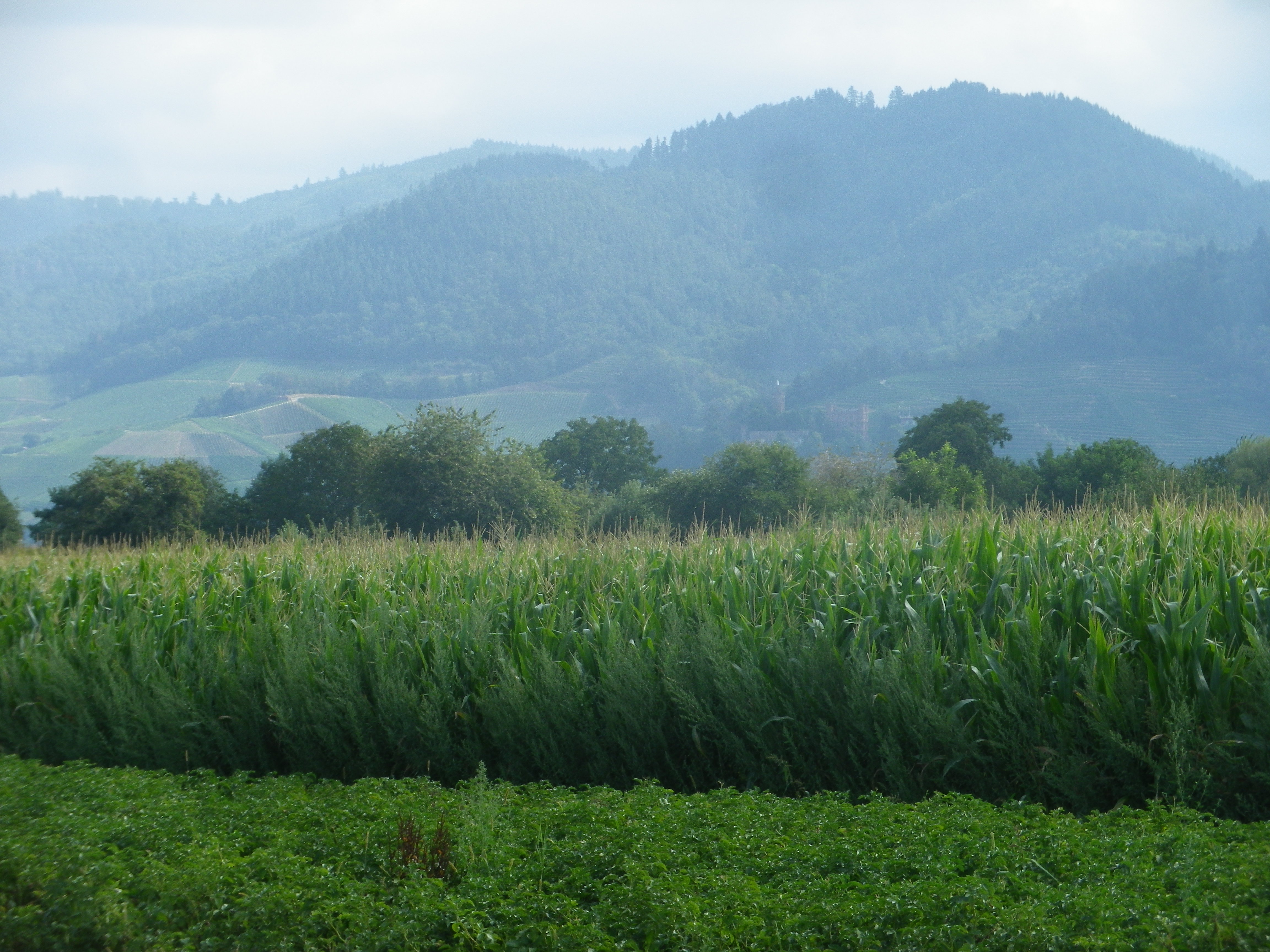
Finally, the Sentiero Valtellina gets an honorable mention here. The trail itself is marvelously laid out along the river valley floor, with views of vertiginous mountainsides, covered with vineyards on the lower stretches, and followed by forests and snow-capped peaks. But most impressive is the fact that five communities work together to keep this trail in great shape, and unusually for Italy, much of this trail’s itinerary is on dedicated bike path!
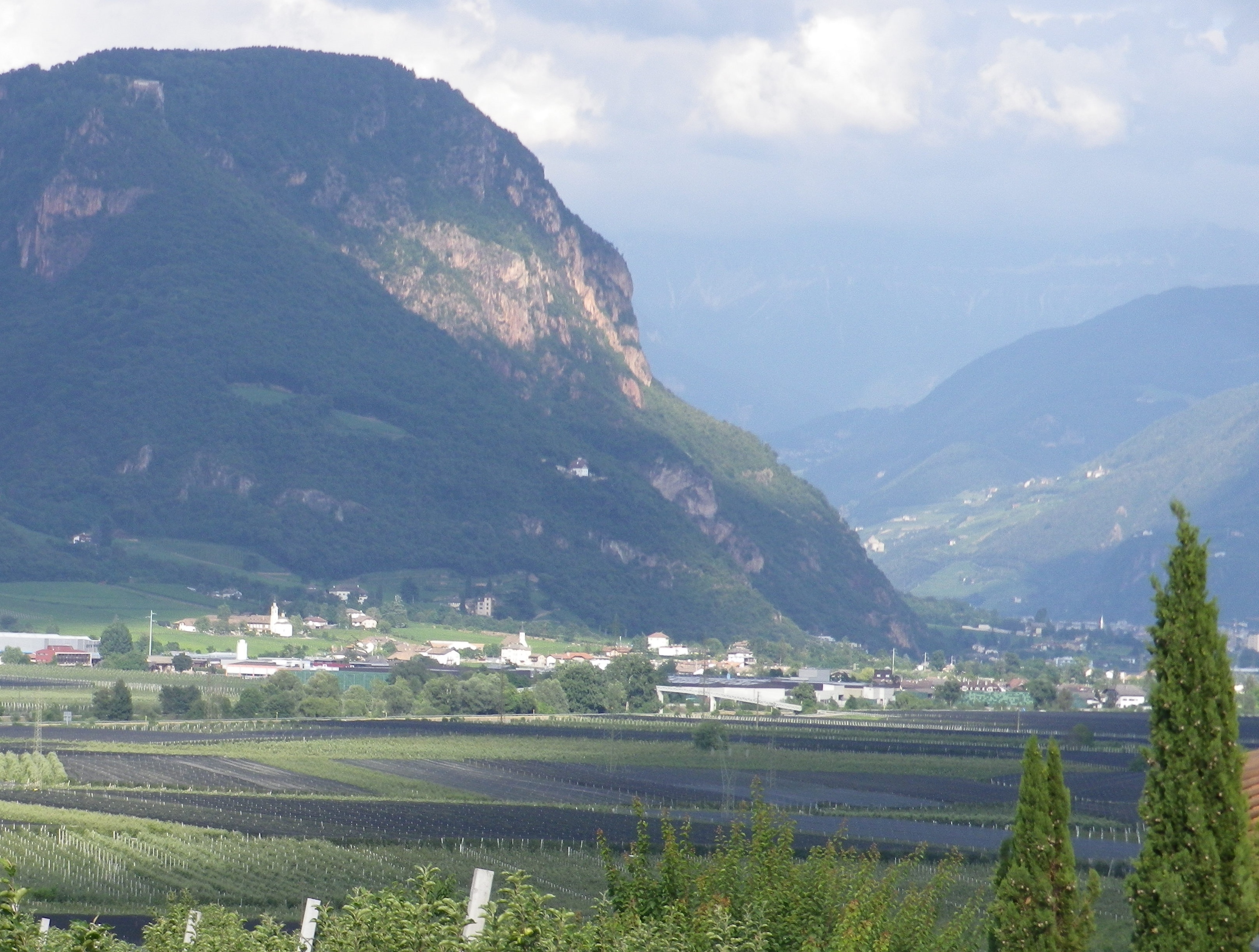

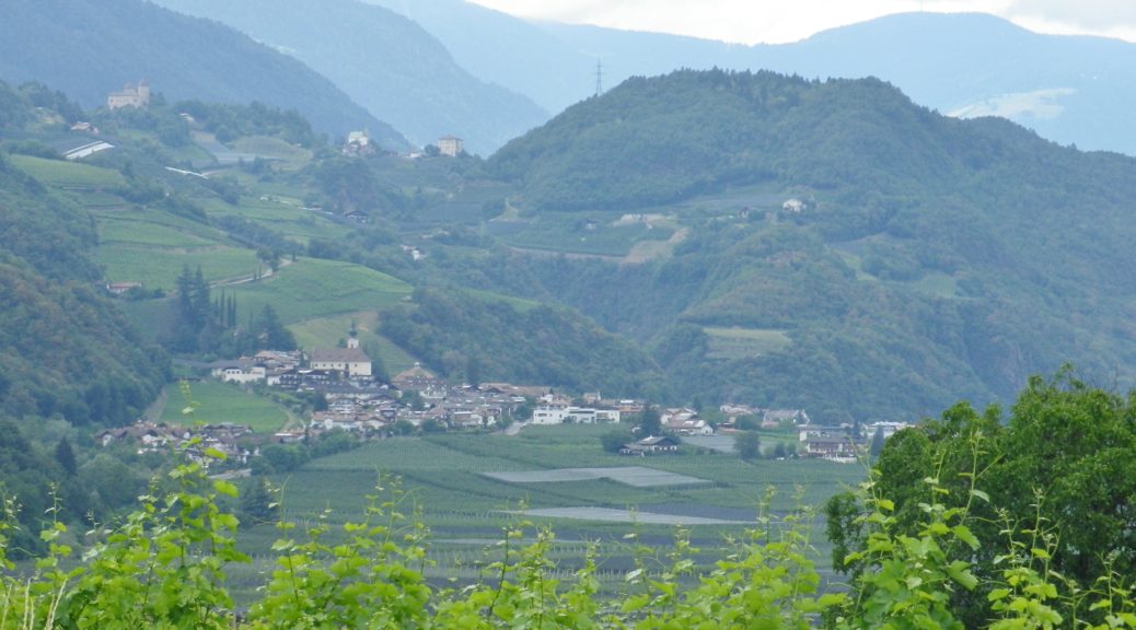
A mere 17 miles from the Austrian border at the Brenner Pass, the first vineyards appear in northern Italy, along with some linguistic confusion. Following along the Eisack River, the Isarco in Italian, the vineyards begin just as the dramatic narrow pass begins to widen at Novacella, Neustift in German, by Brixen, Bressanone in Italian. Thus, it continues all the way south, throughout Suedtirol/Alto Adige, the South Tirol as English speakers call it.
This area is well-known throughout the German speaking world as a hiking and biking paradise set in the magnificent Dolomites. Here, the German passion for precision and perfection meets the Italian passion for food and wine, and the results are amazing.
Hiking in the northern half of the South Tirol provided more options and was less challenging than biking in it. While the mountains are steep, the paths are relatively well maintained and well-laid out. Although the physical effort was not as easy as hiking in the Rheinhesse wine region in Germany, or the Carnuntum wine region in Austria, any reasonably fit person could complete them.
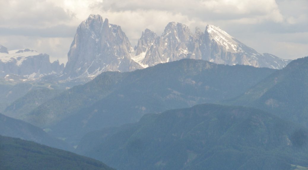
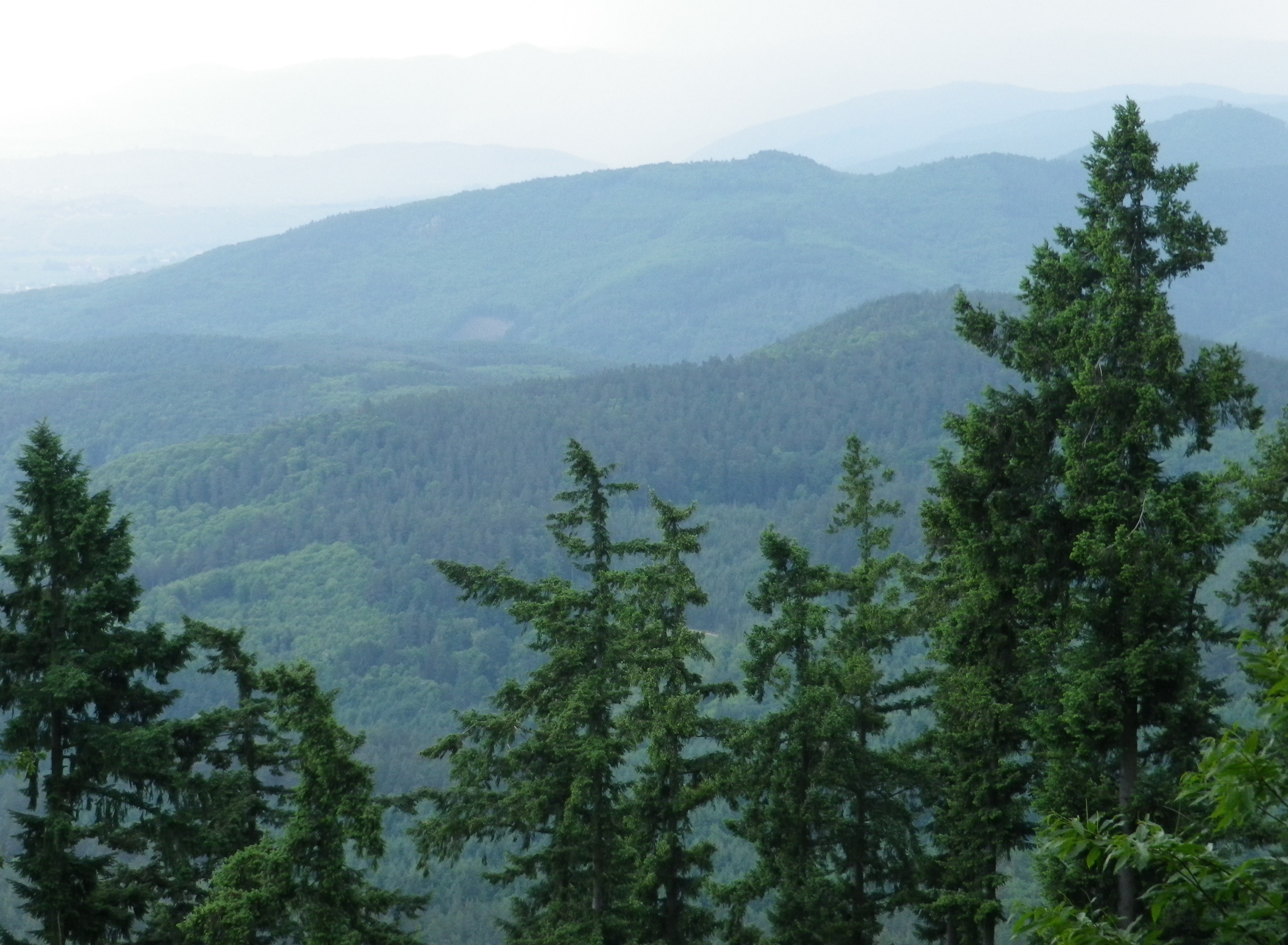
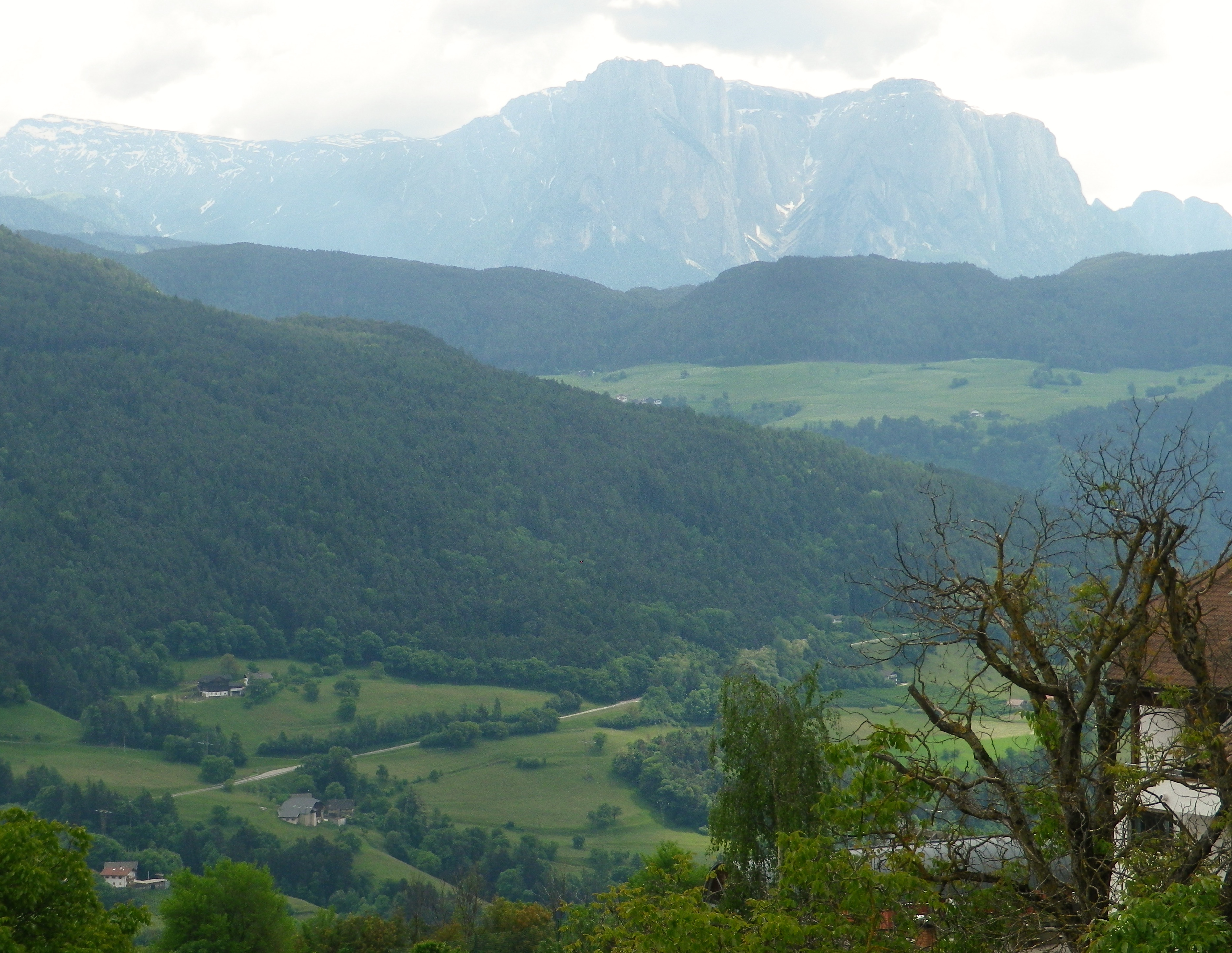
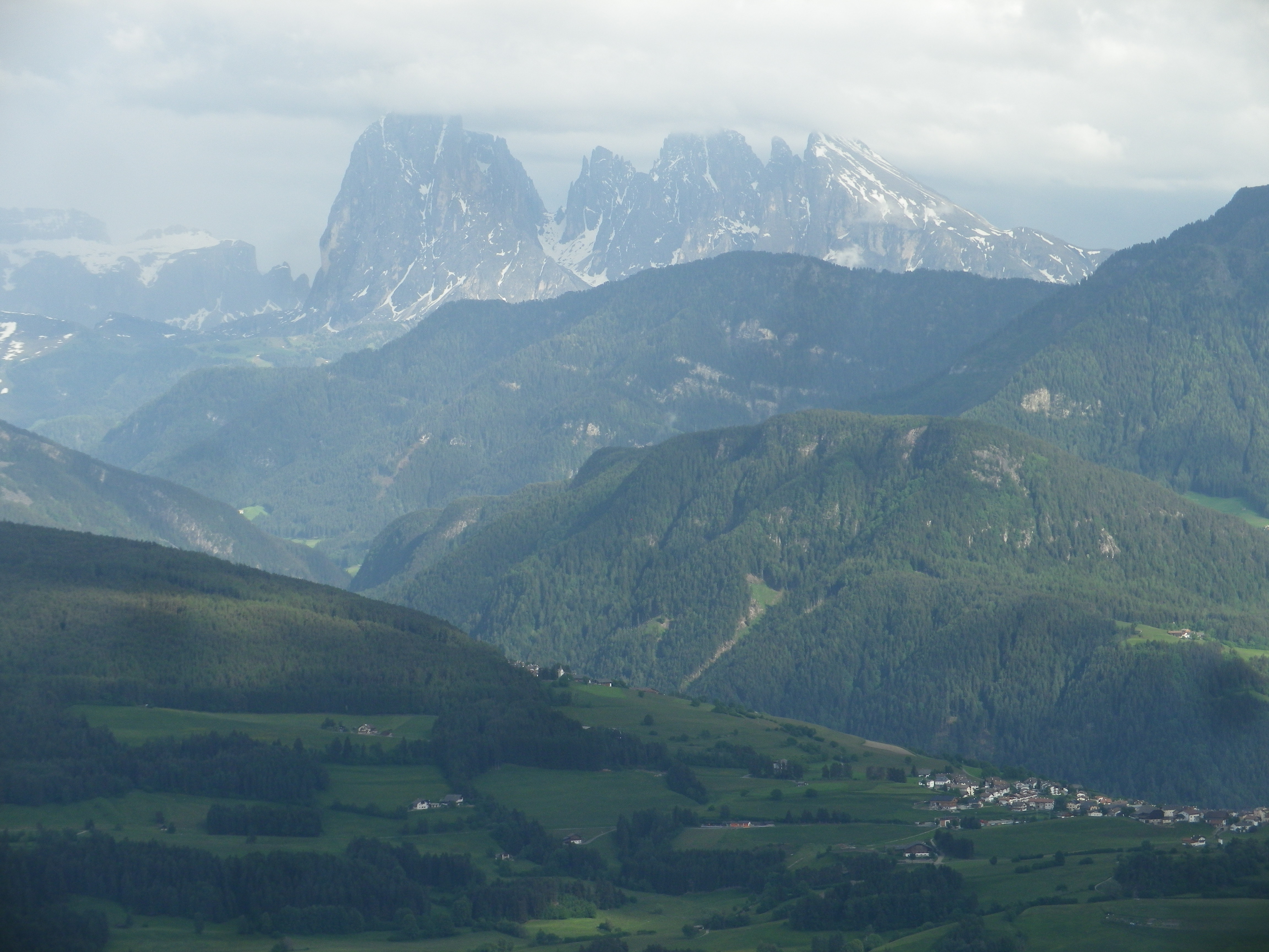
Amongst a plethora of trails, one wine-themed trail was located high up the western edge of the Dolomites. It was also opposite the Nature Park of Puez-Odle, and its famous peaks, the Odle Group, among them. I figured that from a higher elevation, the views from the trail of the mountain peaks would be spectacular. I was not wrong in that regard.
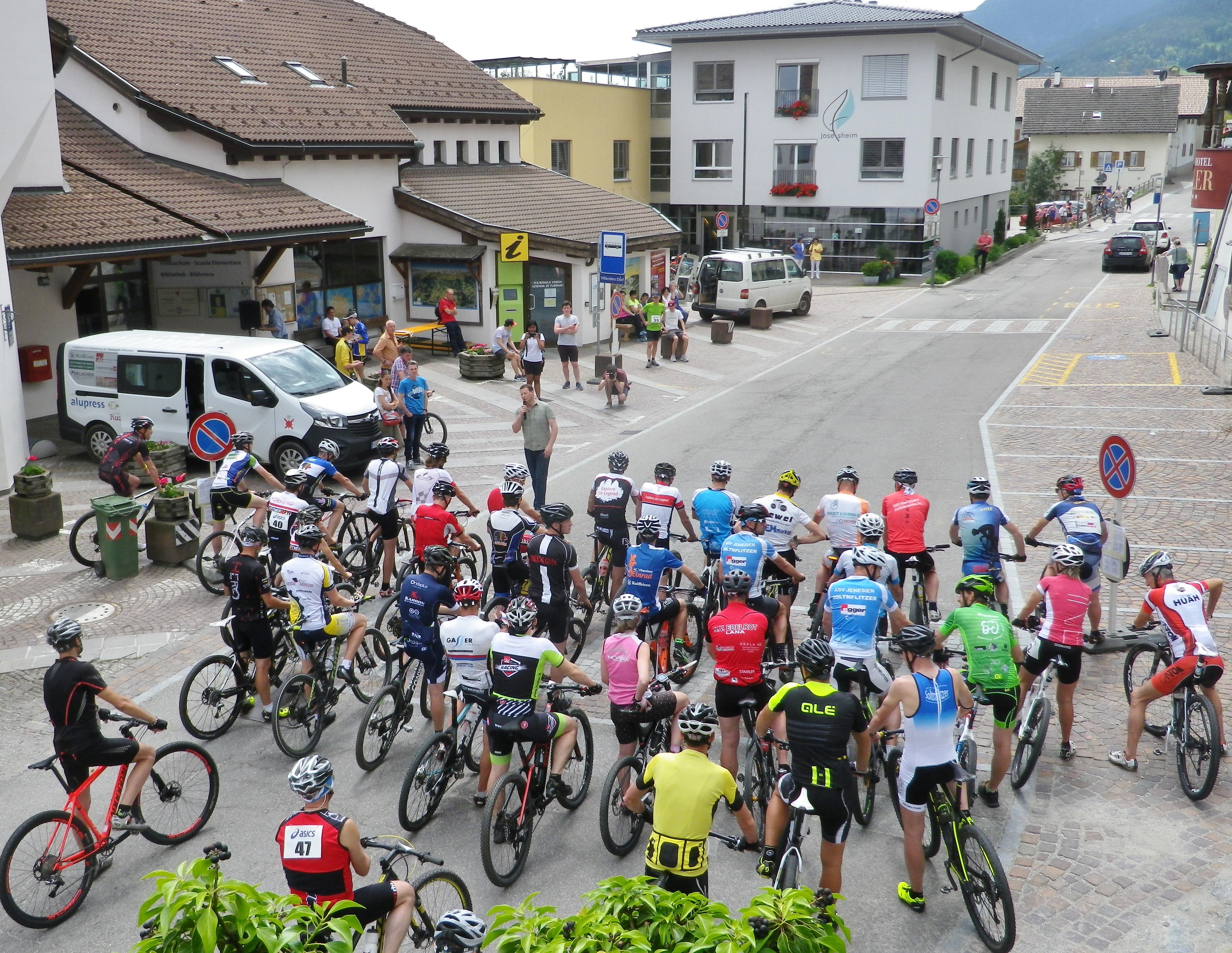
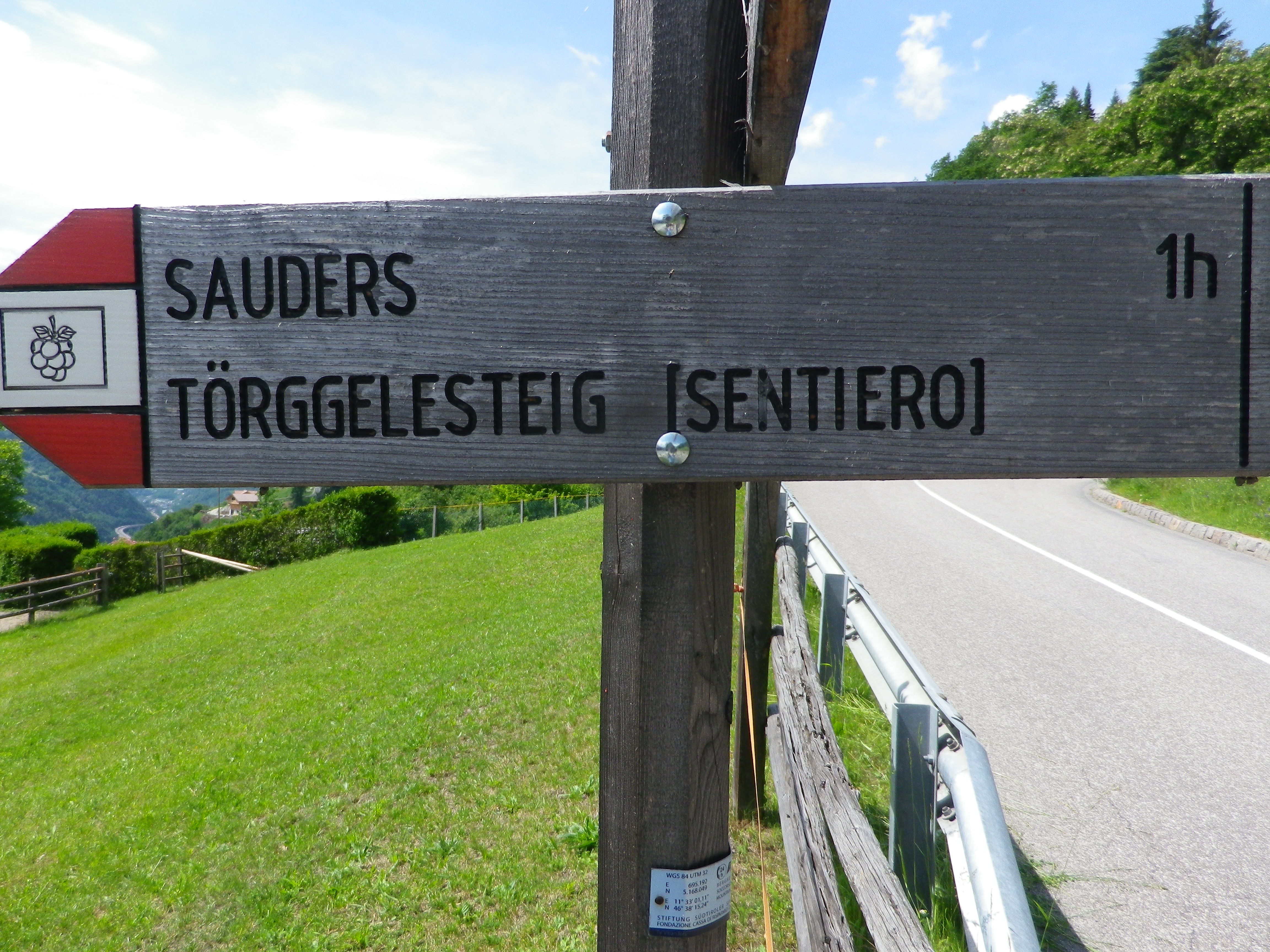
The trail was named the Toerggeleweg. A toerggele is a wine press, and in this district, wine taverns are often identified with this term. The trail passes through or by vineyards, and wine taverns, as it meanders up and down the mountainside above Klausen/Chiusa, the main town in this district. This district is traditionally agricultural, and several multi-purpose farms run by extended families still exist. The trail often passes right along them. Nowadays, in addition to farming, and running the seasonal wine tavern (toerggele), many families rent places to sleep.
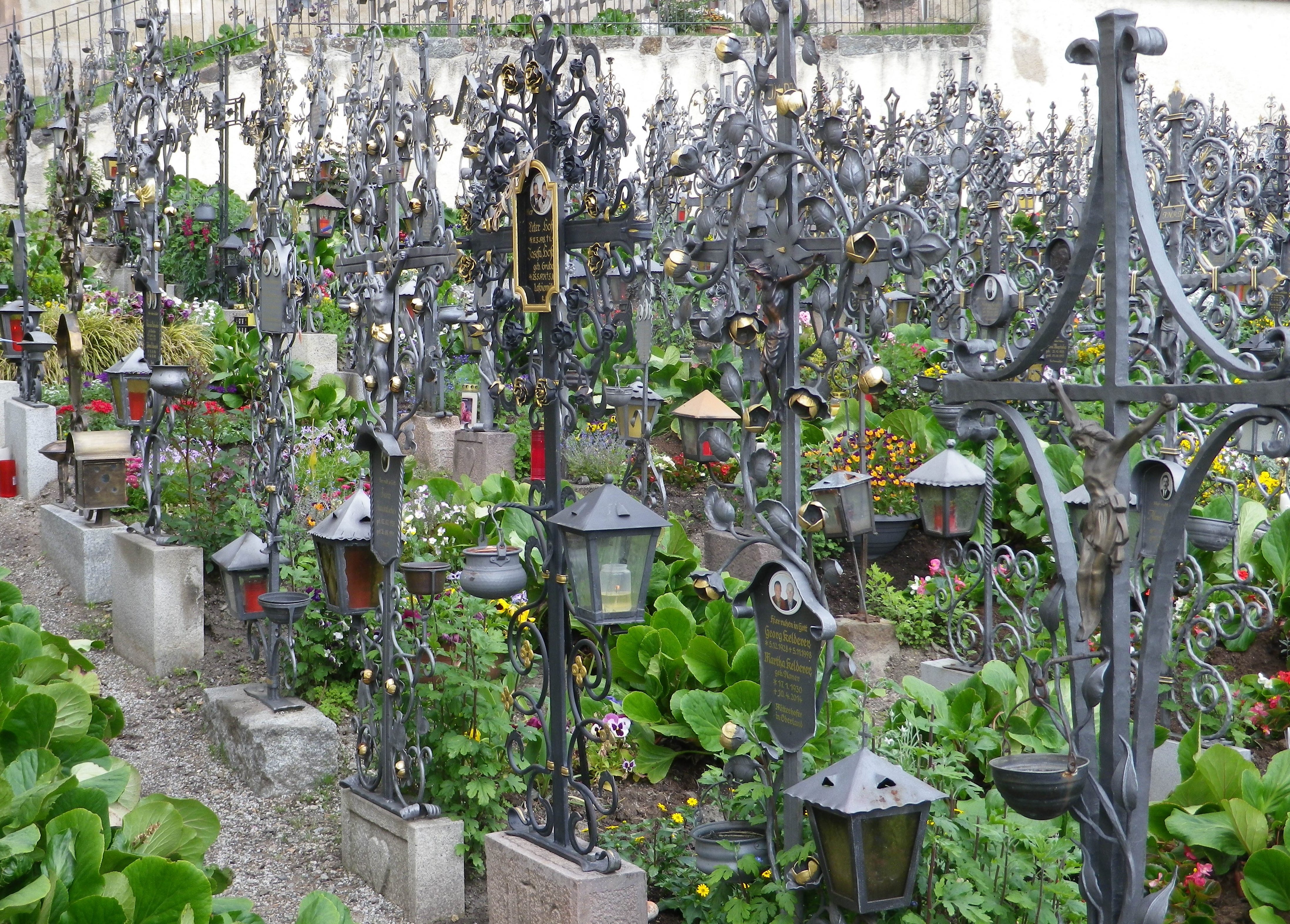
The trail began in the village of Villanders, a popular summer destination. In addition to the old houses lining the narrow streets, the village has an attractive old church, Santo Stefano, on the outskirts of the village. It is worth a visit, especially since the walled cemetery next to it is considered one of the most beautiful in the region. On just about every grave amazing ironwork commemorates the deceased. Much of the ironwork is extremely detailed, imaginative and expertly wrought.
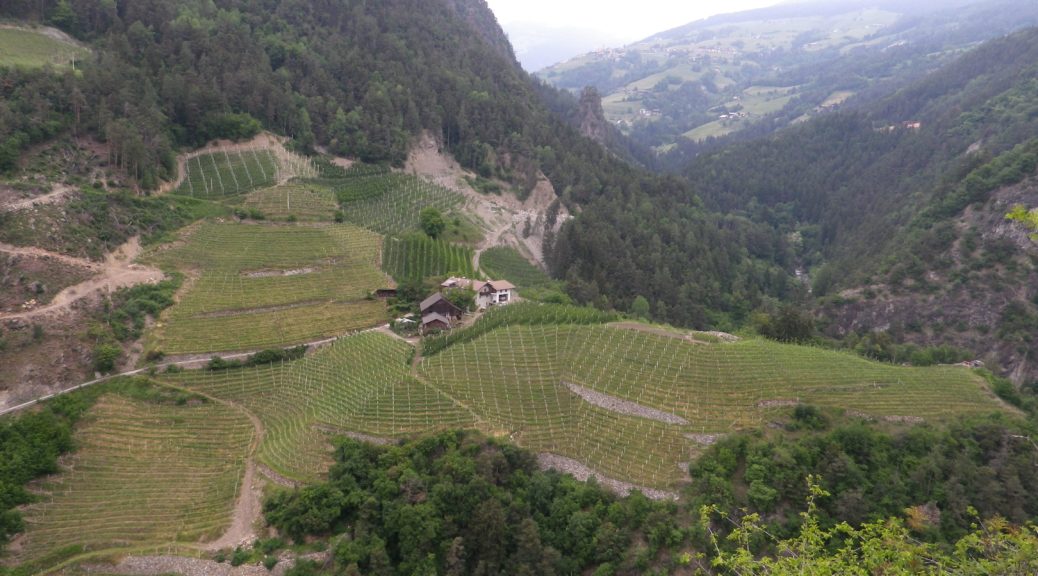
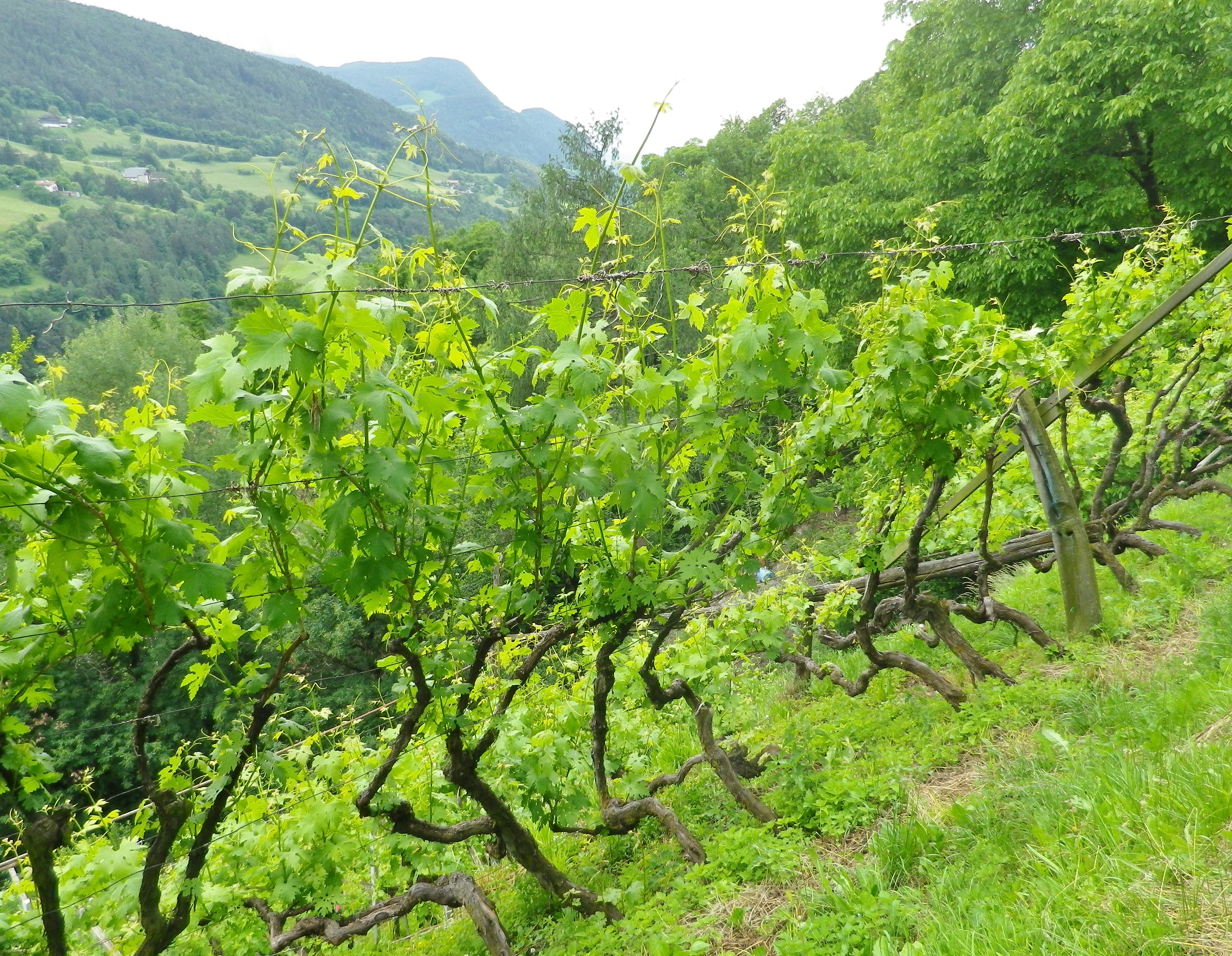
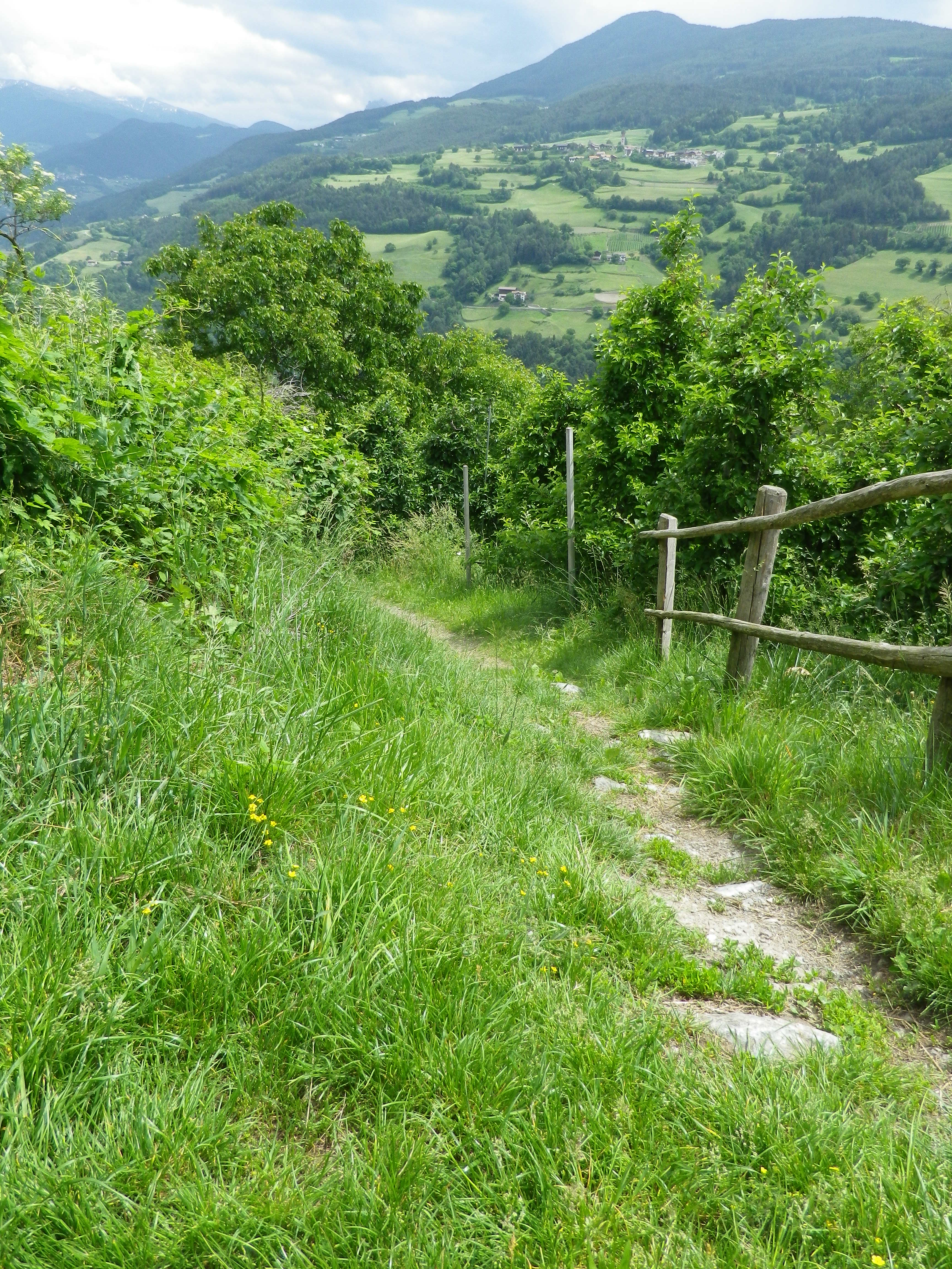
The trail proceeded through woodlands containing chestnut trees. This part of the Toerggeleweg follows along a popular long-distance trail called the Keschtnweg/Sentiero delle Castagne, or the Chestnut Trail. Before long though, I was in vineyards, the object of my hike. Most of the vines are trained high. In this southern Alpine wine region, the growth can be luxuriant quite early in the season. So many shades of green greeted the eye, everywhere I looked.
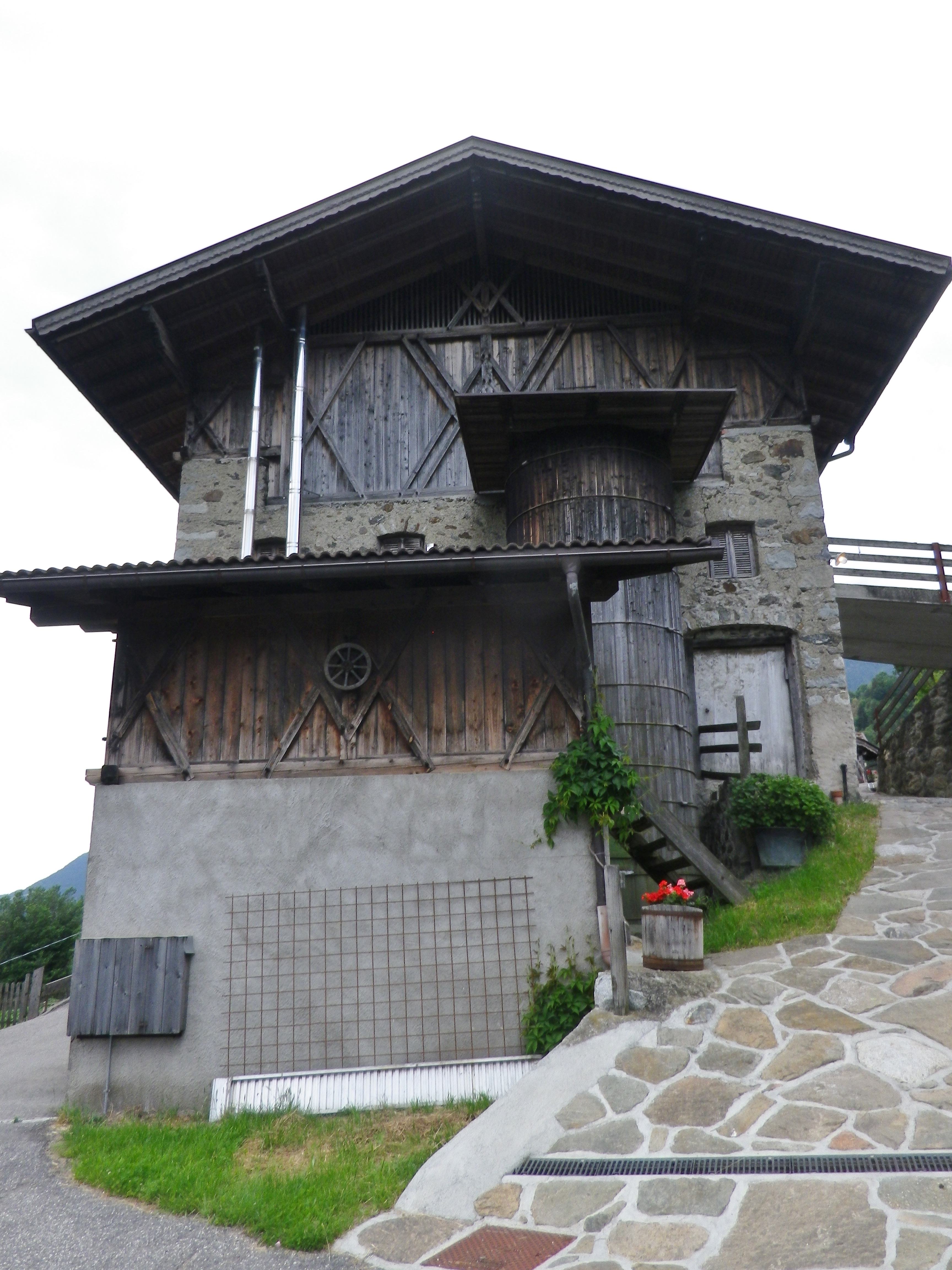
Every now and then, the trail lead through a farming compound or settlement. As I passed these buildings, I realized what spectacular settings most of them offered. Set on a steep-sided mountain looking across the deep valley, surrounded in part by vineyards, they were forested on untillable sites watered by rushing streams. These farms were well maintained, and looked inhabited. But they were eerily silent. Many rural settlements in Italy are slowly being emptied of local inhabitants, populated only as rentals during the summer season, as the young move to large towns for work, and the old move to towns for companionship. One older man, finishing his farm work for the day, drove by in a creaky Fiat Cinquecento and asked if I wanted a lift. Given that I had quite an incline ahead of me, I was tempted. I should have taken his offer, as I am sure he would have had interesting stories to tell about life on the mountain in days gone by.
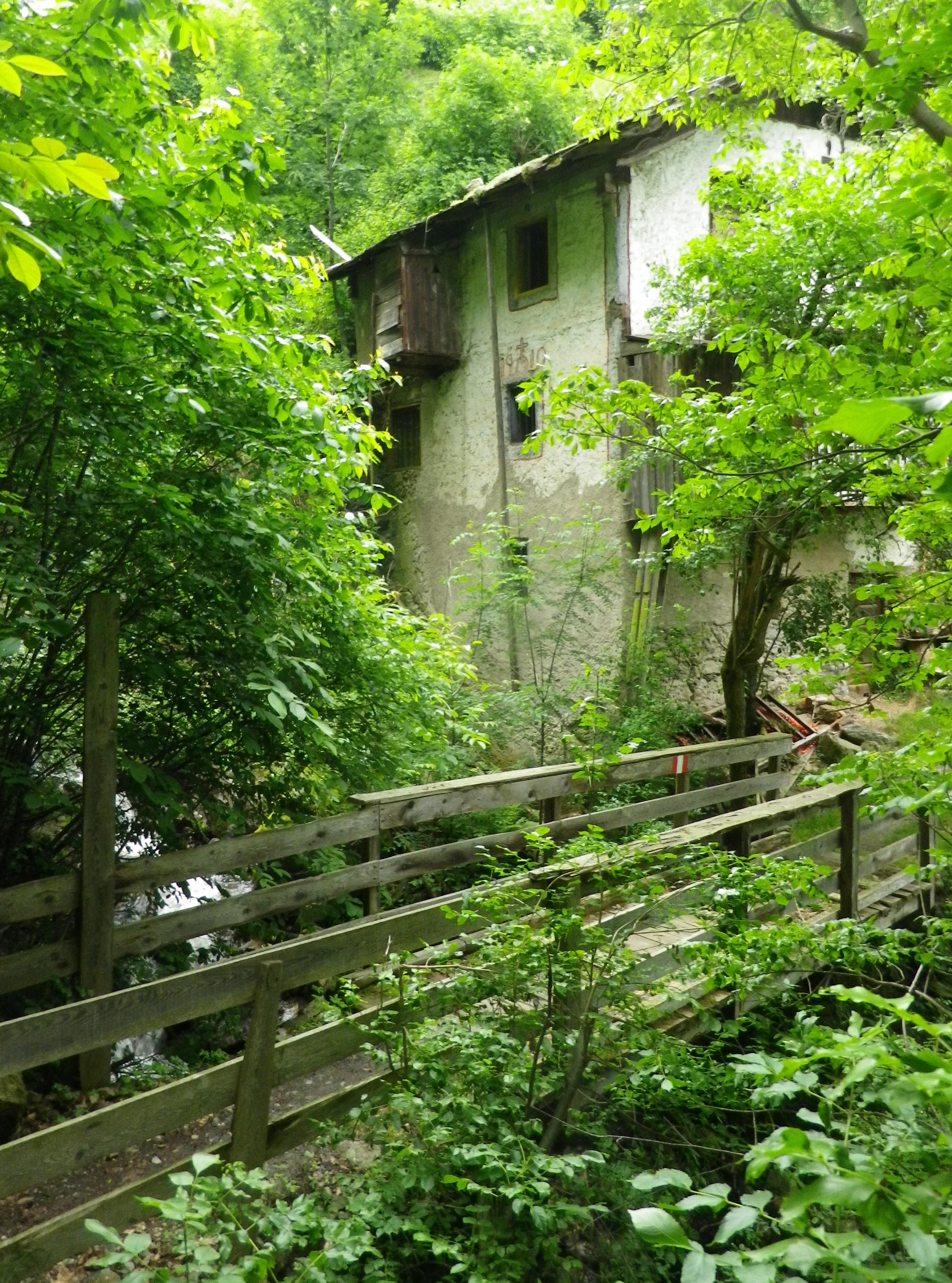
The trail eventually reached the hamlet of Sauders. More houses, and more people (three) than I had seen for over an hour. At Sauders, the trail reached its southern-most point. The slow incline up and back to Villanders began, leading out of the hamlet on a well-maintained trail, the Kirchsteig. It soon passed an old mill on a torrent, barely contained in its course as it bounded down the mountainside.
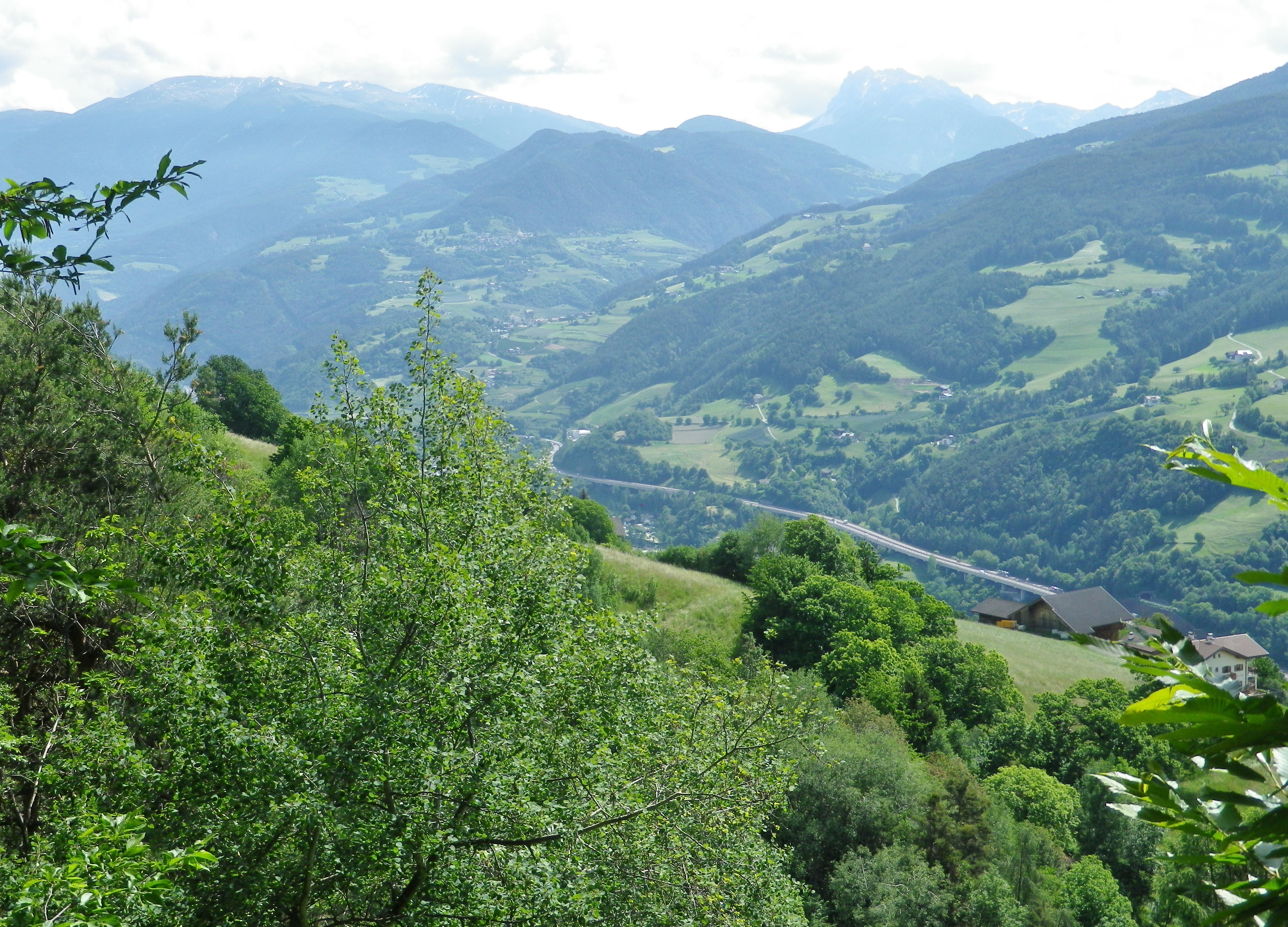
Just as the Kirchsteig joined the road to the center of Villanders, I had one more expansive view of the Eisack river and its valley, making its way through the Dolomites on its way to points south. A memorable end to a memorable trail, or possibly four or five due to the multiplicity of trails and trail names involved!
Trail Name: Toerggeleweg Villanders/Villandro (AKA Toerggelesteig) (See comment below)
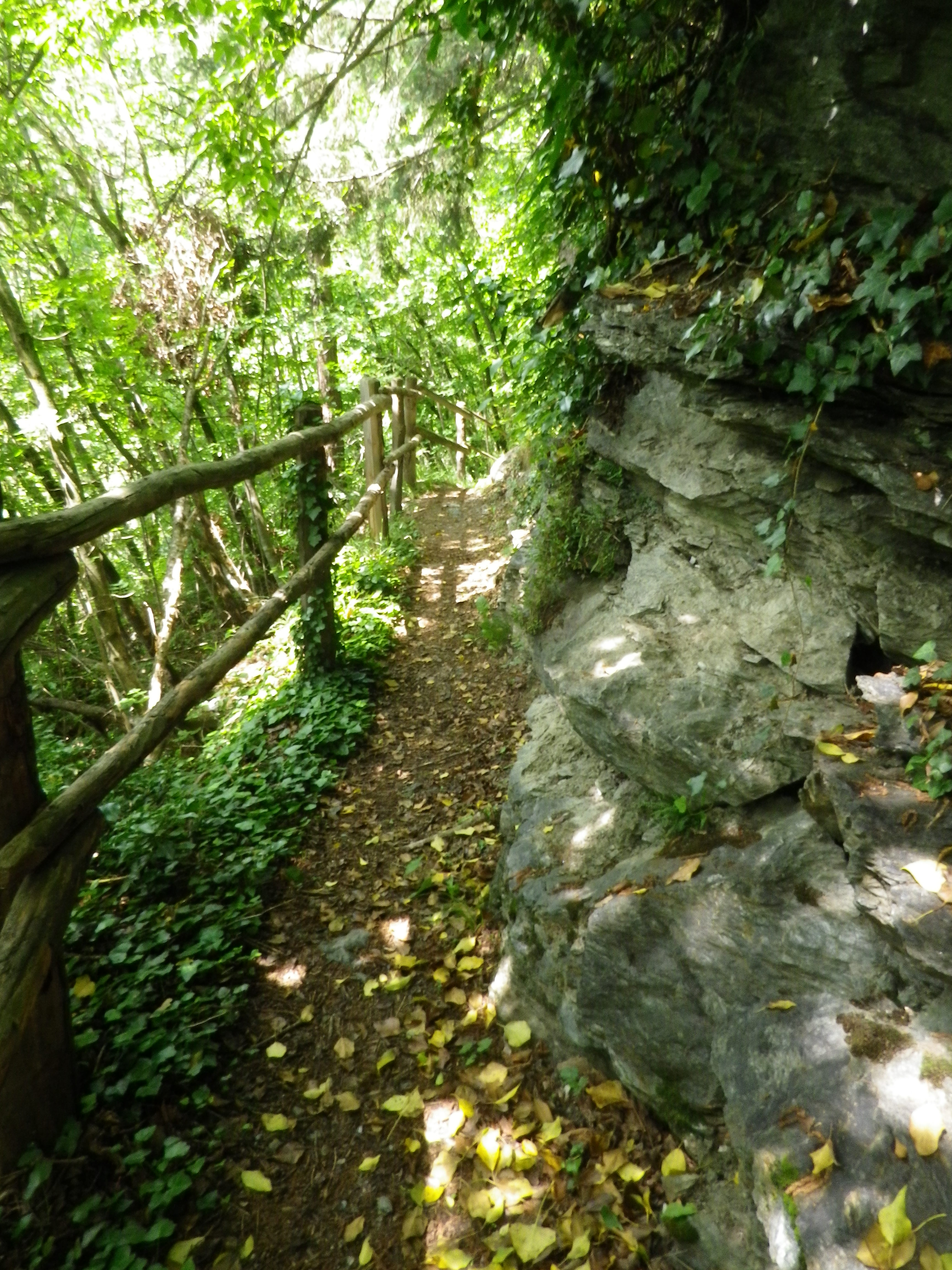
Trail Type: Short distance circuit; somewhat maintained, mostly rough surfaces outside built-up areas, sometimes spotty marking on the trail.
Length:
Total – approximately 8.5 kilometers/ 5.25 miles
Convenient to: Klausen/Chiusa, Bozen/Bolzano, or Brixen/Bressanone, Suedtirol/Alto Adige, Italy
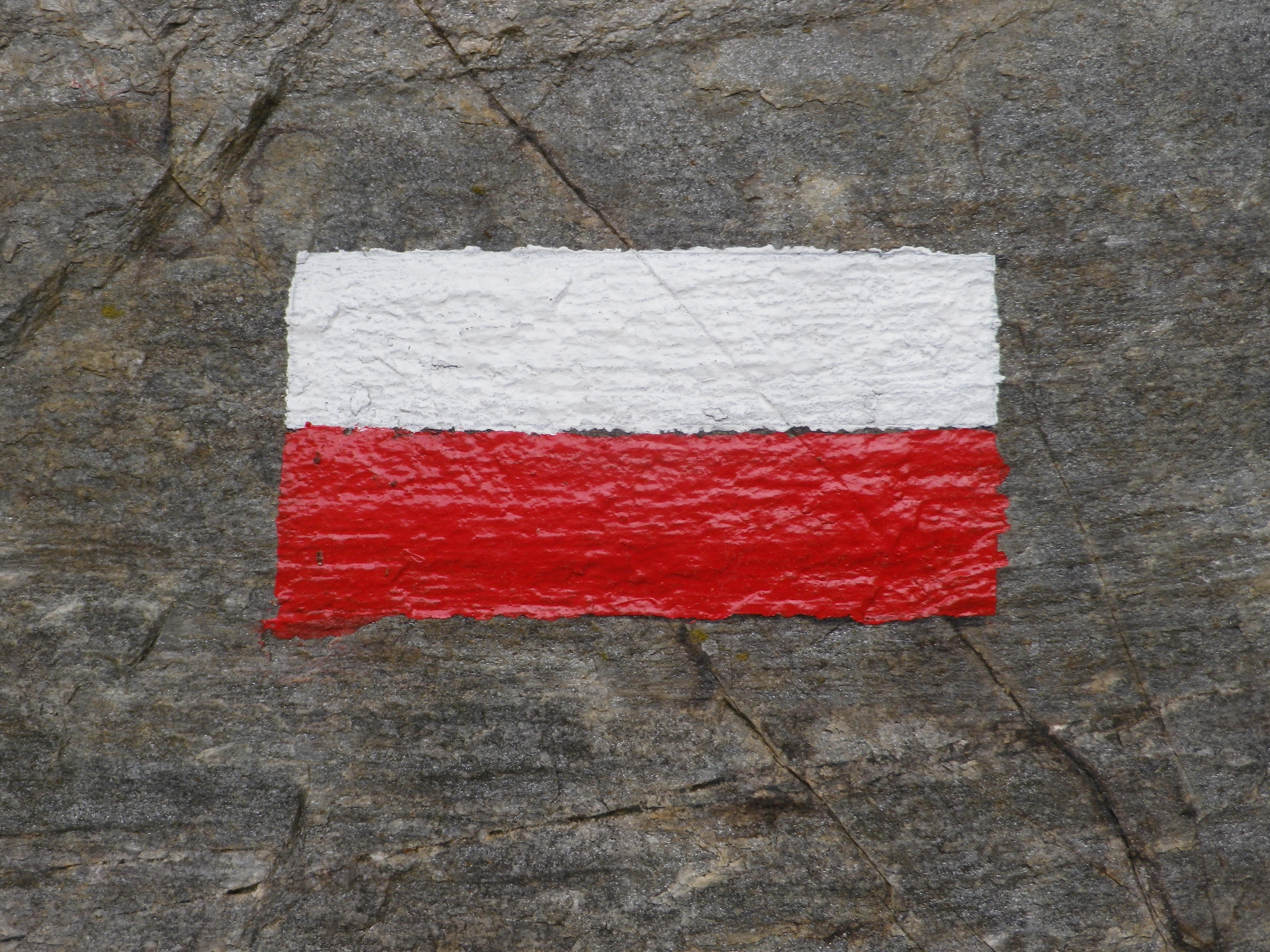
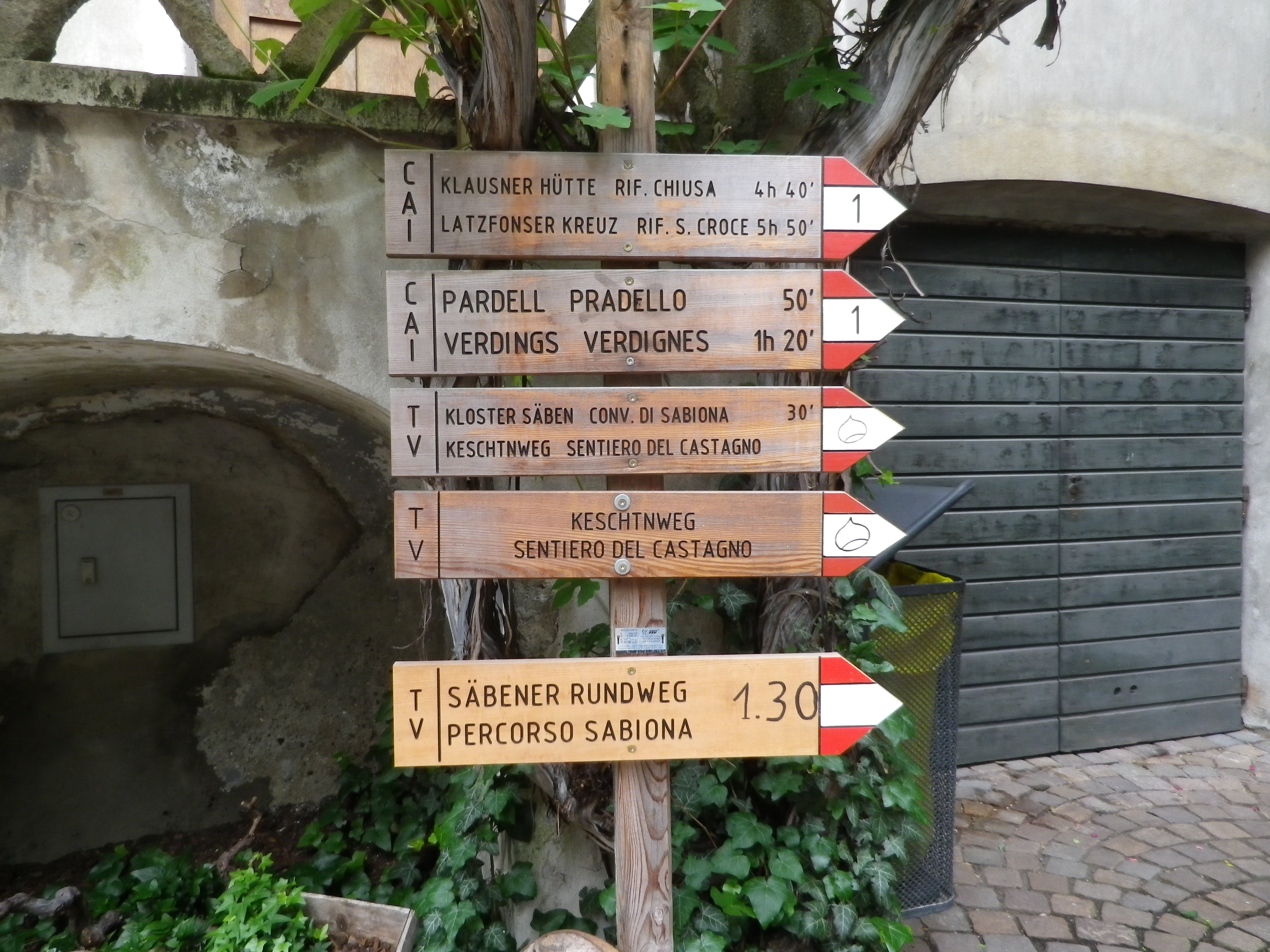
Marking: Partly along the Keschtnweg/Sentiero del Castagno (chestnut outlined in black on a white background), partly along the Toerggeleweg (AKA Toerggelesteig) bunch of grapes outlined in black on a white background; In Italy in general, horizontal white and red rectangles, either in isolation or with a trail name or symbol, indicate you are on a hiking trail.
Trail Description: Beginning in a village, this circuit trail passes through a nice variety of woodland, meadow and vineyard landscapes, while providing fantastic views of the majestic Dolomite peaks in the Odle Group. While slightly more challenging than some vineyard hikes on account of the rougher trail surfaces (in places), numerous ascents and descents, and generally steeper terrain, it is suitable for most moderately fit hikers.
Trailhead: Villanders: Kirche Sankt Michael/San Michele, Vicolo Franz v. Defregger (by Hotel Ansitz zum Steinbock)
Parking:
Villanders: Unterdorf, a medium-sized lot (behind and below the townhall/tourism office)
Public Transportation Options:
Rail: Regular service from Brixen (to the north) or Bozen (to the south) to Klausen
Bus: Service from Klausen to Villanders is available through Verkehrsverbund Suedtirol, the 345/ Villandro-Chiusa line. Information may be found (as of June 2020) at www.suedtirolmobil.info.
Suggested Stages: Not applicable
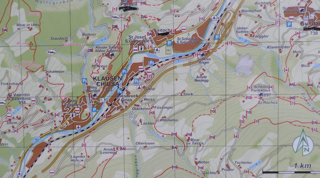
Trail Itinerary-Reference Points: (Clockwise)
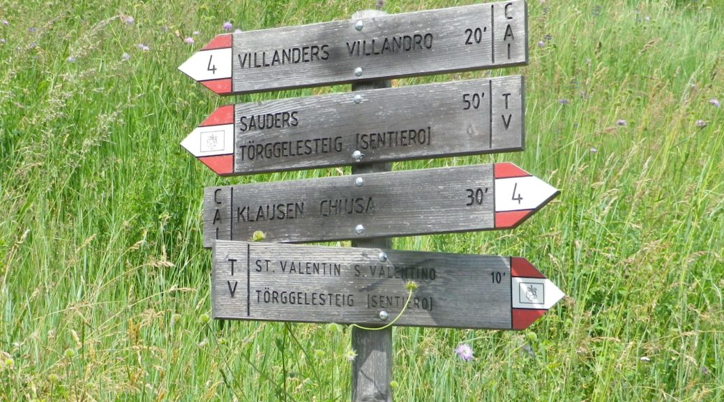
Villanders: Center of Villanders (Unterdorf x Hofstatt)’ Path below Kirche Sankt Michael/San Michele, Fussweg St Stefano-Gravetsch, briefly on St Valentin; cross the creek; woods, Erzweg, Johannser (settlement), cross creek lower down; Sankt Valentin/San Valentino: Am Erzweg/Via alle Miniere, Landestrasse/SP 87, past a chapel; Bodenacker: Past some houses, onto Toerggelesteig path, downhill then uphill through woods; Oberstattleitner compound; Unter St Stefan/St. Stefano: Past the Ober- and Unter- Furner compounds; Sauders: past a church; Kirchsteig path (blue and white signs), Villanders: Hofstatt, toward town center (Ortsmitte)
Representative Trail Photos:
Restrooms:
Villanders/Villandro: In the Cemetery, in the hillside above the graves
Villanders/Villandro: Down behind the town hall complex, by the sports fields
Attractions on or near Trail: None (except the scenery!)
Tasting along the Trail:
Look for Toerggele or Buschenschank, especially in Sauders and nearby Oberfurner and Oberpartegg, and hotel restaurants in Villanders center.
The regional cooperative is on the outskirts of Klausen.
Alternative Options:
Hiking: Lots of hiking trails, naturally, but only the other Toerggelesteig trails in Klausen, Feldthurns and Barbian (see comment below), and the Leitach-Chiusa Sentiero del Vino (a 4.5 km circuit), are wine-themed trails.
Additional Information:
Regional: https://www.klausen.it/it/
Trail specific: https://www.klausen.it/it/365-giorni-attivita/escursionismo/escursioni-consigliati/
Comments:
In addition to Villanders, nearby Klausen/Chiusa, Barbian/Barbiano and Feldthurns/Velturno also have Toerggelesteig trails, especially popular during new wine season in the autumn. This may account for a number of trails in the area being marked on some maps as “Toerggelesteig,” which exceed the scope of the Villanders circuit described above.
What I Learned:
In the South Tirol area as a whole, almost 45 percent of the territory is planted with red varietals. These include Cabernet Sauvignon, Merlot and Pinot Noir, and two special varietals: Lagrein, and Vernatsch. These two grape varietals have indigenous origins, and have been traditionally vinified in the South Tirol for centuries.
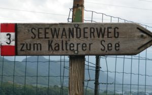
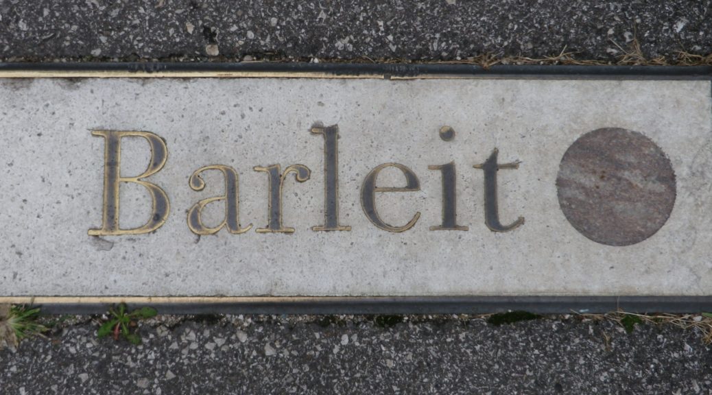
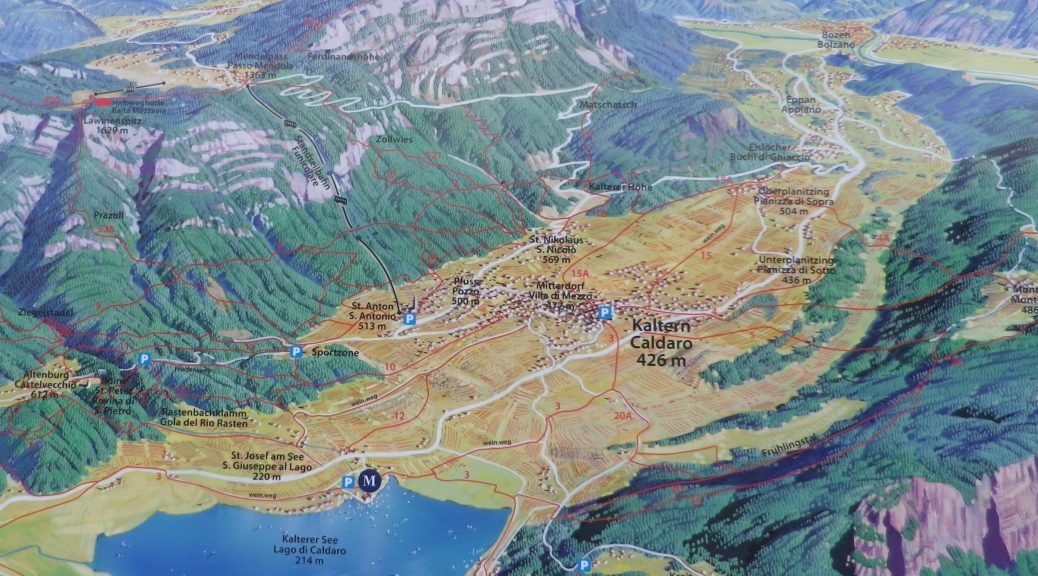
The wine region of Suedtirol Alto Adige has seven wine districts. The Oltradige district, the area around Kaltern and Eppan, is dominated by high hills on both the east and west sides of a valley, and contains a lake in the middle. This district produces one third of all wine from the region, with white wine production predominating slightly at 56 percent. However, the red varietals and wines from this district are unique, especially when from around the lake called both Kalterer See (in German), and Lago di Caldaro (in Italian).
Trail Name: Wein.weg
Trail Type: Short distance circuit; almost exclusively paved, well maintained, and well-marked albeit with successively different path numbers.
Length: Approximately 9.5 kilometers / 5.9 miles
Convenient to: Bozen/Bolzano, Italy
Marking: Red and white markings with black numbers for paths 12, 12a, and 3 (Seerundweg)