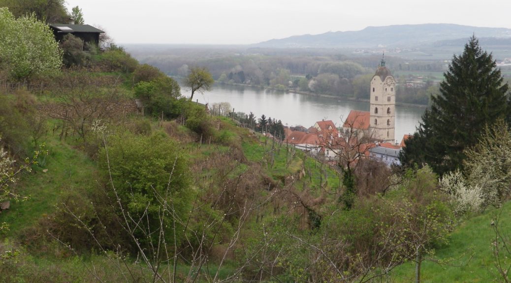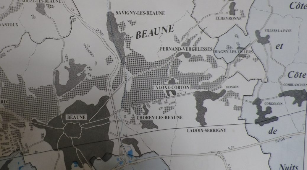
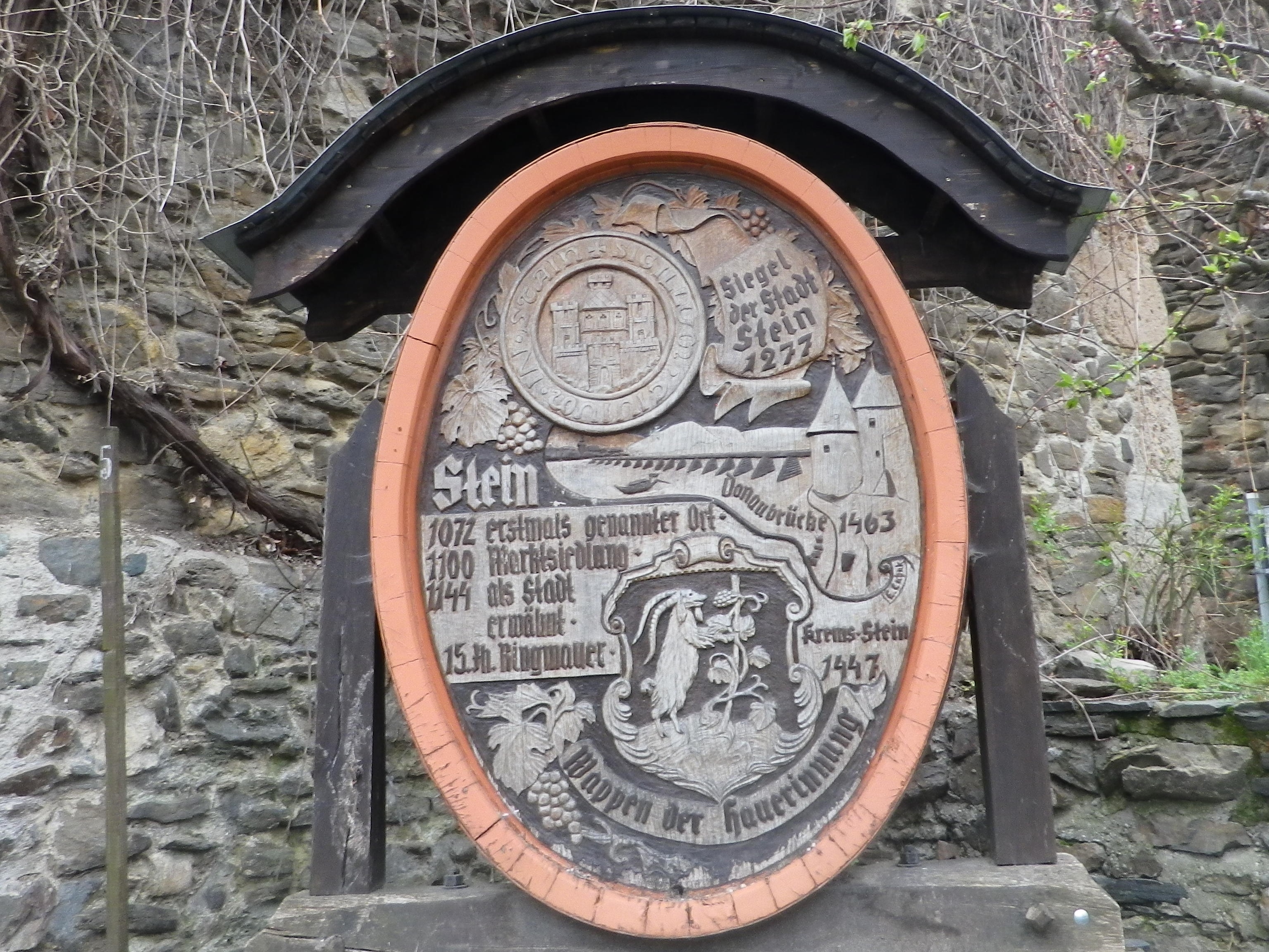
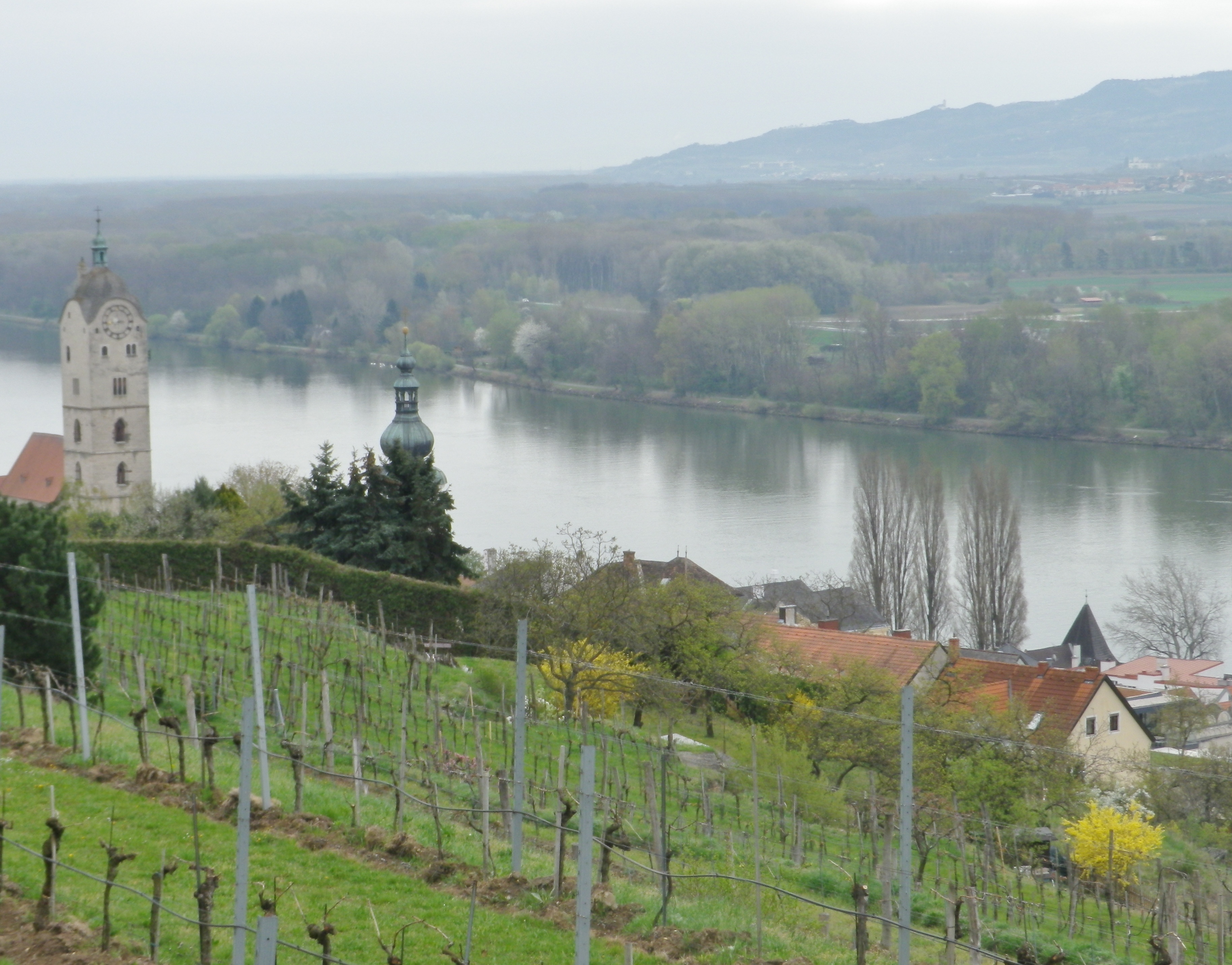
Schreckberg, specifically the Steiner Schreck, Hund, Altenburg, and Steiner Pfaffenberg are four named vineyards along the itinerary on this hike above the town of Stein an der Donau, Austria. The Krems River is a major tributary to the Danube. The Kremstal wine region has Krems, on the Krems River and the Danube, as its main city. Krems has the little town of Stein an der Donau attached to it. Although Stein’s vineyards form part of the Kremstal wine region, it is easy to see why some experts believe that this area belongs to the Wachau wine region. Situated along the Danube upriver from Krems, Stein vineyards flow into those of the Wachau by Loiben, at the end of a visually dramatic and historically significant section of the Danube. A hike along this section of the Danube is a fairy tale come true.
This itinerary granted the typical three wishes for an ideal vineyard hike: beautiful natural scenery, charming small towns, and renowned vineyards. On magical moments here and there along the trail, all three lined up for a memorable photo opportunity.
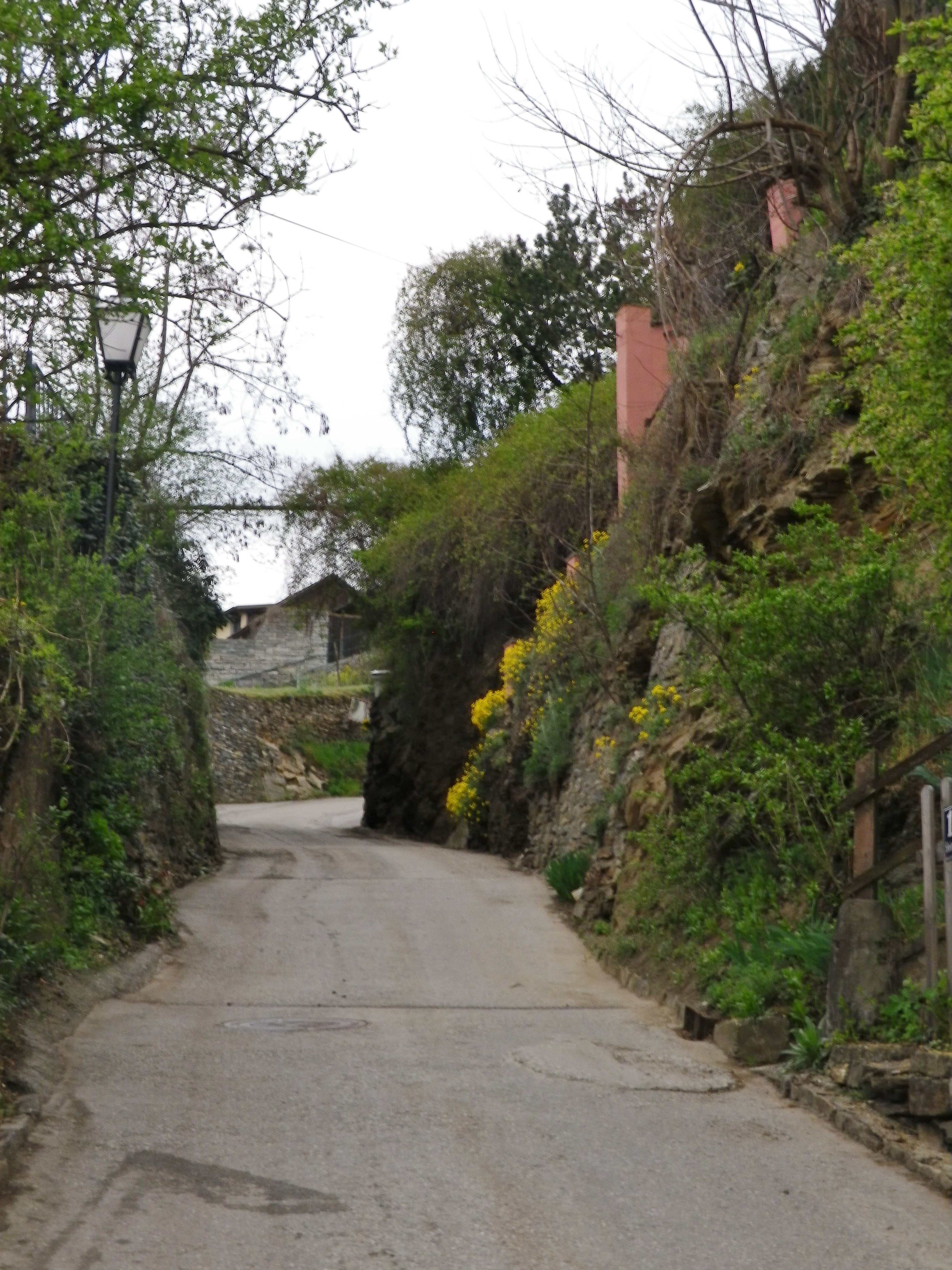
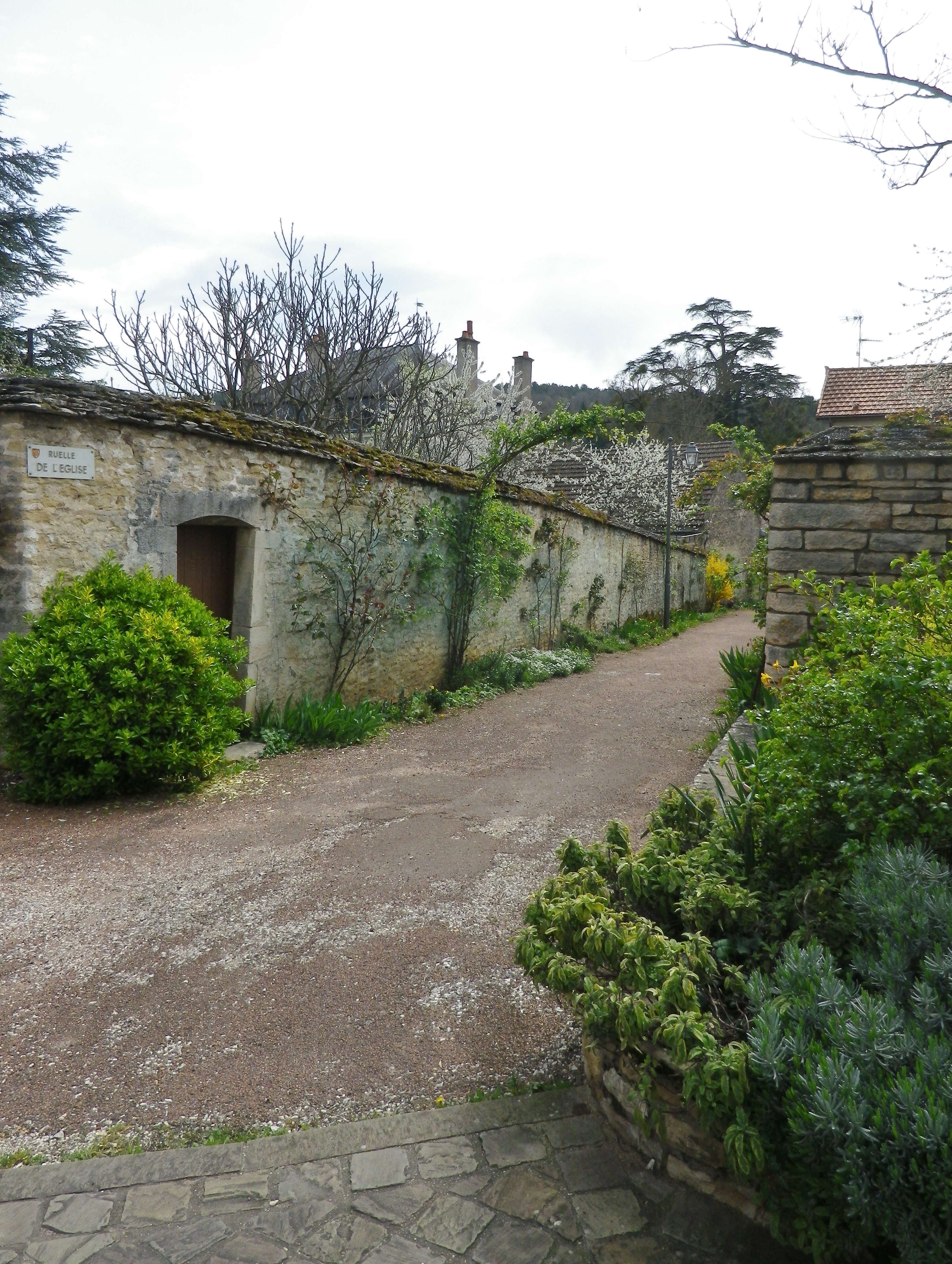
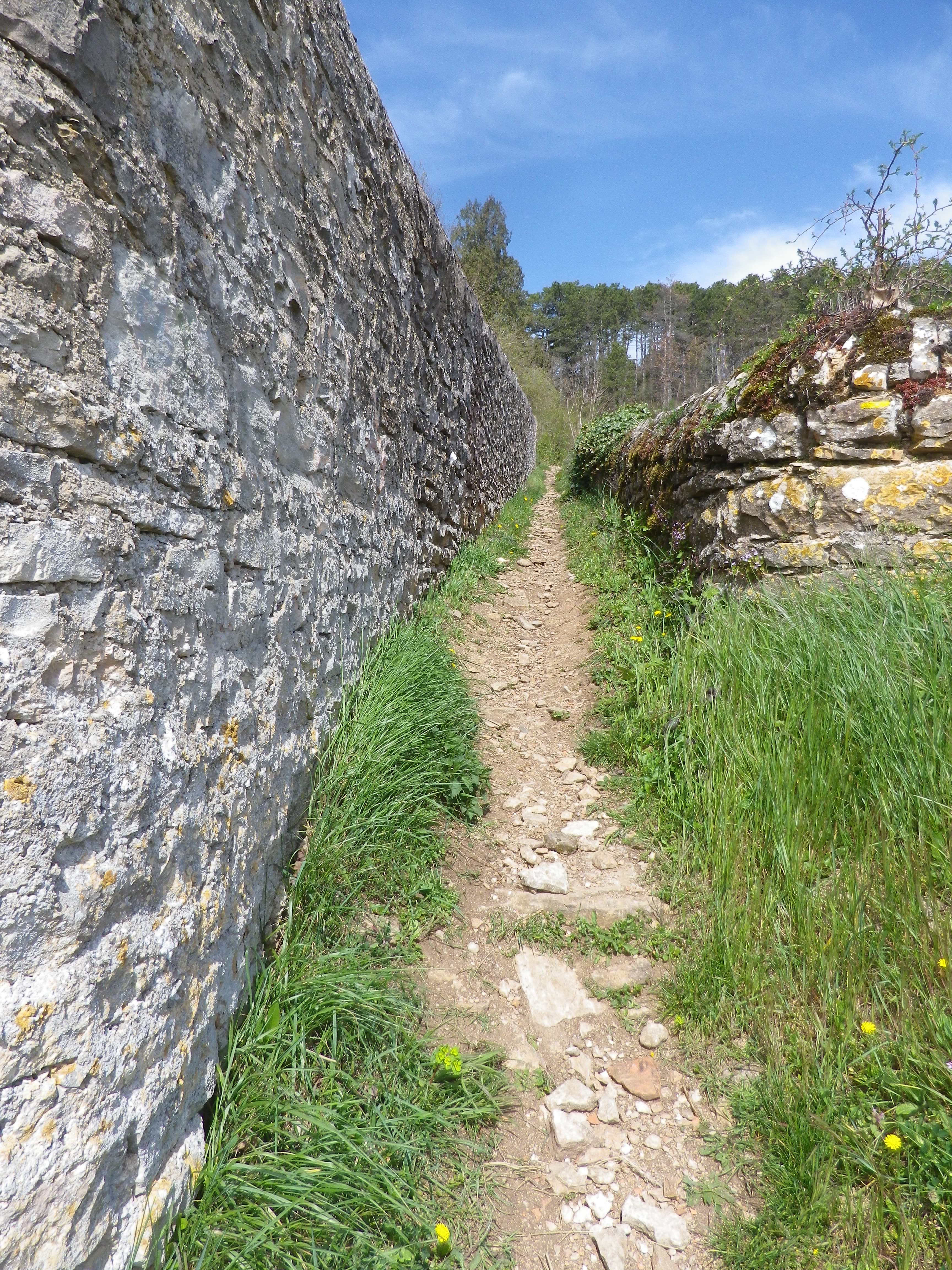
My hike began along the Steiner Kellergasse, or Stein’s “Cellar Lane,” where the vintners had their cellars, and in some cases, still do. This area is just below the vineyards, on the edge of the built-up area of town, and climbs uphill toward the vineyards. Soon I was in them. No doubt Stein is still very much a wine village.
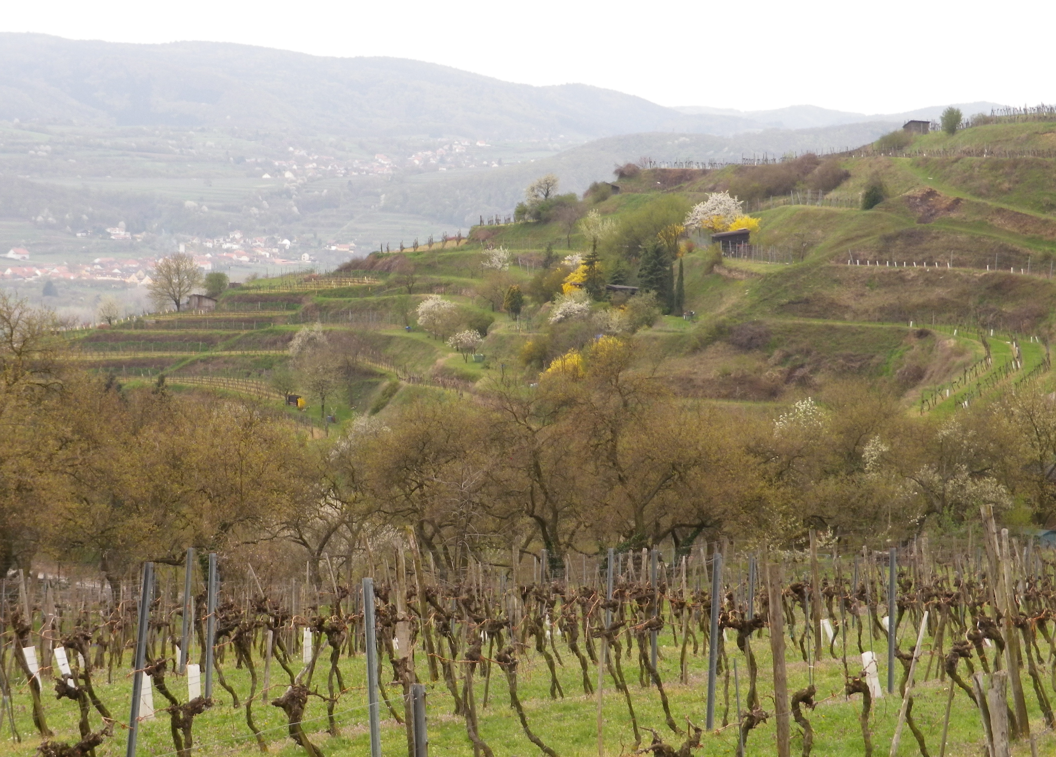
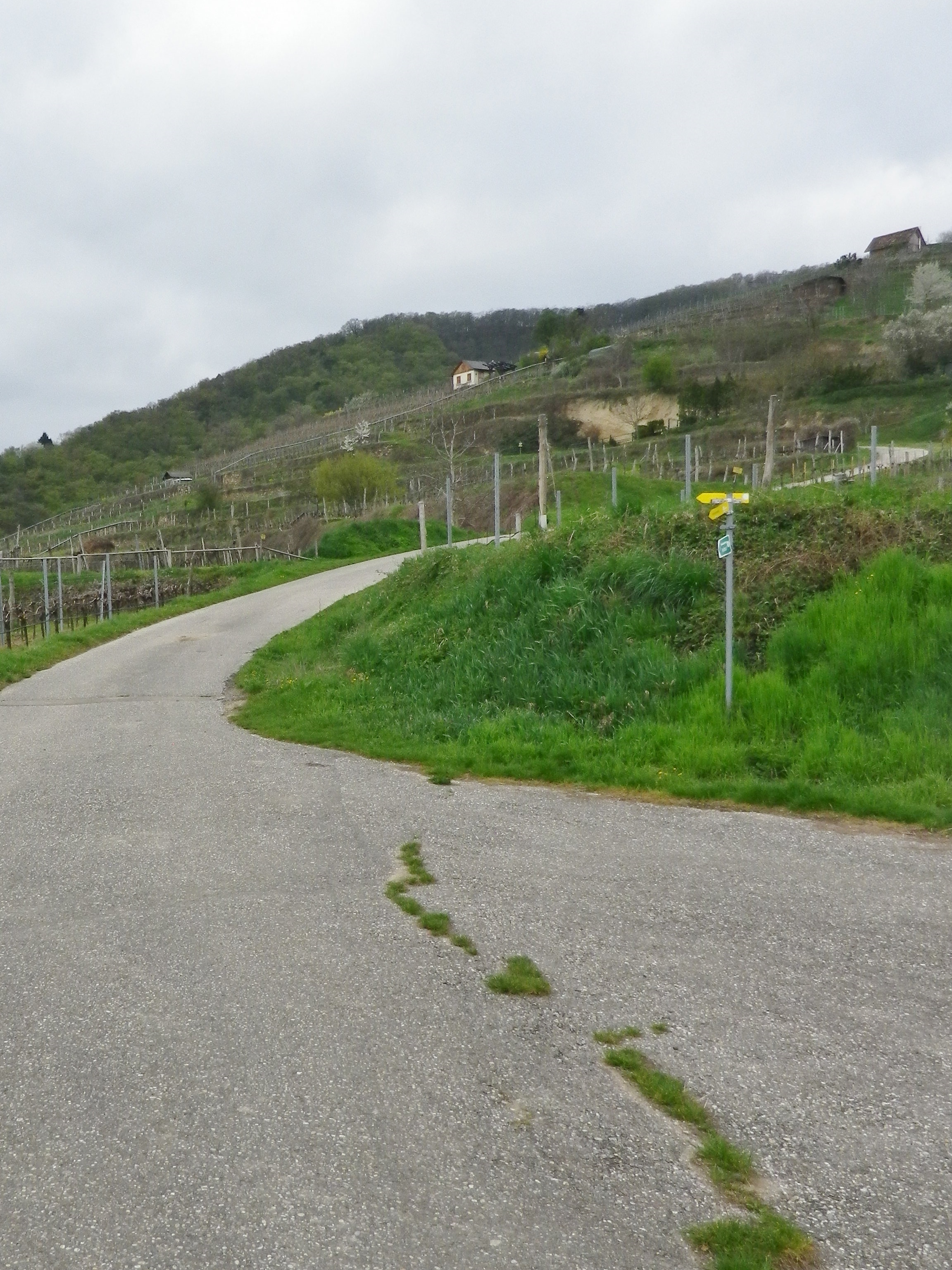
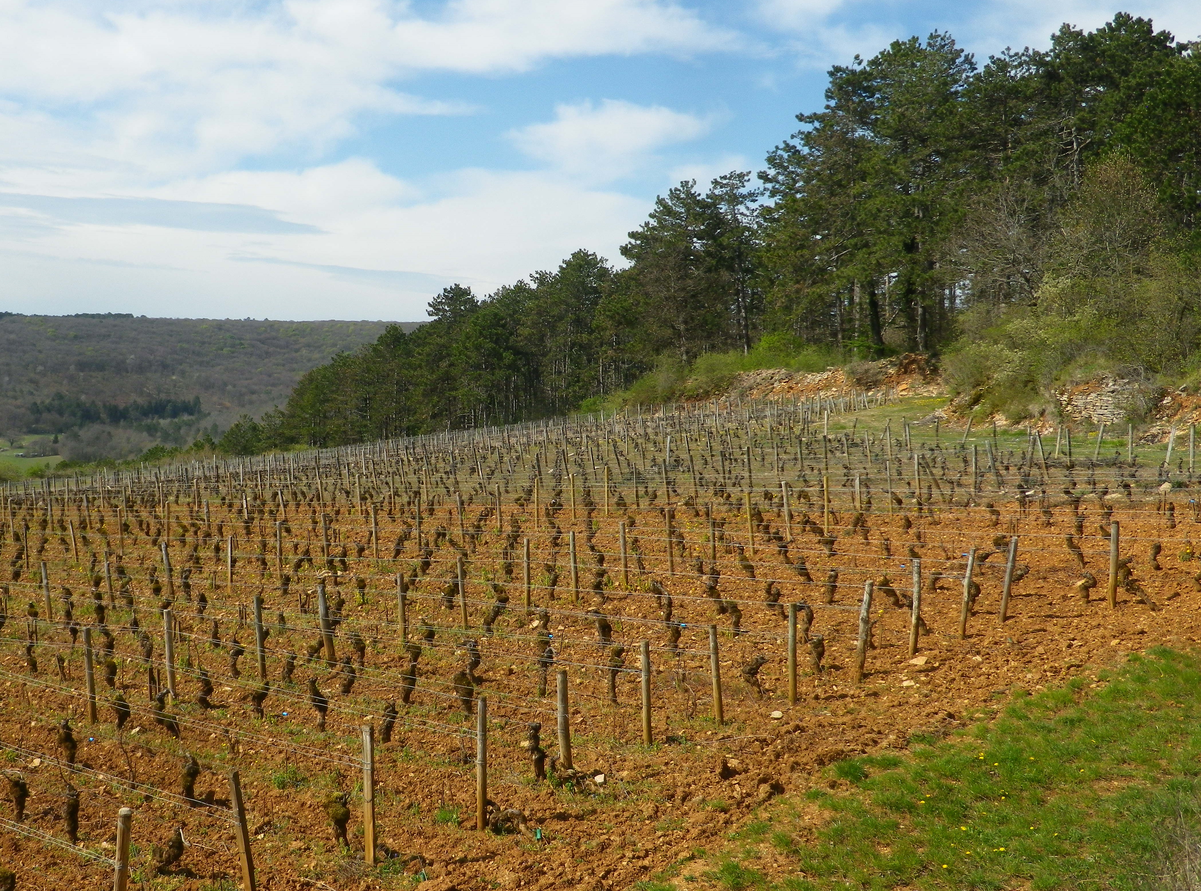
This final section of vines in the Kremstal appellation, has some unique parcels, with unique soils and aspects. The vineyards on the Schreckberg are steep and terraced. Each terrace seems uniquely formed to provide the best aspect for a few rows of vines. From a distance, these look charmingly higgledy piggledy, but up close, they make perfect sense. Deep cuts between parcels expose the subsoils, showing deep sedimentary layers. On finally reaching the top of the Schreckberg, the trail circled around to head back down into town.
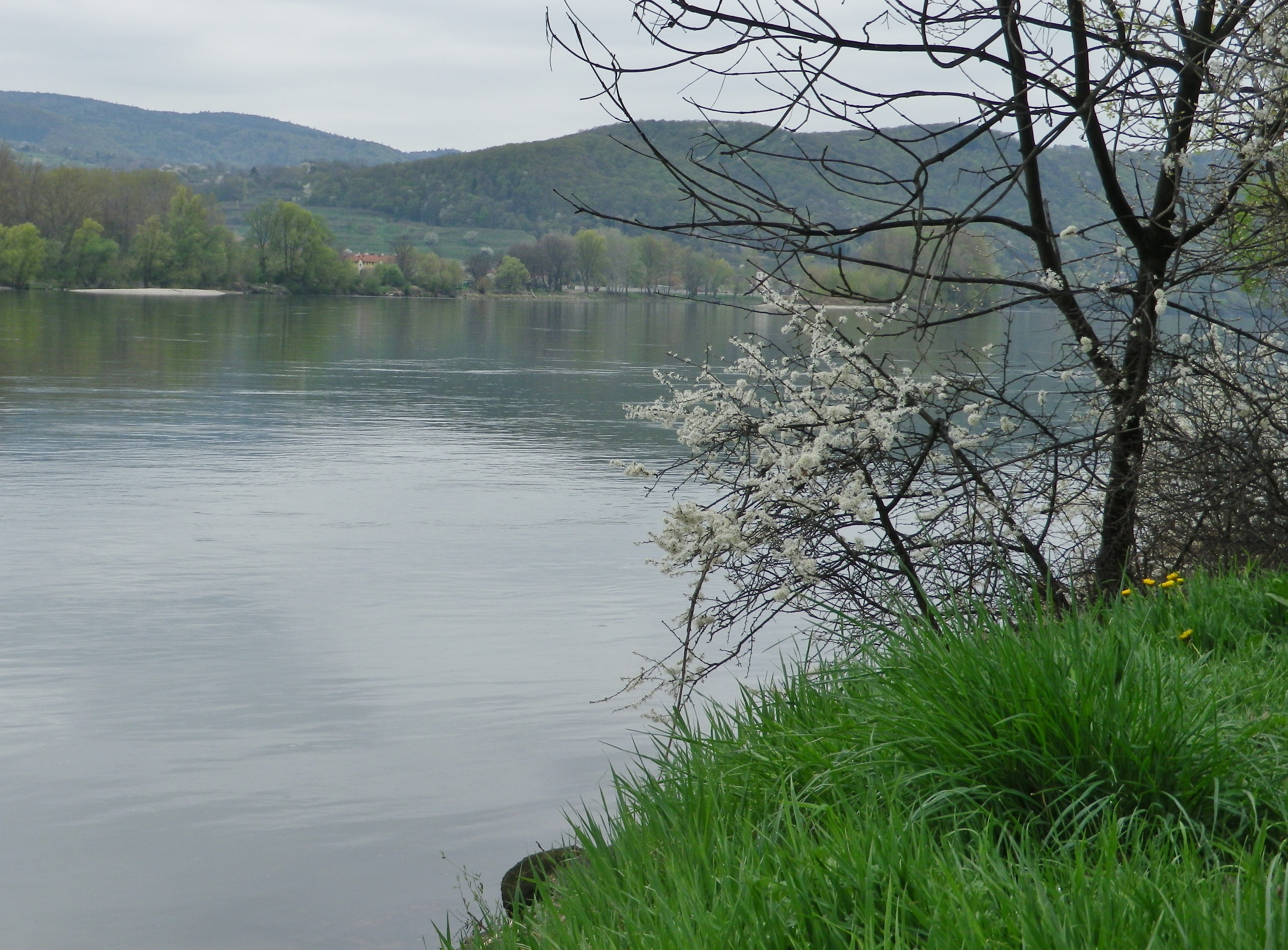
From this perspective, beautiful views of the Danube and the forested hilltops of the right bank. Upriver, the Danube twists and turns through a relatively narrow valley flanked by cliffs, with vineyards on the left bank facing south, and forests of trees (to include apricot trees at lower elevations) on the right. The water flows swiftly and silently along this section. It is difficult to believe that this peaceful spot is only 60 minutes by car or 75 minutes by train from Vienna!
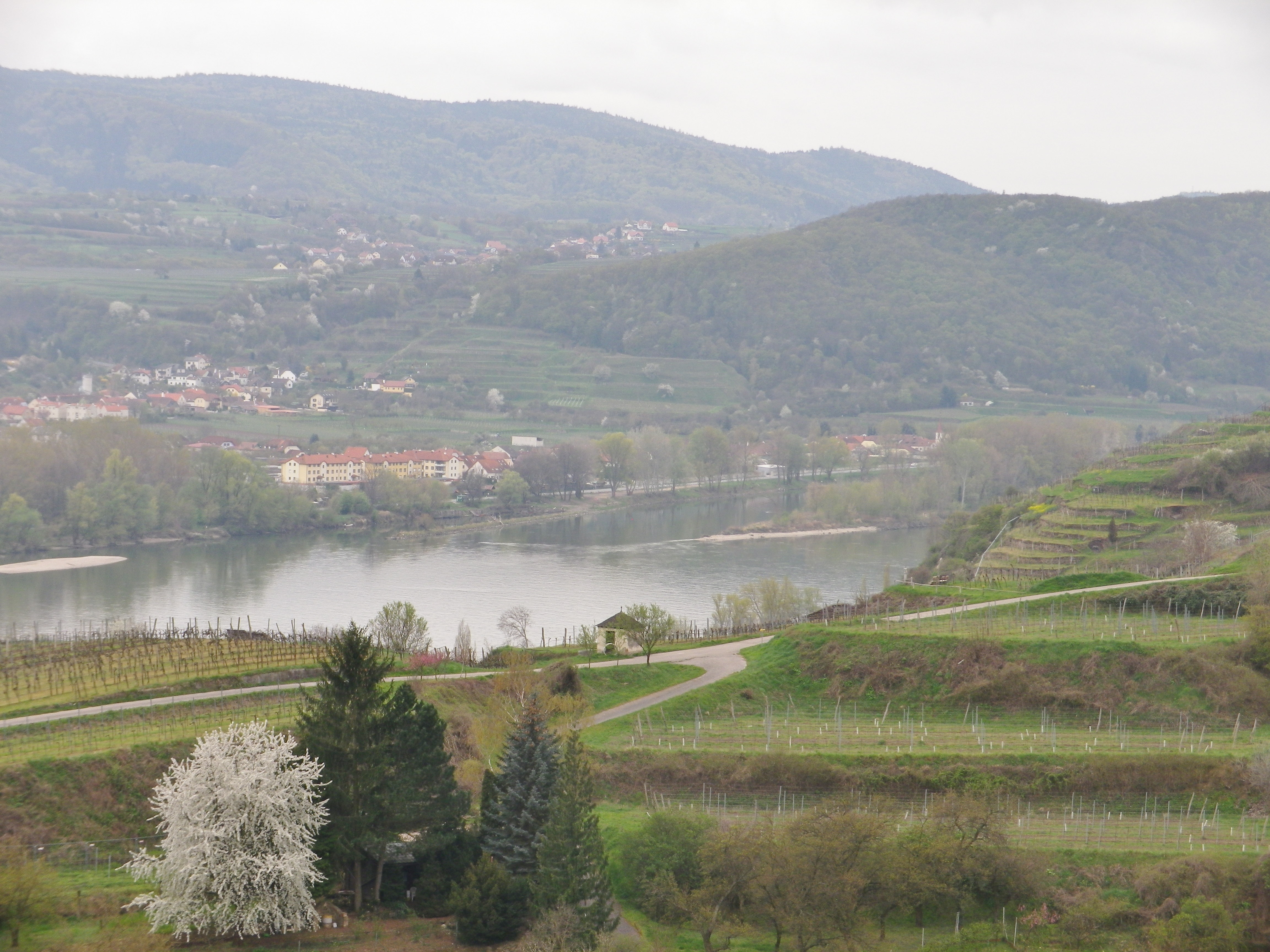
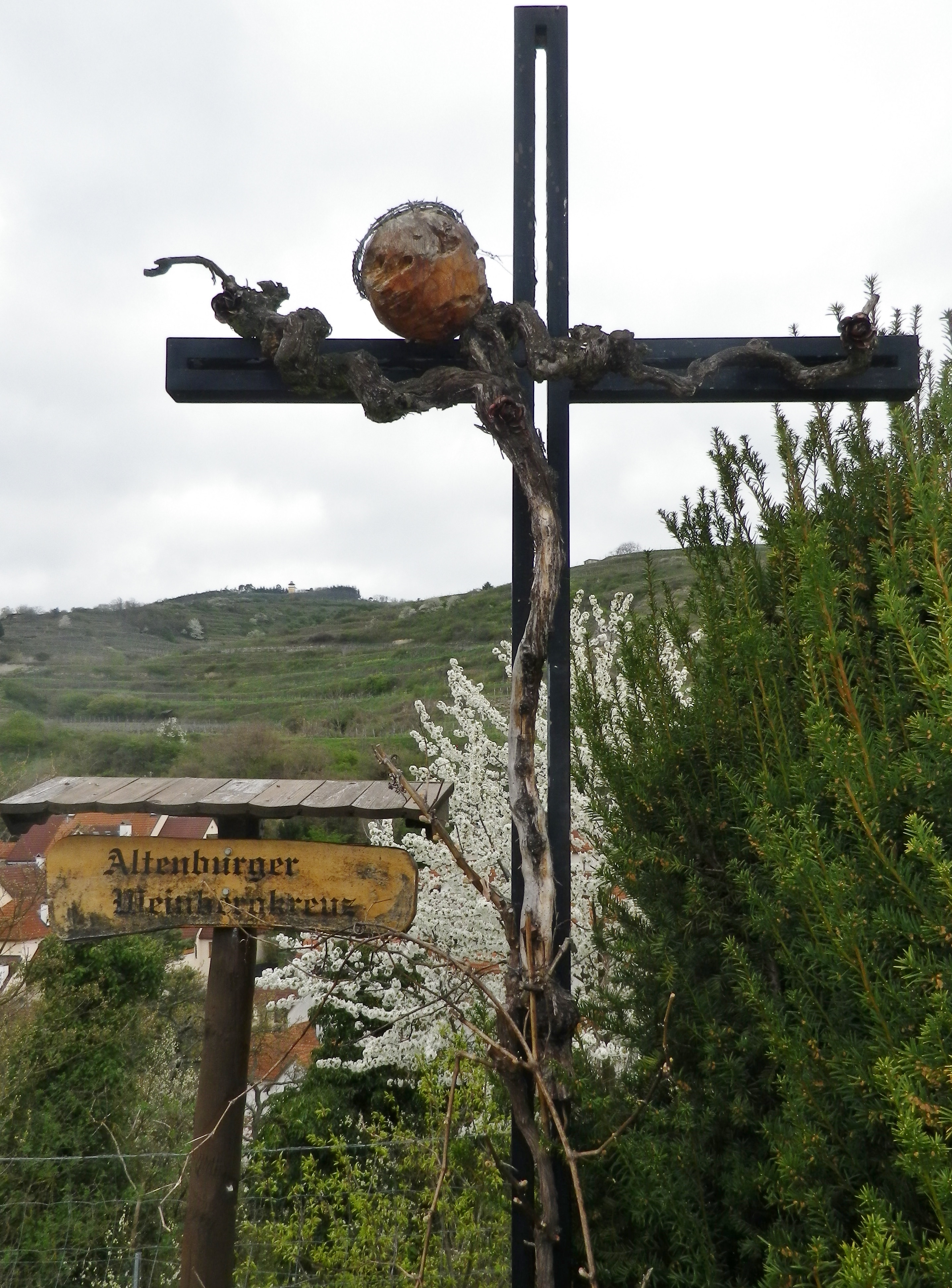
Separated by a road in a deep cut (the Reisperbachtal road), the next part of the hike went up the Steiner Pfaffenberg. It is closer to the Danube, rising seemingly from its narrow bank. Here, after passing the Altenburg ruins, and the Altenburger Weinberg Cross, made in part of vines, the noise and bustle of the town really fades away. The vineyards were quiet, and the terraces looked more regular, not quite as fantastical.
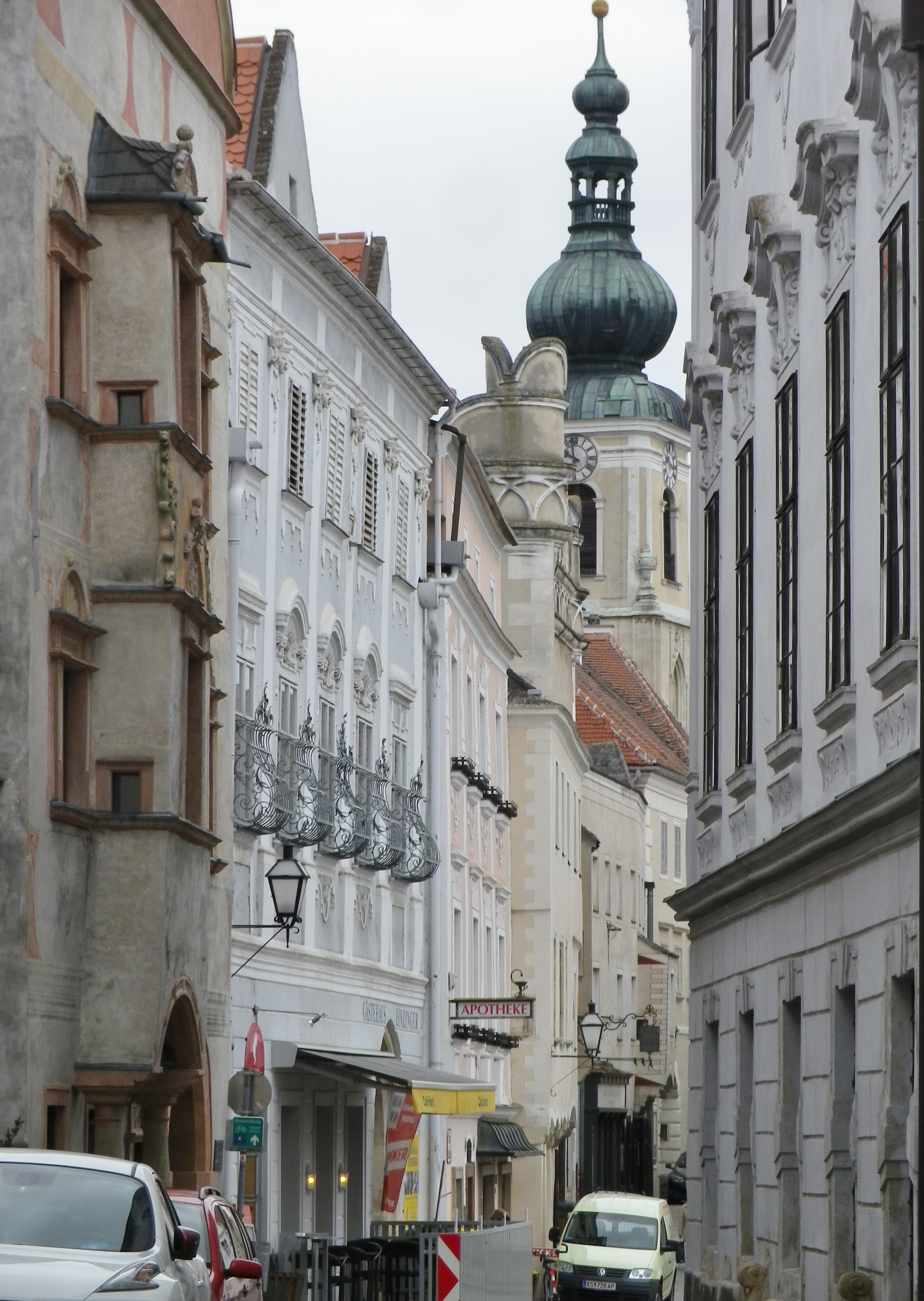
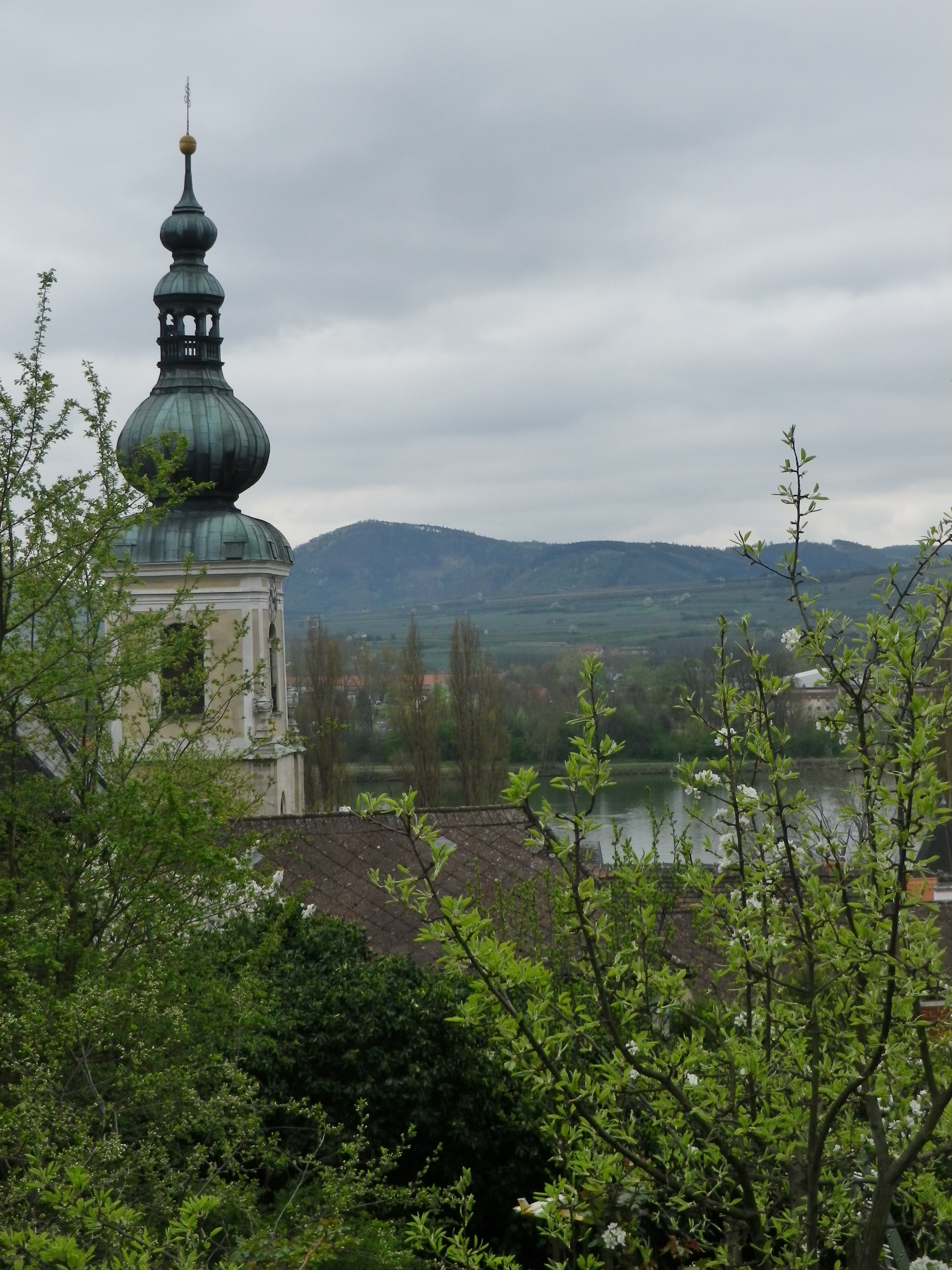
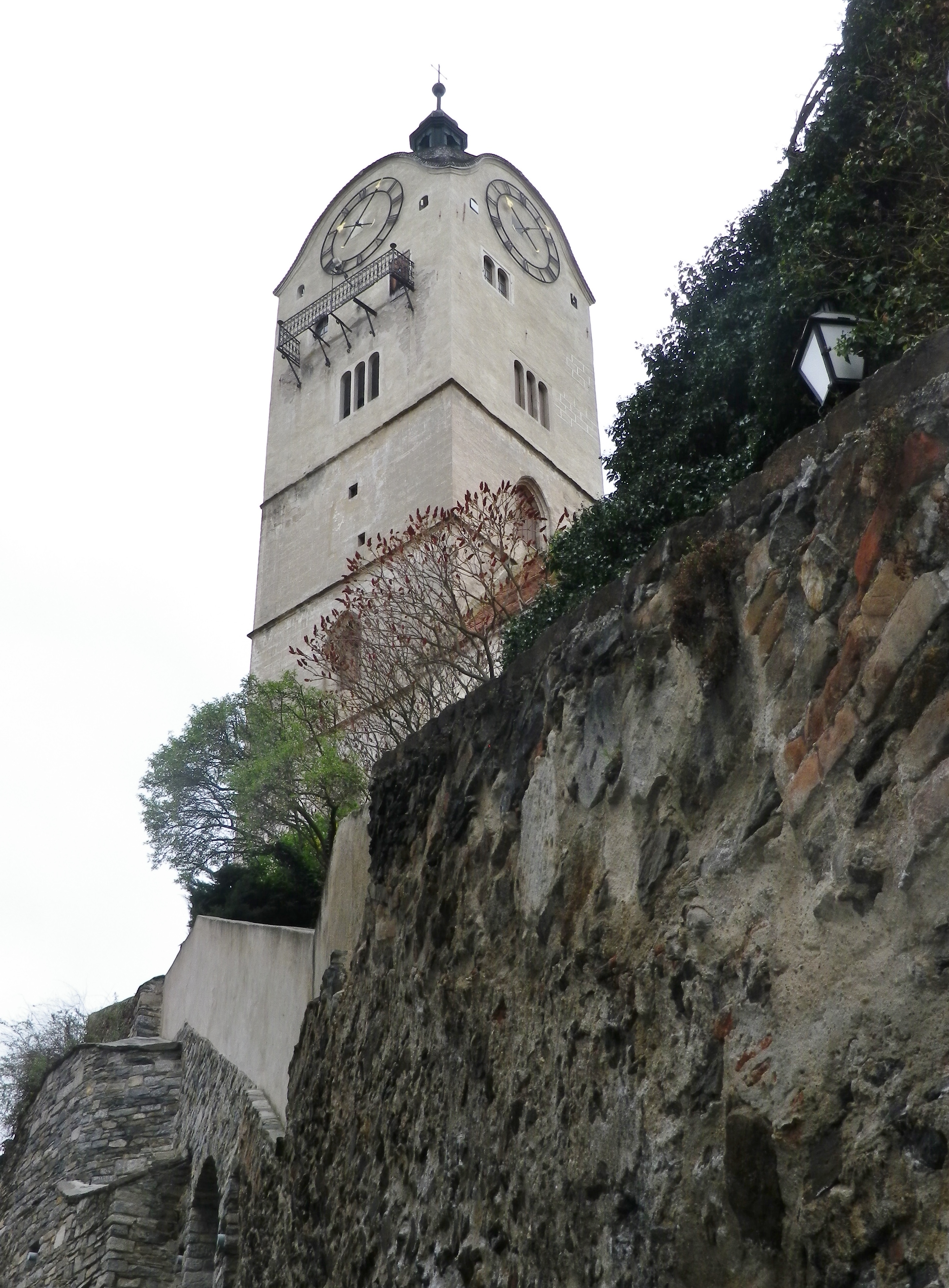
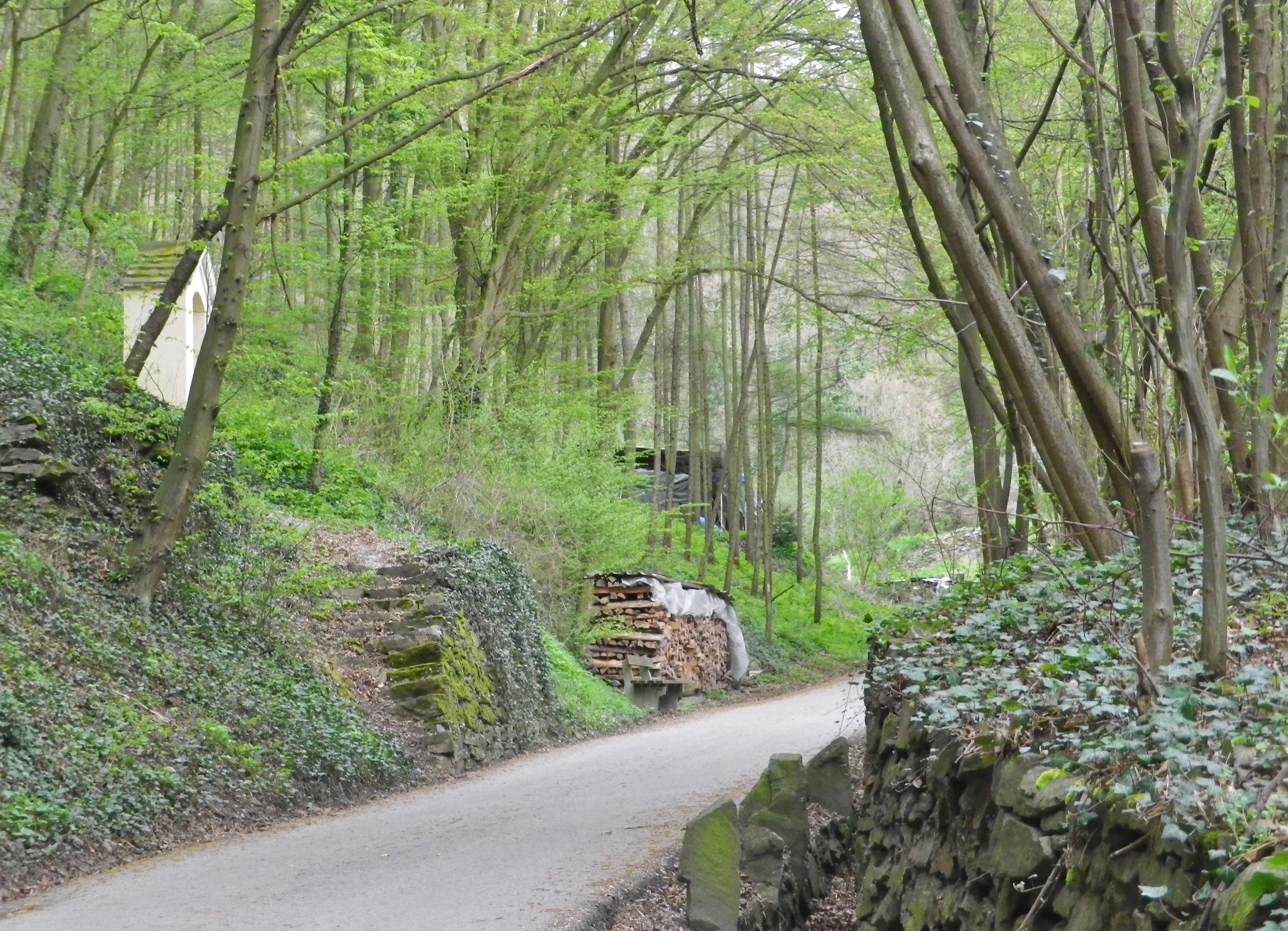
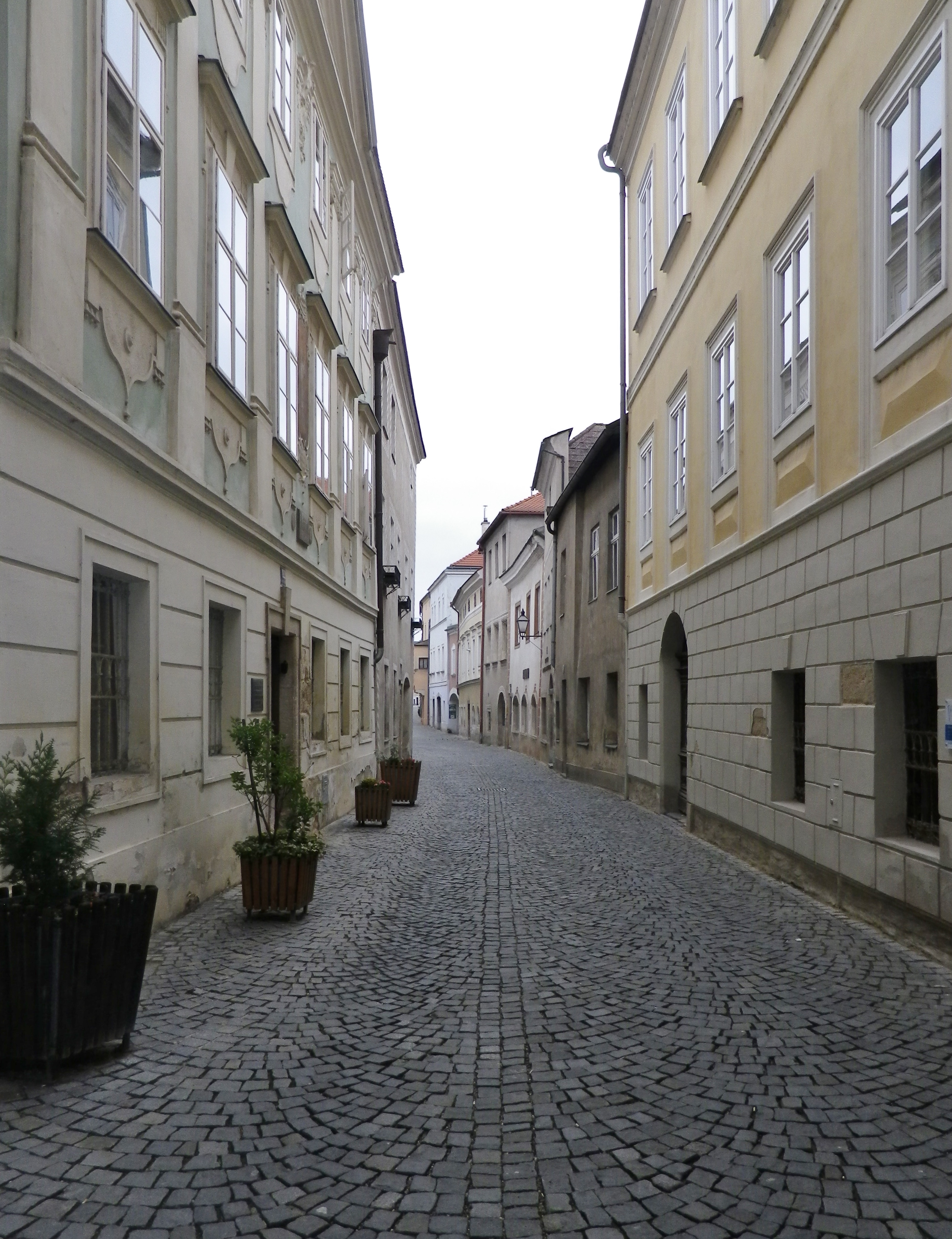
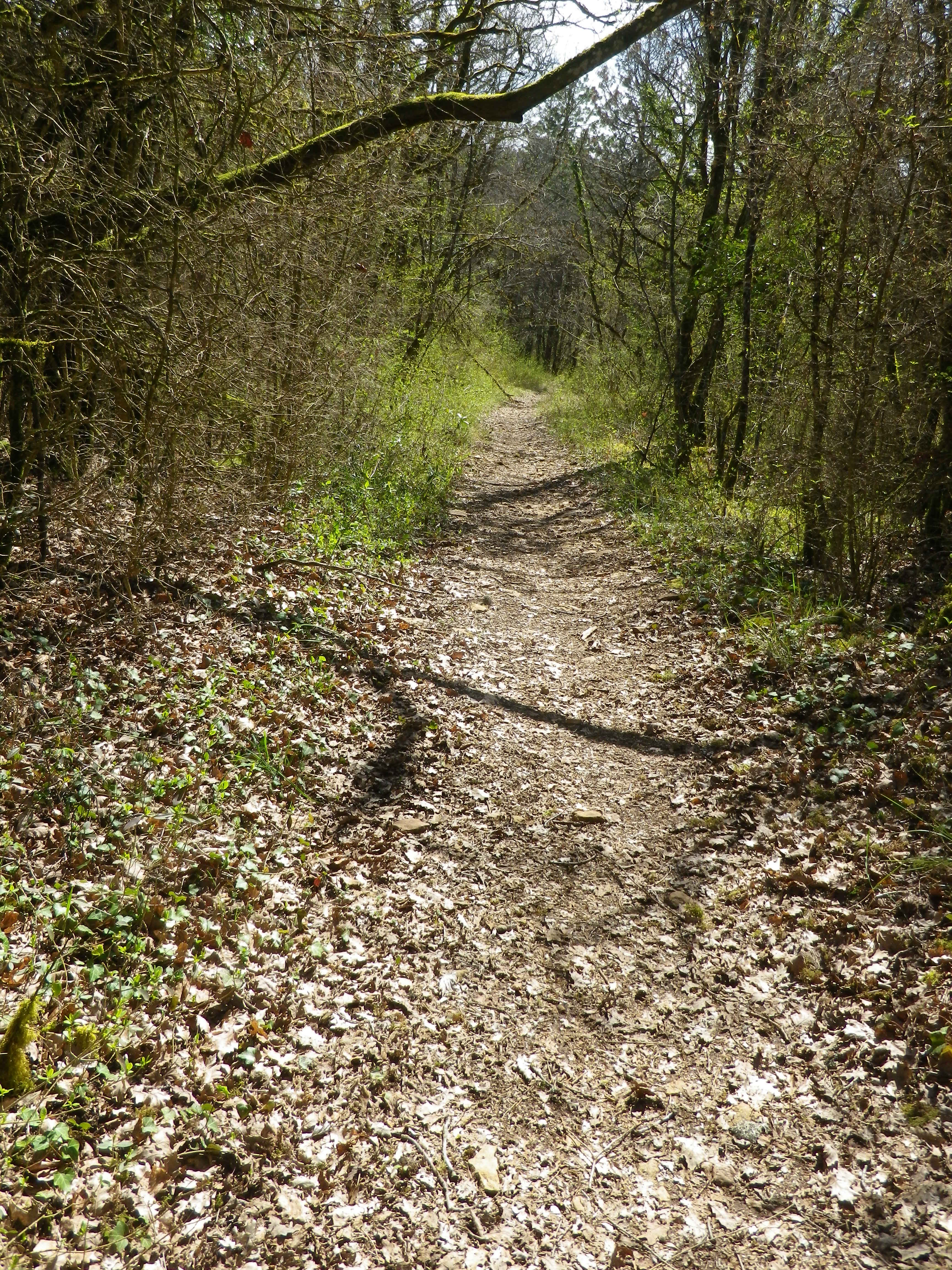
After a woodland interlude, the trail led down to Foerthof, a hamlet by the river with a medieval chapel of note. Following the river downstream, I soon reached Stein, and entered the historical section by an old gate. Nearby were well-maintained pastel-colored houses and shops, many with simple, but elegant Baroque facades. A slight detour led up to the parish church above the Steiner Landstrasse, and a set of stairs from the church yard led back down to it.
While it was one of the shorter hikes I have ever done, it managed to hit all the highlights of this magical district of Austria, and had the advantage of having great wine, which like an elixir, restores one’s idealistic belief in the myth of wine and eternal well-being!
What I Learned:
Kremstal (Krems Valley), in Krems, Austria, along with its associated village of Stein, and a narrow band of area on the opposite side of the Danube, form a wine district known as Kremstal. This district lies on both sides of the Danube River and its tributary, the Krems River. Vineyards lie above the communities on high slopes overlooking the communities and the rivers. Loess and sedementary soils predominate in this region.
Noted Ried (named vineyards) in Stein are: (from up to down river) Steiner Pfaffenberg and Hund; with other esteemed vineyards being: Pitschental, Altenburg, Grillenparz, Danzern, and Schreck.
Wine-making in the Krems region dates back about 2000 years. As Christianity moved east, monastic organizations revitalized the tradition. The oldest vintner association in Europe, the Hauerinnung Krems-Stein, has been here since 1442. In 1938 it founded Winzer Krems, a name that endures today. Its cooperative winery, Sandgrube 13, is located at the same address in Krems, and worth a visit.
Like the neighboring Wachau wine region, the Gruener Veltliner is the single-most cultivated grape, accounting for half the annual production. While grown elsewhere, this grape, and the white wine it produces, is Austria’s claim to fame in the wine world. Riesling is the second most cultivated grape. White varietals predominate here, and other white varieties include, Rivaner known elsewhere as Mueller-Thurgau), Muskatteller, Neuburger, and Pinot Blanc and Gris. Grown to a lesser extent, the red varietals include Sankt Laurent and Zweigelt.
What I tasted:
2016 Rivaner, Winzerbraut, Qualitaetswein, Halbtrocken, Winzer Krems (Niederoesterreich): An off-dry white wine with medium minus gold color; a nose of green apple and ripe white peach, toasted nuts, peach and slight spice flavors; medium acidity, nicely balanced overall.
2015 Sauvignon Blanc, Kellermeister Privat, Niederoesterreich, Qualitaetswein, Trocken, Winzer Krems: A dry white wine with medium minus gold color; light boxwood, gooseberry nose, with boxwood and citrus flavors, with a hint of spice; medium plus acidity.
2015 Gruener Veltliner, Frauengrund, Kremstal DAC, Josef Dockner: A dry white wine with light gold color; a floral and spicy nose, both sweet and sharp; floral, honey, tangy spice, vanilla and grilled peach flavors; mild acidity.
2014 Riesling, Ried Grillenparz, Erste Lage, Kremstal DAC Reserve, Weingut Stadt Krems: A dry white wine with light gold color; a sweet grape nose, and tropical fruits, turpentine, and spicy, mustard-like flavors, with a hint of minerality; medium acidity with a smooth finish.
2013 Gruener Veltliner Steinberg, DAC, Weingut Hutter: A dry white wine with a dark gold color; floral and fruity notes with a hint of grapefruit, very mild acidity.
2013 Riesling, Stein Terrassen, Weingut Hutter: A dry white wine with light gold color; floral notes with a slight hint of grapefruit; medium acidity.
Trail Name: Wein Wandern Stein (Unofficial name)
Trail Type: Short distance hiking circuit; almost exclusively paved, well maintained, but the route itself is not exclusively marked.
Length: Approximately 6 kilometers/3.7 miles
Convenient to: Krems an der Donau, Austria
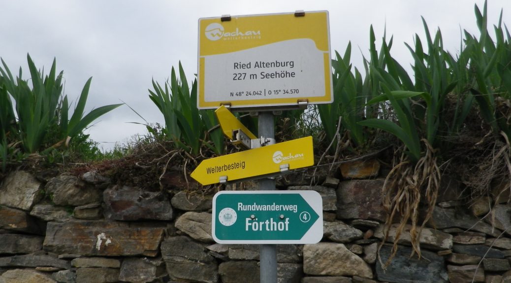
Marking: No trail-specific marking, although throughout this itinerary there are markings for other trails (to include the Welterbesteig signs, as shown below), and signposts (see the photo below) indicating named places and the “Welterbesteig Wachau” trail.
Trail Description:
An easy circuit through the village of Stein (part of Krems), and through the vineyards above the village, returning along the Danube. It focuses both on the village’s long-established viticultural traditions, and the vineyards that made it all possible.
Trailhead:
Stein an der Donau: Steinerkellergasse x Doktor-Karl-Dorrek-Strasse
Parking:
Krems/Stein:
Along Steiner Donaulaende, there are many parking spots, but on weekdays and summers, all likely will be taken; On Steiner Donaulaende, by Gottweigerhofgasse, a small parking lot.
Parking Garages on Yachthafenstr and Steiner Landstr x Anibas Promenade
Stein/Foerthof: Along Route 3/Donau Bundestrasse, there are two or three small, unimproved parking areas along the Danube.
Public Transportation Options:
Bus: Post bus serves Stein an der Donau. Check www.postbus.at
Rail:
OBB services Krems, connecting with nearby towns, and Vienna
Wachaubahn provides seasonal service upriver from Krems to Grimsing, to include Stein, Loiben (Unter and Ober-), Duernstein, Weissenkirchen in der Donau, Spitz an der Donau and Willendorf
Suggested Stages: Not applicable
Trail Itinerary-Reference Points: (Counterclockwise)
Stein: Doktor-Karl-Dorrek-Str x Steinerkellergasse, Steinspreng (at signs for Tullner and Mariazellerweg Trails), Guetersweg Schreckberg, circle counterclockwise on the Schreckberg lanes, return to Steinspreng; Right on Steiner Kellergasse, over train tracks by tunnel; Reisperbachtalstr, stairs (with W), on an path to an unnamed, paved agricultural lane, first passing the ruins of Altenburg castle, then the Altenburg Weinbergkreuz (a crucifix of vine stocks), Pfaffenbergweg-Foerthofstr-Steiner Donaulaende-Steinerlandstr-Reisperbachtalstr-Hintere Fahrstr-Frauenberg, stairs (at the St Nikolaus church) down to Steiner Landstr
Representative Trail Photos:
Restrooms:
None observed
Attractions on or near Trail:
Lining the Steiner Kellergasse are many nicely maintained wine cellars, some of which are still in use as such!
Tasting along the Trail:
There are several “Heuriger” (seasonal wine taverns), along the trail, and numerous taverns, bars and restaurants in town.
Alternative Options:
Walking: The Welterbesteig Wachau trail begins in Krems proper, and continues upriver to Melk (the famous abbey) on the high route along the Danube and sometimes inland through the vineyards and villages along the way. From Melk, it continues downriver back to Krems for a total of 180 kilometers. See the Nutshell here.
Additional Information:
Regional: https://www.krems.info/de/home/
Trail specific: None
Comments:
I adapted this circuit from one suggested by a local hiker, hence no definitive markings, or references to it online or in town literature. Therefore, there is no trail specific signage, although this itinerary does follow a section of the Welterbesteig Wachau trail leading from Resiperbachtal Strasse to Pfaffenbergweg, and then the two itineraries diverge at Foerthof
To extend the hike slightly, follow the Welterbesteig Wachau upriver along the Pfaffenbergweg, to the border between the Kremstal and Wachau appellations. To close the circuit, head downhill to the hamlet of Rothenhof and follow along footpath along the river paralleling the main road (B3) back to Foerthofstrasse. Continue the itinerary above from Fuerthof.
Like any fine Burgundian wine, Savigny should be savored. Not just the wine either: the sights and sounds of its sites merit time and attention as well.
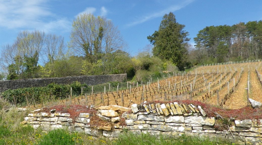
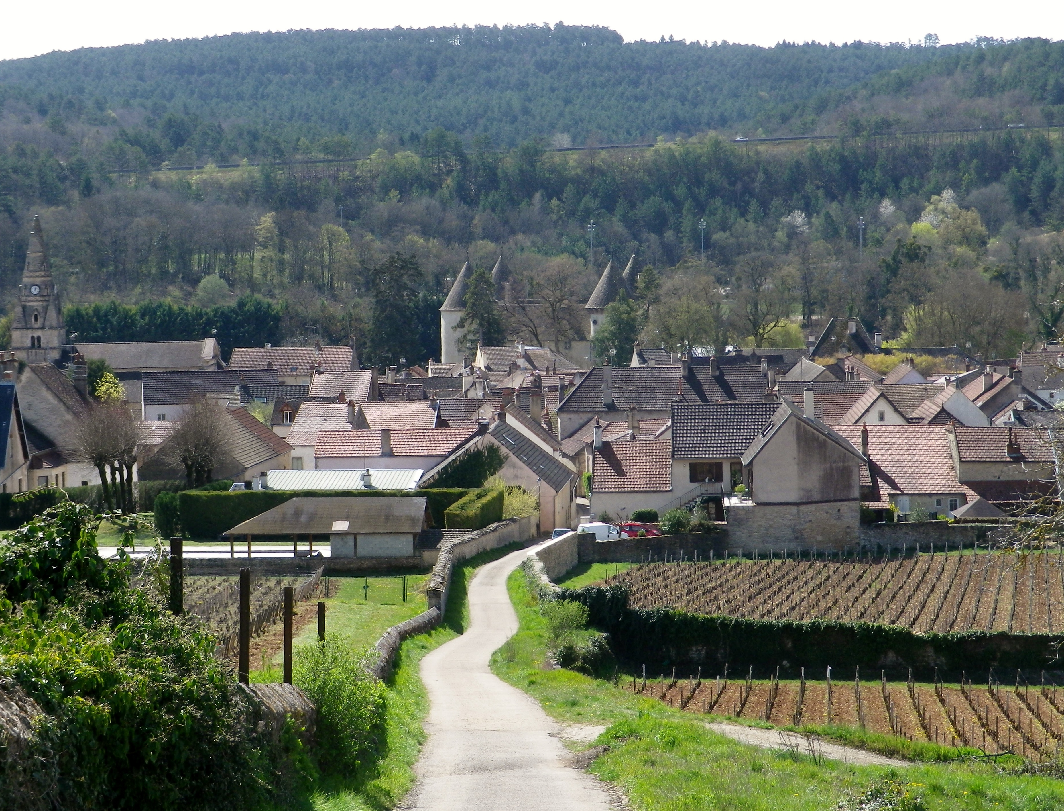
Savigny-les-Beaune, as its full name indicates, is located near Beaune, the main hub of the Cote de Beaune wine district. Like Beaune, this small town has its own appellation, covering both red (Pinot Noir) and white (Chardonnay) wines. It is in a beautiful setting. The village essentially follows along a narrow river valley, backed by high hills, and surrounded by forests and vineyards. While most visitors search for the wine, I wanted to explore the town’s vineyards and forests, as well as savor the quaint corners of the historical center.
The first sensation to hit me, aside from the bucolic scenery, was the soft scent of pine. After passing through the outskirts of town, the trail passes through a wooded area made up of many pine trees. It was an aromatic climb uphill, as I breathed deeply of the forest scents. Pines do well in poorer soils, as do vines, which appeared as soon as I crested the hill.
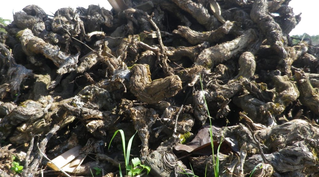
Chunks of limestone dotted the reddish soil surrounding the vines. Limestone is a prominent feature in the soil here. So much so that the rocks pulled from the soil are often piled together. Called “murgers,” these piles represent the backbreaking work of the vintners. Along much of this section of the trail, murgers would appear, the new serving as breaks between vines, and the old slyly hiding under a thick growth of vegetation in thickets and copses.
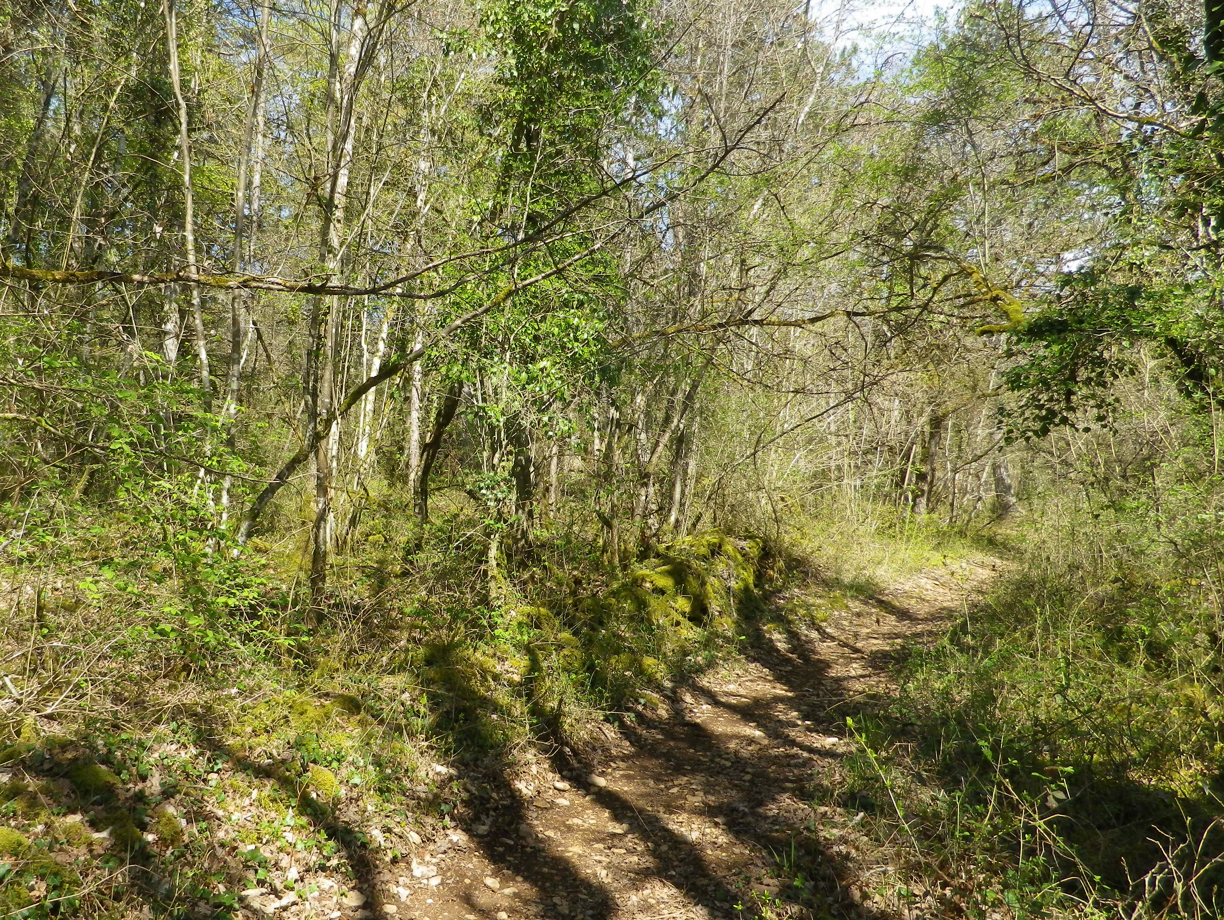
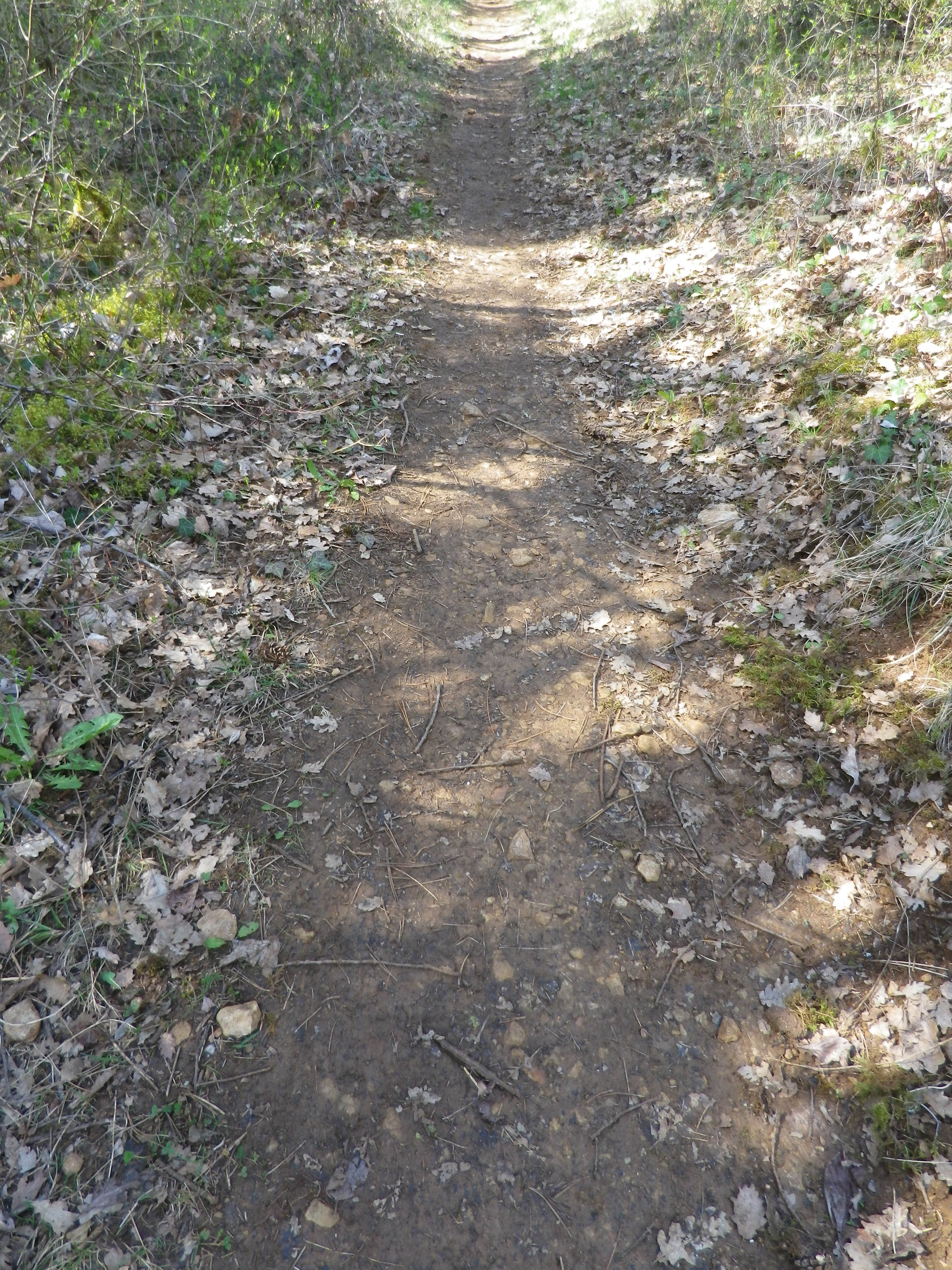
Following the passage through vineyards, a long descent through woodland ensued. The trail was rougher, but evidently well used. The shady interlude was greatly appreciated. It terminated in a “combe” a narrow valley not defined by a river. There are many combes in Burgundy, and they are well marked on maps.
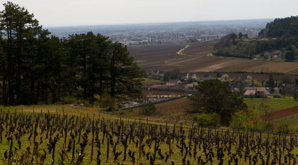
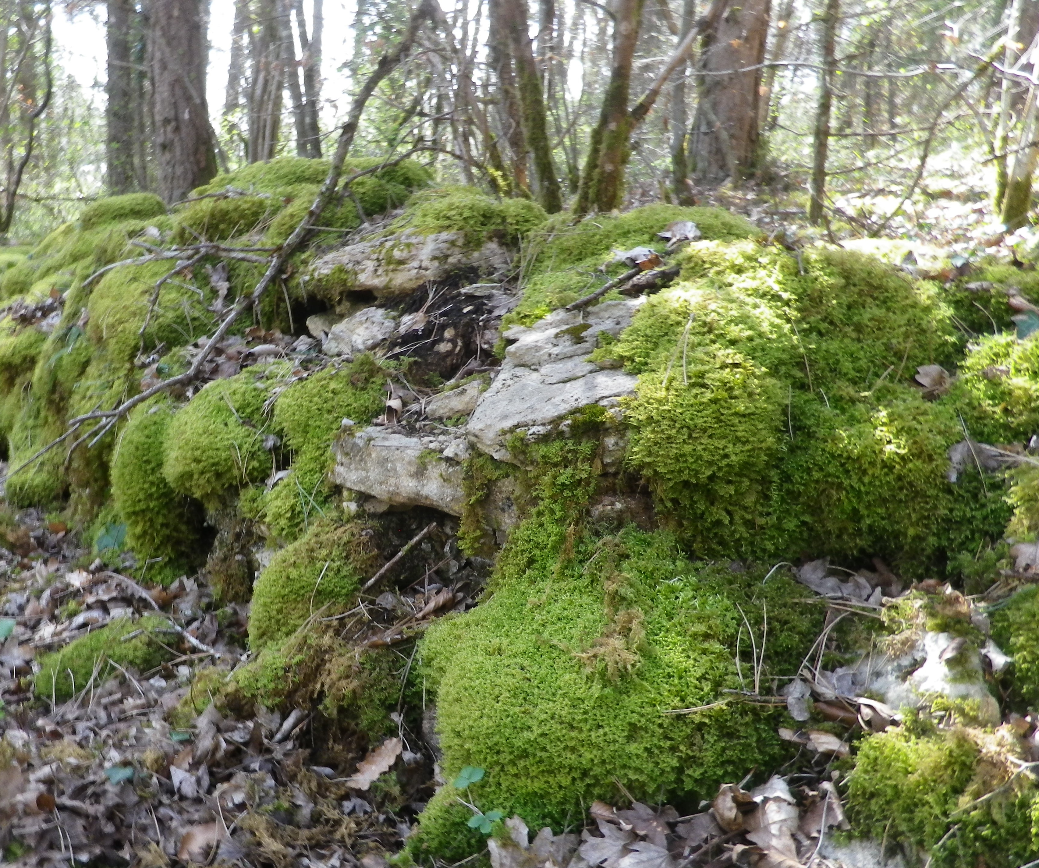
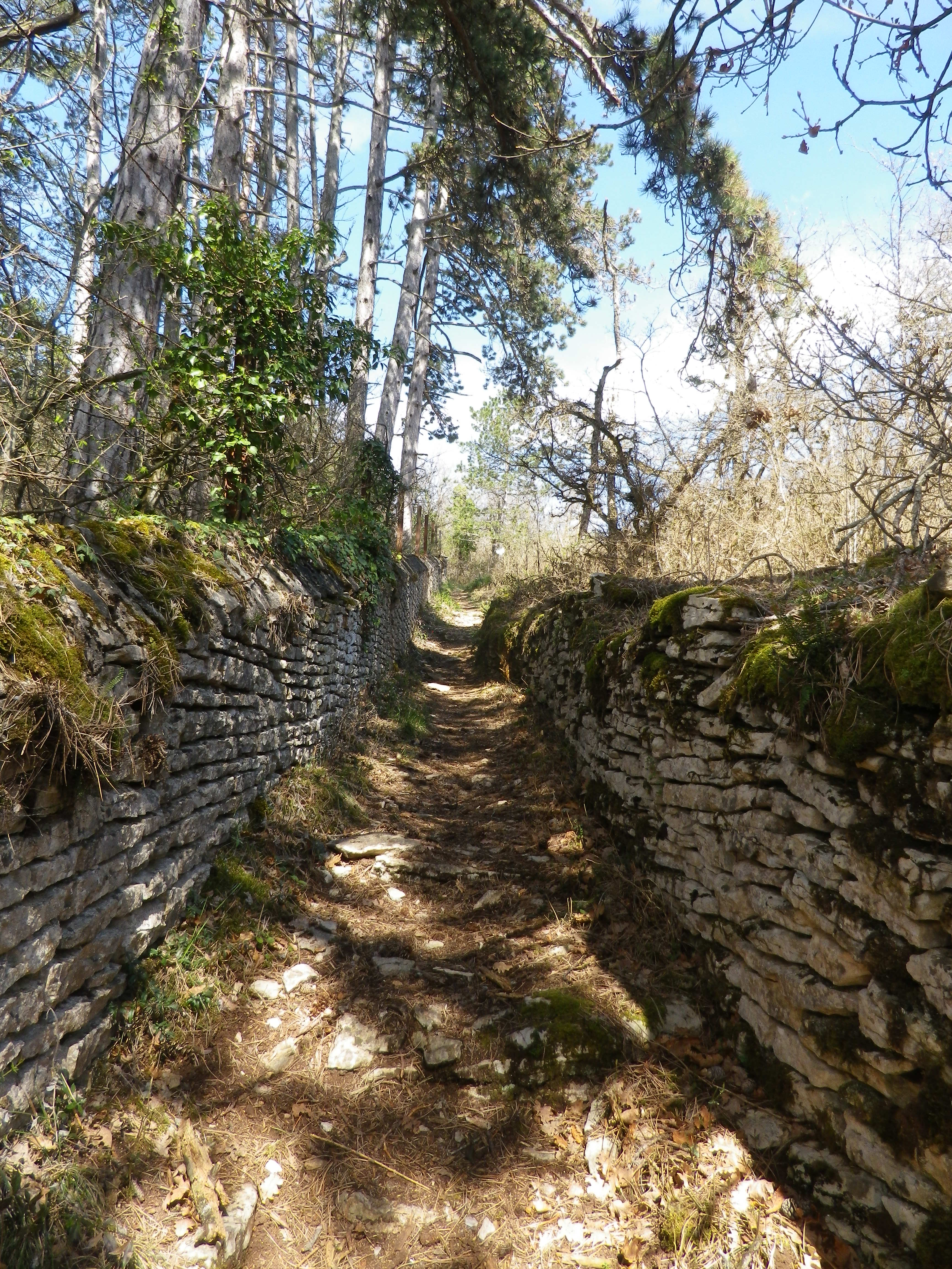
Upon leaving the combe, the trail headed uphill through more vineyards. In fact, from the top of the climb, the amazing sight of acres and acres of vineyards spread out below me, south and east, all the way to Beaune. (See the feature photo at the top.) The Cotes de Beaune is no less impressive than the Cotes de Nuits when it comes to the sheer numbers of vines planted on the famous slopes of the Cote d’Or. The trail headed downhill. It twisted and turned as it threaded its way through the woods, carefully inscribed between moss-covered limestone walls. Treasures as yet unseen lay behind these walls.
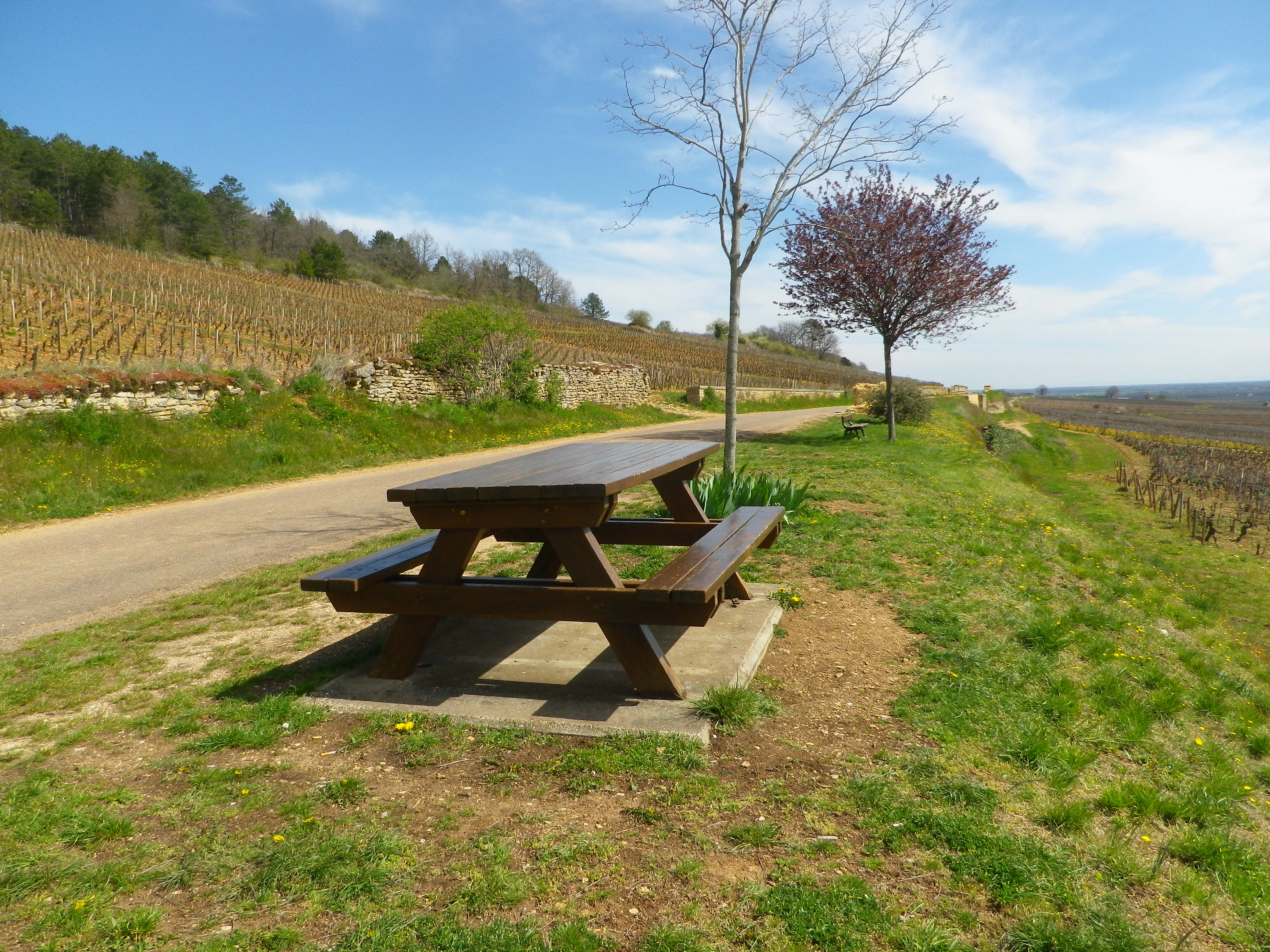
What lies behind the walls is evident only upon reaching the wide agricultural road at mid-slope. I turned around to discover that on this partially wooded slope lies the vast majority of the town’s Premier Cru: Aux Serpentieres, Petits Godeaux, Aux Gravains. Further down the slope, I could see many lieux-dit, named parcels, like the Aux Grands Liards parcel. The grapes here made up the village appellation wines. Someone thoughtfully stationed a picnic table overlooking the town’s glorious vineyards. But I pressed on…
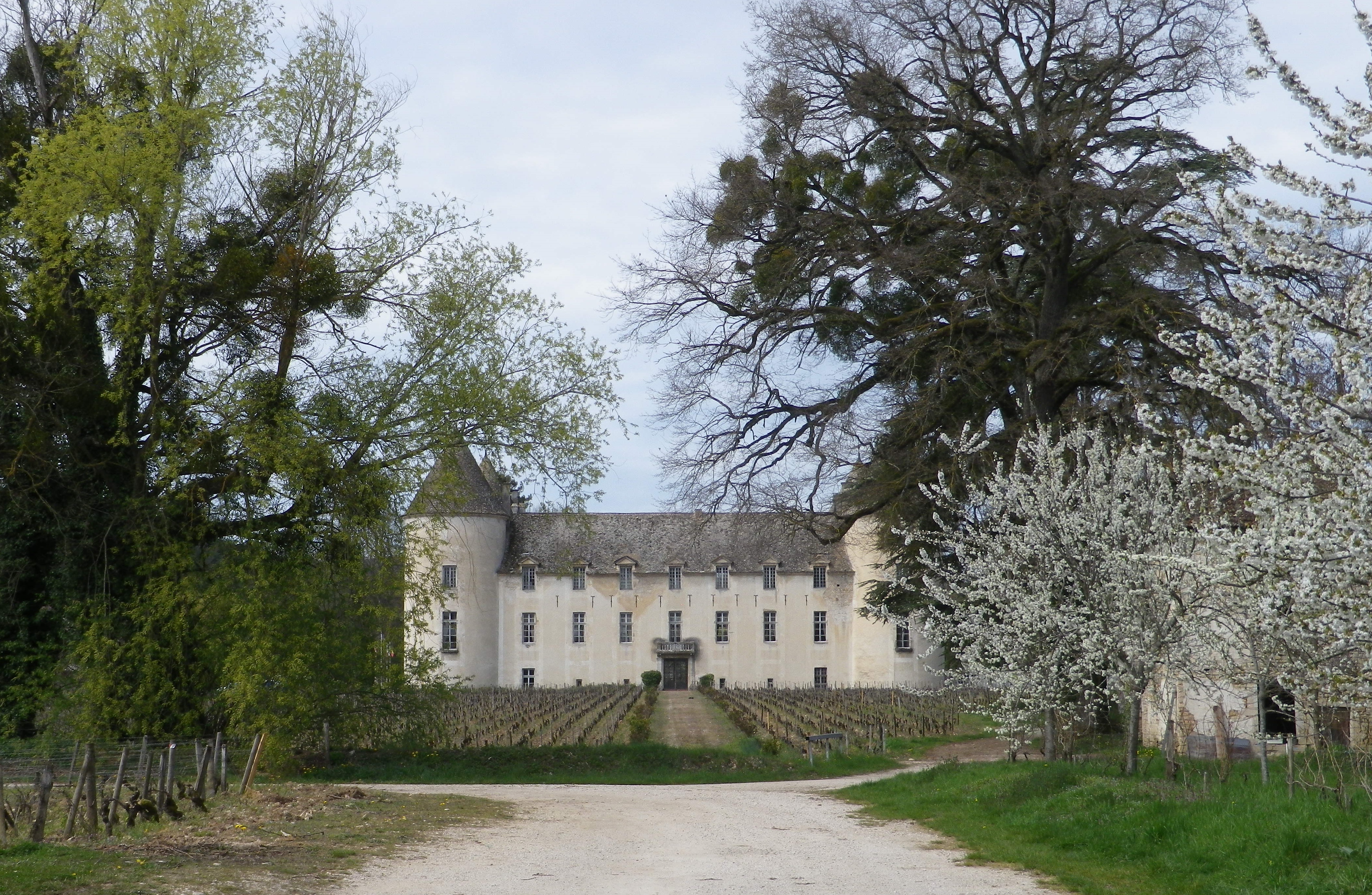
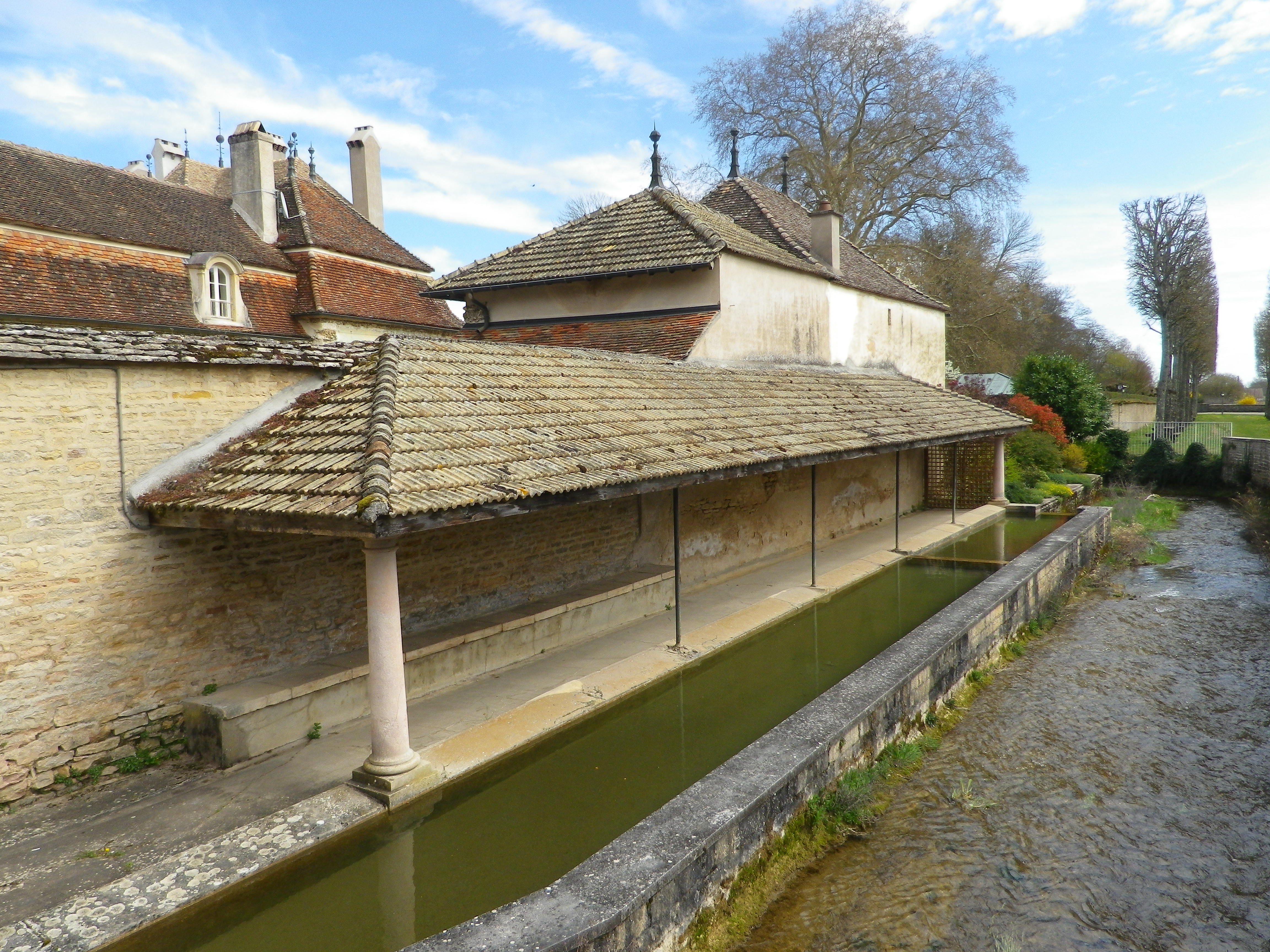
Soon after that, I came back into town. Homes and caves all constructed in limestone line the narrow lanes, ghostly white and just as quiet in the afternoon sun. The sound of a small river announced the Rhoin. An old washhouse, lined the northern bank. Every town in Burgundy seems to have one, and this one is was located just outside the castle gates.
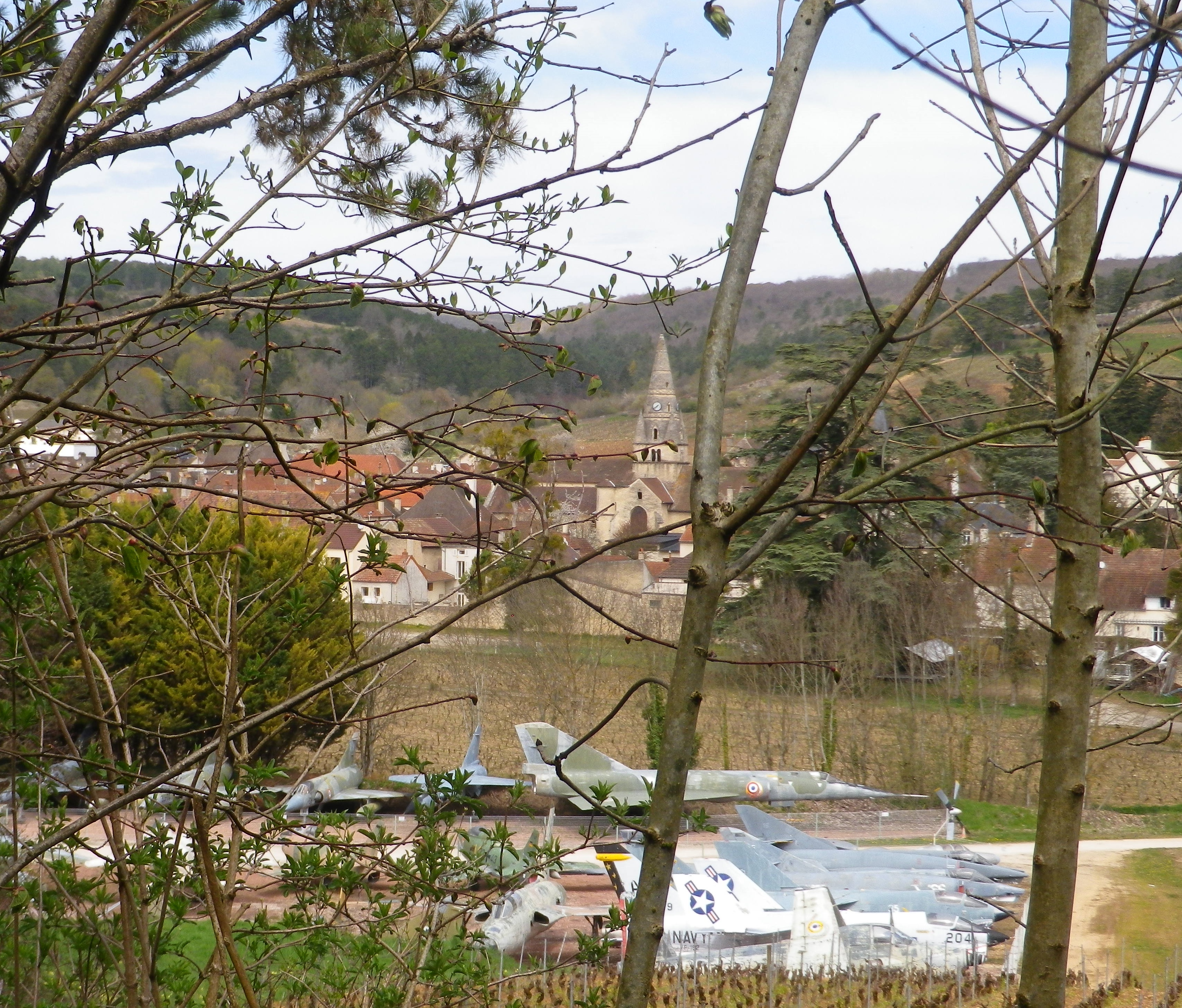
The Chateau de Savigny is many things. A winery, an historical site, a museum site with eclectic collections, including, but not limited to, displays on wine-making, motorcycles, old cars, and old fighter jets. Some of the last are visible from the trail, as it circles around the south side of town, back to the official start. Not something ordinarily seen on a vineyard trail! This final leg comes with another ascent, more vineyards, a delightful section of forest, and descent followed by a short meander along the Rhoin, providing a musical interlude.
Many people use Beaune as a staging point for visits to the nearby wine villages. But however good her wineries may be, Savigny, like so many other villages of the Cote de Beaune, must be savored with more than just a cursory tour of its wineries.
What I Learned
The Burgundian wine region known as the Cote d’Or has a northern section and a southern section. Cote de Beaune is the name of the southern section. This part of the Cote d’Or famously produces some of the most esteemed white wines in the world, in addition to some very good red wines, which is the reverse of the northern section known as the Cotes de Nuits.
The Cote de Beaune is generally speaking more famous for its white wines, such as those from the crus in Meursault, or Puligny-Montrachet or Chassagne-Montrachet. However, Savigny-les-Beaune is known primarily for its red wines. Like Pommard, a bit further south in the same district, and also well-known for its reds, Savigny lies at the mouth of a transversal valley. This type of valley, formed by the Rhoin River in Savigny, crosses a crestline, the Cote d’Or, at right angles. Hence in Savigny, this means a narrow, fairly protected valley with steep sides, with west- and south-facing vineyards, ideal for vines.
While there are no Grand Cru in Savigny, there are just over 20 Premier Cru, perhaps the most well-known being Aux Vergelesses, at the border of the neighboring town Pernand-Vergelesses. The village has its own Village Appellation, Savigny-les-Beaune Controlee, as well as its Premier Cru Appellations, for both red and white wines.
The Pinot Noir wines of Savigny-les-Beaune have good aging potential. (In fact, one bottle I had purchased then stored, I only got around to drinking 11 years later, and found it soft, and rich in flavors and mouthfeel.) In any event, the wines in Savigny are good, representative Pinot Noir and Chardonnay wines, with as good a price-to-quality ratio as a wine lover is likely to find anywhere along the Cote d’Or.
What I Tasted
2014 Pinot Noir, Aux Grands Liards, Appellation Savigny-les-Beaune Controlee, Domaine Giboulot (Savigny): A dry red wine with medium red brick color; a floral and peppery spice nose, with forward flavors of vanilla, oak and red cherry flavors; medium tannins.
2008 Pinot Noir, Savigny-les-Beaune, Appellation Savigny-les-Beaune Controlee, Domaine Andre Morey: A dry red wine with medium plus brick red color; a nose of spice and light tobacco; flavors of vanilla, slight fruit, and a hint of herbaceousness; medium tannins. (Consumed in 2019!)
2007 Pinot Noir, Savigny-les-Beaune, Appellation Savigny-les-Beaune Controlee, Domaine du Chateau de Meursault: A dry red wine with light medium ruby red color; slight red berry and spice nose, with flavors of the same; medium plus tannins.
2006 Pinot Noir, Aux Clous, Appellation Savigny-les Beaune Premier Cru Controlee, Pierre Andre: A dry red wine with medium plus ruby red color; spice, red berry and wood nose, with stewed red berries and spice flavors; high minus tannins.
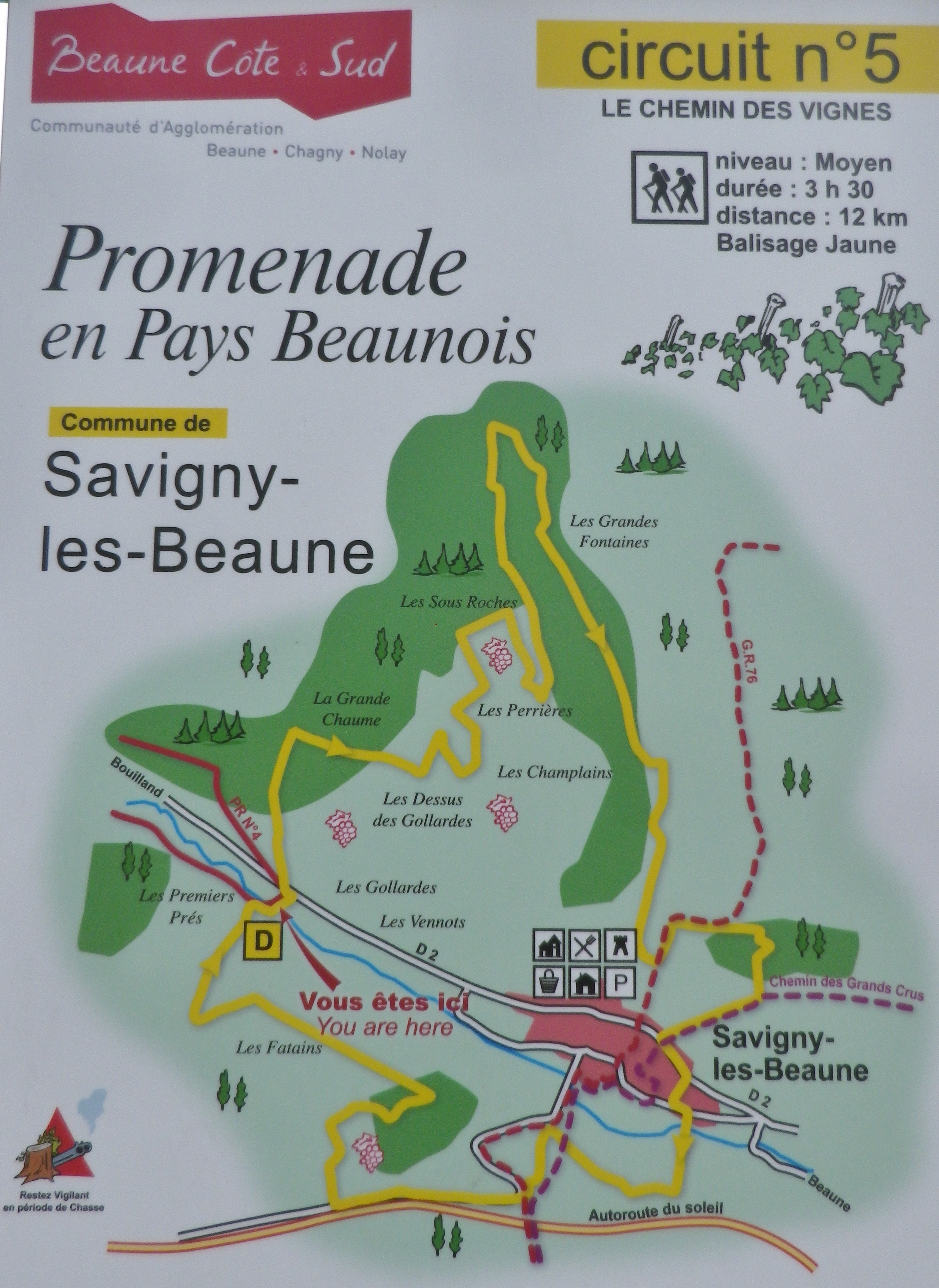
Trail Name: Chemin des Vignes (AKA : Circuit 5)
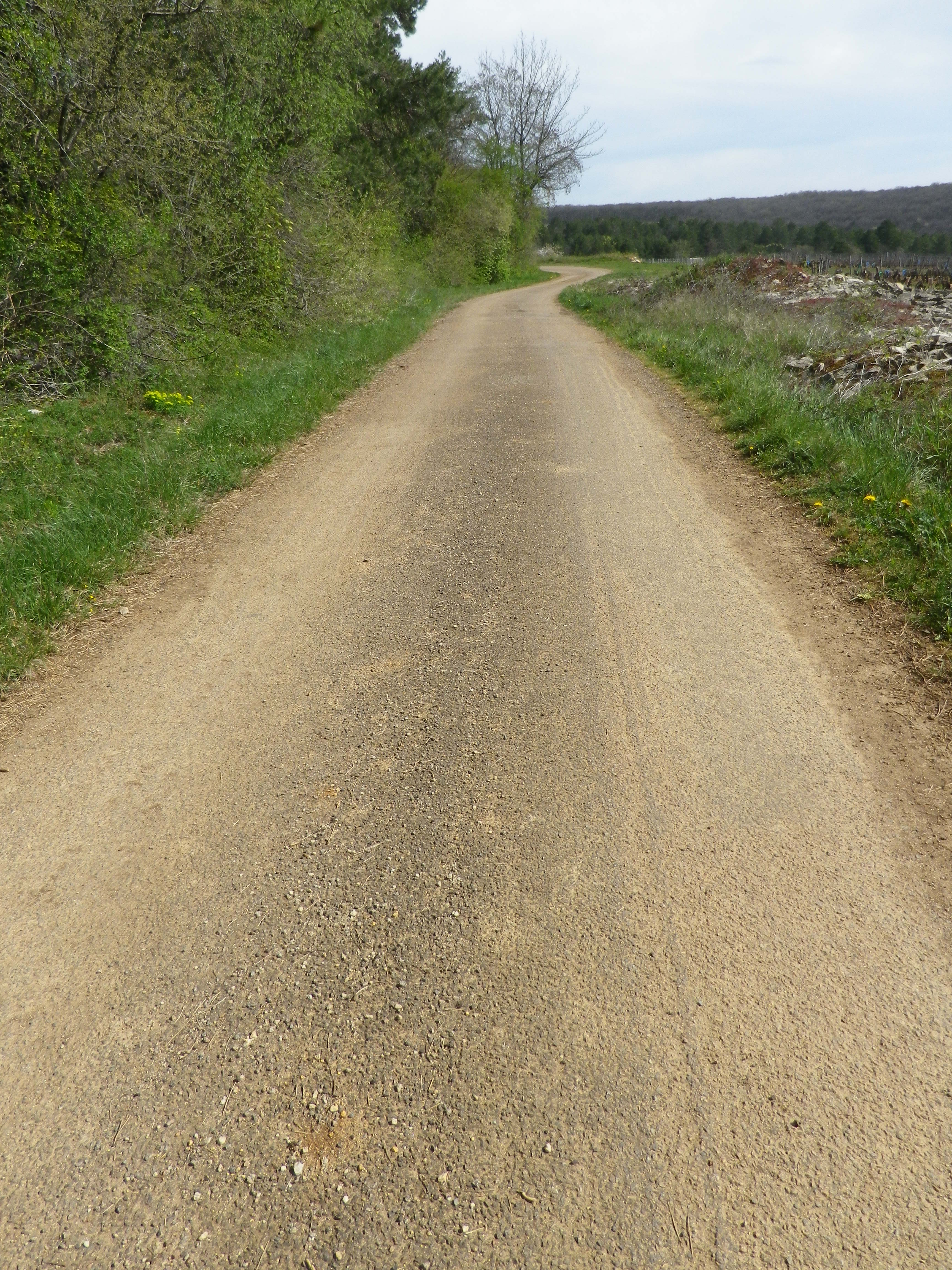
Trail Type: Mid-distance circuit; well-maintained and with a variety of surfaces from rough and scree to tarmac. While trail-specific signage can vary (see below), overall marking on the trail is rather good.
Length:
Total – 11.5 kilometers/7 miles
Convenient to: Beaune, France
Marking:
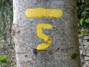
Painted yellow bar(s) indicating trail and/or direction, and sometimes a yellow number 5; the occasional yellow sign with a black number 5 on it; yellow signs on posts with black letters indicating PR 5.
Trail Description: This trail has a great variety of terrain, elevation, scenery, and flora, all along a relatively easy circuit trail that circles the small town of Savigny-les Beaune and its well-known vineyards.
Trailhead:
Official: Savigny-les-Beaune, Rue des Chanterives
Alternate: Rue General Leclerc x Rue Soeur Gaby
Parking:
Savigny-les-Beaune: Rue des Chanterives x Route de Bouilland/D2(opposite camping site)
Savigny-les-Beaune: Limited parking along the street of Rue General Leclerc
Public Transportation Options:
Bus: The Cote&Bus company runs Line 10 round-trip from Beaune to Savigny-les-Beaune. It appears to service a school route, as well as commuters into Beaune, so be sure to check the website (www.coteetbus.fr) for changes or required reservations.
Rail: Nearest rail service is in nearby Beaune
Suggested Stages: Not applicable
Trail Itinerary-Reference Points: (North-South/Clockwise)
Savigny-les-Beaune: Chemin des Vermots, also seen on some maps as Chemin de la Grande Chaume, right onto a straight trail through woods all uphill, vineyards, then a long stretch through forest; Cross Chemin de Citeaux, along the Combe de Barboron (a vale), follow R du Jarron about 150 meters uphill, turn right through vines, then forest; downhill between walls to picnic table, downhill on the agricultural road/C7; Savigny-les-Beaune: southeast on R Dr. Guyot/D2, R des Porches, R Soeur Gaby, cross the creek and continue straight onto a grass path), past sports fields (fighter jet collection on the right), R des Combattants, R Chanoine Donin-Chemin des Carrieres, parallel the highway for about 400 meters; through forest; downhill on R des Fatains, R des Petites Chanterives
Representative Trail Photos:
Restrooms:
None observed!
Attractions on or near Trail:
Chateau de Savigny has a museum with collections pertaining to wine and agricultural vehicles, as well as Abarth racing vehicles and fighter jets.
Tasting along the Trail:
Several wineries in town, and at the chateau.
Alternative Options:
Hiking: Beaune has several hikes around its vineyards, just south of Savigny. For an idea of one of them, see the Nutshell here. See others at http://www.beaune-rando-vigne.com/fr/circuits-vignoble-beaune/
Biking: Veloroute Voie des Vignes, an approximately 30-kilometer-long trail from Beaune to Santenay to Nolay, mostly on dedicated bike path!
Additional Information:
Regional: https://www.beaune-tourism.com/
Trail specific: https://www.beaune-tourism.com/ideas-for-round-trips/circuit-5-the-chemin-des-vignes-vine-route-615157
Comments:
A great hike for even people only moderately in shape, in an unspoiled Cote de Beaune wine village.