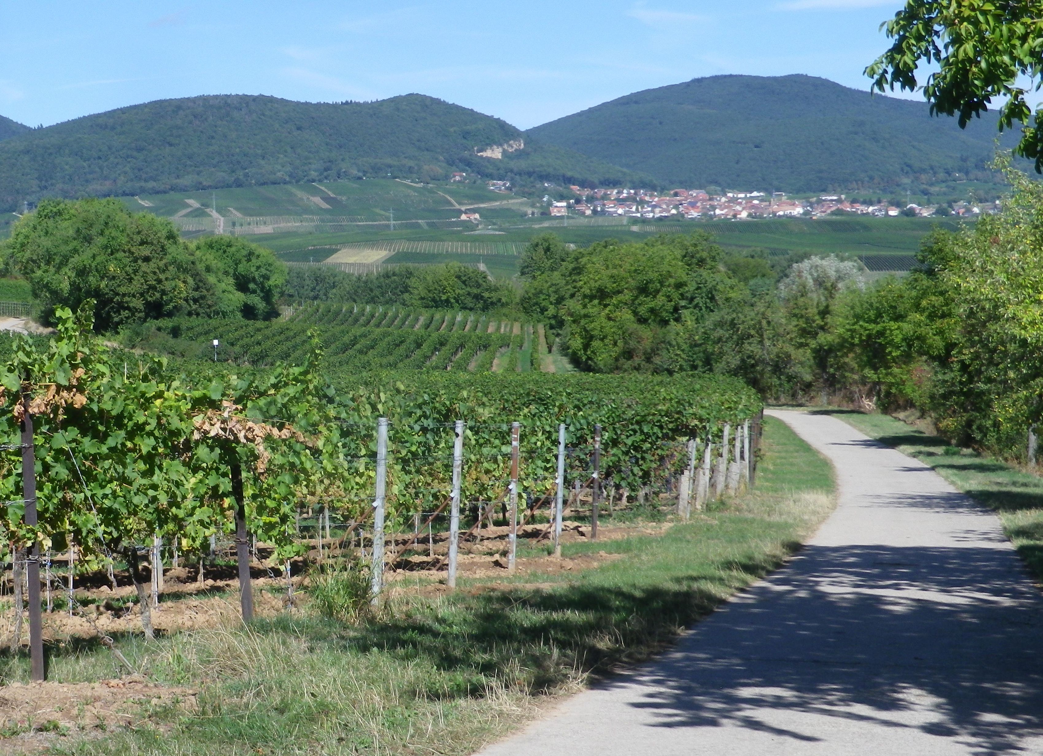
As anyone who earns their living by the soil will tell you, the fields are important. As those who make their living by grapes know, each individual parcel of the vineyards is very important and rather unique. Like most vintners, those of Suedliche Weinstasse feel a deep connection with the land, and attempt to maximize the potential of the terroir and microclimate for each parcel, and carefully match that with each varietal planted. Parcels may be adjoining, or separated by a couple of kilometers. To access these, vintners use agricultural lanes, most of them as well tended as the vineyards they serve.
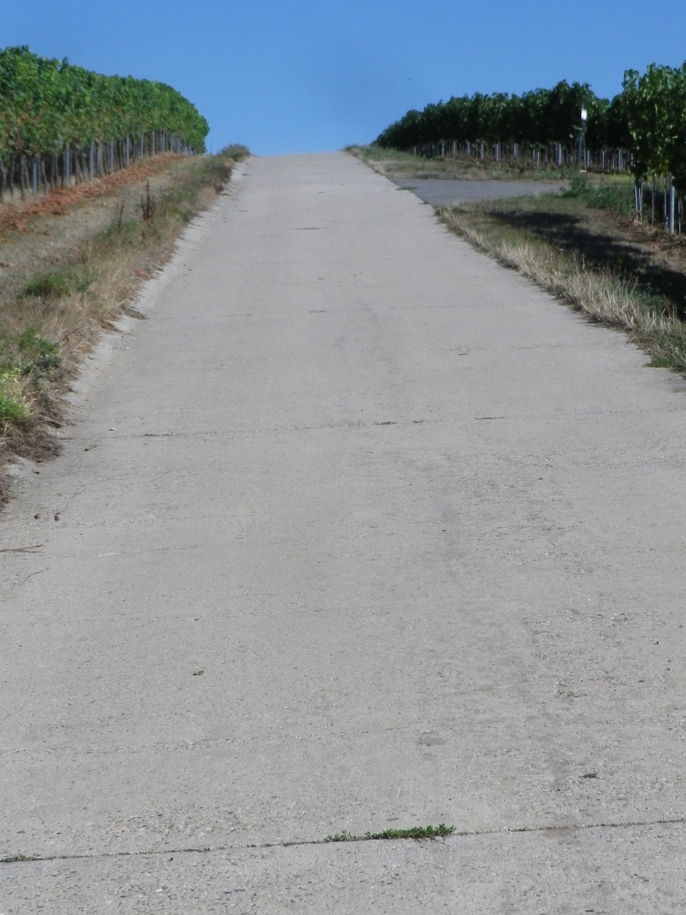
This bicycling itinerary led mostly along these lanes, through acres of vineyards, both in prime condition. The itinerary was called the Winzerradrundweg, or Vintner Bicycle Circuit Trail. Previously, vintners and vineyard workers, usually family, may have ridden bicycles to access distant parcels. Today though, they use cars, and compact trucks, and cyclists use these quiet lanes to explore this beautiful countryside.
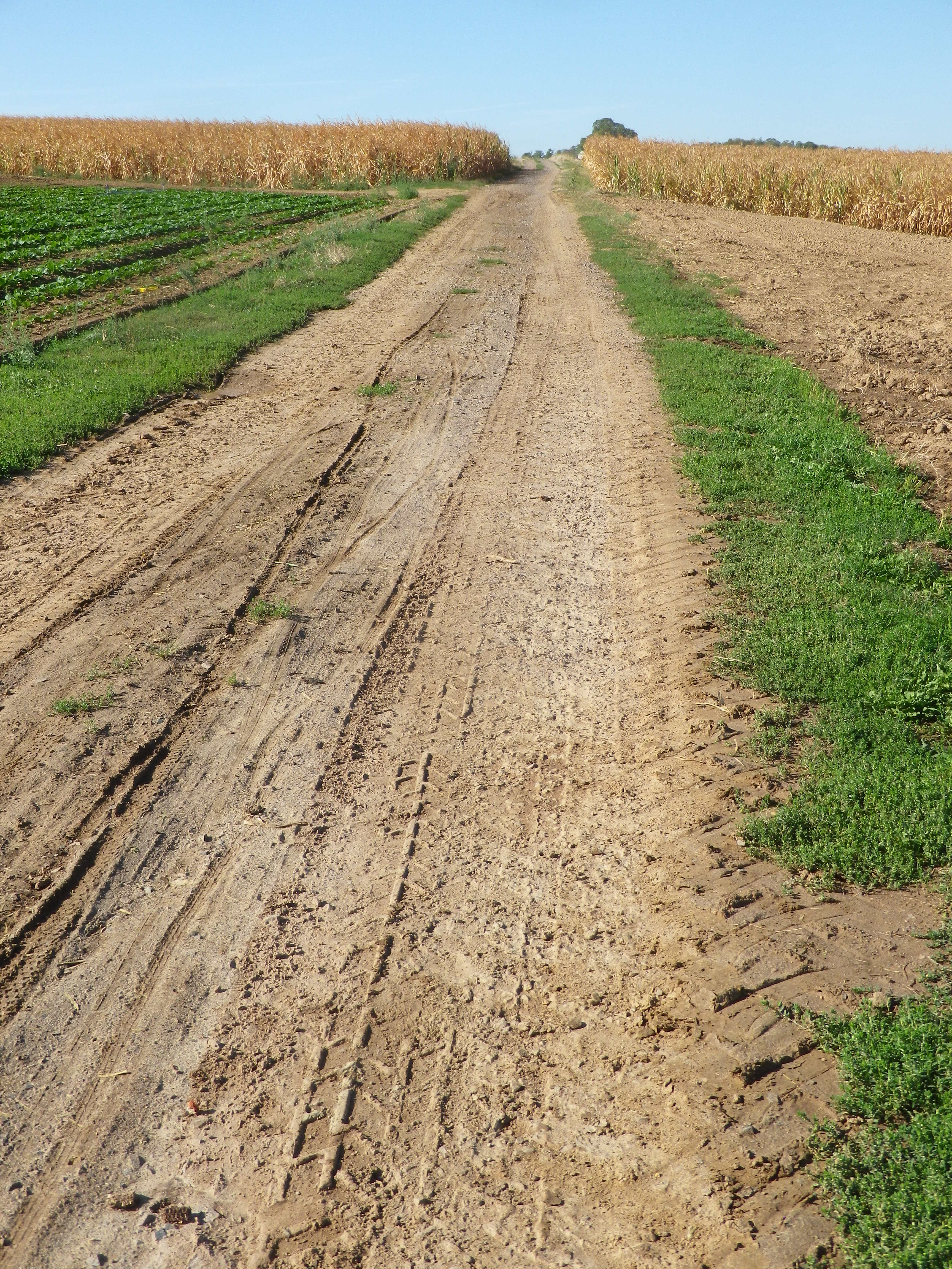
However, starting in the city of Landau in der Pfalz, the first two or three miles pass through wheat, corn and cabbage fields. There, I had my first encounter ever with a (John Deere!) farm combine. Curving upward from a steep gully, lined by high hedgerows, I first heard it, then only saw it, as it barreled down toward me on a lane rather narrow for it, let alone me and it. This thing was huge, about two stories tall! Happily, it suddenly veered to the right to begin harvesting the corn in an expansive golden field. Sadly, I didn’t get a photo. Shortly thereafter, I entered vine country, where such large machines are not used, not in Germany at least.
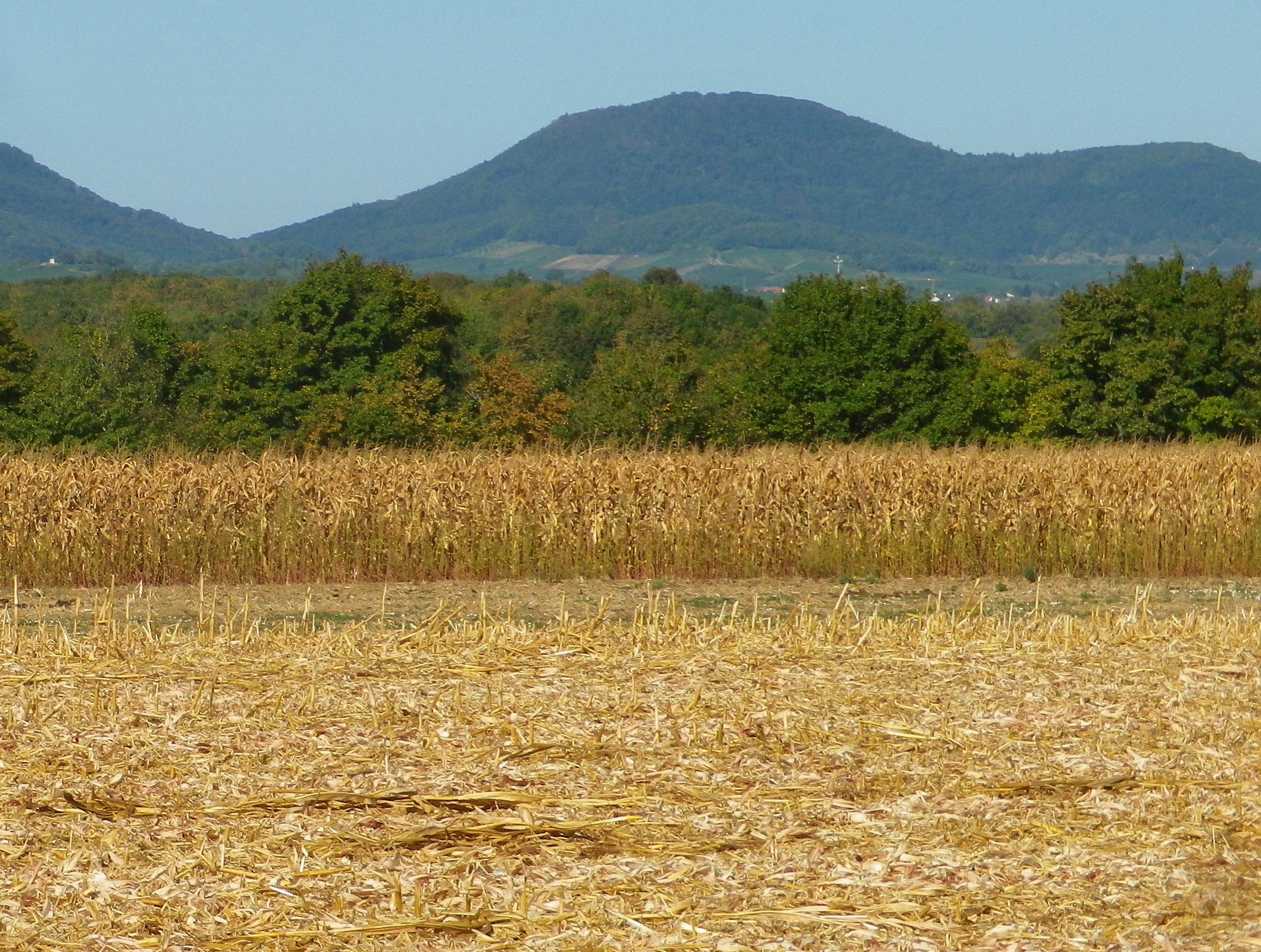
Two things to notice on this itinerary: the terrain for vines is distinctly different than the terrain for fruits and vegetables. The vineyards started where the flat fields left off, and hills or ridgelines began. The other noticeable difference was in the composition of the villages: the vintner family houses and businesses tended to be set in the villages, whereas the farmers tended to live on the edge of town.
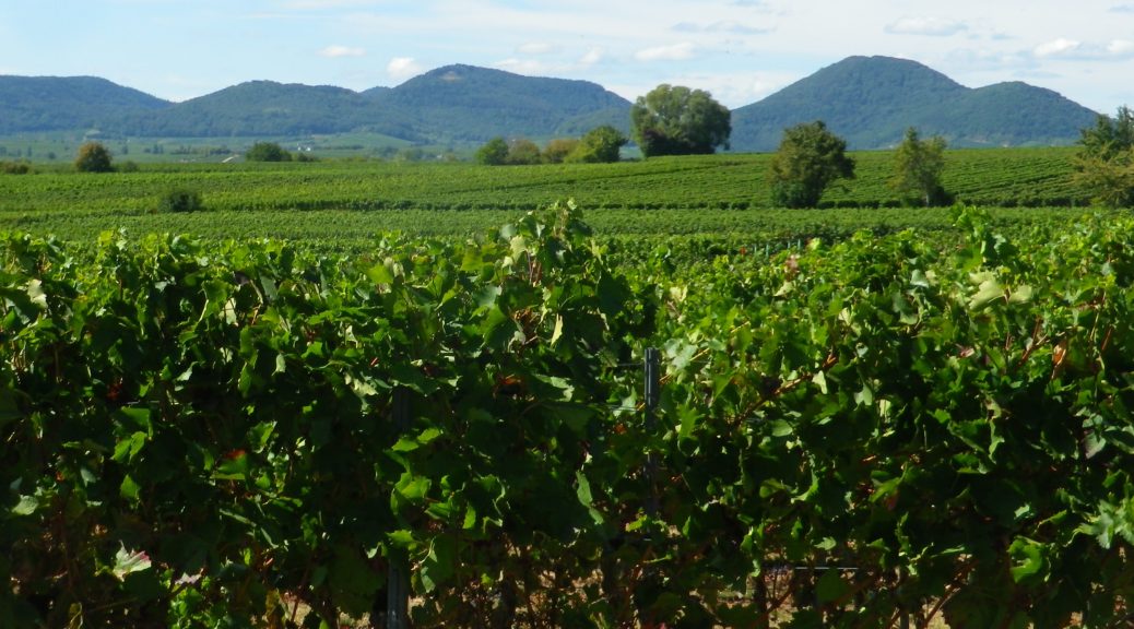
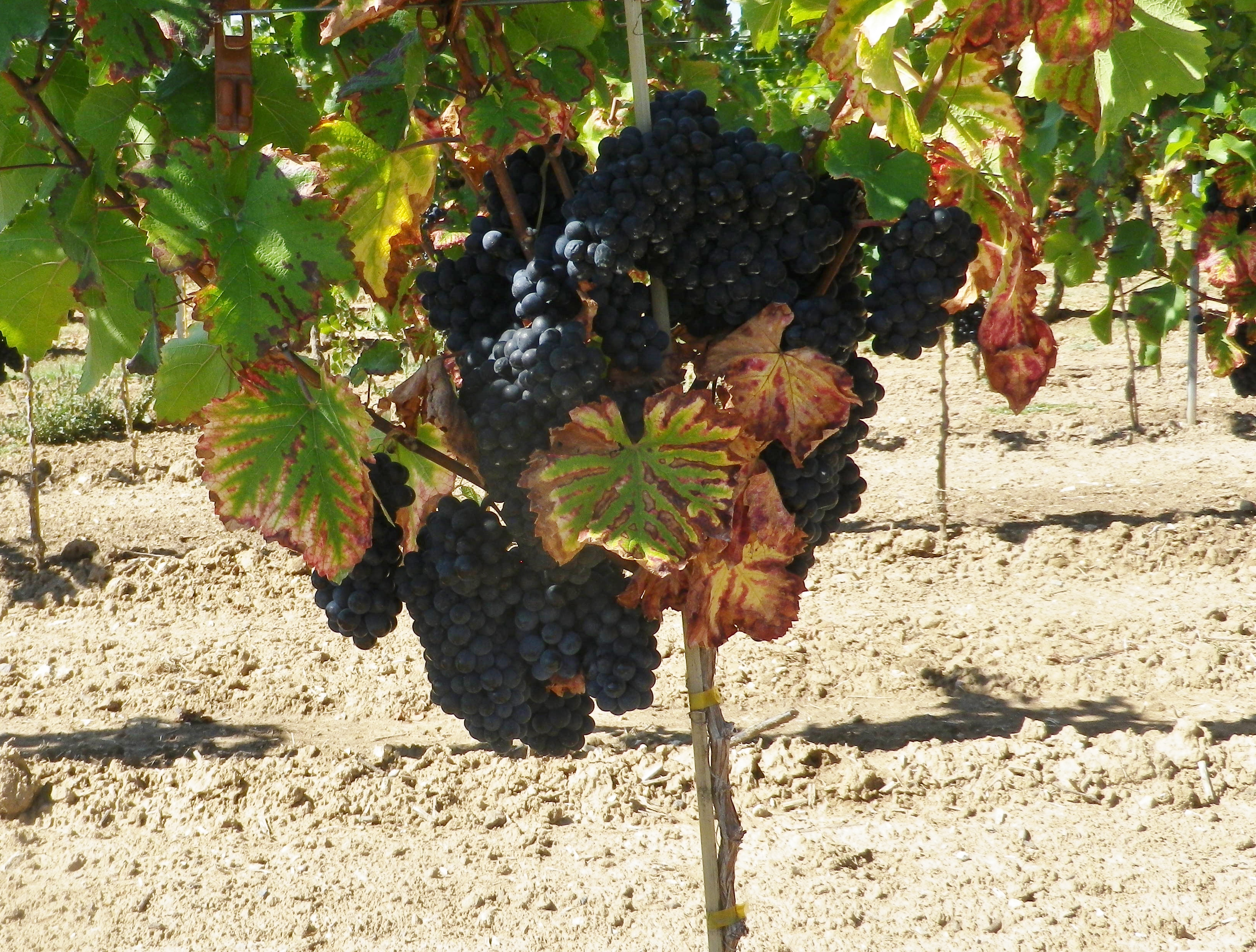
Going through the first vineyards, I noticed that harvest had yet to begin. The vegetation, last cut back weeks ago, while trim, was lush and now filled out. The grape bunches hung heavily on the vines. These vineyards while full of grapes, were empty of people. Presumably, the vintners were at the wineries, busy preparing the equipment and cellars for the harvest soon to come.
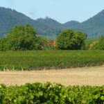
At first, the vineyards were interspersed with corn or vegetable fields in the flat areas in between. This area is one of the “garden” spots of Germany, so there is a diverse agricultural scene here. This was especially true around the villages of Insheim, Knoeringen and Dammheim. But that began to change as the trail approached the base of the Haardt mountains.
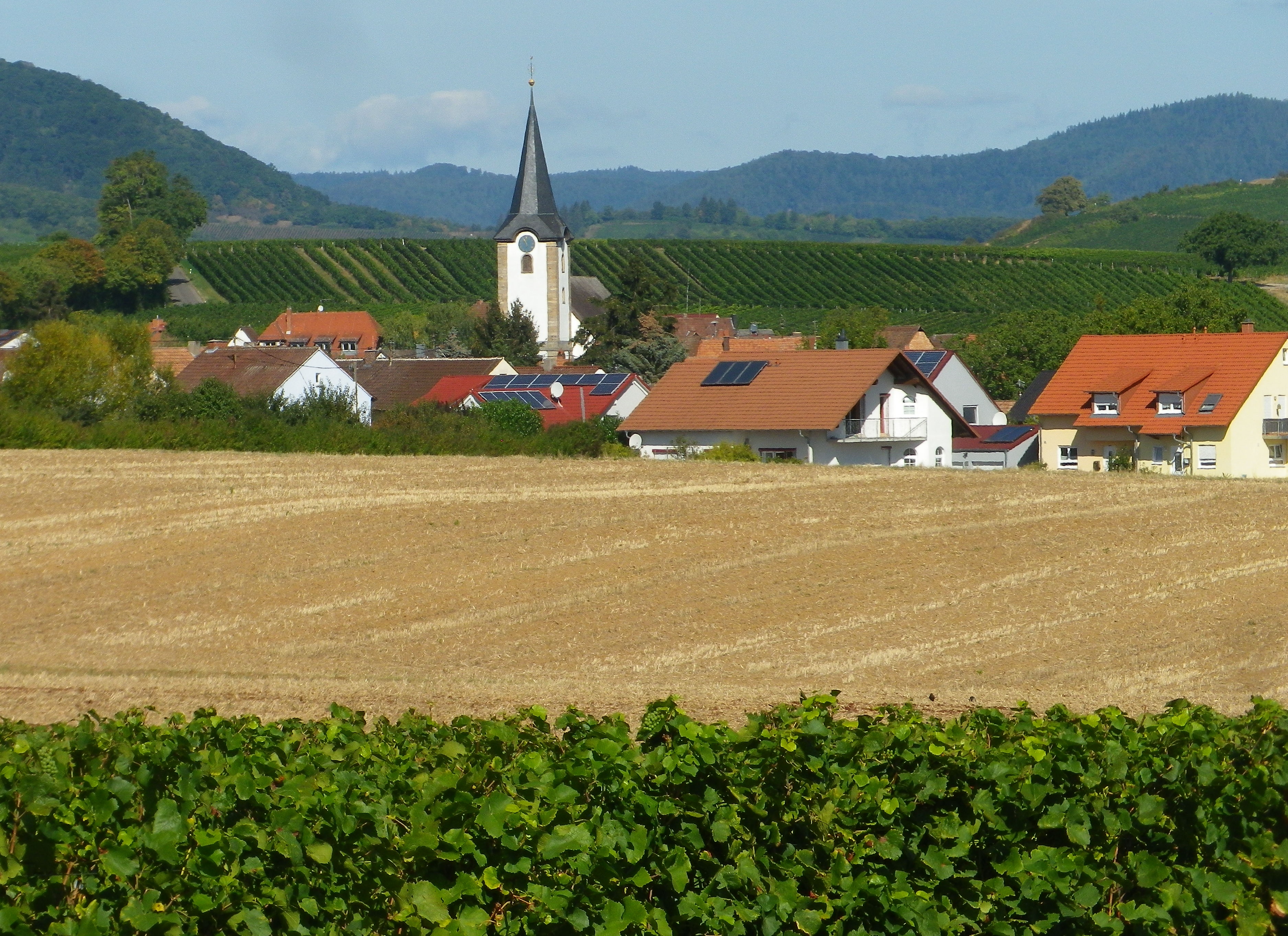
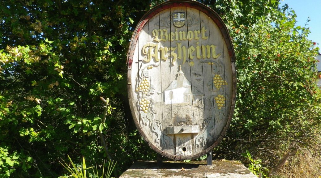
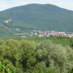
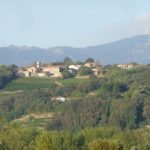
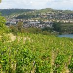
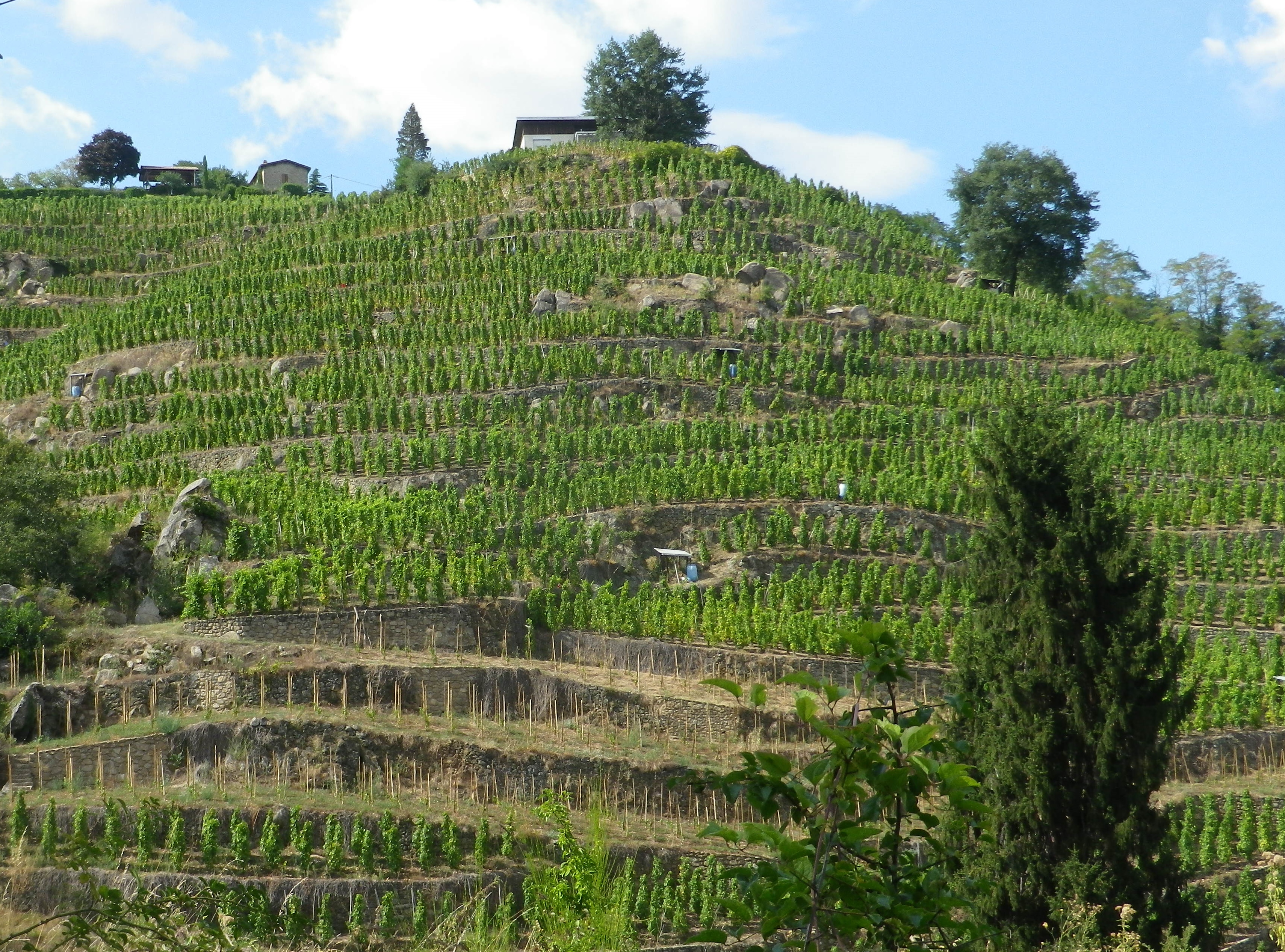
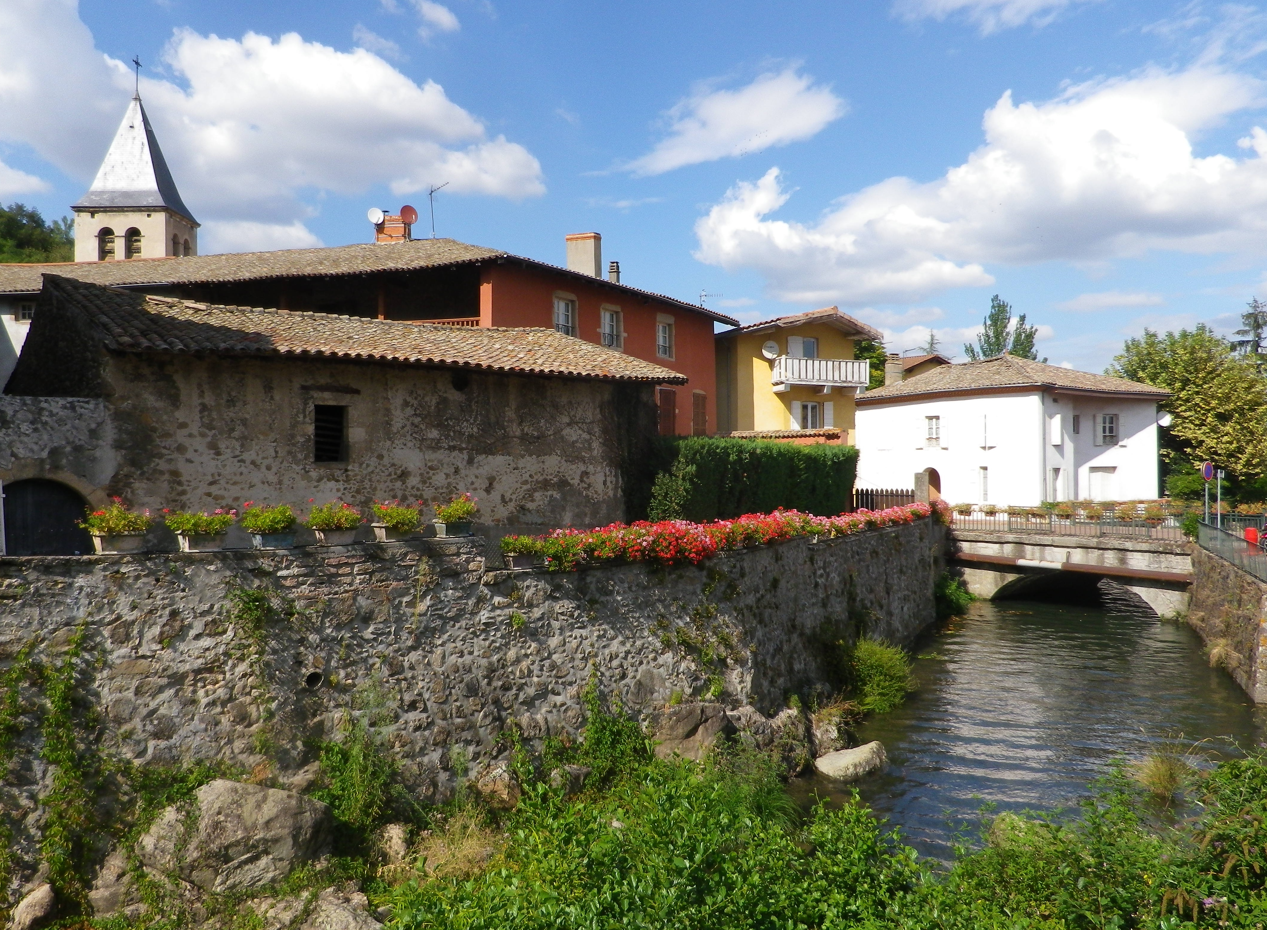
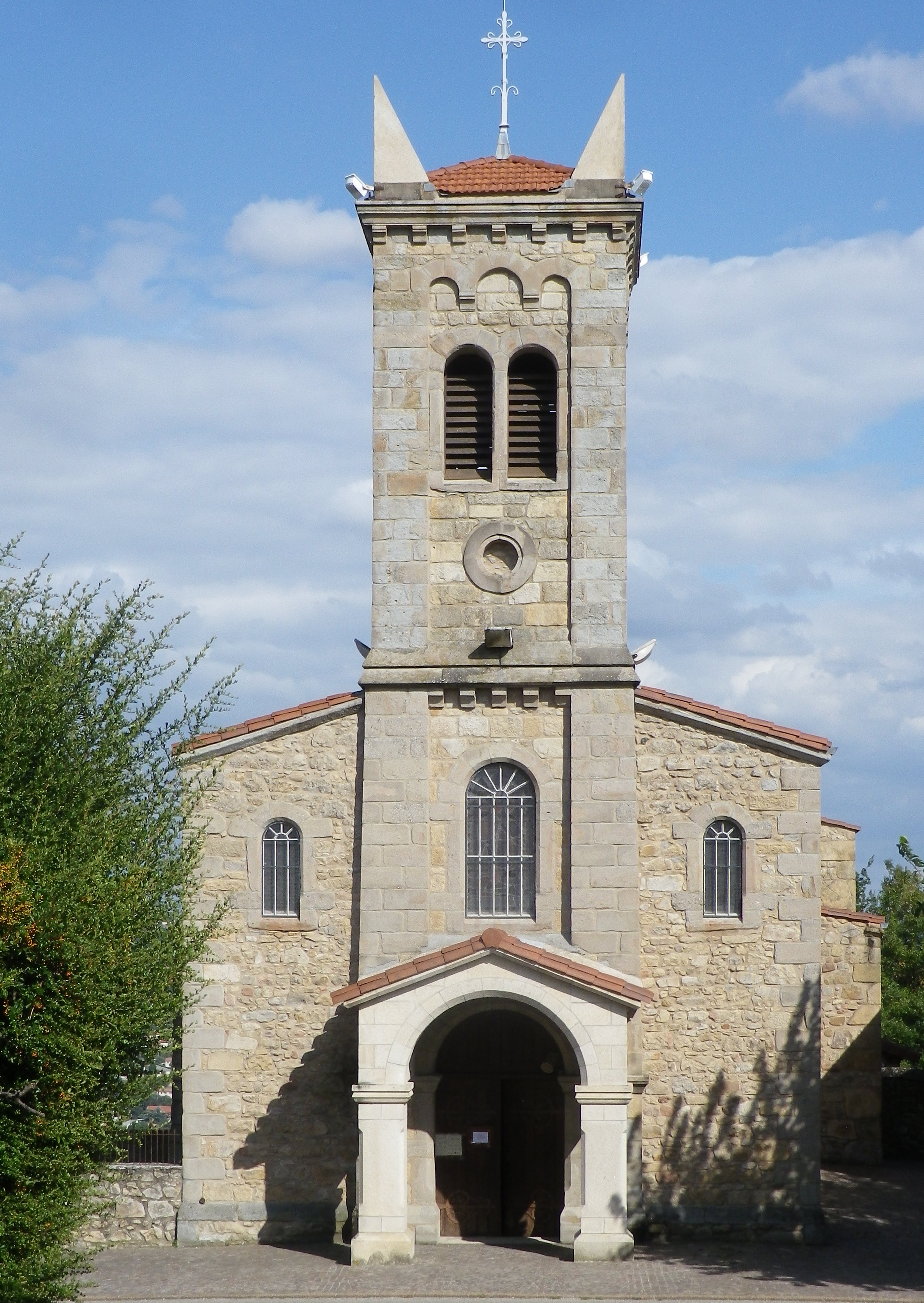
The vineyards predominate once west of the village of Moerzheim. Kilometers of vineyards, each sited with precision, arrayed magnificently along the vintner lanes, which were proving ideal for cycling. The lush green vegetation looked gorgeous under a brilliant sun and a clear blue sky. They were interrupted only by the neat and compact winemaking villages of Wollmesheim, Ilbesheim and Arzheim. Once I reached Siebeldingen, I was at the home of German grape varietal development, the Institut fuer Rebenzuechtung, where experimental new varietals are scientifically engineered, cultivated and tested every year.
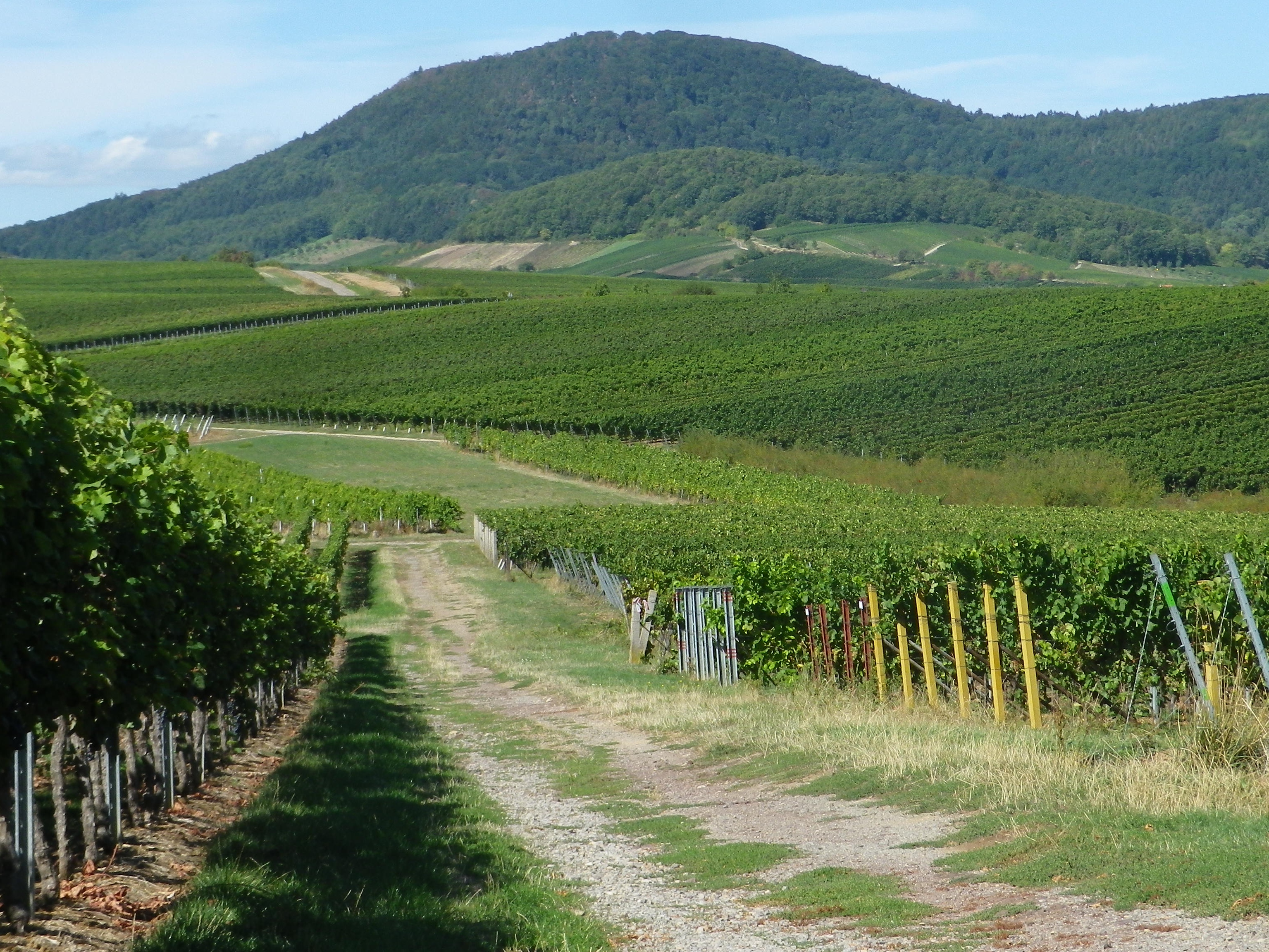
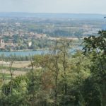
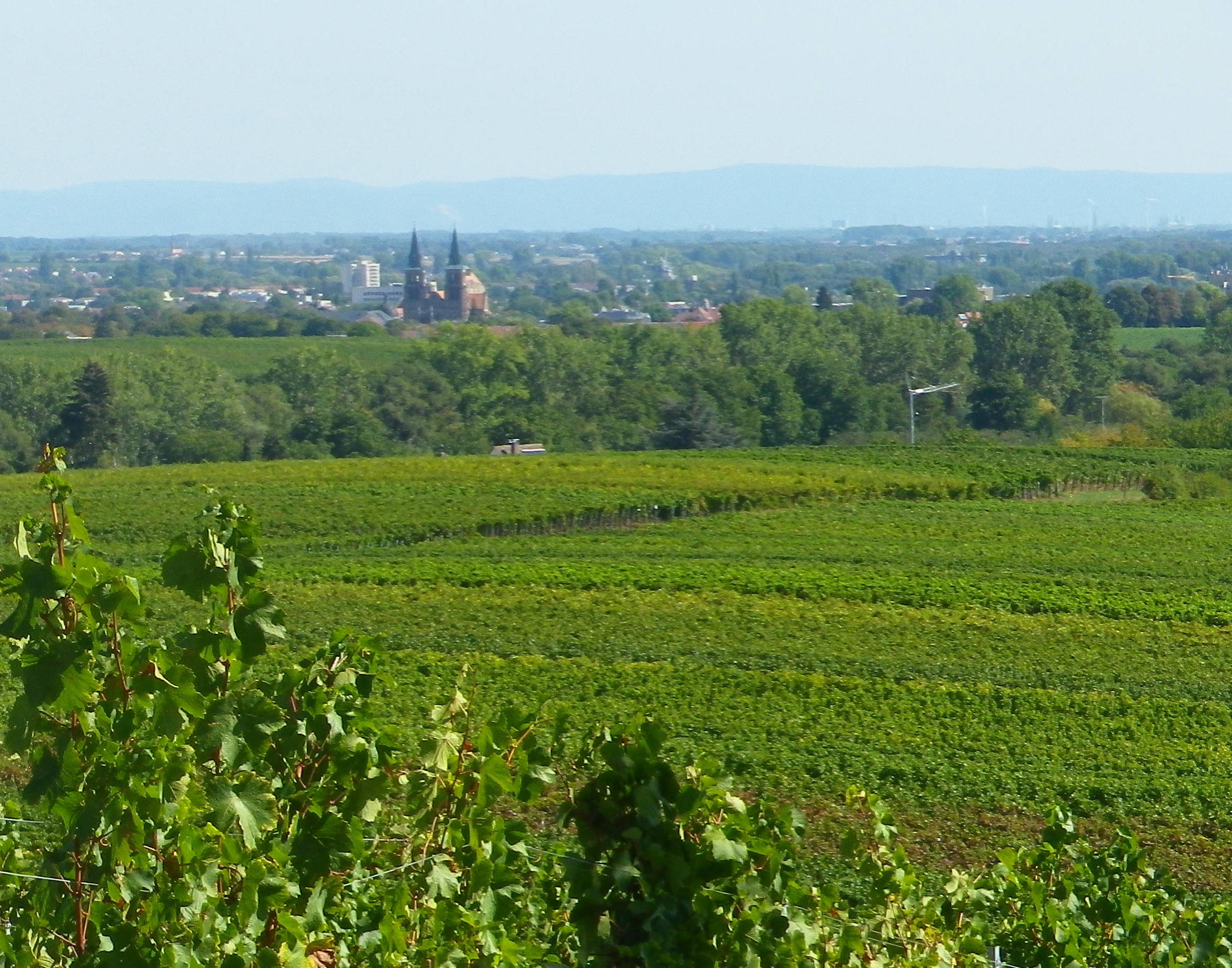
The itinerary followed up and over ridgeline after ridgeline. On top of each ridgeline, the views were tremendous. The flat lands of the Rhine River Valley stretched east to Baden-Wuerttemburg, where the base of its tree-lined ridges stood out well on this crystal-clear day. Seemingly near enough to touch, stood the Haardt mountains to the west. Some of its beloved red sandstone landmarks clearly stood out against its dark pines. There could not have been a better day for cycling this trail.
The occasional village provided opportunities for something to eat or drink. But the village of Nussdorf really stood out. Set in a sea of vines, this little village which once sheltered Roman-era vintners, really celebrated its viticultural heritage. Nussdorf’s unique wine education trail (Weinerlebnispfad), complete with picnic benches, a wading pool for aching feet (Kneipp), and a rest area, also partly served as the itinerary for this section of the Winzer Radrundweg. There were several sculptures celebrating the life of the vine, and chimes lined the trail, awaiting the inspirational touch of passersby to bring sound to the vineyard. Flowers, usually roses, marked the end of rows of vines. (Historically, vintners used flowers to lure insects away from the vines, thus protecting them.) Speaking of celebrating, in addition to hosting several wine festivals throughout the year, some enterprising local vintner also had what looked like a large prairie schooner (Planwagen), apparently rented by a group of partygoers, enjoying the local wines as they were drawn along the wine trail.
A good time on the trail was had by all that day, especially by me. This trail provided a wealth of sights and sounds, a variety of landscapes, and above all, a variety of wines to sample and enjoy!
What I Learned:
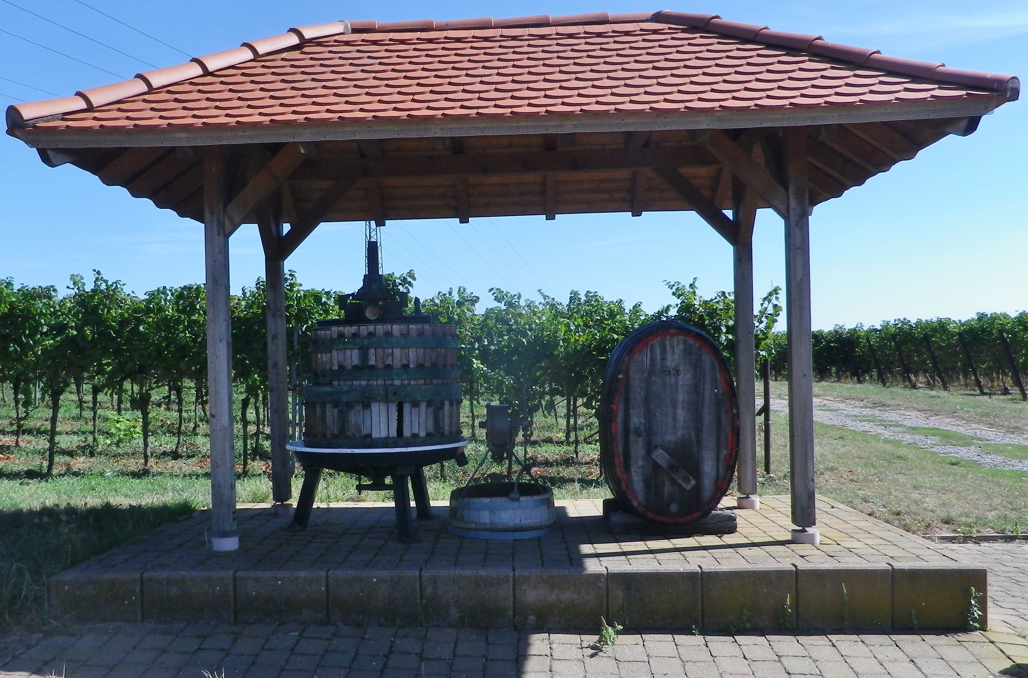
The Pfalz Wine Region has a long history of wine making. The pressing room and vats at the Weilberg Roman Winery (Römische Weingut Weilberg), near Bad Duerkheim, and the implements found throughout various sites all along the Deutsche Weinstrasse, testify to this long history.
The tradition continued with the establishment of regional monasteries, such as the ones in Klingenmuster and Wissembourg dating to the 600s. This was especially true along the Pfalz’s Suedliche Weinstrasse. Wissembourg was a rich and powerful monastery in its day. In today’s Edesheim, the abbey owned the “Villa Auduino,” which consisted of an agricultural manor house and two churches. In Nussdorf, the Monastery of Fulda (far to the north) owned its own manor house. These places were important to the monks, not just for providing food products, but also for their wines, which they needed for liturgical services.
Hence, in the Suedliche Weinstrasse district, winemaking has been an important economic activity for about 2000 years. Not only has this area had an uninterrupted history of winemaking, it also continues to modify and improve its traditions over time.
Siebeldingen’s Institut fuer Rebenzuechtung (Institute for Grape Cultivation) Geilweilerhof (the building itself a former cloister) is an invaluable resource in this regard. The institute maintains databases on grape varietals, and has test cellars to make and test wines from new varietals. This all supports its main function: to develop new varietals, genetically resistant to climatic changes and pests.
Some of its older creations will be familiar to lovers of German wines: the white varietals of Morio-Muskat and Bacchus, and the red varietals of Domina and Regent (two of the most flavorful and powerful German red wines, IMHO). One of the newest grapes to come onto market as wine is the white Calardis Blanc, a cross between a Bacchus and Seyval Blanc, and a Seyve Villard. (Finding a bottle will be a challenge for a few years to come, so head to the Institute’s wine shop in Siebeldingen for now!)
Over 125 varietals are planted in the Pfalz wine region, to include the ones listed above! But only half a dozen or so make up over 60 percent of the plantings. Riesling has always played an important role, but more so in the northern part of the Pfalz wine region. Mueller Thurgau is also an important white varietal, especially so in the south. Weissburgunder (Pinot Blanc) is another white wine grape that is planted here, although in far smaller quantities. As for the red varietals, there is Dornfelder, the most widely cultivated red wine grape locally. As a percentage of red wine grapes grown, it has overtaken the traditional favorite: Portugieser. Spaetburgunder, aka Pinot Noir, represents a full 7% of the grapes planted, and is gaining in popularity.
What I Tasted:
2017 Gruener Silvaner, Ortswein, Trocken, Weingut Voegeli (Wollmesheim): A dry white wine with a medium yellow gold color; a mineral nose, with herbal, grass, spice and slight pear flavors; medium acidity, with a tangy finish.
2017 Chardonnay, Lagewein, Trocken, Weingut Voegeli: A dry white wine with a medium white gold color; a peach, honey and mineral nose, with peach, pear and floral flavor; medium acidity, with a smooth finish.
2016 Riesling, Lagewein, Trocken, Weingut Voegeli: A dry white wine with a medium gold color; a slight mineral and turpentine nose, with spice and green apple flavors, medium plus acidity, with a crisp, tart finish.
2012 Weissburgunder Sekt: Weingut Wilhelmshof, (Siebeldingen): A sparkling white wine with lively, persistent perlage and medium gold color; a powerful fruity nose, with powerful fruity grape and white stone fruits flavors, a medium and sweet finish.
Trail Name: Winzer Radrundweg
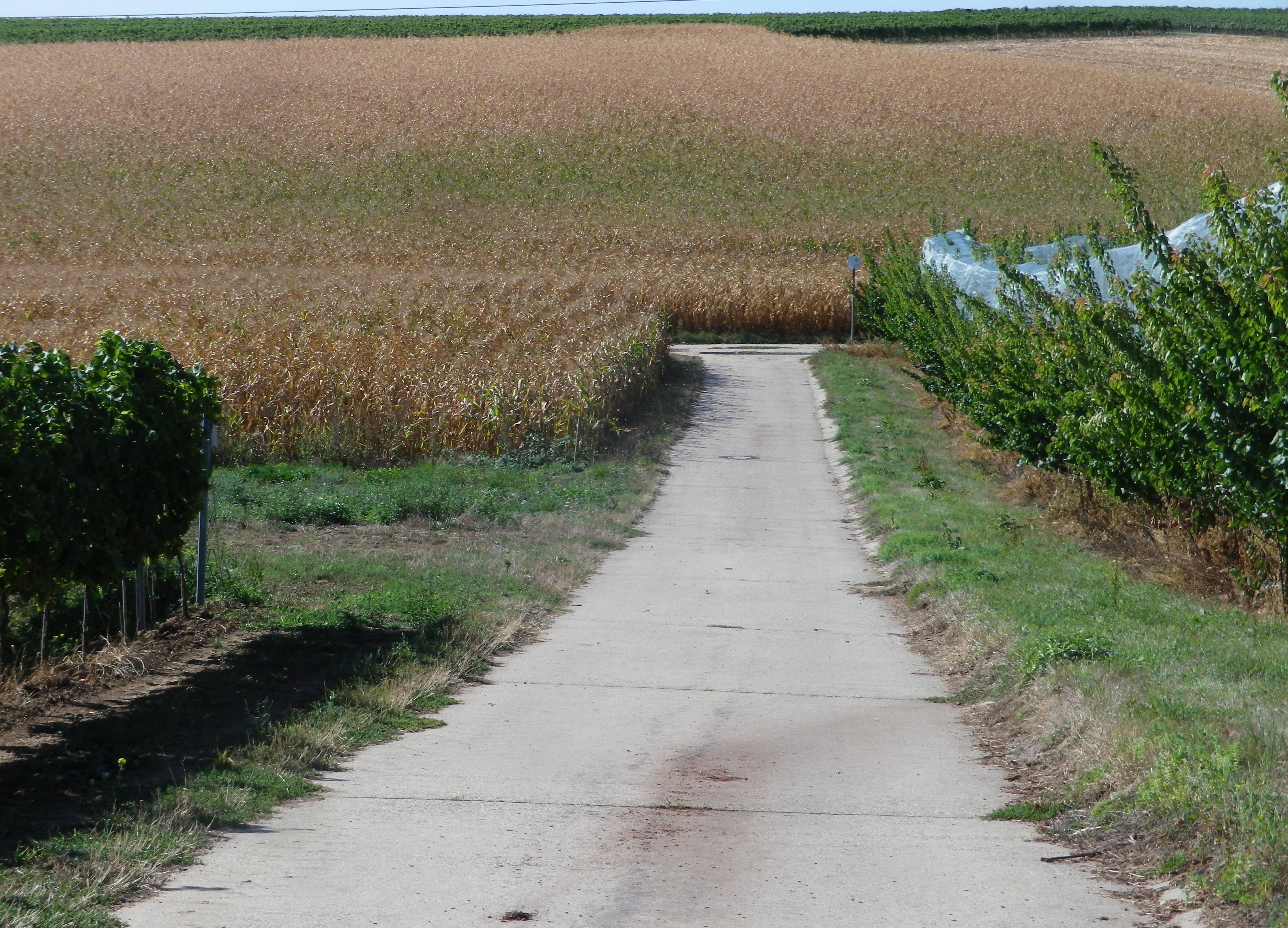
Trail Type: Medium distance circuit cycling itinerary; well-maintained and mostly paved trail surfaces, albeit with a couple of grass paths, and a few hard-packed earth surface sections, marking on the trail for the specific itinerary is sporadic.
Length:
Total – 44 kilometers/27.3 miles
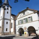
Convenient to: Landau in der Pfalz, Germany
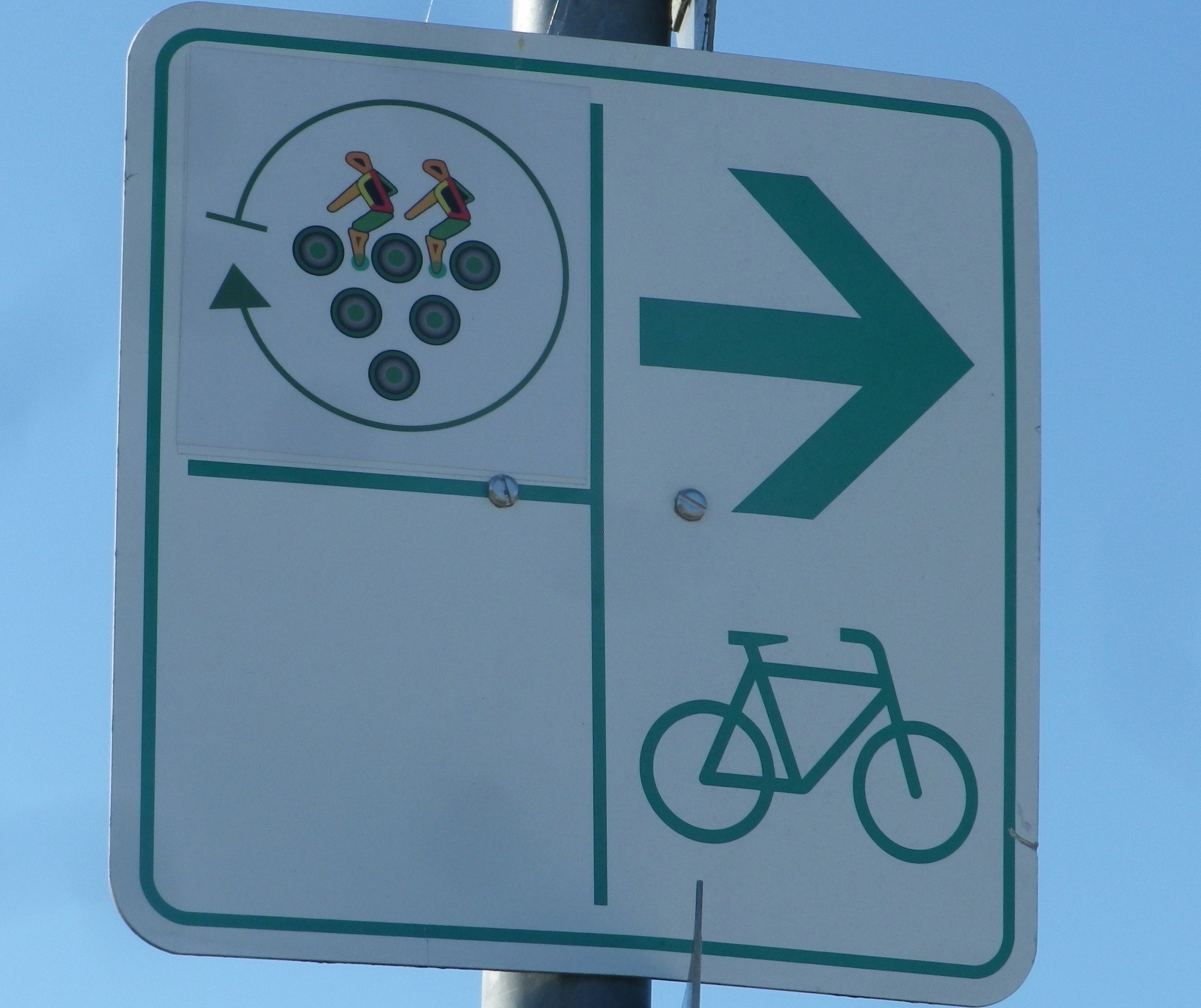
Marking: A white sign with stylized circles forming a grape cluster with two stylized riders on top
Trail Description: A delightful medium-length circuit primarily through vineyards, circling around the smaller, and lesser known (hence quieter and not as tourist-filled) wine villages of the southern part of Deutsche Weinstrasse.
Trailhead:
Official: Siebeldingen: Bismarckstr
Mine: Laundau: L509 Queichheim Hauptstr, at the Landau Zentrum exit off A65
Parking:
Insheim: Bahnhofstr;
Moerlheim (at exit Landau-Zentrum): P+R (just east of exit)
Landau: parking in and around the Freizeitbad (a water park) and the nearby Stettiner Str
Public Transportation Options:
Rail: Deutsche Bahn has frequent rail service connecting Landau with the main Rhine Valley cities via Karlsruhe.
Bus: VRN (Verkehrsverbund Rhein-Neckar) has bus lines connecting Landau and/or Bad Bergzabern (both with frequent train service) to the smaller towns and villages on this itinerary.
Suggested Stages: Not applicable
Trail Itinerary-Reference Points: (Counterclockwise)
Landau: Horststr, Horstring, Am Kugelfang; Dammheim: Am Bahnhofstr, Alte Bahnhofstr, Dorfstr, Schmiedstr; through fields, along A65; Knoeringen: Bahnhofstr, Hauptstr, Kirchstr; Walsheim: Hauptstr; through fields; Nussdorf: Kirchstr, Lindenbergstr, Am Heimlichen Eck, Kaiserberg, along Weinerlebnis Pfad; Godramstein: Unterer Steinweg, Bornergasse (P), Frankweilerstr, Kapellenweg, L511; Siebeldingen: Jahnstr, along Queich creek, outskirts; Arzheim: Hauptstr-Kalmitstr, Kapellenstr, Erzabt-Josef-Koch-Str, Ilbesheim bei Landau: Arzheimerstr, Hauptstr, Moerzheimer Str; Wollmesheim: Wollmesheimer Hauptstr, L510/Moerzheimerstr; Moerzheim: cross K6 (or turn left) Goecklinger Weg, Zum Kirchweg, Herrenstr, Unterstr, Bruehlstr, Augartenweg, fields; Impflingen: Obergasse-Bruchgasse, In der Kuhweide, fields; Insheim: Sportplatzstr, Kettelerstr, Kandeler Str-Sandweg, past train station (P), Bodelschwingstr, Offenbacherstr; Along, then over A65; Moerlheim: Moerlheimer Str; Queichheim-Landau: Queichheimer Hauptstr (P); Landau: Hauptbahnhof (P)
Representative Trail Photos:
Restrooms:
Nussdorf: On the Weinerlebnispfad, in the vineyards is a small restroom set in a nice rest area.
Landau: Off the trail (but closest and pay) toilets at Am Kronwerk x Fortstr (make sure you have coins)
Attractions on or near Trail:
Seasonal local wine festivals (see below), and wine education paths Nussdorf and Siebeldingen
Tasting along the Trail:
Many wineries along the trail, most notably in Siebeldingen, Nussdorf, Ilbesheim and Godramstein; whereas Landau has a couple of wine taverns/vinoteks. Additionally, Ilbesheim, Heuchelheim-Klingen, Siebeldingen have wine festivals in September
Alternative Options:
Hiking: In Heuchelheim-Klingen, the Weinrundwanderweg, a 13.6-kilometer-long easy circuit hike through the two villages surrounded by a sea of vines. Ilbesheim, by contrast has a number of wine-themed short (2-3 kilometer) circuits. Last but not least is Nussdorf’s Weinerlebnispfad, a unique combination of visual and audio art set in the vineyards along a two-kilometer trail through the vineyards overlooking the mountains and valleys of the Pfalz.
Car: Deutsche Weinstrasse, a thematic car route itinerary of about 100 kilometers, much of it on secondary roads, past vineyards and through charming wine villages, from Bockenheim to the border town of Schweigen-Rechtenbach.)
Additional Information:
Regional: https://landauland.suedlicheweinstrasse.de/
Trail specific: https://www.outdooractive.com/de/route/radtour/pfalz/winzer-radrundweg/3201806/ or
https://vis-a-vis-pamina.eu/en/activities/
Comments:
Not a lot of shade, so perhaps best in cooler weather.
A couple of short, but steep inclines. However, overall, this is an easy to medium difficulty trail.
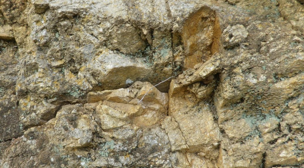
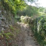
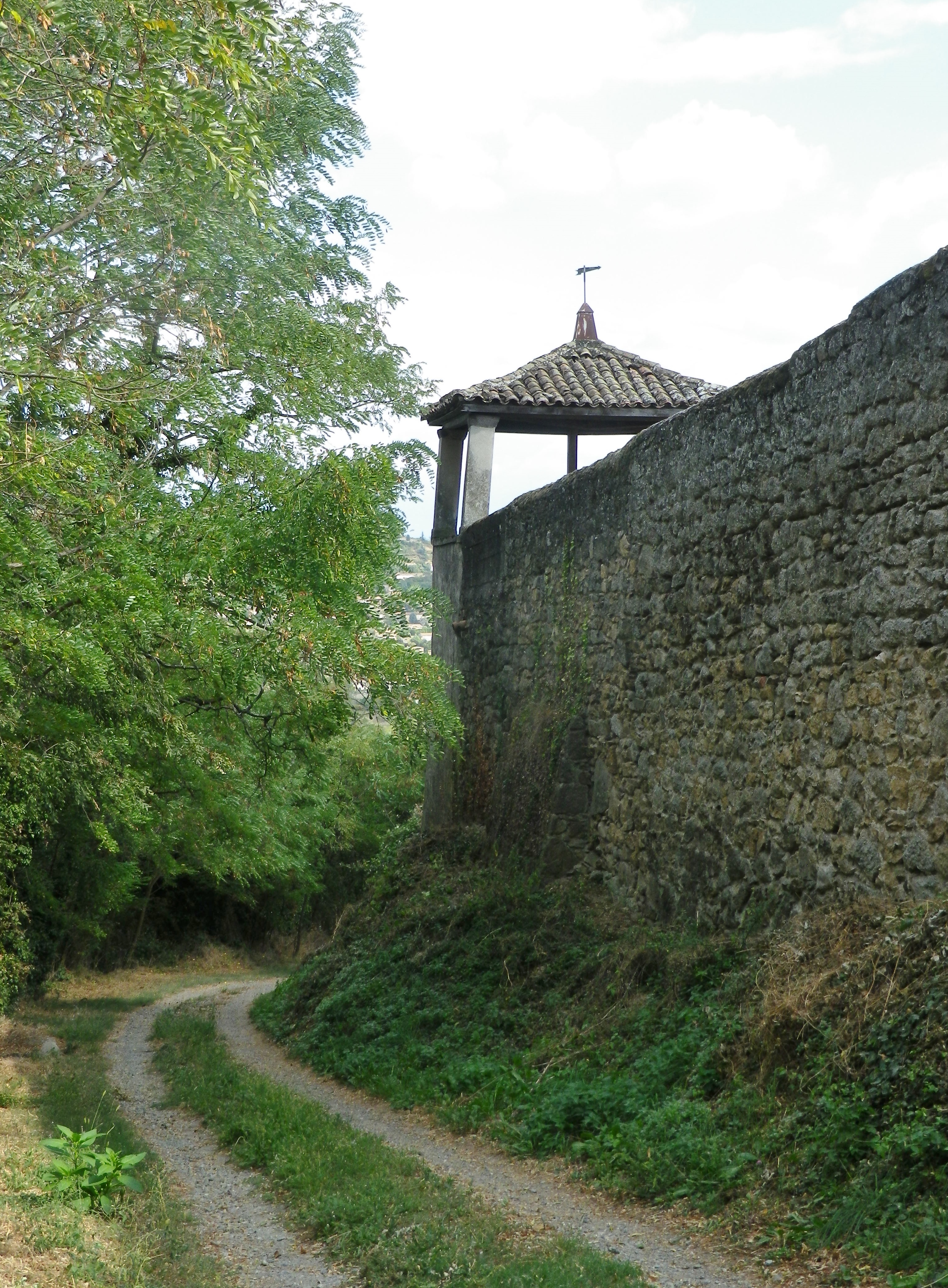
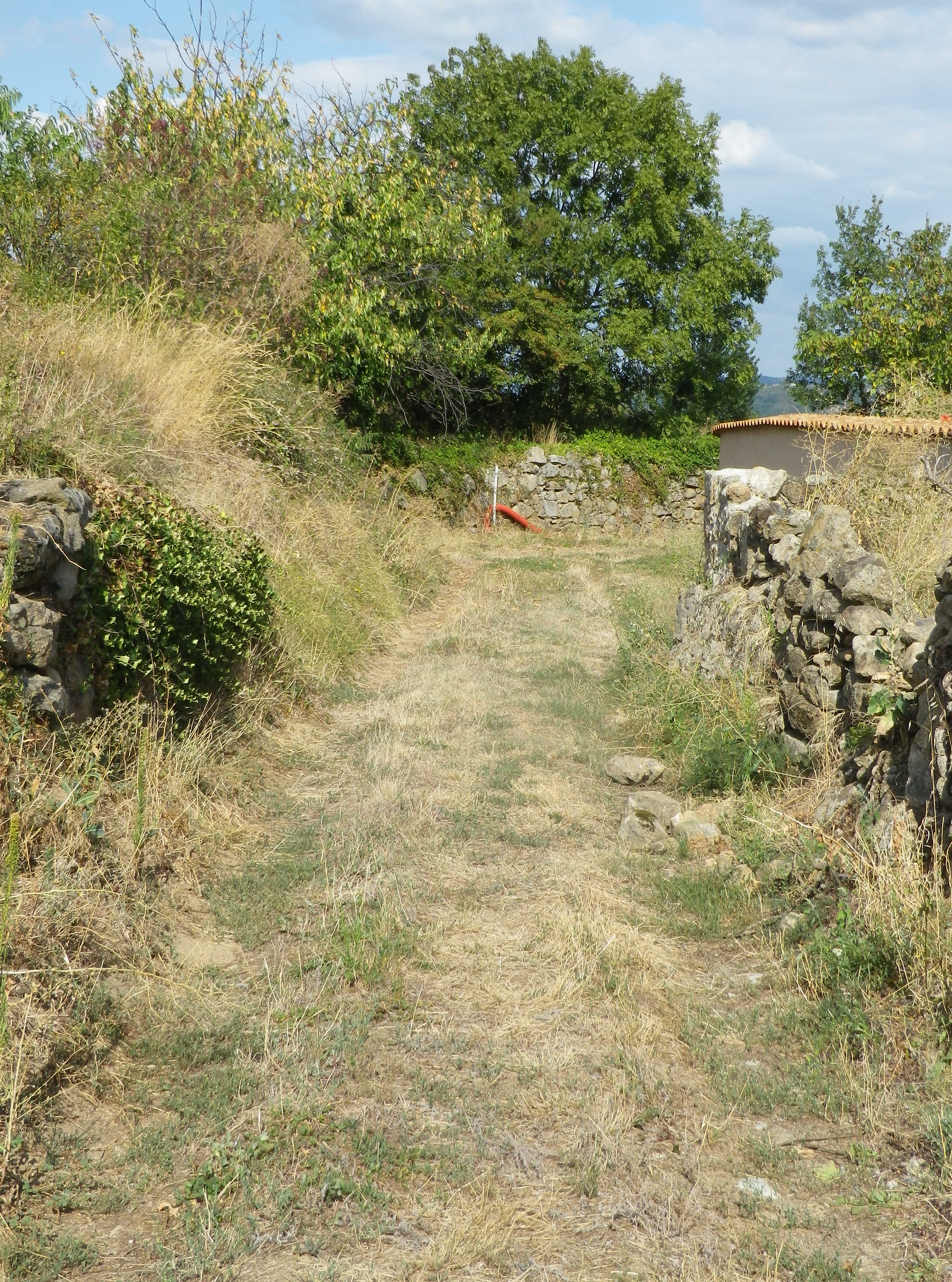
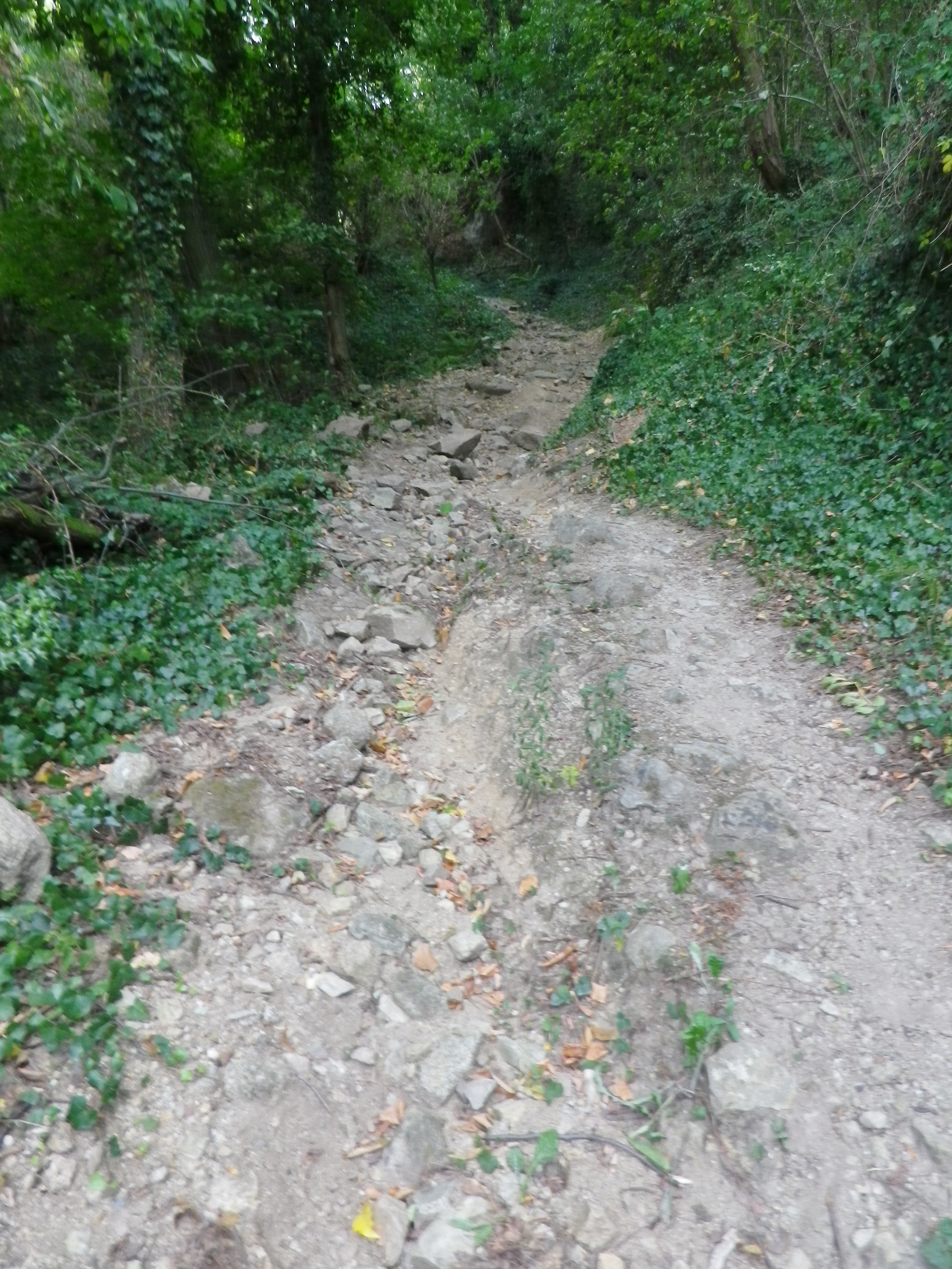
I included the earthen trail surface photo above to show that even the most degraded surface on this itinerary is quite suitable for most bicycles, except perhaps directly after a very heavy or prolonged rain.
Condrieu, the cradle of Viognier, is a small town, as well as the name of an appellation devoted to Viognier. While the appellation stretches about 8 miles/12.5 kilometers south of Condrieu, I found a wine-themed hike through the villages of Verin and Saint Michel sur Rhone, circling Chateau Grillet, one of France’s smallest appellations (a bit over 8.5 acres), likewise devoted exclusively to Viognier.
Like these two appellations, the one nested completely within the other, the hike itself was small. (One map said six, another said seven kilometers.) Still, I considered myself fortunate to have found it, and to have hiked it, as Viognier is one of my favorite wines, and the opportunity to see the homeland of this varietal, to hike the hills where it is still grown after all these centuries, was fantastic.
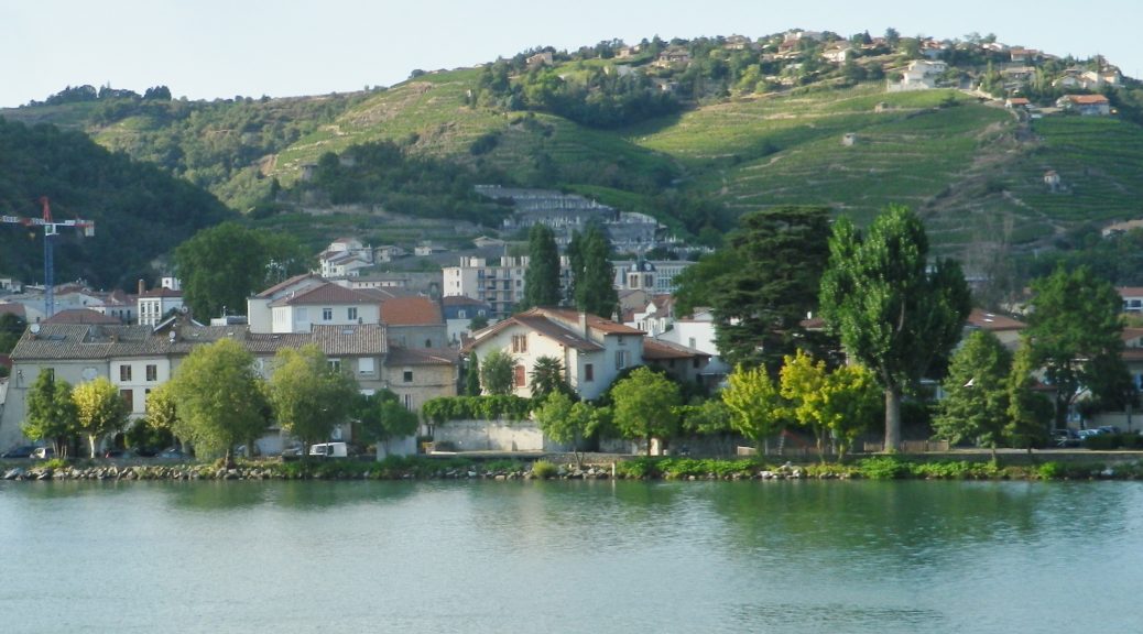
In fact, I was in such a hurry to begin, that I parked along the Rue Nationale in Verin, and began there, as opposed to starting at the official start point in St Michel sur Rhone. I hurried north upriver to enter the old village center. Verin, like Saint Michel sur Rhone, is a small village. No industry apparently, just lots of vineyards. Still the old center is charming, a couple of narrow lanes, set along a stream that feeds into the nearby Rhone. Being able to hike again in the northern Rhone region along the river was another reason to be ecstatic about the hike.
Once leaving the village, the trail begins a steady climb up a rather steep slope. The steepness of the slopes here, combined with their southerly exposition, is part of the reason the Viognier grape does so well here. This part of the trail was thankfully through woods. Occasionally, a tantalizing hint of the Chateau Grillet vineyards appeared, making my mouth water.
Completing the last push uphill to the hamlet of l’Ollagniere, the views began to open up. It was a peaceful spot high above the river, with more open fields, and fewer vineyards.
The first descent went through a small wood, and followed along a quiet lane into the village of St Michel sur Rhone. The stone church caught my eye, as did the large parking lot and restrooms. I saw one small inn with a restaurant, but not a soul in sight anywhere in this amble through the village. Leaving the center of the village via the cemetery, I reflected that at least there had been inhabitants in the village.
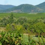
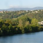
The second descent was certainly more punishing than the first, but rewarding for its passage through the acres of vines all growing Viognier! The loose granitic soil, and the well-worn rock surface it lay on only added to the challenge. But once the trail reached another wood, the going was easier. Meanwhile, the south and east facing views of the Rhone were amazing.
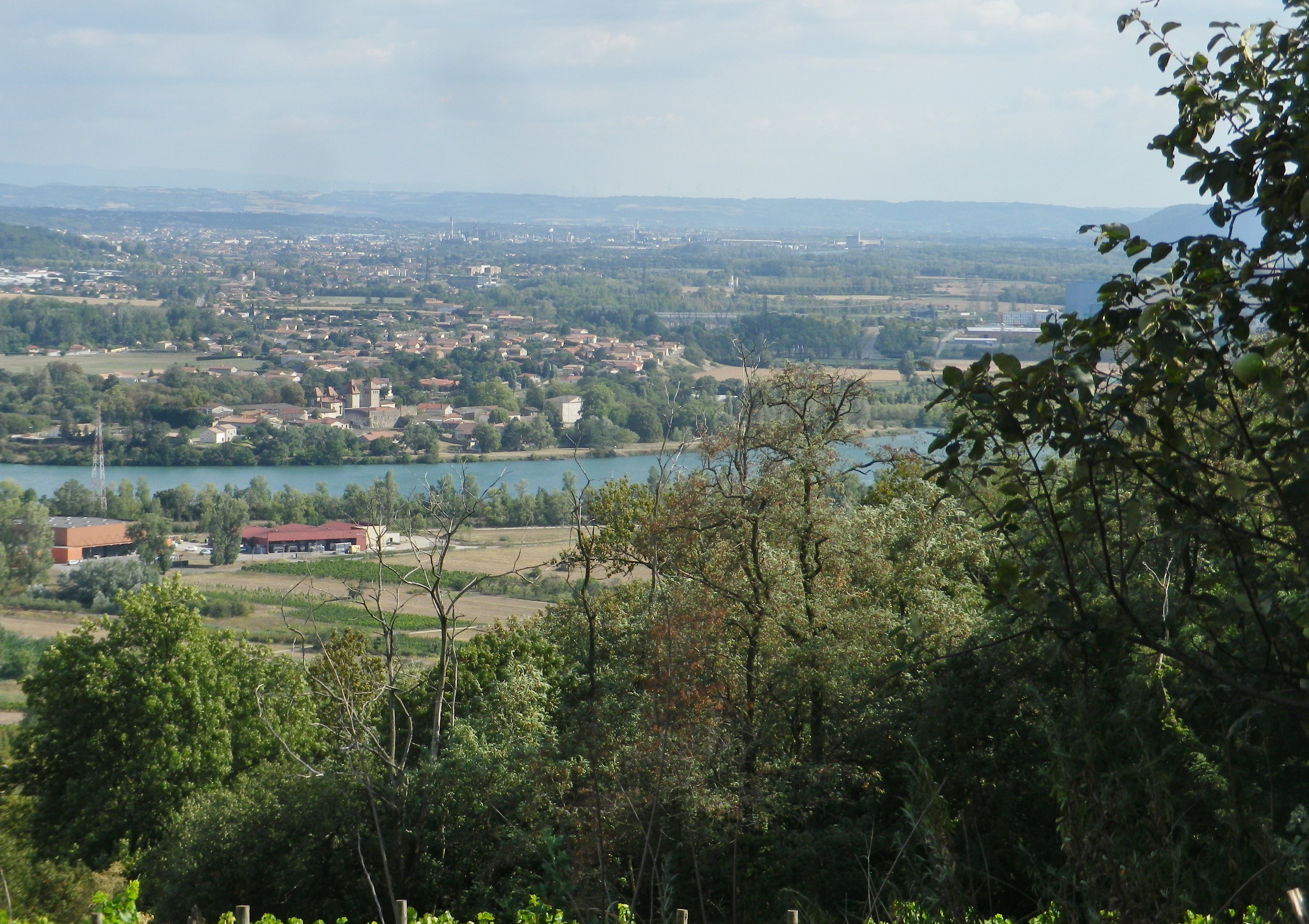
The trail along the river’s flood plain was easy. While not necessarily scenic, it was quiet, and flat, which is rare in this area. And from that perspective, it demonstrated how, in this section of the Rhone, the cliffs literally rise up suddenly. Heading north, the trail turned west, and within a quarter of a kilometer, I was hiking along the base of steep slopes. It was my last section of the trail, that ended following along the final vineyards on this hike. While they would be the last vineyards I saw while hiking, they certainly won’t be the last vineyards I savor from this hike!
What I Learned
Three great Appellations d’Origine Controlee (AOC) begin about 20 miles south from Lyon. They are, from north to south, the famous Cote Rotie, Condrieu, and St Joseph. In these AOC, the Syrah and the Viognier varietals reign supreme.
Condrieu is a small town, and the vines of its appellation are sandwiched between the Cote Rotie appellation, and the Saint Joseph appellation, While the Cote Rotie is famous for its red wines, Condrieu is famous for its white wines. And while the Saint Joseph appellation is the largest in this part of the northern Rhone, the Condrieu appellation is one of the smallest in the region.
This appellation covers only about 260 hectares, and only six other communes (Chavanay, Limony, Malleval, Verin, Saint Michel sur Rhone, and Saint Pierre de Boeuf), most of which are considerably smaller than Condrieu. Encircled by this appellation is one of the smallest appellations in France: Chateau Grillet.
The white Viognier grape is the sole varietal for the Condrieu and Chateau Grillet appellations. This varietal produces delicious, full bodied and full-flavored wines that are perfumed treasures for white wine lovers. Only about 6000 hectoliters are produced each year in the Condrieu appellation. (And unless you have very deep pockets, you can forget about including a bottle of Chateau Grillet, with its even smaller production, in your collection of appellation Viognier wine from this area.)
Granitic soils predominate here, unlike the limestone and calcareous soils in so many other non-Rhone Valley appellations. The unique substrata in the northern Rhone area forced the river to carve its way south. The valley here is rather narrow and twisting (and quite picturesque), resulting in numerous vineyards with steep south facing exposures – great for soaking up sun and retaining heat!
What I Tasted
2016 Viognier, AOP, Domaine Louis Clerc: A dry white wine with medium gold color; nose of spice, green wood; and flavors of spice, wood, and vanilla; medium acidity, smooth aromatic finish.
2016 Viognier, Resurgence, Appellation Condrieu Protegee, Xavier Mourier (Chavanay): A dry white wine with medium gold color; nose of spice, green wood; and flavors of spice, wood, vanilla; medium acidity, smooth aromatic finish
2016 Viognier, La Berne, Vieilles Vignes, Appellation Condrieu Controlee Domaine Lionel Faury (Chavanay): A dry white wine with medium gold color; nose is fruity and slightly floral, with white stone fruit and vanilla flavors; medium plus acidity, with a smooth medium length finish.
2016 Viognier, La Berne, Appellation Condrieu Controlee Domaine Lionel Faury: A dry white wine with medium gold color; a mineral and slightly floral nose, with floral, clove, oak, and vanilla flavors; medium acidity and length
2016 Viognier, Les Rouelles, Appellation Condrieu Controlee, Gilles Flacher (Charnas): A dry white wine with medium gold color; spice and smoky nose, with floral, spice and smoky flavors; high acidity, but a relatively smooth finish.
Trail Name: Les Coteaux St Michel, AKA Saint Michel n. 1
Trail Type: Short distance; somewhat maintained and varied surfaces from paved to rough, with loose gravel on some of the steep slopes, marking on the trail good, but with one exception, not specific to the trail itself.
Length:
Total – about 7 kilometers/ 4.5 miles
Convenient to: Vienne and Lyon, France
Marking:
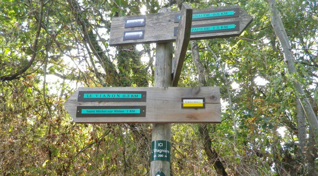
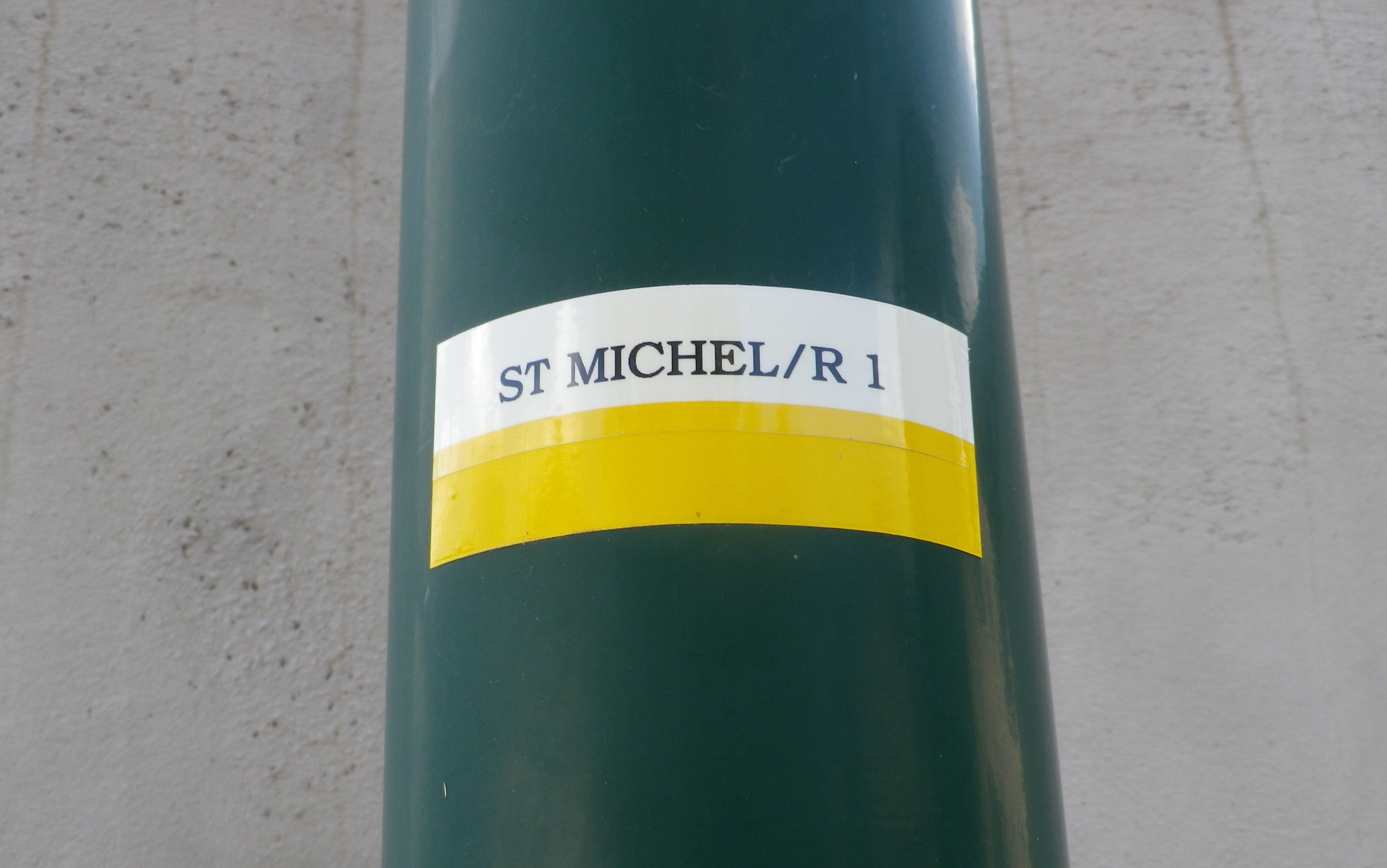
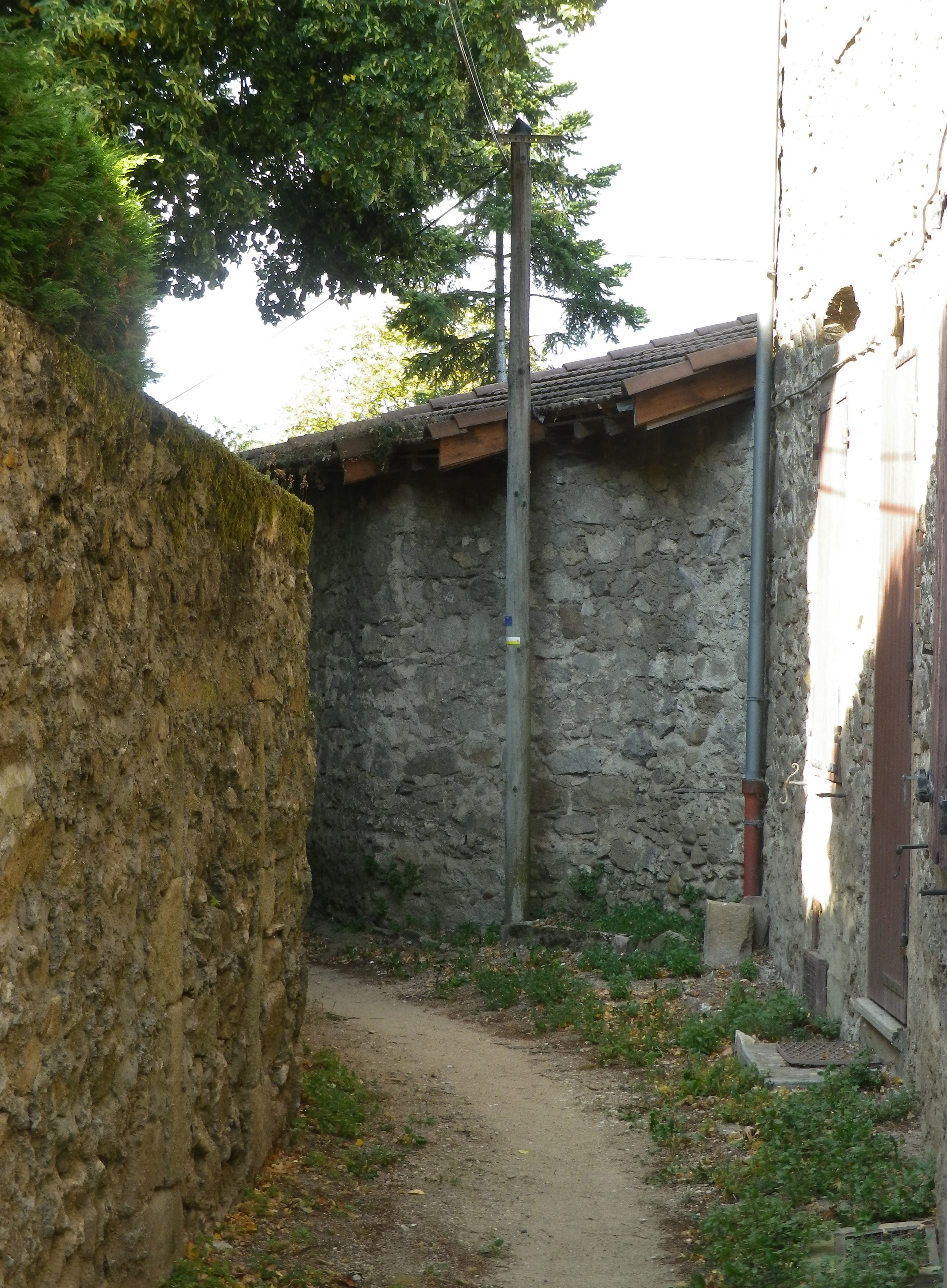
A white horizonal bar over a yellow horizonal bar, and occasionally a post noting current location and direction arrows with distances to further locations. (See photo above)
Trail Description:
A beautiful and sometimes challenging trail through a variety of landscapes from hamlets to fields and forests, but mostly dominated by scenes of the Condrieu vineyards and the Rhone River. With the dramatic views, and constantly changing trail, this trail will satisfy those looking to explore the quiet area of this small appellation.
Trailhead:
Official: St Michel sur Rhone: Mairie – R du Solon x Place des Muriers
Mine: Rue de la Voie Romaine, Verin
Parking:
St Michel sur Rhone: R du Solon, by church about 20 places; Rue Haute (Place du Bourg Vieille), about 9 spots
Verin: R. Nationale, parking along the street, south of R Jean Vincent, and between R. de la Voie Romaine and D34; small lot at the intersection of R Jean Vincent and R. Nationale/D34
Public Transportation Options:
Rail: SNCF routes north to Lyon and south to Valence, pass through the station St Clair les Roches, across the river from Condrieu in Les Roches de Condrieu.
Bus: Bus, more like van, service is available on demand.
Suggested Stages: Not Applicable
Trail Itinerary-Reference Points: (Counterclockwise)
St Michel sur Rhone: Place des Muriers, La Piaton, woods, Impasse Cote Foret, Cote Foret (along tracks), cross D1086, dogleg , R du Grand Val, north on R de Lone, east to R. de Jassoux, Impasse du Puit, cross tracks, Impasse de la Croix Rouge, Impasse de Poncin, cross tracks, north on R. Roches Molles (Chateau Grillet); Verin : R. de la Voie Romaine, R. de Beatrice de Roussillon, path on left by house just after underpass, above another house, Impasse de la Croix Margot, R. de la Cartherie, Impasse au Bois, R. de l’Ollagniere ; Impasse la Gaie, down between house and pool, R Rampot
Representative Trail Photos:
Restrooms:
St Michel sur Rhone: R du Solon, by church and Restaurant
Attractions on or near Trail:
Just lots of wonderful views of the famed vineyards
Tasting along the Trail:
Condrieu, the town, has the most wineries, although there are a few, smaller ones along the trail, especially in Saint Michel sur Rhone
Alternative Options:
Hiking: Dans les Vignobles de Cote-Rotie et Condrieu, a three-day, 44-kilometer circuit trail of short stages around both the Cote Rotie and Condrieu appellations.
Additional Information:
Regional: https://www.condrieu.fr/# and https://www.vienne-condrieu.com/
Trail specific: https://www.mairie-saintmichelsurrhone.fr/loisirs_randonnees_a_saint_michel.php
Comments:
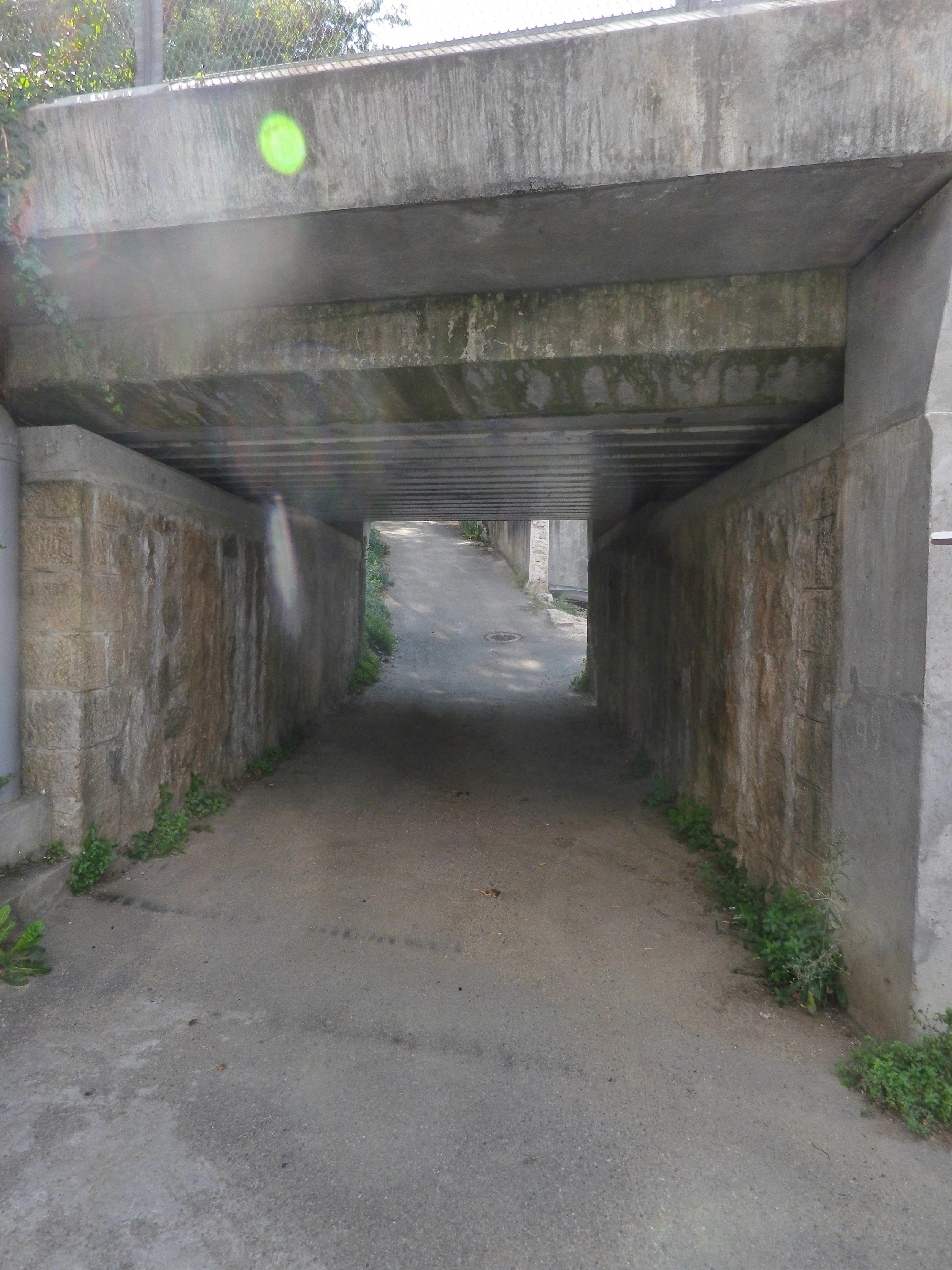
There were a couple of places where the trail followed in between a house and a barn or other building, or a house and a pool. In all cases, it was indeed part of the trail. (There were a couple of rail track underpasses as well. )