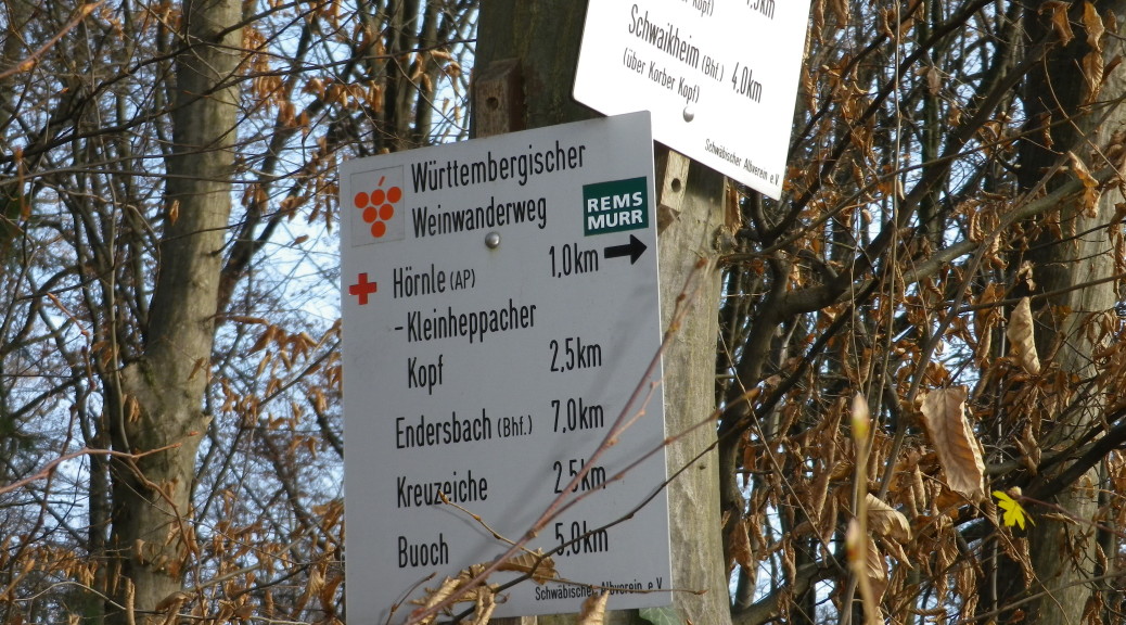
Stuttgart is a huge metropolis, connected by an extensive rail system. Using Stuttgart’s subway/urban rail system trains, the “S-Bahn” in German, I hiked along the southern end of the 470 kilometer-long (292 miles) wine hiking trail known as the Wuerttembergischer Weinwanderweg. The W4, I as refer to it below for expeditious reasons, wends its way through the quiet, green belt surrounding the Stuttgart region, encompassing its vineyards in the Neckar and Rems Valleys.
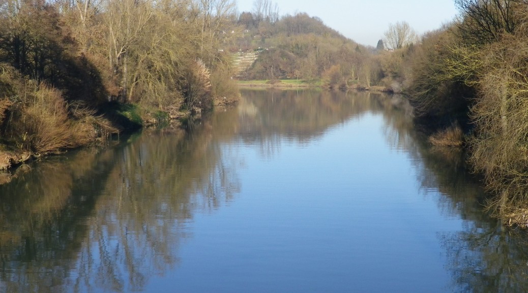
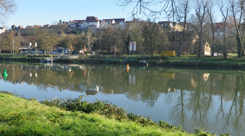
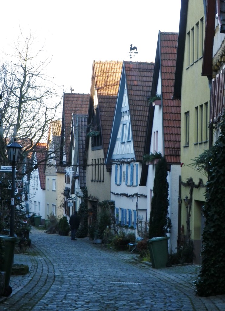
Stuttgart’s public transportation system is extremely efficient, and unbelievably inexpensive with a tourist pass. To prove the point, over two weekends there I decided to hike the southern-most sections of the W4, using my three-day, all-network passes. Leaving from downtown Stuttgart, I headed to the town of Marbach on the the S-4 line. Famous as the home of the great German author Schiller, Marbach is the site of the northern-most conjunction of Stuttgart’s S-Bahn system and the W4. About 30 minutes later, I was on the trail, passing through the charming old town, high above the Neckar River.
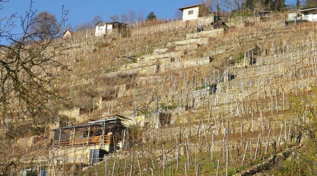
Wuerttemberg is a large and diverse wine region. Throughout the region red varietals tend to predominate, especially the Trollinger variety. The Wuerttembergische Weinwanderweg trail through greater Stuttgart essentially covered two of Wuerttemberg’s six wine districts. This post covers the first one, to the north of Stuttgart.
Wuerttembergisch Unterland is the name of the wine district around Marbach and Benningen facing each other on opposite sides of the Neckar. Then Hoheneck (part of Ludwigsburg) and its counterparts on the opposite shore, Neckarweiher and Poppenweiler. The southern-most section of this district continues to around Affalterbach.
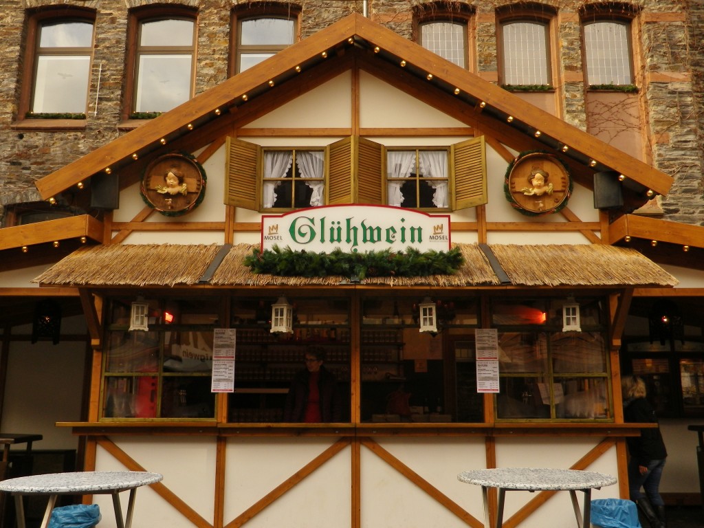
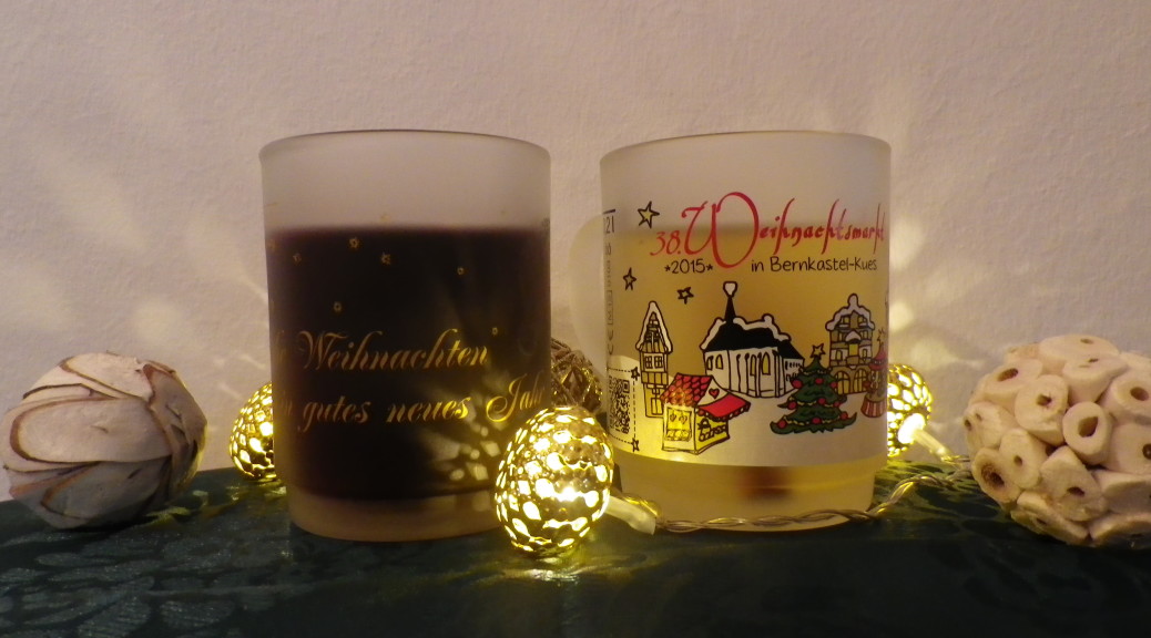
December: Often a cold month, and the month with the shortest days of the year. But along the Moselle, temperatures can be mild in December, and the short days are celebrated, as they are throughout Germany, with Christmas Markets! Anyone who has been to Germany during December knows what fun these can be.
Traditionally, Christmas Markets open at the beginning of Advent, (usually around the last weekend of November), and run until Christmas Eve. Usually set up in the town square (or squares!), they offer hand-made crafts, Christmas items (such as tree decorations, Christmas-themed table linens, nutcrackers and smoker men), live entertainment, and food and drink. Wine plays a role here too, as Gluehwein, or warm mulled wine, is a popular drink. Red or white, the Gluehwein not only helps warm chilled hands and feet, it also helps warm the heart. At Christmas Markets, Christmas cheer is evident, even if the weather can be cold.
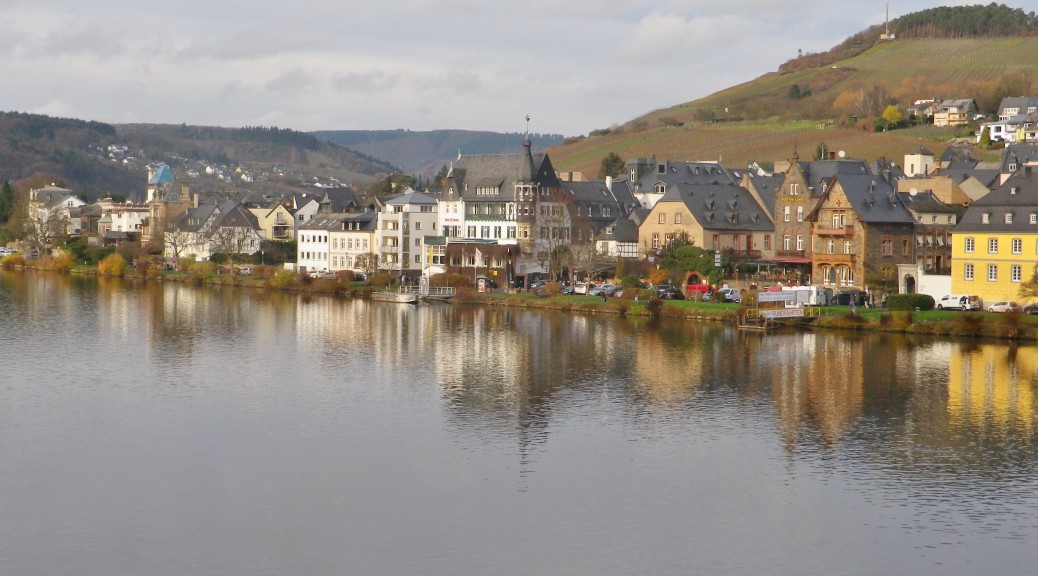
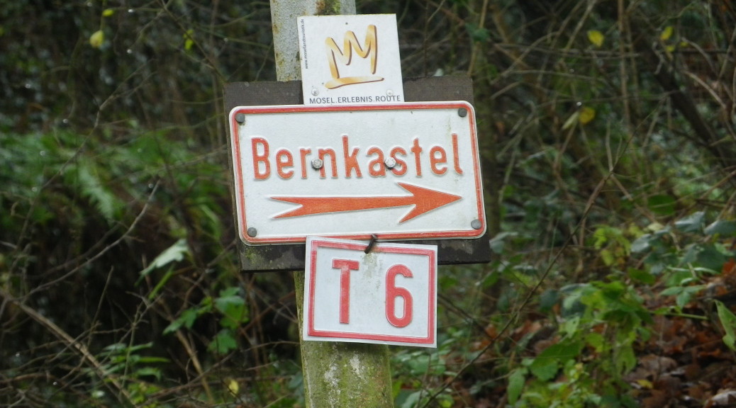
Along the Moselle River valley wine region, there are three sections: The Upper Moselle area, the Middle Moselle area, and the Lower Moselle. This post addresses wines and wine production in a small area of the right bank of the Middle Moselle, between Bernkastel and Trarbach. (For more information about this region’s wines, read here: http://www.winecountrywandering.com/wine-notes-moselles-bernkastel-district/.)
Trail Type: Short distance trail; much of it paved, some of it grassy, the rest is dirt trail; well maintained, but the markings are not exclusive to this route, and change in places.
Length: total: 6.5 kilometers/ 4 miles
Convenient to: Koblenz or Trier, Germany
Marking: Multiple signs indicate the direction to “Traben-Trarbach” (or “Bernkastel” if going the opposite way); Gold lizards on a red heart on a red square marked this trail the first part of the way; Once atop the hill, “T-6” and “Mosel Erlebnis Route”, were also signs on this same trail all the way to Trarbach. (See the featured photograph above, and red sign in the first photo below.)