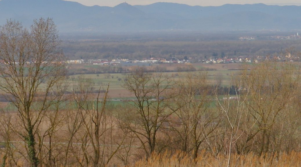
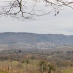
Above the small town of Ringsheim, after a long, but steady, climb up the Kaiserberg, I took in my first view of the distant mountains. Off to the west, over 30 kilometers (18.5 miles) away, were the Vosges Mountains in Alsace, standing out against a clear sky. Off to the east were the mountains of Germany’s best-known forest, the Black Forest. I took some time to try to get good photos, thinking the opportunity was too good to pass. I was there, the sun was in the right position, and the atmospherics were mostly clear. Little did I know that I would cross close to this spot again, to complete the second part of this circuit trail, which was laid out like a rough figure eight. In fact, there were several circuit trails in this hiking paradise.
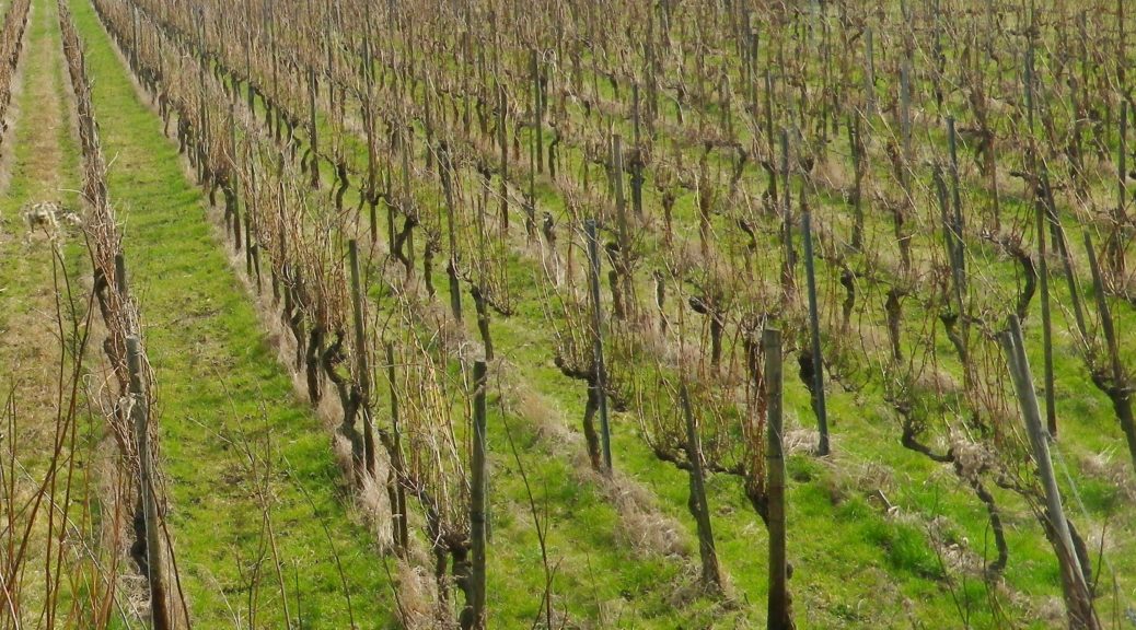
So twice the hike to the top of the Kaiserberg, which really is not as challenging as it may seem. On the plus side, I had two opportunities to take in the great views. But the Kaiserberg is really famous in this area of the Breisgau for its vines and wines. In fact, the official start of this trail is in Ettenheim, a town at the foot of the Kaiserberg that attracted a famous French nobleman and bon-vivant: Bishop (later Cardinal) Louis Rene Edouard de Rohan. Maybe it was the wines?
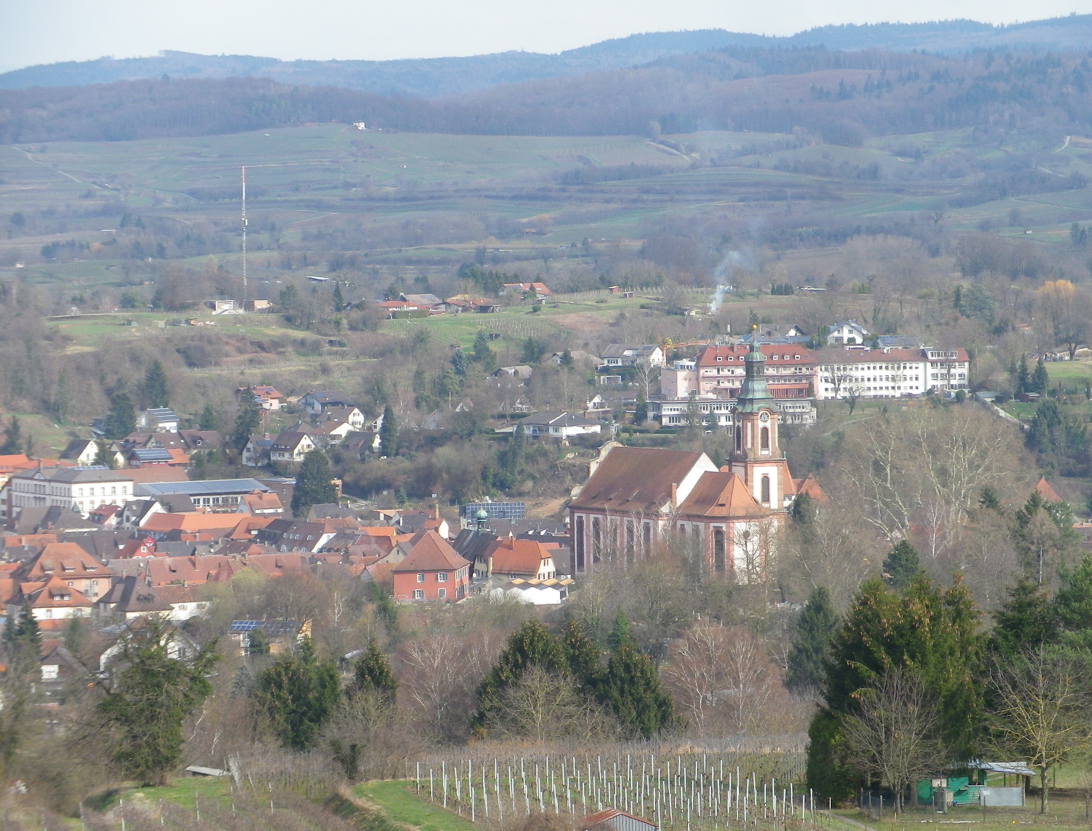
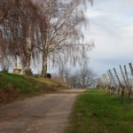
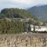
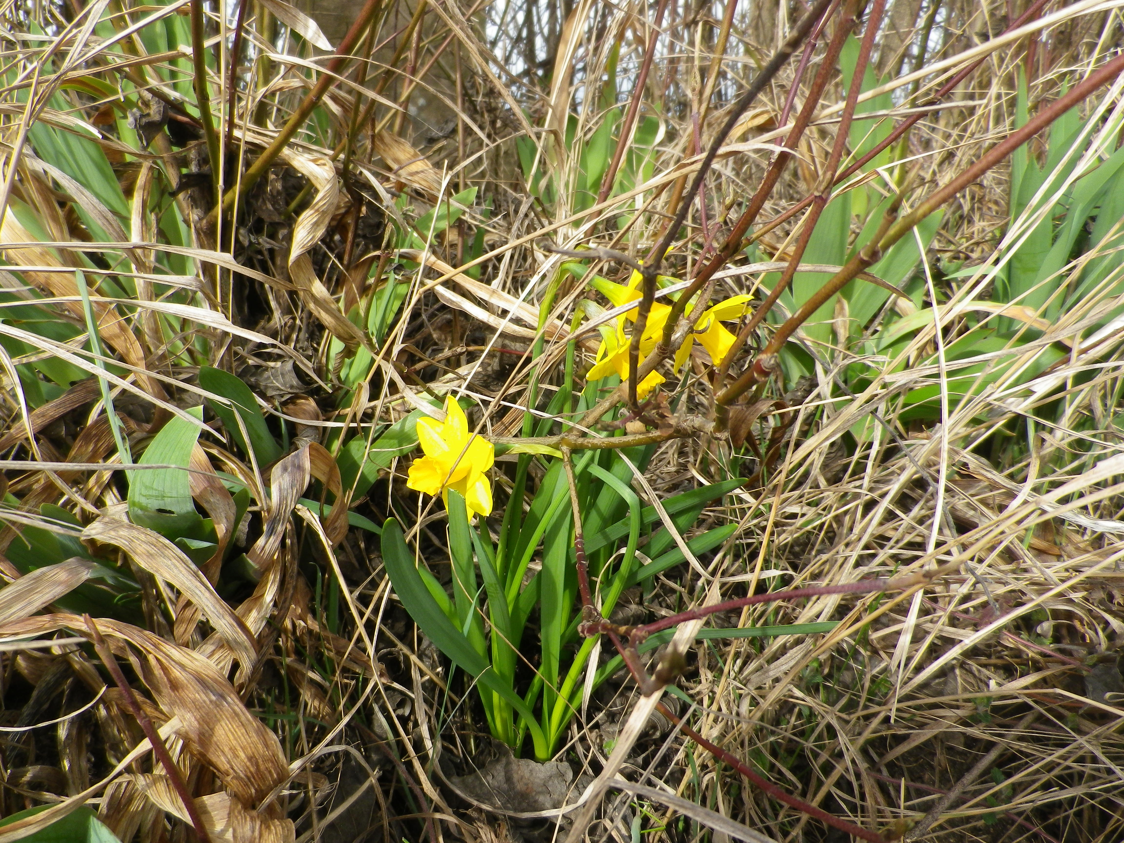
The situation of the Kaiserberg and Ettenheim is good for capturing sun and warmth, being high enough – but not too high – in the foothills of the Black Forest, with good and long western and southern exposure to sun. The scenery was certainly an attraction as well: dark green of the Black Forest, little blue mill ponds and the peaked mountain tops on both sides of the valley. Some of these were still snow covered. But to my delight, flowers were already blooming along the trail, a surefire indicator of imminent spring weather.
It was still too early though for the taverns on the trail to be open. (Normally, taverns on trails close in winter, and don’t open until at least Easter or April, whichever comes first.) Pity, as the trail passed two, each looking equally inviting. One was close to the highest point of the Kaiserberg, next to an observation tower. The other, set in a traditional style building, was nestled further down the Kaiserberg in a hollow, where it was warm and sunny, and sheltered from wind for the most part. Very gemuetlich! Both offer local wines, as there are several vintners in the surrounding towns of Ringsheim, Ettenheim and Herbolzheim, producing some of the best wines in the Breisgau wine district.
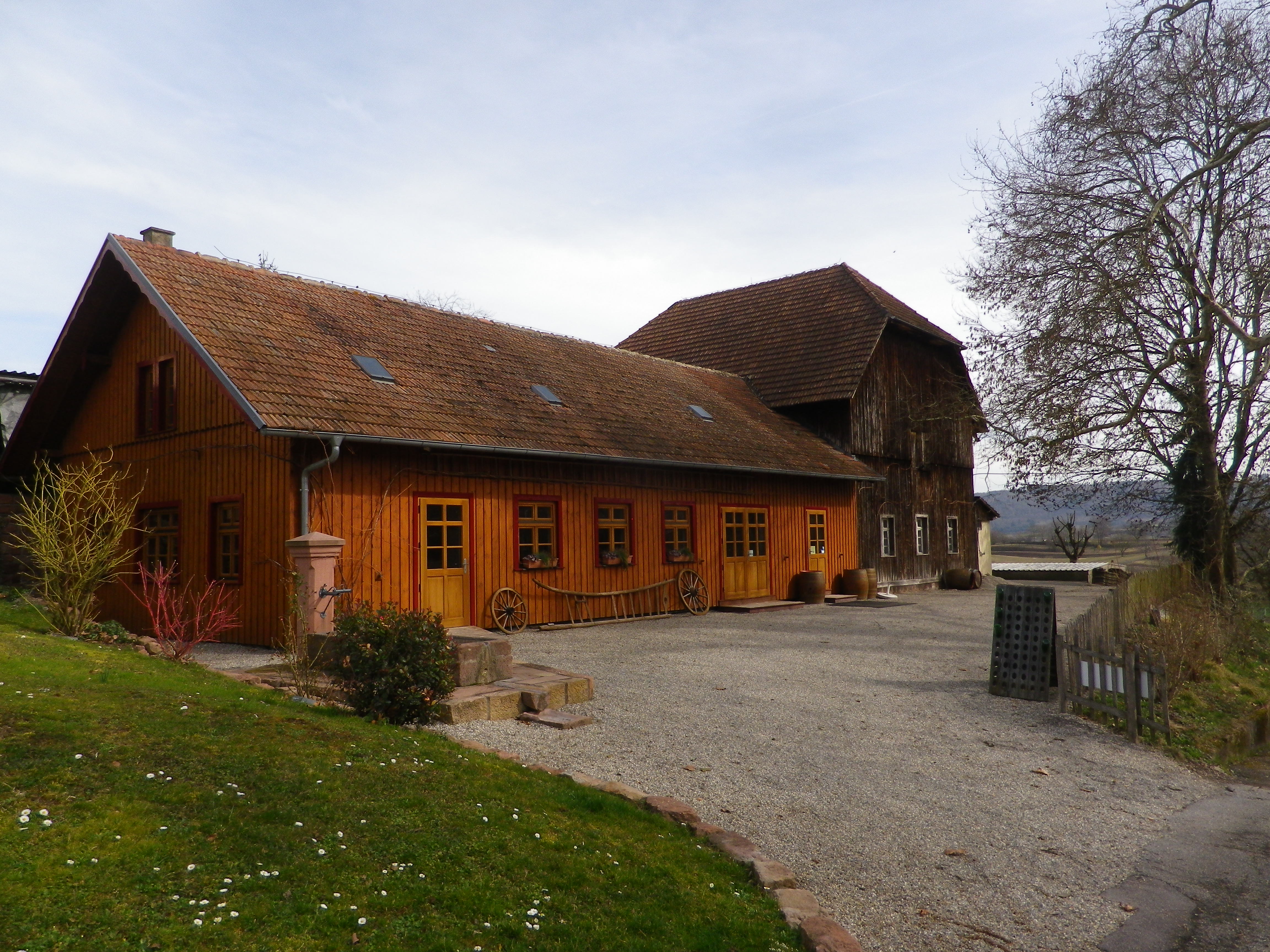
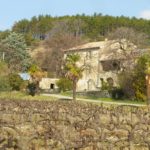
Fortunately though, the trail ends (and begins) by the Weingut Weber (Weber Winery). While their “wine lounge” with its attractive view from the patio was also closed, at least the shop and restaurant were open. Maybe Cardinal de Rohan knew something, or maybe he started something, but it is certainly true that one can eat, drink and even hike well in this bucolic corner of the Breisgau.
What I Learned:
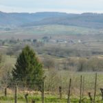
The Breisgau area of Germany’s Baden Wine Region has some unique topography, both natural and manmade. From the plain, you see ridgeline after ridgeline, each rising higher as it moves away from the Rhine, and toward the upper reaches of the Black Forest to the east.
This district produces red and white wines, in almost equal quantities. Mueller-Thurgau is the most planted white varietal, followed by Rulaender (Grauer Burgunder/Pinot Gris), and then Pinot Blanc. The Pinot (Burgunder) varietals are widely planted here. In fact, according to the Weinlandbreisgau.de site, the Blauer Spaetburgunder (Pinot Noir) constitutes a whopping 42.9% of all wine made in the Breisgau. Combined with the Pinot Blanc figure of 9.5% and the Pinot Gris figure of 12%, this means that the Pinots themselves constitute over 60% of all wine from this area.
Most planted varietal in the Breisgau area around Kippenheim is the Spaetburgunder. Other areas within the Breisgau grow the red varietals of Regent (developed in 1967 in the neighboring Pfalz wine region) and Cabernet Mitos, and Riesling and Chardonnay as other white varietals. All other grapes grown each constitute less than one per cent of the total.
What I Tasted:
2018 Sauvignon Blanc, Ettenheimer Kaiserberg, Trocken, Deutscher Qualitaetswein, Wein und Sektgut Weber (Ettenheim): A dry white wine with medium gold color; nose of gooseberry and citrus, with gooseberry, citrus and slight spice and pear flavors; medium plus acidity, with a tart finish, well balanced and a great representative of this varietal wine.
2012 Weissburgunder, Ettenheimer Kaiserberg, Trocken, Qualitaetswein, Weingut Jaeger (Ettenheimweiler): A dry white wine with medium gold color; citrus flavors with a full mouthfeel.
2011 Grauburgunder, Ettenheimer Kaiserberg, Trocken, Qualitaetswein, Weingut Jaeger, (Ettenheimweiler): A dry white wine with light gold color; floral notes with a trace of minerality, and a full, smooth mouthfeel.
Sekt, Brut, Blanc de Noir, Deutscher Sekt, Wein und Sektgut Weber (Ettenheim): A dry red sparkling wine vinified white, with very fine, lively bubbles, and dark minus golden color; floral and yeast nose, green apple and bread flavors; medium plus acidity.
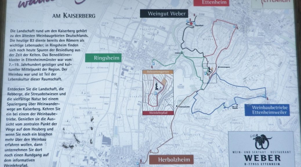
Trail Name: Weinbergwanderung Kaiserberg AKA Weinwanderwege am Kaiserberg
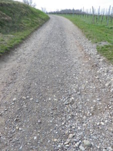
Trail Type: Short distance figure eight circuit; well-maintained and almost exclusively paved, fairly good marking on the trail.
Length: 9.75 kilometers/6 miles
Convenient to: Offenburg, Freiburg, Baden-Wuerttemberg, Germany
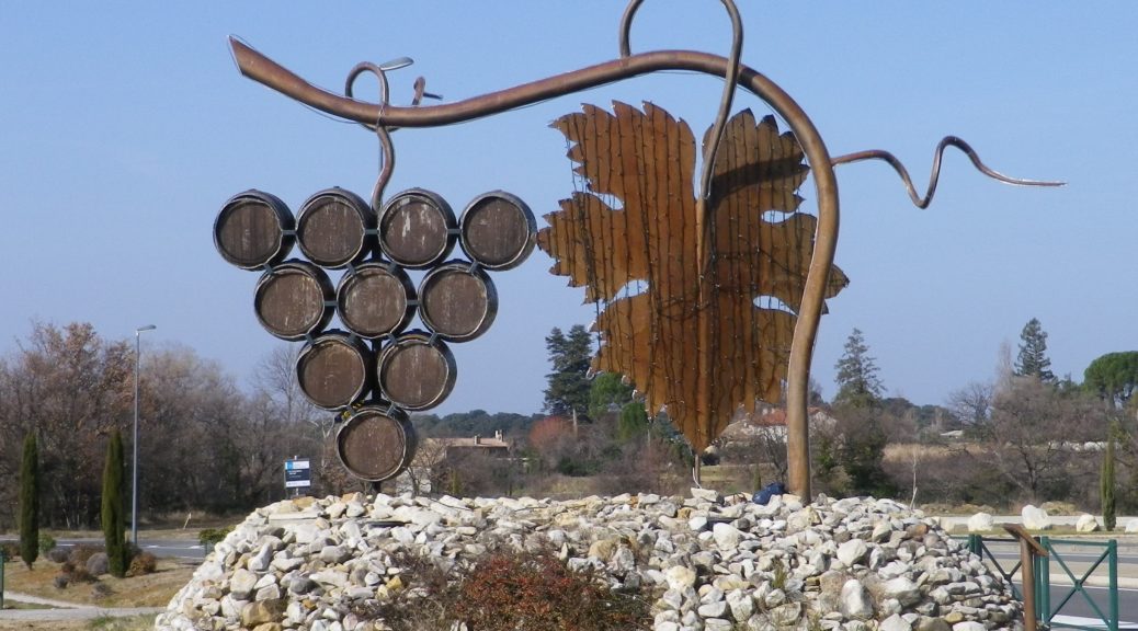
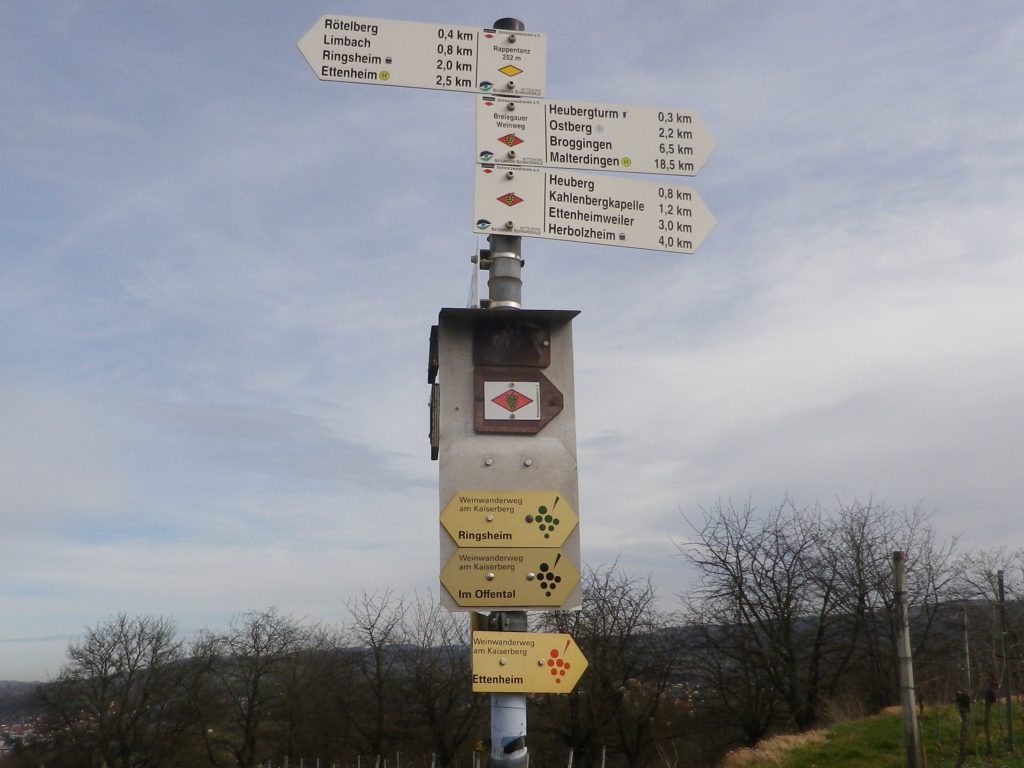
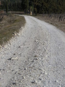
Marking: Small, yellow aluminum signs with black lettering and stylized black grapes on the side. (Bottom three in the photo below)
Trail Description:
This moderately challenging hike (with several inclines and declines), covers the Kaiserberg, a hilly and wonderfully rural area set in the foothills of the Black Forest, yet not far from more urban areas. The biggest towns of Herbolzheim and Ettenheim sponsor several marked wine-themed trails, to include a short wine education trail through the vineyards. This trail, sponsored originally by the Weber winery, joins segments of these shorter trails to make a longer circuit, suitable for families young and old, and even cyclists.
Trailhead:
Ettenheim, Im Offental
Parking:
Ettenheim has a number of small parking lots, not too far from the trail. The closest is on Schwarzwaldstrasse
A small, unimproved parking lot at the top of the main Kaiserberg hill may be reached via Ringsheim’s Bergwerkstrasse.
See the additional comment below about parking.
Public Transportation Options:
Rail: Regional trains DB and SBB) frequently service the Ettenheim area (The closest station to the trail is Ringsheim.)
Bus: Sudbadenbus services this area, and provides route and schedule information at www.suedbadenbus.de
Suggested Stages:
Either the northern or southern half of the figure eight circuit may be hiked separately
Trail Itinerary-Reference Points: (Counterclockwise)
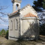
Ettenheim: Im Offental, through the Weber winery complex, vineyards, past a memorial with benches; up a draw between vines and woodline; past Kahlenbergkapelle (chapel); toward Lindenmann-Hutte (hut), scenic overlook with boulders; downhill into vineyards; past a hut; On Margarten, past Hummels Viehweid Straussi (Tavern), continue through vineyards; through intersection/section of trail by Kahlenbergkapelle; Heubergturm; through vineyards, return to Weber winery.
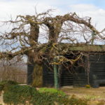
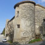
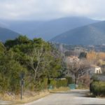
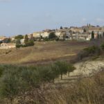
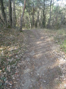
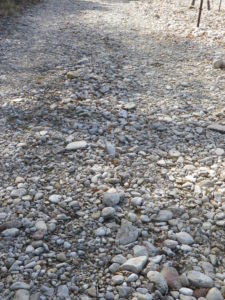
Representative Trail Photos:
Restrooms:
Heubergturm (on the trail) has restrooms, but they are sometimes locked.
Attractions on or near Trail:
Just lots of bucolic scenery.
Tasting along the Trail:
Weber winery, and two seasonal taverns: the Heubergturm, and Hummels Viehweid Straussi; all right on the trail.
Alternative Options:
Hiking: In addition to the long-distance/multi-day Breisgauer Weinweg (see the Nutshell here), there are several circuit hikes. These range from 1 to 5 kilometers, and may be combined for more distance and hiking pleasure. See Ettenheim’s https://www.ettenheim.de/weinwanderwege-am-kaiserberg to download the flyer.
Car: The Badische Weinstrasse, a 200-kilometer car route for wine enthusiasts, begins in Baden-Baden and ends at Weil Am Rhein (on the Swiss border). It roughly follows Highway 3 from north to south, passing through the towns listed here.
Additional Information:
Regional: https://www.ettenheim.de/tourismus-kultur-freizeit
Trail specific: https://www.outdooractive.com/de/wanderung/schwarzwald/weinbergwanderung-kaiserberg-weingut-weber-ettenheim/117526408/#dm=1
Comments:
The Weber winery actively promotes hiking, hence many Weber signs and some events happen here in the vineyards on the Kaiserberg. However, while parking may be allowed in their large parking lot during those times, the sign otherwise notes that parking is only for winery customers.
One small section of the trail, the roughest surface section, was closed off that day due to the danger of falling trees. However, an alternative was clearly marked, and rejoined the trail within a few hundred meters.
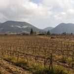
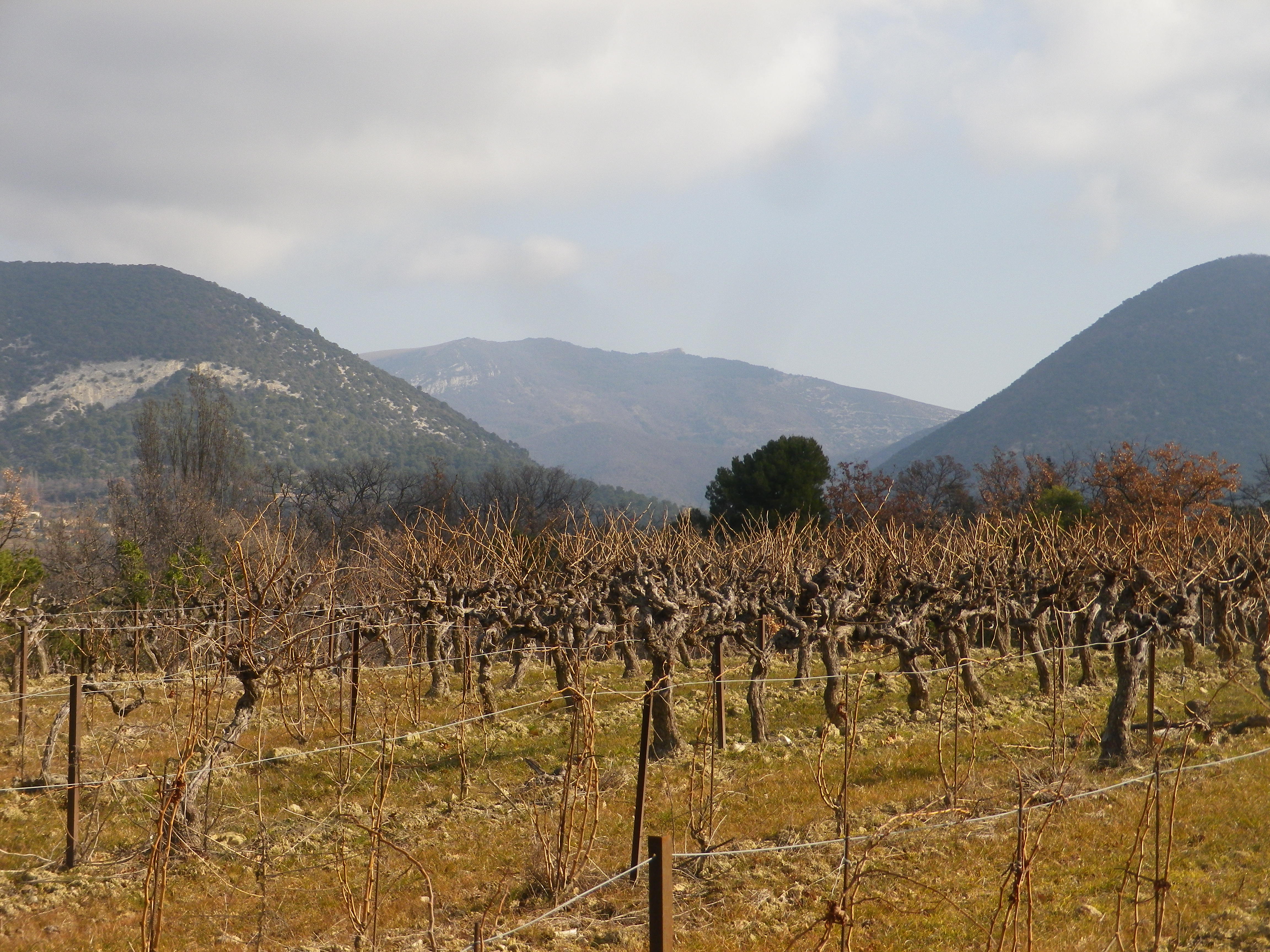
Walking through the garrigue, only a few meters away from the Vaucluse, with views of the Baronnies Provencales National Park, with its arid landscape, surrounded by vines producing Cotes du Rhone wine, you could be forgiven for thinking you were in Provence.
Instead, I was in the Drome Provencale, in Saint Pantaleon-Les Vignes, to be exact. A wine-themed trail developed in association with the local cooperative, the Vignerons de Valleon, runs through and around the village. While the trail begins in the village, itself on the border with the Vaucluse, it soon enters vineyards. Not surprising as the village has the word “vines” in its name.
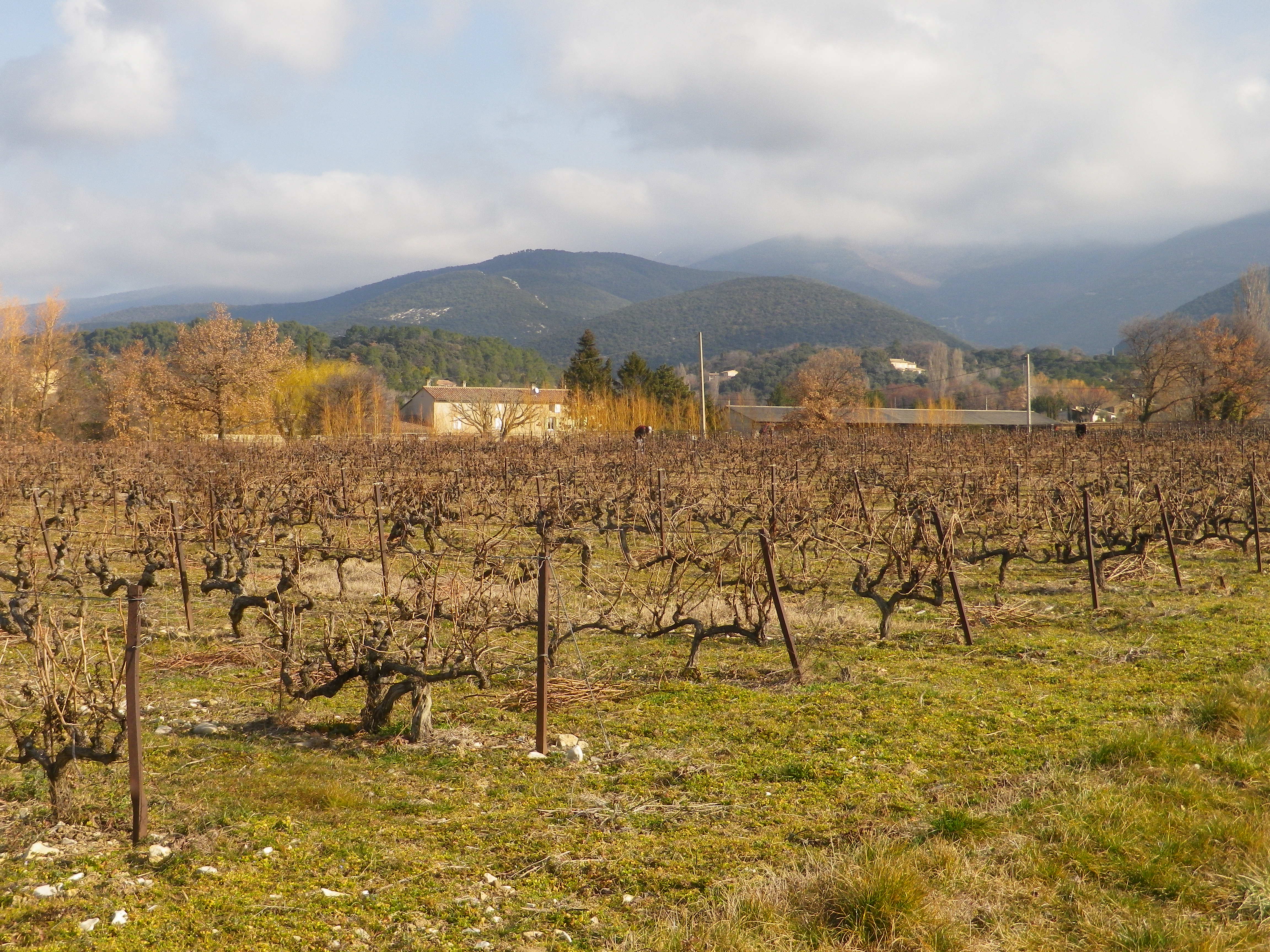
Saint Pantaleon is one of the 16 or so villages dedicated to producing some of the best Cotes du Rhone red wines there are. The village wines may carry the appellation name Cotes du Rhone Village and its own name on its bottles, a signal honor indeed. No doubt they had plenty of practice. In 900s, it was officially cited as having vineyards, although at that point, viticulture was probably close to a thousand years old in the area. Proud of their history, there is a wine education trail along part of the trail apparently identified by number bottles (but I lacked the brochure/key to what it all meant).
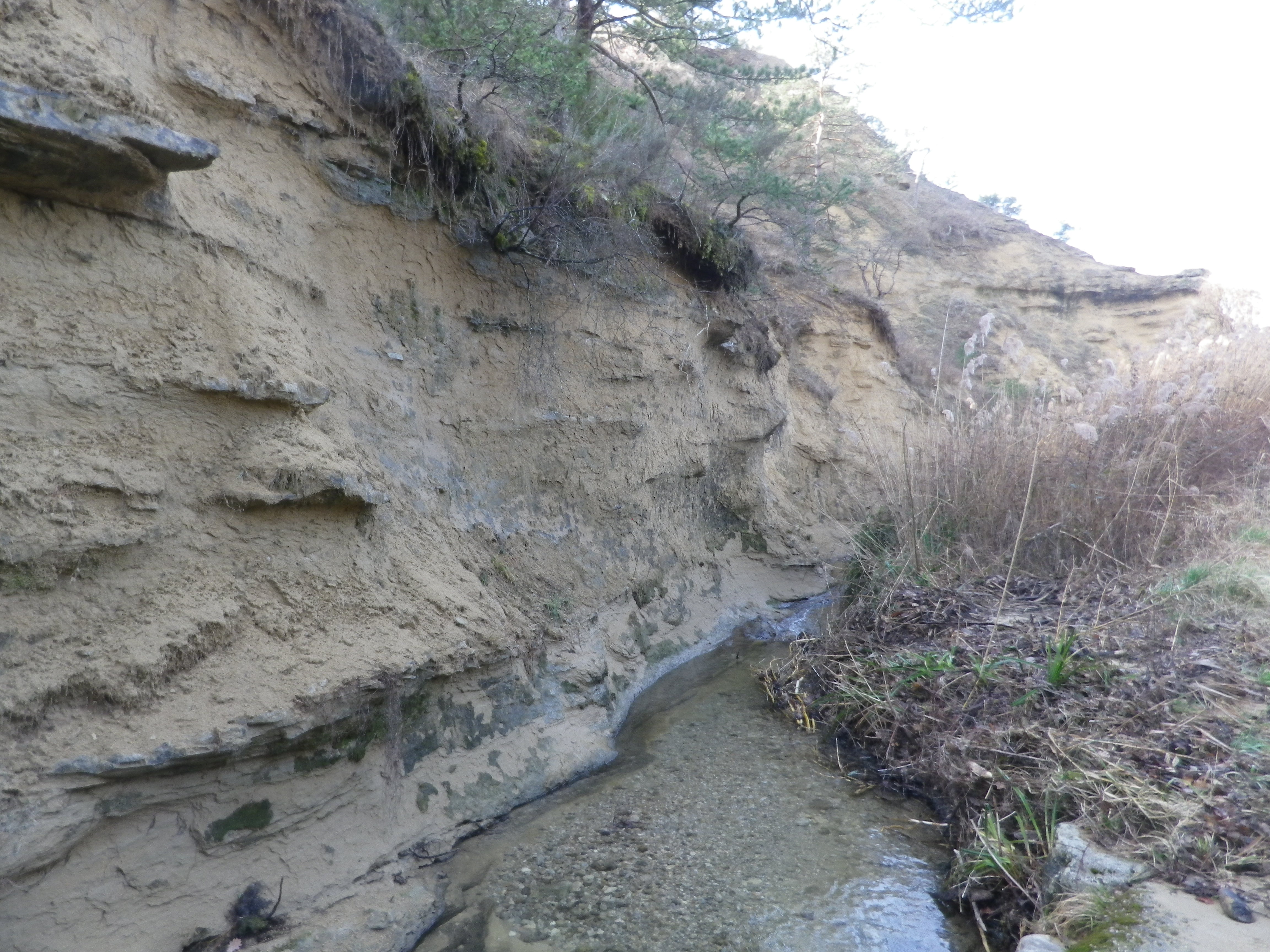
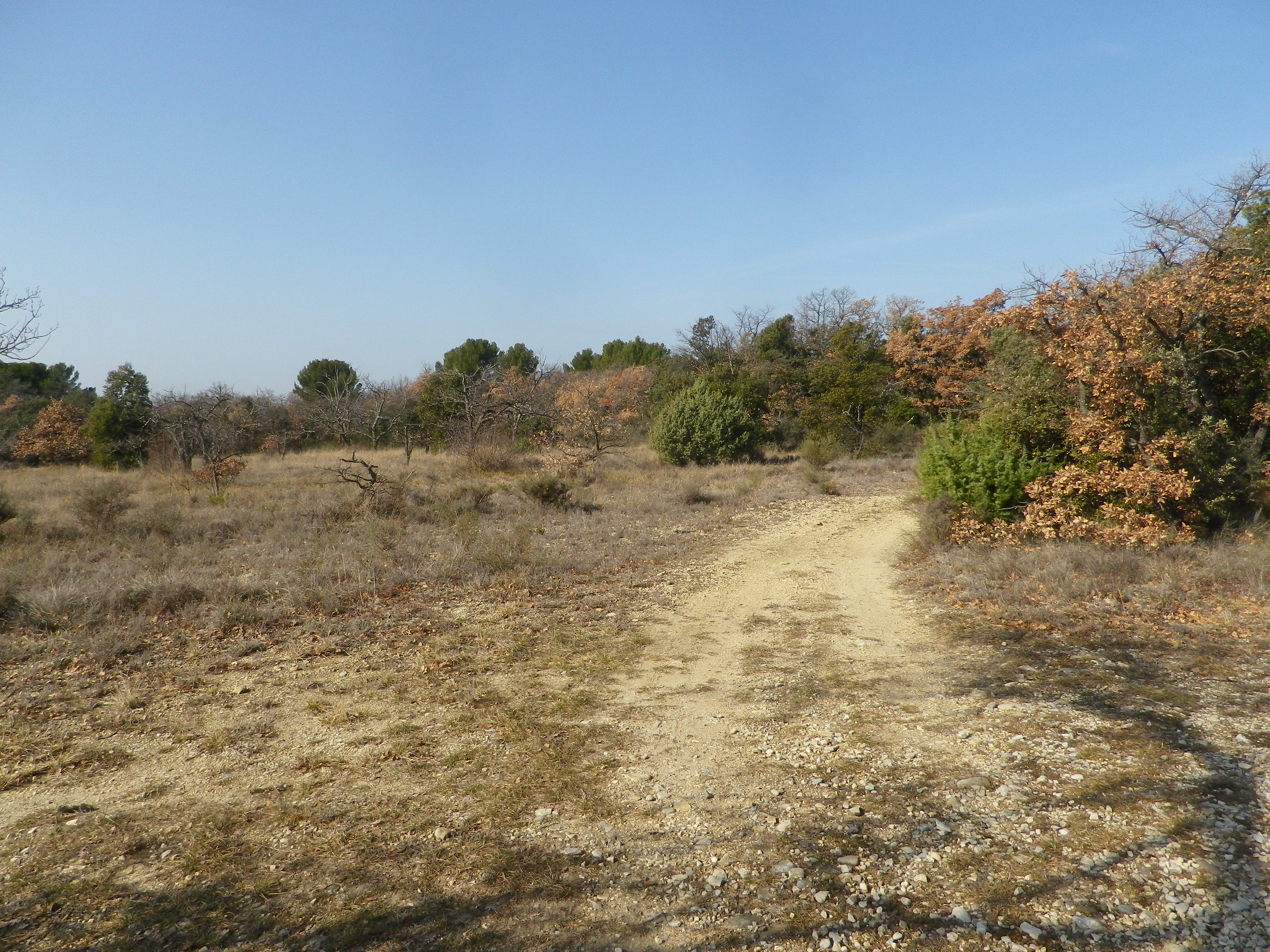
At a cluster of farmsteads, passing several palm trees slightly swaying in a warm February breeze, the trail began to lead to different terrain. A different, wilder, landscape begins to appear. After passing through the hamlet on the other side of the main road, the trail leads to a ravine. The exposed bank showed a mix of sand, clay and pebbles, mostly limestone, it seemed. So, this is what the vines grew in! Fortunately, it had not rained for a while. The small stream ran swiftly along its base, and judging from the gravel and rocks on the trail, it ferociously overran its banks on occasion. Picking my way over the rubble, I followed the trail uphill.
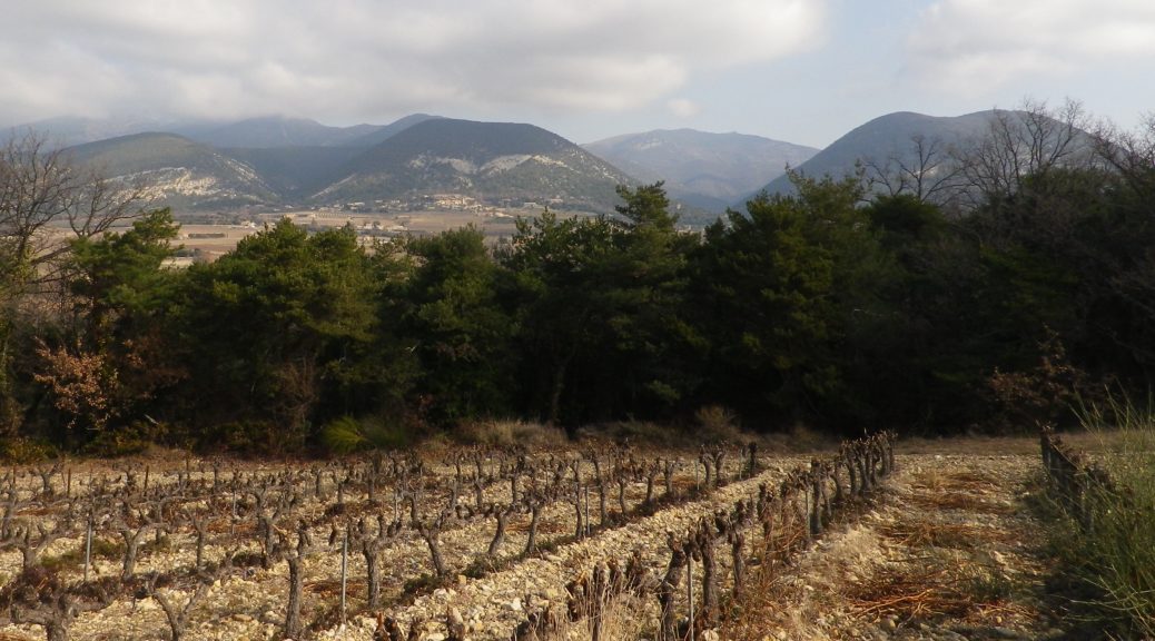
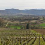
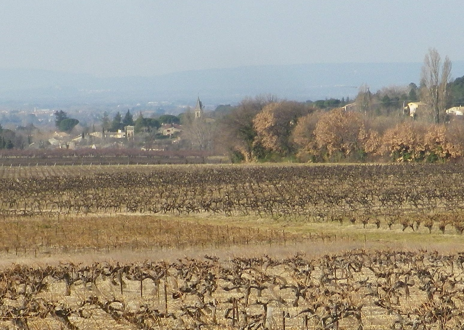
After a short and gentle incline, I soon reached the high ground. Unlike the vineyards below, these vineyards were sheltered and more discrete. Wandering through a mix of vineyard, fields and woods, it was a quietly peaceful interlude. All the better to enjoy the beautiful views. The distant Rhone River Valley and the Ardeche mountains lay to the west, at a minimum some 30 kilometers (20 miles) way, but appearing closer in the bright sun and clear air. To the north and east, the Baronnies National Park and the Prealpes, foothills to the Alps further east, seemed close enough to reach out and touch.
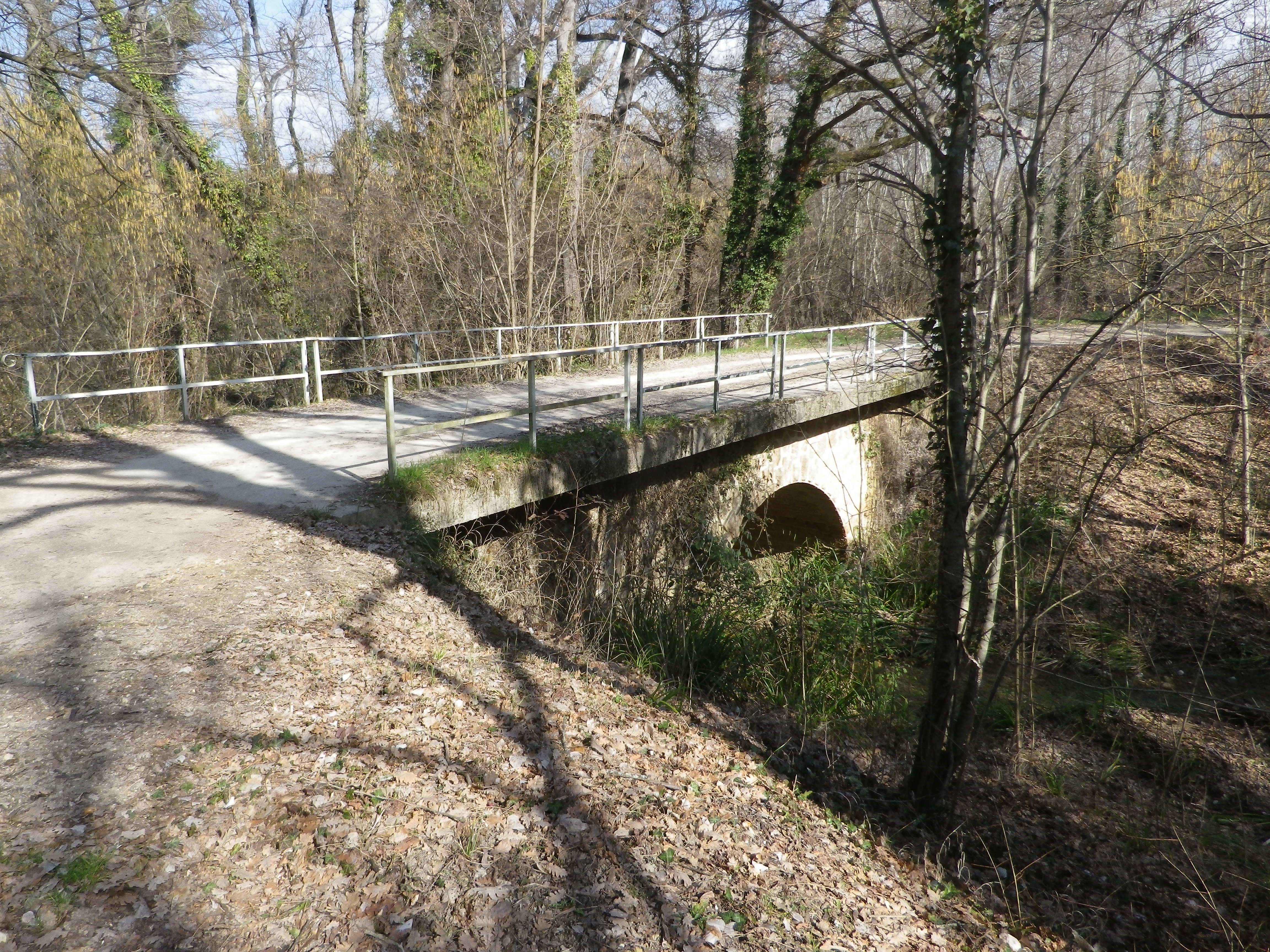
The terrain is lined with ravines, some with water. While the trail managed to avoid the roughest parts, it did have some ascents and descents along the way. Luckily the trail crossed one of the drops along a viaduct. It had been constructed for the train from the Rhone to Nyons, further east. The cooperative created a red wine cuvee and named it in honor of the train, and the bottle label bears a drawing of the train passing along the viaduct.
As I headed downhill, the smell of garrigue filled the air: Pine, rosemary, and thyme. Lavender plants, not in bloom in winter, were nonetheless present here and there. The generally dry and mostly sunny climate in this part of France enables these plants, along with grape vines, to grow well here. In fact, in many places, they will grow wild. Running fingers through a wild rosemary bush on the trail, is one way to whet an appetite for dinner – which naturally would include local wine. What a nice end to a day on the trail!
What I Learned
Cotes du Rhone covers a large area, but this post covers only wines from the central part of the Department of Drome, on the left bank of the Rhone River. In the area between Montelimar (of nougat fame) and Orange (a famed Roman colony), where the Drome meets Provence’s department of the Vaucluse, this part of the large Drome department is tellingly known as the “Drome Provencale.”
In this region, Lyon is a distant northern memory, and Avignon is only an hour south by car. It is an area that is overwhelmingly agricultural, with a triad of Mediterranean crops: Lavender, olives, and of course, grapes. Viticulture has a pre-classical history here, as many believe the vine was introduced not by the Romans, as is so often the case in regions north or west of the Alps, but by the Phoenicians, some 500 years BCE.
Within the Cotes du Rhone appellation, there are two, higher, or more esteemed appellations: The Cotes du Rhone Village, and the Cotes du Rhone “Named Village” appellations. Rousset les Vignes, Saint Pantaleon les Vignes, and Suze la Rousse, among others, are named villages, within the Drome, and all within my defined scope.
Here, in the Drome, the Appellation Cotes du Rhone wine is true to the humbler roots of its terroir. The red wines are fruit-forward, untamed and unpretentious wines, with definite value for money. As the tasting notes below note, in this area, even the simple (and inexpensive) Cotes du Rhone wines are flavorful, full-bodied wines. It is where vineyards large and small are in abundance, and family run wineries co-exist with cooperatives. Most of the wine produced here is red, with some rose, and a small amount of white wine.
The Cooperative of the Vignerons de Valleon, making Cotes du Rhone wines with grapes from Saint Pantaleon des Vignes and Rousset les Vignes, is a significant contributor to the economy in this area of a very rural Drome. It produces Cotes du Rhone red, white and rose wines, and Cotes du Rhone Village red (only) wines. A commemorative cuvee “Le Petit Train,” honors the little train from Nyons to Pierrelatte, that used to pass over a viaduct within the township of Saint Pantaleon les Vignes, where the cooperative is located. The cooperative also sponsored the wine-themed trail which crosses over the viaduct at one point on its itinerary. History, vines, wines and pride of community all in one, making it a great place to visit! (See https://www.valleon.fr/ and the associated Nutshell for this trail here. )
What I Tasted
2017 Le Petit Train, Appellation d’Origine Controlee Cotes du Rhone, Vignerons de Valleon (Saint Pantaleon-les-Vignes): A dry red wine cuvee (Grenache, Syrah), with dark purple-red garnet color; nose of smoke and green wood, with a hint of dark cherry, flavors of the same; medium plus tannins.
2017 Rose Les Frangins, Appellation Cotes du Rhone Controlee, Domaine des Gravennes (Suze la Rousse): A dry rose with very light salmon color; strawberry and green wood nose with strawberry, strawberry leaf, oak and slightly mineral flavors, medium tannins, and a slightly acidic finish.
2016 Vin Blanc, Café du Centre, Appellation Cotes du Rhone Controlee, Domaine Gris-des-Bauries (Taulignan/Bedoin): A dry white wine blend (primarily Clairette) made by the domaine above, and bottled for the eponymous cafe/restaurant, with medium gold color; a floral and spice nose, with nutmeg, vanilla, and fruity flavors, medium acidity, with an unexpected mildly tart finish.
2014 Viognier, Appellation Cotes du Rhone Protegee, Domaine du Jas (Suze la Rousse): A dry white wine with pale gold color; a mineral and sandalwood nose, with sandalwood, vanilla, smoke and slight white fruits flavors, medium finish.
Trail Name: Sentier des Terroirs
Trail Type: Short to mid-distance circuit trail; well-maintained and widely varying surfaces from paved to very rough, marking on the trail very good in places, completely missing in others
Length:
Total – About 18 kilometers/11 miles
Southern/yellow circuit: 9.35 kilometers/5.8 miles.
Convenient to:
Montelimar or Nyons, France
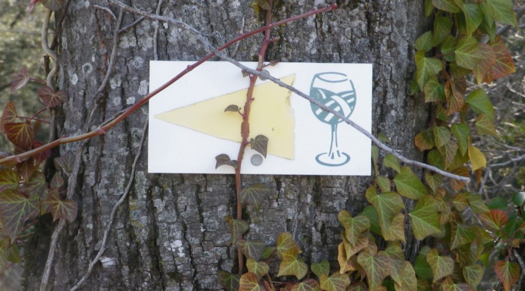
Marking: Numbered wine bottles (some missing) in part, red or yellow arrows with a stylized vineyard area depicted in a wine glass, in other places
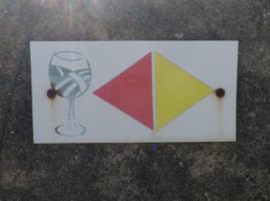
(The featured photo on top shows signage for the Yellow trail only.)
Trail Description: A relatively easy, family-friendly and varied trail offering wine education (close to the village), garrigue and vineyard landscapes, overlooked by tall mountains to the east. The trail has two conjoined circuits, making it possible to adapt hiking plans, depending on available time or weather situations. (See the comment below about flooding.)
Trailhead:
St Pantaleon-Les-Vignes: By the townhall (with church-like tower); or Cave Vignerons, Route de Nyons 1
Parking:
St Pantaleon: just off traffic circle, or by the town hall (Mairie), D548 x D541, and by Chateau Urdy
Public Transportation Options:
Rail: The closest rail service is at Montelimar, with good connections plying the major French North-South artery of the Rhone.
Bus: Buses provided by the Auvergne-Rhone-Alps Region (Oura on the website) “Cars Region” service, frequently connect Saint Pantaleon, Rousset, and Taulignan, with Montelimar, (and the rest of France).
Suggested Stages:
The full trail (both northern (heading to Rousset les Vignes) and southern halves) can be done together, or separately.
Trail Itinerary-Reference Points: (Southern circuit only – Clockwise)
Traffic circle on D 541/Rte. de Nyons – Montelimar, D548 -Grand Grange, right fork to Route des Juliannes; La Beaume, cross bridge over the Rieumau creek, Cross D541/Plan du Gre/Rte. de Nyons; Fontaine de Barral; Chapel; Cross the viaduct over Torrent de la Fosse; Chateau Urdy; Traffic circle with super-sized “ wine corks;” Cross D541 to return to the village
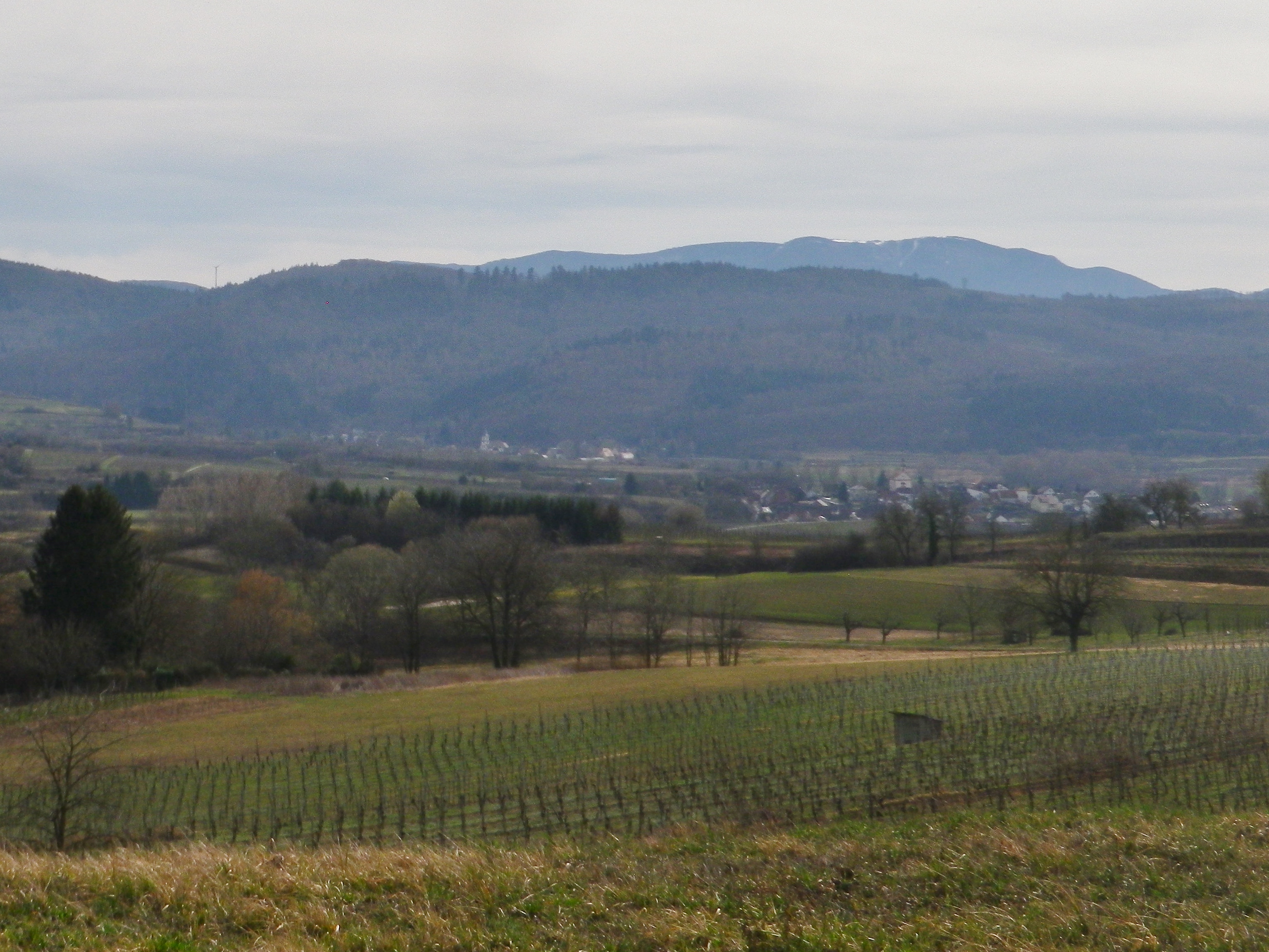
Representative Trail Photos:
Restrooms:
In the village, by the church.
Attractions on or near Trail:
The Vignerons de Valleon winery offers tours and tastings to the public, are open liberal hours, and are very helpful and knowledgeable about the wines, as well as about the area and the trail.
Tasting along the Trail:
Chateau d’Urdy
Cave Vignerons de Valleon
Alternative Options:
Car: The Route de la Drome Provencale passes through Taulignan, St Pantaleon-Les-Vignes and Rousset-Les-Vignes, showcasing vineyards, quiet villages and beautiful old structures.
Additional Information:
Regional: https://www.grignanvalreas-tourisme.com/votre-sejour/agenda/
Trail specific: While not much is available online (to help with advance planning), the following website has a map of the southern route http://balades26-07.blogspot.com/2017/01/st-pantaleon-les-vignes-nd-de-sante-par.html (a big “Merci!”); and a map of the northern route may be found online at https://www.valleon.fr/un-terroir-et-des-hommes/, and at the winery’s front office, and the townhall.
Comments:
Snow is rare in this area, but…
Heavy rain can occur, and will flood parts of this trail, especially the low ground at the base of the hill south of the hamlet of Barral, at the Torrent de la Fosse!