Trail Name: Weinbergwanderung Kaiserberg AKA Weinwanderwege am Kaiserberg
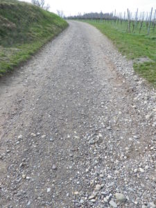
Trail Type: Short distance figure eight circuit; well-maintained and almost exclusively paved, fairly good marking on the trail.
Length: 9.75 kilometers/6 miles
Convenient to: Offenburg, Freiburg, Baden-Wuerttemberg, Germany
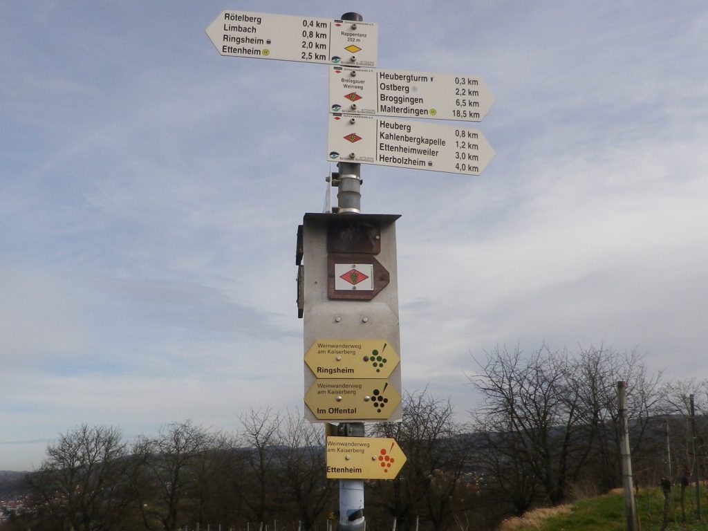
Marking: Small, yellow aluminum signs with black lettering and stylized black grapes on the side. (Bottom three in the photo below)
Trail Description:
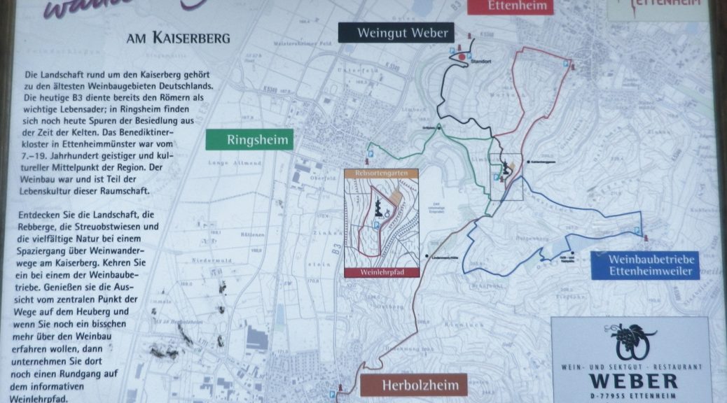
This moderately challenging hike (with several inclines and declines), covers the Kaiserberg, a hilly and wonderfully rural area set in the foothills of the Black Forest, yet not far from more urban areas. The biggest towns of Herbolzheim and Ettenheim sponsor several marked wine-themed trails, to include a short wine education trail through the vineyards. This trail, sponsored originally by the Weber winery, joins segments of these shorter trails to make a longer circuit, suitable for families young and old, and even cyclists.
Trailhead:
Ettenheim, Im Offental
Parking:
Ettenheim has a number of small parking lots, not too far from the trail. The closest is on Schwarzwaldstrasse
A small, unimproved parking lot at the top of the main Kaiserberg hill may be reached via Ringsheim’s Bergwerkstrasse.
See the additional comment below about parking.
Public Transportation Options:
Rail: Regional trains DB and SBB) frequently service the Ettenheim area (The closest station to the trail is Ringsheim.)
Bus: Sudbadenbus services this area, and provides route and schedule information at www.suedbadenbus.de
Suggested Stages:
Either the northern or southern half of the figure eight circuit may be hiked separately
Trail Itinerary-Reference Points: (Counterclockwise)
Ettenheim: Im Offental, through the Weber winery complex, vineyards, past a memorial with benches; up a draw between vines and woodline; past Kahlenbergkapelle (chapel); toward Lindenmann-Hutte (hut), scenic overlook with boulders; downhill into vineyards; past a hut; On Margarten, past Hummels Viehweid Straussi (Tavern), continue through vineyards; through intersection/section of trail by Kahlenbergkapelle; Heubergturm; through vineyards, return to Weber winery.
Representative Trail Photos:
Restrooms:
Heubergturm (on the trail) has restrooms, but they are sometimes locked.
Attractions on or near Trail:
Just lots of bucolic scenery.
Tasting along the Trail:
Weber winery, and two seasonal taverns: the Heubergturm, and Hummels Viehweid Straussi; all right on the trail.
Alternative Options:
Hiking: In addition to the long-distance/multi-day Breisgauer Weinweg (see the Nutshell here), there are several circuit hikes. These range from 1 to 5 kilometers, and may be combined for more distance and hiking pleasure. See Ettenheim’s https://www.ettenheim.de/weinwanderwege-am-kaiserberg to download the flyer.
Car: The Badische Weinstrasse, a 200-kilometer car route for wine enthusiasts, begins in Baden-Baden and ends at Weil Am Rhein (on the Swiss border). It roughly follows Highway 3 from north to south, passing through the towns listed here.
Additional Information:
Regional: https://www.ettenheim.de/tourismus-kultur-freizeit
Trail specific: https://www.outdooractive.com/de/wanderung/schwarzwald/weinbergwanderung-kaiserberg-weingut-weber-ettenheim/117526408/#dm=1
Comments:
The Weber winery actively promotes hiking, hence many Weber signs and some events happen here in the vineyards on the Kaiserberg. However, while parking may be allowed in their large parking lot during those times, the sign otherwise notes that parking is only for winery customers.
One small section of the trail, the roughest surface section, was closed off that day due to the danger of falling trees. However, an alternative was clearly marked, and rejoined the trail within a few hundred meters.