
The Fraenkische Saale, a river flowing from near the Bavaria-Thüringen border to the Main River by Gemuenden am Main, is a jewel. Its quiet, gently flowing waters, offer low-key activities for families and friends along its shores, and on its waters, from hiking and biking to canoeing and rafting. This is an area famed for rest and relaxation, and there are several well-known spa towns along the river. From Bad Koenigshofen near its headwaters to Bad Neustadt, Bad Bocklet and Bad Kissingen, all are on the Fraenkische Saale as it heads to the Main. While the Main River is extremely well-known for its vineyards and wine, the Fraenkische Saale, connecting the wine districts of the Maindreieck and the Mainviereck, doesn’t do too badly either in that regard.
Part of the attraction for me was the opportunity to cycle along yet another river bicycle trail. Germany seems to excel in developing these trails, and the Fraenkische Saale Radweg (Bike Trail) was just another example of excellence in riverside cycling trails. The other part of the attraction for me was the chance to explore the terroir and the wines in relatively unknown wine corner of Franconia.
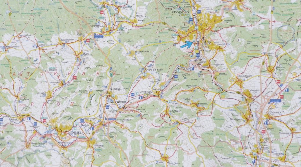
The Fraenkische Saale Radweg is about 125 kilometers, but the vineyards, Franconia’s and by extension Bavaria’s, concentrate in a short 28-kilometer-long stretch of the river and its side valleys. This made exploring them relatively easy work on a weekend. Hence, I decided to begin at Bad Kissingen, the northern and eastern-most point of my ride, one fine morning.
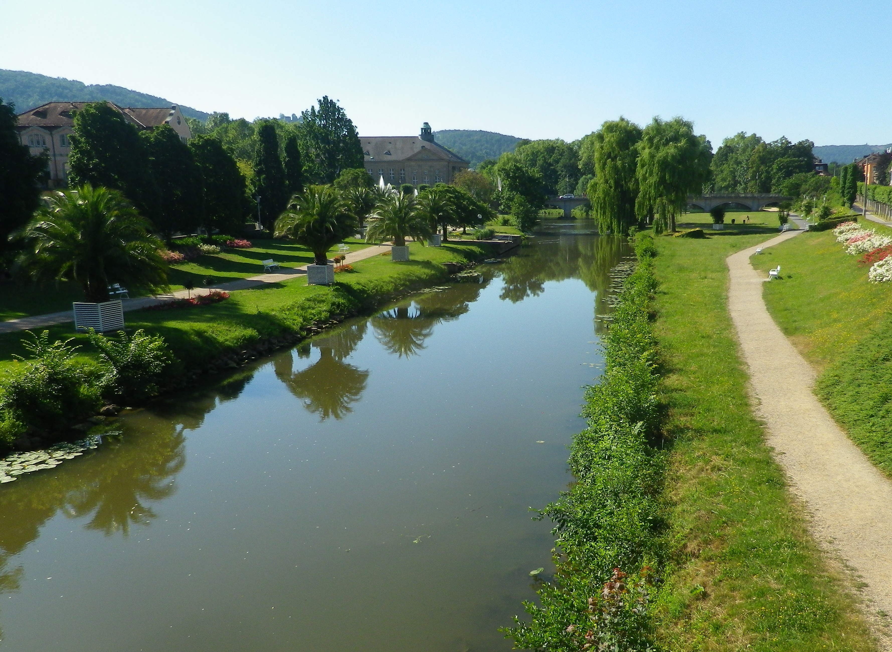
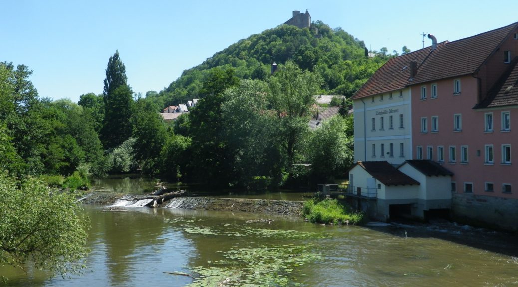
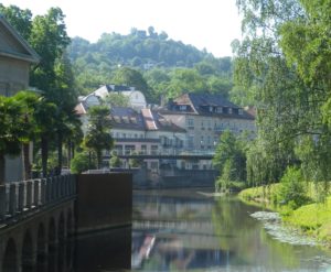
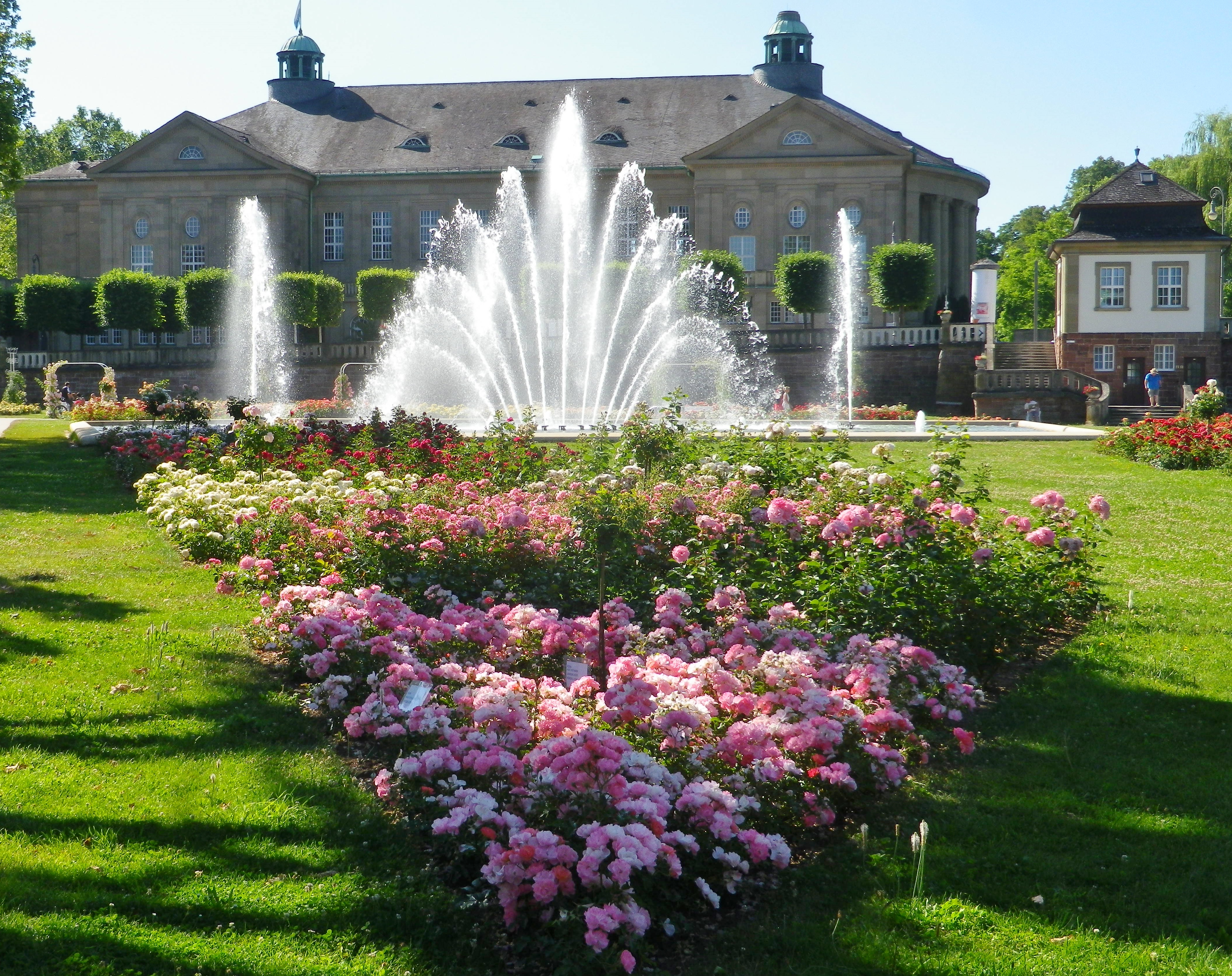
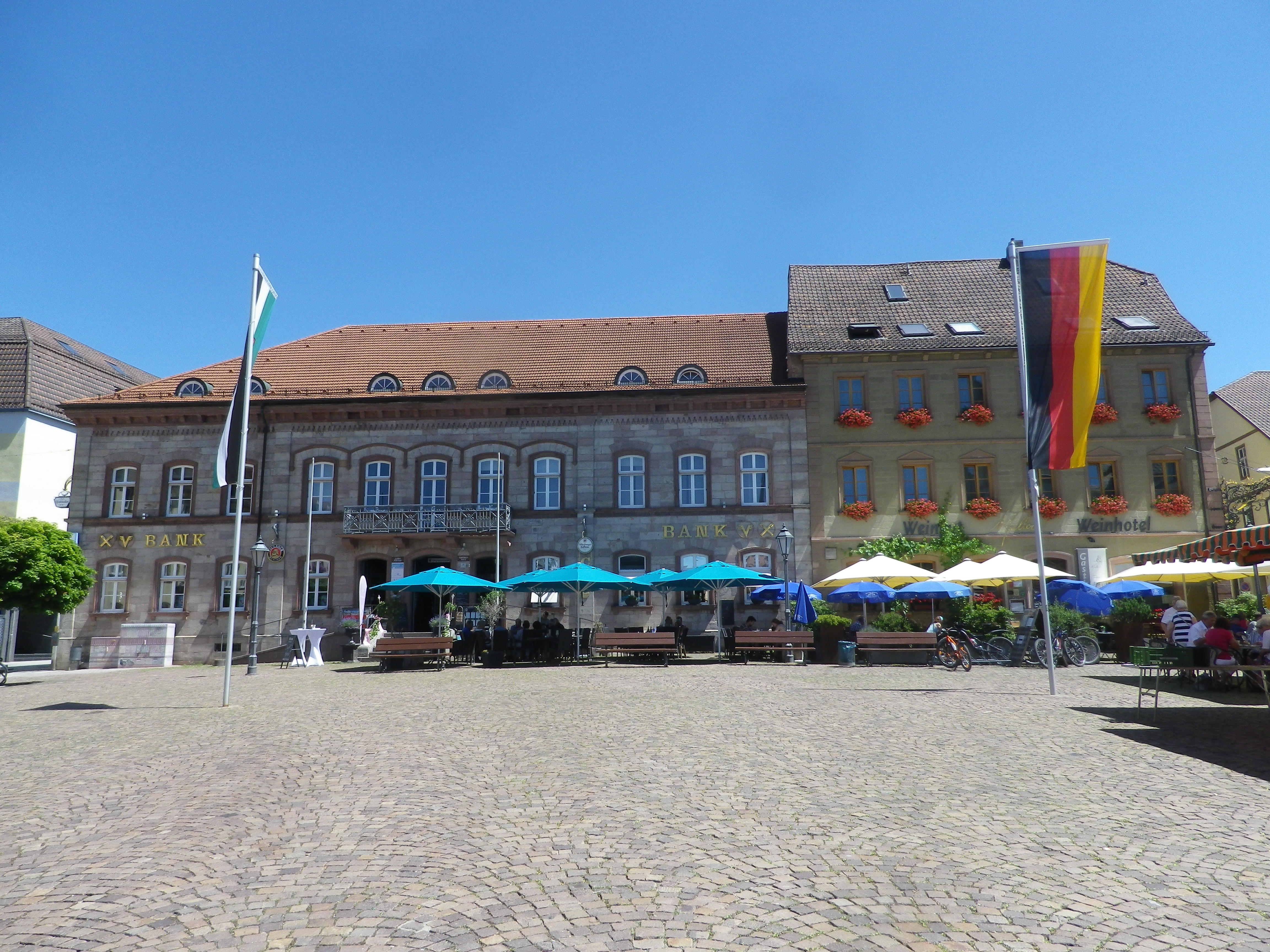
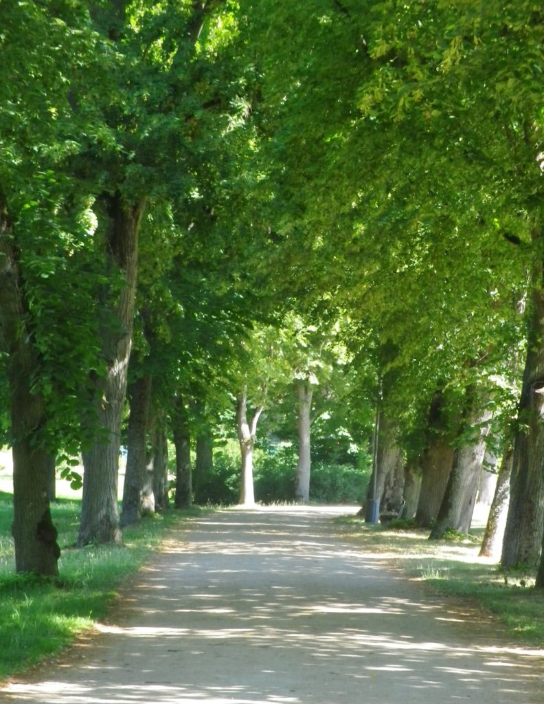
As a spa town, Bad Kissingen has a great variety of dining and lodging options to choose from. In addition, it is a lovely small town, with stately green spaces filled with curving paths along the river. The buildings are classic “German spa” and there is almost always something to attend, be it art exhibits, local festivals, or open-air concerts. I found it an excellent town to stage from, especially as the trail wove through its classic parks and gardens as it passed through town.
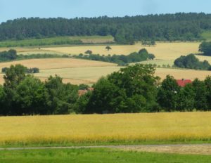
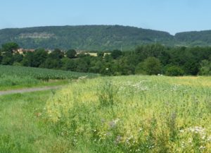
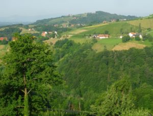
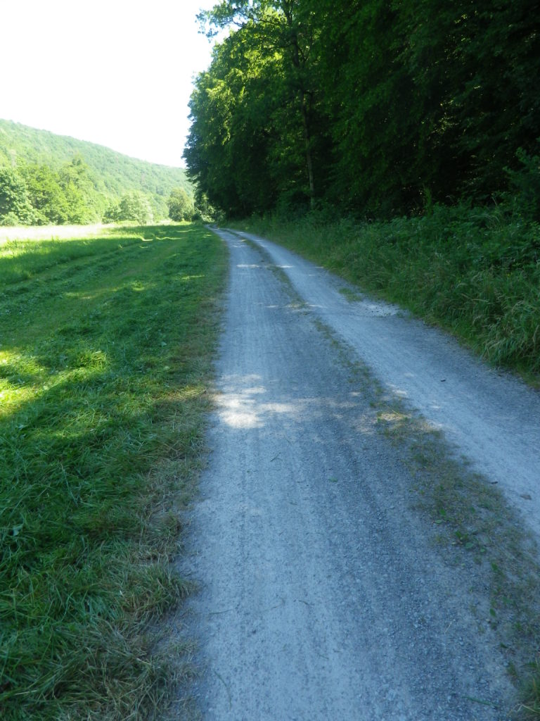
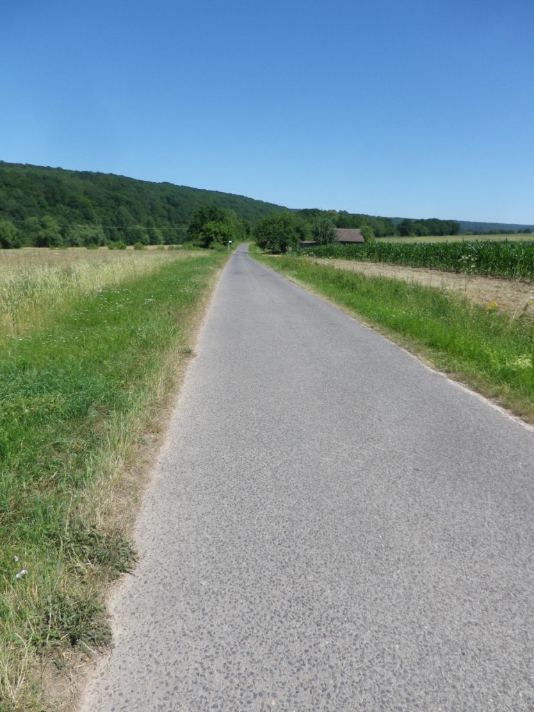
Once out of town, the trail led for a few kilometers through woods, then along fields bordering the river to Euerdorf. It proved a quiet interlude, with just nature for company. South of the Euerdorf the vineyards of Ramsthal begin.
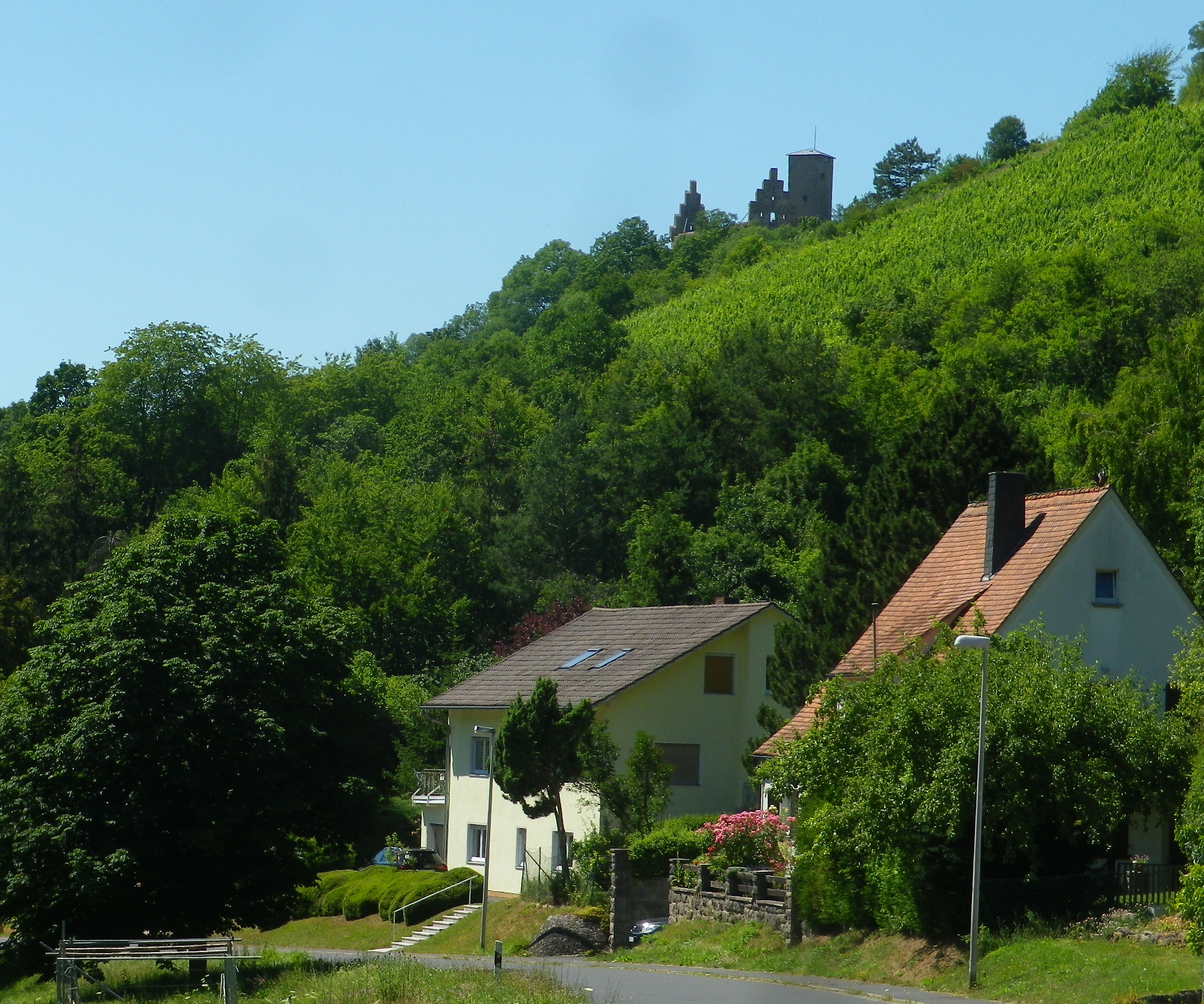
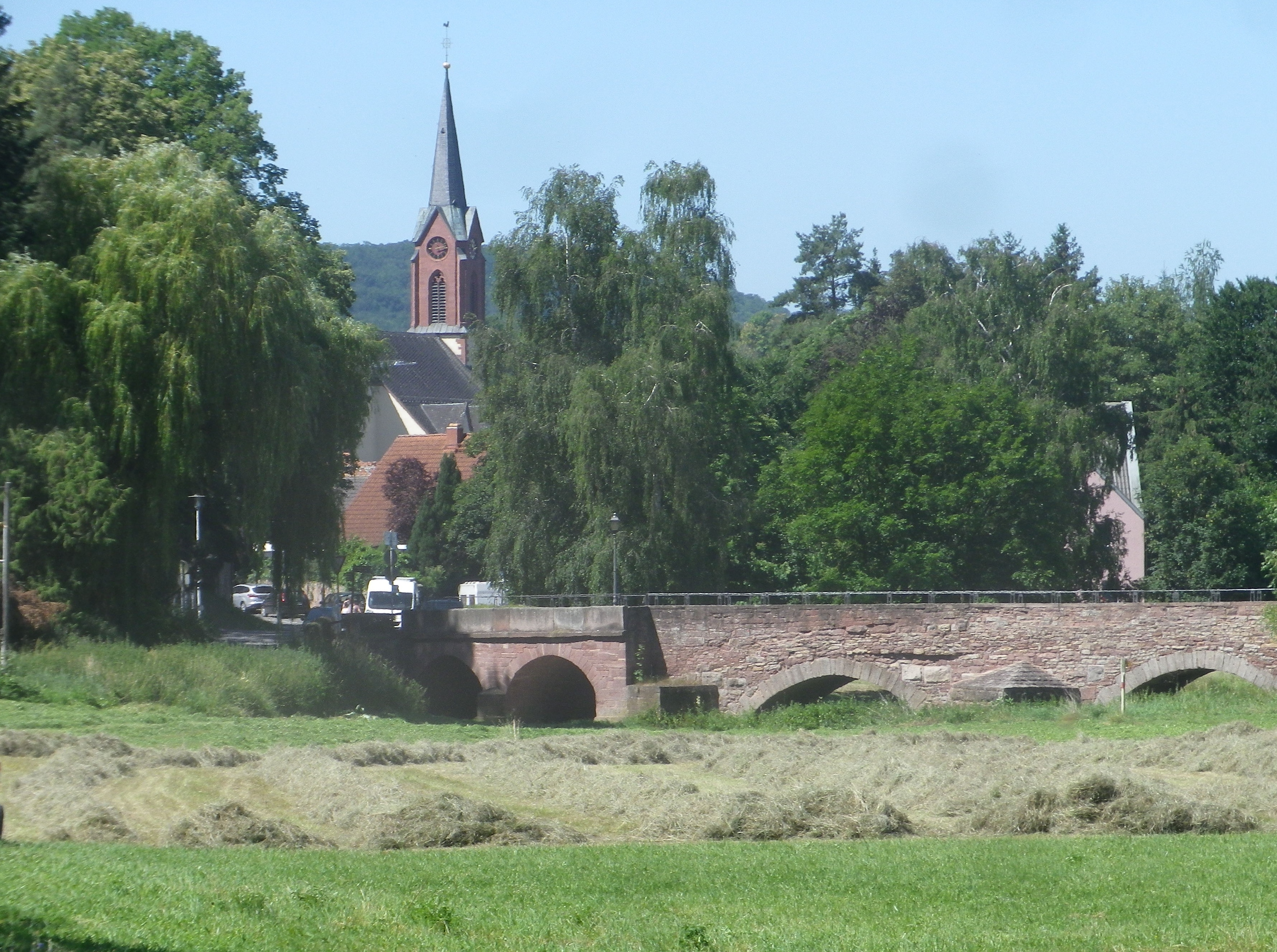
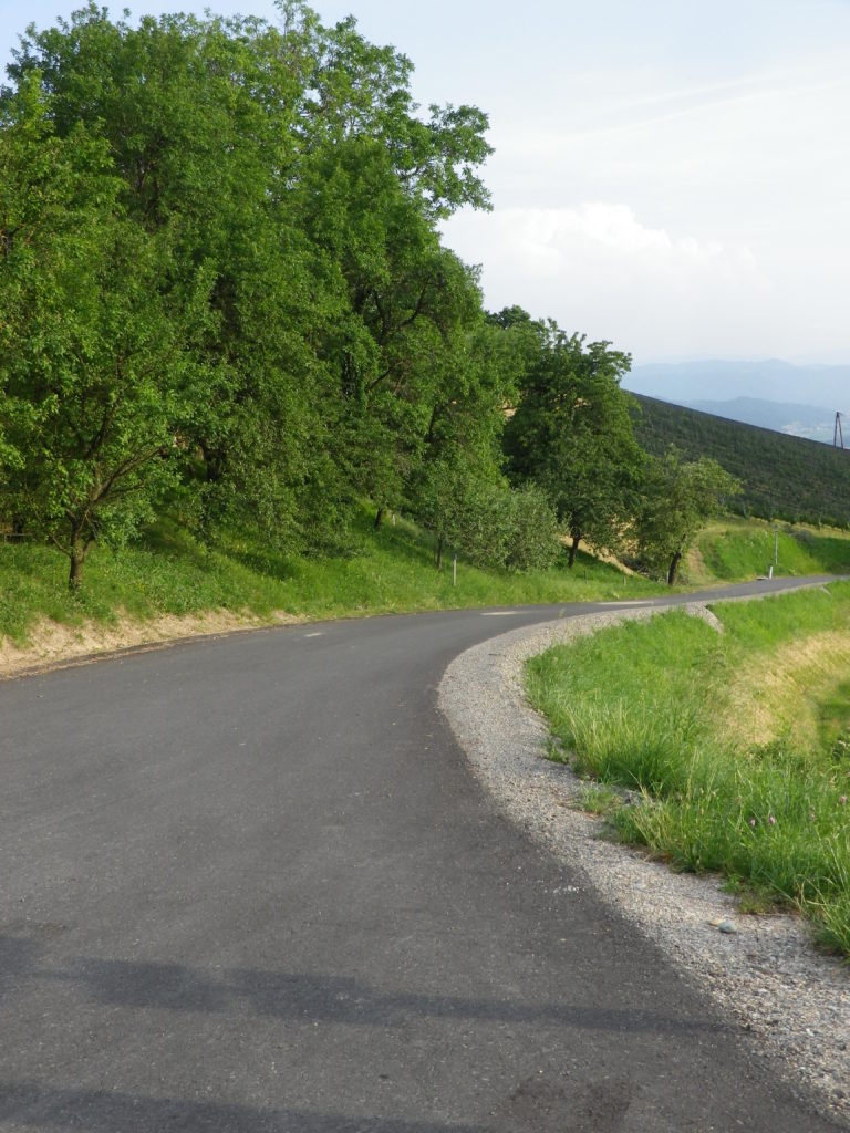
The river really does twist and turn. At Trimberg, there are more vineyards, and a castle ruin came into view. Here I crossed the river first time since leaving Bad Kissingen. But henceforth, the trail was constantly crossing the Fraenkische Saale on a series of well-maintained bridges, providing plenty of opportunities to photograph the picturesque little river. While this left me without a clear sense of where I was after so many river crossings, I was never lost, as the trail was so well marked.
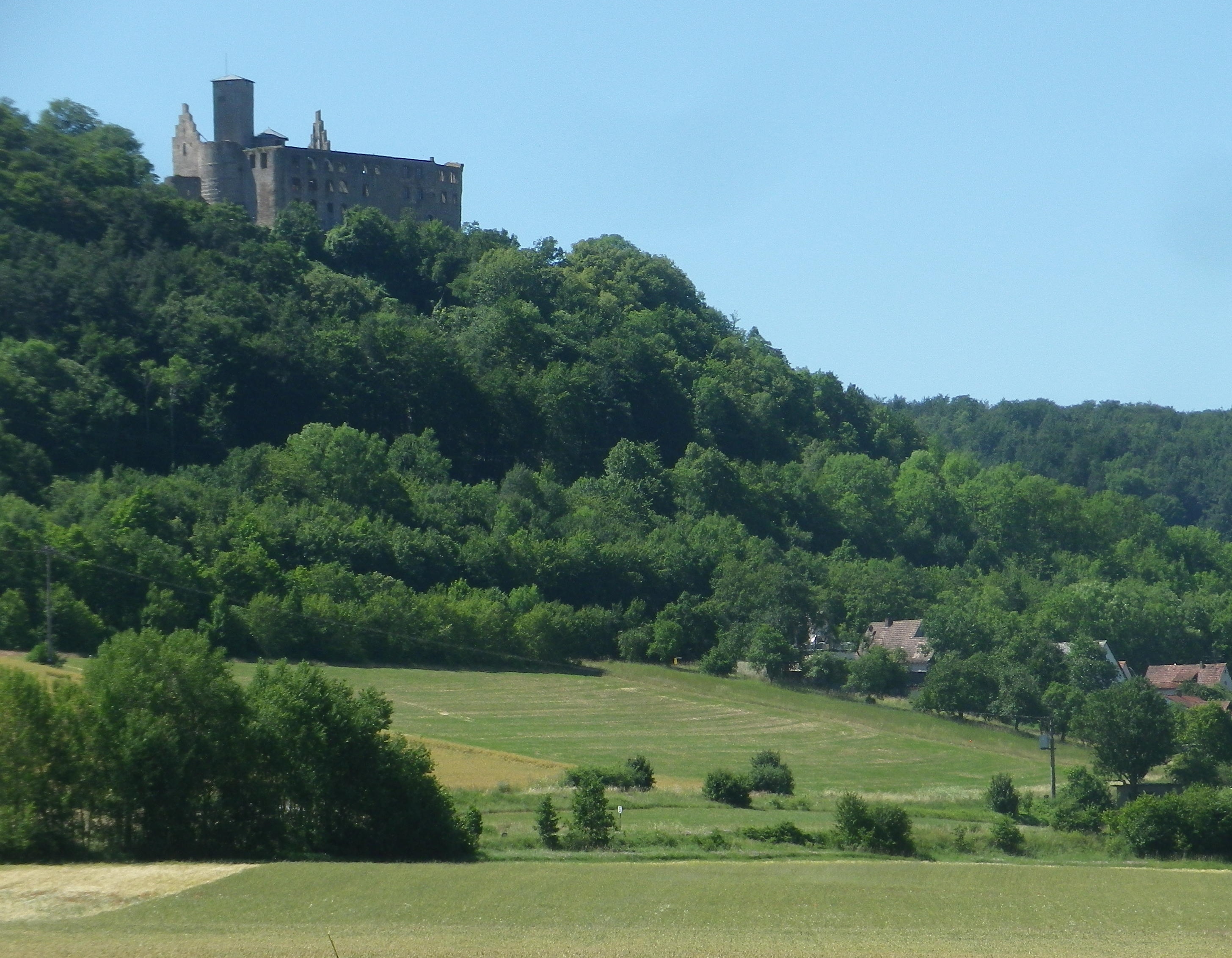
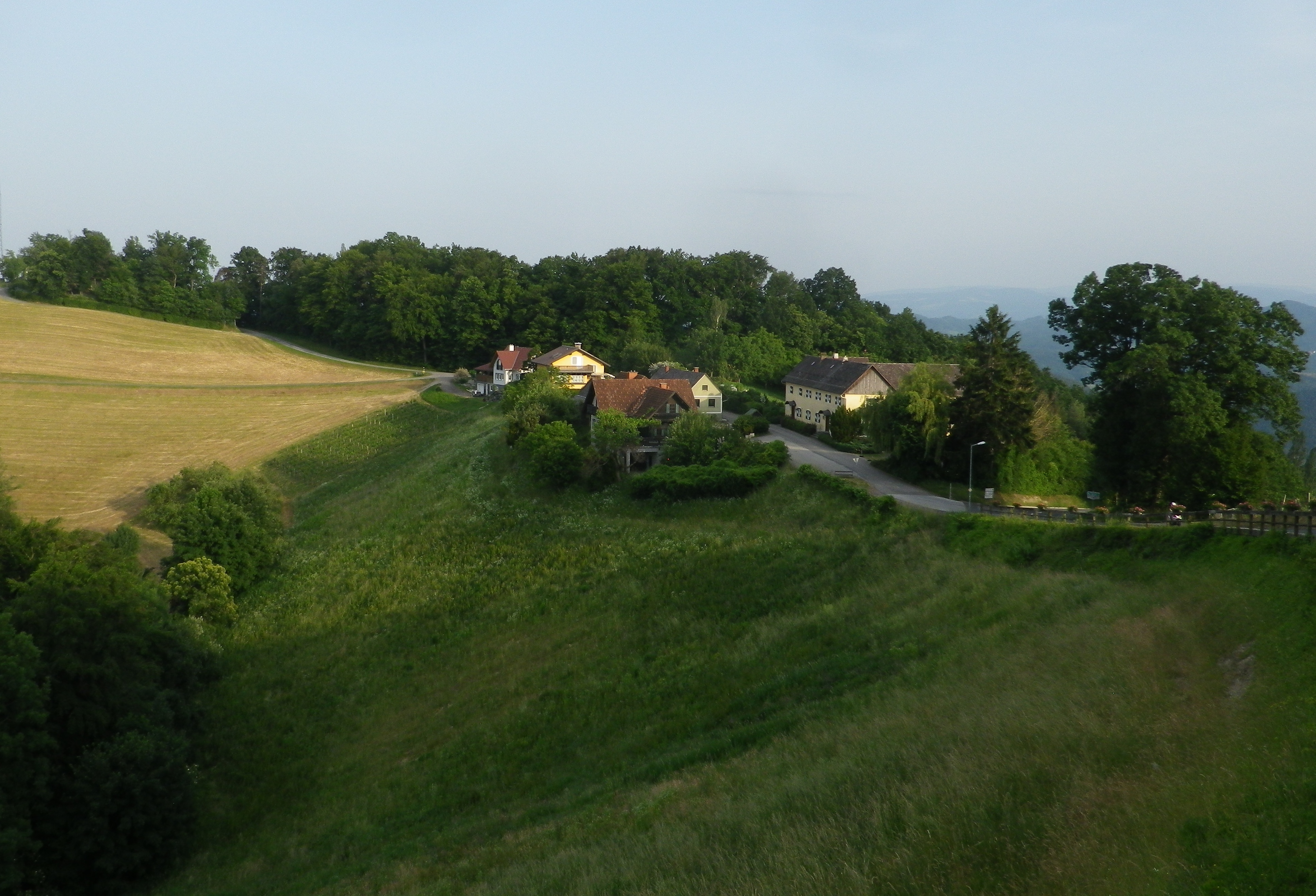
Before I knew it, I rode into Hammelburg, center for viticulture in this area. This town has a history of wine making which goes back centuries, in part due to the old abbeys. The vineyards on the hills loom over the town to the north. To the west lie the final vineyards of this wine-producing area of northern Franconia. They are in the hills above the city districts of Obereschenbach and Untereschenbach , my end destination, which was between the two sets of vineyards. While they are overseen by another picturesque castle ruin, they are not overlooked by lovers of Franconian wine!
What I Learned
The Maindreieck is a triangle of land surrounded on three sides by the Main River. The Main is a tributary to the Rhine. The river makes three dramatic curves close to the heart of Franconia, forming this “peninsula,” this triangle of land surrounded by the river as a paragon of viticulture in south central Germany.
While the riverine wine towns and villages form the most well-defined area of the Maindreieck wine district, i.e., Wuerzburg, Randersacker, Sommerhausen, Volkach, there are two lesser known wine-producing areas in this district. Both of them follow along valleys with smaller rivers, the Wern and the Fraenkische Saale. These two are tributaries entering the Main River at Schweinfurt and Gmuenden am Main respectively.
Bavaria’s northern most vineyards lie along the Fraenkische Saale – a river flowing from close to the Bavaria – Thuringen border to the Main by Gemuenden am Main. In wine speak, that would be from the Maindreieck border to the Mainviereck border in the Franconian Wine Region.
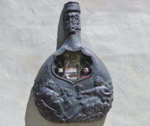
The wines produced along the Fraenkische Saale and its tributaries are the northern-most wine-producing area in Franconian Bavaria. The town of Hammelburg is known as Franconia’s oldest wine town. In 777, Charlemagne, who held a small fortress settlement on this site, donated the site and its lands to the Abbey of Fulda, some 40 miles north. Wine production for the abbey, founded about 30 years earlier, used the south facing, limestone-based slopes, overlooking the Fraenkische Saale, to grow grapes for wine. Over time, grapes also grew in neighboring settlements, and up side valleys. The Abbey built a cellar-palace, which the abbot used as a summer residence. At its height in the 18th century, the cellar stored almost three-quarters of a million liters of wine. Today the complex belongs to the major Franconian cooperative GWF. However, there are also a dozen or so independent wineries. Overall, about 70 local farmers/viticulturists grow grapes for local wine production.
The major Franconian grape varietals grow in this sub-district. Not surprisingly, they are the hardy, cold-resistant varietals. listed below.
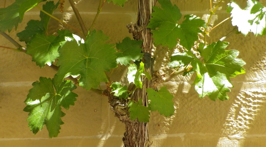
Silvaner: This varietal has been grown in the Franconia area since the 17th century, and is one of the more important varietals for this particular area. Many locals prefer it over Riesling. For more information on Silvaner, see Wine Notes: Franconia’s Silvaner here.
Mueller-Thurgau: This hybrid varietal is also known as Rivaner, and produces a light, fruity wine. In Franconia, it is currently more widely planted than Silvaner.
Riesling: Riesling wine is the most planted varietal in Germany, but less so in Franconia. Here, true to form, many Riesling wines take on a mineral flavor determined by the soil.
Bacchus, a Silvaner-Riesling cross with a Mueller Thurgau, has only been around as a wine for about 50 years, and has been especially successful in Franconia.
What I Tasted
2018 Bacchus, Halbtrocken, Q.b.A., Weingut Mueller (Hammelburg): An off-dry white wine with a medium golden gold color; a fruity nose, with citrus and hints of gooseberry, and with gooseberry, apricot, and slight lemon flavors; medium minus acidity, with a smooth finish.
2018 Silvaner, Trocken, Qualitaetswein, Weingut Neder (Ramsthal): A dry white wine with medium plus gold color; a nose of spice and green apple, with spice, green apple, citrus and slight floral flavors; medium acidity with a refreshing tart finish
2017 Silvaner, Hammelburger Heroldsberg, Trocken, Kabinett, Weingut Mueller: A dry white wine with medium lemon-yellow color; a slightly spicy nose, with green apple, spice and slight honey flavors; medium plus acidity with a tart medium length finish.
2017 Silvaner, Hammelburger Heroldsberg, Trocken, Kabinett, Weingut Mueller: A dry white wine with medium gold color; green apple and floral nose, with flavors of the same; medium acidity, with a tart finish.
Trail Name: Radwanderweg Fraenkische Saale
Trail Type: Long distance bicycle trail (much of it dedicated bicycle trail); well-maintained and diverse surfaces from paved to crushed stone, fairly good marking along the trail.
Length:
Total – circa 127 kilometers/79 miles
My Stage: circa 28 kilometers (See Comments below)
Convenient to: Bad Kissingen, Gmuenden, Franconia, Germany
Marking: Blue background with white letters “Saale”
Trail Description: Fairly flat, with the inclines due to small spurs of more distant ridges, this quiet trail indeed follows mostly along the river, and through some of the riverside towns and villages, which make for great stops along the way.
Trailheads:
All Stages: -Trappstadt-Alsleben // Gmuenden am Main
My Stage: Bad Kissingen, In der Au x Bismarkstr // Diebach, Reuthweg
Parking (My stage only):
Bad Kissingen:
In der Au, dozens of perpendicular parking spaces along the lane; Costs one Euro per day/Four Euros for the week.
Maxstr, Parkplatz Tattersall is a large, improved lot, but costs more per day.
Diebach: Obertor, large unimproved area in a field (by parking sign at the eastern edge of town)
Public Transportation Options:
Rail: DeutscheBahn serves Hammelburg and Bad Kissingen with small stations in most of the towns mentioned in the trail itinerary below.
Bus: HOB Bus lines 8165, 8141
Suggested Stages: Not applicable for my stage
Trail Itinerary-Reference Points: (My stage only – heading downriver)
Bad Kissingen: Bismarkstr, Lindesmuhlpromenade (an alternate path through the park), Oskar von Miller Str, Im Lindes, past water treatment plant, parallel Iringstr; into forest, along the river, cross the Lollbach, parallels B287; Euerdorf: Ringstr, Kissingerstr, Gerbergasse, path along the river, parallel Auraerstr, Ara: Hauptstr, Trimbergerweg; Trimberg: Quellenstr, Hugo-von-Trimberg-Str-Brueckenstr; Elfershausen: Pass Elfershausen-Trimberg train station, August-Ullrich-Str, Marktstr, Langendorfer Str, cross river; Pass under A7, parallel river; Langendorf: Hauptstr, Westheimerstr, cross river; Westheim: Grenzstr, path left to cross river (two times in about 500 meters); Hammelburg: Pass Hammelburg Ost train station, An der Walkmuehle, Kissinger Str, straight at circle, continue, Am Marktplatz, Bahnhofstr, Saaletalstr, then cross tracks and follow parallel path;
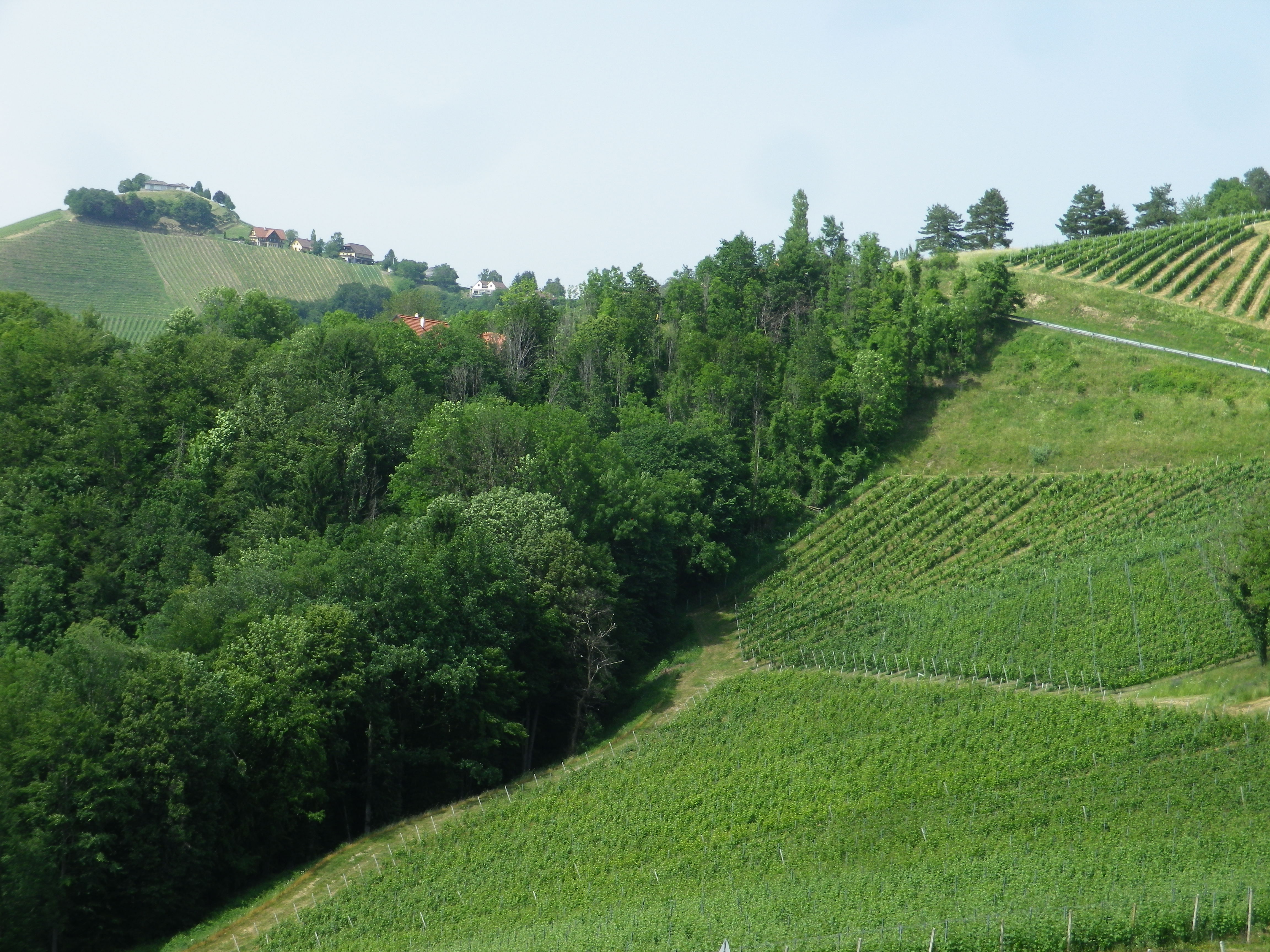
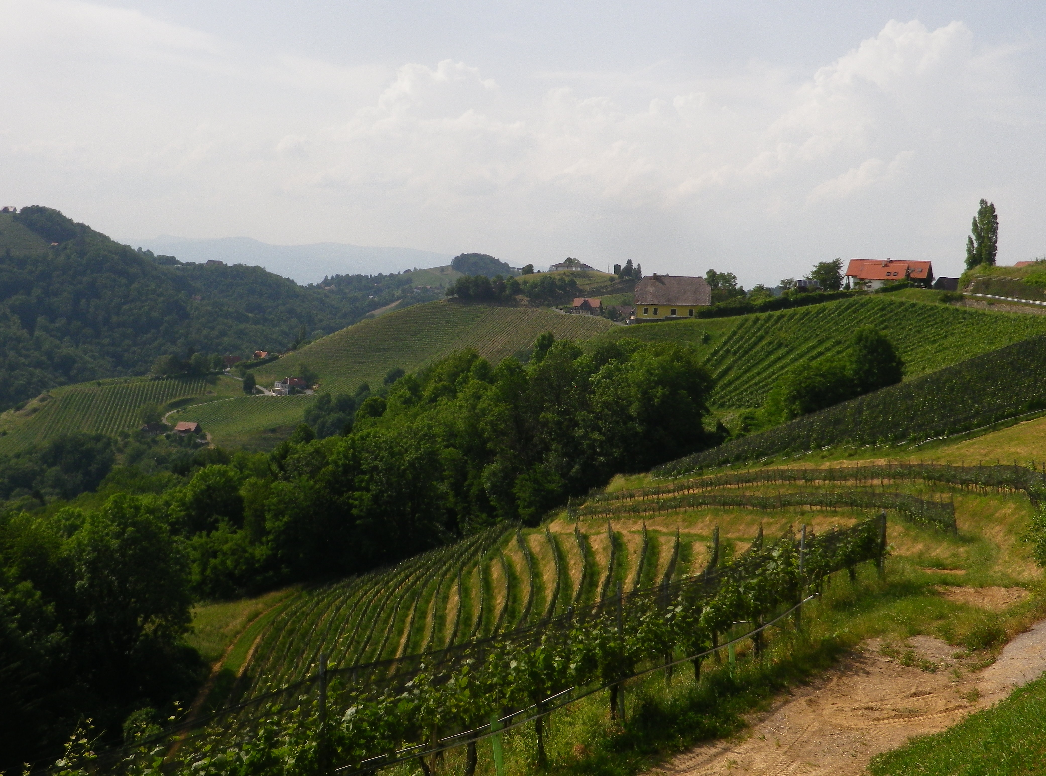
Representative Trail Photos:
Restrooms (My stage only):
Bad Kissingen: Am Kurgarten, in the Arkadenbau (arcaded building)
Elfershausen: Schlossstr x Marktstr, at the Community Center, in an outbuilding facing the courtyard
Hammelburg: Marktplatz, on the side of the Rathaus
Attractions on or near Trail (My stage only):
Hammelburg:
Kellereischloss: Historic wine cellar, with wines on offer weekly, usually Friday evenings
Museum Herrenmuehle details the history of wine-making in this area, and with its other emphasis on bread-making, from grain to final product. A recent new exhibition combines these two items under the theme: Bread and Wine.
Tasting along the Trail (My stage only):
Hammelburg: Weingut/Hotel/Restaurant Mueller; Weingut Schloss Saaleck, Kellereischloss (see above), right on the trail; several small wineries on the outskirts of town
Ramsthal: A couple of wineries in town. (Ramsthal is about three kilometers from the river trail.)
Bad Kissingen: No wineries, but lots of wine taverns and local wine selections at the many restaurants.
Alternative Options (My stage (and wine-themed) only):
Hiking:
Rundweg Hammelburg 9: A seven-kilometer trail beginning in Hammelburg, passing in about equal parts through vineyards and forest, with beautiful views all around.
Wein und Stein trail, from Euerdorf to Bad Kissingen, a 12 kilometer-long, signposted trail of medium difficulty. See details in regional link below.
Ramsthal: The Ramsthal Weinerlebniswege: Three circuits around the town’s vine-bearing hills, ranging from the three kilometers-long Bacchus Rundweg, to the Schoppen Rundweg at 7.2 kilometers in length.
Additional Information:
Regional: https://www.frankens-saalestueck.de/weinland-franken/frankenwein-urlaub/index.html
Trail specific:
http://bay-rad.de/gpxrw/BfR_Radwanderweg_Fraenkische_Saale.gpx
Downriver only from Elfershausen to Hammelburg and Gemuenden am Main:
Comments:
The trail along the Fraenkische Saale is long, but I focused only on the vineyard part of it: from south of Bad Kissingen to just west of Hammelburg (Stadtteil Untereschenbach).
This trail connects with the Main Radweg, the Main River Bicycle Trail, leading to the Rhine by Mainz, from which point it is possible to follow the Rhine Bicycle Trail. For details on part of each trail, see the Rhine Nutshell here, and the Main Nutshell here.
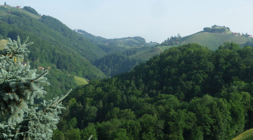
Set in the highest wine village in Europe, the Kitzecker Weinwanderweg surely lived up to its name, with multiple steep, vine-laden slopes to conquer, culminating in a sense of standing on top of the wine world. But having multiple opportunities to crest some of the highest slopes in the district, I could see for myself the incredible 360 degree vistas that height affords, all around this tranquil village in southern Styria.
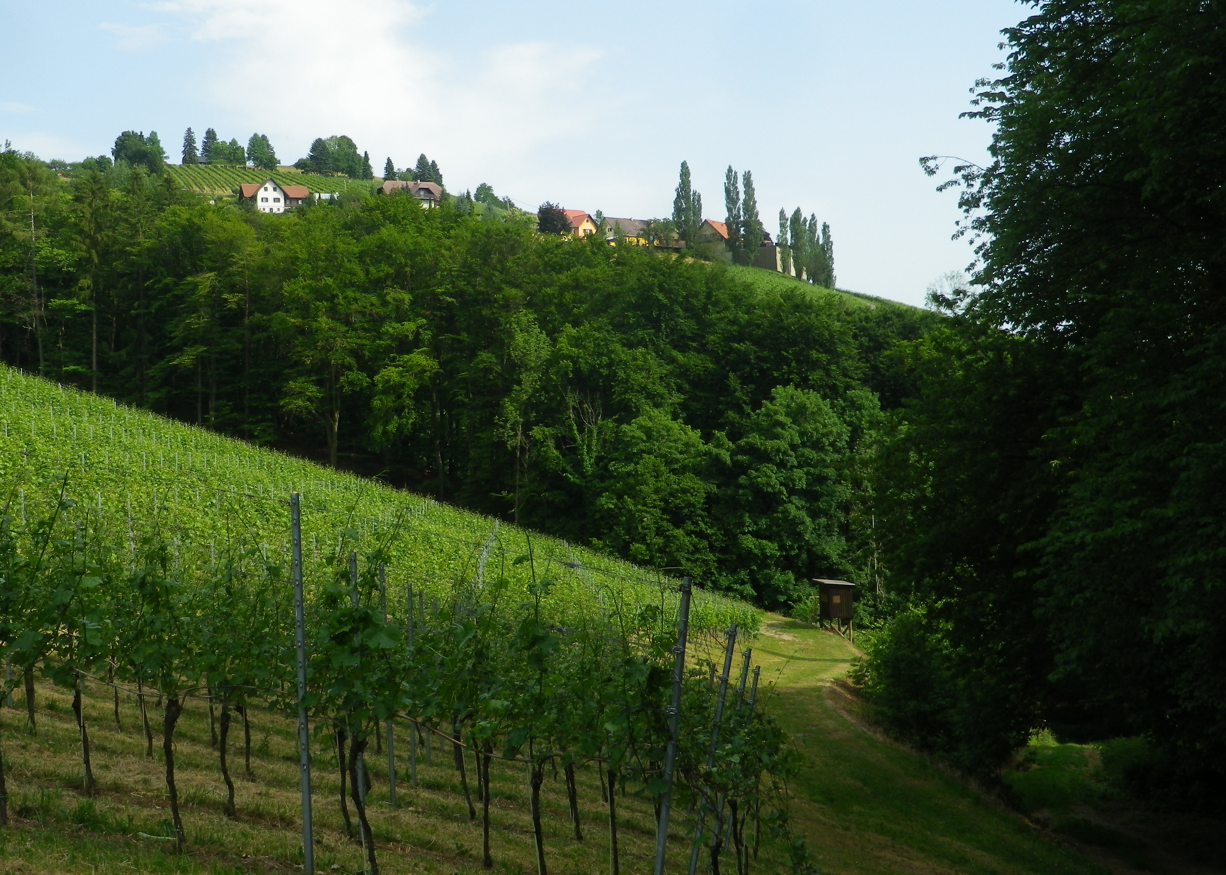
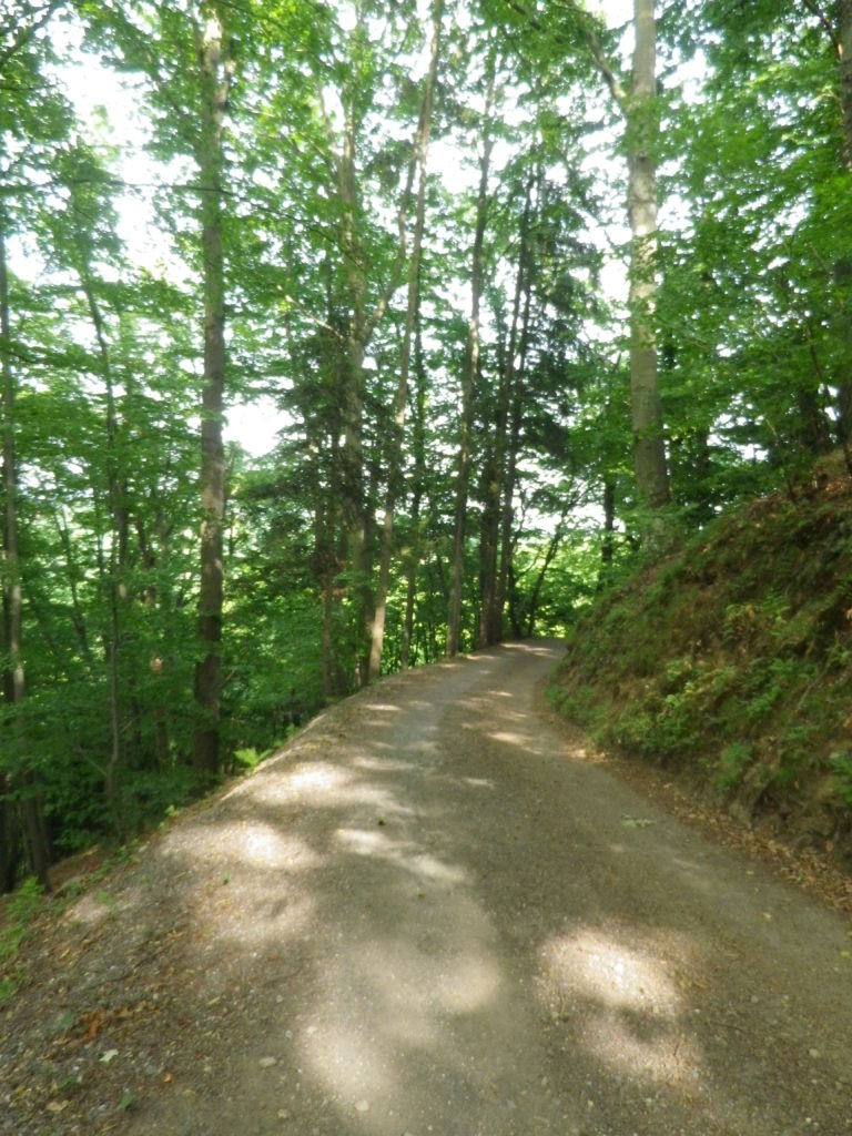
The trail was nicely laid out. The elevation changed constantly, leading through diverse landscapes. From village center to meadows and forests. Then there were the vineyards, irregularly shaped parcels covering sun-drenched slopes, often in view, and only occasionally passed through. There were streams and hillsides to walk along, usually shaded by old trees. In other words, there is a lot of variety to be had in a relatively short distance.
Hiking this trail in June meant long days, hot sun and lush vegetation in the meadows, forests and vineyards. So I began this short (9.2 kilometer) trail at around 5 p.m., when the sun was less fierce, and the temperatures dropped. While the leaf-cover from trees overhead was much appreciated, there wasn’t much I could do about the vegetation in the meadows. In a couple of places, it rose about 1.25 meters/four feet high, and unfortunately ticks, and tick-borne diseases, are on the rise in Europe. Where possible, I took an alternate route to rejoin the trail through vineyards or forest. Fortunately, this was possible as the town has a number of trails through and around it, making it a hiker’s paradise. Unfortunately though, on that day I belatedly concluded that this idyllic trail might be best hiked in later fall or early spring, when the meadow vegetation has scaled back.
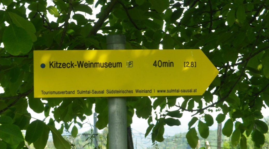
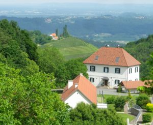
But even my couple of alternative routes (one along a road) were conducted in peaceful solitude. In reality, you get here a lot of quiet here. No rushing vehicles, no bustling village center. There is the wine museum right at the start of the trail that should not be missed, but otherwise, there is not much to indicate an actual urban hub. The village is more like a series of beautifully maintained farms loosely strung along a country lane. A couple of farms have converted to tourist accommodations, ranging from elegant to simple. Other farms do double duty as restaurants or wine taverns.
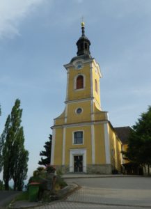
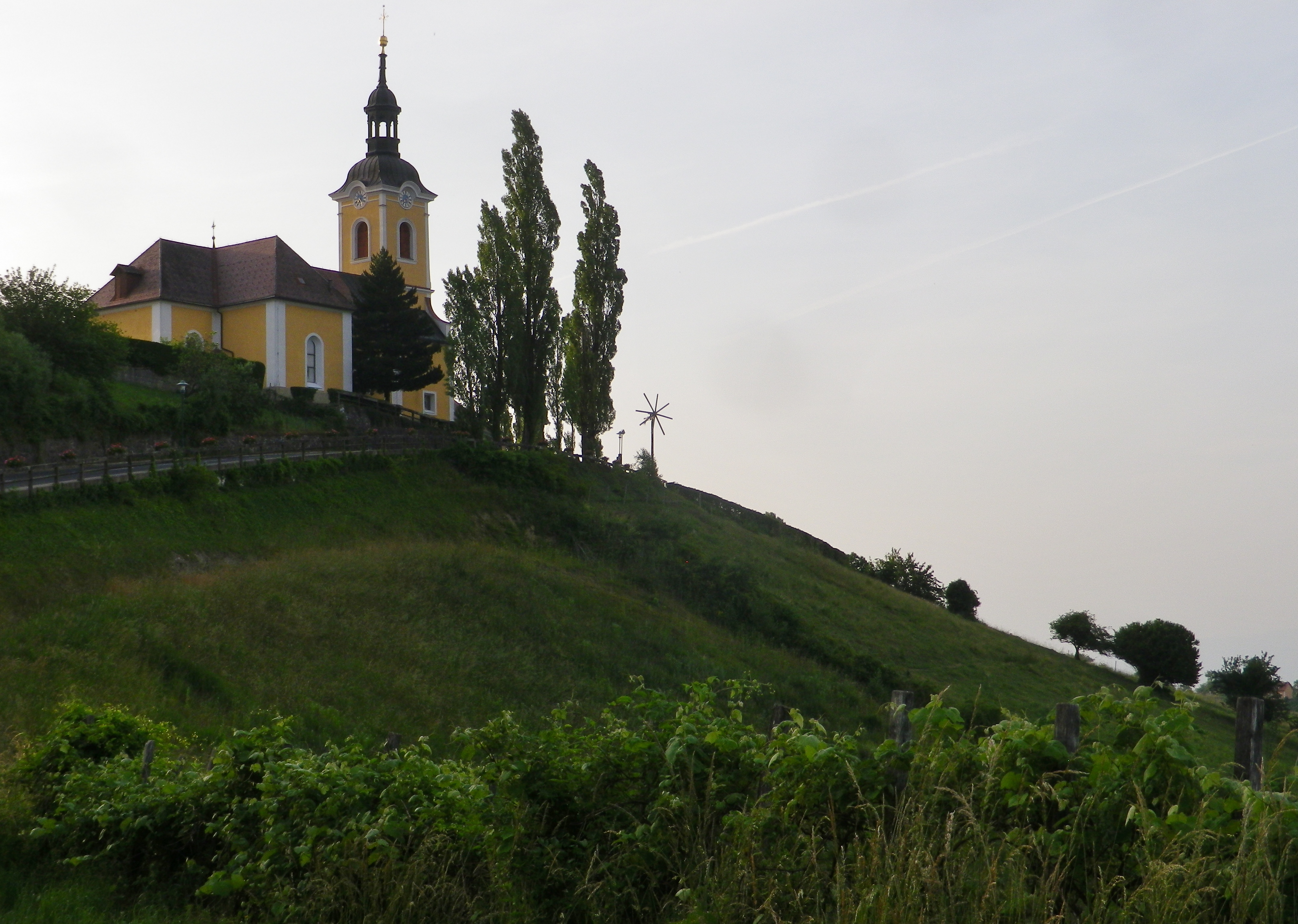
A church dramatically tops the highest point of Kitzeck. Its tower is like a beacon, and eyes from all around are drawn to it, starkly thrust up against an endless sky. Inside is simply decorated. But this small church with its stunning location, needs no further adornment.
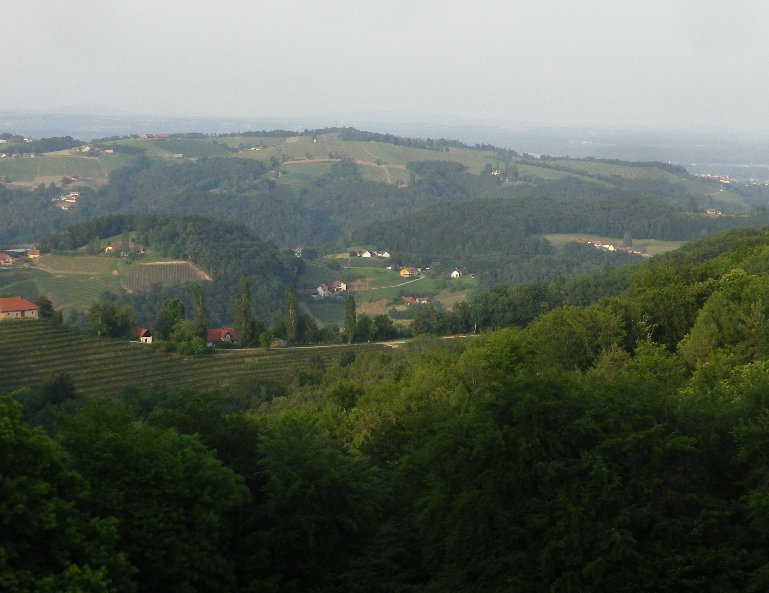
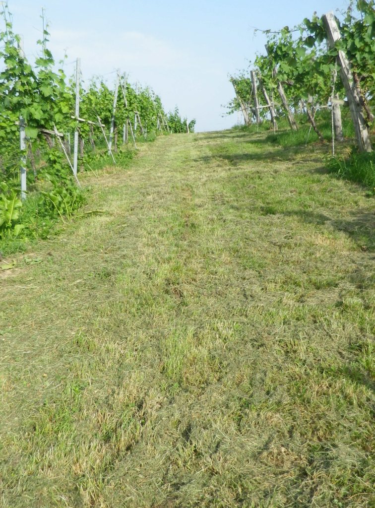
But while the hikers tendency might be to look down, as from the church, the high vantage point around, or from an open hillside, to appreciate the steepness of the terrain hikers should pause to look up every now and then along this trail. The vines seem to be stacked on top of each other, and the trees rise like sentinels, one behind the other. The luxuriant and brilliant greens were everywhere and constantly evolving. The greens darkened and the blues intensified as the sun sank lower in the horizon.
Leaving the final forested section, I entered a compound of half a dozen houses and farm buildings. Here I passed a wine tavern, sadly closed on a Tuesday at around 7:30 on a beautiful evening. My thirst unquenched, but visually rewarded with a dramatic view of the church tower, backlit by the last rays of the setting sun, I made my way to the top of the hill, passing the church, and enjoying the last views of the day from yet another wine-themed trail, this time in Kitzeck.
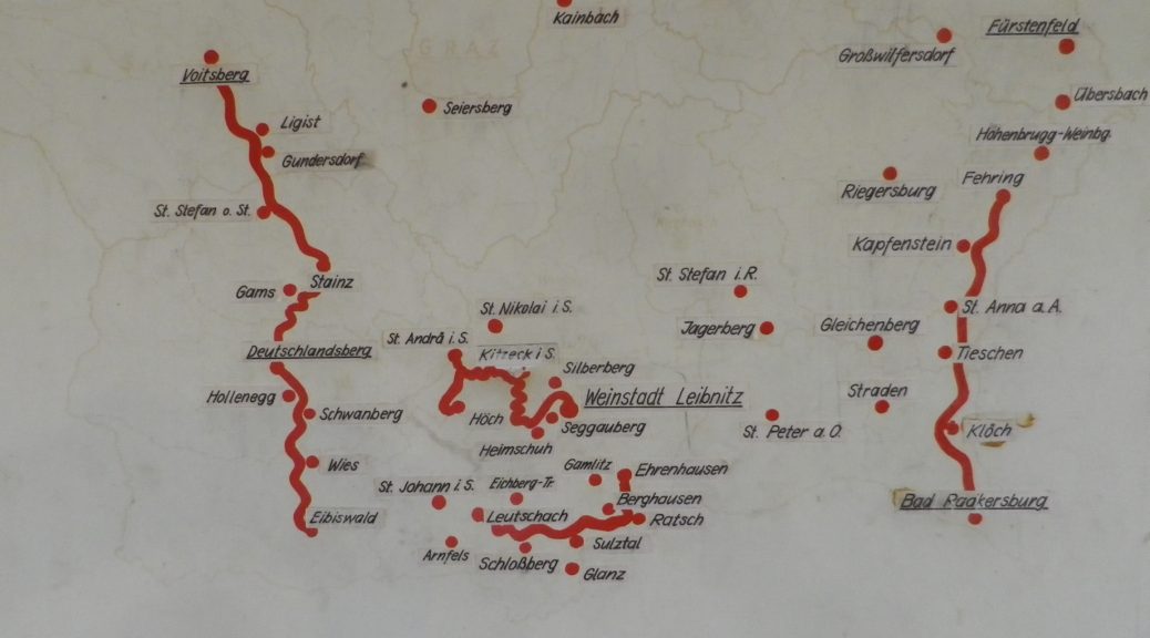
The Steiermark is a wine region in the southeast corner of Austria. It is called Styria in English. The Steiermark lies just north of the Slovenian Alps, and east of the Austrian ones. Within this political and wine entity, there are three wine sub-regions. (See the red lines of the photo of the map above.)
-The easternmost, the Suedoststeiermark lies closest to Hungary, from where gets some of its climatic influences. Its topography is moderately hilly in most places, and as the name for one of its districts implies, was formerly covered by volcanos, hence the denomination name “Vulkanland”.
-Then there is the Weststeiermark. It is known by Austrian wine-lovers, and promoted by the local tourism industry, as Schilcher-land, home to a rose wine of the same name.
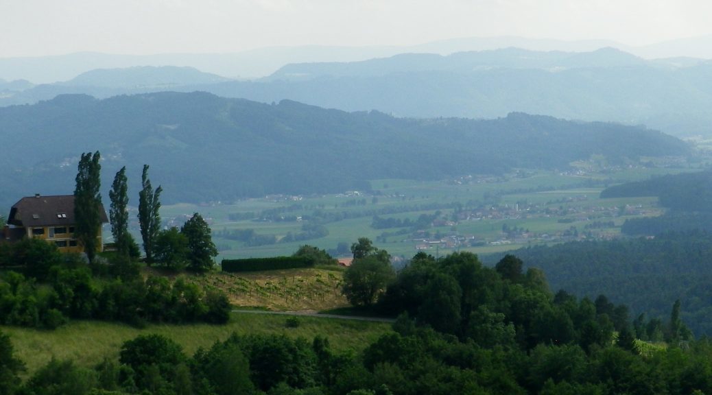
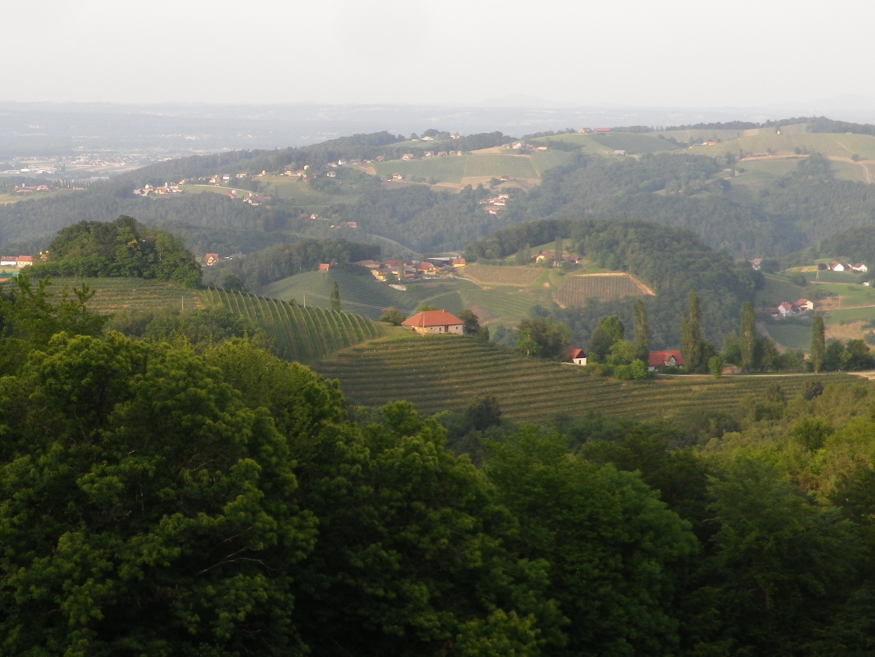
But this blog post is about the southernmost sub-region of the Steiermark, the Suedsteiermark. This relatively small sub-region shares a long border, as well as a tradition of viticulture, with Slovenia. Lying just north of the Slovenian border, it is located in very high hill region, if not a mountainous one, with steep sided slopes, interspersed with deep, narrow valleys. (Think roller-coaster ride, which it sure felt like in a car, and you have the general idea.) Kitzeck, one of the leading wine villages in Suedsteiermark, claims the distinction of being Europe’s highest wine village. The weather here, though, is similar to that of Tuscany. (Hence, it is sometimes referred to as the “Styrian Tuscany.”)
Viticulture in the Suedsteiermark focuses only on a few varietals, predominately white. Morillon, known as Chardonnay elsewhere, is grown here, and along with Sauvignon Blanc, and Pinot Blanc. These three varietals are readily recognized by most wine drinkers. However, two white varietals, and resulting wines, are rather unique to this area.
The Welschriesling (not related to Riesling at all), is a late ripening grape. Because of the Tuscan-like climate in this district, it can sometimes be harvested late for trockenbeerenauslese wines. This dried berry harvest occurs later than the regular harvest, when the berries literally dry up and shrivel on the vine before being picked. Therefore, these berries will produce a sweet wine when picked late, in spite of their natural acidity. Otherwise, the Welschriesling varietal produces a light, somewhat dry wine that is meant to be drunk young.
Another unusual variety and its wine is called Saemling. It is known as Scheurebe elsewhere in the Germanic wine-world. While it can be rather fruit-forward on the palate, it can also have a backbone of acidity to it. These wines will keep. It also makes a decent sweet wine.
What I Tasted
2018 Sauvignon Blanc, Qualitaetswein aus Oesterreich, Weingut Schneeberger (Heimschuh): A dry white wine with dark minus gold color, gooseberry and citrus nose, with flavors of the same; medium minus acidity.
2018 Welschriesling, Oesterreichischer Landwein, Weinbau Koschak (Kitzeck): An off-dry white wine with medium gold color; a tart green apple nose, with green and red apple flavors; medium acidity
2017 Welschriesling, DAC Suedsteiermark, Pichler-Schober (Mittereck/St Nikolai in Sausal): An off-dry white wine with medium minus gold color; a green apple and wet stone nose, with green apple and raw almond flavors; medium plus acidity, with a clean crisp finish.
Trail Name: Kitzecker Weinwanderweg
Trail Type: Short-distance circuit trail; mostly well-maintained and with a variety of trail surfaces; marking on the trail mostly good.
Length:
Total – 9.3 kilometers/5.75 miles
Convenient to: Graz, or Leibnitz, Austria
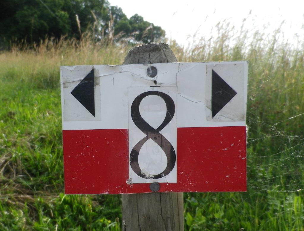
Marking: Black number 8 on a rectangular red and white stripe background
Trail Description: This trail passes through a great variety of landscapes, and its hikers will encounter diverse trail conditions along the way. Three significant inclines/declines, but once on top hikers will enjoy fantastic panoramas of the surrounding district and beyond.
Trailhead:
Kitzeck in Sausal, Steinriegel, by the wine museum and church
Parking:
Kitzeck in Sausal, Steinriegel, by the wine museum and the church
Public Transportation Options:
Rail: Closest rail connection is in Leibnitz, coming from Graz. The Austrian train system is the Oesterreichische Bundesbahnen (OeBB), and the https://www.oebb.at/en/fahrplan link will provide timetable information for both the OeBB trains and Post bus system. (See below).
Bus: The OeBB Post bus system currently (June 2020) services Kitzeck from Leibnitz about 3 times a day on weekdays. Less often on weekends or holidays.
Suggested Stages: Not applicable
Trail Itinerary-Reference Points: (Clockwise)
Kitzeck: Sauegg Weg, path (found across from Kitzeckmueller tavern/restaurant driveway) through field then woods downhill to Sauegg, path along stream; Greith: cross L636, Schnabelveigl Weg; Annaberg: Landgutstr, path through forested area, Poetscherlweg; Perlleiten: along hamlet lane, vineyards, meadow, then pass Weingut Albert; Kleingauitsch: Uphill along L678, turn right onto path through fields and vineyards, woods; Kitzeck: Joshweg-Sacherneggweg I, L636 (AKA: Steinriegel and Sausaler Weinstrasse)
Representative Trail Photos:
Restrooms:
Kitzeck: Steinriegel, behind the wine museum
Attractions on or near Trail:
Wein Museum: Highest wine museum in Europe
Tasting along the Trail:
Several wineries along or very close by, the trail
Alternative Options:
Biking: The Weinstrasse Tour offers four different variations (72, 49, 31 or 25 kilometer-circuits) on mostly little used roads through this wine district.
Mountain biking: The Klapotetz (elaborate scarecrow-like devices vintners use in the vineyards) MTB Runde is a 31-kilometer-long circuit passing through Kitzeck, and passing as far south as Heimschuh.
Car: Both the Suedsteirische Weinstrasse and the Sausaler Weinstrasse are relatively short, scenic car routes which take visitors to different wine villages, wineries and past local vineyards in this area.
Additional Information:
Regional: https://www.kitzecksausal.at/tourismus/tourismusverband/
https://www.sulmtal-sausal.at/de
Trail specific: https://www.outdooractive.com/de/route/wanderung/suedwest-steiermark/kitzecker-weinwanderweg-/1512229/
Comments:
Trail sections through meadows can be rather overgrown in June.