Trail Name: Mainradweg (Main (River) Bike Trail)
Trail Type: Long distance cycling trail; almost exclusively paved, well maintained, mostly well marked.
Length:
Total: circa 375 km/233 miles
Segment: circa 70.5 km/44 miles
Convenient to: Wuerzburg, Bavaria, Germany
Marking: “Main” in white letters on a blue square, “Radweg” in green letters below a green square next to the blue square, on a white background. A stylized river runs through the two colored squares.
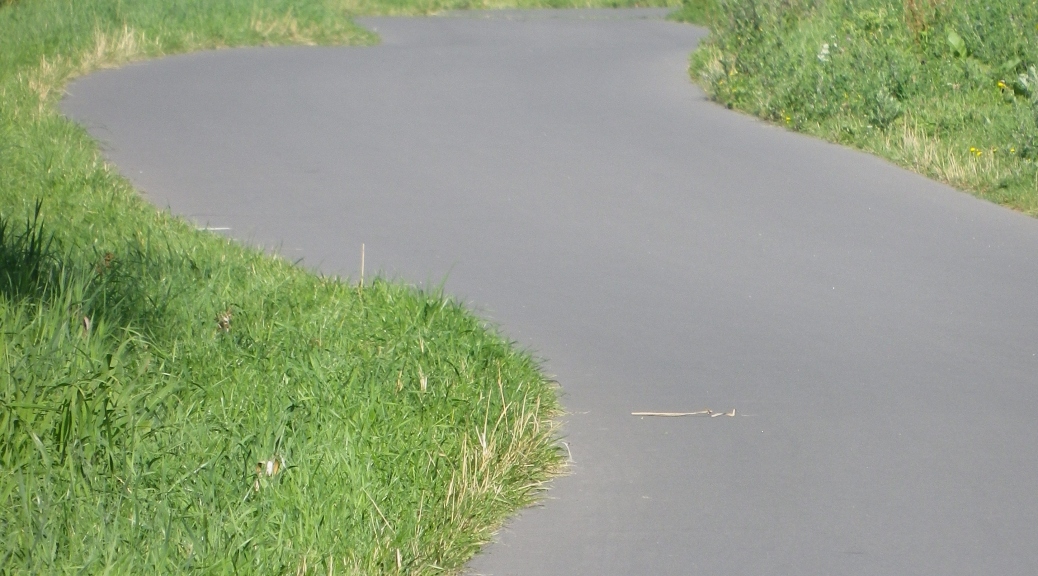
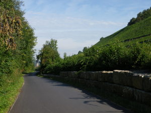
Trail Description: This trail segment is easy, mostly level, but with a slight gradient (up going upriver/down going downriver). It is on dedicated bike path most of the time, except in the towns where space is shared with pedestrians or cars. It is dedicated to following the course of the river, the towns and countryside along it; but this segment passes through Franconia’s most renowned wine villages and by some of its premier vineyards.
Trailheads: (This segment)
Margetshoechheim: foot of the pedestrian bridge over the river
Volkach: Georg Benz Strasse
Alternates: Wuerzburg – at the old bridge; or upriver on Heiner Dikreiter Weg, for easier parking
Parking Possibilities:
Margetshoechheim/Veitshoechheim: large lots in Veitshoechheim at Am Guessgraben and at Parkstr
Ochsenfurt: large parking lots/areas by the river along Mainufer Strasse
Volkach: large lot off Georg Benz Strasse; large lot at Josef Waechter Strasse x Gaibacher Strasse
Public Transportation Options:
Bus: Bus lines serve some of the villages along this route, not served by rail. See http://www.vvm-info.de/vvm/de/information/linieninformationen/liniennetzplaene/liniennetzplaene.jsp
Rail: Wuerzburg is a major rail hub in this area; easily accessible to and from other large cities. Rail also serves Veitshoechheim, Ochsenfurt, Marktbreit, Kitzingen, and Volkach.
Ferries: Run between Wuerzurg and Veitshoechheim in summer season only.
Suggested Stages: Not applicable
Trail Itinerary-Reference Points:
Margetshoechheim (On Main left bank): Zur Mainfaehre-Am Sportplatz, path along river; Wuerzburg: water treatment plant, following Mainaustr, under the Old Bridge (Alte Mainbruecke), to double back to cross over it, (On Main right bank) Buettnerstr-Willy Brandt Kai-Theodor Heuss Damm-Kurt Schumacher Promenade-Heiner Dikreiter Weg; Randersacker: Mainparkplatz, riverside, along river past a lock, under Highway 3; Eibelstadt: along river; Sommerhausen: along river, past Gasthof Anker; Kleinochsenfurt: Sandstr, cross bridge; Ochsenfurt (On left bank): double back under the bridge on Vorhof-Mainuferstr, follow along river, follow along Marktbreiterstr-Ochsenfurterstr; Marktbreit: Hafenstr-adam Fuchs Str-Michelfelderstr; Marktsteft: Tiefenstockheimer Weg-Untere Maingasse, path along the river then along (not on) a road, under two bridges; Kitzingen: cross river on Alte Mainbruecke-(on right bank)-Obere Mainkai, path along river (follows Mainstockheimerstr); Mainstockheimer: Grabendamm, path along Hauptstr; under Highway 3 (again), path along the river; Dettelbach: Uferstr-Bambergerstr, path along Road 22; cross river; Schwarzach (on left bank): Hoerblacherstr-Schweinfurtstr-Gartenstr-Dimbacherstr to path on left continue through Gerlachshausen, past bridge; cross over road and canal onto Am Leitersberg; Sommerach: Schwacherstr-Hauptstr, path along county road K29, past water treatment plant; Nordheim: Langgasse-Volkacherstr, follow path on riverside along K29, cross river on K29; Volkach: path along river to Georg Benz Strasse and parking lot.
Representative Trail Photo:
Restrooms:
Wuerzburg:
By Bus stand near Sanderstr x Sanderring
In the Kranengarage, slightly downriver from the old bridge, near Mainkai x Kranenkai
Marktbreit: next to the Tourism Office at Mainstr x Bachgasse
Ochsenfurt: by the museum on Vorhof
Kitzingen: slightly downriver from the tourism office on Schrannenstrasse
Dettelbach: at the KUK (tourist office, museum, library, etc) on Rathausplatz
Attractions on or near Trail:
Veitshoechheim: palace and extensive gardens with features, set in a lovely small town
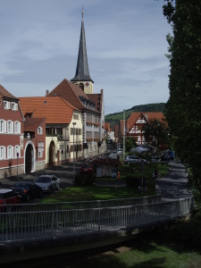
Wuerzurg: Marienburg Fortress, Residenz Palace, exquisite Baroque architecture and features, ancient cathedral, captivating historic center, riverscape; wine…
Ochsenfurt: Historic town center in an attractive setting between river and wooded hills
Kitzingen: Pastry Museum, Fastnacht (Mardi Gras) Museum, Synagogue
Schwarzach: Benedictine Abbey (still active), with a history dating to the 700s, with Carolingian connections.
Volkach: Historic town center
Tasting along the Trail:
Wuerzburg: Wine Bar on the Old Bridge, and many others. Also has the Juliuspital (supporting good causes) and the Staatliche Hofkeller, near the Residenz palace.
Nordheim: Divino Nordheim
Towns: Especially Volkach and Sommerach
Alternative Options:
Walking: Any part of this route may be easily walked.
Running: Any part of this route may be easily run.
Biking: May easily lengthen or shorten this route.
Additional Information:
Regional: http://www.frankentourismus.com/?setLanguage=true (English); and http://www.frankentourismus.de/ (Only in German, but has more detail than the English language page)
Trail (segment) specific: http://www.mainradweg.com/karte/
Comments:
Because driving and parking options were easier in Veitshoechheim, I drove there, parked there, and began at Ludwig Volk Steg, the official name for the pedestrian bridge over the river connecting Veitshoechheim and Margetshoechheim.
Note that this itinerary went upriver. The slight continuous gradient in sections on the trail could be avoided by reversing this itinerary.
Wuerzburg is definitely worth a whole day visiting.