Mankind is often hard pressed to improve upon nature. Humans leave an indelible mark on the natural world, and sometimes their efforts can enhance our experiences. In these cases, not just the natural landscape, but also the manmade landscape can appeal equally.
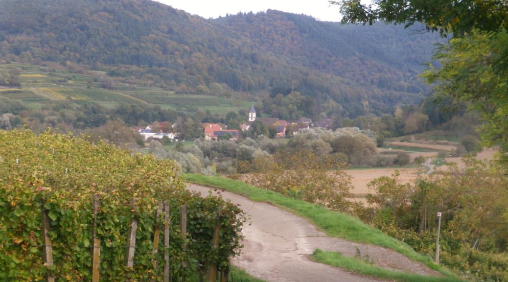
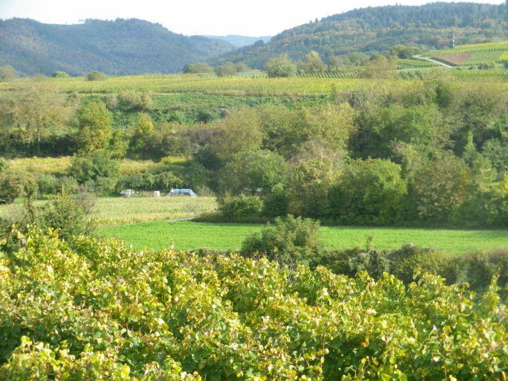
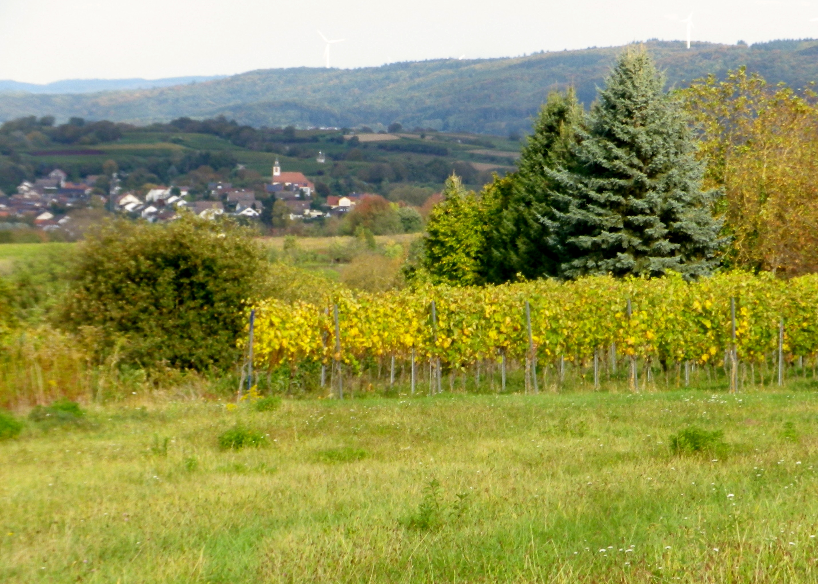
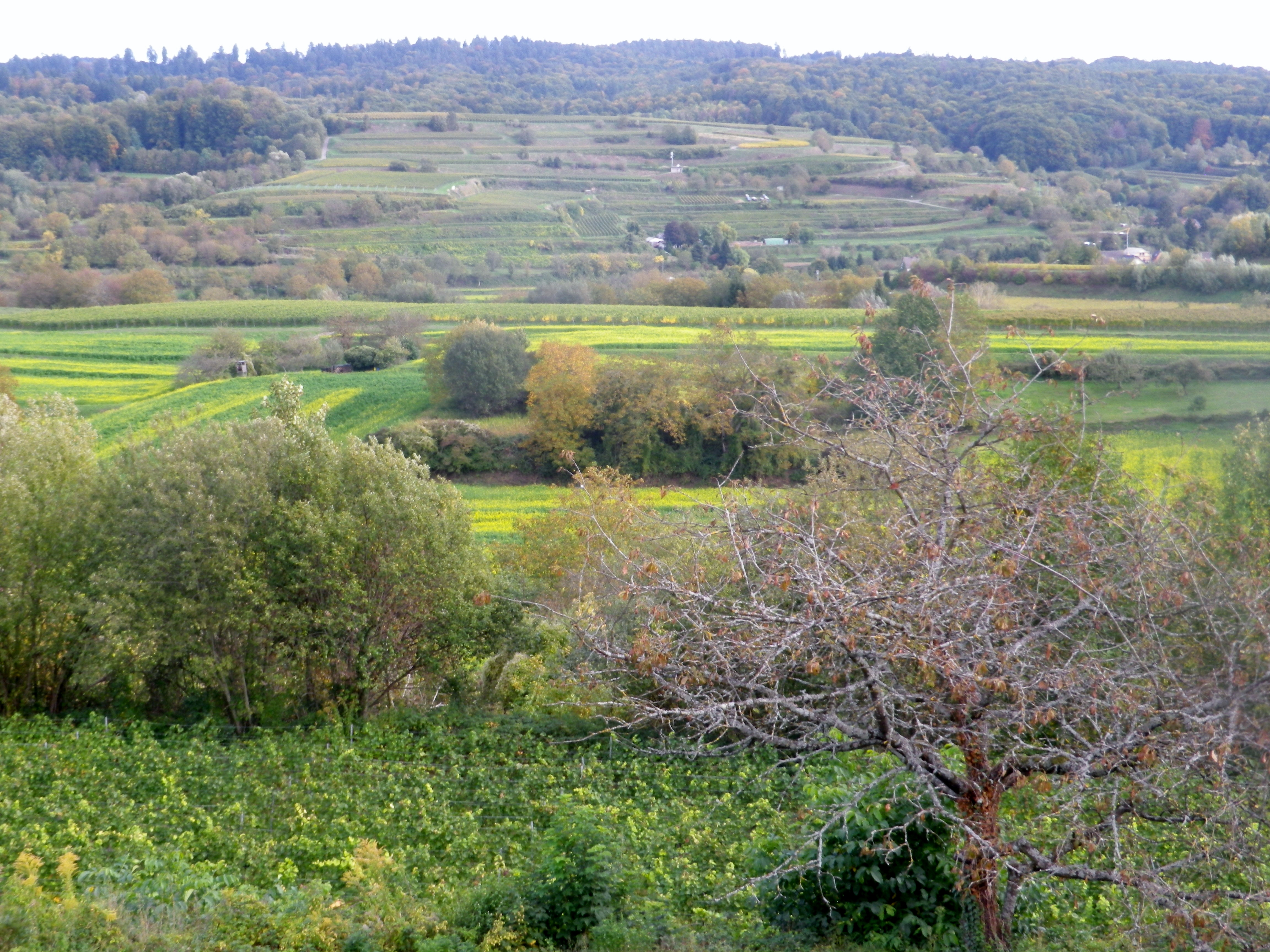
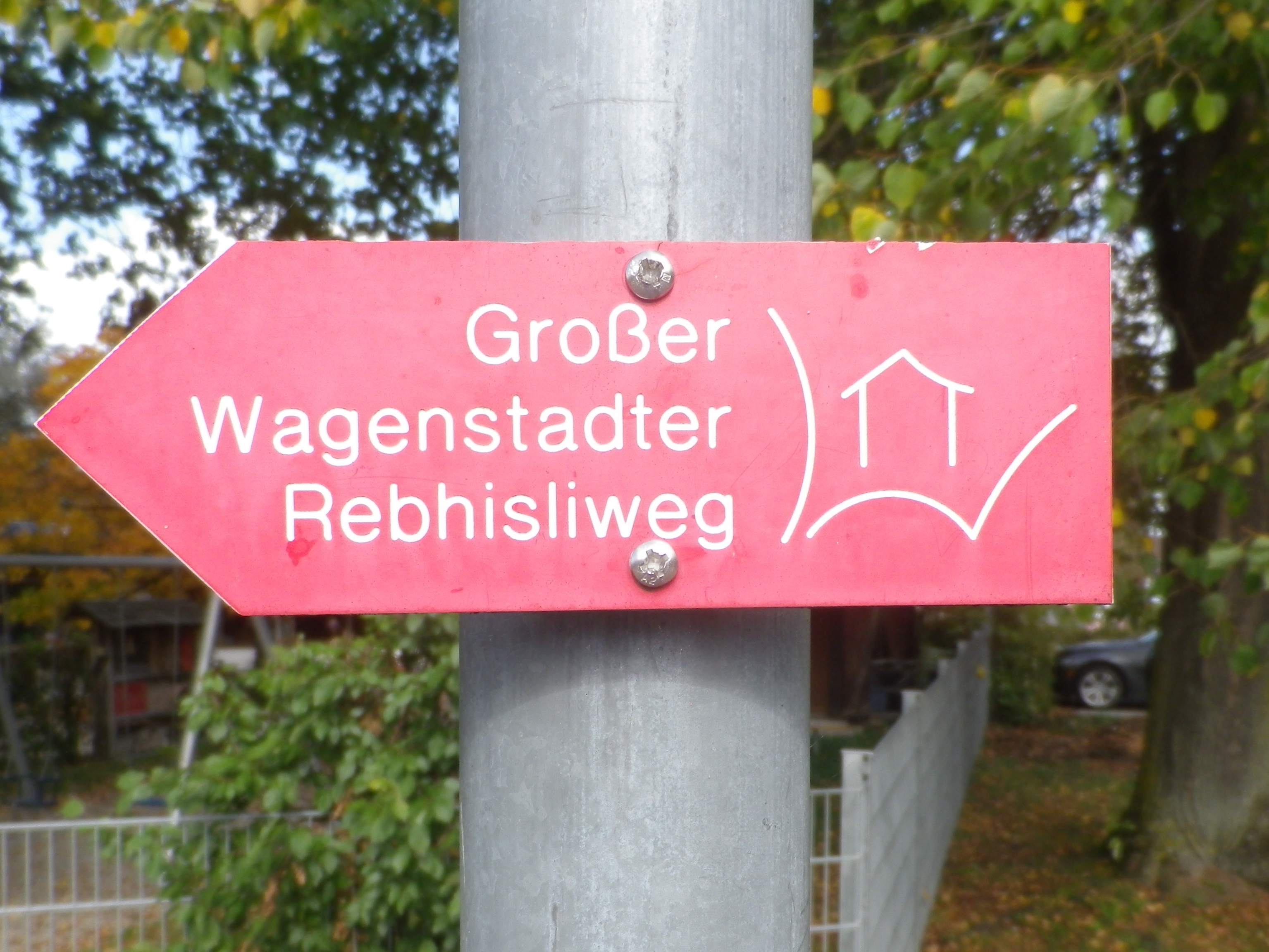
The Rebhisliweg itinerary focuses on manmade huts found in a beautiful, lush landscape. The circuit lies by Wagenstadt, in the Breisgau, a district of Baden. Topographically, layers of hills, some terraced, and ridgelines to the north, south and east devolve into the Black Forest, which appears as a mountain wall, capped by mixed forest vegetation. The dark greens of the fir trees, and the brilliant autumnal leaf colors add to the background. In the distant west, the majestic Vosges, turn from blue to purple as the evening approaches.
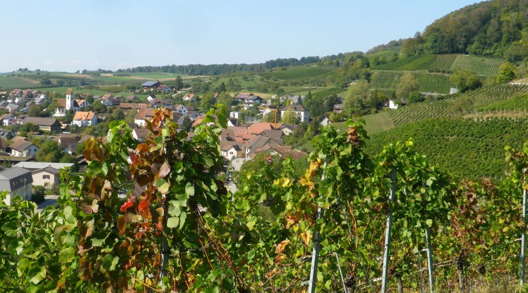
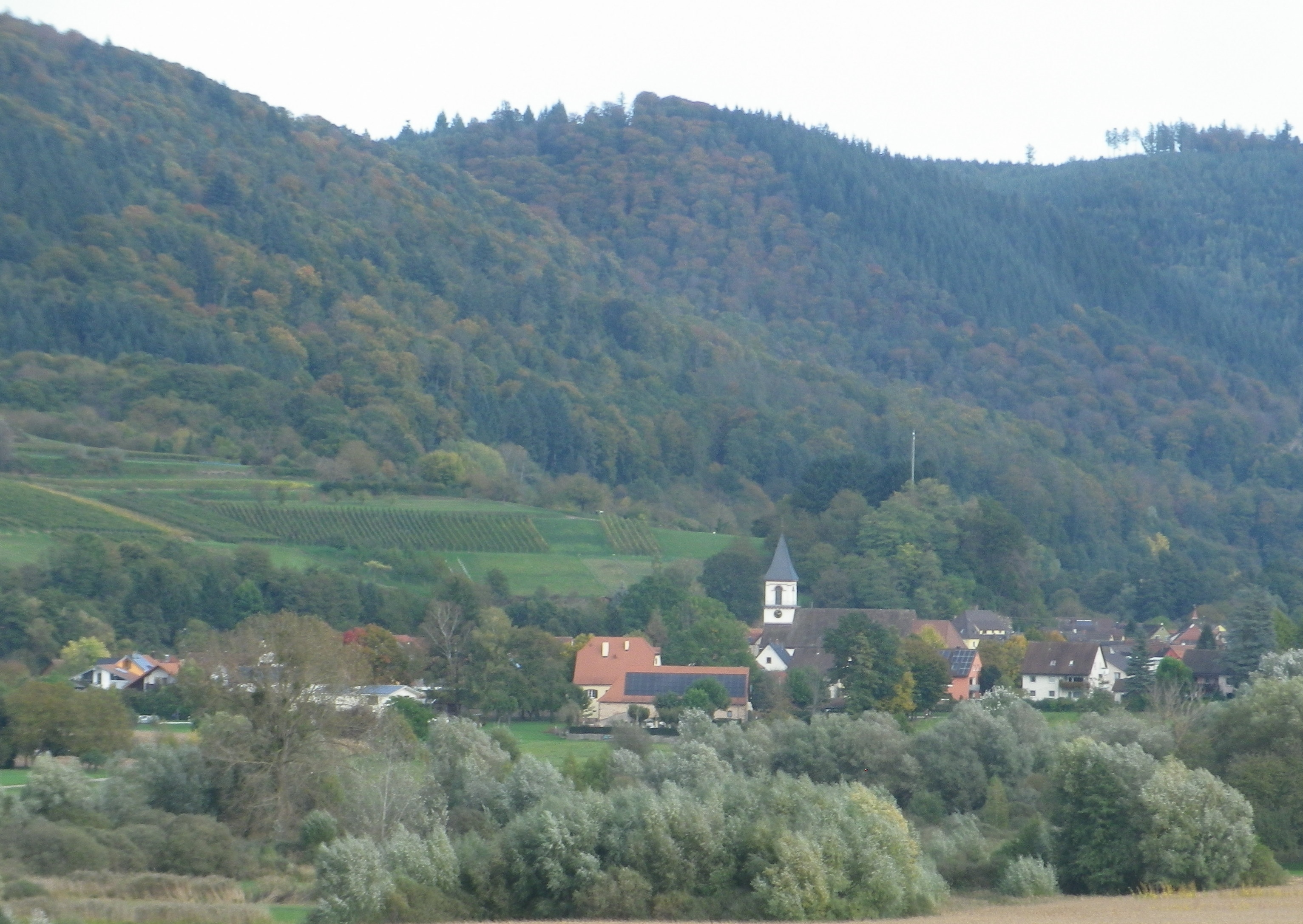
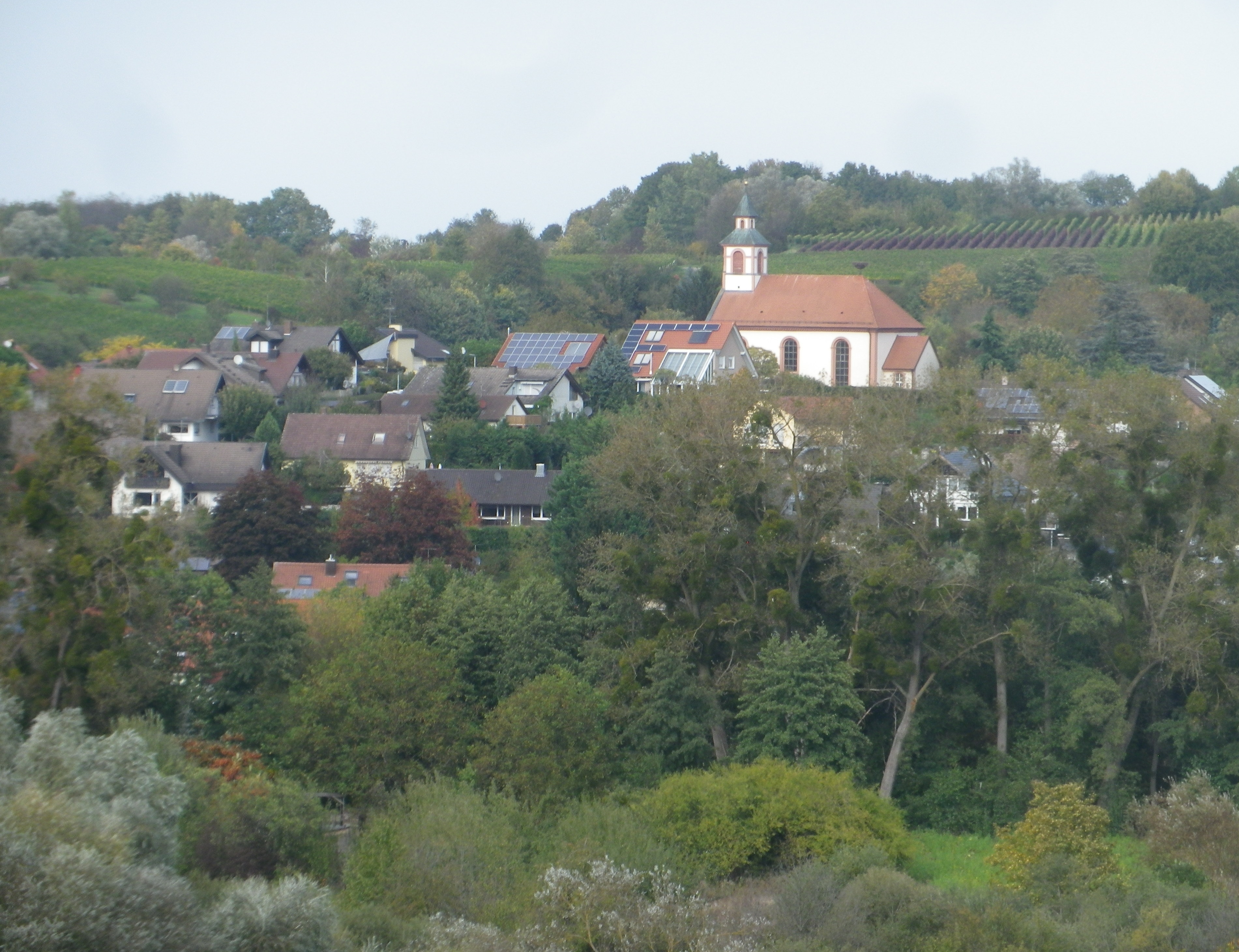
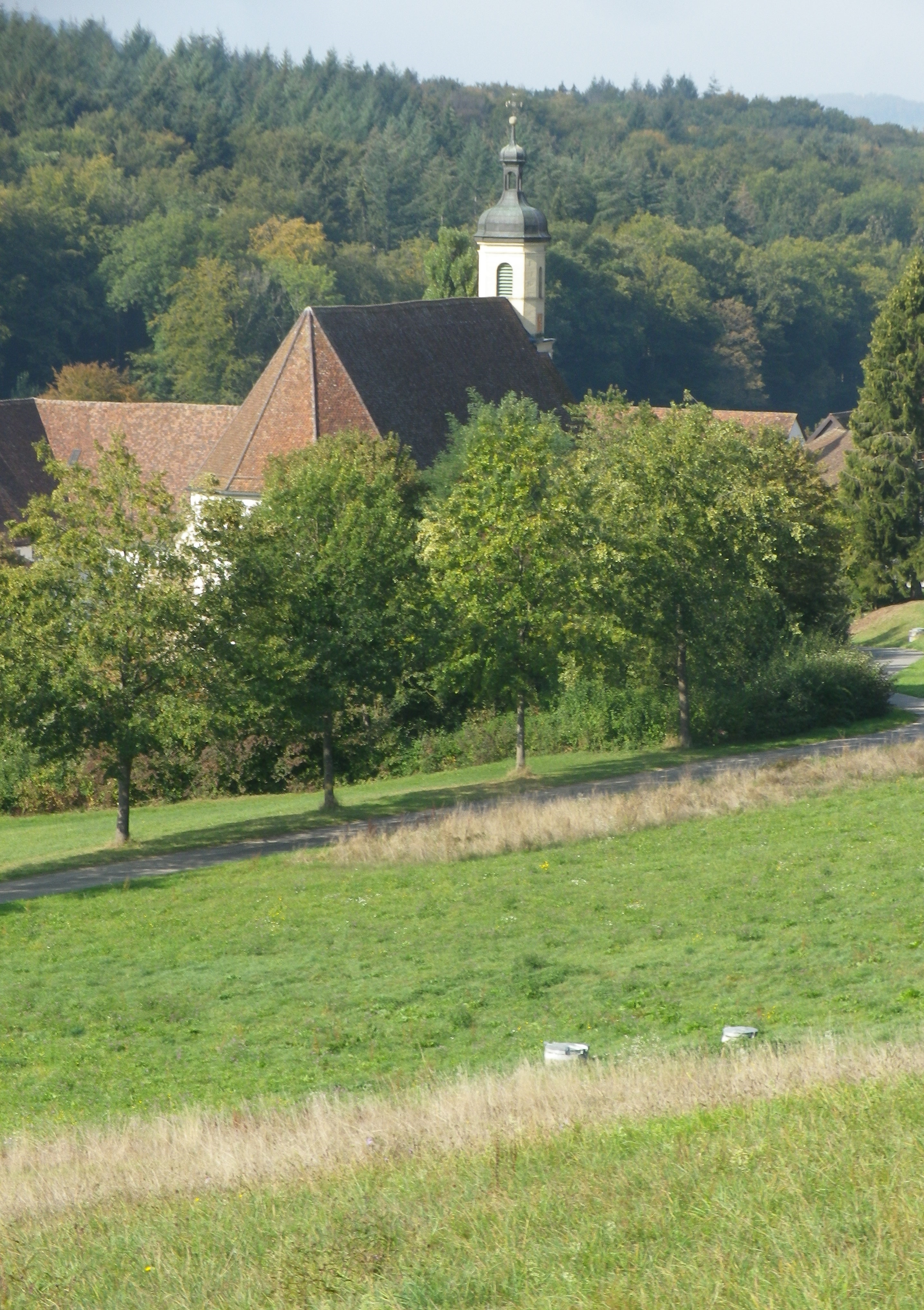
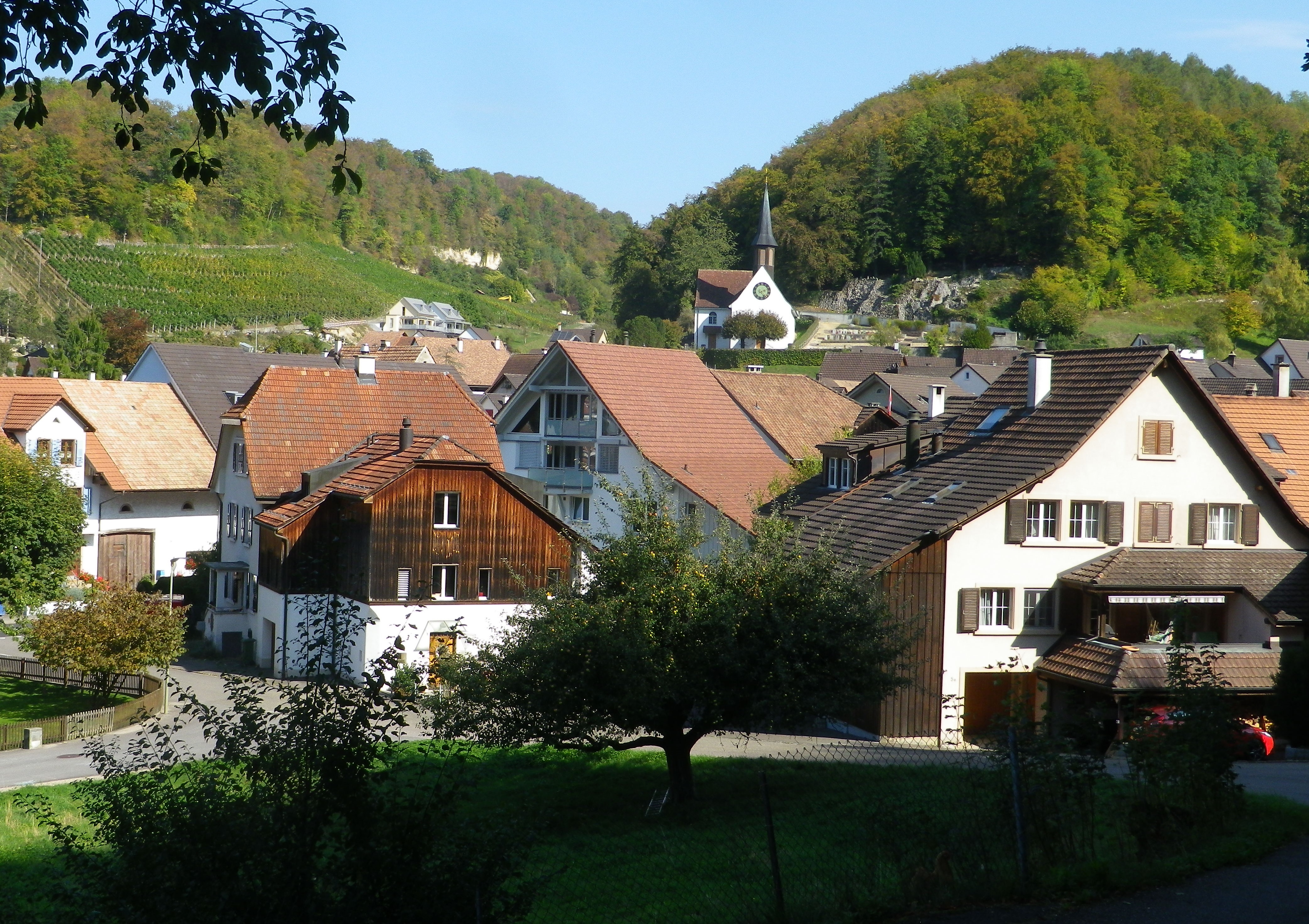
The nearby villages are compact gems, which harmonize, not distract, from nature. Set amongst vineyards, forests and fields, most buildings are only three stories at most. The red roofs set off nicely against nature’s greenery. The eye is drawn to, and then beyond, each village’s church steeple, or municipal bell tower. Each one distinct from the other, a sort of talisman for the inhabitants. The ridgelines ultimately dwarf them, but only because man’s construction draws the eye up, then away, onto that backdrop, thence to the mountain tops. They serve to unite middle and distant vistas.
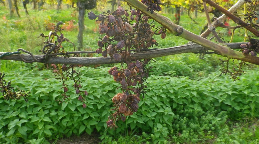
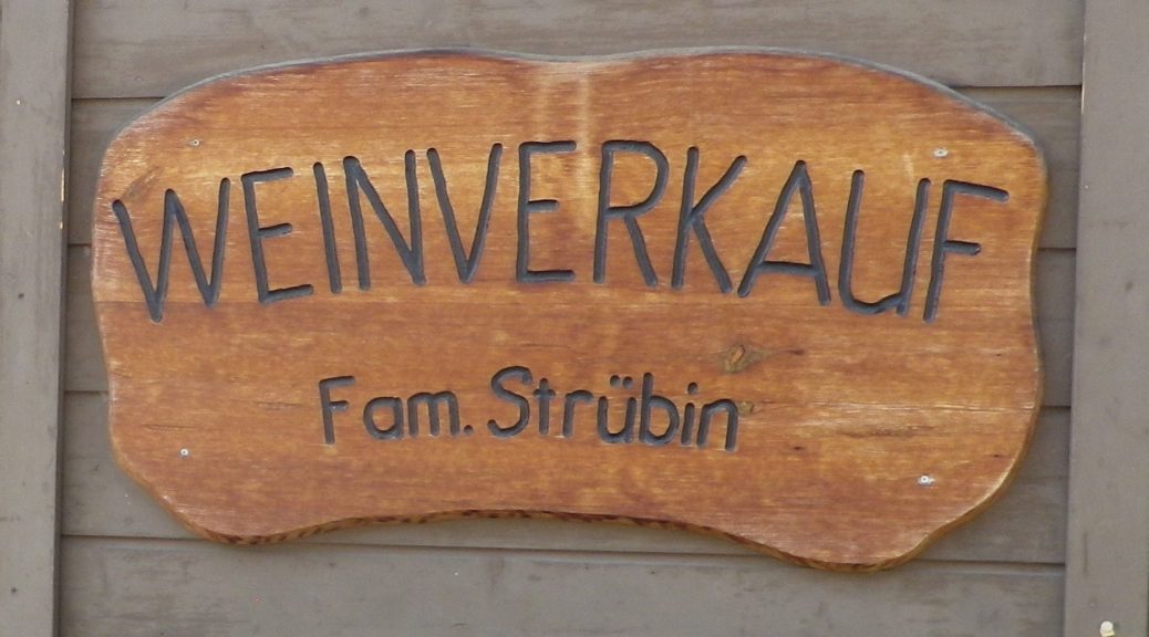
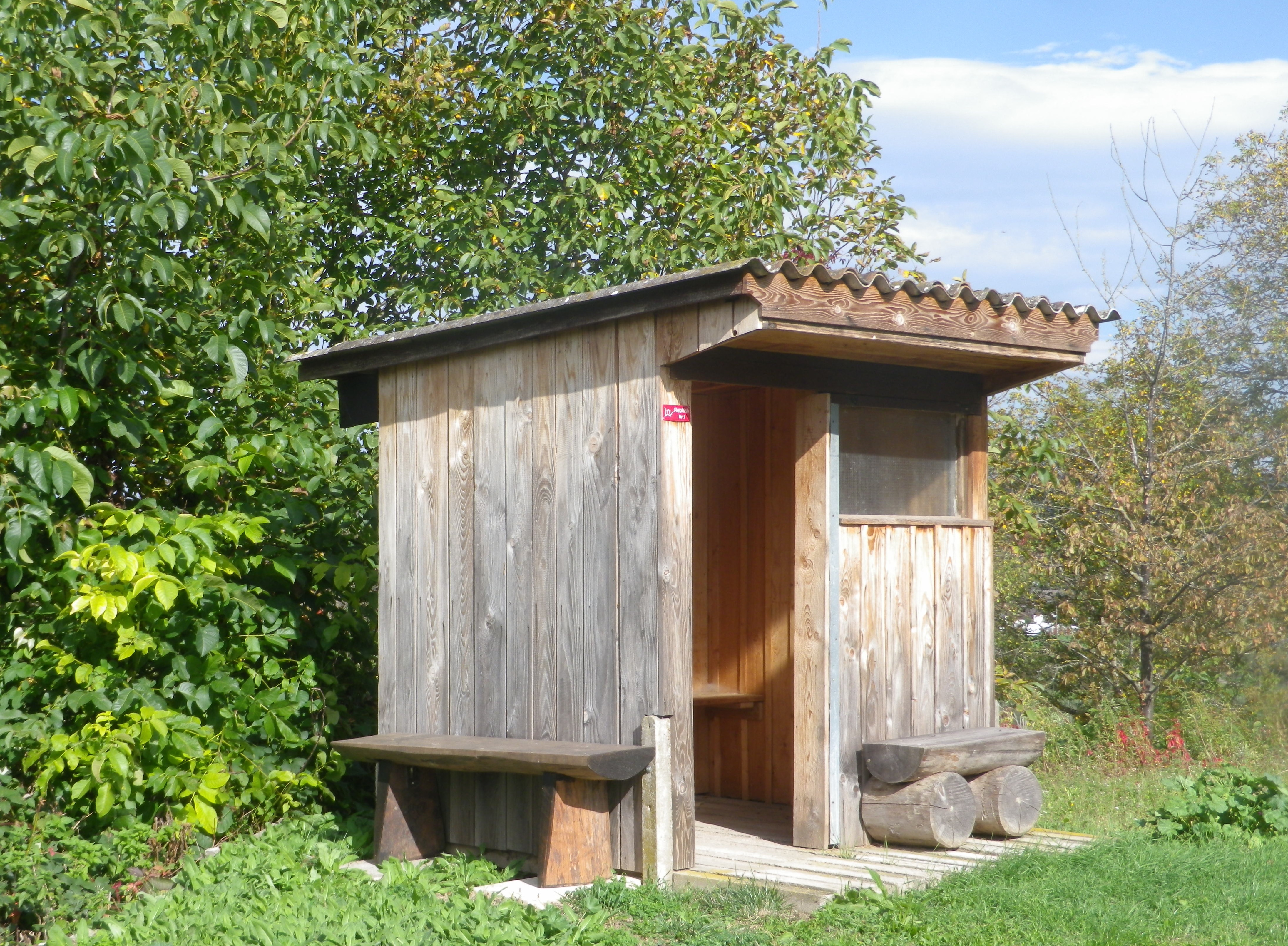
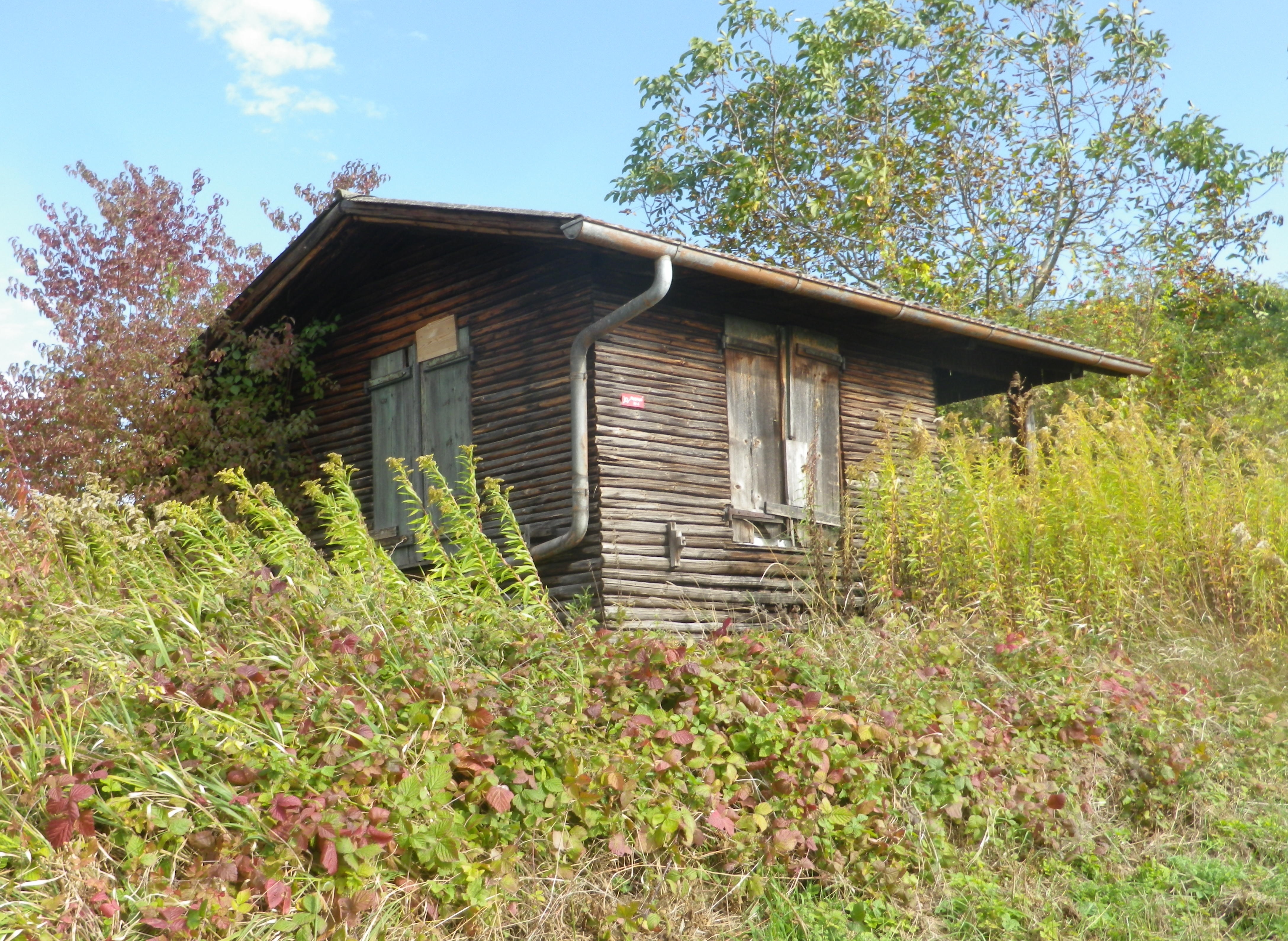
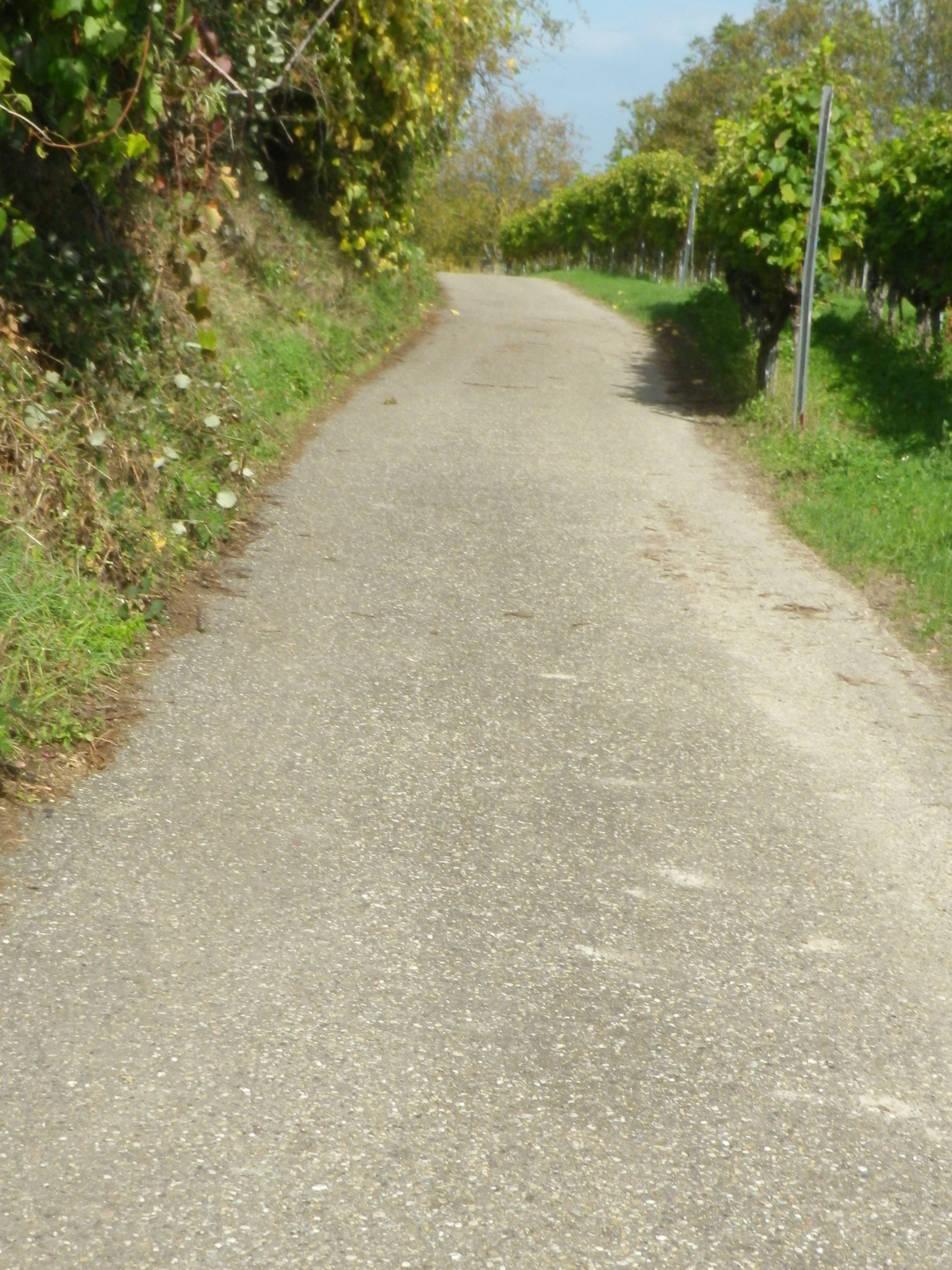
At eye level, the manicured vineyards, punctuated with fields, some farmed, others fallow or reclaimed by nature, and small huts. Known as Rebhisli in the old German Alemannic dialect, they are huts for those who work the vineyards. Whether sheltering the workers, or their tools, these vintner huts still exist in Germany. They provided the inspiration for this trail’s name and itinerary. The huts dot the landscape all along the trail. Some vintners still maintain certain huts, whereas nature is slowly reclaiming others. All are picturesque in their own ways, and are often offset against the magnificent landscape.
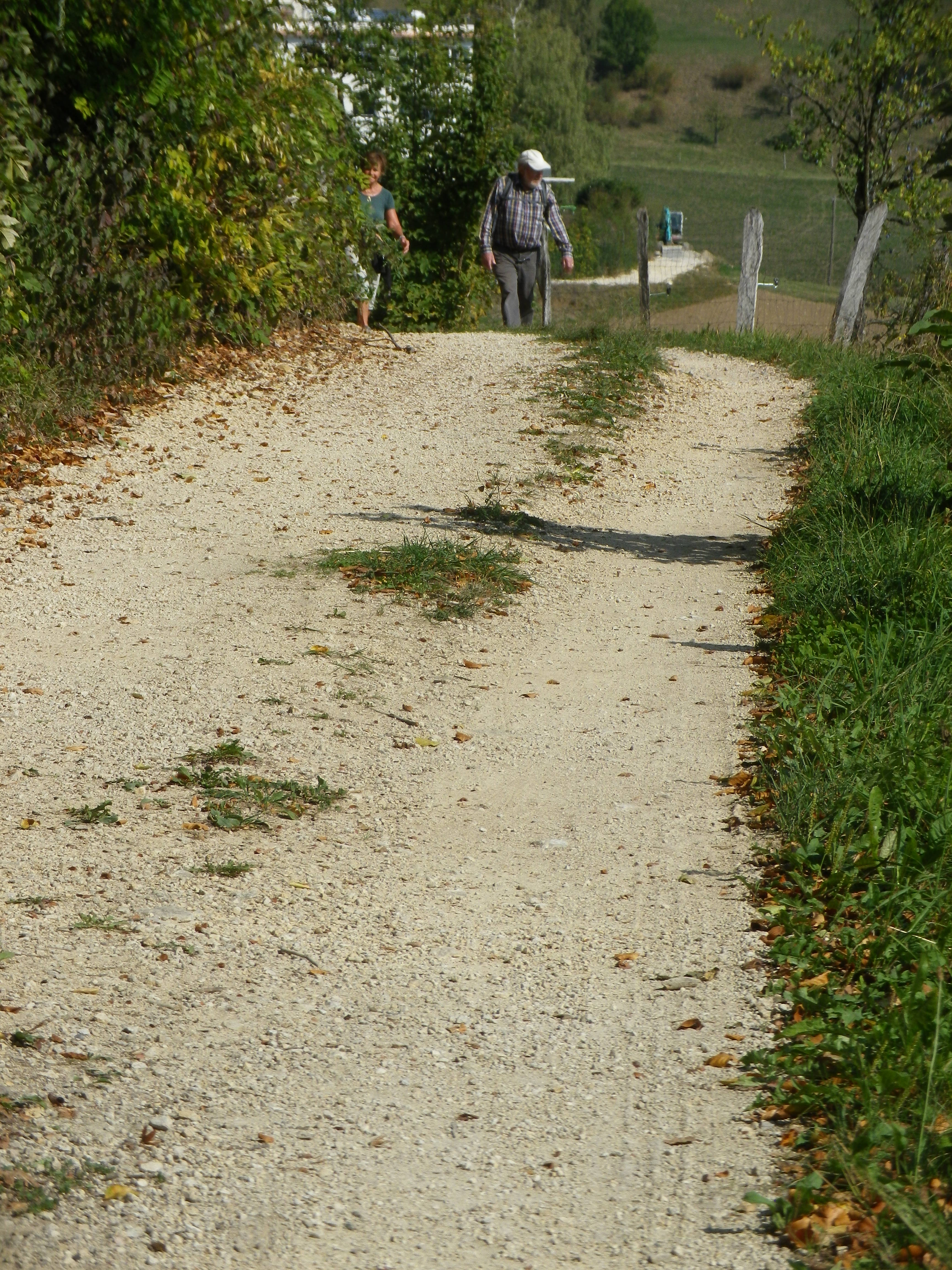
As this hike left the village of Wagenstadt, it passed through fields before proceeding upward. As the vineyard terraces began, the air filled with the scent of crushed grapes, and fallen leaves. The harvest was mostly over, only the spaetlese or beerenauslese grapes remained, the grape leaves turning yellow.
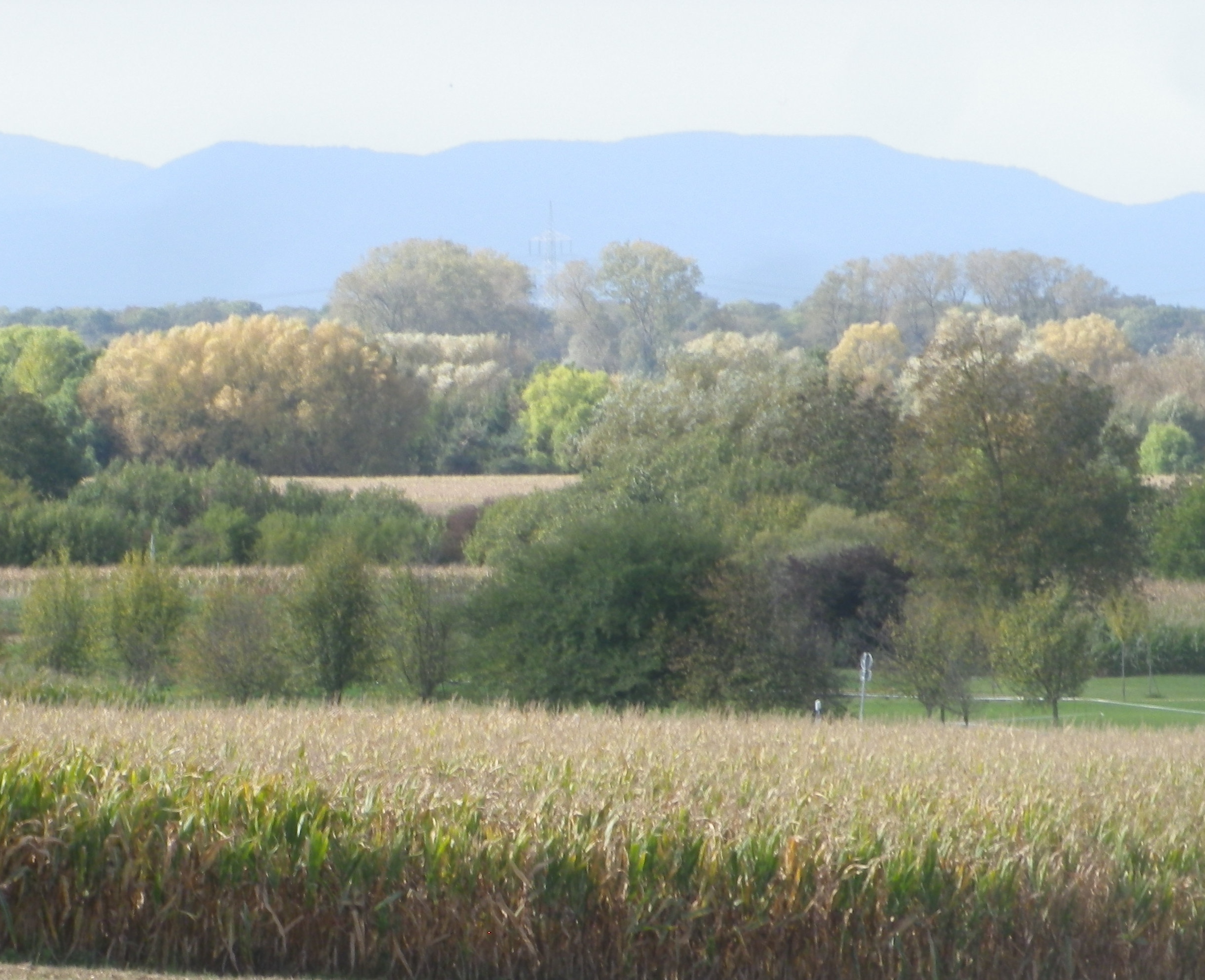
During the first part of the hike, the views were to the west, toward the Vosges and rapidly sinking sun. In the distance lay the Alsatian town of Selestat, and vineyards, a thin yellowish line, at the foot of the Vosges, somewhere between Dambach la Ville and Scherwiller.
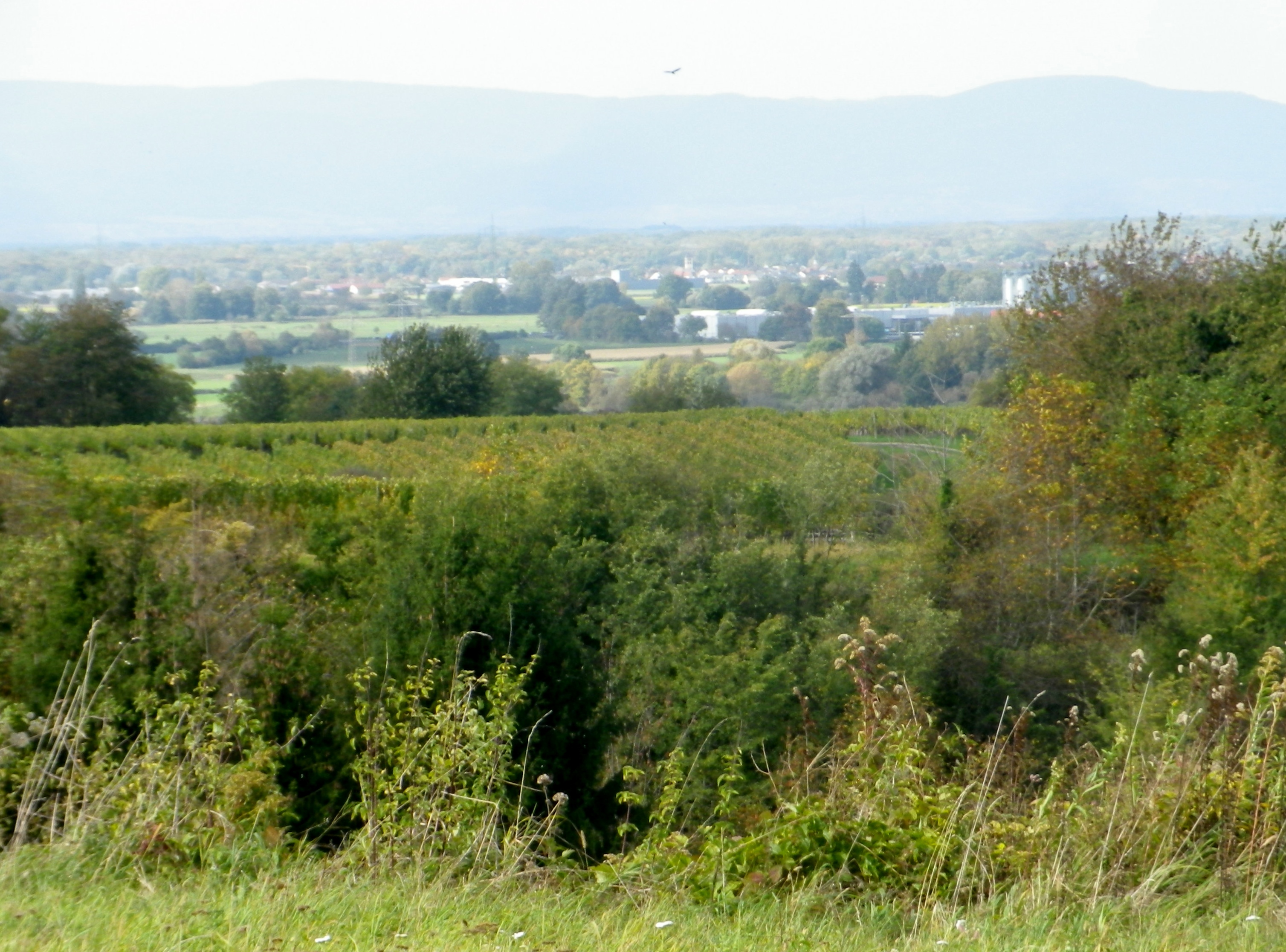
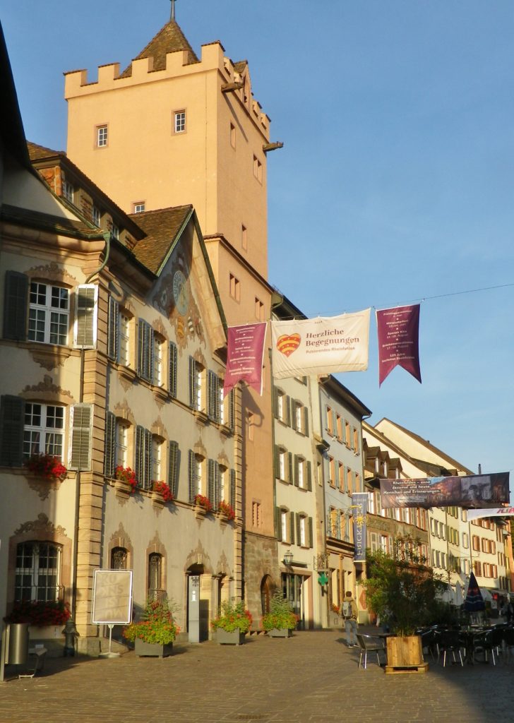
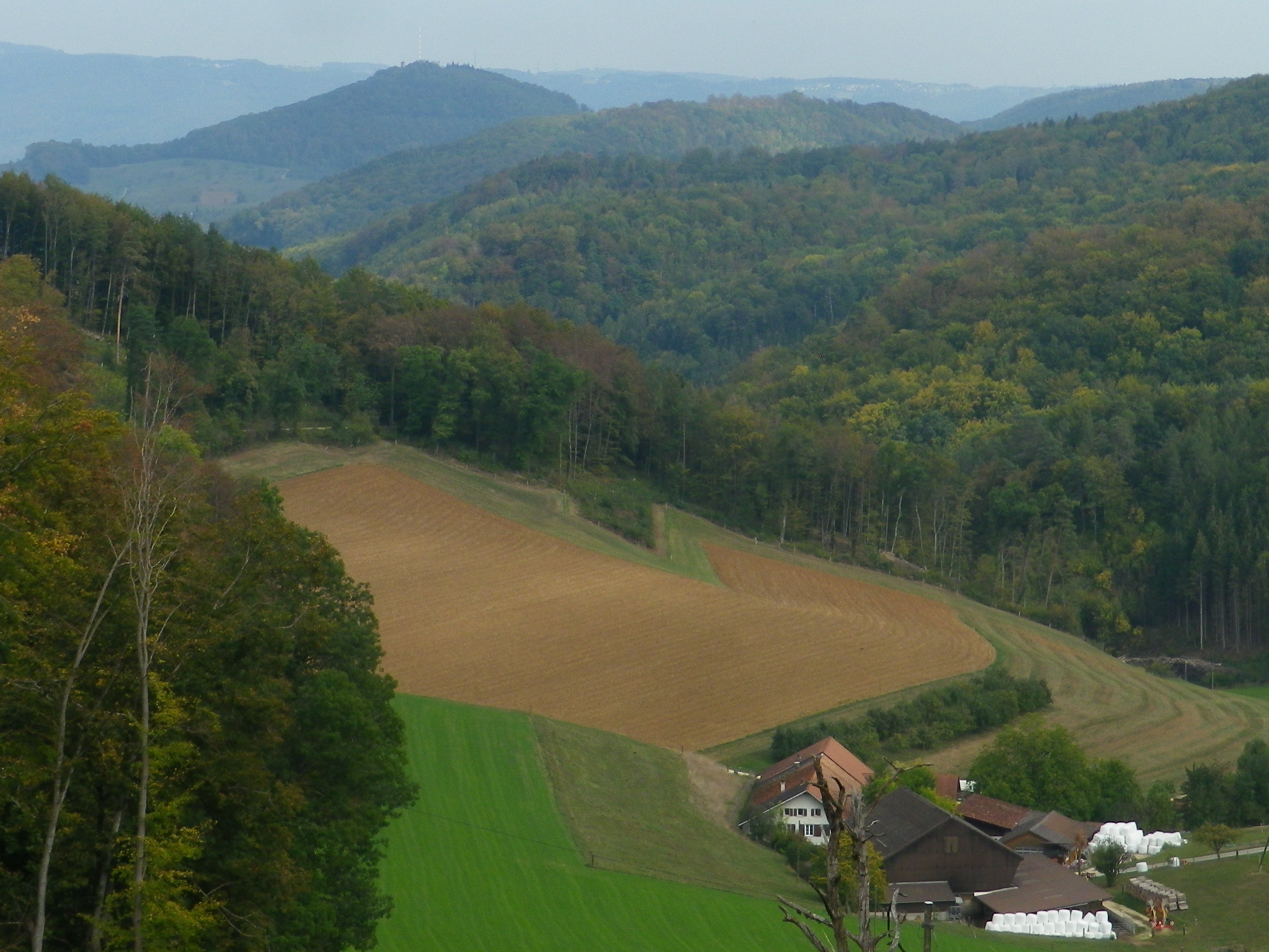
As the trail rounded its southern most extent, and headed north, the first views of the nearby Black Forest came into sight. Bleichheim and its solitary church steeple hove into view, but put into perspective by the massive foothills of the Black Forest behind. Tutschfelden and its distinctive steeple appeared.
Heading back toward the village, I passed a couple of wineries, (the Schaudt and the Ringwald), and more vintner huts. All nestled comfortably into the folds of this rolling terrain, and blended in effortlessly. Then just like that, from vineyard to village, I was back in Wagenstadt.
No, mankind did not outdo nature here, but came in a close second. The true merit of mankind’s efforts was housing the implements, wineries and the taverns where nature’s fruit of the vine could be harvested, produced and enjoyed with friends and neighbors.
What I Learned:
The Breisgau district in Germany’s Baden Wine Region has some unique topography, both manmade as well as natural. From the ancient Rhine River floodplain, you see ridgeline after ridgeline, each rising higher as it moves away from the Rhine, and toward the upper reaches of the Black Forest to the east.
The vine-covered hills, usually on the first or second ridgelines after the plain, tend to be small, but steep. Vintners have terraced many of them over time. The terraced banks provide plenty of opportunity to notice the primarily loess and sandy soils that predominate in this district.
Just south of this circuit, in vineyards near Mundingen, archeological finds attest to winemaking taking place on the left bank of the Rhine beginning in Roman times. (These sources identify areas in Alsace and the Pfalz.) On the right bank of the Rhine, winemaking can be definitively dated to the Carolingian era, around 781 A.D., in the Kaiserstuhl.
In the Breisgau, the first written mention of vineyards in nearby Koendringen (further east from the Rhine than the Kaiserstuhl district), dates to 1307, although it may be supposed that it actually occurred earlier.
In other places in the Breisgau though, viticulture is fairly recent. In Glottertal, a sign on the Rebhaeusle, an historic vintner’s hut on the Breisgauer Weinweg trail, notes that the first vineyards in the valley date from 1868.
This district produces red and white wines. Mueller-Thurgau is the most planted white varietal, followed by Rulaender (Grauer Burgunder/Pinot Gris), and then Pinot Blanc. The Pinot (Burgunder) varietals are widely planted here. In fact, according to the Weinlandbreisgau.de site, the Blauer Spaetburgunder (Pinot Noir) constitutes a whopping 42.9% of all wine made in the Breisgau. Combined with the Pinot Blanc figure of 9.5% and the Pinot Gris figure of 12%, this means that the Pinots themselves constitute over 60% of all wine from this area. Not surprising considering that France is less than 30 minutes from here.
Most planted varietal in the Breisgau area around Kippenheim is the Spaetburgunder. Other areas within the Breisgau grow the red varietals of Regent (developed in 1967 in the neighboring Pfalz wine region) and Cabernet Mitos, and Riesling and Chardonnay as other white varietals. All other grapes grown constitute less than one per cent of the total.
What I Tasted:
2018 Gutedel, Qualitaetswein, Trocken, Staatweingut Freiburg (Freiburg): A dry white wine with medium minus gold color; mineral and slight floral nose, with slight toasted nuts and fruity flavors; medium acidity.
2018 Sauvignon Blanc, Ettenheimer Kaiserberg, Deutscher Qualitaetswein, Trocken, Wein und Sektgut Weber (Ettenheim): A dry white wine with medium gold color; nose of gooseberry and citrus, with gooseberry, citrus and slight spice and pear flavors; medium plus acidity, with a tart finish, well balanced and a great representative of this varietal wine.
2016 Grauburgunder, Blankenhornsberger Doktorgarten, VDP Grosse Lage, Trocken, Staatweingut Freiburg (Freiburg): A dry white wine with medium minus gold color, mineral and sweet floral nose, with white stone fruit, vanilla and floral flavors; medium plus acidity, but a very smooth finish with lingering complex flavors.
2016 Solaris, Auslese, Lieblich, Staatweingut Freiburg (Freiburg): A sweet white wine, with medium gold color; mineral, honey and floral nose, with floral, exotic fruits and bergamot flavors; low acidity.
Trail Name: Grosse Rebhisliweg
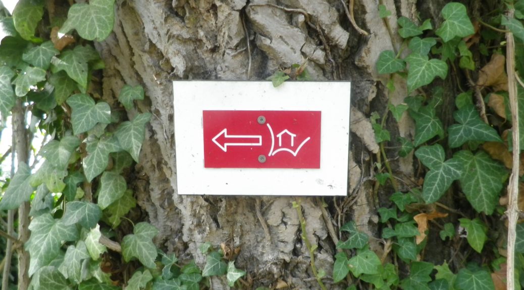
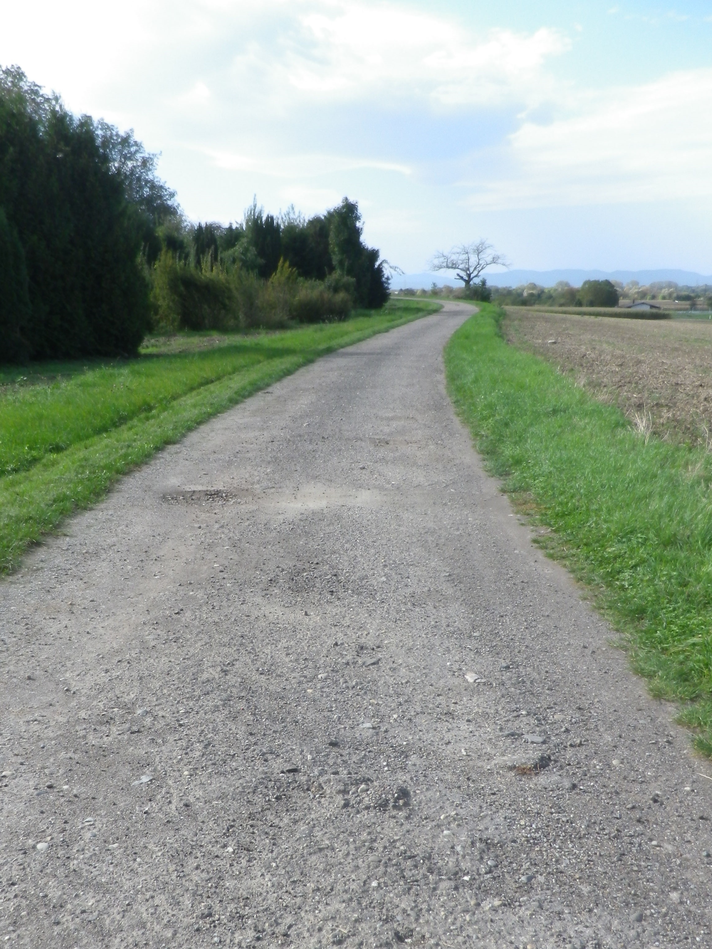
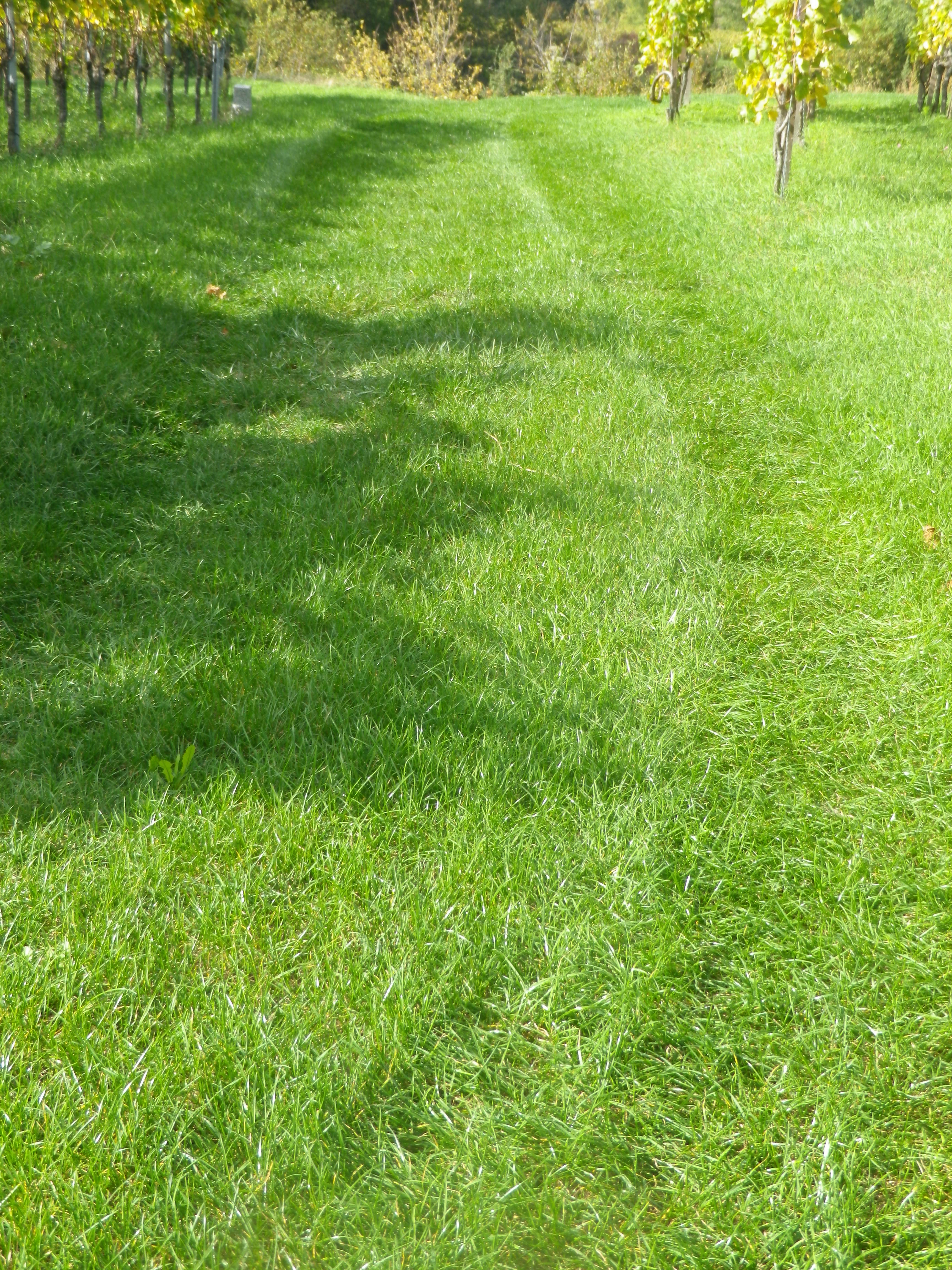
Trail Type: A short distance circuit; well-maintained and mostly hard-packed or paved with some grassy surface; marking on the trail fairly good, but a map could be useful.
Length:
Total – 7.4 kilometers/5.2 miles
Convenient to: Freiburg, Germany
Marking: A rectangular red background with a stylized white letter W, with a stylized white hut inside it
Trail Description: A gentle hike over modest inclines with well-maintained trail surfaces through vineyards and fields with the vintner huts throughout. Great views in all directions, but especially toward the Black Forest.
Trailhead:
Herbolzheim-Wagenstadt, August Ziegler Weg, by the Evangelical church
Parking:
Herbolzheim-Wagenstadt, Im Erb or Im Weiherle
Public Transportation Options:
Rail and Bus: Herbolzheim, and nearby Kenzingen, are two of the many stations on the main north-south train route through the Rhine River Valley. DeutscheBahn (DB) has many trains serving this area, and operates buses which serve the nearby villages like Wagenstadt.
Suggested Stages: Not applicable
Trail Itinerary-Reference Points: (Counterclockwise)
Herbolzheim-Wagenstadt: Kenzingerstr, Brechterstal, fields, vineyards, edge of forest, vineyards, Weingut Schaudt, Kenzingerstr, Ob dem Dorf, past the cemetery, vineyards, down a slope to trailhead.
Representative Trail Photos:
Restrooms:
None observed
Attractions on or near Trail:
None related to wine
Tasting along the Trail:
Three wineries are on the trail (but note hours), plus other wineries and taverns in the nearby towns Kenzingen and Malterdingen
Alternative Options:
Hiking: Nearby Ettenheim has the Weinwanderung Kaiserberg, a circuit similar in distance and landscape. See the Nutshell here.
Car: The Badische Weinstrasse, a car route of over 500 kilometers on mostly secondary roads, covers not only Wagenstadt, Bleicheim and Tutschfelden, but most of the wine villages and towns from Laudenbach, north of Heidelberg, to Weil am Rhein by Basel, Switzerland.
Additional Information:
Regional: https://www.schwarzwald-tourismus.info/schwarzwald/regionen/region-europa-park
Trail specific: https://www.alltrails.com/explore/map/rebhisliweg-wagenstadt
Comments:
Two trails actually, with a tiny bit of overlap, the Grosse, or long trail has red signage, and the shorter one (about 4.1 kilometers) has blue and yellow signage.
A pleasant trail, and I could recommend it for families with children of about six or seven and up.
The one grass covered surface section might not be mowed, which could be an issue in mid-summer. However, there are easily identifiable detours all around.
Anspruchsvoll – demanding, as in challenging, the one word I did not know in the German language online description of this trail. Everything else in the description was comprehensible, and seemed ideal – rural, mostly on trails, two Swiss cantons/wine districts- so what difference could the final word make?
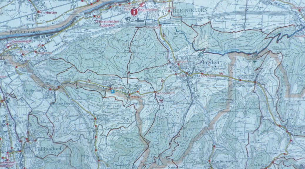
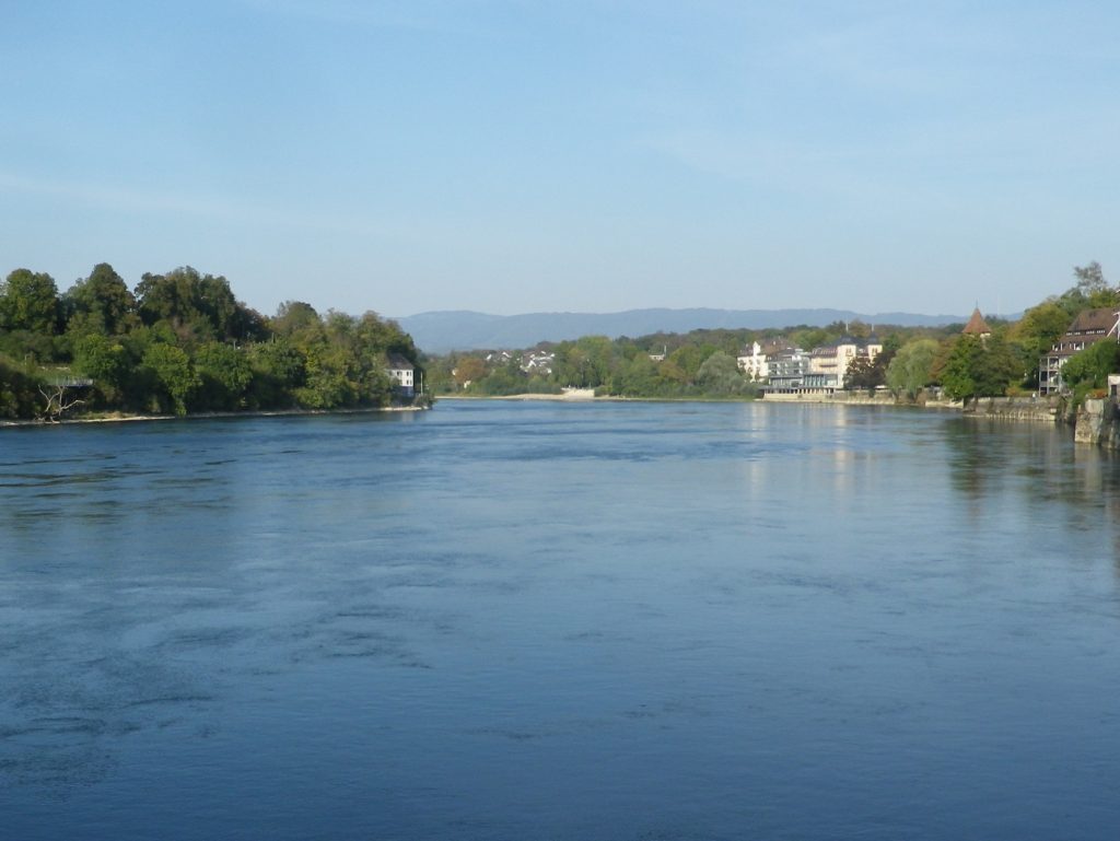
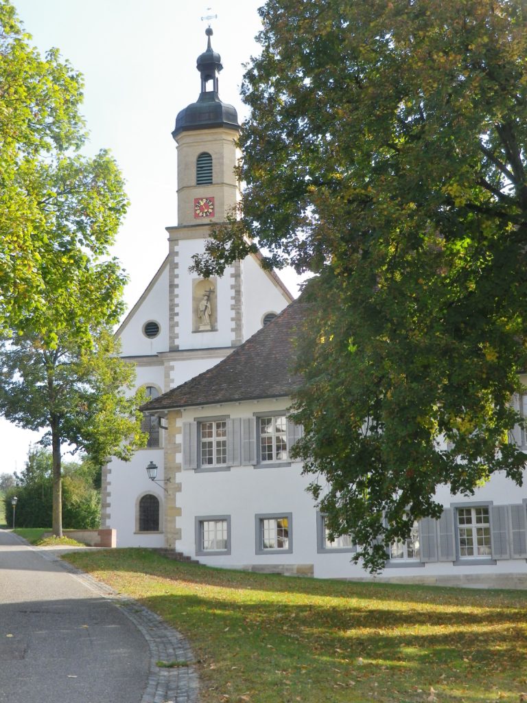
The Basel-Land vineyard area is found high above the Rhine River. To get there from Rheinfelden required a two-mile-long uphill climb. But while I felt like celebrating by the time I looked down on Olsberg and its famous former convent, looking toward the horizon, I realized that this would be a climbing itinerary.
By the third hill, I wondered about that one word. Being lazy (I had read it online, too lazy even to google translate!), I would not have ordinarily attempted this itinerary, as there were indeed mountains (albeit not the Alps) to cycle up – starting with the first one, the slog from the Rhine River, past the train station and along the lovely allee up to the official start point, and then some.
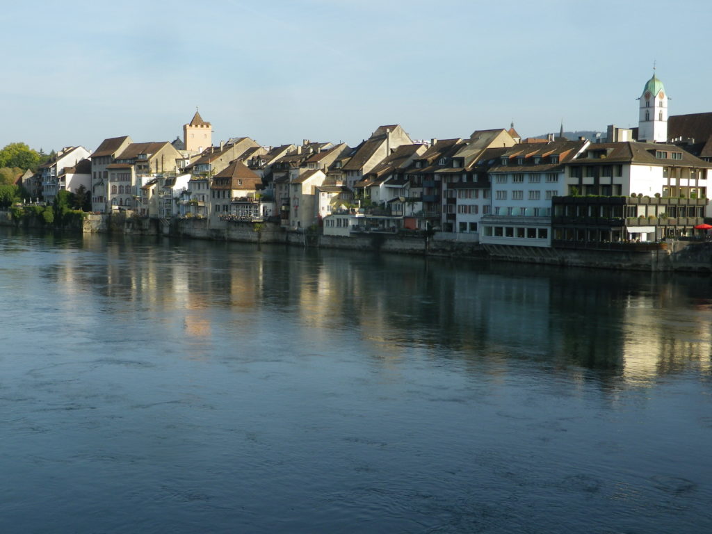
But being very determined, I also wouldn’t stop. So, continuing to follow the itinerary over hill and dale, I cycled past miles of pristine working farms, orchards and fields, all the way to Liestal, the only real town on the route. It lays in a narrow valley along the river Ergolz, a tributary to the Rhine. Its old town center still has a part of medieval wall with a tower. It would have been a good place to walk a bit to enjoy the sights at a snail’s pace, and to relax my thigh muscles.
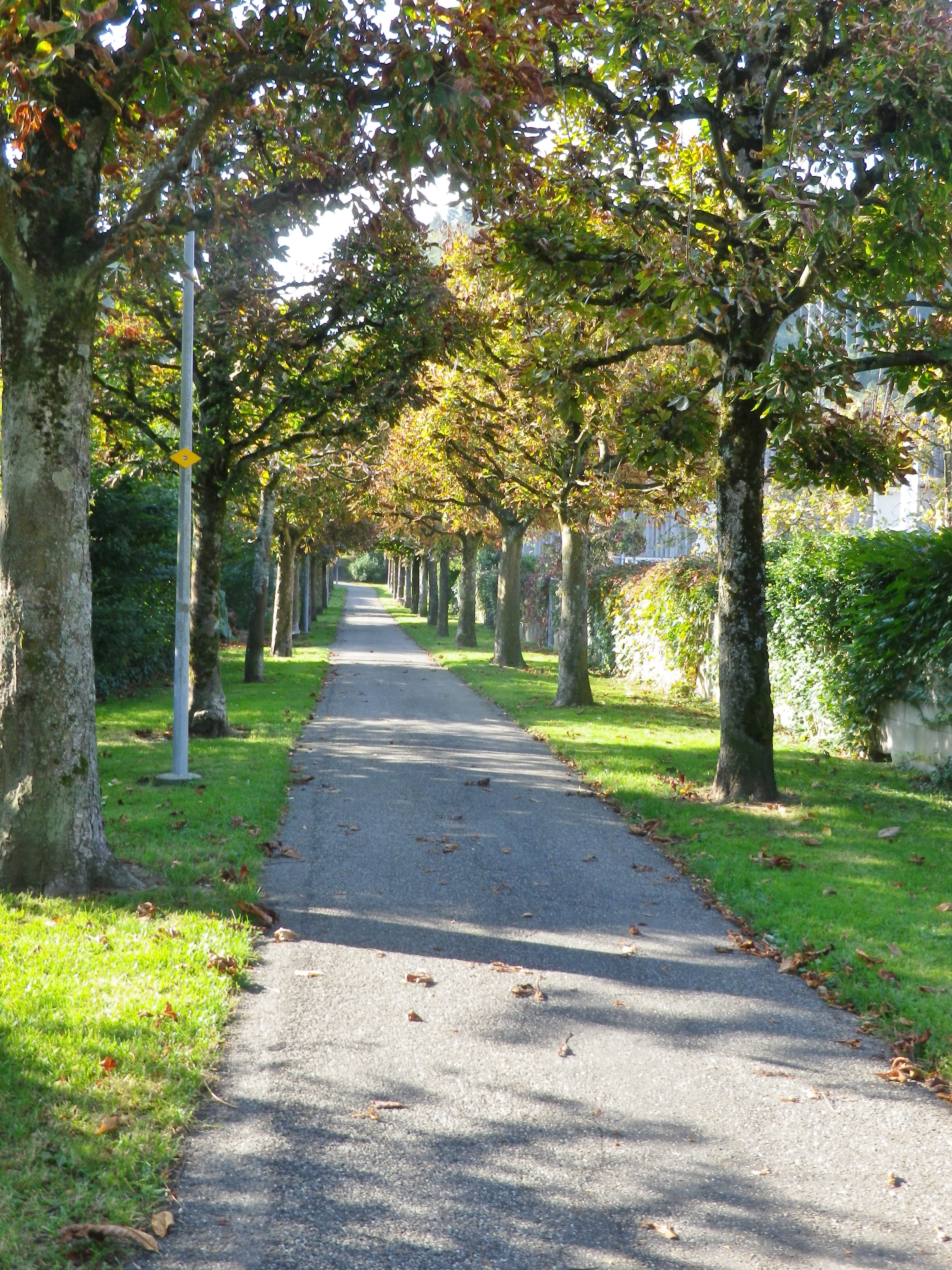
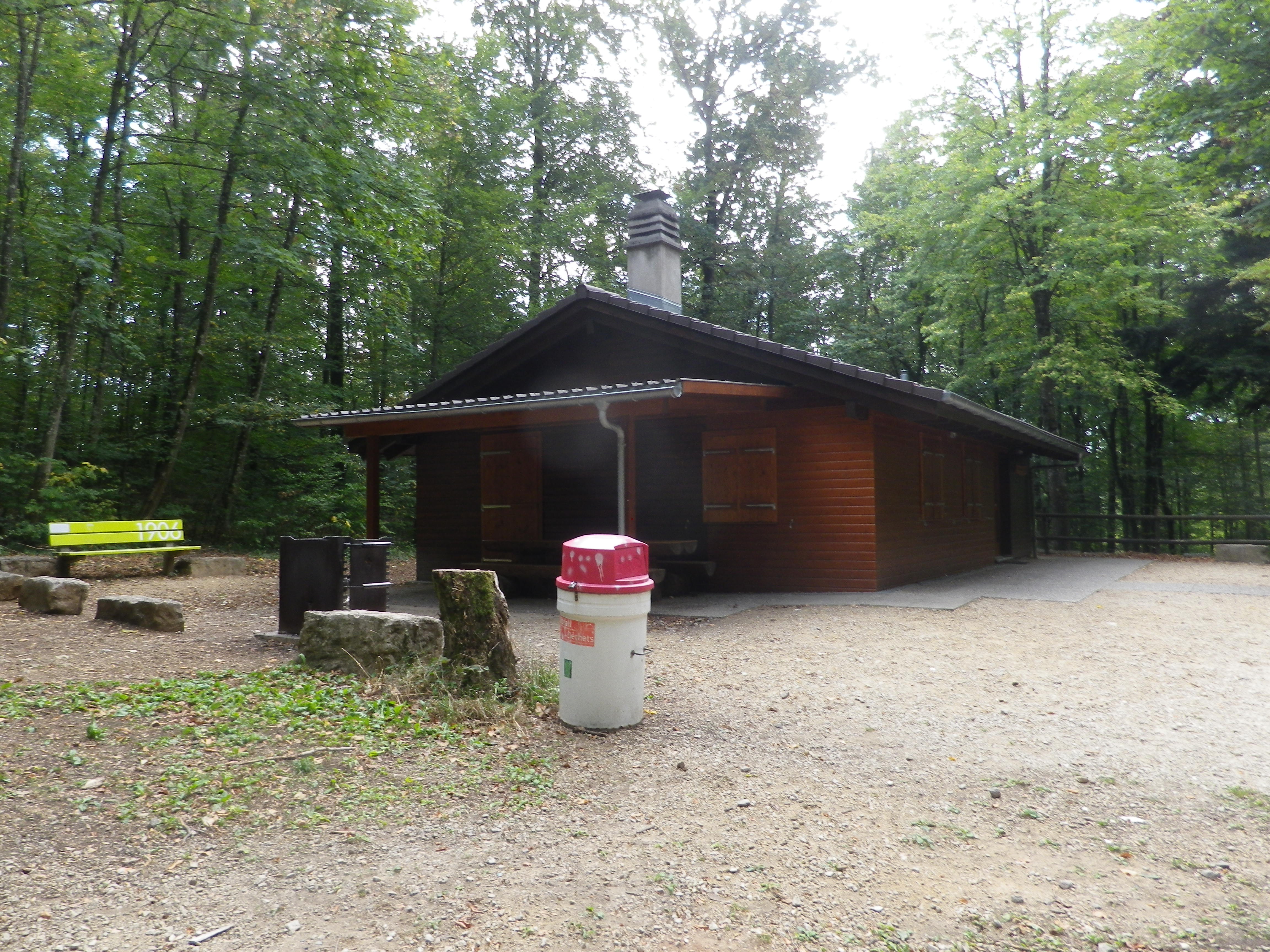
Instead, I found myself walking when halfway up the Brunneberg, as I risked rolling backwards downhill pedaling so slowly. While it was only about three-quarters of a mile to the Edleten Hut, this part of the itinerary was rather steep. The hut itself was typical of the hiking huts found in the German-speaking hiking world, with a nice overhang to protect against rain, a picnic table, and in a cool clearing in the middle of the woods. Almost at the very top, it was a great place to stop for a water break.
From this point on, the hills were easier. To reach Wintersingen, then Buus and the first vines I would encounter, I had to pass through Hersberg and Nusshof (uphill, again). Nuss means nut, the name giving an indication of what its claim to fame had been. Passing the village hall, the village flag on display showed three nuts, which turned out to be red hazelnuts. Maybe a lack of oxygen at this point caused me to hallucinate about the Piedmont, in Italy, where hazelnuts likewise grow in close proximity to vines, on similarly steep hillsides.
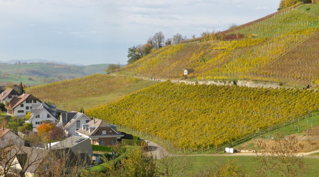
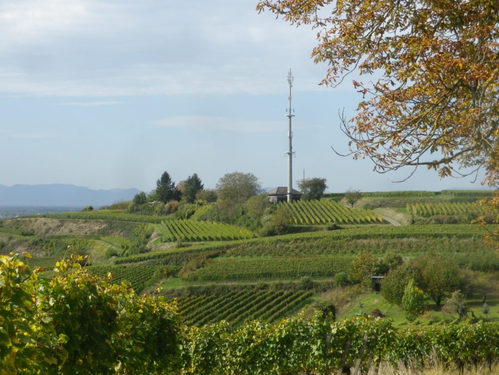
There is a climb out of Wintersingen, but rewardingly, it led to Buus, a village set quite attractively against tree-topped hills and vines in the sun. For the next few miles, vines predominated in this overwhelmingly agricultural landscape. And Maisprach seemed to be the center of viticulture for this part of the Basel-Landschaft wine district. The lush vineyards looked down from their lofty positions above the village. The little village was compact, and proverbially tidy. It even had a couple of eateries featuring local wines.
On leaving Maisprach, the itinerary leaves the Basel-Land canton. I was back in the Aargau, about to close the circuit, first going through Magden, then along a great shaded trail at the edge of the woods to the start point. But the best part for this lazy cyclist was the downhill gradient all the way to the Rhine, and my hotel!
What I Learned
Switzerland does indeed have vineyards, and produces its own quality wines under a system similar to the French appellation system. Only about two percent of all Swiss wine is exported, and most of that to neighboring Germany. Furthermore, the largest and best-known vineyard areas are in southern Switzerland, in the Cantons of Valais, Vaud and Ticino. Less well known are the wines of the Deutschschweiz, or German Switzerland, in the northwest corner of Switzerland.
The cycling itinerary I followed traversed vineyards in the Basel-Landschaft Canton, and the Aargau Canton, in the northwest corner of the Deutsche Schweiz. Like many places north of the Alps, viticulture in this part of Switzerland arrived with the Romans, and picked up again as Christian monasteries took root in the area. This whole history is neatly encapsulated in two towns lying side by side: Basel-Landschaft’s Augst, formerly the Roman colony of Augusta Raurica, with a large Roman era archeology site today; and the Aargau’s Kaiseraugst, an imperial stronghold and site of a monastic foundation in the medieval era.
Within the Deutschschweiz, there are several appellations, often named after the cantons. Both the Aargau and Basel-Landschaft cantons produce wines, which are bottled under eponymous appellations, albeit on a smaller scale than other Deutschschweiz cantons, like Schaffhausen or the Graubuenden. Both produce predominately red wines, as Pinot Noir is one of the primary red grapes grown here. Only about one third of the grapes are white, mostly Chasselas and Pinot Gris.
While there are plenty of vineyards, there were few wineries on the ground to visit (only about six along the whole route). As is often the case in smaller wine-producing regions, the local grapes are often vinified in a nearby cellar that will produce wine from the harvests of small, independent vineyards.
What I Tasted
2017 Blanc de Noir, Trocken, AOC Basel Landschaft, Siebe Dupf Kellerei (Liestal): A dry red grape (Pinot Noir) wine, vinified white; with pale gold color, fruity nose with ripe berry fruit flavors; very smooth, velvety mouthfeel, pure fruit flavor shines through with virtually no tannins or acidity TDA
2017 Pinot Noir, Maispracher Pinot Noir, Trocken, AOC Basel Landschaft, Siebe Dupf Kellerei (Liestal): A dry red wine with medium ruby red color; nose of vanilla and cherry and flavors of the same; medium tannins
Trail Name: Reben Tour
Trail Type: Mid-distance circuit bicycling itinerary; well-maintained with hard (paved or packed earth) surfaces; no marking for this itinerary.
Length:
Total – 40.7 kilometers/25 miles
Convenient to: Basel or Rheinfelden, Switzerland
Marking: None specific to the itinerary
Trail Description: While starting in a small city, this trail leads uphill to the hinterlands above the Rhine, through a variety of agricultural landscapes (orchards, fields, vineyards), as well as through forests and riverlands. No doubt the hills will be challenging to many, given the numbers of them, (even though the gradients never got above the 8-10 percent range), due to the length of some of them.
Trailhead:
Official: Rheinfelden: Olsbergerstr/Rueschelenhaldenweg x Bergweg
Mine: Train station to Alleeweg to the official start
Parking:
Rheinfelden center: None free, but parking garages and lots, one of each on Schutzenweg, closest to the trail;
Rheinfelden outskirts (Riburgerstr): Park and Pool (at the traffic circle) (24-hour restriction), Sportanlagen Schiffacker
Arisdorf: Parking Kaenelmatt on Kaenelmattstr
Public Transportation Options:
Information for both rail (Basel to Rheinfelden or Liestal), and bus services from these towns to the villages listed below, may be found at the Tarifverbund Nordwestschweiz (TNW) website at tnw.ch/fahrplan-liniennetz/online-fahrplan (as of October 2020)
Suggested Stages: Not applicable
Trail Itinerary-Reference Points: (Counterclockwise)
Rheinfelden: Forest trail, Rheinfelderweg, Rheinfelderstr; Olsberg: downhill through fields and vineyards, Hofgutweid, through Chloster grounds (formerly Olsberg Cloister), Hagachermatt, Hauptstr; Arisdorf: Arisdorferstr, Olsbergerstr, Hauptstr, Winkel, Kaenelmattstr, underpass beneath highway, fields, Arisdorferstr; Fuellinsdorf: Obererhofackerstr, down a flight of stairs at Obererhofackerstr x Huempelweg, Liestalerstr; Uetental: Uetentalweg, Suttenbergweg, Oberer Burghaldenweg, Erzenbergstr; Liestal: Gaststr, Rheinstr, path to Kasernenstr, Militaerstr, Kasinostr, over highway, Heidenlochstr; Lausen: Gartenstr, Weiherhofstr, Ringstr, Apfelhurststr-Edletenweg, up the mountain to Waldhuette Edleten, through woods for a while; Hersberg: Hersbergerstr, Hauptstr; Nusshof: Hauptstr, left onto Sissacherstr, Breitenhof path to Wintersingen; Wintersingen: Im Graben, Hauptstr, Buelweg, Dorfmattstr, fields, Rickenbacherstr briefly, then fields along the ridge overlooking town; Buus: Wiebentalweg, Hauptstr, Laigweg, path paralleling Hauptstr; Maisprach: Buuserstr, Magdenerstr, Hauptstr; Magden: bike path to Salzackerweg paralleling Hauptstr, Buenn-Sonnenplatz, Hauptstr, Bruelstr, Waldweg, Mooshaldenweg
Representative Trail Photos:
Restrooms:
Rheinfelden: Froeschweid, a pay toilet by the parking garage (Only one seen, and not on the trail!)
Attractions on or near Trail:
Nothing wine-themed, other than the tranquil scenes of vineyards!
Tasting along the Trail:
Magden, Maisprach Buus and Wintersingen all have taverns serving local wine, although hours are limited. Olsberg also has a tavern, the Weinresidenz, in the village center. The larger towns, Rheinfelden and Liestal both have lots of cafes and restaurants that sell wine by the glass, although they might not be local. Liestal has the Siebe Dupf Kellerei, which is a cellar vinifying grapes from local farmers, and has a shop open Monday through Saturdays all day!
Alternative Options:
Hiking: The 13-kilometer long Syydebaendel & Rebenweg, trail (not a circuit!) from Maisprach to Wintersingen, through mostly vineyards and fields.
Additional Information:
Regional: https://www.baselland-tourismus.ch/
Trail specific: https://www.baselland-tourismus.ch/erleben/velofahren-mountainbiken/ausgesuchte-velotouren/reben-tour
Comments:
A delightful, even if somewhat challenging, itinerary through this little-known wine area of Switzerland, with its peaceful, rural landscape.