

Boats on the Rhine


Paddling Along The Rhine

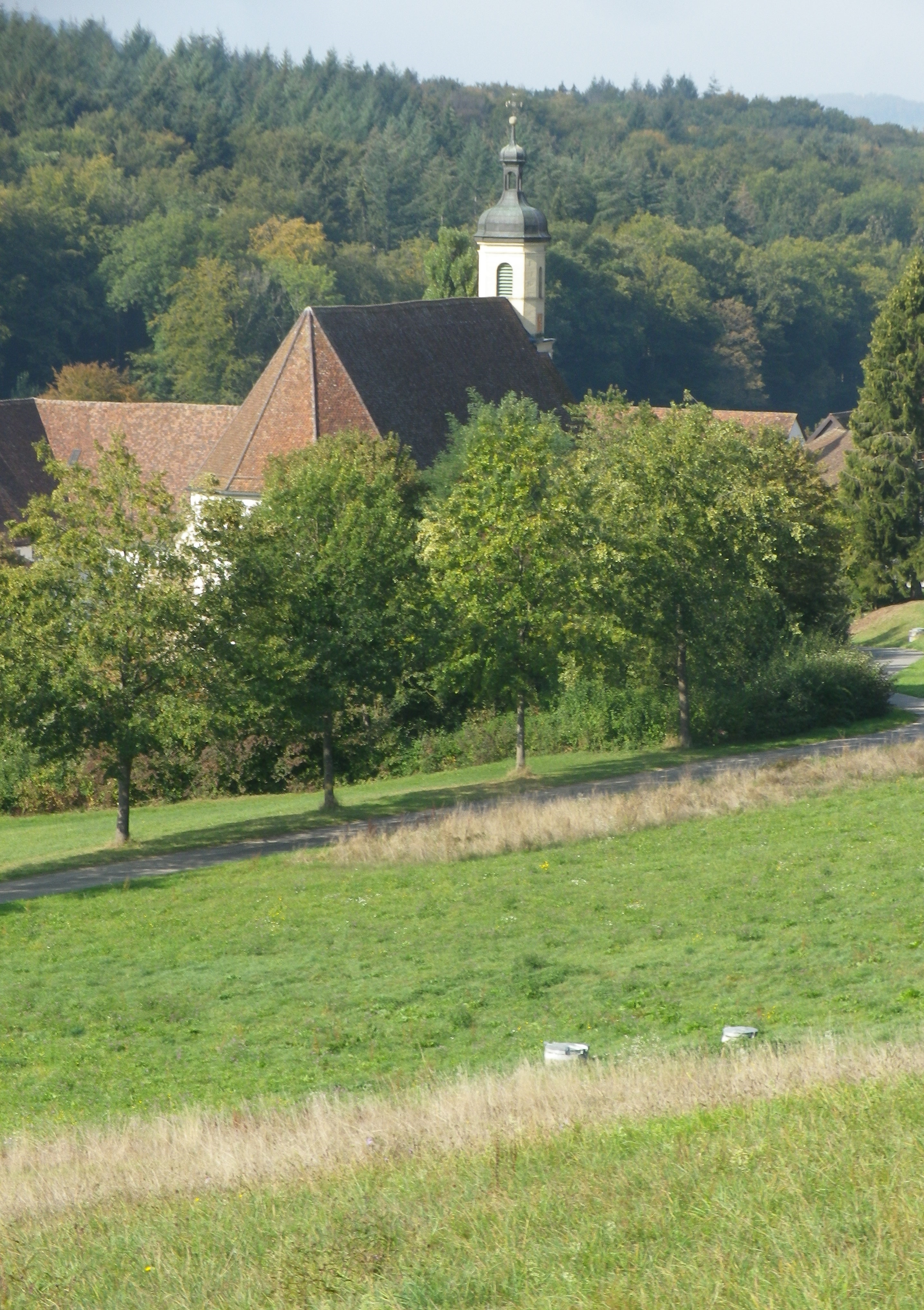
Buchberg: Iconic Church

Signs of Spring in March!

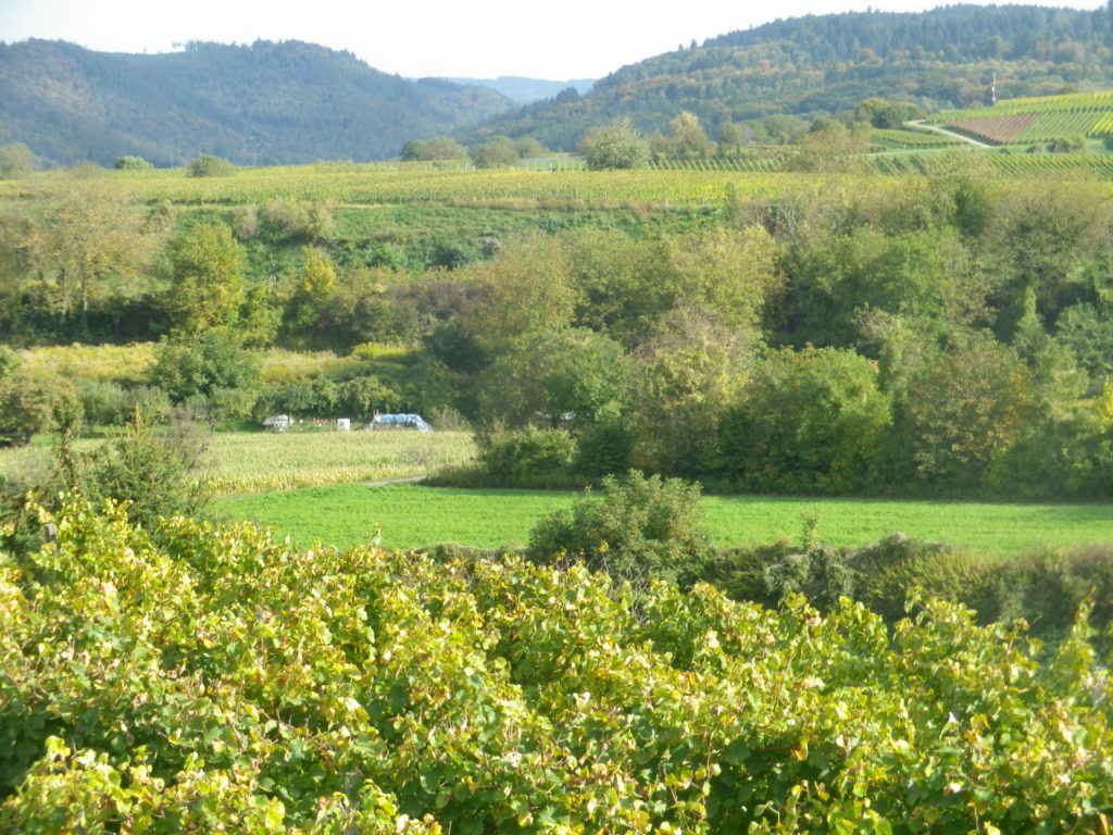
German Fields, Swiss Foothills

Jestetten: The Volkenbach
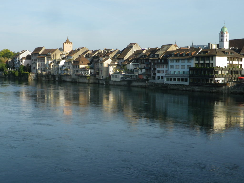
The city of Schaffhausen in Switzerland earned its fame as the city of the Rheinfall, where the Rhine River tumbles and falls with a deafening roar over boulders as it curves through the cliffs lining the river. It is also the leading city of the canton, and the vineyards around it, and in nearby Hallau, and downriver, are also named after this city. Although it has these and several other claims to fame, it is not a heavily visited area on the Rhine.
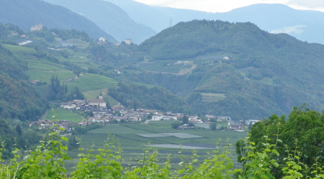
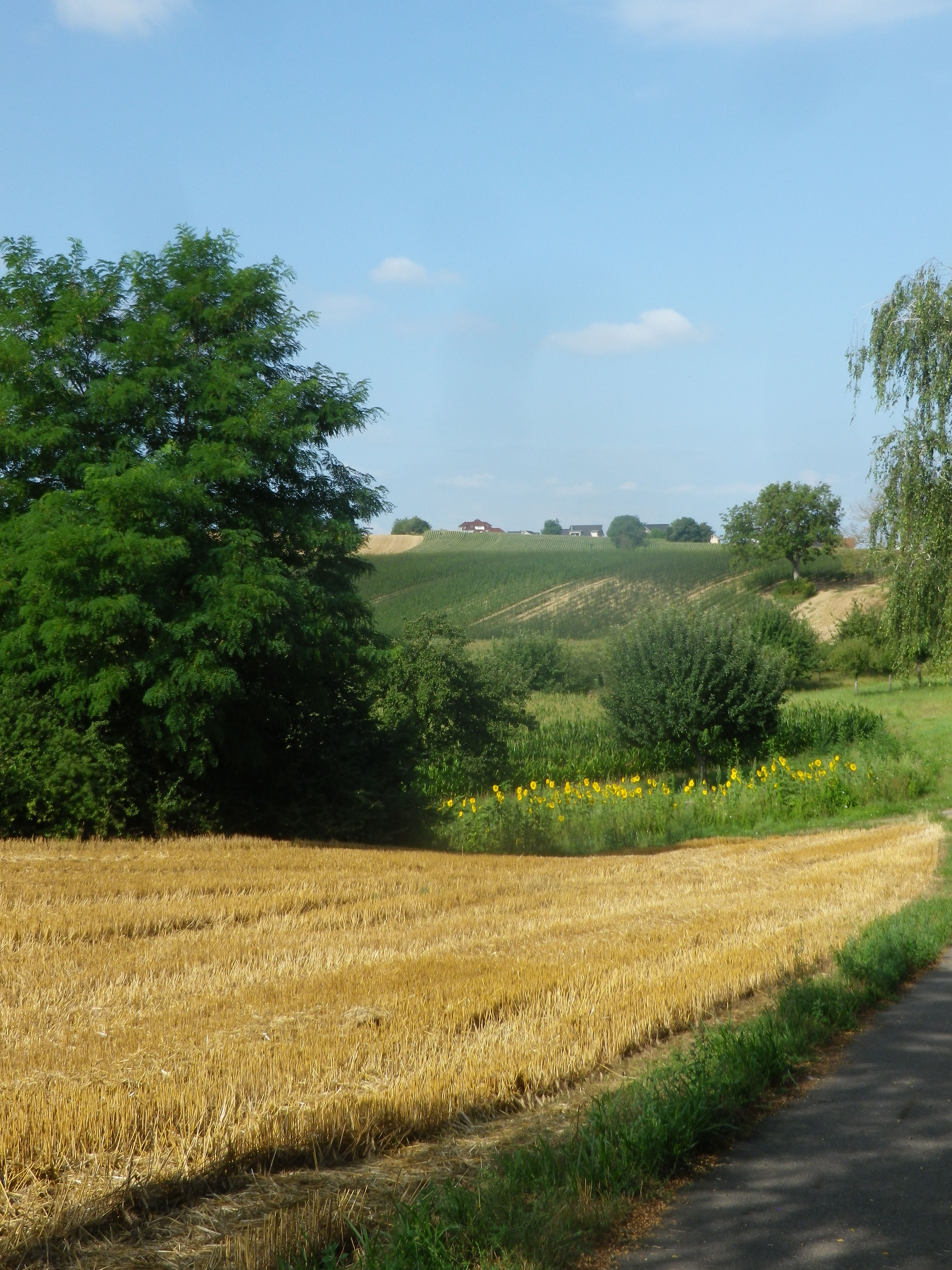
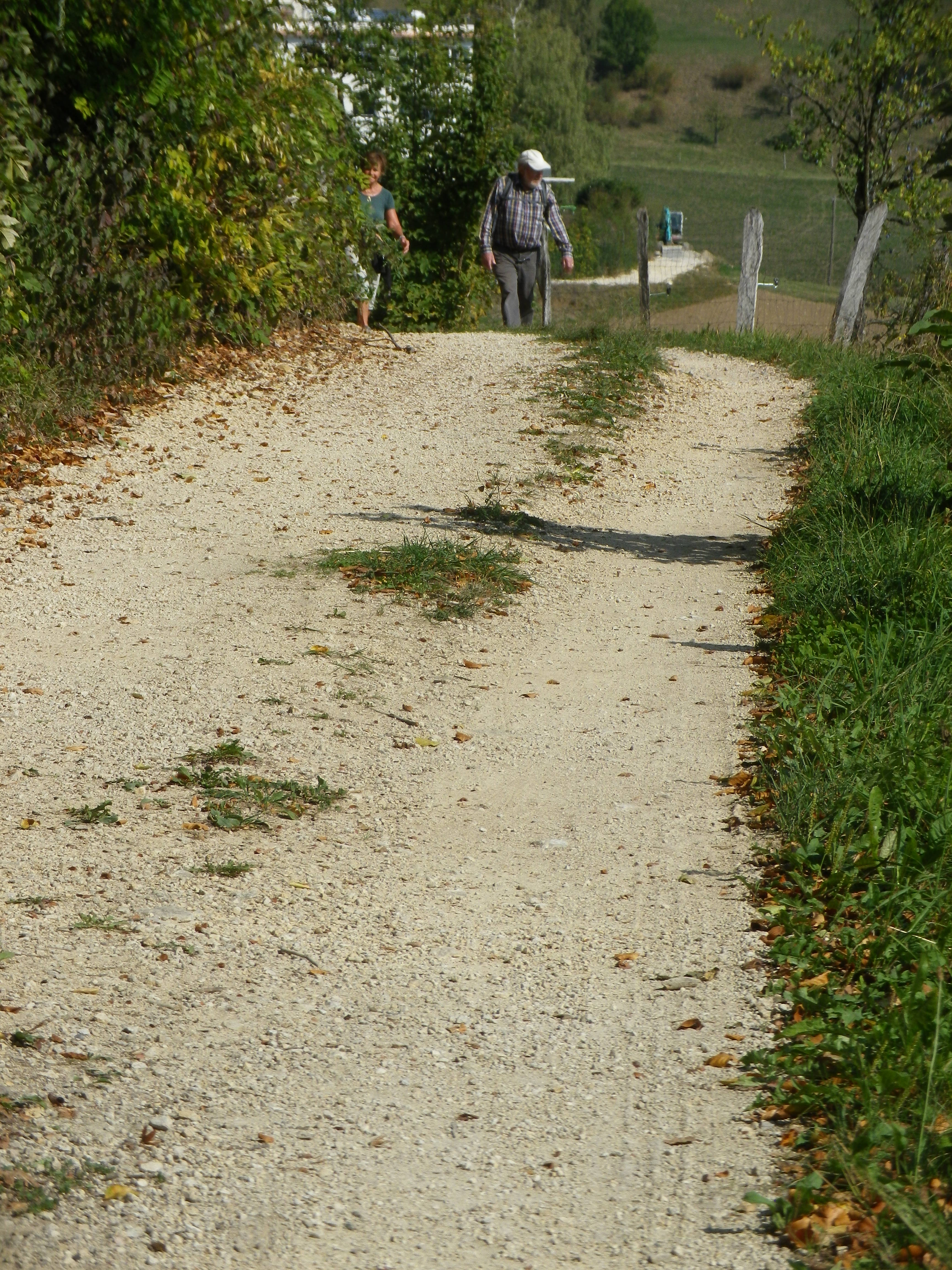
I made a quick visit to this canton in 2019 to complete a hike. It was an easy one, through largely flat terrain as it mostly meanders along the Rhine River. It starts in the German town of Jestetten, a pleasant little town to visit, set amongst the farms of this rural district. Along with the villages of Lottstetten and Altenburg, and the hamlets of Balm and Nack, Switzerland almost completely surrounds this enclave of Germany on the right bank of the Hochrhein (High Rhine).
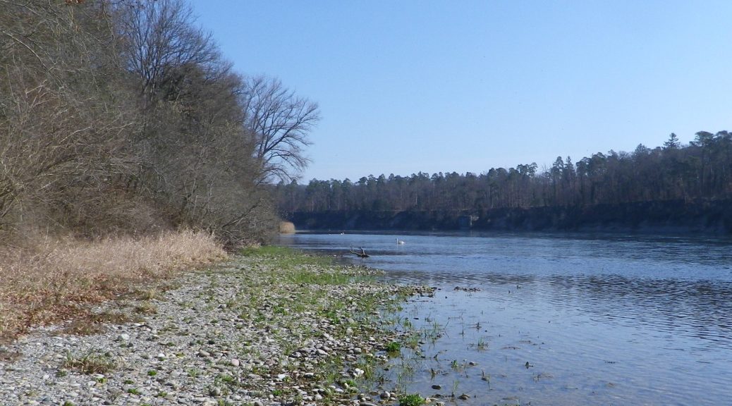
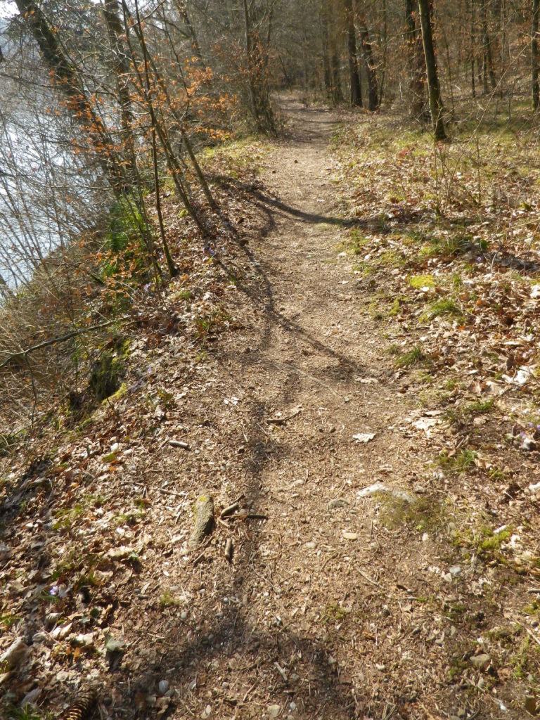
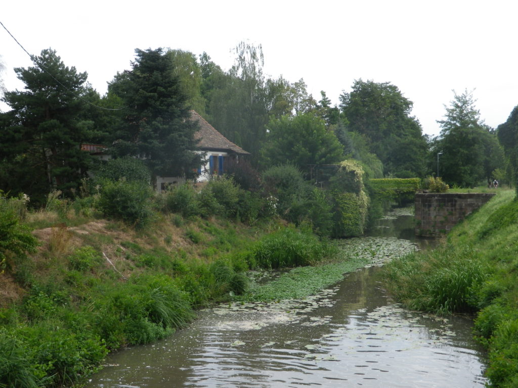
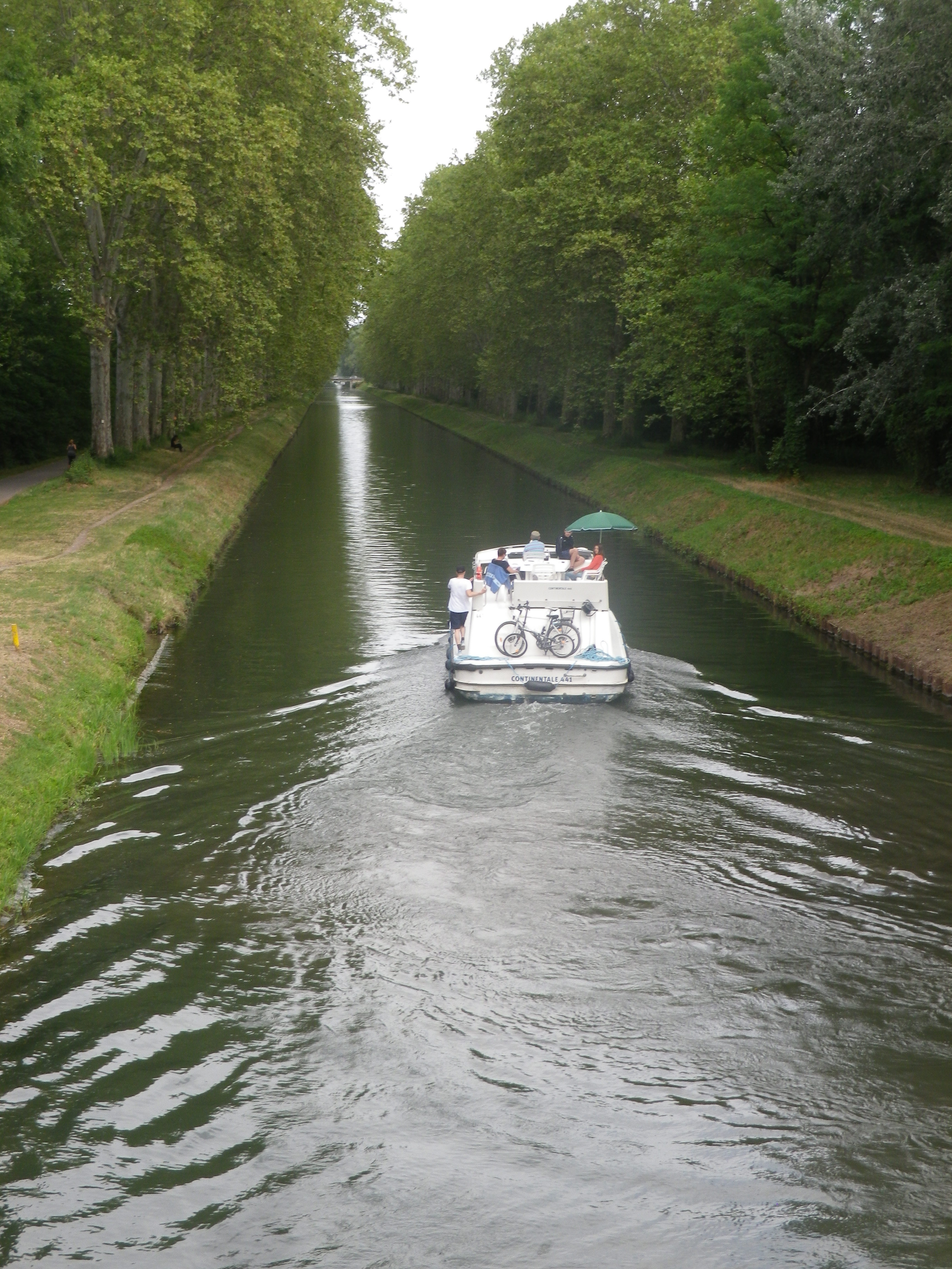
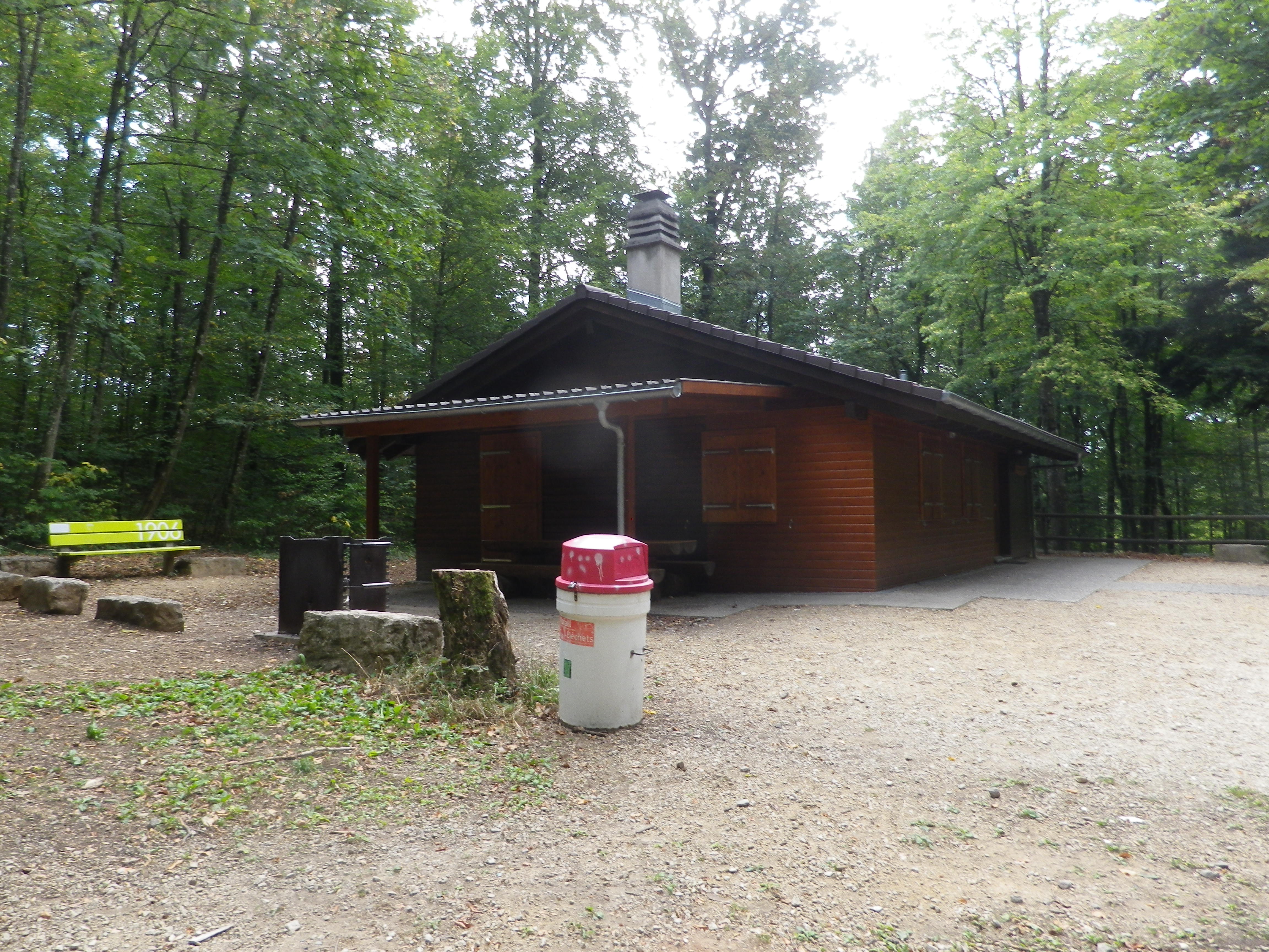
A steep descent to the “Roman” bridge (built circa 1696), led to the Volkenbach, a creek set in a dramatically narrow ravine. After climbing out of the ravine, the trail continued through woods, then fields. After Balm, the trail followed the Rhine in earnest, mostly through woods, with trees dedicated to former forest wardens, and bigger-than-life carved wooden fish commemorating generations of anglers, I suppose. For about seven kilometers (4.5 miles), the quiet sounds of riverine life prevailed: waves lapping against the shoreline stones, ducks and swans paddling through water, the occasional fish splashing about.
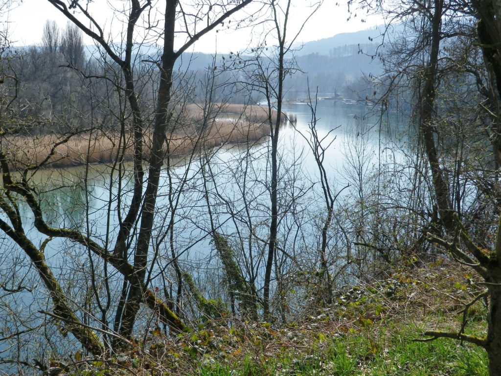
As soon as I crossed into Switzerland, a quirky sign of civilization appeared in the form of a bell. The accompanying sign warned would-be passengers to ring loudly for the ferry. On the opposite shore, in Ellikon am Rhein, were two little water-front restaurants or taverns. But at 10:30 the taverns were not yet open, so I sadly continued following downriver.
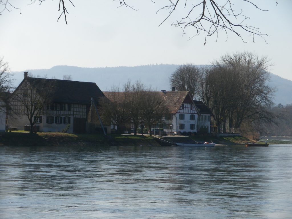
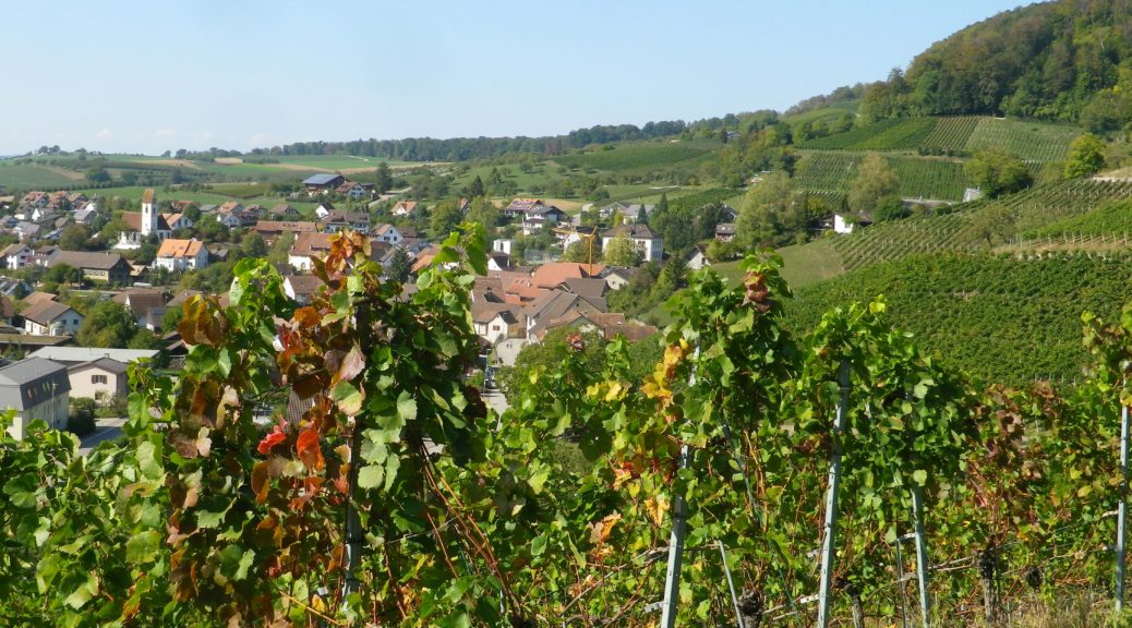
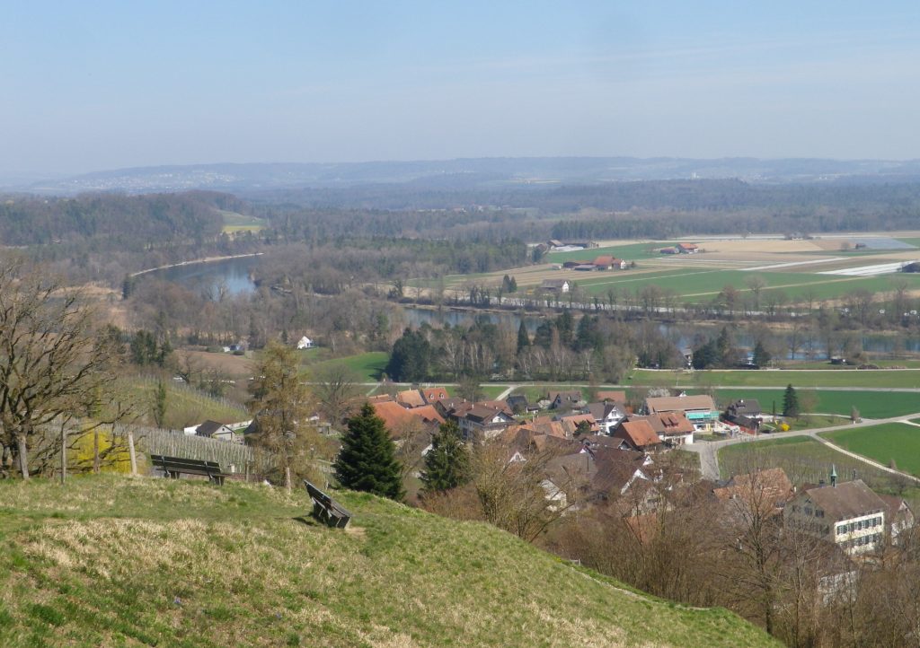
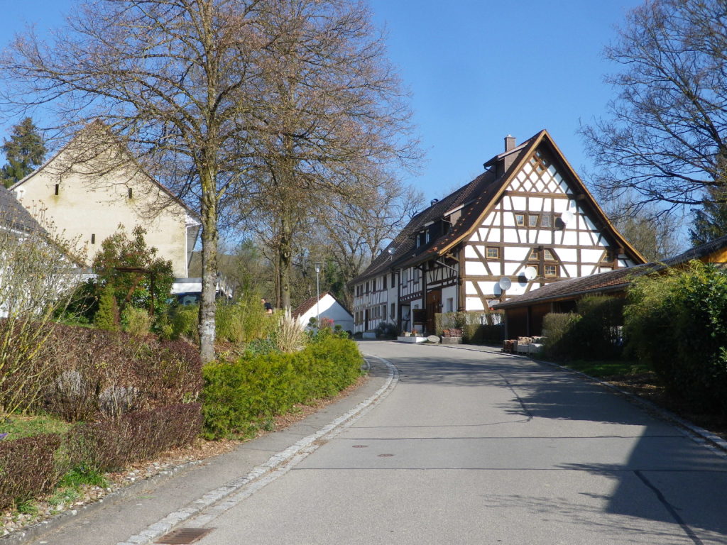
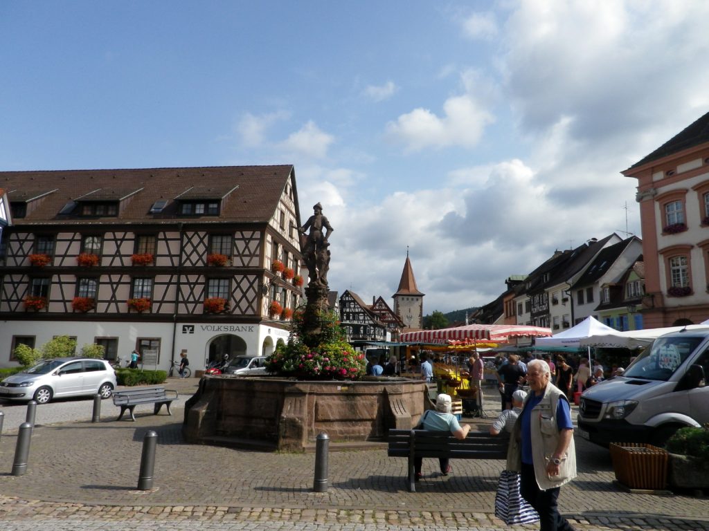
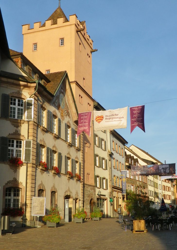
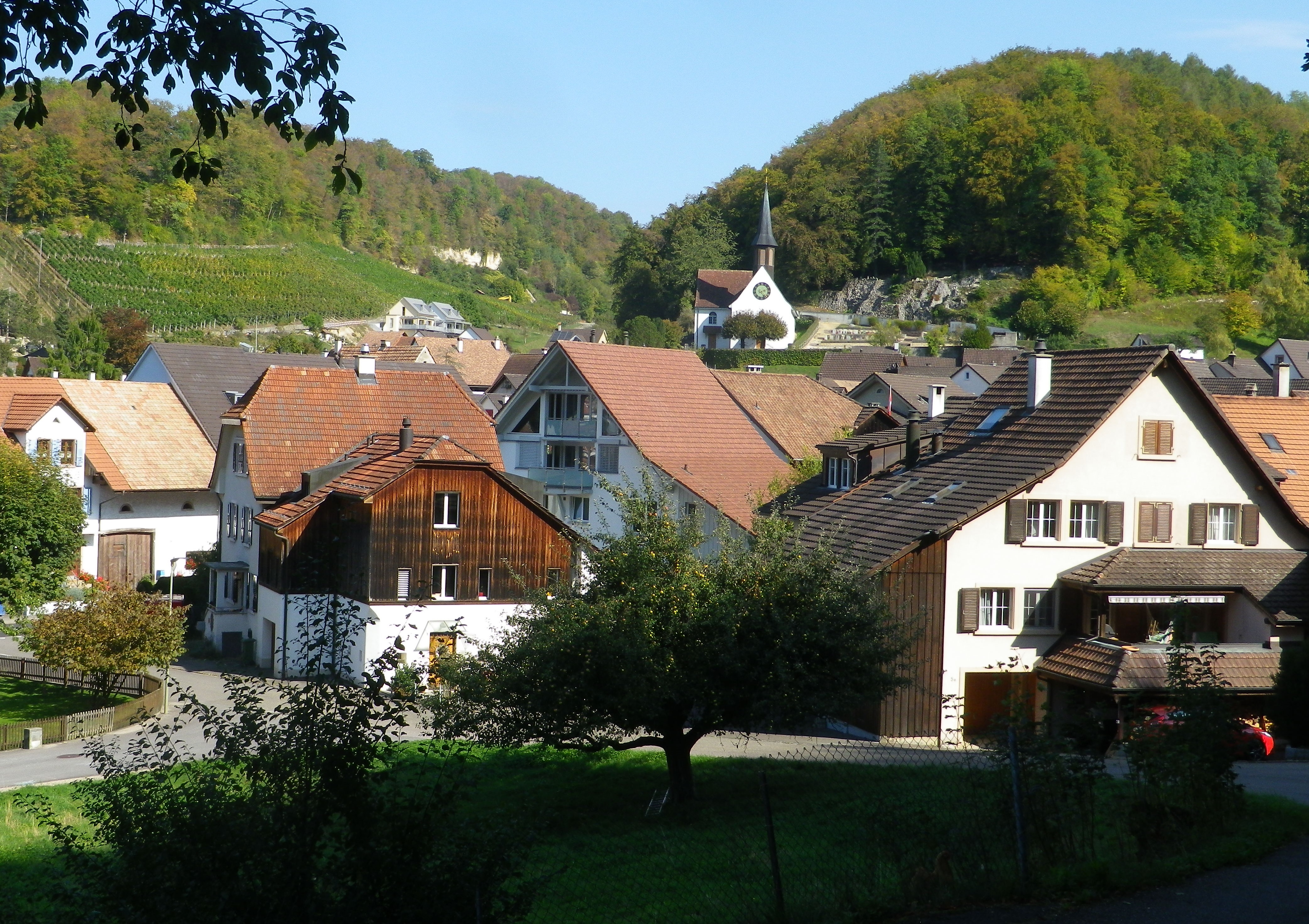
Just before the bridge crossing the Rhine (one of the few in this area), the trail cut away from the river, and quickly entered Ruedlingen. It was a small village, more like a settlement of farming families. It had an interesting center though. Set as it was against the steep Buchberg hill, at a curve in the Rhine, it seemed ideal for day-trippers to visit.
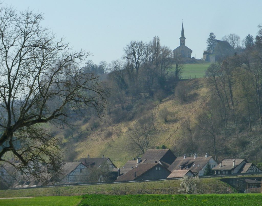
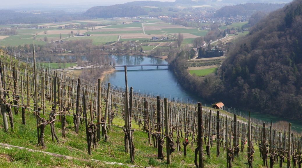
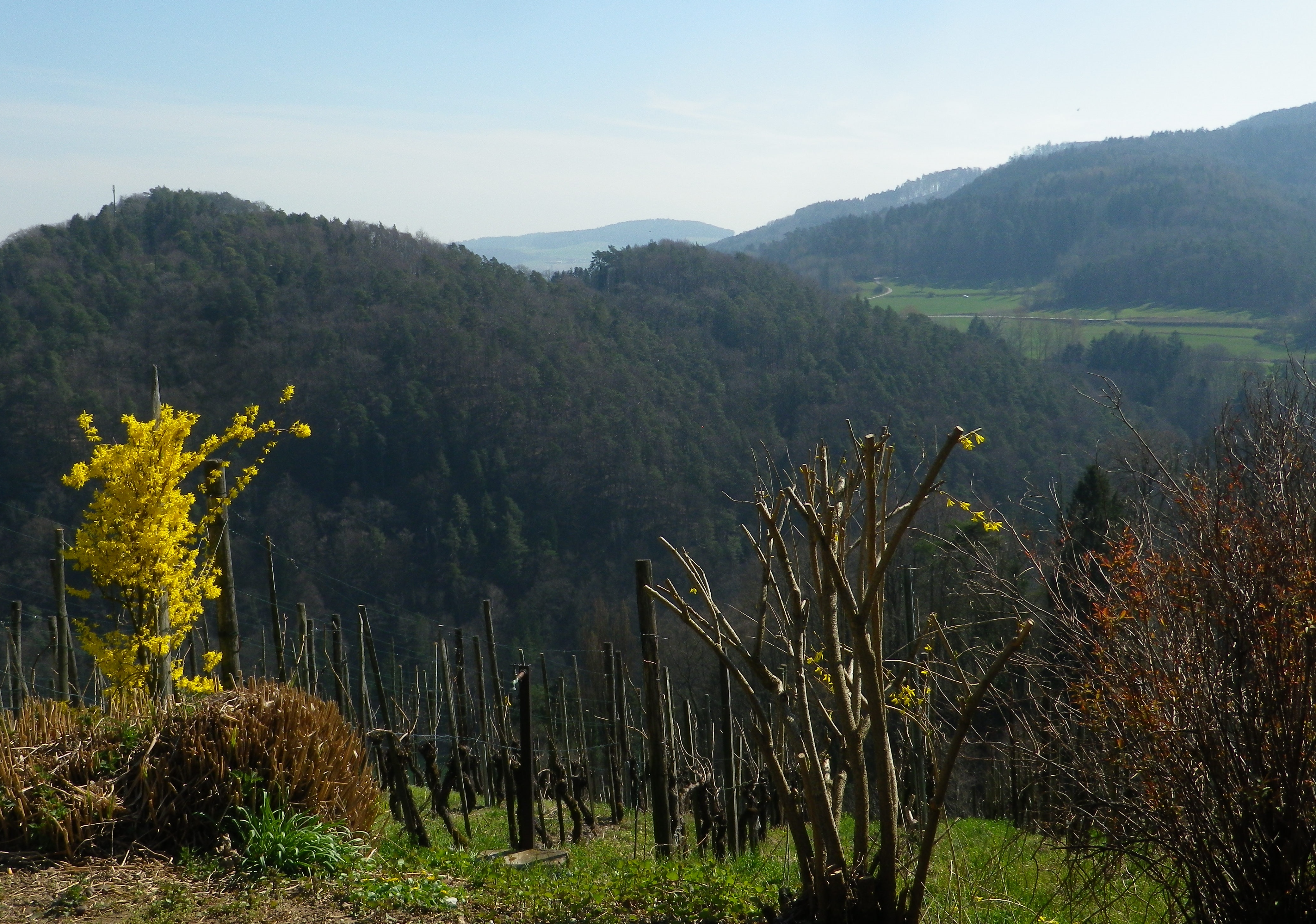
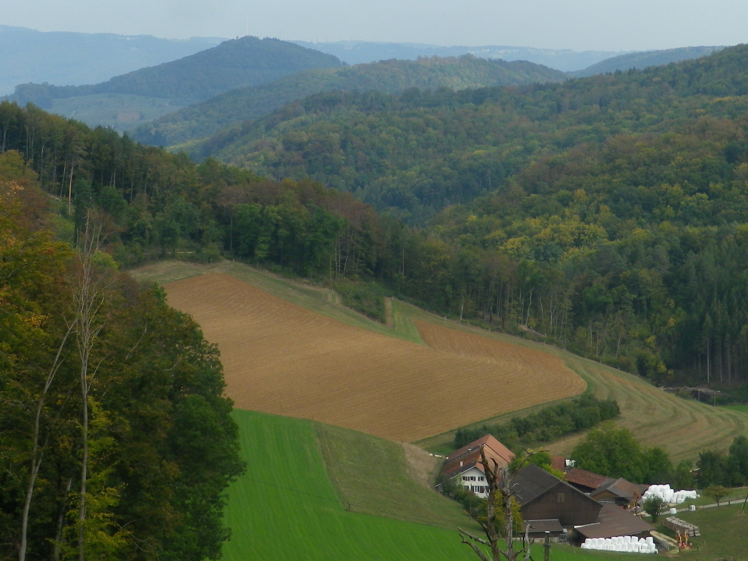
The ascent up the Buchberg was through vineyards. These were the last vineyards in the Schaffhausen Canton. They lie in a completely self-contained enclave of the Schaffhausen Canton within the Zurich Canton. The Baden wine region vineyards of Lottstetten lie to the north of them; the Zurich Canton vineyards surround them to the east and west.
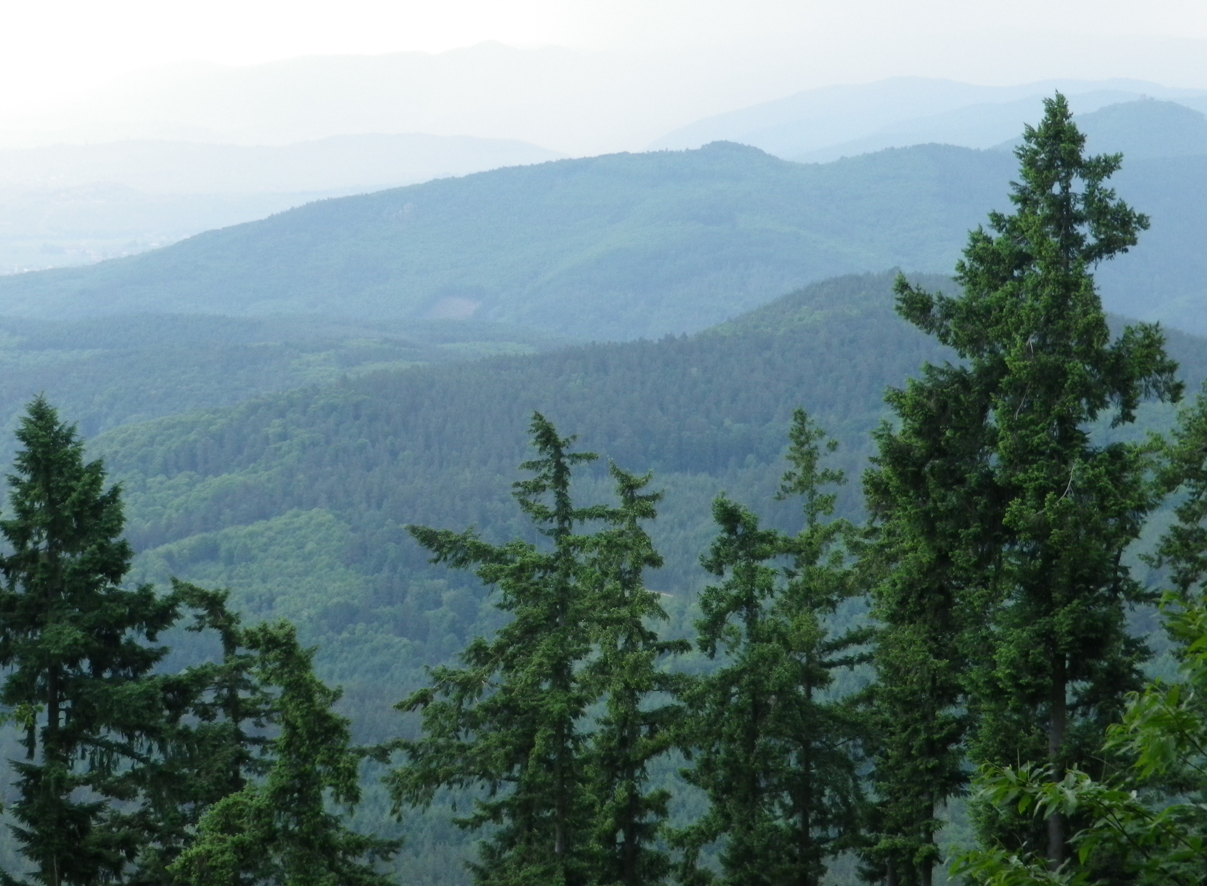
South though, lay steep hills (maybe mountains). Heavily wooded and appealing after the flatter lands by the river, they presaged an unseen Alpine presence less than 50 miles away. Those hikes will have to wait, but in the meantime, there is some Swiss wine to enjoy!
What I Learned:
In Germany, the Steinler in Nack, a hamlet south of Lottstetten, the Kapellenberg in Erzingen to the northwest of Nack, and the Oelberg outside Hohentengen to the southwest of Nack, are the vineyard areas in this remote pocket of the Baden-Wuerttemberg. With no grossanlage, the labels on local wine bottles simply designate the name of the wine region: Baden. The small Steinler vineyard is the only one in this Jestetten/Lottstetten area, and I could only catch glimpses of its south facing vineyards from time to time. Nevertheless, the local Weingut Clauss in Nack enthusiastically produces some very good wines.
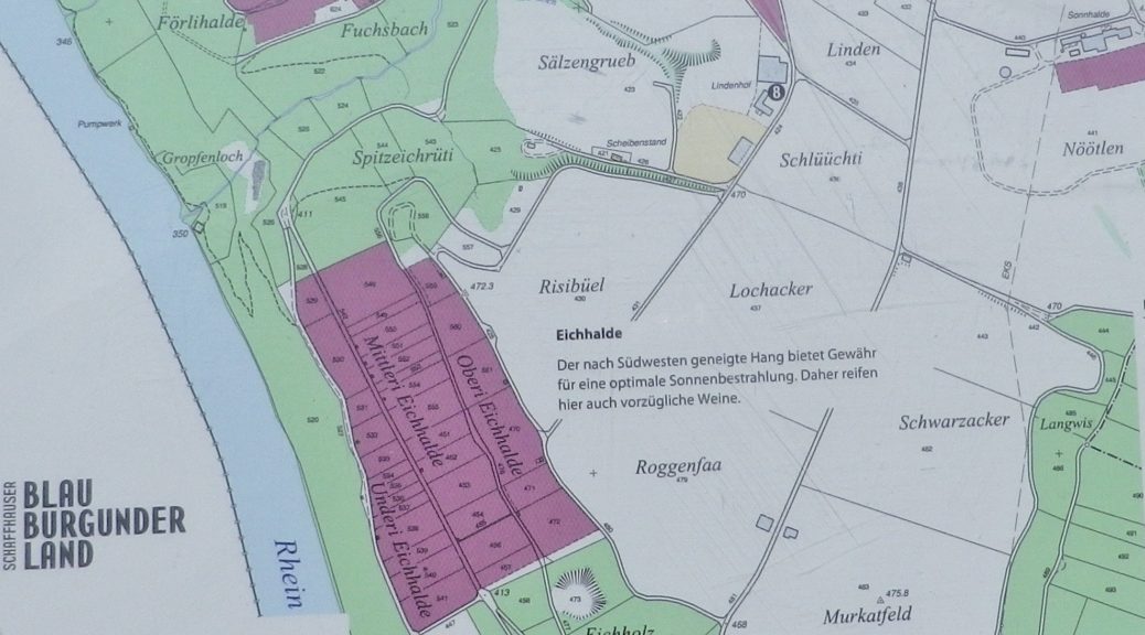
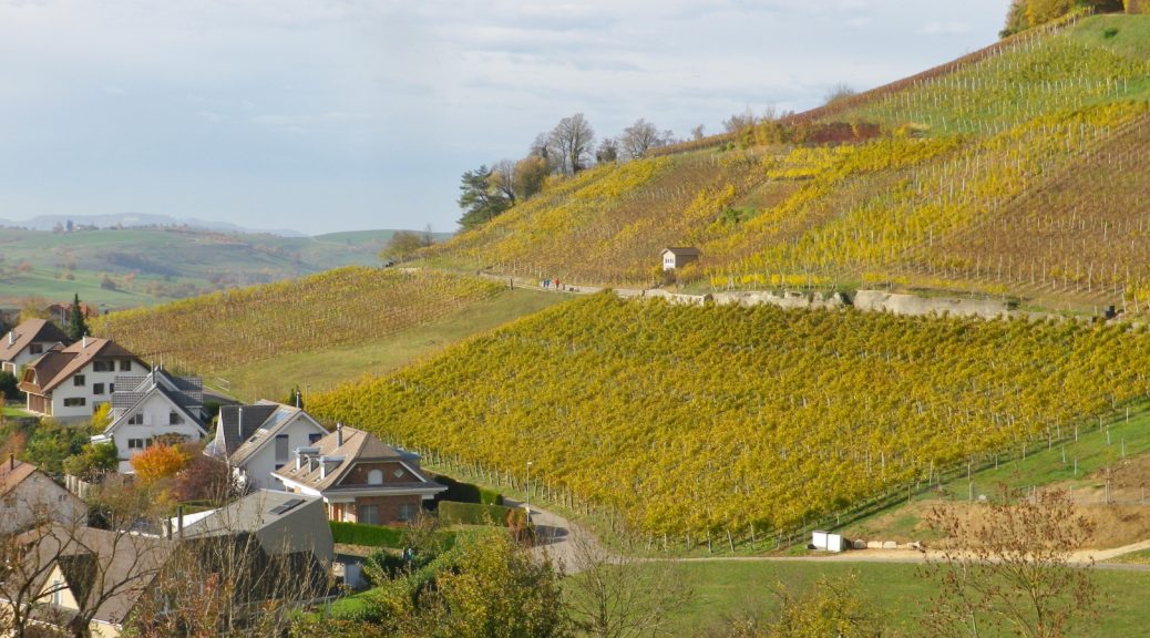
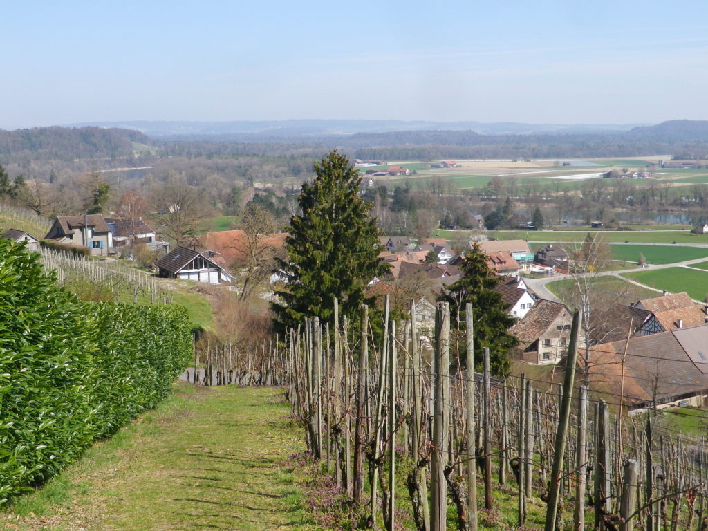
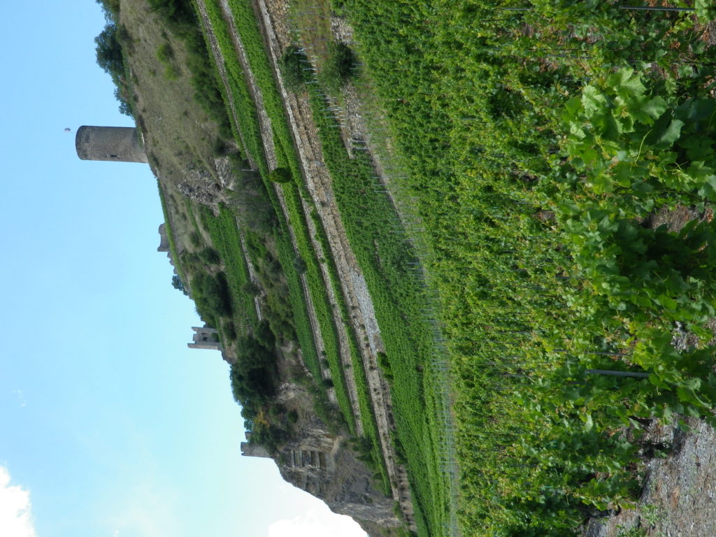
Only two miles away, the Swiss vineyards in this area begin in the village of Ruedlingen, and continue up to the top of the hill to Buchberg. These vineyards visited fall within the Schaffhausen appellation. Buchberg is the southernmost village in the Schaffhausen canton, therefore it automatically has the southernmost vineyards in the appellation. While about one-eighth of the grape vines here are Mueller-Thurgau, known locally as Riesling x Sylvaner (yes, with the “y”), the vintners here grow the Blauburgunder (Pinot Noir) varietal more than any other. In fact, the Schaffhausen appellation area is known as “Blauburgunderland” (Pinot Noir Country).
In Buchberg especially, the vineyards are ideally sited on steep, south-facing terrain, directly overlooking the Rhine River. However, true to my experiences in Switzerland, none of the wineries, and only one tavern (in Ruedlingen) was open on the day I was there!
What I Tasted:
2017 Grauburgunder (Pinot Gris), Belemnit, Qualitaetswein, Trocken, Weingut Clauss (Nack, Germany): A dry white wine with medium gold color; fruity and spicy nose, with peach and vanilla flavors; medium plus acidity.
2017 Ruedlinger, Riesling x Sylvaner, AOC Schaffhausen, by Peter Matzinger, local grower, (Ruedlingen, Switzerland) with Gebrueder Kuemin Weinbau (winery) (Freienbach, Switzerland): A dry white wine with medium minus gold color; neutral nose with a hint of citrus, with vanilla and citrus flavors, with a hint of nuts; medium acidity, and a belatedly tart finish.
2017 Spaetburgunder (Pinot Noir), Nacker Rose, Qualitaetswein, Trocken, Weingut Clauss (Nack): A dry rose wine with dark minus salmon color; slightly fruity nose, with sweet cherry and slight smoke flavors; medium tannins
2017 Spaetburgunder (Pinot Noir), Nacker, Qualitaetswein, Trocken, Weingut Clauss (Nack): A dry red wine with dark minus ruby red color; sweet dark cherry wood nose and flavors, with a hint of tar; medium tannins, and a smooth finish.
Trail Name: Rhein Reben Route (Rhine Grapes Route)
Trail Type: Mid-distance trail; well-maintained and almost exclusively hard surfaces, no trail-specific marking for this trail, although there are the standard directional and distance (or time) markers.
Length:
Total – 13.5 kilometers/8.4 miles
Convenient to: Schaffhausen, or Zurich, Switzerland
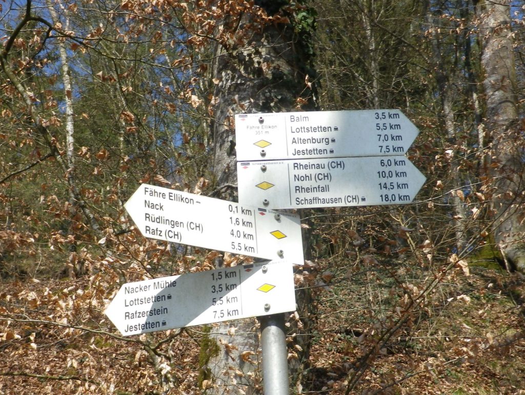
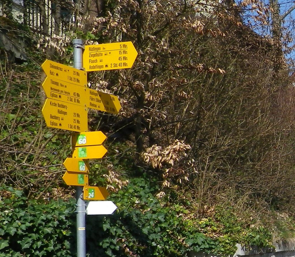
Marking: No trail-specific signage. Directional signs only follow (See comments below)
Trail Description:
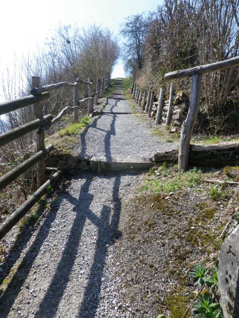
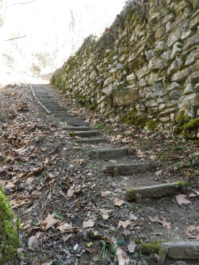
Following mostly along the Rhine River’s edge in a little-known corner of Germany and Switzerland, this very easy trail, with only two short but somewhat steep inclines, offers variety in the landscape, tranquil scenery, and often shady paths.
Trailheads:
Jestetten, Germany: Saarstr (x Bahnhof) (start)
Buchberg, Switzerland: Dorfstr (end)
Parking:
Jestetten, Germany: Bahnhofstr (by station)
Buchberg, Switzerland: by the church
Public Transportation Options:
Rail: S9, Schaffhausen-Jestetten-Uster, stops in Rafz, (about 4 kilometers distant, but the closest to Buchberg)
Bus: Zurcher Verkehrsverbund, (ZVV), runs a frequent and direct bus service to Rafz on ZVV Bus 675
Suggested Stages: Not applicable
Trail Itinerary-Reference Points: (North-South/Upriver-Downriver)
Jestetten, Germany: Saarstr, Altenburger Str, Im See; Cross the Volkenbach; through woods and fields; Lottstetten: Cross Weiherweg, Balmerstr, along river (and mostly through wooded terrain) for a while; Ruedlingen: past parking lot on river; cross Rafzerstr, past water treatment plant, Chratzeren, Hinterdorfstr, Sustenstr, Schuelwegli; vineyards, Buchberg, Switzerland: vineyards, Church, Dorfstr
Representative Trail Photos:
Restrooms:
Jestetten, Germany: Bahnhofstr x Saarstr, by the station
Ruedlingen, Switzerland: Chratzeren, at the water treatment facility
Attractions on or near Trail:
Tasting along the Trail: Café Rebe, Buchberg, Dorfstr 22; Besen-Beiz, Buchberg, Lindenhof (after 4 Apr 19)
Alternative Options:
Bike: Rhein-Route 2, Stage 7 (Schaffhausen to Bad Zurzach), a 53-kilometers (33 miles) bicycle itinerary covers this territory and more, following mostly along the Rhine River.
Additional Information:
Regional: https://schaffhauserland.ch/en/
Trail specific: https://www.outdooractive.com/de/wanderung/schwarzwald/rhein-reben-route-im-naturpark-schaffhausen/20734468/
Comments:
An option to cross the river by a small ferry is possible opposite Nack. (Look for the bell to ring to summon the ferry from the far side of the river.) There are not one, but two, water-side eateries there to slack the thirst and sate the hunger of hikers, bikers and boaters!
In Switzerland, instead of distance, the required time is usually indicated. (And in my experience, represents a healthy pace.)
Like last month, the pandemic has left me without many cycling options for 2021. Therefore, I would like to take the time this month to note some of my favorite cycling itineraries passing through vineyard areas in Europe, in the hopes that someday soon, we can all get out there again to enjoy outdoor and wine tasting adventures with friends!
No boundaries! See great wine producing districts on both sides of the Rhine.
The Activity: Cycling a 235-kilometer-long circuit, the Romanik und Wein/Style Roman et Vin
Why this one: This cycling itinerary offers great diversity: From Black Forest Mountains to the Vosges Mountains, through bucolic fields, woods, and vineyards of course, through hamlets, picturesque villages and the city of Strasbourg, passing from easy, to moderate, to more challenging cycling segments. Cyclists will discover quiet, charming, unspoiled locations in which to take a break, and enjoy the atmosphere. Then comes Strasbourg, with its almost overwhelming sights and opportunities for food, wine, cultural events and people-watching from numerous cafes. Finally, while there is some street riding (although very little of it through Strasbourg as this itinerary passes through the city’s extensive pedestrian zones), much of this itinerary is vehicle-free, using agricultural access lanes, bike paths and even canal tow paths, repurposed and maintained (!) for bicycles.
Caveats: I did not cycle the segment between Wasselonne and Hagenau because this area has no vineyards and it had the most street-riding along the whole itinerary. Therefore, I cannot address any issues there. Most cyclists would require at least three days to complete this circuit, cycling at least 78 kilometers/48 miles a day.
Winning Wine Discovery: Two very different wine cultures and both are delicious!
From East to West:
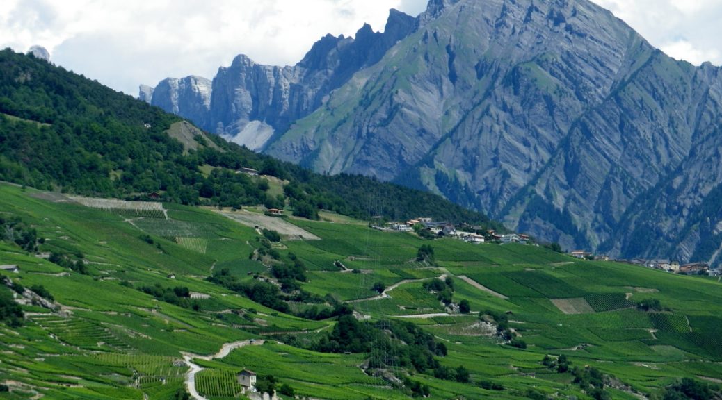
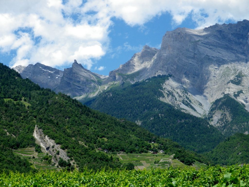
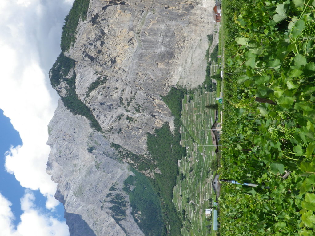
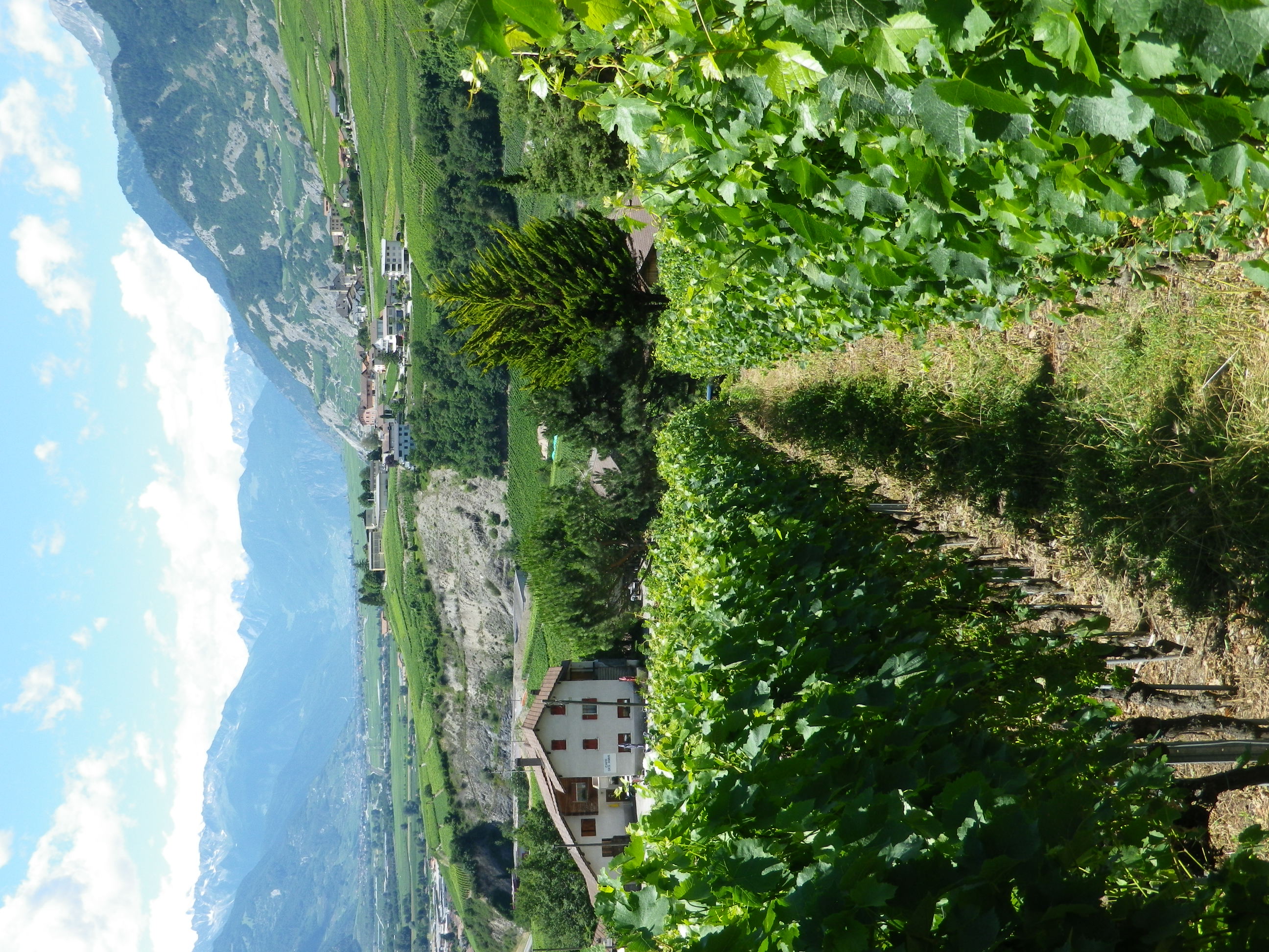
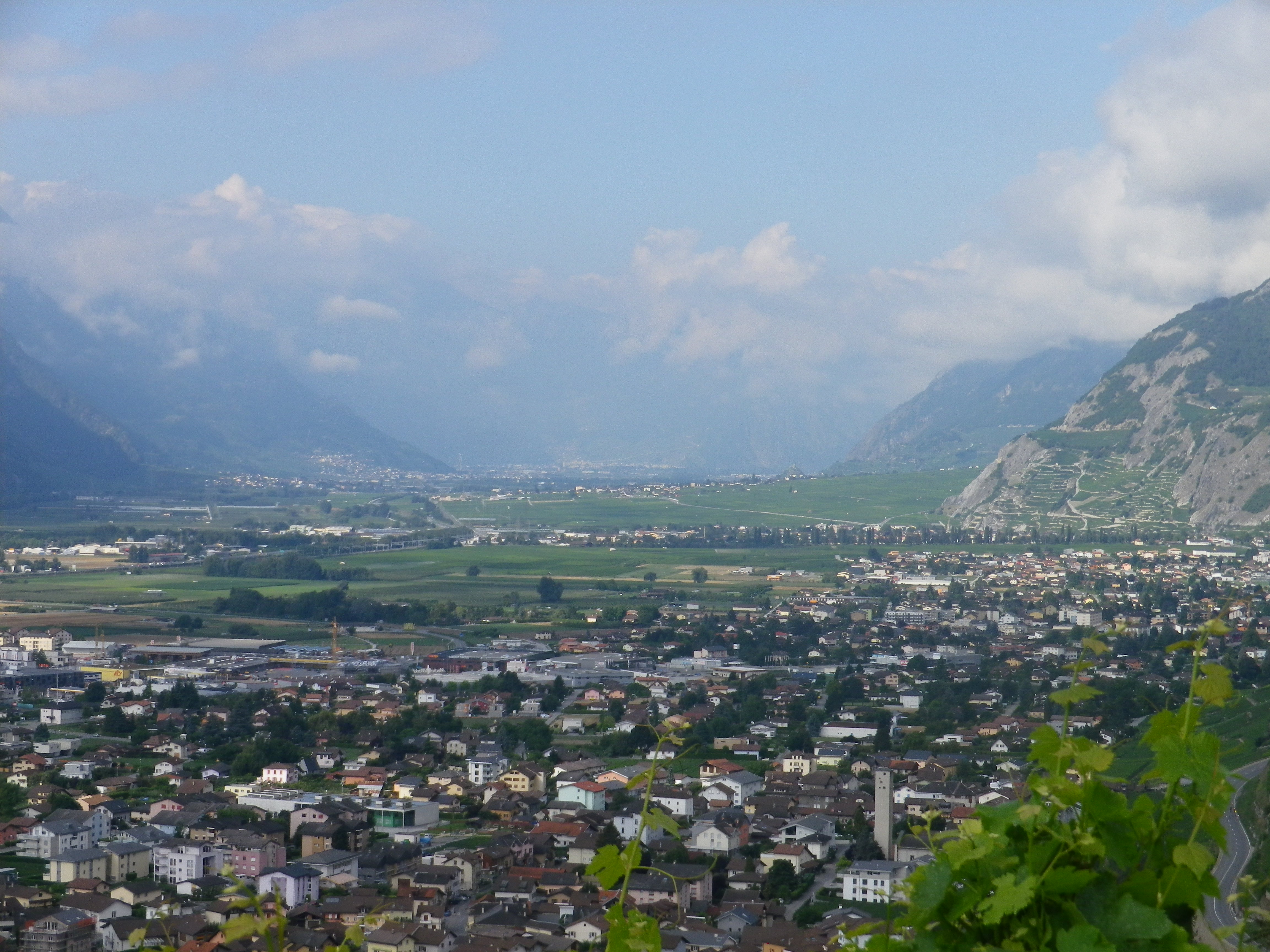
The Activity: Cycling the 82-kilometer-long Chemin du Vignoble trail from Martigny to Leuk
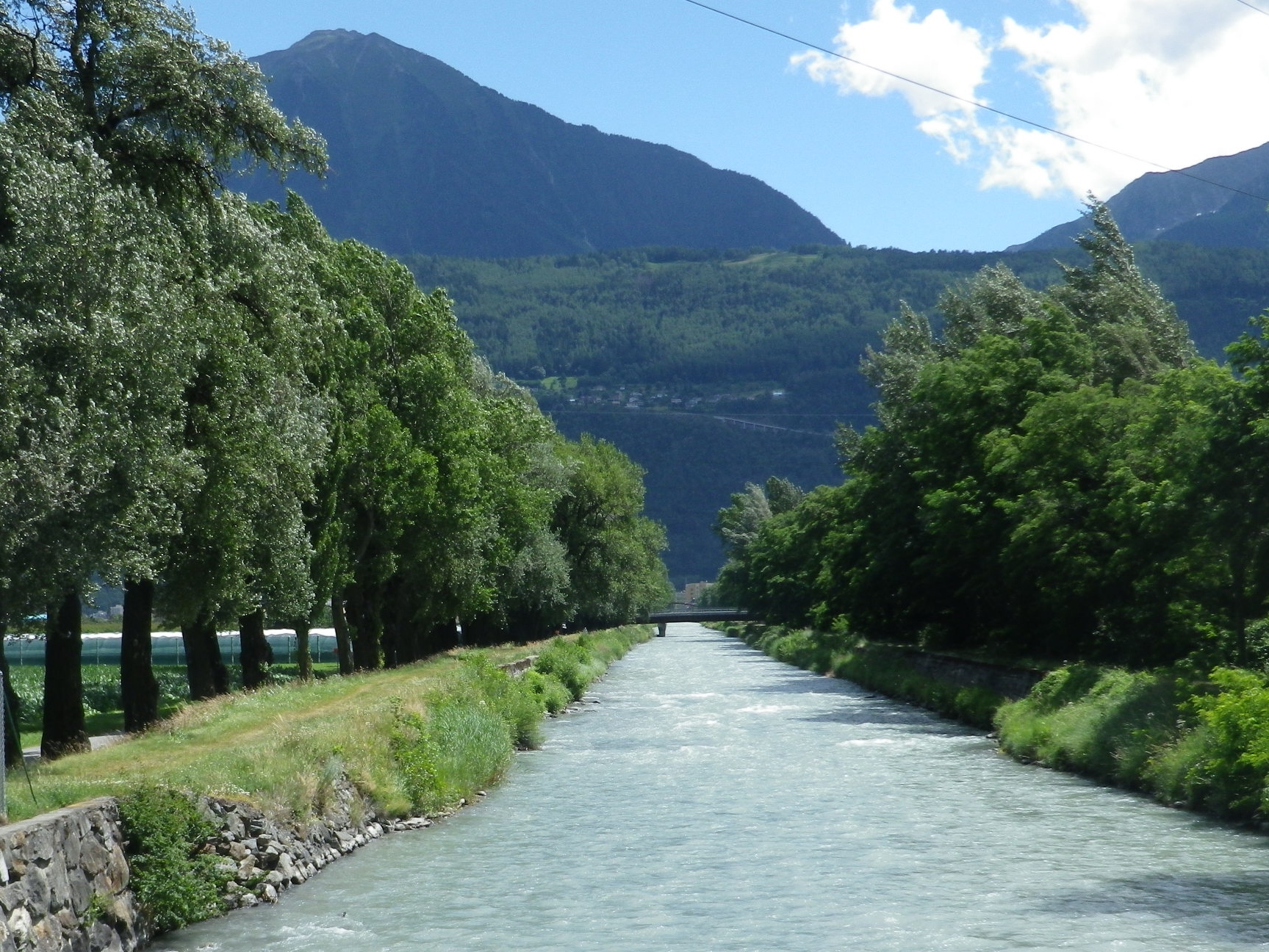
Why this One: The Alpine scenery is spectacular, no doubt about it. The mountainsides rise dramatically all around, the blue-green Rhone River pours through the valley between them, and cyclists pedal along, enjoying the beauty of it all.
Caveats: This route is listed as difficult, and two days are suggested to complete it. (Sion is the suggested intermediary point.) However, if you reverse the itinerary (from Leuk to Martigny), it is much easier, as it follows the river valley downhill, vice uphill. Mind, there will still be some inclines, but except for the long uphill segment between St Leonard and Grimisuat, they were not show stoppers.
Winning Wine Discovery: Arvine, also known as Petit Arvine, is a white grape varietal indigenous to the Valais region, and very rarely found elsewhere. It is nicely crisp, with unique mineral and citrus flavors. All combined to form a memorable palate of tangy, salty, and slightly sweet (due to ripe, white stone fruit flavors), making a uniquely delicious wine.
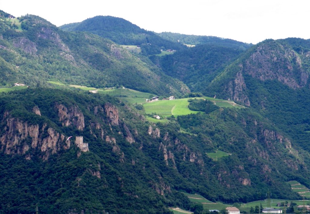
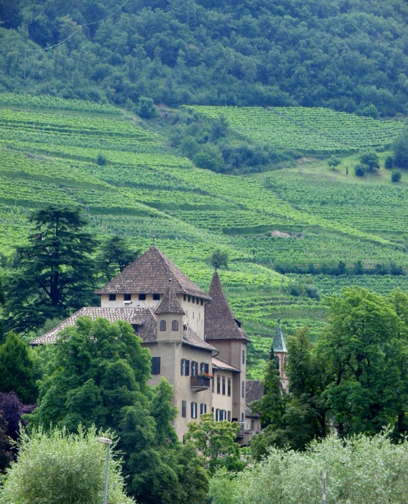
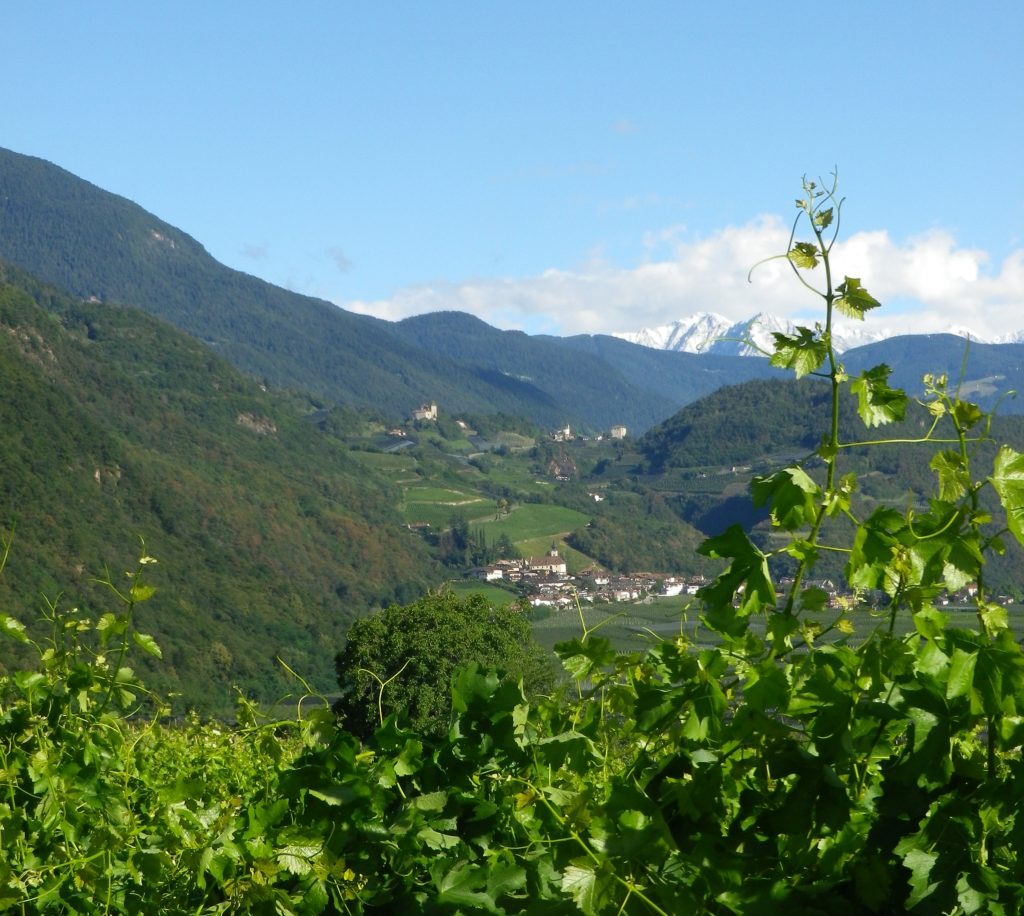
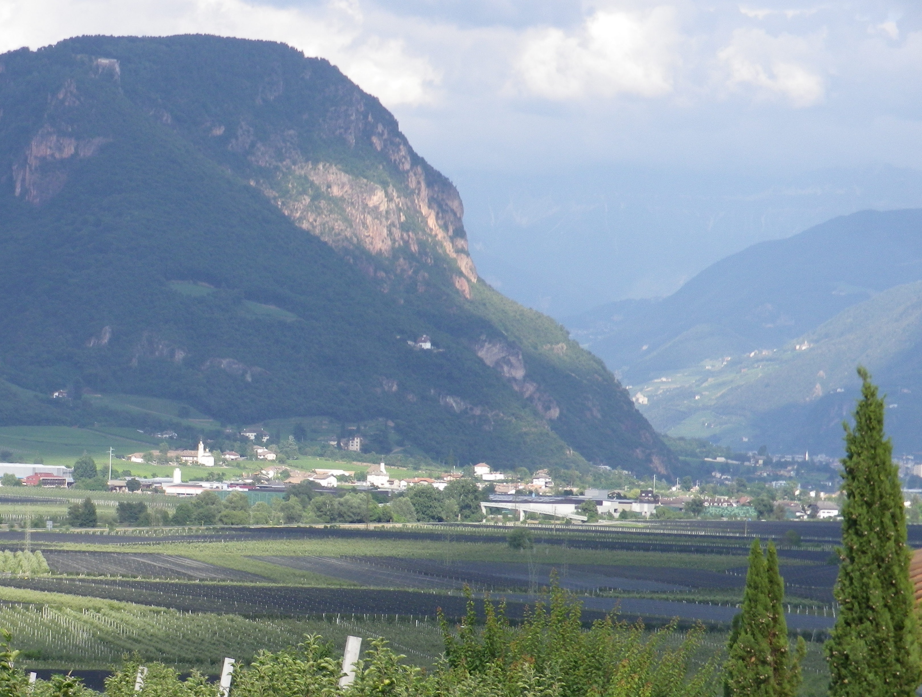
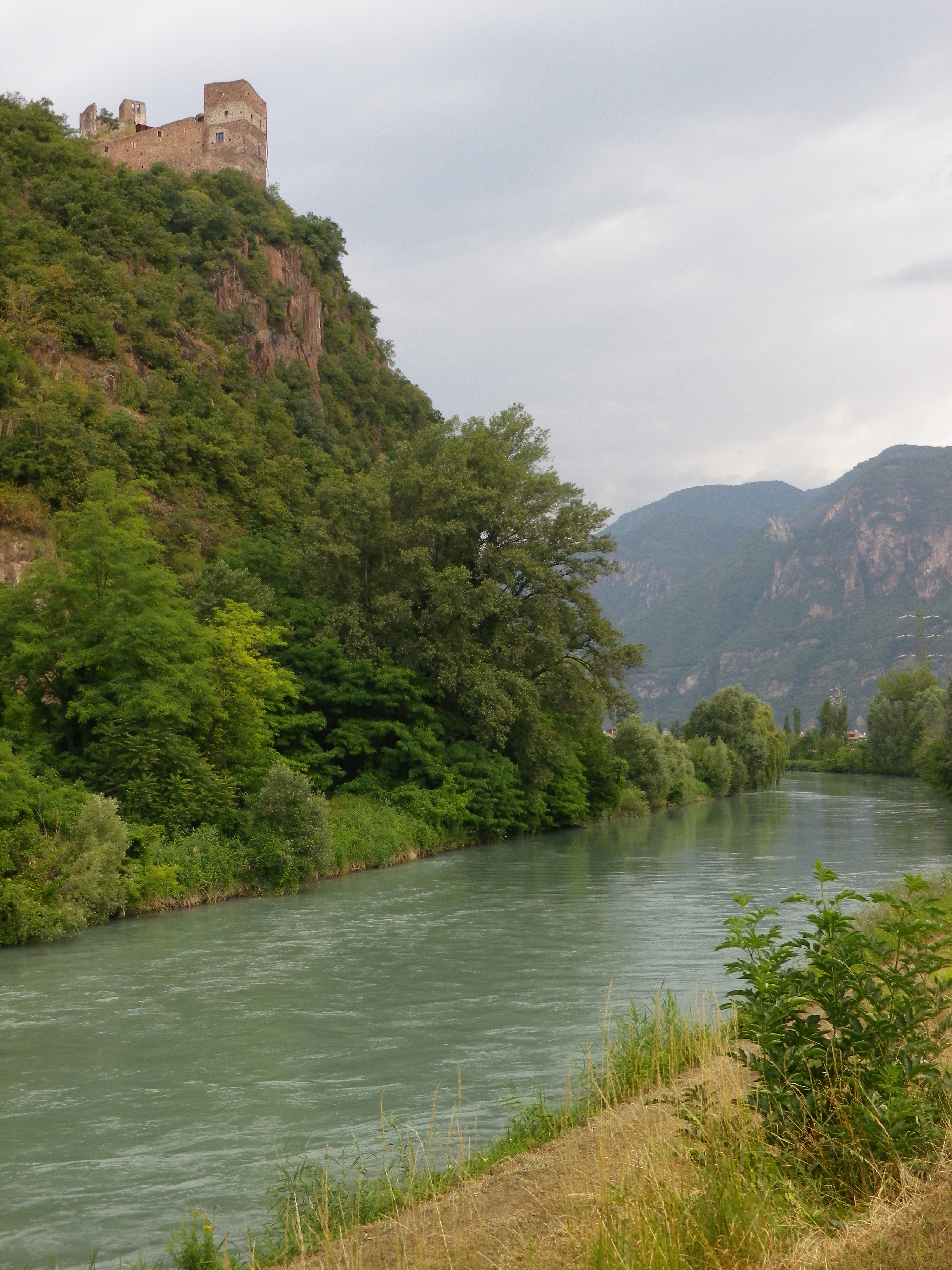
The Activity: Cycling the Weinradroute Nord/Itinerario Nord/Vino e Bici circuit
Why this One: Set in the beautiful Dolomites in the well-regarded Suedtirol/Alto Adige wine region of northern Italy, this district is much less frequented by tourists than many other regions of Italy. But that is not to say it is not visited. It is a popular spot for vacationing Germans and Austrians who take full advantage of the area’s great hiking and biking trails, and the good and plentiful lodging opportunities. In fact, this itinerary is just one of three interconnected (via the Etsch/Adige bike trail) wine-themed cycling circuits. Thus, while the German names might confuse those not familiar with the rich cultural history of this area, relax – it is still Italy after all – enjoy the great weather of this sunny side of the Alps and take the time to cycle all three!
Caveats: There are some segments of street cycling along narrow roads, with little or no shoulders. Bring a good map or navigation device, as the trail markings were not always where they needed to be.
Winning Wine Discovery: Lagrein is a red grape varietal grown both in the Suedtirol and the neighboring Trentino region. It vinifies as a red wine that produces powerful red berry aromas and flavors.
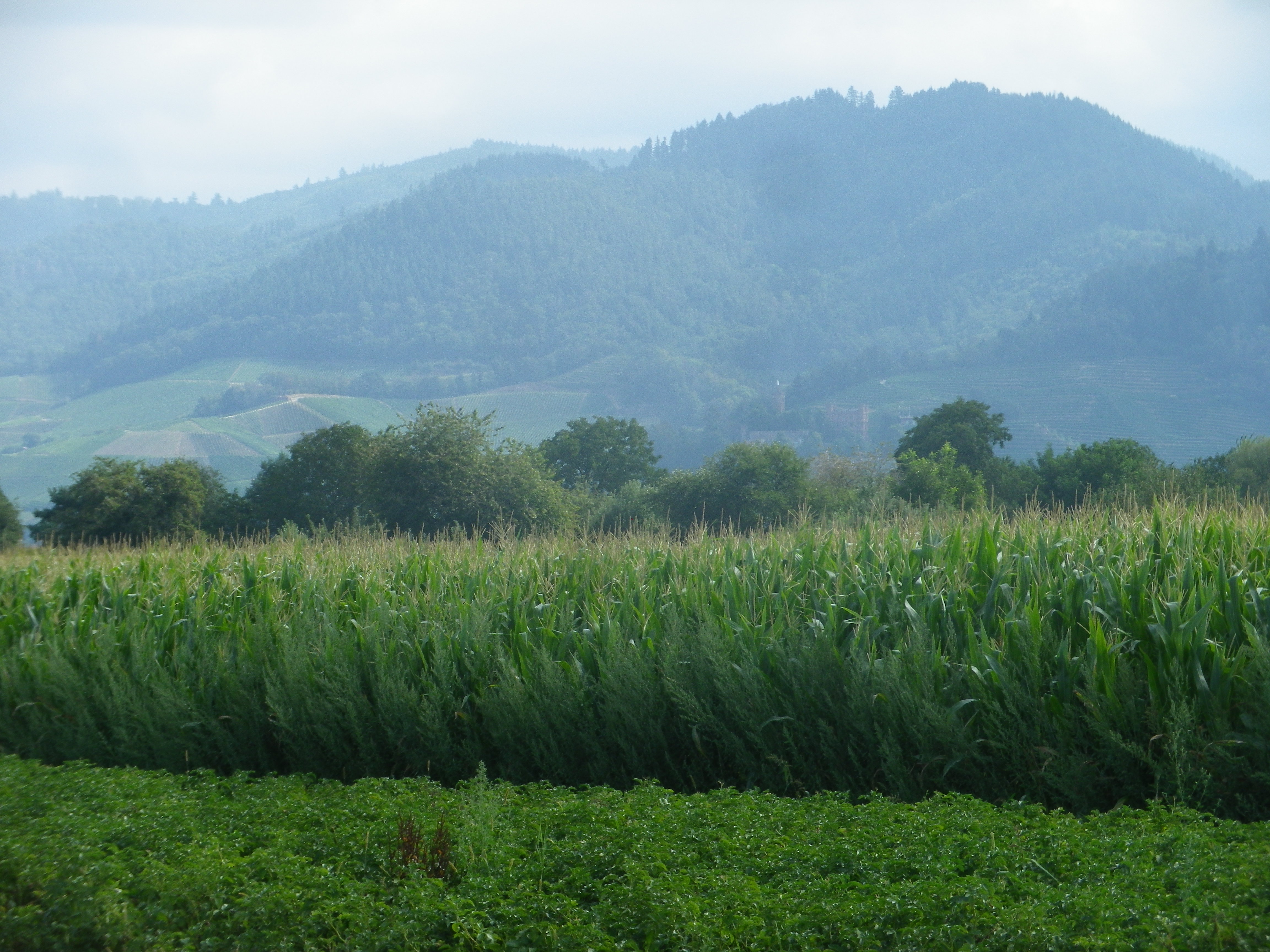
Finally, the Sentiero Valtellina gets an honorable mention here. The trail itself is marvelously laid out along the river valley floor, with views of vertiginous mountainsides, covered with vineyards on the lower stretches, and followed by forests and snow-capped peaks. But most impressive is the fact that five communities work together to keep this trail in great shape, and unusually for Italy, much of this trail’s itinerary is on dedicated bike path!

Anspruchsvoll – demanding, as in challenging, the one word I did not know in the German language online description of this trail. Everything else in the description was comprehensible, and seemed ideal – rural, mostly on trails, two Swiss cantons/wine districts- so what difference could the final word make?
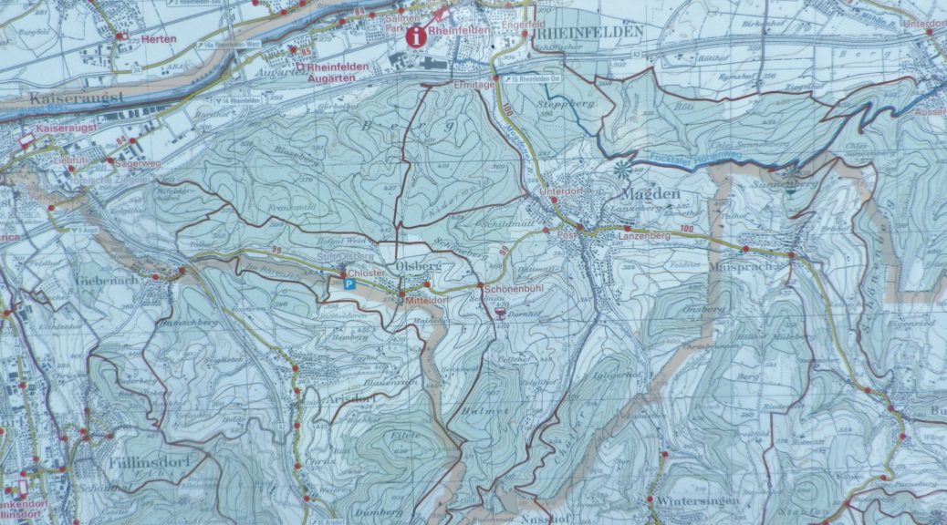
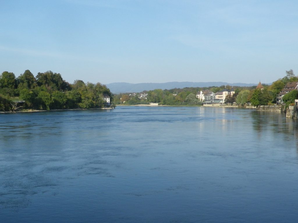
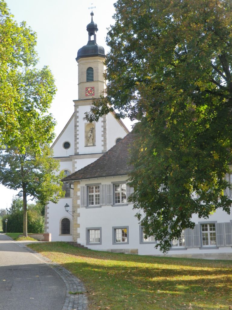
The Basel-Land vineyard area is found high above the Rhine River. To get there from Rheinfelden required a two-mile-long uphill climb. But while I felt like celebrating by the time I looked down on Olsberg and its famous former convent, looking toward the horizon, I realized that this would be a climbing itinerary.
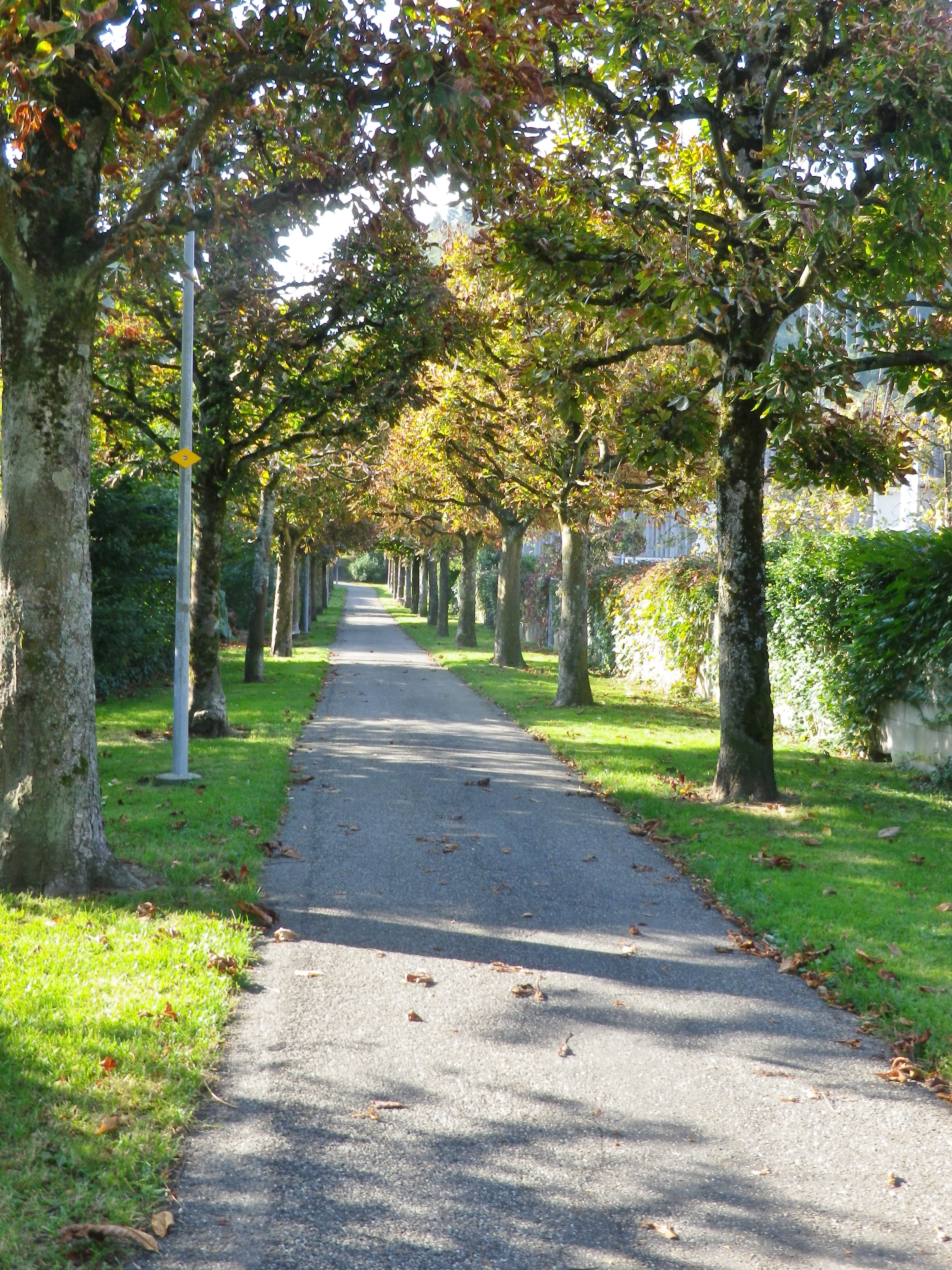
By the third hill, I wondered about that one word. Being lazy (I had read it online, too lazy even to google translate!), I would not have ordinarily attempted this itinerary, as there were indeed mountains (albeit not the Alps) to cycle up – starting with the first one, the slog from the Rhine River, past the train station and along the lovely allee up to the official start point, and then some.
But being very determined, I also wouldn’t stop. So, continuing to follow the itinerary over hill and dale, I cycled past miles of pristine working farms, orchards and fields, all the way to Liestal, the only real town on the route. It lays in a narrow valley along the river Ergolz, a tributary to the Rhine. Its old town center still has a part of medieval wall with a tower. It would have been a good place to walk a bit to enjoy the sights at a snail’s pace, and to relax my thigh muscles.
Instead, I found myself walking when halfway up the Brunneberg, as I risked rolling backwards downhill pedaling so slowly. While it was only about three-quarters of a mile to the Edleten Hut, this part of the itinerary was rather steep. The hut itself was typical of the hiking huts found in the German-speaking hiking world, with a nice overhang to protect against rain, a picnic table, and in a cool clearing in the middle of the woods. Almost at the very top, it was a great place to stop for a water break.
From this point on, the hills were easier. To reach Wintersingen, then Buus and the first vines I would encounter, I had to pass through Hersberg and Nusshof (uphill, again). Nuss means nut, the name giving an indication of what its claim to fame had been. Passing the village hall, the village flag on display showed three nuts, which turned out to be red hazelnuts. Maybe a lack of oxygen at this point caused me to hallucinate about the Piedmont, in Italy, where hazelnuts likewise grow in close proximity to vines, on similarly steep hillsides.
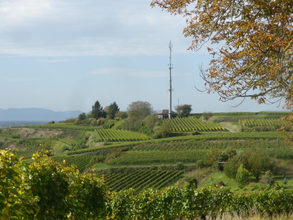
There is a climb out of Wintersingen, but rewardingly, it led to Buus, a village set quite attractively against tree-topped hills and vines in the sun. For the next few miles, vines predominated in this overwhelmingly agricultural landscape. And Maisprach seemed to be the center of viticulture for this part of the Basel-Landschaft wine district. The lush vineyards looked down from their lofty positions above the village. The little village was compact, and proverbially tidy. It even had a couple of eateries featuring local wines.
On leaving Maisprach, the itinerary leaves the Basel-Land canton. I was back in the Aargau, about to close the circuit, first going through Magden, then along a great shaded trail at the edge of the woods to the start point. But the best part for this lazy cyclist was the downhill gradient all the way to the Rhine, and my hotel!
What I Learned
Switzerland does indeed have vineyards, and produces its own quality wines under a system similar to the French appellation system. Only about two percent of all Swiss wine is exported, and most of that to neighboring Germany. Furthermore, the largest and best-known vineyard areas are in southern Switzerland, in the Cantons of Valais, Vaud and Ticino. Less well known are the wines of the Deutschschweiz, or German Switzerland, in the northwest corner of Switzerland.
The cycling itinerary I followed traversed vineyards in the Basel-Landschaft Canton, and the Aargau Canton, in the northwest corner of the Deutsche Schweiz. Like many places north of the Alps, viticulture in this part of Switzerland arrived with the Romans, and picked up again as Christian monasteries took root in the area. This whole history is neatly encapsulated in two towns lying side by side: Basel-Landschaft’s Augst, formerly the Roman colony of Augusta Raurica, with a large Roman era archeology site today; and the Aargau’s Kaiseraugst, an imperial stronghold and site of a monastic foundation in the medieval era.
Within the Deutschschweiz, there are several appellations, often named after the cantons. Both the Aargau and Basel-Landschaft cantons produce wines, which are bottled under eponymous appellations, albeit on a smaller scale than other Deutschschweiz cantons, like Schaffhausen or the Graubuenden. Both produce predominately red wines, as Pinot Noir is one of the primary red grapes grown here. Only about one third of the grapes are white, mostly Chasselas and Pinot Gris.
While there are plenty of vineyards, there were few wineries on the ground to visit (only about six along the whole route). As is often the case in smaller wine-producing regions, the local grapes are often vinified in a nearby cellar that will produce wine from the harvests of small, independent vineyards.
What I Tasted
2017 Blanc de Noir, Trocken, AOC Basel Landschaft, Siebe Dupf Kellerei (Liestal): A dry red grape (Pinot Noir) wine, vinified white; with pale gold color, fruity nose with ripe berry fruit flavors; very smooth, velvety mouthfeel, pure fruit flavor shines through with virtually no tannins or acidity TDA
2017 Pinot Noir, Maispracher Pinot Noir, Trocken, AOC Basel Landschaft, Siebe Dupf Kellerei (Liestal): A dry red wine with medium ruby red color; nose of vanilla and cherry and flavors of the same; medium tannins
Trail Name: Reben Tour
Trail Type: Mid-distance circuit bicycling itinerary; well-maintained with hard (paved or packed earth) surfaces; no marking for this itinerary.
Length:
Total – 40.7 kilometers/25 miles
Convenient to: Basel or Rheinfelden, Switzerland
Marking: None specific to the itinerary
Trail Description: While starting in a small city, this trail leads uphill to the hinterlands above the Rhine, through a variety of agricultural landscapes (orchards, fields, vineyards), as well as through forests and riverlands. No doubt the hills will be challenging to many, given the numbers of them, (even though the gradients never got above the 8-10 percent range), due to the length of some of them.
Trailhead:
Official: Rheinfelden: Olsbergerstr/Rueschelenhaldenweg x Bergweg
Mine: Train station to Alleeweg to the official start
Parking:
Rheinfelden center: None free, but parking garages and lots, one of each on Schutzenweg, closest to the trail;
Rheinfelden outskirts (Riburgerstr): Park and Pool (at the traffic circle) (24-hour restriction), Sportanlagen Schiffacker
Arisdorf: Parking Kaenelmatt on Kaenelmattstr
Public Transportation Options:
Information for both rail (Basel to Rheinfelden or Liestal), and bus services from these towns to the villages listed below, may be found at the Tarifverbund Nordwestschweiz (TNW) website at tnw.ch/fahrplan-liniennetz/online-fahrplan (as of October 2020)
Suggested Stages: Not applicable
Trail Itinerary-Reference Points: (Counterclockwise)
Rheinfelden: Forest trail, Rheinfelderweg, Rheinfelderstr; Olsberg: downhill through fields and vineyards, Hofgutweid, through Chloster grounds (formerly Olsberg Cloister), Hagachermatt, Hauptstr; Arisdorf: Arisdorferstr, Olsbergerstr, Hauptstr, Winkel, Kaenelmattstr, underpass beneath highway, fields, Arisdorferstr; Fuellinsdorf: Obererhofackerstr, down a flight of stairs at Obererhofackerstr x Huempelweg, Liestalerstr; Uetental: Uetentalweg, Suttenbergweg, Oberer Burghaldenweg, Erzenbergstr; Liestal: Gaststr, Rheinstr, path to Kasernenstr, Militaerstr, Kasinostr, over highway, Heidenlochstr; Lausen: Gartenstr, Weiherhofstr, Ringstr, Apfelhurststr-Edletenweg, up the mountain to Waldhuette Edleten, through woods for a while; Hersberg: Hersbergerstr, Hauptstr; Nusshof: Hauptstr, left onto Sissacherstr, Breitenhof path to Wintersingen; Wintersingen: Im Graben, Hauptstr, Buelweg, Dorfmattstr, fields, Rickenbacherstr briefly, then fields along the ridge overlooking town; Buus: Wiebentalweg, Hauptstr, Laigweg, path paralleling Hauptstr; Maisprach: Buuserstr, Magdenerstr, Hauptstr; Magden: bike path to Salzackerweg paralleling Hauptstr, Buenn-Sonnenplatz, Hauptstr, Bruelstr, Waldweg, Mooshaldenweg
Representative Trail Photos:
Restrooms:
Rheinfelden: Froeschweid, a pay toilet by the parking garage (Only one seen, and not on the trail!)
Attractions on or near Trail:
Nothing wine-themed, other than the tranquil scenes of vineyards!
Tasting along the Trail:
Magden, Maisprach Buus and Wintersingen all have taverns serving local wine, although hours are limited. Olsberg also has a tavern, the Weinresidenz, in the village center. The larger towns, Rheinfelden and Liestal both have lots of cafes and restaurants that sell wine by the glass, although they might not be local. Liestal has the Siebe Dupf Kellerei, which is a cellar vinifying grapes from local farmers, and has a shop open Monday through Saturdays all day!
Alternative Options:
Hiking: The 13-kilometer long Syydebaendel & Rebenweg, trail (not a circuit!) from Maisprach to Wintersingen, through mostly vineyards and fields.
Additional Information:
Regional: https://www.baselland-tourismus.ch/
Trail specific: https://www.baselland-tourismus.ch/erleben/velofahren-mountainbiken/ausgesuchte-velotouren/reben-tour
Comments:
A delightful, even if somewhat challenging, itinerary through this little-known wine area of Switzerland, with its peaceful, rural landscape.