A mere 17 miles from the Austrian border at the Brenner Pass, the first vineyards appear in northern Italy, along with some linguistic confusion. Following along the Eisack River, the Isarco in Italian, the vineyards begin just as the dramatic narrow pass begins to widen at Novacella, Neustift in German, by Brixen, Bressanone in Italian. Thus, it continues all the way south, throughout Suedtirol/Alto Adige, the South Tirol as English speakers call it.
This area is well-known throughout the German speaking world as a hiking and biking paradise set in the magnificent Dolomites. Here, the German passion for precision and perfection meets the Italian passion for food and wine, and the results are amazing.
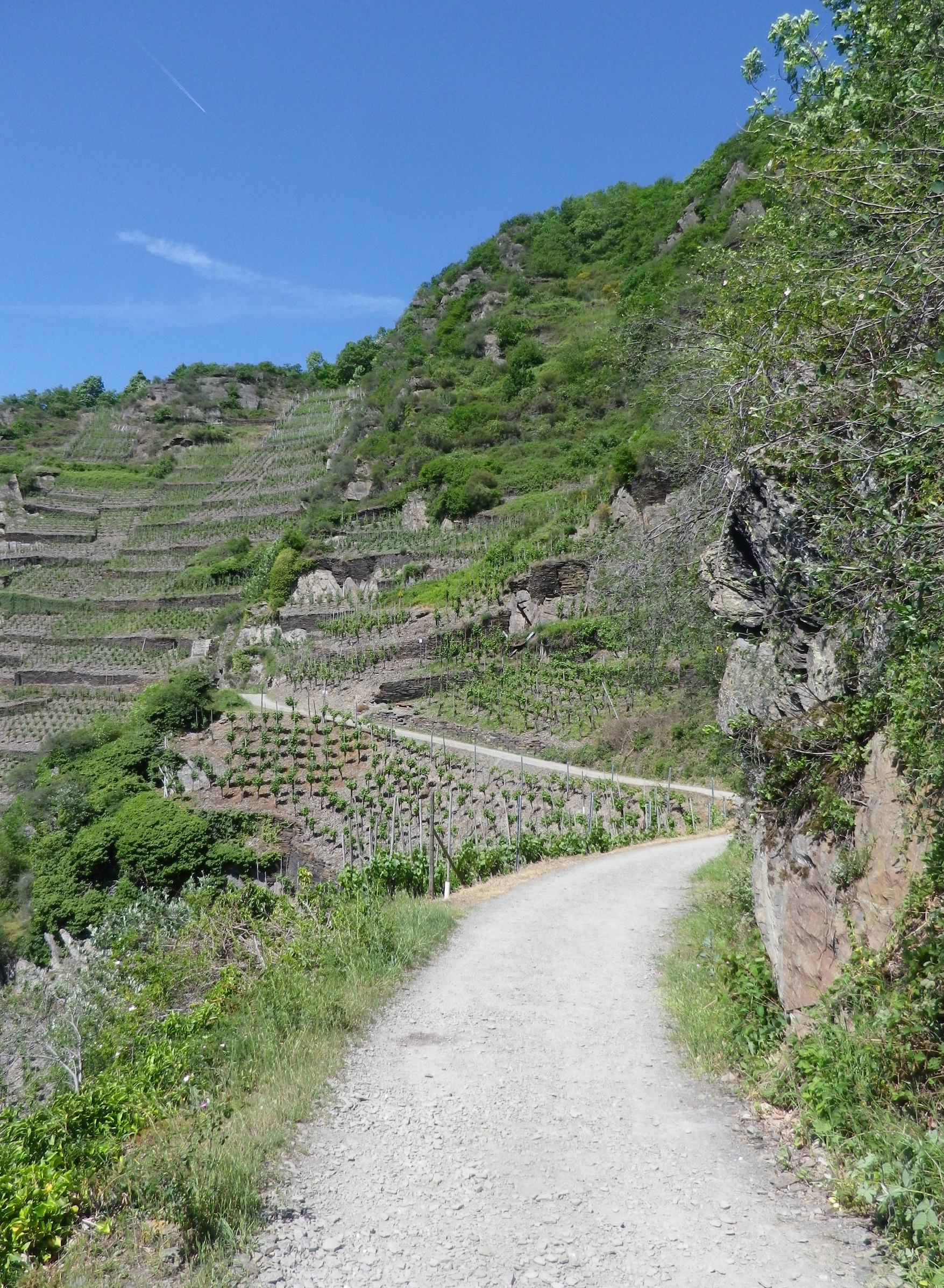
Hiking in the northern half of the South Tirol provided more options and was less challenging than biking in it. While the mountains are steep, the paths are relatively well maintained and well-laid out. Although the physical effort was not as easy as hiking in the Rheinhesse wine region in Germany, or the Carnuntum wine region in Austria, any reasonably fit person could complete them.
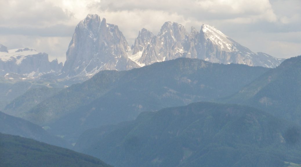
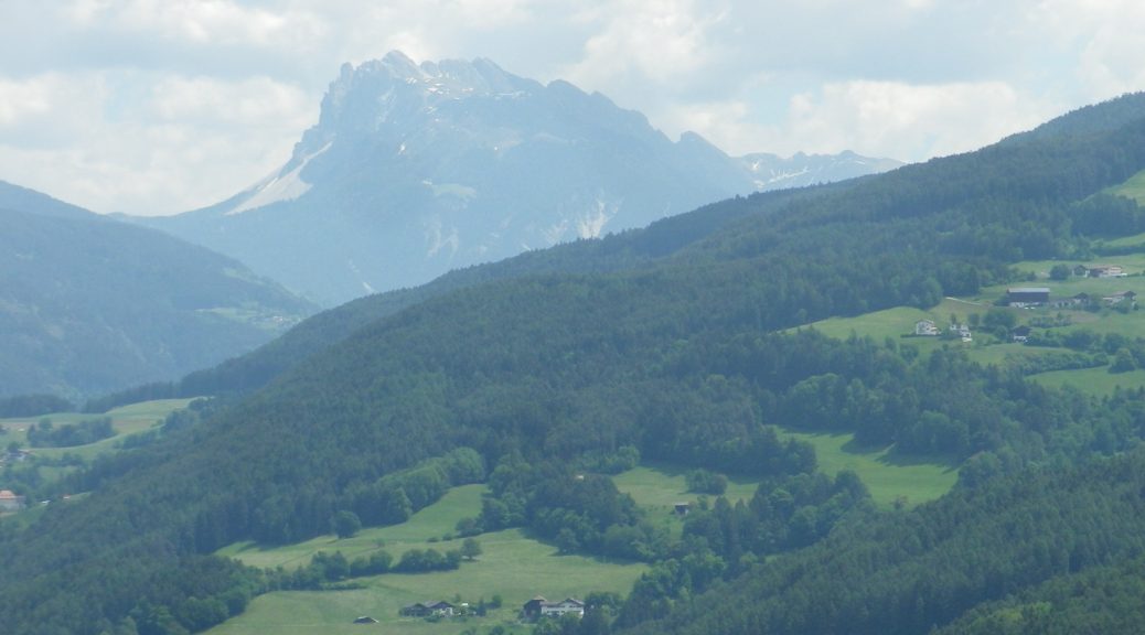
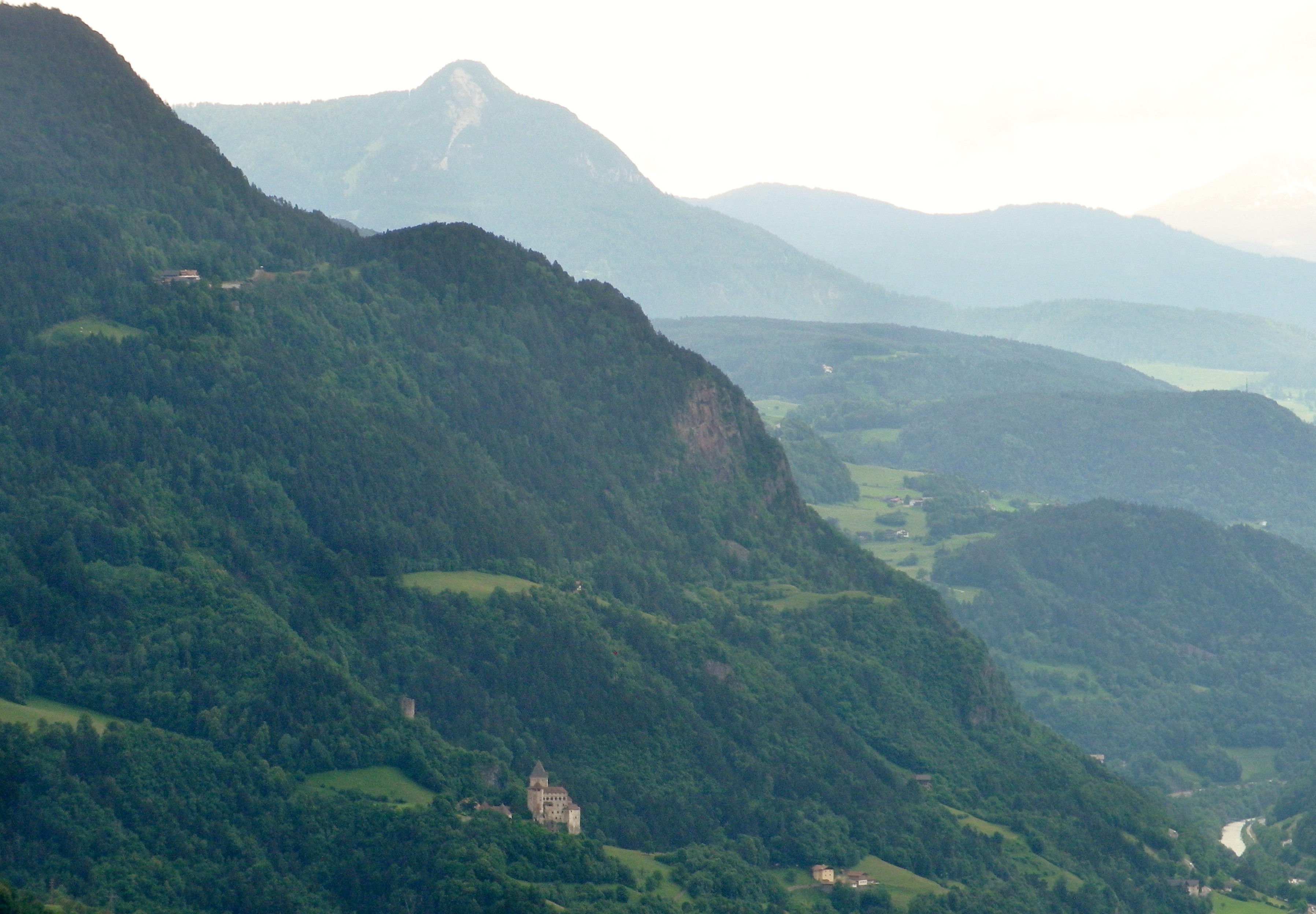
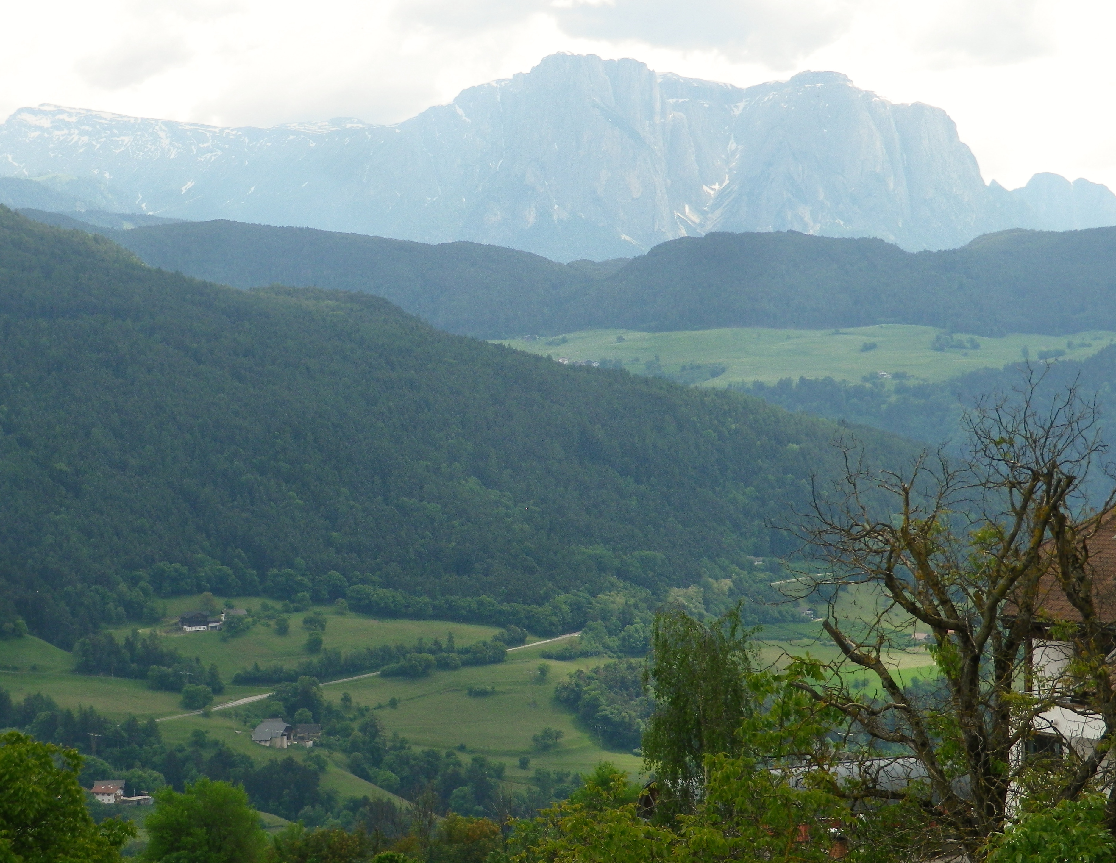
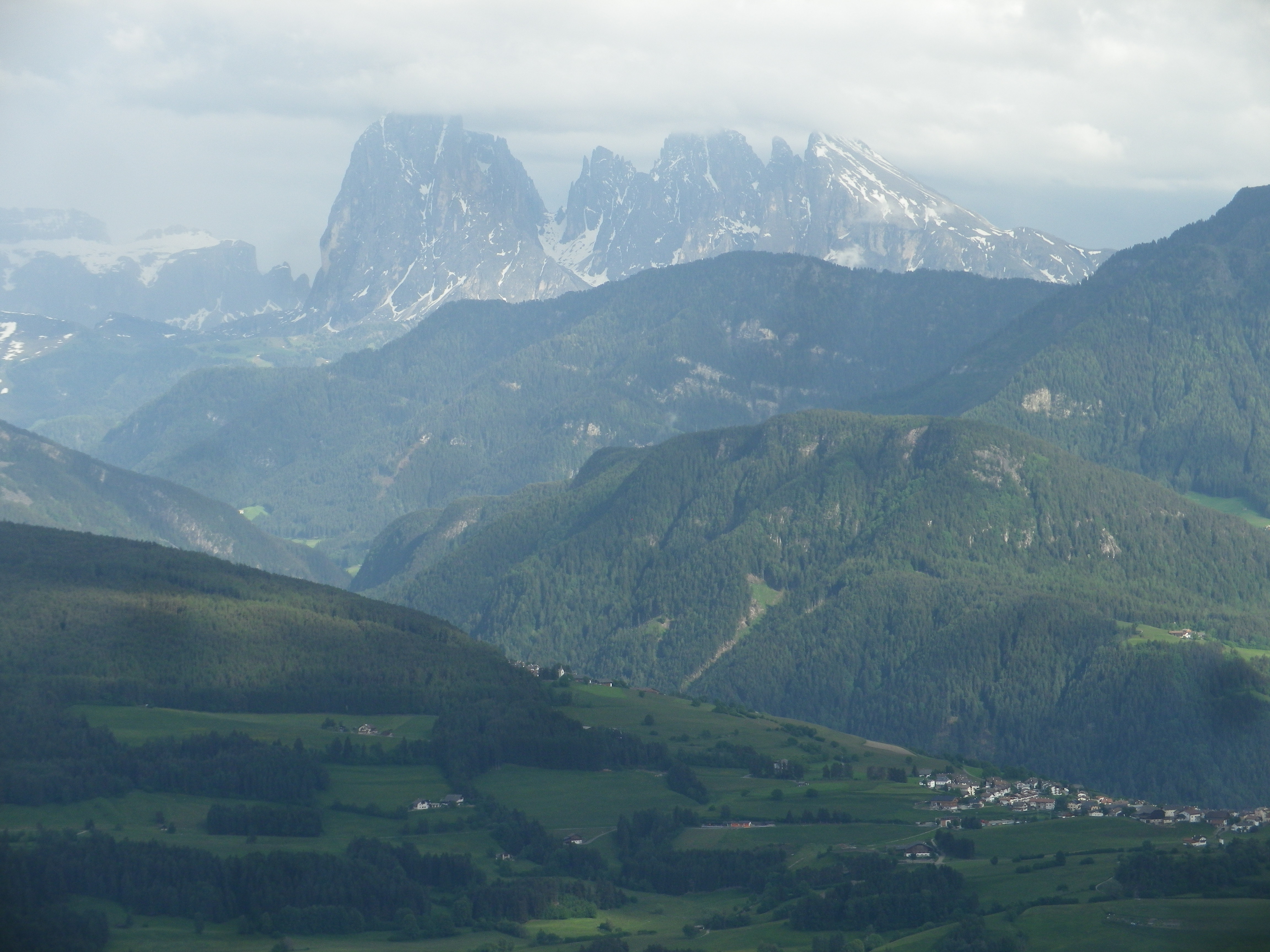
Amongst a plethora of trails, one wine-themed trail was located high up the western edge of the Dolomites. It was also opposite the Nature Park of Puez-Odle, and its famous peaks, the Odle Group, among them. I figured that from a higher elevation, the views from the trail of the mountain peaks would be spectacular. I was not wrong in that regard.
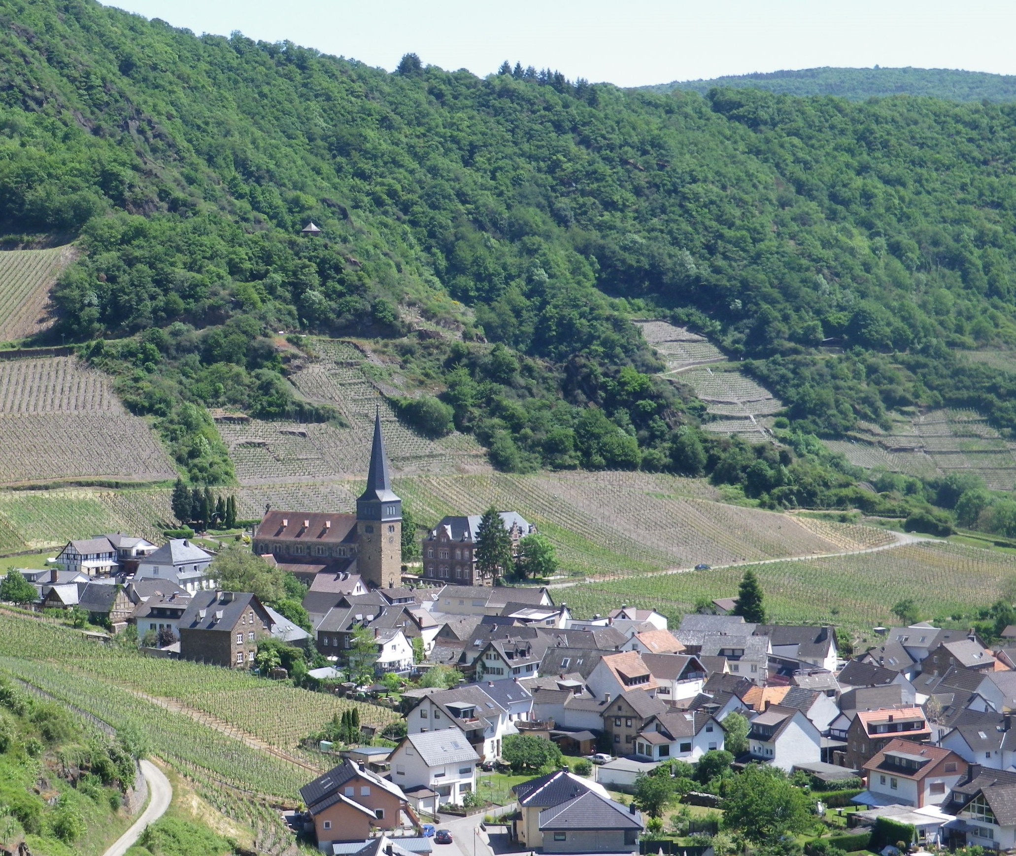
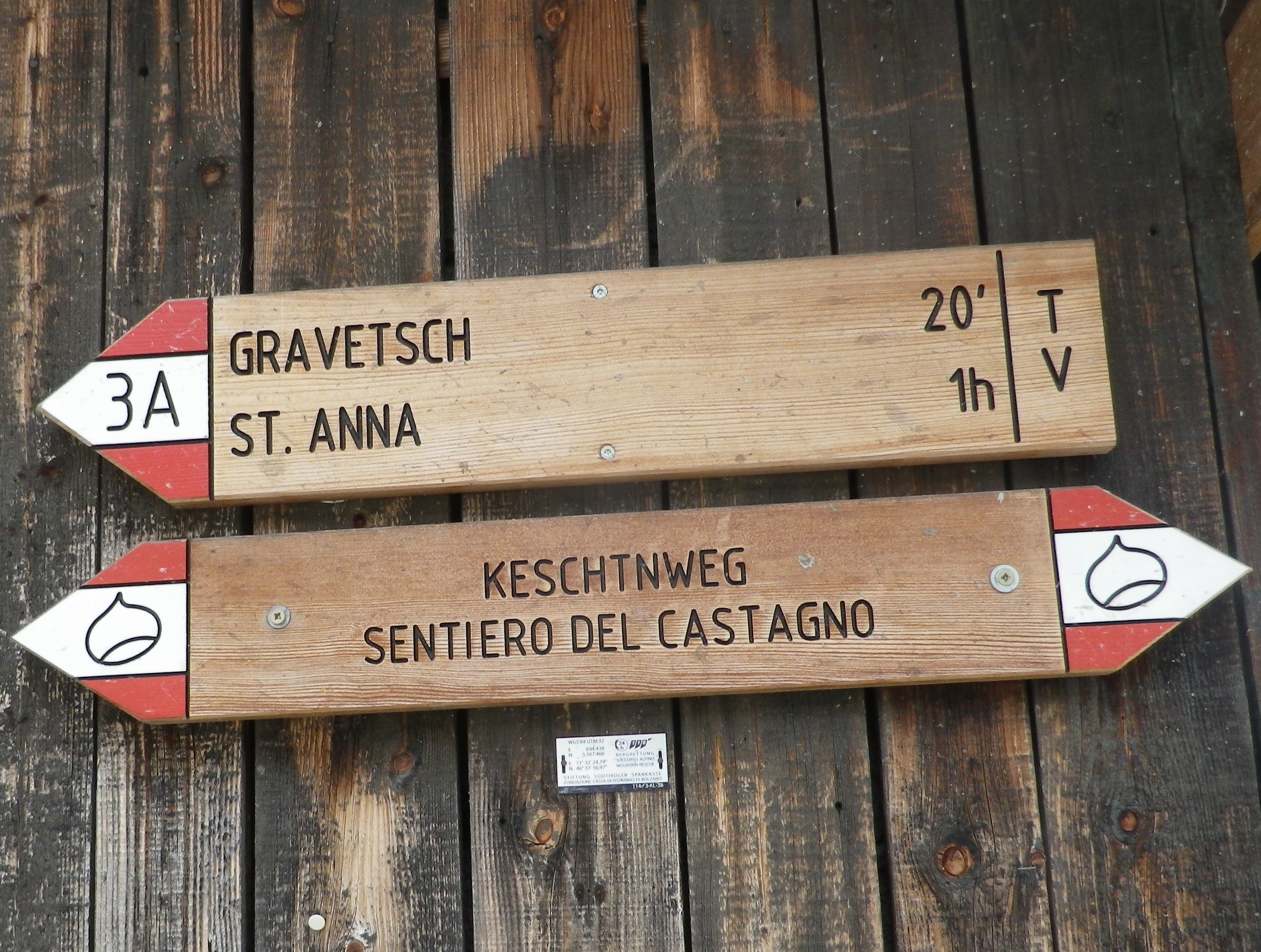
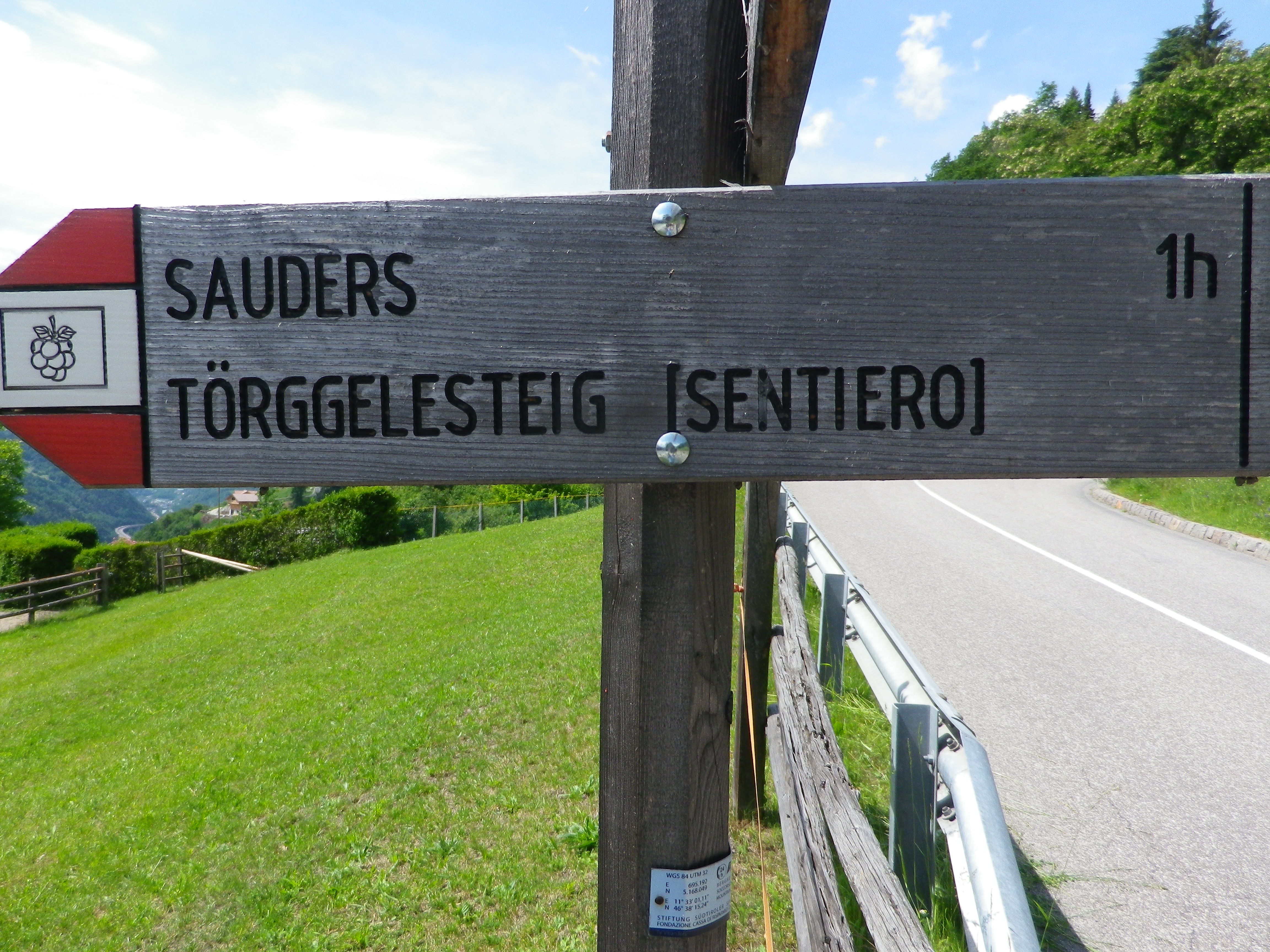
The trail was named the Toerggeleweg. A toerggele is a wine press, and in this district, wine taverns are often identified with this term. The trail passes through or by vineyards, and wine taverns, as it meanders up and down the mountainside above Klausen/Chiusa, the main town in this district. This district is traditionally agricultural, and several multi-purpose farms run by extended families still exist. The trail often passes right along them. Nowadays, in addition to farming, and running the seasonal wine tavern (toerggele), many families rent places to sleep.
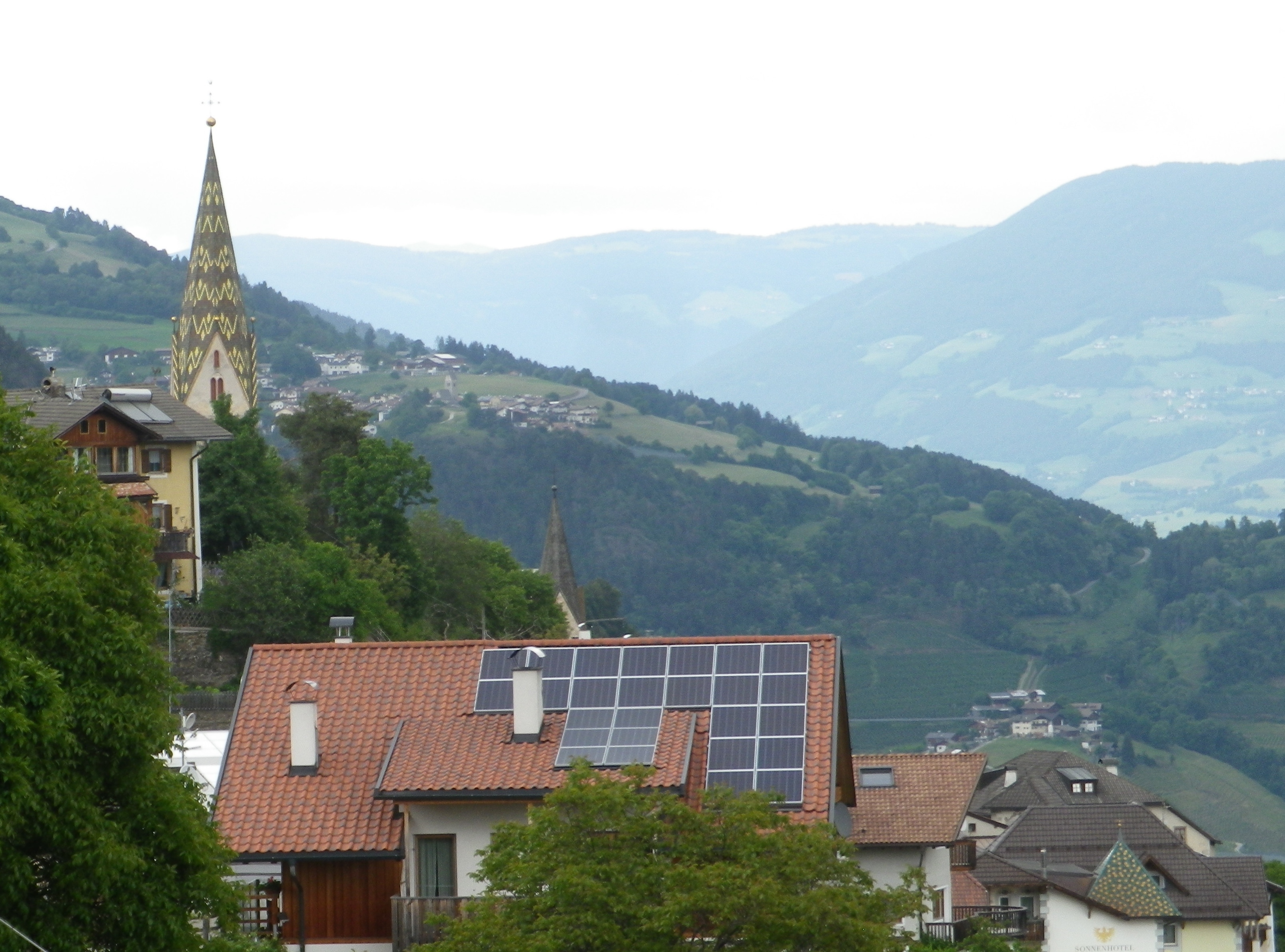
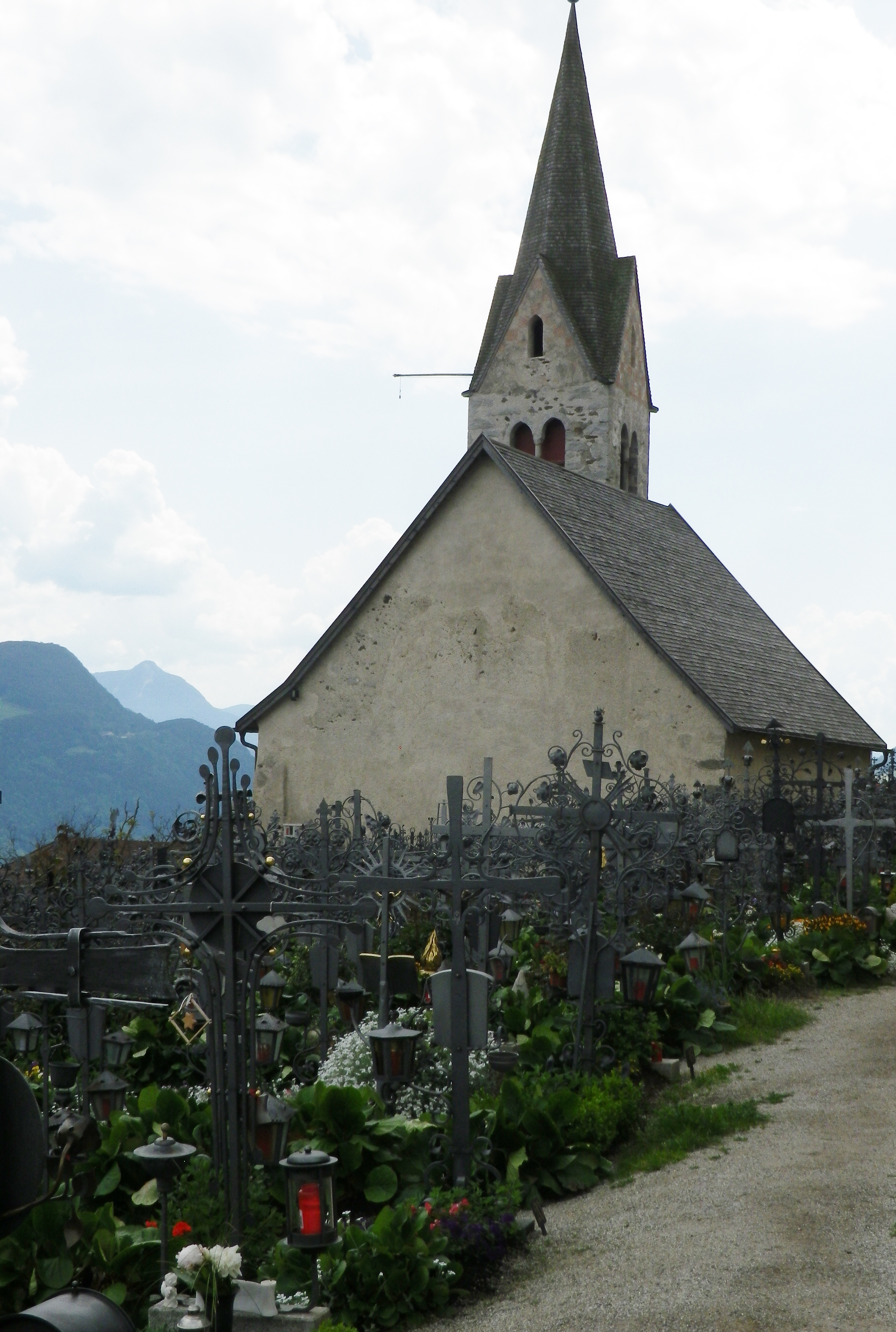
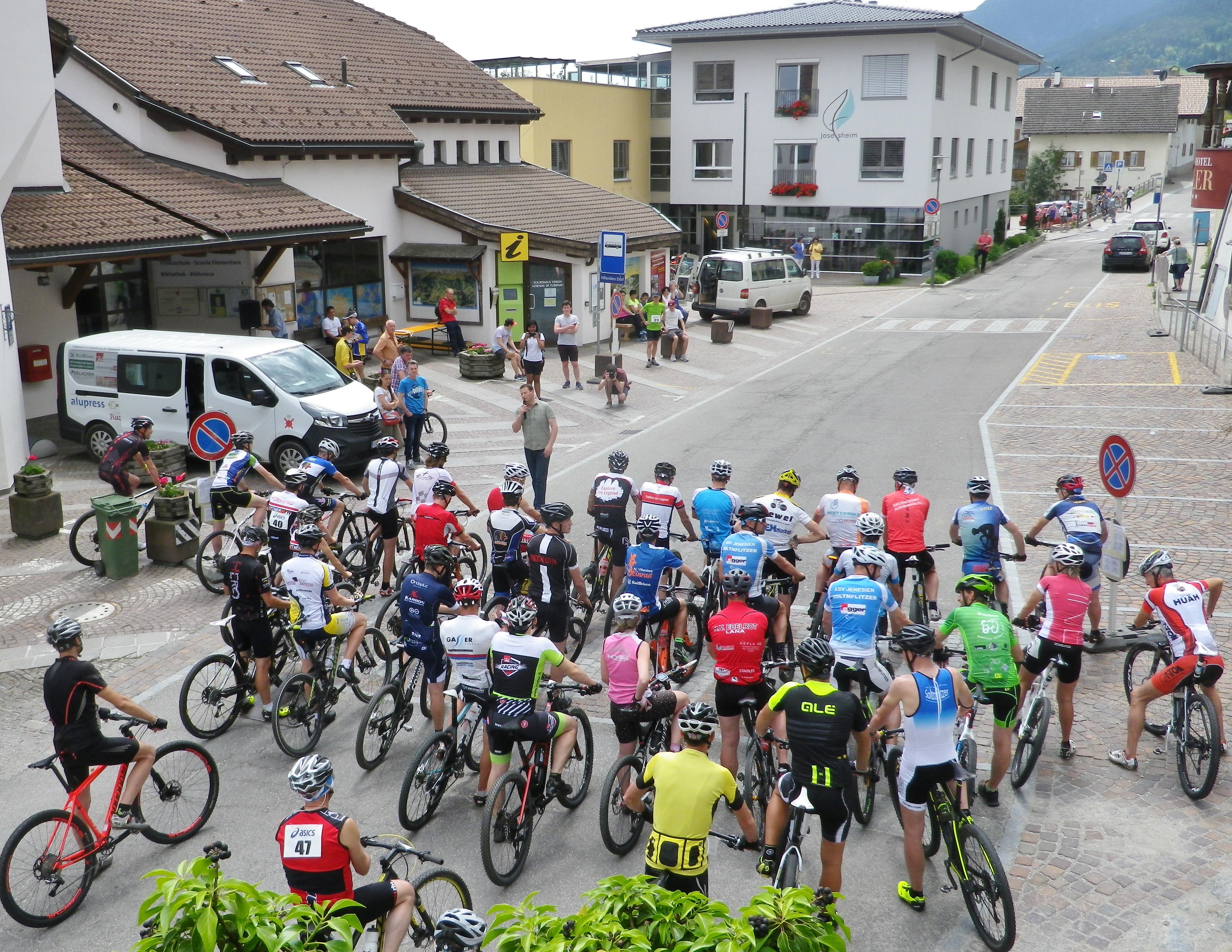
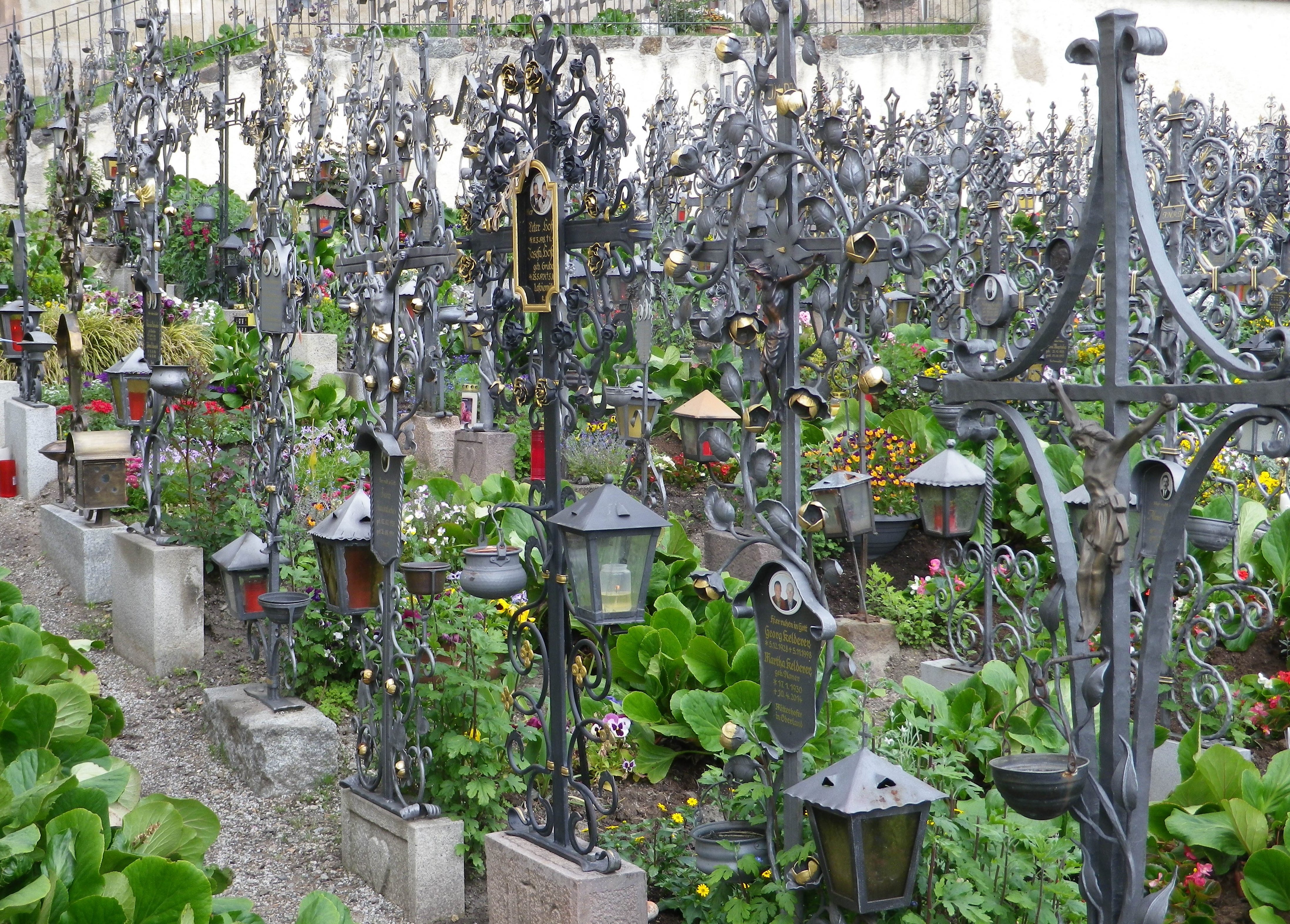
The trail began in the village of Villanders, a popular summer destination. In addition to the old houses lining the narrow streets, the village has an attractive old church, Santo Stefano, on the outskirts of the village. It is worth a visit, especially since the walled cemetery next to it is considered one of the most beautiful in the region. On just about every grave amazing ironwork commemorates the deceased. Much of the ironwork is extremely detailed, imaginative and expertly wrought.
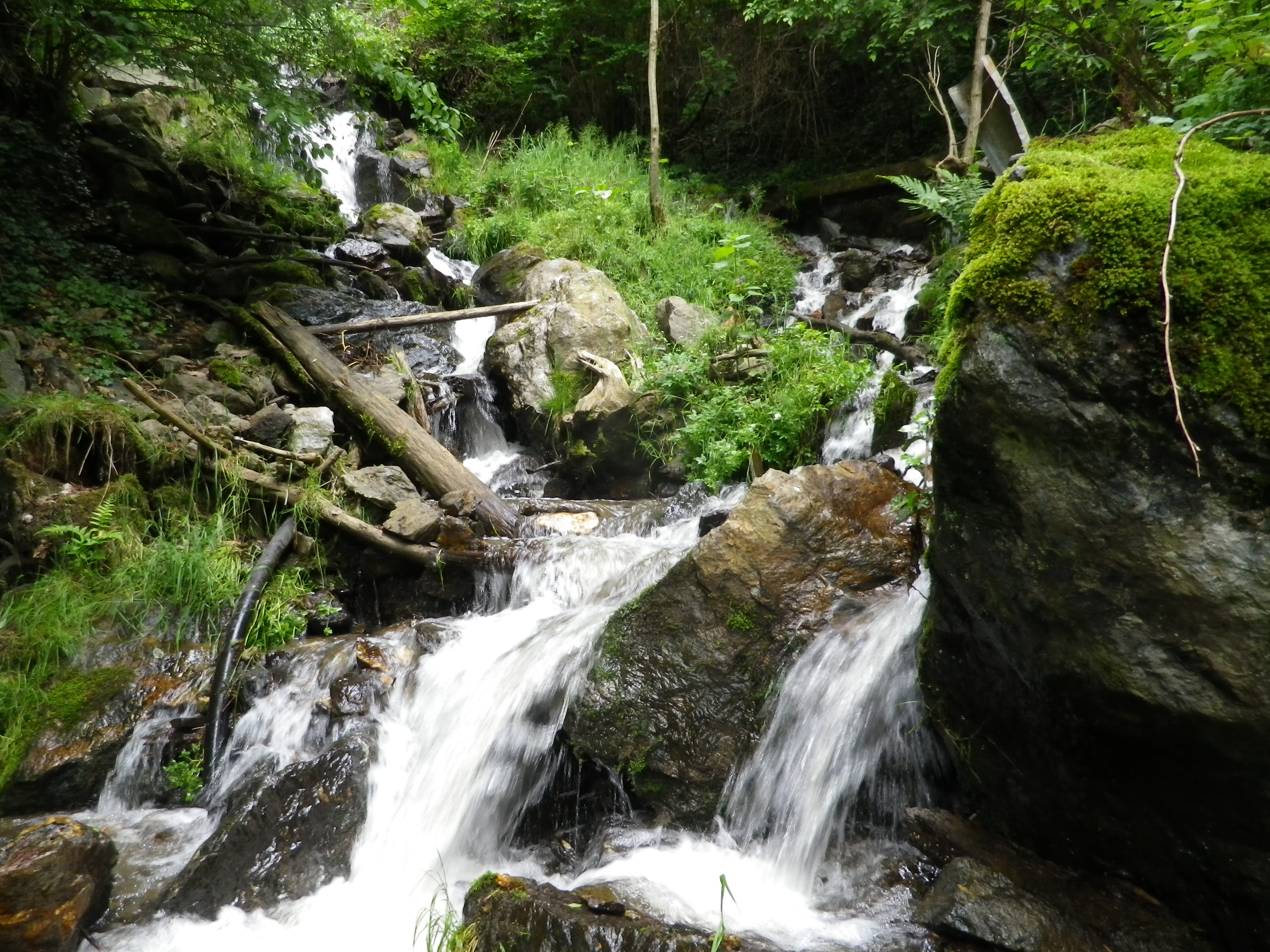
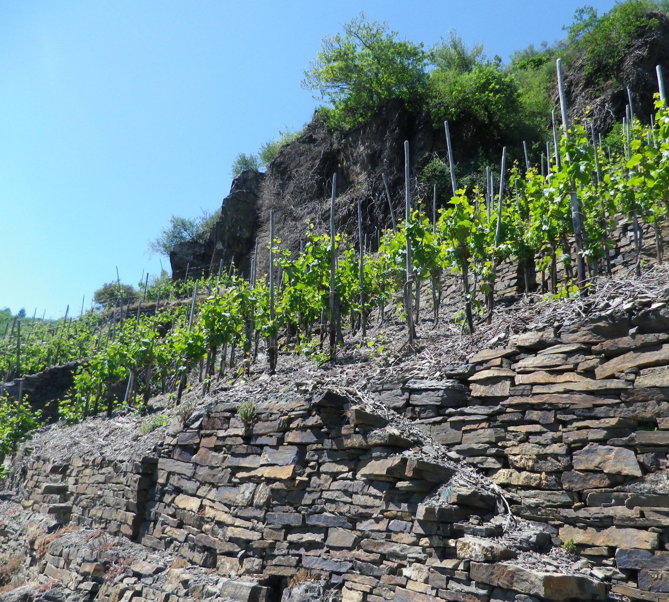
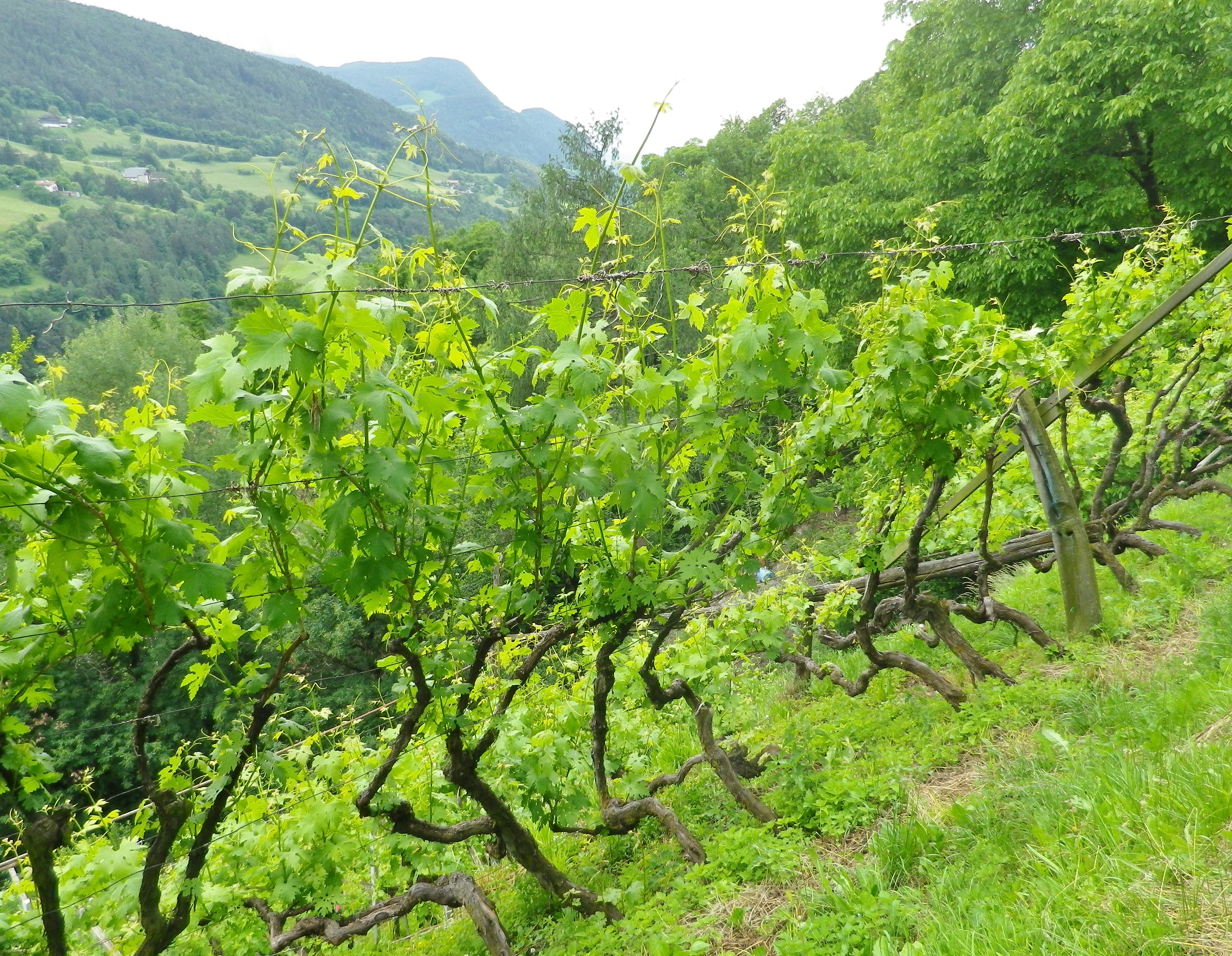
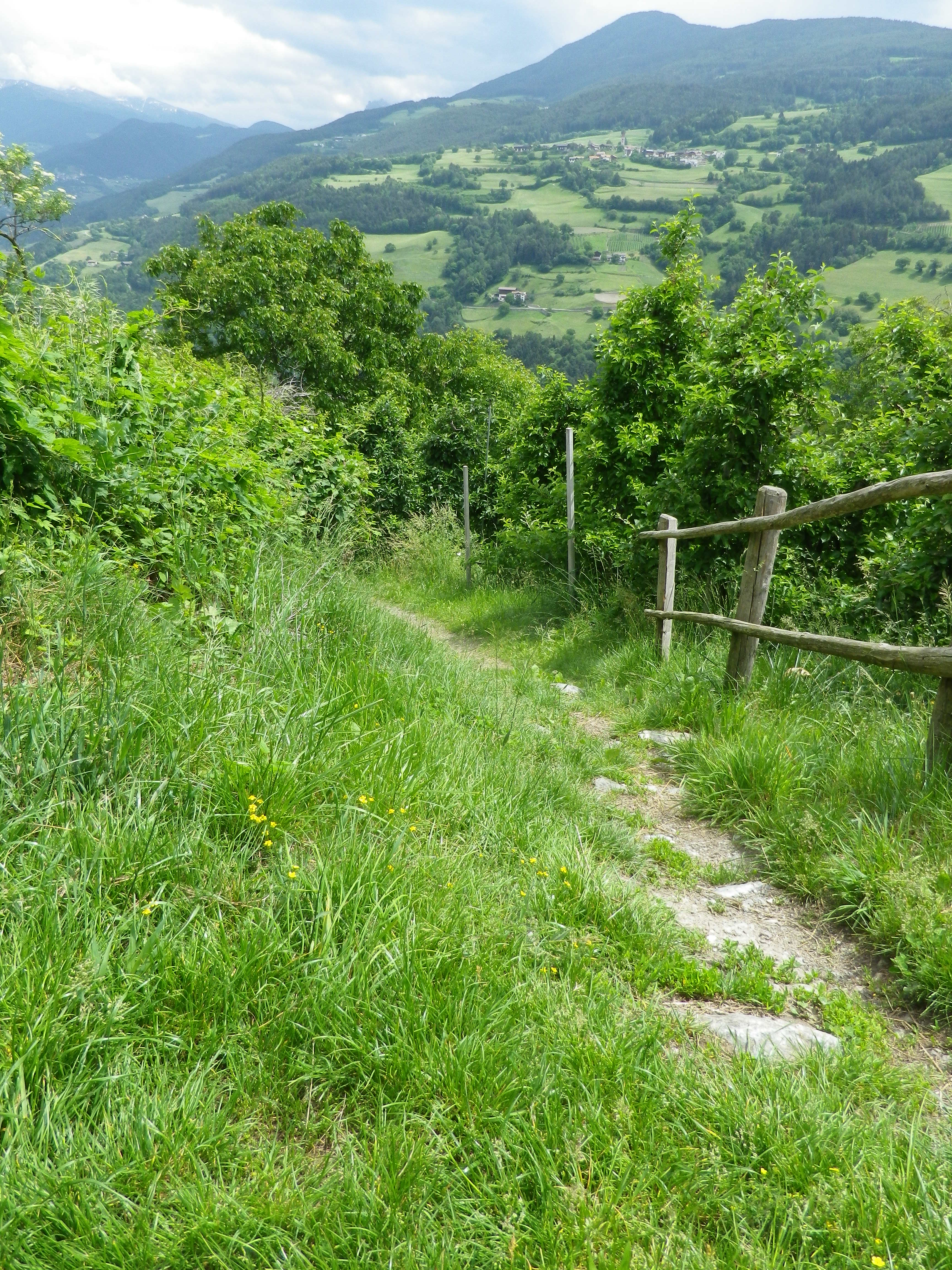
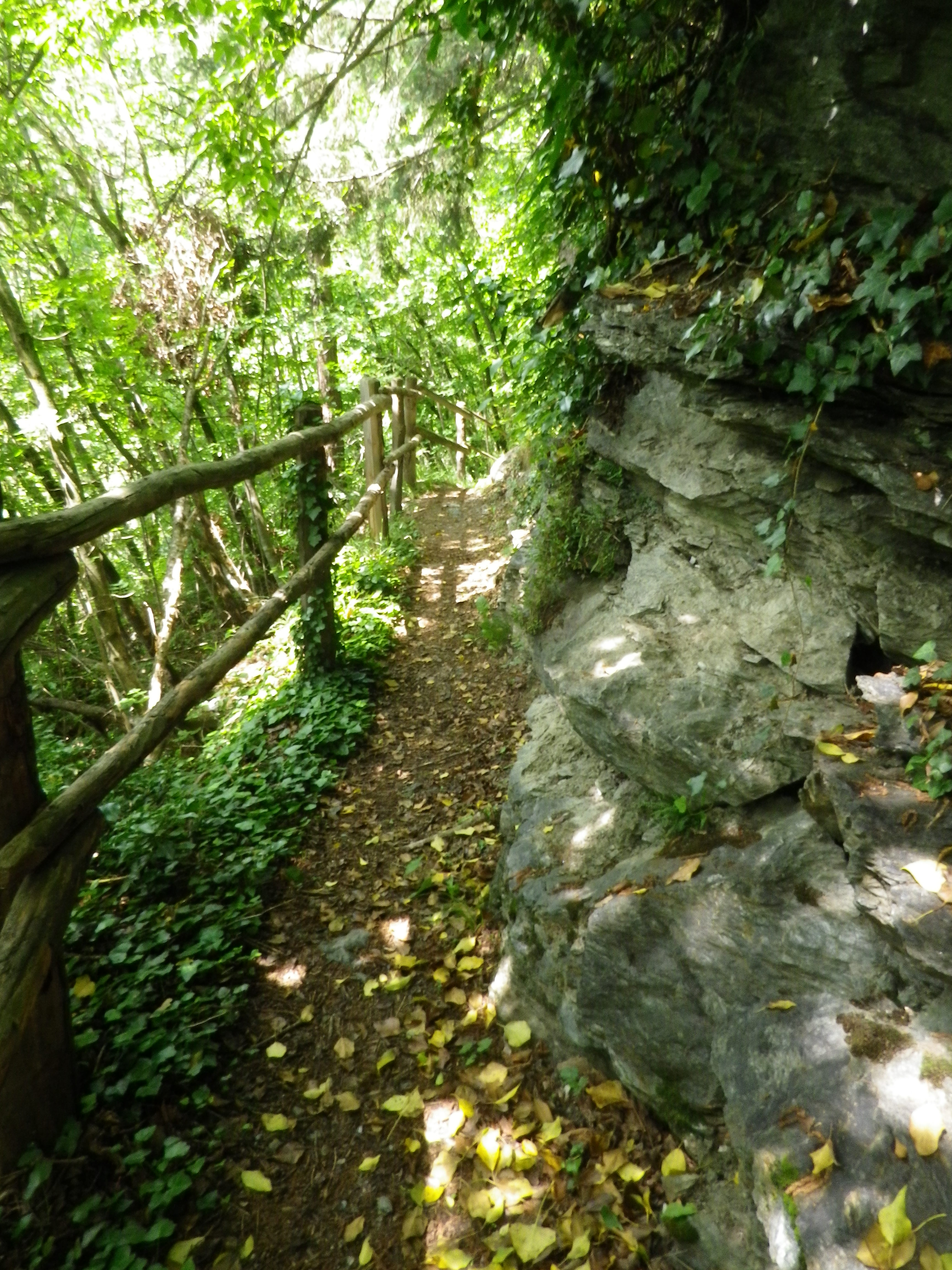
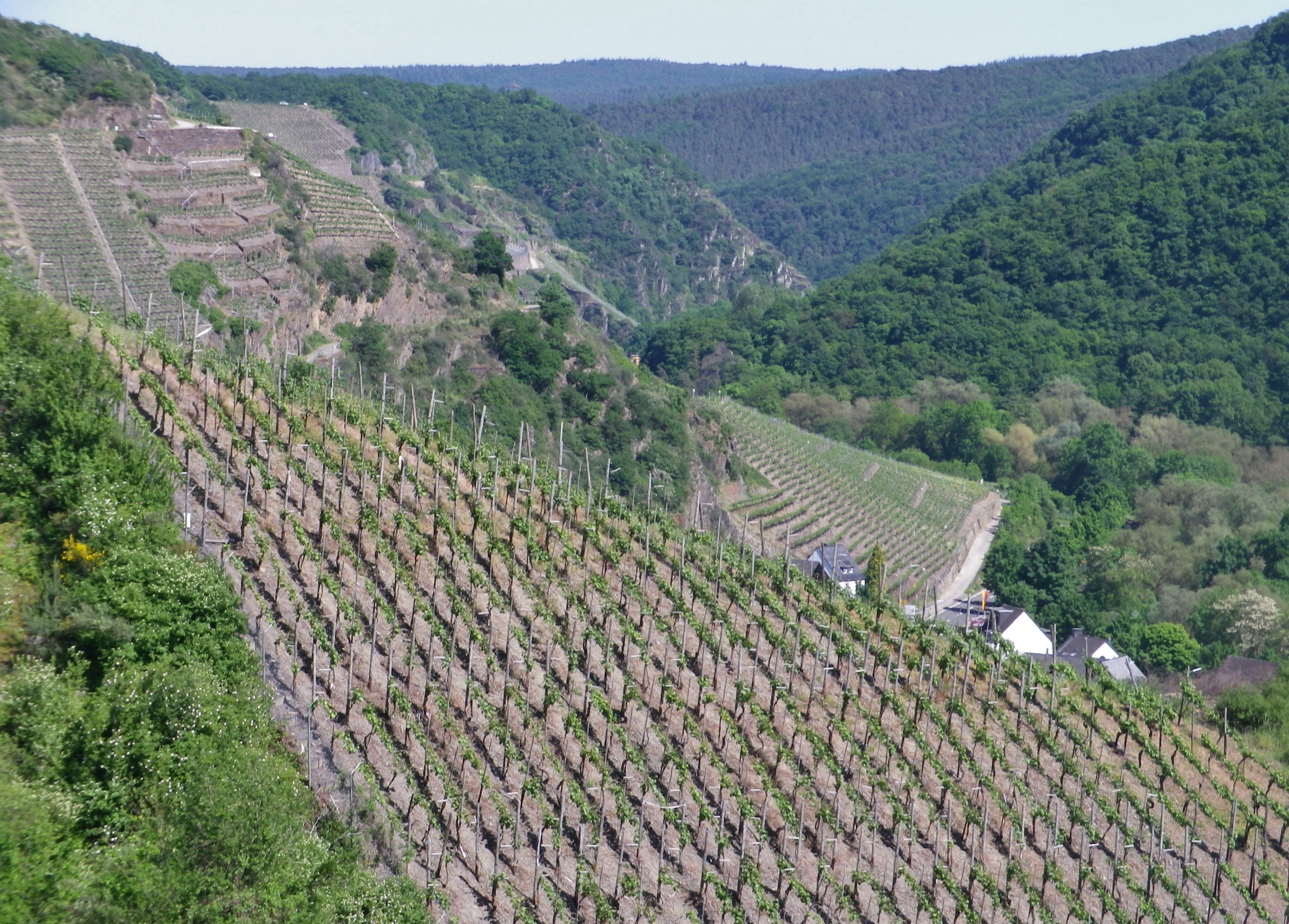
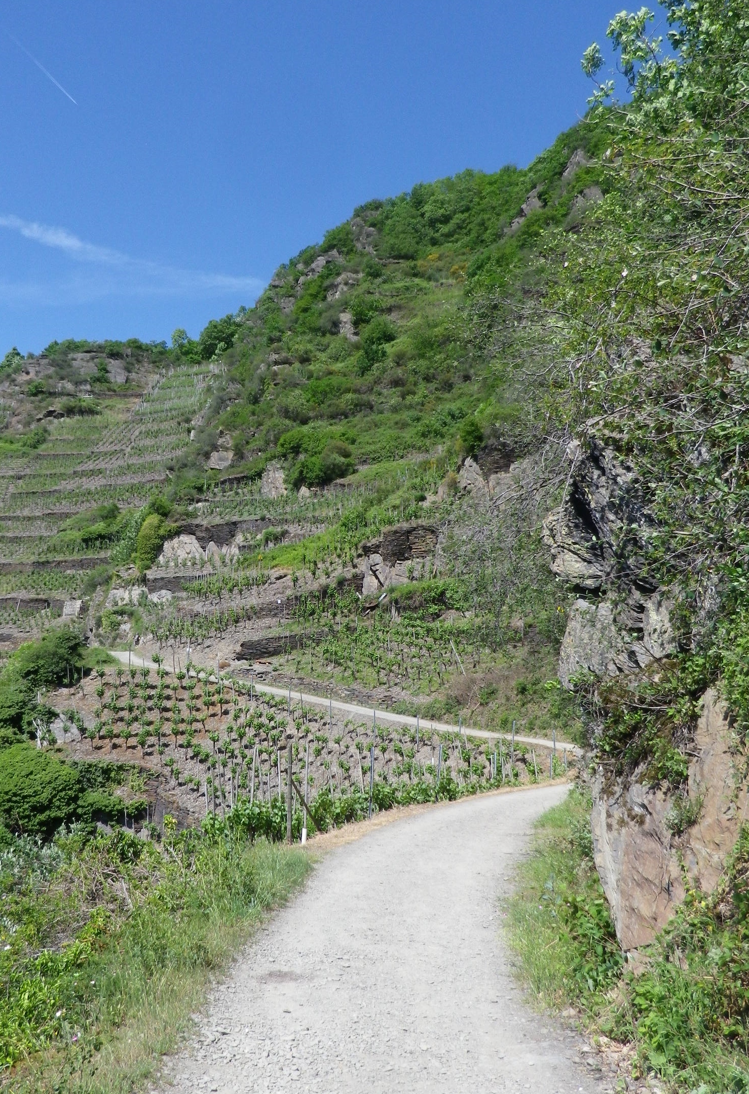
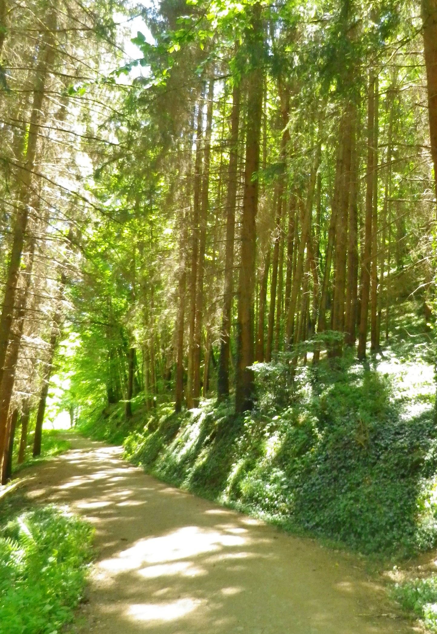
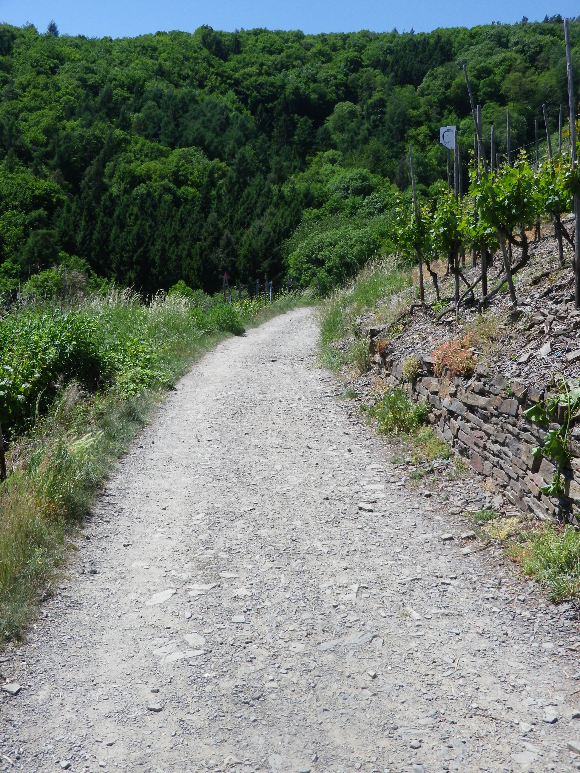
The trail proceeded through woodlands containing chestnut trees. This part of the Toerggeleweg follows along a popular long-distance trail called the Keschtnweg/Sentiero delle Castagne, or the Chestnut Trail. Before long though, I was in vineyards, the object of my hike. Most of the vines are trained high. In this southern Alpine wine region, the growth can be luxuriant quite early in the season. So many shades of green greeted the eye, everywhere I looked.
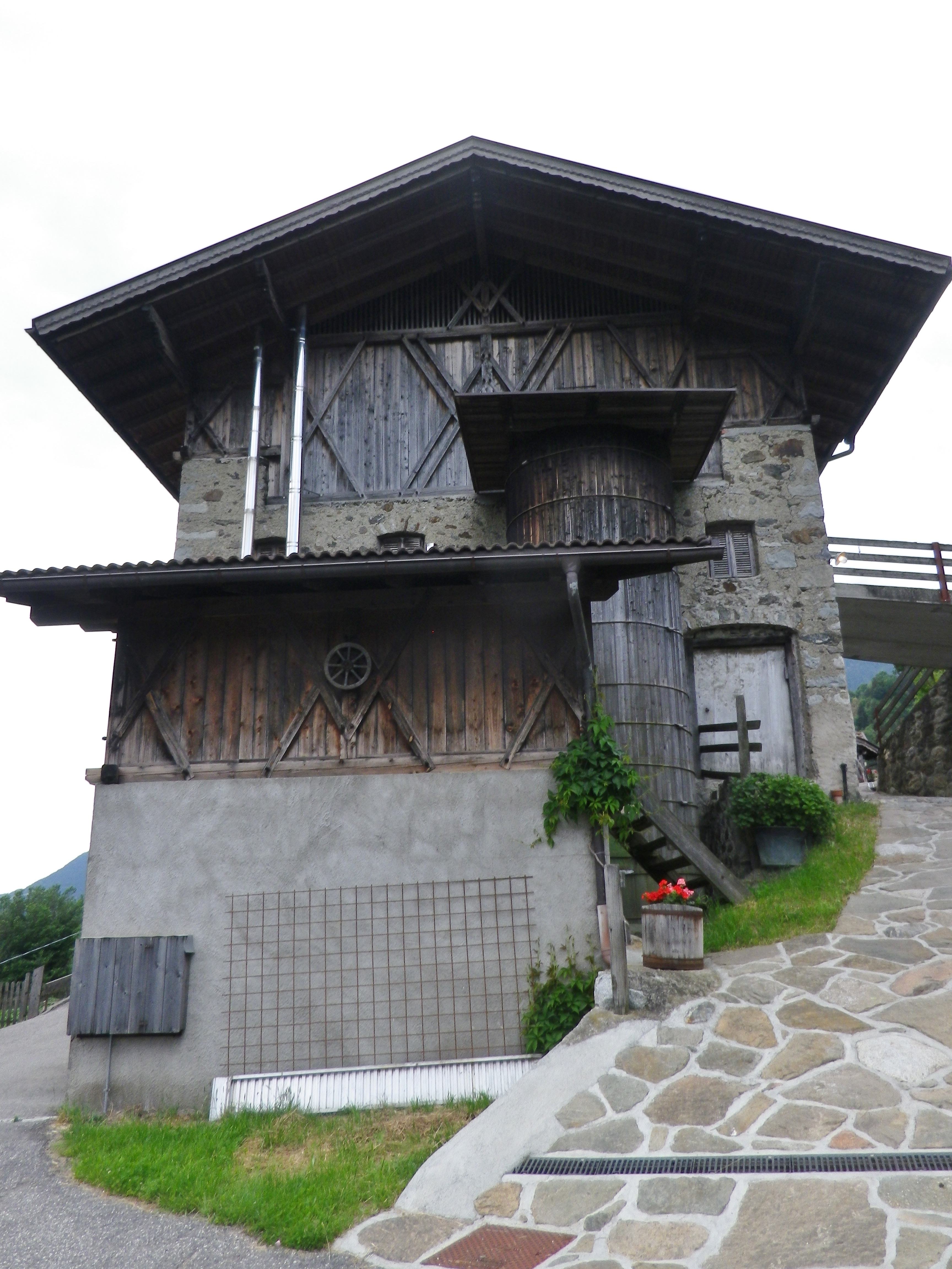
Every now and then, the trail lead through a farming compound or settlement. As I passed these buildings, I realized what spectacular settings most of them offered. Set on a steep-sided mountain looking across the deep valley, surrounded in part by vineyards, they were forested on untillable sites watered by rushing streams. These farms were well maintained, and looked inhabited. But they were eerily silent. Many rural settlements in Italy are slowly being emptied of local inhabitants, populated only as rentals during the summer season, as the young move to large towns for work, and the old move to towns for companionship. One older man, finishing his farm work for the day, drove by in a creaky Fiat Cinquecento and asked if I wanted a lift. Given that I had quite an incline ahead of me, I was tempted. I should have taken his offer, as I am sure he would have had interesting stories to tell about life on the mountain in days gone by.
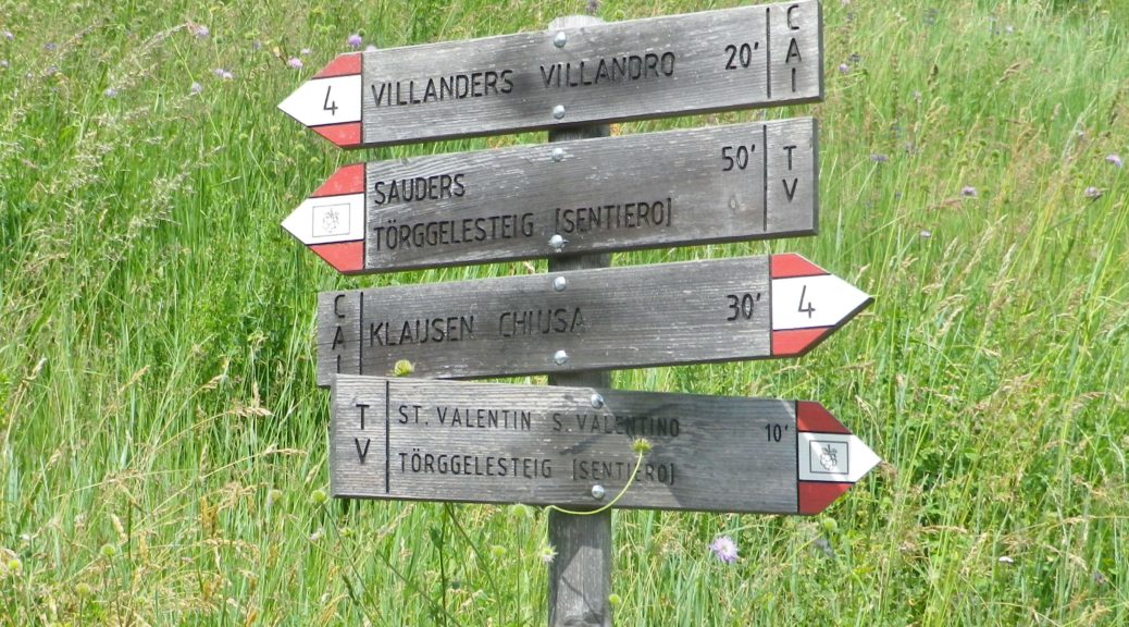
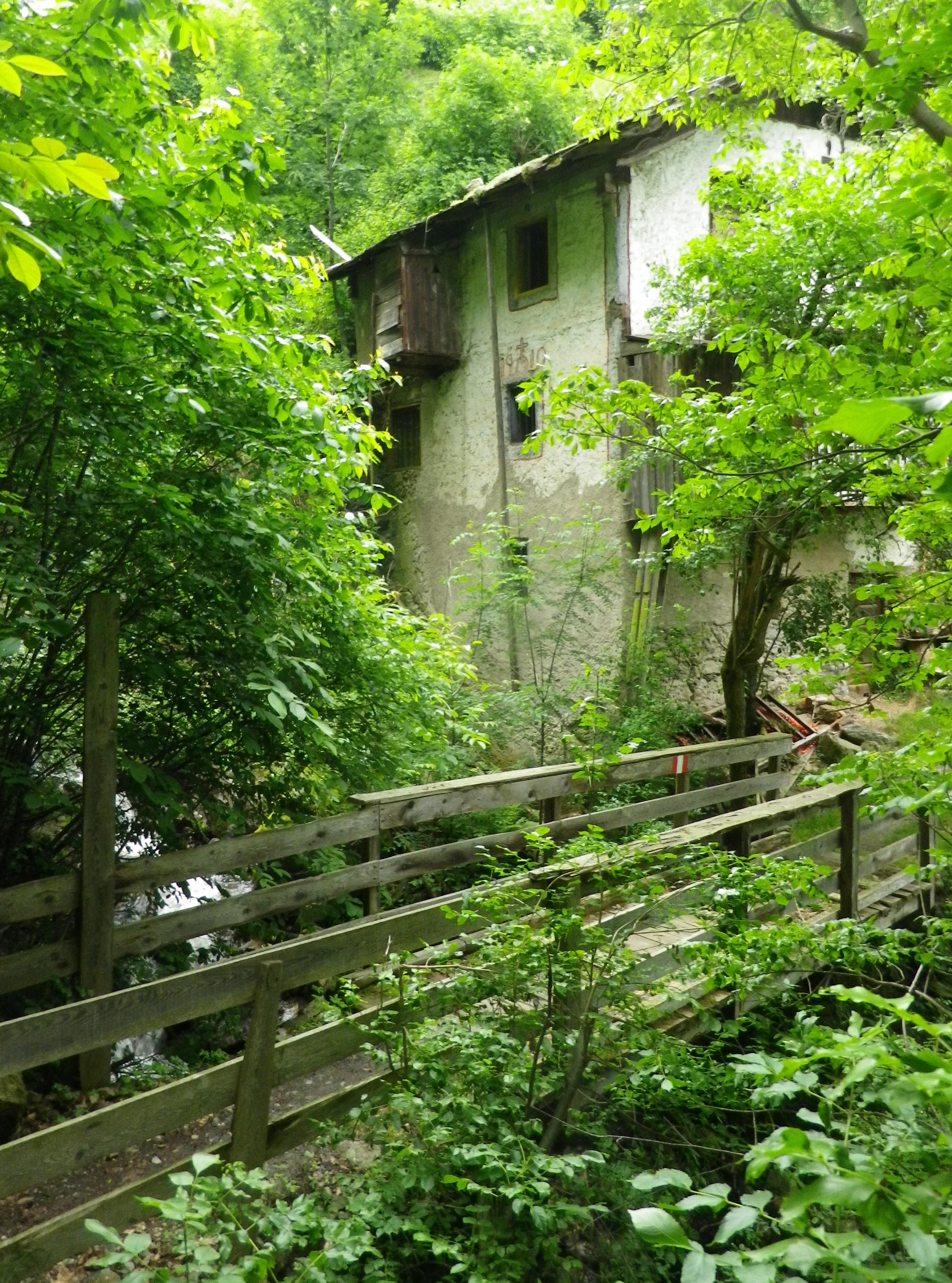
The trail eventually reached the hamlet of Sauders. More houses, and more people (three) than I had seen for over an hour. At Sauders, the trail reached its southern-most point. The slow incline up and back to Villanders began, leading out of the hamlet on a well-maintained trail, the Kirchsteig. It soon passed an old mill on a torrent, barely contained in its course as it bounded down the mountainside.
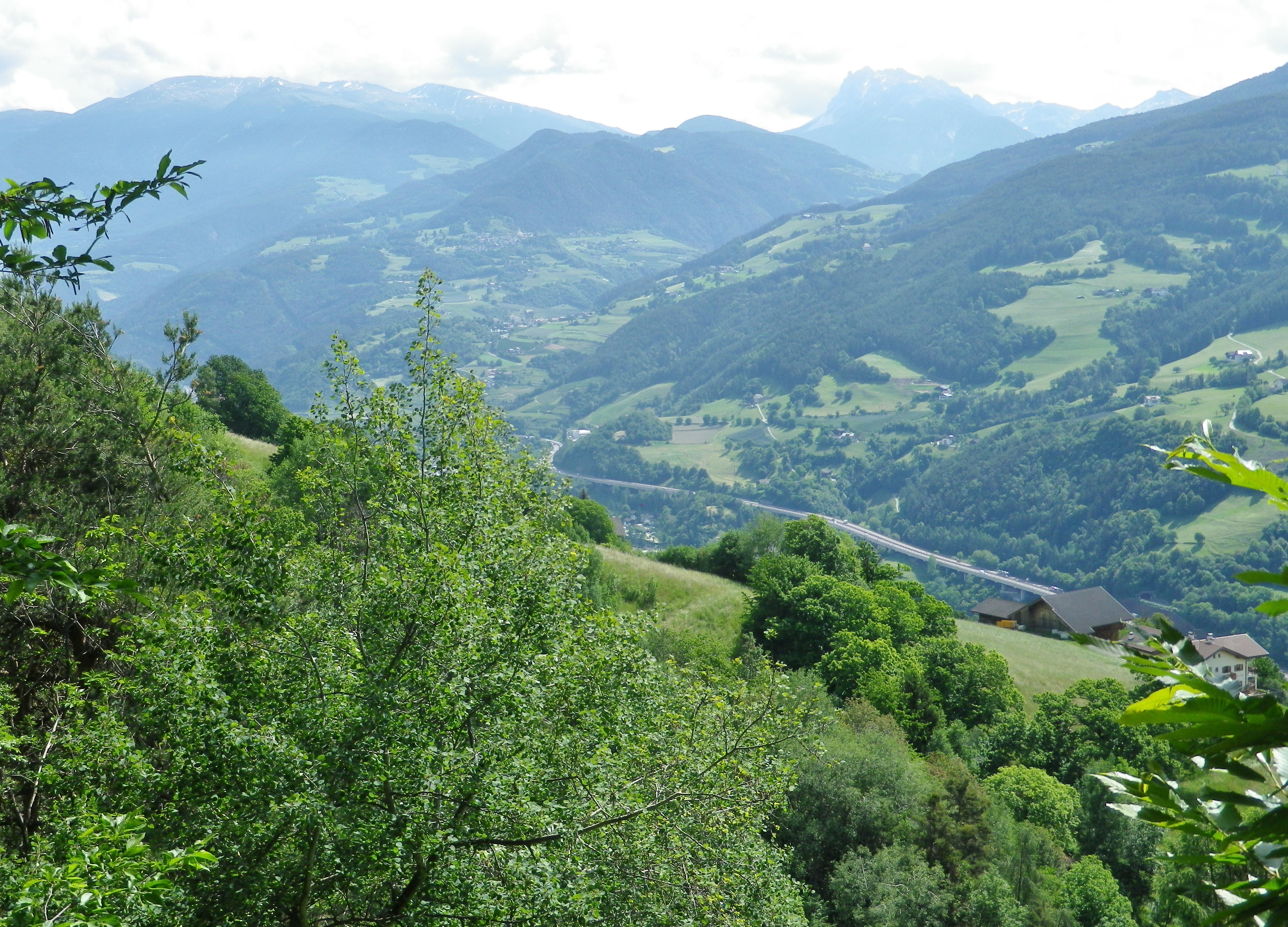
Just as the Kirchsteig joined the road to the center of Villanders, I had one more expansive view of the Eisack river and its valley, making its way through the Dolomites on its way to points south. A memorable end to a memorable trail, or possibly four or five due to the multiplicity of trails and trail names involved!
What I Learned
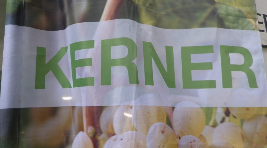
The Eisacktal district is one of several denominated wine districts of the Suedtirol wine region. The Eisack river is named Isarco in Italian, and the valley it created over the millennia is one of northern Italy’s main north-south routes. The district is located in north-central Italy, just south the Brenner Pass connecting Italy and Austria. It has less than 400 hectares devoted to vineyards. The vineyards exist at lower elevations than the pass, and are usually in relatively sheltered places with good exposure to the sun. (After all, we are talking about an area distinguished primarily by the Alps and Dolomites.) Some of the best vineyards are on the slopes south (and below) Saebens, an ancient monastery, rising above Klausen. About 90% of the wine from here is white wine. Sylvaner (yes with a Y here), Kerner and Gewuerztraminer) with the remainder a red blend (permitted varietals include Vernatsch/Schiava Grossa, Blauer Portugieser, Pinot Noir) called Klausner Laitacher.
What I Tasted
2017 Sylvaner “Aristos” Eisacktal DOC, Eisacktaler Kellereigenossenschaft, (Klausen): A dry white wine with medium plus gold color; a fruity, spicy and mineral nose, with vanilla and gooseberry flavors; medium plus acidity.
2017 Kerner “Aristos” Eisacktal DOC, Eisacktaler Kellereigenossenschaft, (Klausen): A dry white wine with medium plus gold color; vanilla, mango and peach nose, with licorice, peach and vanilla flavors, medium plus acidity.
2017 Veltliner, Eisacktal DOC, Eisacktaler Kellereingenossenschaft (Klausen): A dry white wine with light gold color; peach and spice nose, with peach, apricot and vanilla flavors; medium acidity.
2016 Zweigelt “Z”, IGT, Eisacktaler Kellereigenossenschaft, (Klausen): A dry red wine with dark garnet color; spice and dark cherry nose, with flavors of the same; medium tannins.
2016 Caruess Mitterberg Weiss, IGT, Weingut Roeck (Villanders): A dry white wine cuvee (Gewuerztraminer (about 50%), Pinot Grigio and Sylvaner), with medium plus gold color; chalk and slight floral nose, with white fruits, spicy, slight vanilla and oak flavors
2014 Zweigelt Mitterberg Caruess, IGT, Weingut Roeck (Villanders): A dry red wine with medium plus ruby red color; smoke and violet nose, with vanilla, tobacco and dark cherry flavors; medium plus tannins.
Trail Name: Toerggeleweg Villanders/Villandro (AKA Toerggelesteig) (See comment below)
Trail Type: Short distance circuit; somewhat maintained, mostly rough surfaces outside built-up areas, sometimes spotty marking on the trail.
Length:
Total – approximately 8.5 kilometers/ 5.25 miles
Convenient to: Klausen/Chiusa, Bozen/Bolzano, or Brixen/Bressanone, Suedtirol/Alto Adige, Italy
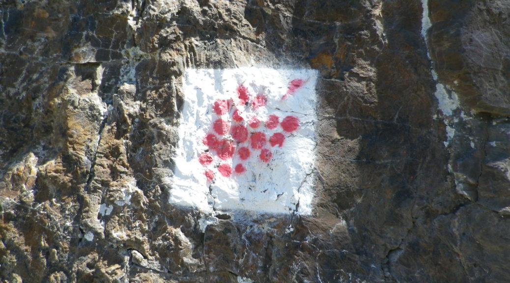
Marking: Partly along the Keschtnweg/Sentiero del Castagno (chestnut outlined in black on a white background), partly along the Toerggeleweg (AKA Toerggelesteig) bunch of grapes outlined in black on a white background; In Italy in general, horizontal white and red rectangles, either in isolation or with a trail name or symbol, indicate you are on a hiking trail.
Trail Description: Beginning in a village, this circuit trail passes through a nice variety of woodland, meadow and vineyard landscapes, while providing fantastic views of the majestic Dolomite peaks in the Odle Group. While slightly more challenging than some vineyard hikes on account of the rougher trail surfaces (in places), numerous ascents and descents, and generally steeper terrain, it is suitable for most moderately fit hikers.
Trailhead: Villanders: Kirche Sankt Michael/San Michele, Vicolo Franz v. Defregger (by Hotel Ansitz zum Steinbock)
Parking:
Villanders: Unterdorf, a medium-sized lot (behind and below the townhall/tourism office)
Public Transportation Options:
Rail: Regular service from Brixen (to the north) or Bozen (to the south) to Klausen
Bus: Service from Klausen to Villanders is available through Verkehrsverbund Suedtirol, the 345/ Villandro-Chiusa line. Information may be found (as of June 2020) at www.suedtirolmobil.info.
Suggested Stages: Not applicable
Trail Itinerary-Reference Points: (Clockwise)
Villanders: Center of Villanders (Unterdorf x Hofstatt)’ Path below Kirche Sankt Michael/San Michele, Fussweg St Stefano-Gravetsch, briefly on St Valentin; cross the creek; woods, Erzweg, Johannser (settlement), cross creek lower down; Sankt Valentin/San Valentino: Am Erzweg/Via alle Miniere, Landestrasse/SP 87, past a chapel; Bodenacker: Past some houses, onto Toerggelesteig path, downhill then uphill through woods; Oberstattleitner compound; Unter St Stefan/St. Stefano: Past the Ober- and Unter- Furner compounds; Sauders: past a church; Kirchsteig path (blue and white signs), Villanders: Hofstatt, toward town center (Ortsmitte)
Representative Trail Photos:
Restrooms:
Villanders/Villandro: In the Cemetery, in the hillside above the graves
Villanders/Villandro: Down behind the town hall complex, by the sports fields
Attractions on or near Trail: None (except the scenery!)
Tasting along the Trail:
Look for Toerggele or Buschenschank, especially in Sauders and nearby Oberfurner and Oberpartegg, and hotel restaurants in Villanders center.
The regional cooperative is on the outskirts of Klausen.
Alternative Options:
Hiking: Lots of hiking trails, naturally, but only the other Toerggelesteig trails in Klausen, Feldthurns and Barbian (see comment below), and the Leitach-Chiusa Sentiero del Vino (a 4.5 km circuit), are wine-themed trails.
Additional Information:
Regional: https://www.klausen.it/it/
Trail specific: https://www.klausen.it/it/365-giorni-attivita/escursionismo/escursioni-consigliati/
Comments:
In addition to Villanders, nearby Klausen/Chiusa, Barbian/Barbiano and Feldthurns/Velturno also have Toerggelesteig trails, especially popular during new wine season in the autumn. This may account for a number of trails in the area being marked on some maps as “Toerggelesteig,” which exceed the scope of the Villanders circuit described above.
I didn’t know what to anticipate in the Ahrtal, but it certainly wasn’t this: gorgeous, dramatic scenery, and absolutely delicious food and wine, all set in the heart of the river valley of one of the lesser known German wine regions.
Also unexpected were the steep hills that, by necessity, must accompany such stunning perspectives. And equally unexpected was the excellent red wine. Given its northern latitude, where ripening can prove difficult, good red wine is often challenging to make. Finally, I did not expect such well-developed tourism infrastructure in an area unknown to mass tourism. But Germans certainly knew about it, as the license plates I saw in the towns and villages indicated visitors from all over Germany – and with good reason.
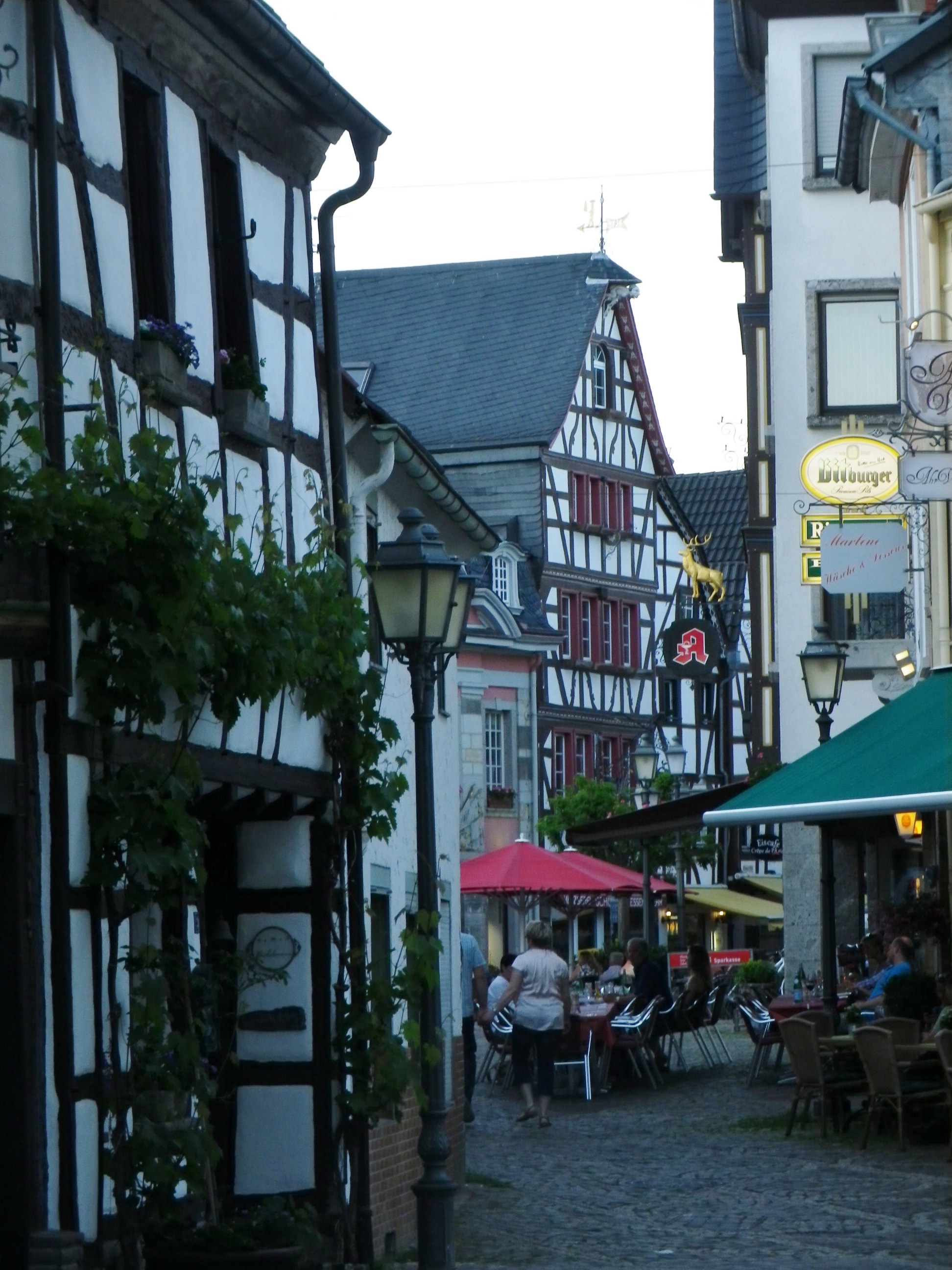
The main town in the area, Bad Neuenahr-Ahrweiler, is a delightful spa town, with all the amenities found in most spa towns: perfectly maintained paths (wheelchair as well as baby carriage accessible) through beautifully manicured parks or gardens; cafes by the dozen where strollers can watch the world go by with a cup of coffee, or a glass of wine in hand; museums and concerts, sometimes even free and outdoors; and, of course, good restaurants. The most important amenity though, pools and spas, are throughout town and in several hotels. (Soaking in a whirlpool of hot water after a long hike is any hiker’s idea of heaven on earth.)
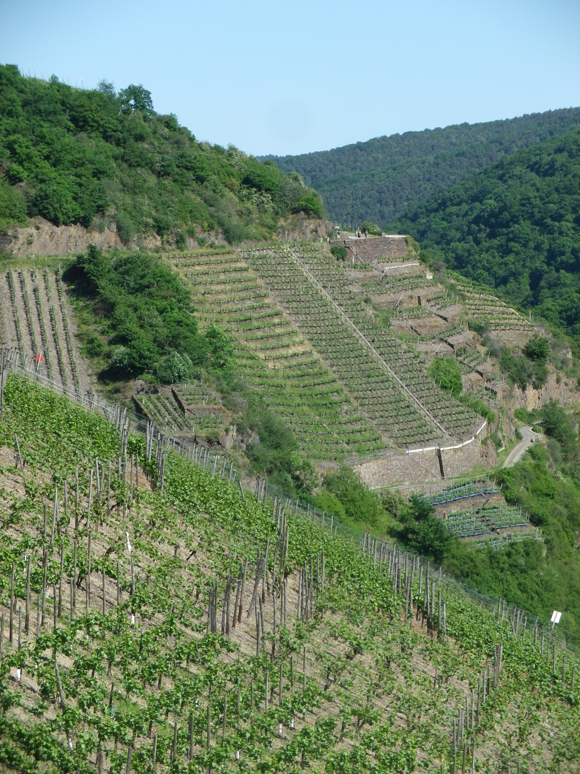
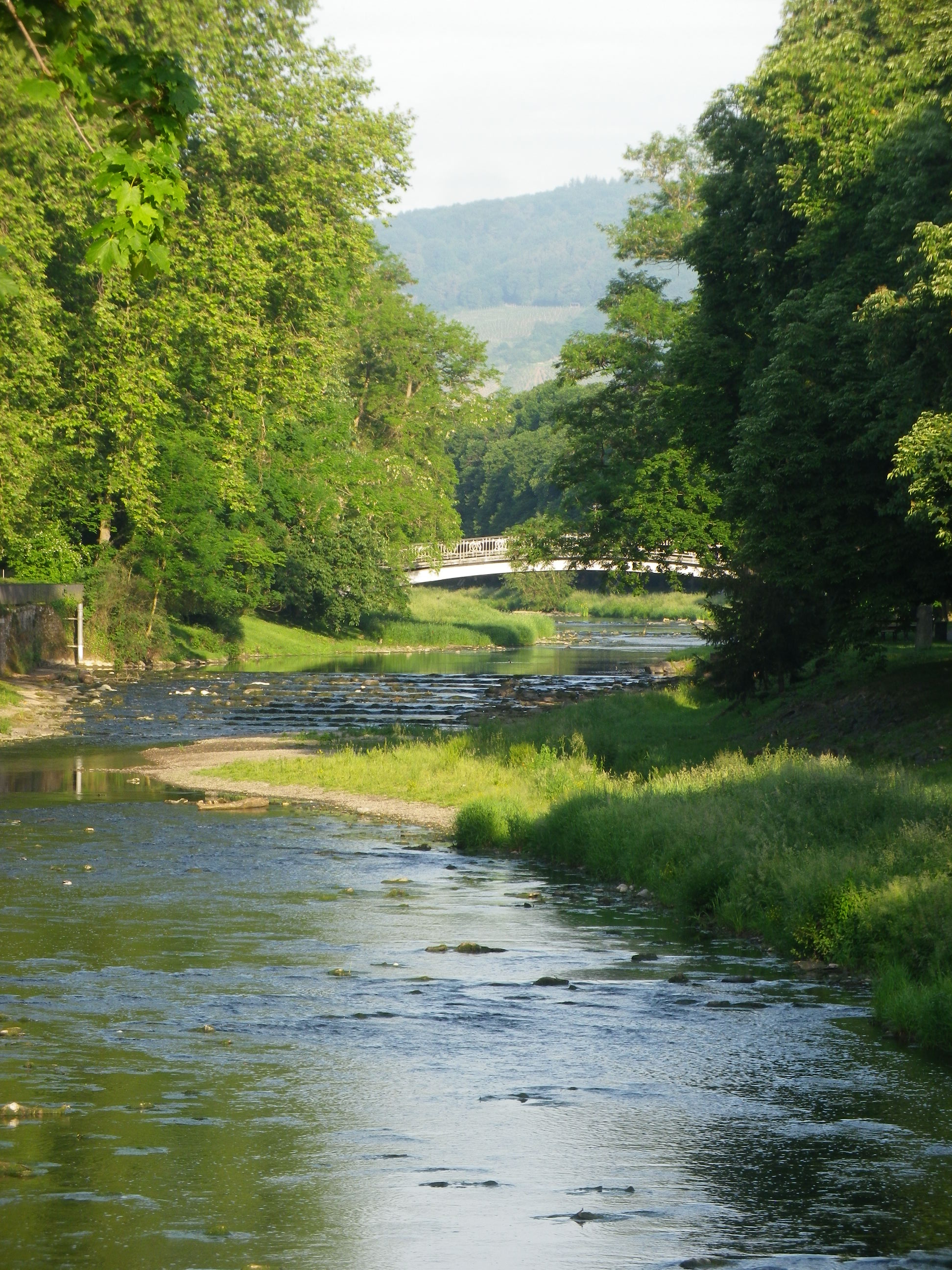
But for those preferring something a bit more strenuous, there is the Rotweinwanderweg. At 35 kilometers, it is designed to be hiked over a couple of days in stages, at your own pace. Conveniently, area hotel guests receive a local rail pass, which was another pleasant surprise! Therefore, it is possible to ride to the start point, in Altenahr, hike your way back down the valley to a point of your choosing, then picking up the following day where you left off the day before.
This trail is certainly do-able in two days, but you will want more time! Lovely wine taverns, wine shops and rest areas line the trail in places. While some taverns were in the villages (Dernau was especially full of them), I stopped at one (the Michaelishof) magnificently set in the midst of the vineyards on the outskirts of Mayschoss to sample some food and wine, in spite of being behind schedule.
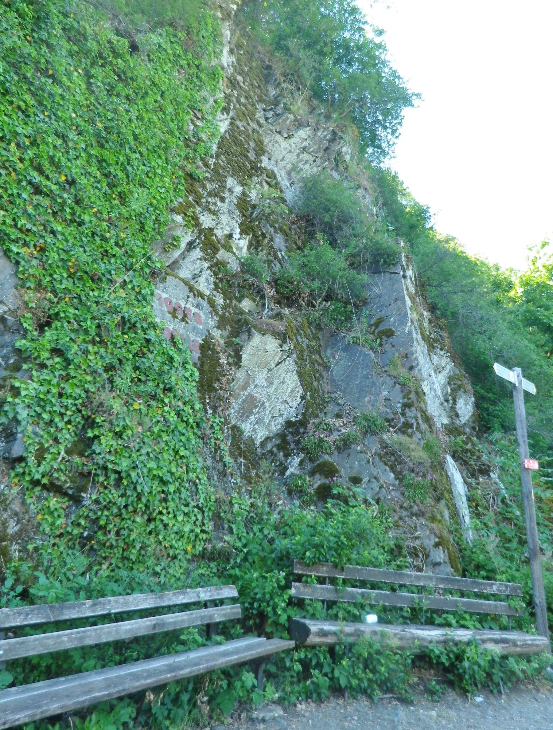
Other places that beg for a stop on the trail are fantastic overlook points, and dramatic cliffside benches. Quiet forest vales also invite hikers to experience a few minutes in shadowy, green tranquility. Sadly, I didn’t have enough time to maximize my enjoyment at each spot, so it was often with a heavy sigh, that I moved on. But at this point, I knew I could definitely count on another unexpected delight around the next bend or atop the next rise – and I was never disappointed.
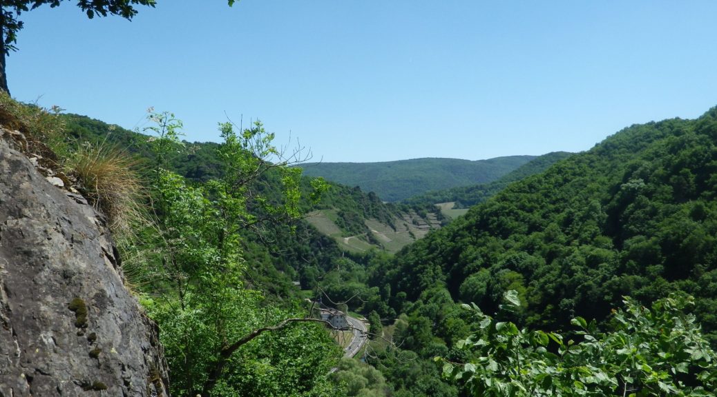
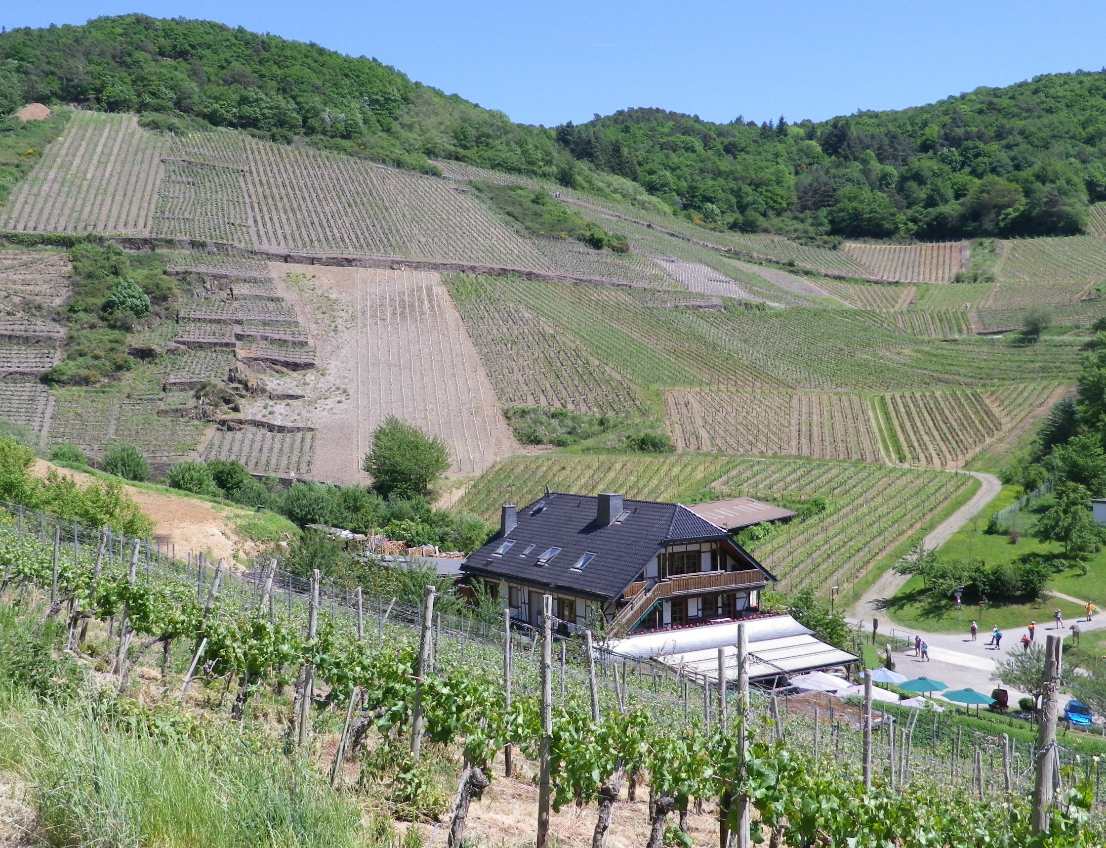
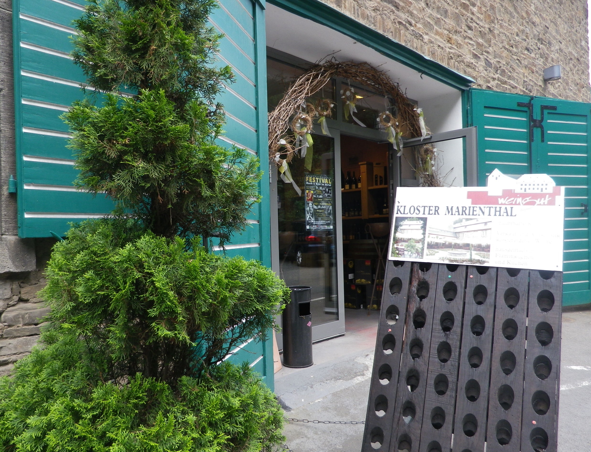
My hike on the Rotweinwanderweg only took me from to Altenahr to Marienthal. That is to say, I only completed the first 13 kilometers of the trail because of personal time constraints. Marienthal is as good a place to stop as any, as it is the site of a former monastery, now home to the Weingut Kloster Marienthal. Set in a hidden, narrow draw lined by vineyards on one side of the road, and tall pines on the other, its historic building contains an impressive wine shop, a wine bar, and a garden café. It was a fitting way to end my hike on this trail, which also included an unexpected desire to return someday to finish this great trail.
What I Learned
Germany’s Ahr Wine Region, almost 50 kilometers north of the Moselle at Koblenz, is the Rhineland-Palatinate’s northern-most wine region, though it is not Germany’s northern most wine region. (That honor goes to the Saale-Umstrut region in Saxony.) But it is the furthest north red wine region in Germany. Until seen, it would be hard to credit that red varietals could ripen well enough this far north. But the vines grow on steep, mostly south-facing slopes of volcanic rock, along a very narrow valley that runs (in a very serpentine fashion) from west to east. Nature and geologic activity have combined to create some ideal conditions for red varietals here, with volcanic stone soils in the western end of the valley, and loess soils in the eastern end of the valley, as it approaches the Rhine.
With only about 560 hectares, it is one of the smallest wine regions in Germany. Red wine predominates, with about 540 of those 560 hectares dedicated to red varietals. Spaetburgunder (Pinot Noir) is the most widely planted varietal, but Domina, Regent, as well as Dornfelder and Portugieser, are other red varietals that are widely planted throughout the Ahr valley. The red Fruehburgunder varietal is a regional specialty.
Wine making has historically been a cooperative affair here. Kloster Marienthal, founded in 1137, has a long history of wine-making. As the name implies, it was formerly a monastery, which needed wine for its services. Abandoned for over 100 years, it became the state wine domain in 1925. A near-by wine cooperative (winzergenossenschaft) claims to be the oldest wine cooperative in the world. The Mayschoss-Altenahr cooperative was founded in 1868 with 18 vintner members, now boasts about 420!
One final word about the wines here: It is especially difficult to find Ahr wine outside the region!
What I Tasted
2016 Spaetburgunder, Blanc de Noir, Trocken, Deutsche Qualitaetswein, Winzergenossenschaft Mayschoss Altenahr: A dry red wine vinified white, a light medium gold color with a slight tinge of pink; floral nose, with floral, vanilla and slight ripe peach flavor, very smooth overall.
2015 Rose, Heimat, Trocken, Deutschen Qualitaetswein, Josten Klein: A dry red wine (Spaetburgunder) with dark salmon pink color; floral and red berry nose, with berry and mineral flavors; very mild tannins.
2015 Spaetburgunder, Ahr-Rose, Trocken, Qualitaetswein bA, Weingut Meyer-Naekel, VDP (Dernau): A dry rose wine with pink grapefruit color, floral and sweet berry nose, with flavors of the same; slightly tart, with no appreciable tannins.
Sekt, Cuvee CK, Brut, Winzerhof Koertgen (Ahrweiler): A dry, sparkling wine cuvee (Pinot Noir, Weissburgunder, Chardonnay), with medium gold color and lively bubbles; slight floral and yeast notes on the nose, with fruity and bread flavors; medium acidity.
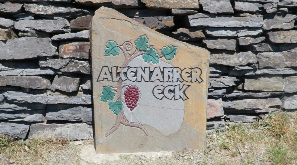
Trail Name: Rotweinwanderweg (Red Wine Hiking Trail)
Trail Type: Long distance; surface footing is all hard, be it on tarmac or hardpacked earth to stair-steps; very well maintained, and extremely well-marked.
Length:
Total: 35.5 kilometers / 22 miles
My segment: Altenahr to Marienthal (@15 kilometers / 9 miles)
Convenient to: Bonn, Germany
Marking: Red grapes on a white background
Trail Description:
This outstanding trail had a lot of variety – from the scenery, to the trail surfaces, with just enough challenge to make it fun. Sun and shade alternated as the trail passed from woods to vineyard. Judging from the numbers of couples and small groups, it is a popular trail, easily accessible from a number of points throughout its length, and one that offered several great wine taverns, as well as occasional rest areas with picnic tables, along the way.
Trailheads:
Altenahr: Seilbahnstrasse x B267
Bad Bodendorf : Bahnhofstrasse x Moselstrasse
Parking: (Altenahr to Heppingen only)
Altenahr: Seilbahnstrasse, a large lot
Rech: Brueckenstrasse (at the far end of the bridge)
Marienthal: Klosterstr, large lot at end of the improved road
Heppingen: Left off Burgstr, Parkplatz Friedhof, a large lot by the cemetery
Public Transportation Options:
Rail: Deutsche Bahn regional trains frequently service the Ahr valley, from Remagen to Ahrbruecke, with stops at all the villages/towns on the trail. (See the free ride tip below.)
Suggested Stages:
Altenahr to Mayschoss (4 km)
Mayschoss to Rech (3 km)
Rech to Dernau (4 km)
Dernau to Marienthal (4 km)
Marienthal to Walporzheim (3.1 km)
Walporzheim to Ahrweiler (3.4 km)
Ahrweiler to Bad Neuenahr (6.7 km)
Bad Neuenahr to Heppingen (2.2 km)
Heppingen to Lohrsdorf (2.5 km)
Lohrsdorf to Bad Bodendorf (2.1 km)
Trail Itinerary-Reference Points: (Altenahr to Bad Neuenahr only)
Altenahr: Altenburgerstr, Rossberg, trail for castle, then for Weisses Kreuz, vineyards, woods, more vineyards; Mayschoss: Weinhaus Michaelishof, Dorfstr, trail through vineyards, Rech: joins above In Der Aue; vineyards, then woods; Dernau: vineyards, cross K35, cross Bachstr, vineyards; Marienthal: Klosterstr; past the Kloster Marienthal winery, then ruins; Vineyards and woods, past Weingut Forsterhof; Bad Neuenahr-Ahrweiler: Im Teufelbach-Am Silberberg, vineyards, cross Elligstrasse, vineyards; Lantershofen-Grafschaft: cross L83/Hemmessener Str; Bad Neuenahr-Ahrweiler: cross over A573, vineyards; cross top of Bergstr, woods; Cross under A61; Heppingen: Jahnstr, past cemetery, cross Burgstr, woods, then vineyards; Lohrsdorf: Ritterstr, Grosser Weg, B266, vineyards, woods; Bad Bodendorf: Heerweg, turn at Winzerverein Bad Bodendorf onto Bahnhofstr.
Representative Trail Photos:
Restrooms: None observed!
Attractions on or near Trail:
Ahrweiler: AhrWeinForum, a museum with permanent displays focusing on the life of vintners in the vineyards and in the cellars.
Tasting along the Trail:
Many taverns, wine bars and wineries (See itinerary above for ones directly on the path). Many more may be found off the trail in town/village centers.
Alternative Options:
Biking: The 75-kilometer-long Ahrradweg (Ahr Bicycle Trail) begins further upriver, and from Altenahr covers the same wine villages, albeit from the valley floor, mostly on dedicated bike paths, following along the river.
Additional Information:
Regional: https://www.ahrtal.de/en/
Trail specific: https://www.outdooractive.com/de/wanderung/ahrtal/rotweinwanderweg-ahrtal/1362674/#dm=1
Comments:
I was enthralled by the gorgeous and dramatic scenery. As a wine drinker, I came to appreciate every curve and new hillside, which sheltered yet another natural bowl for the vines to thrive in. A one-day hike of slightly less than half this trail, (followed by a good soak in the mineral waters), was simply not enough time to spend here.
Bad Neuenahr-Ahrweiler is a health resort area, and it has a number of attractions which might appeal to visitors: open air jazz or classical concerts, wine tastings and spa treatments.
If staying in the valley at a local hotel, the hotel-provided guest card will serve as a train ticket during your stay! The train is the ideal way to cover the stages of this hike.