Trail Name: Toerggeleweg Villanders/Villandro (AKA Toerggelesteig) (See comment below)
Trail Type: Short distance circuit; somewhat maintained, mostly rough surfaces outside built-up areas, sometimes spotty marking on the trail.
Length:
Total – approximately 8.5 kilometers/ 5.25 miles
Convenient to: Klausen/Chiusa, Bozen/Bolzano, or Brixen/Bressanone, Suedtirol/Alto Adige, Italy
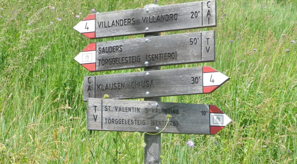
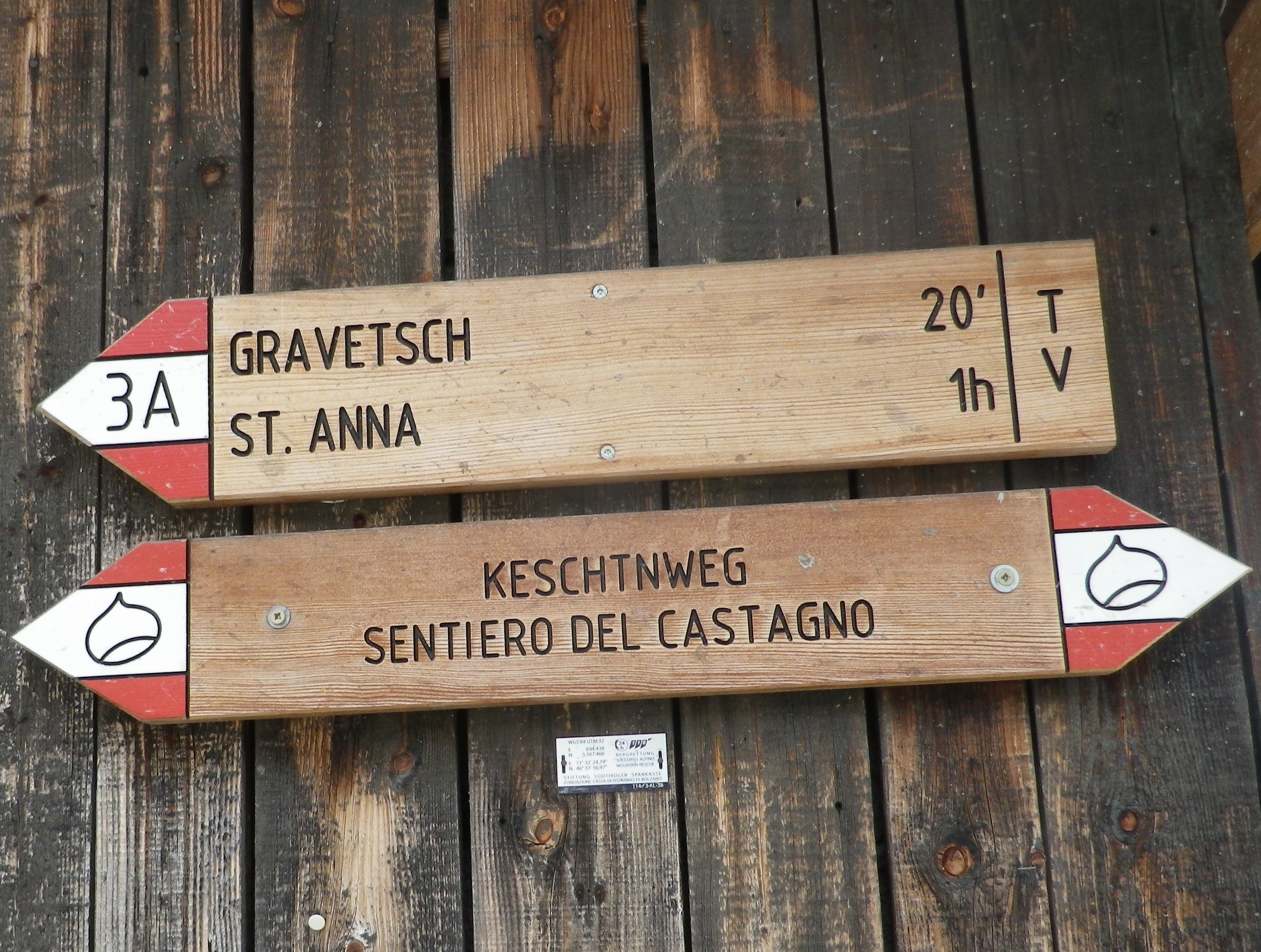
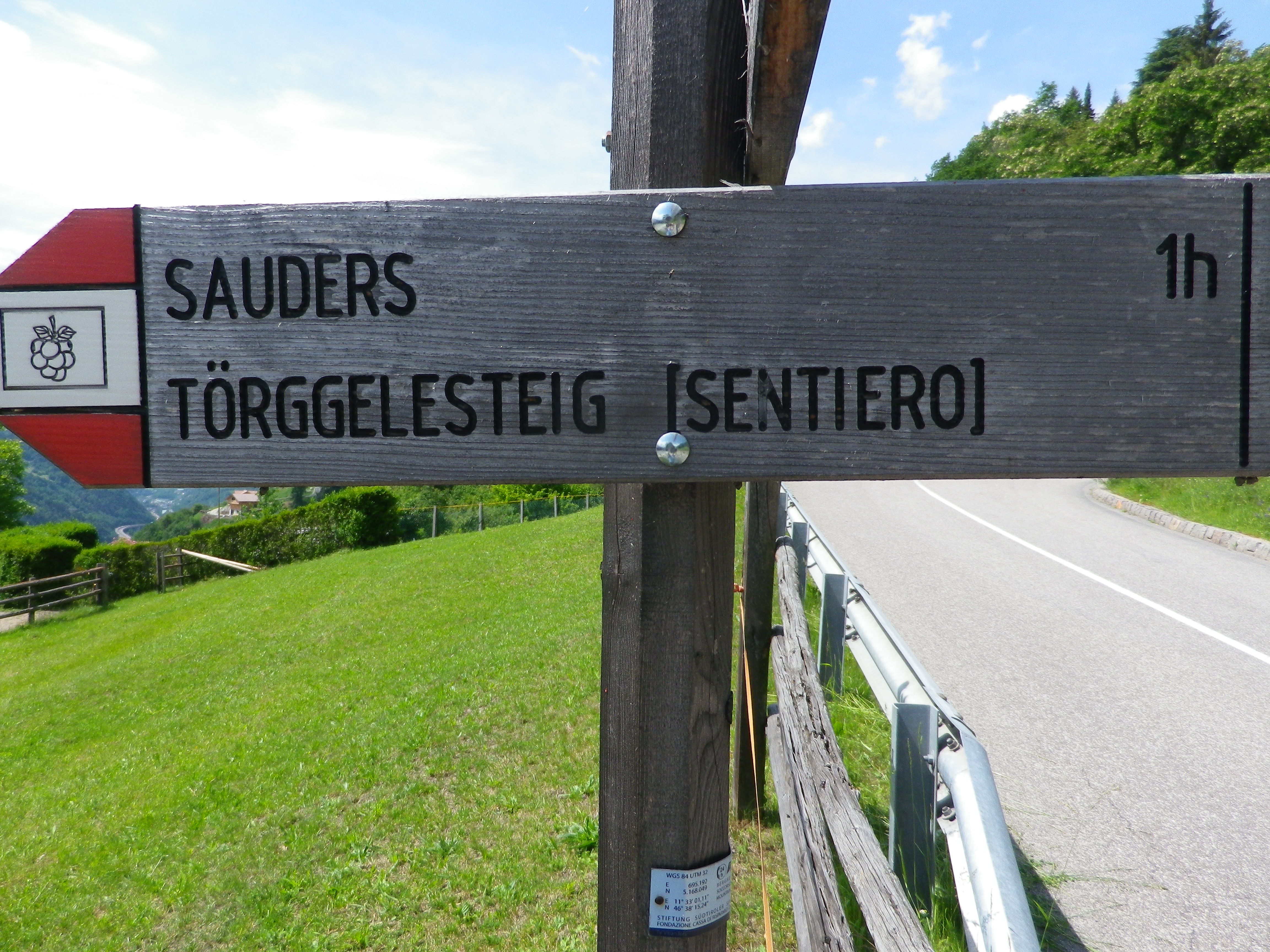
Marking: Partly along the Keschtnweg/Sentiero del Castagno (chestnut outlined in black on a white background), partly along the Toerggeleweg (AKA Toerggelesteig) bunch of grapes outlined in black on a white background; In Italy in general, horizontal white and red rectangles, either in isolation or with a trail name or symbol, indicate you are on a hiking trail.
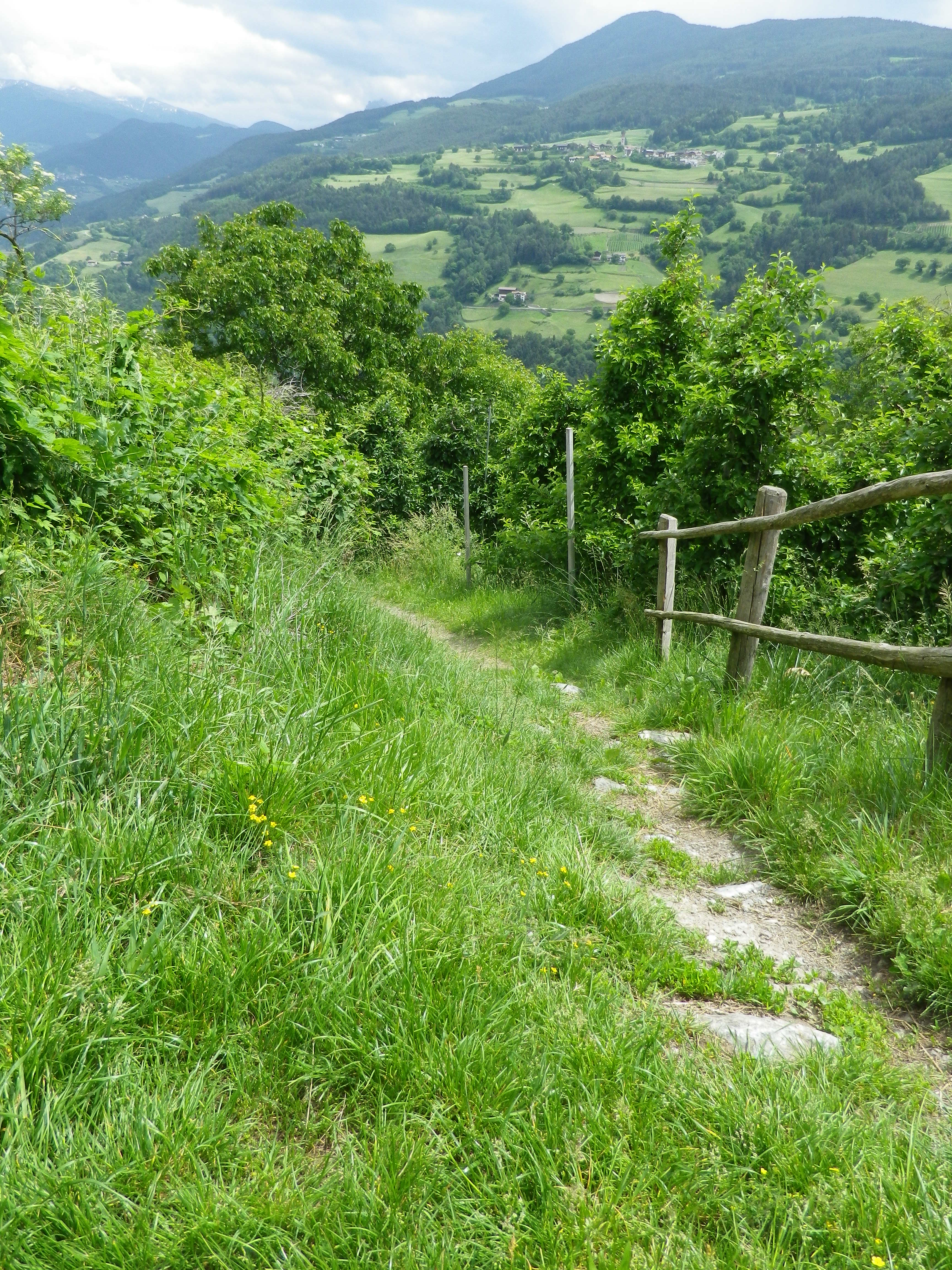
Trail Description: Beginning in a village, this circuit trail passes through a nice variety of woodland, meadow and vineyard landscapes, while providing fantastic views of the majestic Dolomite peaks in the Odle Group. While slightly more challenging than some vineyard hikes on account of the rougher trail surfaces (in places), numerous ascents and descents, and generally steeper terrain, it is suitable for most moderately fit hikers.
Trailhead: Villanders: Kirche Sankt Michael/San Michele, Vicolo Franz v. Defregger (by Hotel Ansitz zum Steinbock)
Parking:
Villanders: Unterdorf, a medium-sized lot (behind and below the townhall/tourism office)
Public Transportation Options:
Rail: Regular service from Brixen (to the north) or Bozen (to the south) to Klausen
Bus: Service from Klausen to Villanders is available through Verkehrsverbund Suedtirol, the 345/ Villandro-Chiusa line. Information may be found (as of June 2020) at www.suedtirolmobil.info.
Suggested Stages: Not applicable
Trail Itinerary-Reference Points: (Clockwise)
Villanders: Center of Villanders (Unterdorf x Hofstatt)’ Path below Kirche Sankt Michael/San Michele, Fussweg St Stefano-Gravetsch, briefly on St Valentin; cross the creek; woods, Erzweg, Johannser (settlement), cross creek lower down; Sankt Valentin/San Valentino: Am Erzweg/Via alle Miniere, Landestrasse/SP 87, past a chapel; Bodenacker: Past some houses, onto Toerggelesteig path, downhill then uphill through woods; Oberstattleitner compound; Unter St Stefan/St. Stefano: Past the Ober- and Unter- Furner compounds; Sauders: past a church; Kirchsteig path (blue and white signs), Villanders: Hofstatt, toward town center (Ortsmitte)
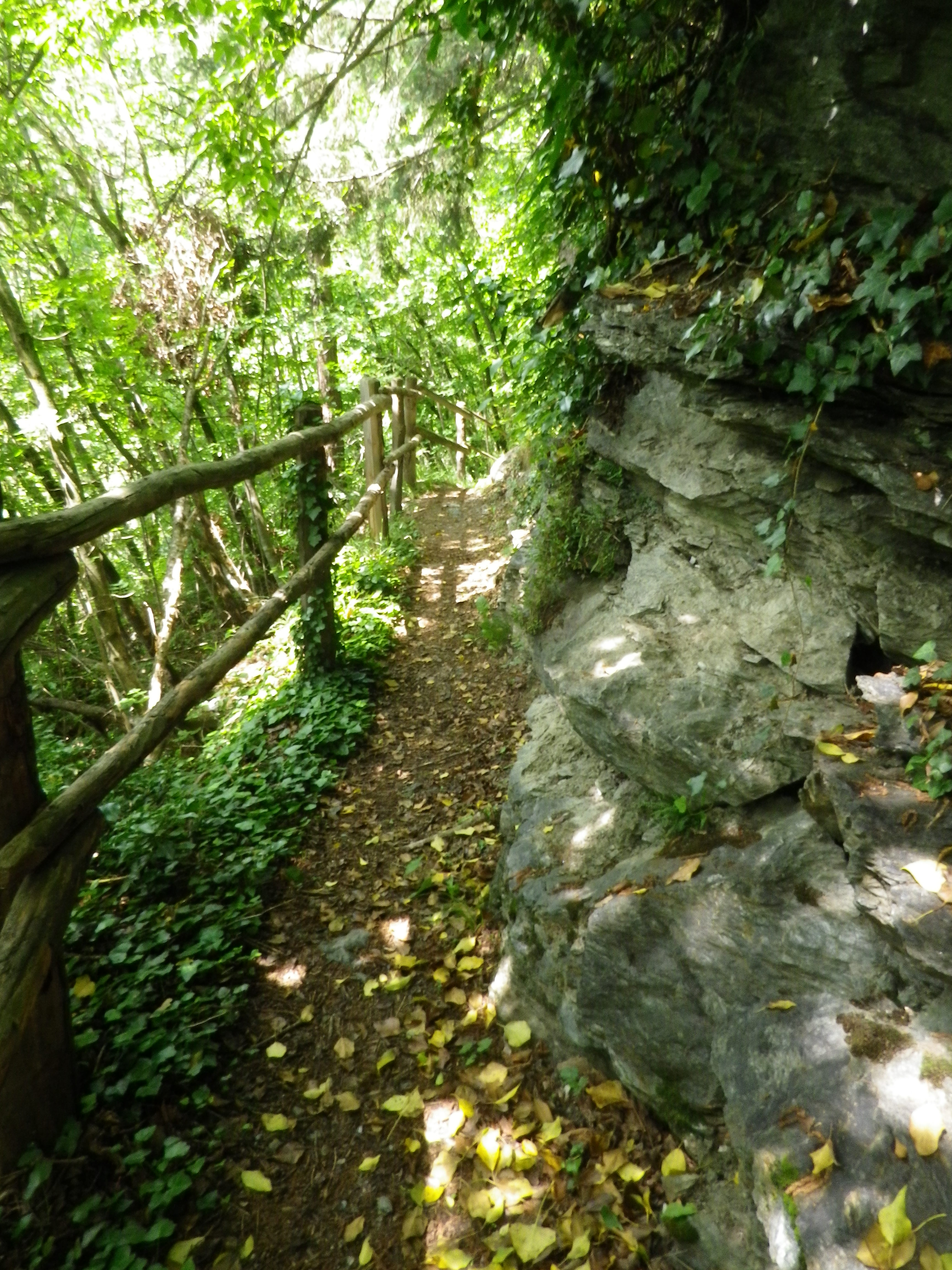
Representative Trail Photos:
Restrooms:
Villanders/Villandro: In the Cemetery, in the hillside above the graves
Villanders/Villandro: Down behind the town hall complex, by the sports fields
Attractions on or near Trail: None (except the scenery!)
Tasting along the Trail:
Look for Toerggele or Buschenschank, especially in Sauders and nearby Oberfurner and Oberpartegg, and hotel restaurants in Villanders center.
The regional cooperative is on the outskirts of Klausen.
Alternative Options:
Hiking: Lots of hiking trails, naturally, but only the other Toerggelesteig trails in Klausen, Feldthurns and Barbian (see comment below), and the Leitach-Chiusa Sentiero del Vino (a 4.5 km circuit), are wine-themed trails.
Additional Information:
Regional: https://www.klausen.it/it/
Trail specific: https://www.klausen.it/it/365-giorni-attivita/escursionismo/escursioni-consigliati/
Comments:
In addition to Villanders, nearby Klausen/Chiusa, Barbian/Barbiano and Feldthurns/Velturno also have Toerggelesteig trails, especially popular during new wine season in the autumn. This may account for a number of trails in the area being marked on some maps as “Toerggelesteig,” which exceed the scope of the Villanders circuit described above.