Trail Name: Radwanderweg Fraenkische Saale
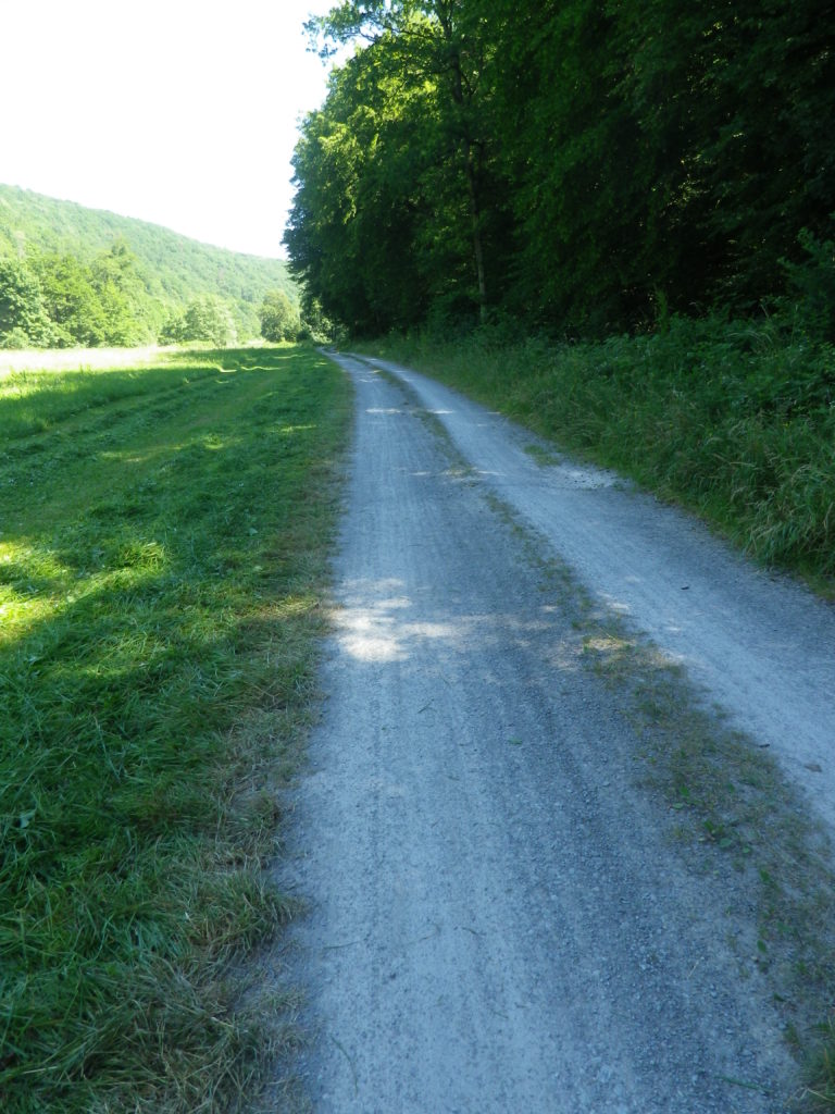
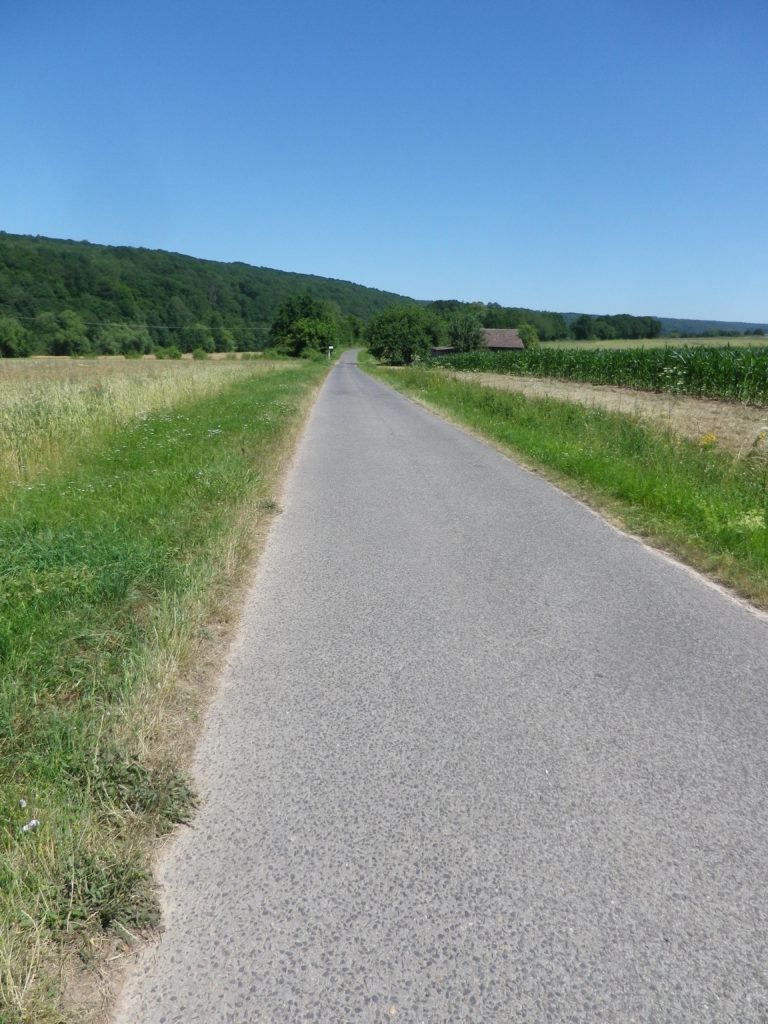
Trail Type: Long distance bicycle trail (much of it dedicated bicycle trail); well-maintained and diverse surfaces from paved to crushed stone, fairly good marking along the trail.
Length:
Total – circa 127 kilometers/79 miles
My Stage: circa 28 kilometers (See Comments below)
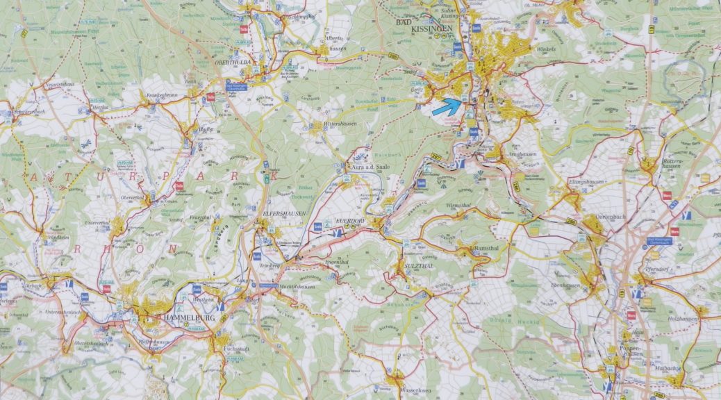
Convenient to: Bad Kissingen, Gmuenden, Franconia, Germany
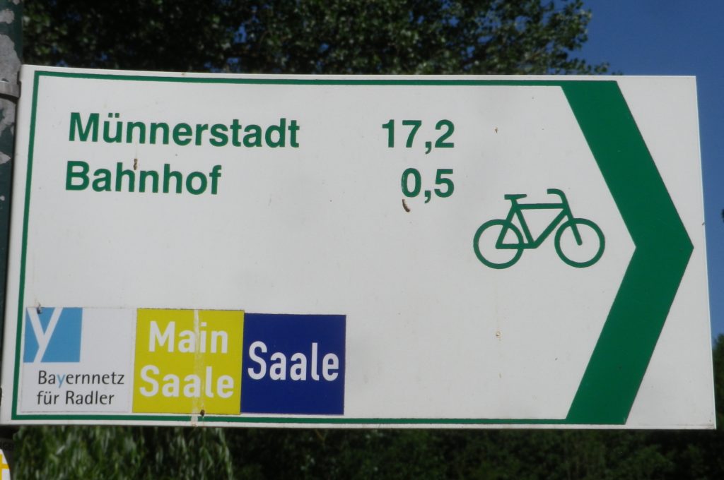
Marking: Blue background with white letters “Saale”
Trail Description: Fairly flat, with the inclines due to small spurs of more distant ridges, this quiet trail indeed follows mostly along the river, and through some of the riverside towns and villages, which make for great stops along the way.
Trailheads:
All Stages: -Trappstadt-Alsleben // Gmuenden am Main
My Stage: Bad Kissingen, In der Au x Bismarkstr // Diebach, Reuthweg
Parking (My stage only):
Bad Kissingen:
In der Au, dozens of perpendicular parking spaces along the lane; Costs one Euro per day/Four Euros for the week.
Maxstr, Parkplatz Tattersall is a large, improved lot, but costs more per day.
Diebach: Obertor, large unimproved area in a field (by parking sign at the eastern edge of town)
Public Transportation Options:
Rail: DeutscheBahn serves Hammelburg and Bad Kissingen with small stations in most of the towns mentioned in the trail itinerary below.
Bus: HOB Bus lines 8165, 8141
Suggested Stages: Not applicable for my stage
Trail Itinerary-Reference Points: (My stage only – heading downriver)
Bad Kissingen: Bismarkstr, Lindesmuhlpromenade (an alternate path through the park), Oskar von Miller Str, Im Lindes, past water treatment plant, parallel Iringstr; into forest, along the river, cross the Lollbach, parallels B287; Euerdorf: Ringstr, Kissingerstr, Gerbergasse, path along the river, parallel Auraerstr, Ara: Hauptstr, Trimbergerweg; Trimberg: Quellenstr, Hugo-von-Trimberg-Str-Brueckenstr; Elfershausen: Pass Elfershausen-Trimberg train station, August-Ullrich-Str, Marktstr, Langendorfer Str, cross river; Pass under A7, parallel river; Langendorf: Hauptstr, Westheimerstr, cross river; Westheim: Grenzstr, path left to cross river (two times in about 500 meters); Hammelburg: Pass Hammelburg Ost train station, An der Walkmuehle, Kissinger Str, straight at circle, continue, Am Marktplatz, Bahnhofstr, Saaletalstr, then cross tracks and follow parallel path;
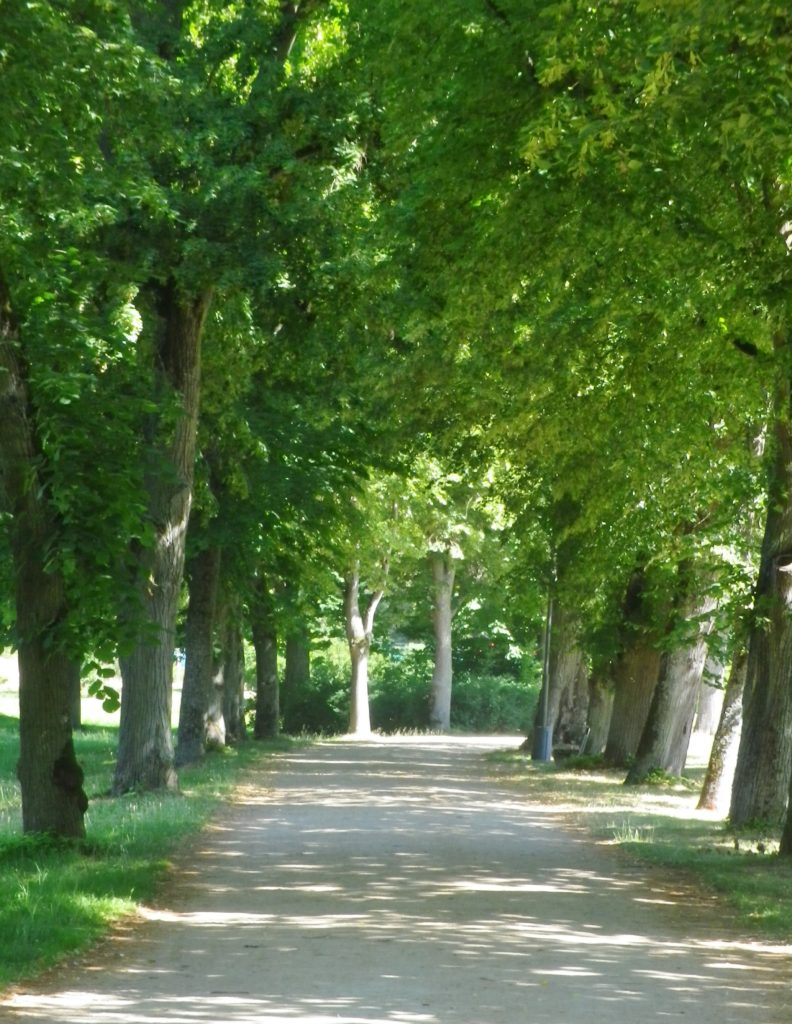
Representative Trail Photos:
Restrooms (My stage only):
Bad Kissingen: Am Kurgarten, in the Arkadenbau (arcaded building)
Elfershausen: Schlossstr x Marktstr, at the Community Center, in an outbuilding facing the courtyard
Hammelburg: Marktplatz, on the side of the Rathaus
Attractions on or near Trail (My stage only):
Hammelburg:
Kellereischloss: Historic wine cellar, with wines on offer weekly, usually Friday evenings
Museum Herrenmuehle details the history of wine-making in this area, and with its other emphasis on bread-making, from grain to final product. A recent new exhibition combines these two items under the theme: Bread and Wine.
Tasting along the Trail (My stage only):
Hammelburg: Weingut/Hotel/Restaurant Mueller; Weingut Schloss Saaleck, Kellereischloss (see above), right on the trail; several small wineries on the outskirts of town
Ramsthal: A couple of wineries in town. (Ramsthal is about three kilometers from the river trail.)
Bad Kissingen: No wineries, but lots of wine taverns and local wine selections at the many restaurants.
Alternative Options (My stage (and wine-themed) only):
Hiking:
Rundweg Hammelburg 9: A seven-kilometer trail beginning in Hammelburg, passing in about equal parts through vineyards and forest, with beautiful views all around.
Wein und Stein trail, from Euerdorf to Bad Kissingen, a 12 kilometer-long, signposted trail of medium difficulty. See details in regional link below.
Ramsthal: The Ramsthal Weinerlebniswege: Three circuits around the town’s vine-bearing hills, ranging from the three kilometers-long Bacchus Rundweg, to the Schoppen Rundweg at 7.2 kilometers in length.
Additional Information:
Regional: https://www.frankens-saalestueck.de/weinland-franken/frankenwein-urlaub/index.html
Trail specific:
http://bay-rad.de/gpxrw/BfR_Radwanderweg_Fraenkische_Saale.gpx
Downriver only from Elfershausen to Hammelburg and Gemuenden am Main:
Comments:
The trail along the Fraenkische Saale is long, but I focused only on the vineyard part of it: from south of Bad Kissingen to just west of Hammelburg (Stadtteil Untereschenbach).
This trail connects with the Main Radweg, the Main River Bicycle Trail, leading to the Rhine by Mainz, from which point it is possible to follow the Rhine Bicycle Trail. For details on part of each trail, see the Rhine Nutshell here, and the Main Nutshell here.