Trail Name: Wein Wandern Stein (Unofficial name)
Trail Type: Short distance hiking circuit; almost exclusively paved, well maintained, but the route itself is not exclusively marked.
Length: Approximately 6 kilometers/3.7 miles
Convenient to: Krems an der Donau, Austria
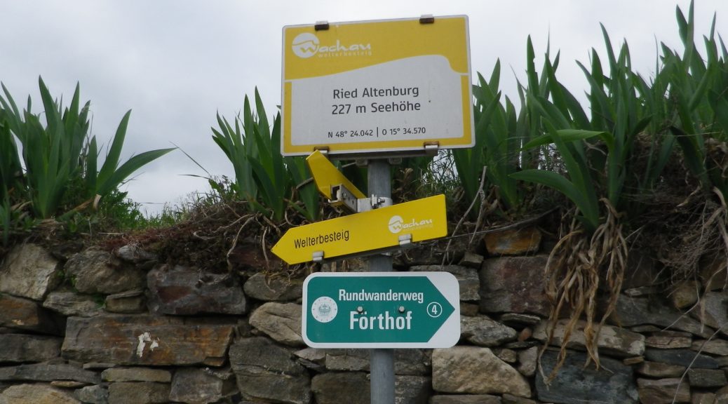
Marking: No trail-specific marking, although throughout this itinerary there are markings for other trails (to include the Welterbesteig signs, as shown below), and signposts (see the photo below) indicating named places and the “Welterbesteig Wachau” trail.
Trail Description:
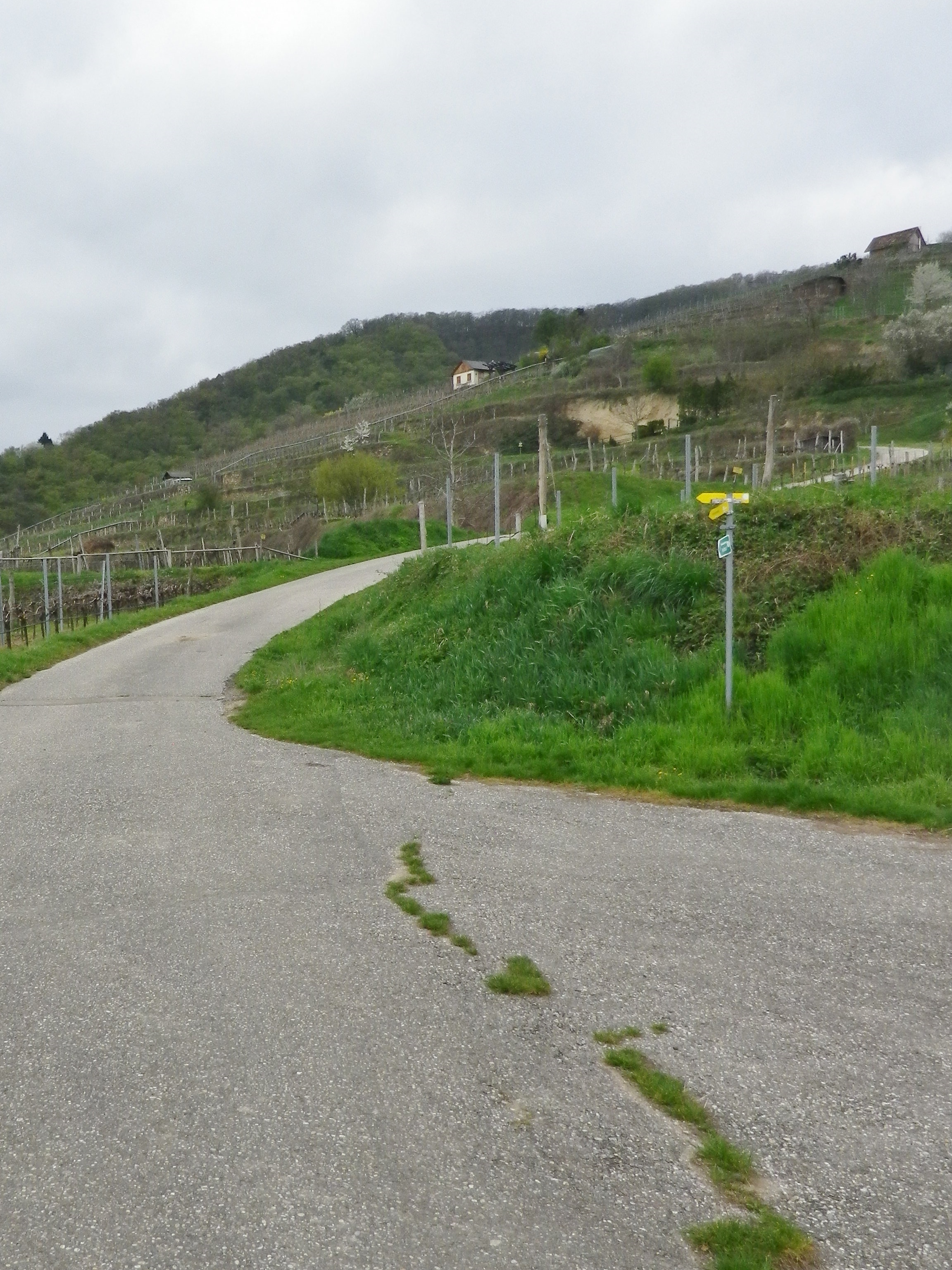
An easy circuit through the village of Stein (part of Krems), and through the vineyards above the village, returning along the Danube. It focuses both on the village’s long-established viticultural traditions, and the vineyards that made it all possible.
Trailhead:
Stein an der Donau: Steinerkellergasse x Doktor-Karl-Dorrek-Strasse
Parking:
Krems/Stein:
Along Steiner Donaulaende, there are many parking spots, but on weekdays and summers, all likely will be taken; On Steiner Donaulaende, by Gottweigerhofgasse, a small parking lot.
Parking Garages on Yachthafenstr and Steiner Landstr x Anibas Promenade
Stein/Foerthof: Along Route 3/Donau Bundestrasse, there are two or three small, unimproved parking areas along the Danube.
Public Transportation Options:
Bus: Post bus serves Stein an der Donau. Check www.postbus.at
Rail:
OBB services Krems, connecting with nearby towns, and Vienna
Wachaubahn provides seasonal service upriver from Krems to Grimsing, to include Stein, Loiben (Unter and Ober-), Duernstein, Weissenkirchen in der Donau, Spitz an der Donau and Willendorf
Suggested Stages: Not applicable
Trail Itinerary-Reference Points: (Counterclockwise)
Stein: Doktor-Karl-Dorrek-Str x Steinerkellergasse, Steinspreng (at signs for Tullner and Mariazellerweg Trails), Guetersweg Schreckberg, circle counterclockwise on the Schreckberg lanes, return to Steinspreng; Right on Steiner Kellergasse, over train tracks by tunnel; Reisperbachtalstr, stairs (with W), on an path to an unnamed, paved agricultural lane, first passing the ruins of Altenburg castle, then the Altenburg Weinbergkreuz (a crucifix of vine stocks), Pfaffenbergweg-Foerthofstr-Steiner Donaulaende-Steinerlandstr-Reisperbachtalstr-Hintere Fahrstr-Frauenberg, stairs (at the St Nikolaus church) down to Steiner Landstr
Representative Trail Photos:
Restrooms:
None observed
Attractions on or near Trail:
Lining the Steiner Kellergasse are many nicely maintained wine cellars, some of which are still in use as such!
Tasting along the Trail:
There are several “Heuriger” (seasonal wine taverns), along the trail, and numerous taverns, bars and restaurants in town.
Alternative Options:
Walking: The Welterbesteig Wachau trail begins in Krems proper, and continues upriver to Melk (the famous abbey) on the high route along the Danube and sometimes inland through the vineyards and villages along the way. From Melk, it continues downriver back to Krems for a total of 180 kilometers. See the Nutshell here.
Additional Information:
Regional: https://www.krems.info/de/home/
Trail specific: None
Comments:
I adapted this circuit from one suggested by a local hiker, hence no definitive markings, or references to it online or in town literature. Therefore, there is no trail specific signage, although this itinerary does follow a section of the Welterbesteig Wachau trail leading from Resiperbachtal Strasse to Pfaffenbergweg, and then the two itineraries diverge at Foerthof
To extend the hike slightly, follow the Welterbesteig Wachau upriver along the Pfaffenbergweg, to the border between the Kremstal and Wachau appellations. To close the circuit, head downhill to the hamlet of Rothenhof and follow along footpath along the river paralleling the main road (B3) back to Foerthofstrasse. Continue the itinerary above from Fuerthof.