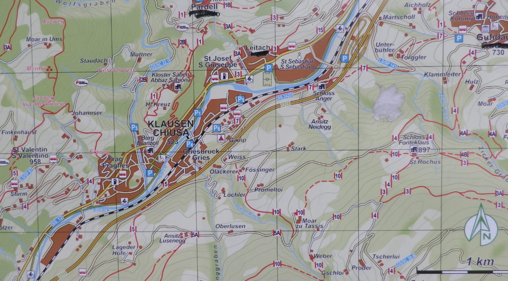
Trail Name: Saebener Rundweg
Trail Type: Very short-distance circuit; well-maintained with hard (paved or packed earth) surfaces, with some cobblestones; mostly good marking for this itinerary.
Length:
Total – 3.0 kilometers/miles
Convenient to: Bozen (Bolzano), Brixen (Bressanone), Italy
Marking:
White over red horizontal bars
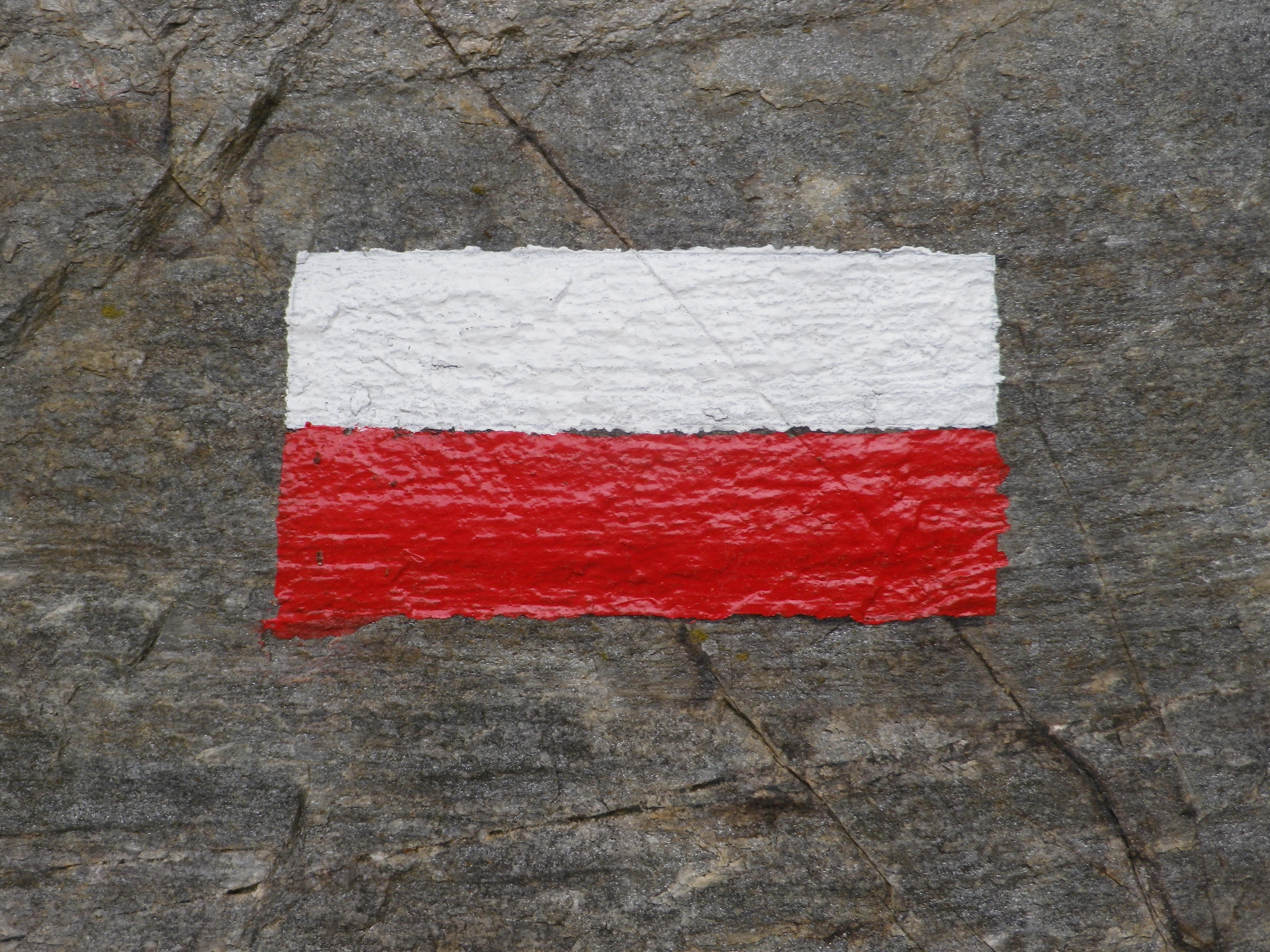
Follows written signs for “Keschtnweg” and Saebener Rundweg
Trail Description:
This somewhat steep circuit trail follows along three well-marked and well-traveled trails (Saebener Promenade, Keschtnweg, Saebener Aufgang (Salita Sabiona)), all leading to Kloster (Cloister) Saebens, on a steep promontory overlooking the Eisack (Isarco) River valley.
Trailhead:
Official: Off Tinneplatz, a few meters down Unterstadt
Parking:
Klausen: Marktplatz, finished parking lot with dozens of spots, but – will be closed on Market day (May 2022, it was Tuesday), and look for the kiosk to pay (very reasonable charges) for a ticket to display on the dashboard.
Public Transportation Options:
Rail: Klausen lies on the main north-south route through northern Italy. Trenitalia, has regular trains in this region, that connect, quickly and easily, Klausen with Verona, to the south, and Brenner (even Innsbruck), to the north. Check out https://www.trenitalia.com/en/purchase.html
Suggested Stages: Not applicable
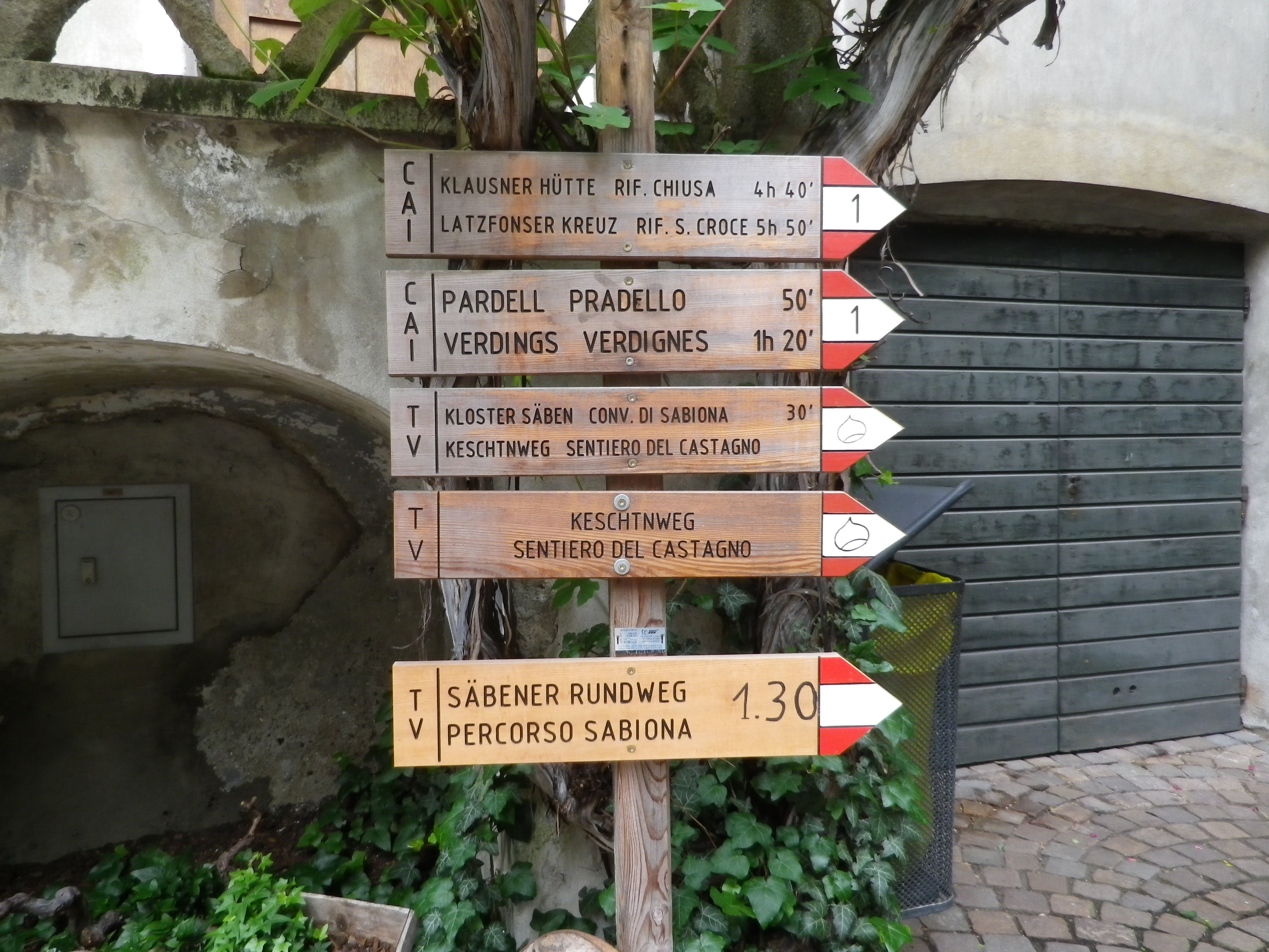
Trail Itinerary-Reference Points:
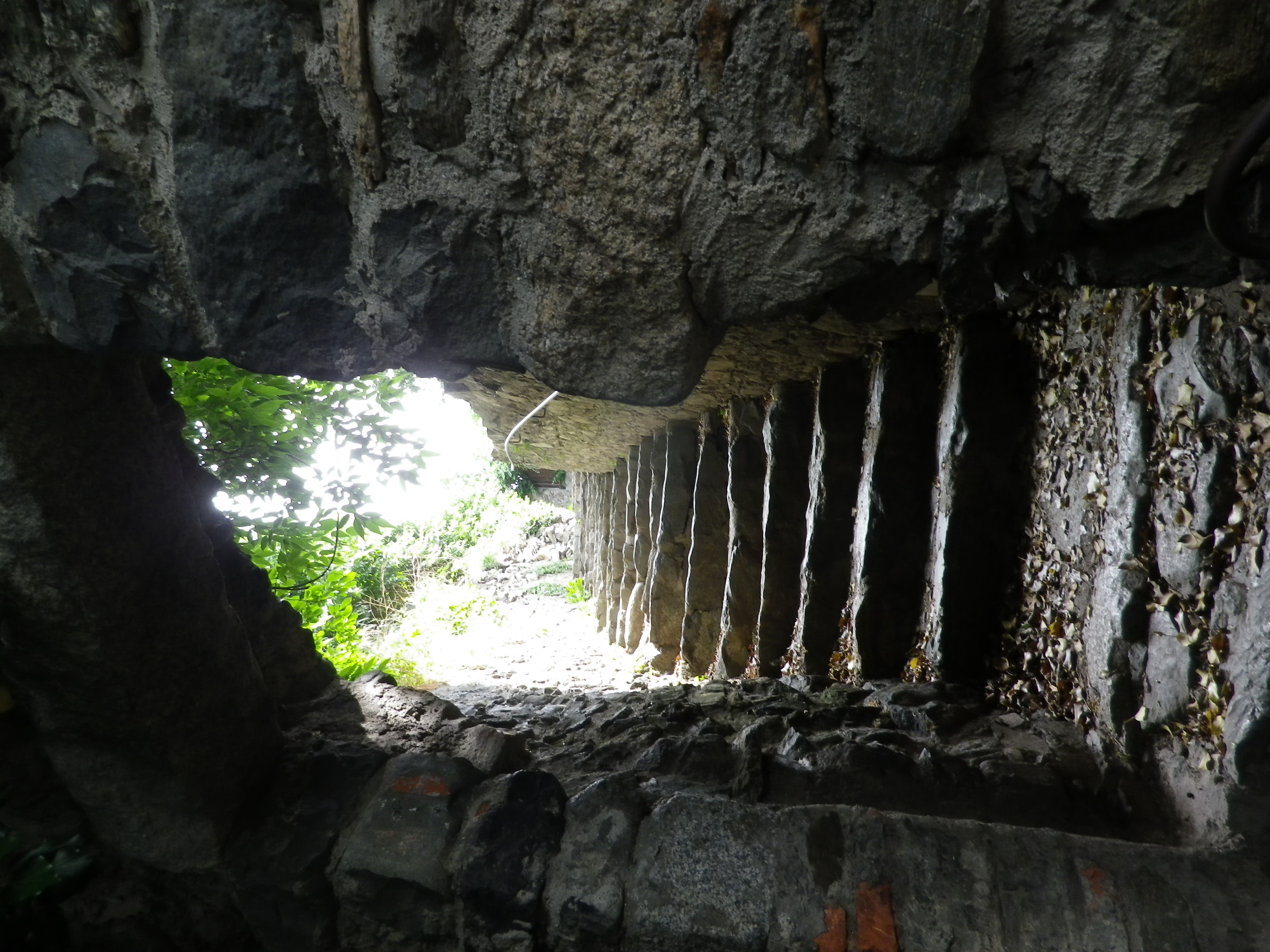
Follow the “Saebener Aufgang (Salita Sabiona)” sign, in between buildings, to a path with some steps, and concrete path, will meander uphill from there to a marked intersection.
Choose to go right – and head along the wooded slope just above the highway. Then a steep incline follows up a series of switchbacks. Turn left (following the Keschtnweg/Chestnut way south) a bit more uphill toward the Heilig-Kreuz/Santa Croce church.
Choose to go left – continuing along the Saebener Aufgang (Salita Sabiona) path, and follow through vineyards, and along the stations of the cross (I-XIV), to the Heilig-Kreuz/Santa Croce Church
After admiring the view, head downhill. Either way, quads will get a work out!
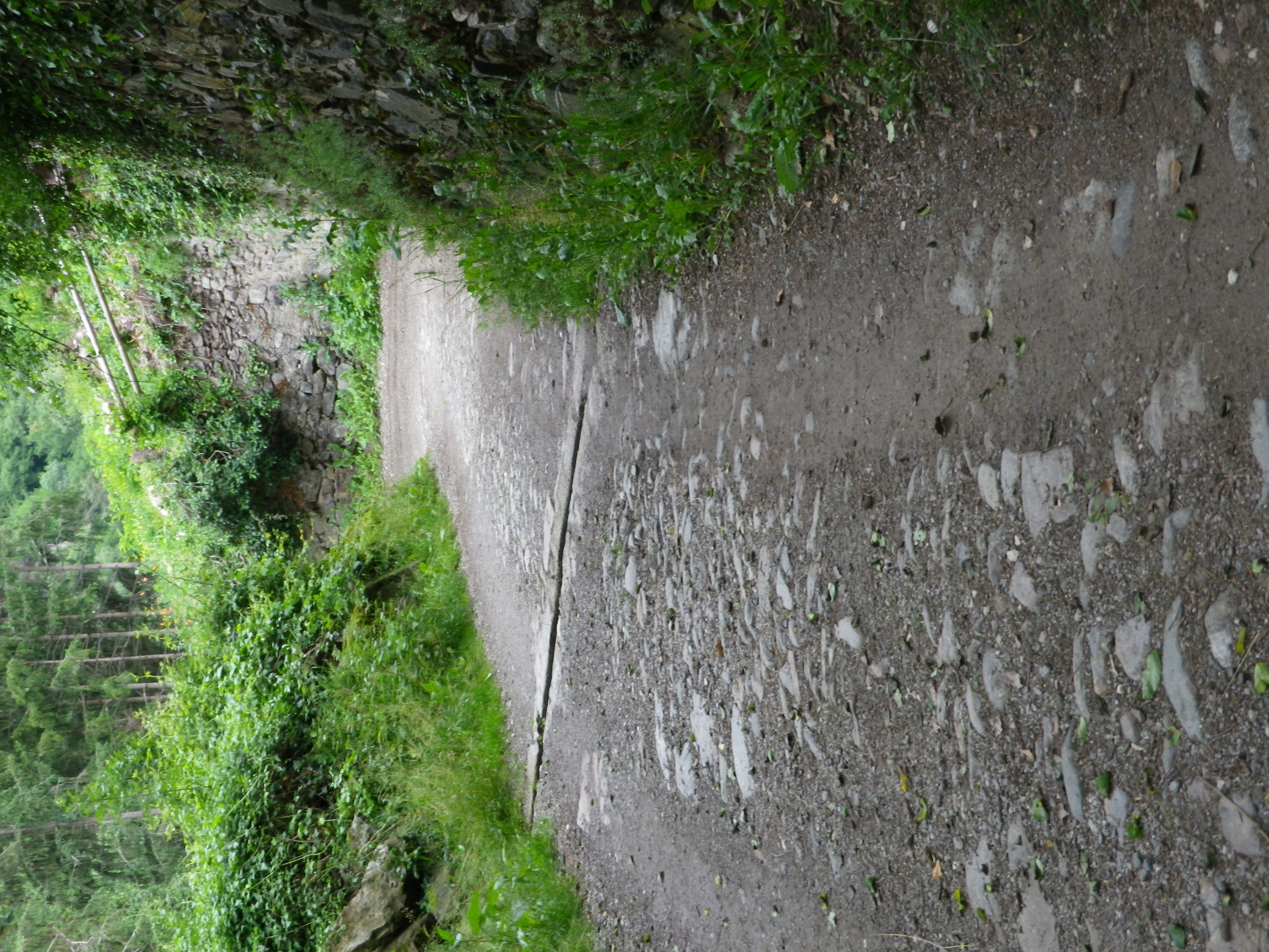
Representative Trail Photos:
Restrooms:
Klausen: Marktplatz, at the end of the parking lot
Attractions on or near Trail:
Just lots of vineyard scenery set in the Dolomites
Tasting along the Trail:
Tasting opportunities are found in Klausen, in the many cafes and restaurants. The local cooperative winery is about a mile north on the main road from Klausen toward Leitach.
Alternative Options:
Hiking: The circuit trail Toerggelewanderung Klausen Saeben-Johaniter-Klausen, is a medium difficulty (some parts are rather steep) 8.5 kilometer hike through the vineyards and forests between Klausen and Leitach. It includes a stretch along the river, and can include a short side trip to the impressive Kloster Saebens. https://www.outdooractive.com/de/route/wanderung/eisacktal/toerggelewanderung-klausen-saeben-johaniter-klausen/108577848/#dm=1
Additional Information:
Regional: https://www.klausen.it/de/urlaub-eisacktal.html
Trail specific: https://www.almenrausch.at/touren/detail/kloster-saeben-von-klausen/
Comments:
The Saebener Aufgang (Salita Sabiona) trail seems a bit easier, as the ascent is a bit more consistently steep, and well maintained, but either way, along this short circuit, (and you can always return downhill the way you ascended), you will have plenty of opportunity to exercise the quads, and rest to enjoy the spectacular mountain and valley views.