Tag Archives: hiking

Communing with Vines


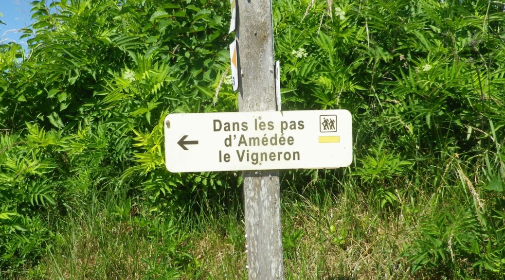
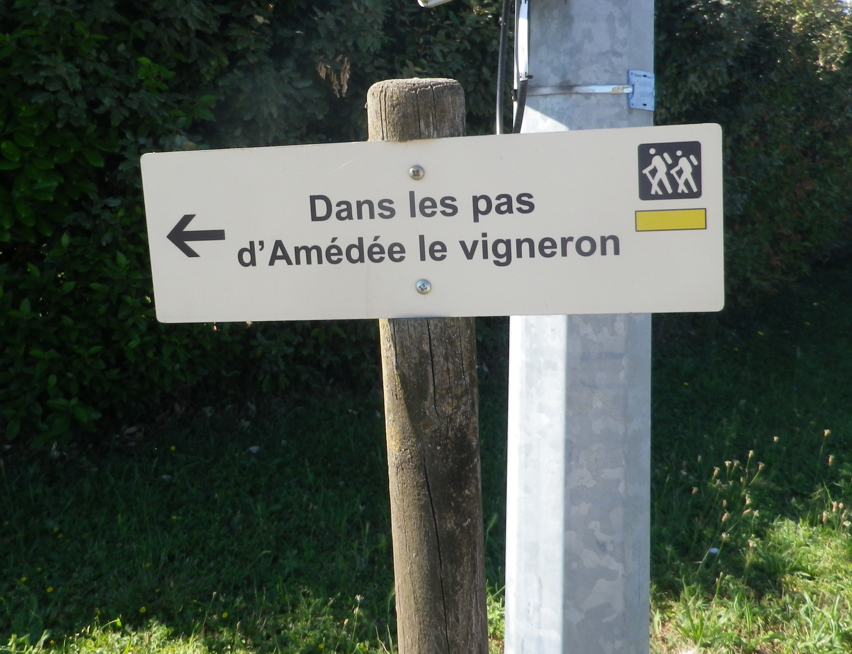
This hike can be defined as slow hiking. According to the Cambridge Dictionary, slow hiking is the act of going on a long walk through countryside, without the pressure of going fast, or climbing hills, or making a distance. It is meant to be an activity accessible to all fitness levels, that predisposes participants for actually enjoying nature. Thus, it sets up a framework for communing with nature.

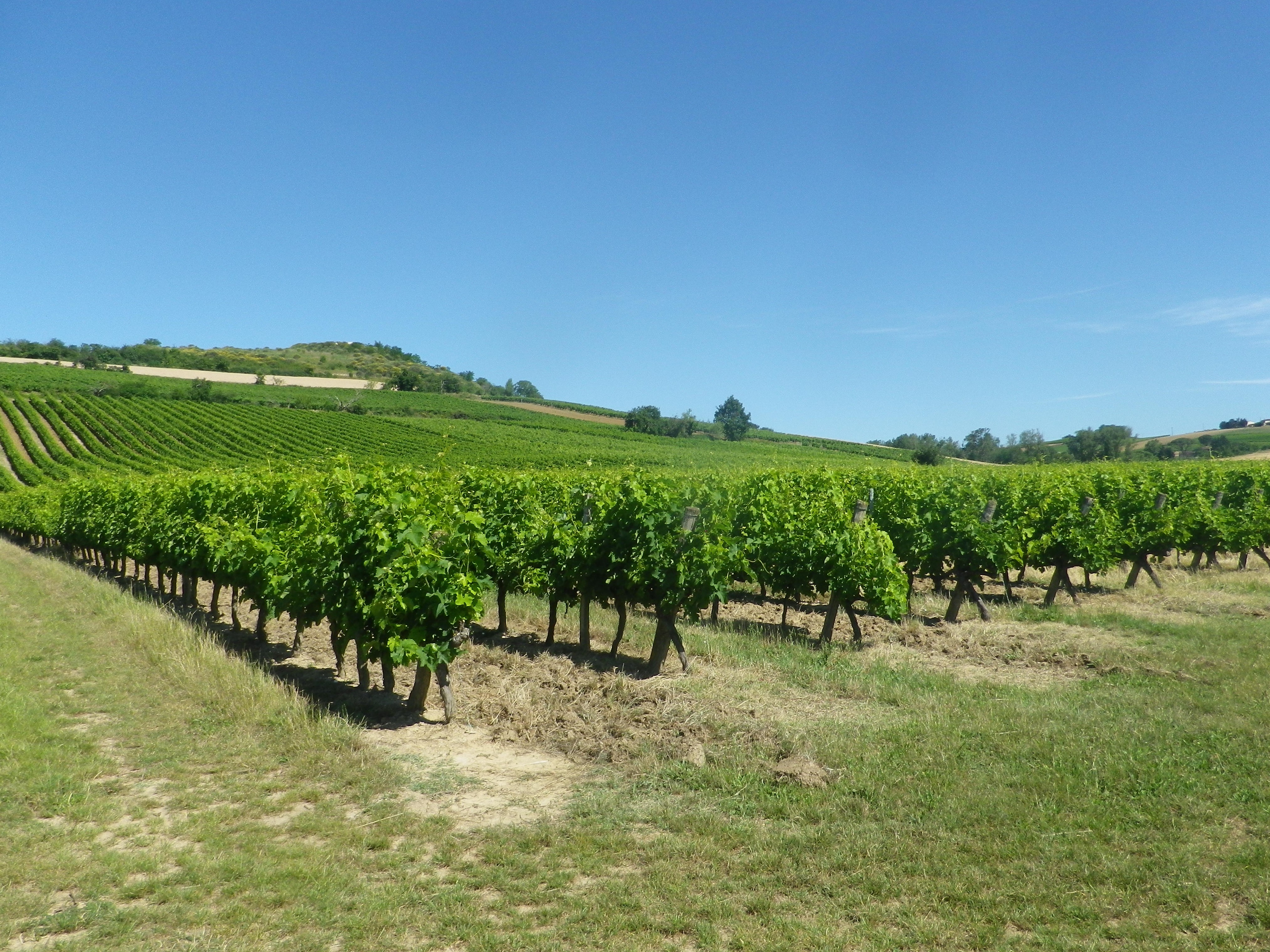
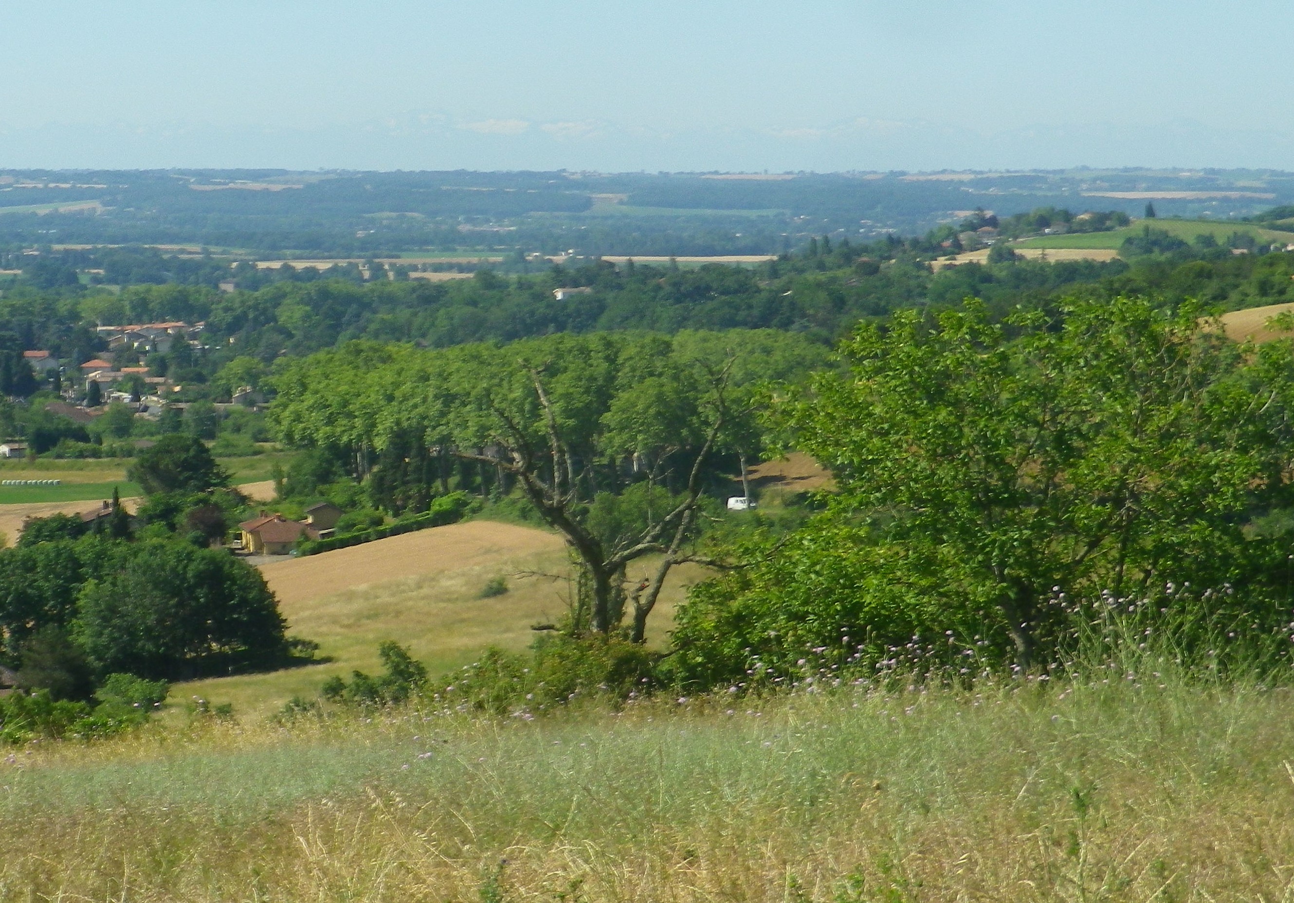
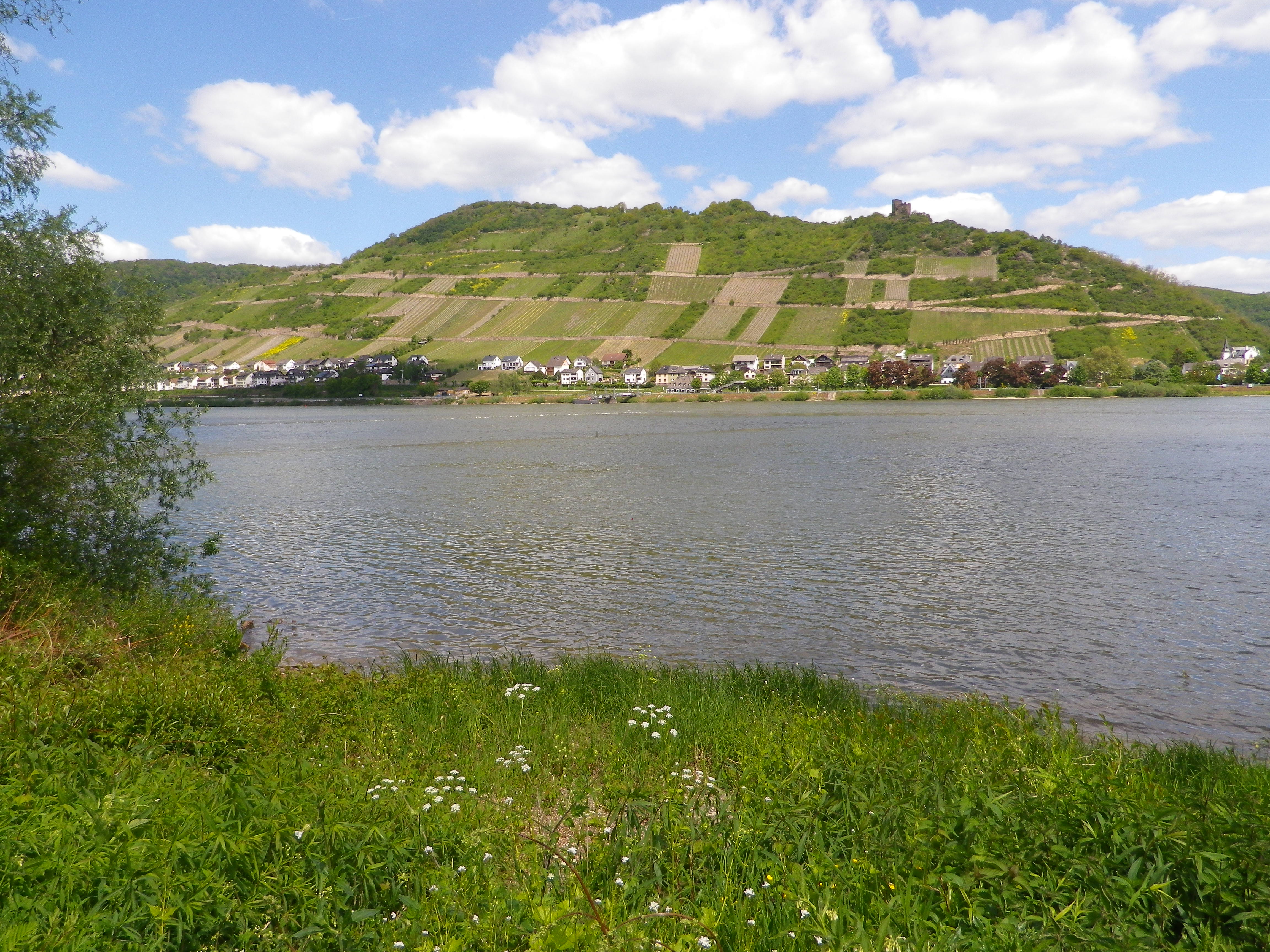
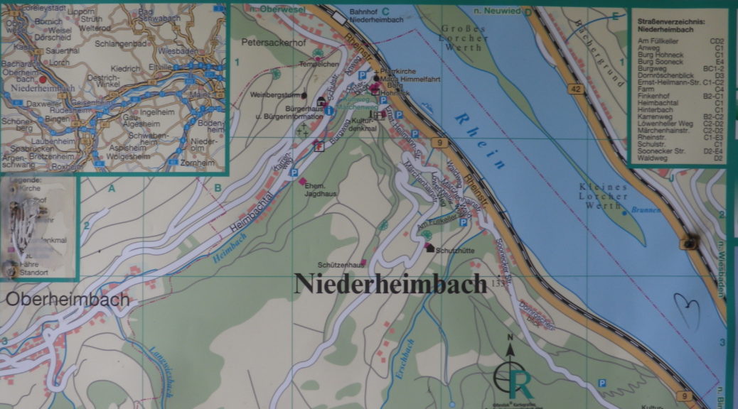
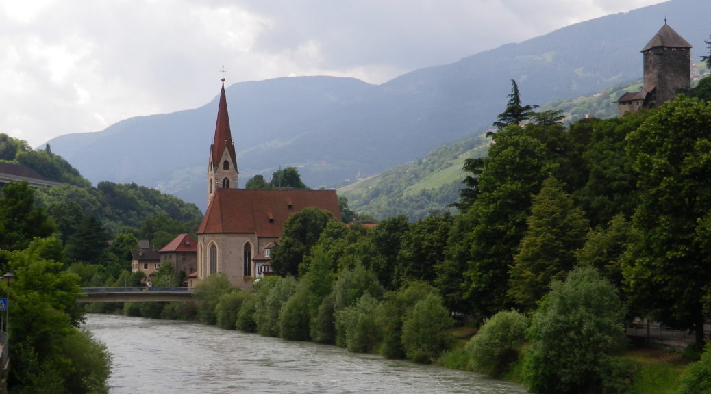
The Steigerwald area I hiked is ideal for slow tourism, defined as far from mass tourism sites, with a focus on local culture, history and traditions. It is characterized by low (and slow) mobility, emphasizing sustainability. The Steigerwald wine district is surely Franconia’s least known district. Iphofen (see here), and Bad Windsheim (see here), are the two biggest towns – delightful, but small. Agricultural pursuits, mostly devoted to vines and grains, cover much of the rest of the area. Thus, I could slow hike in a slow tourism area, and take time to reflect on vines and communities supporting them.

Small Section of the Steigerwald Nature Park

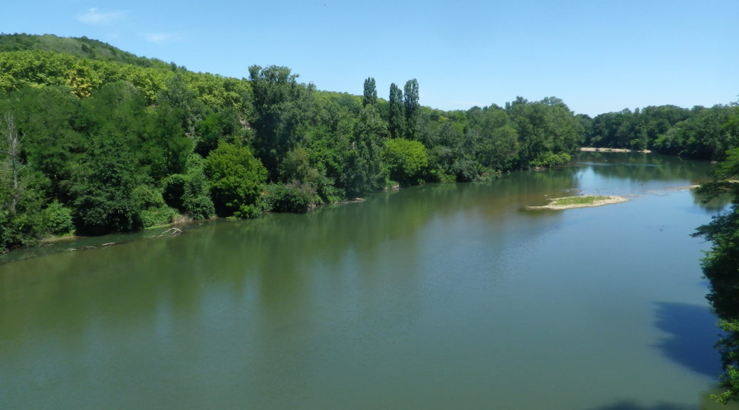
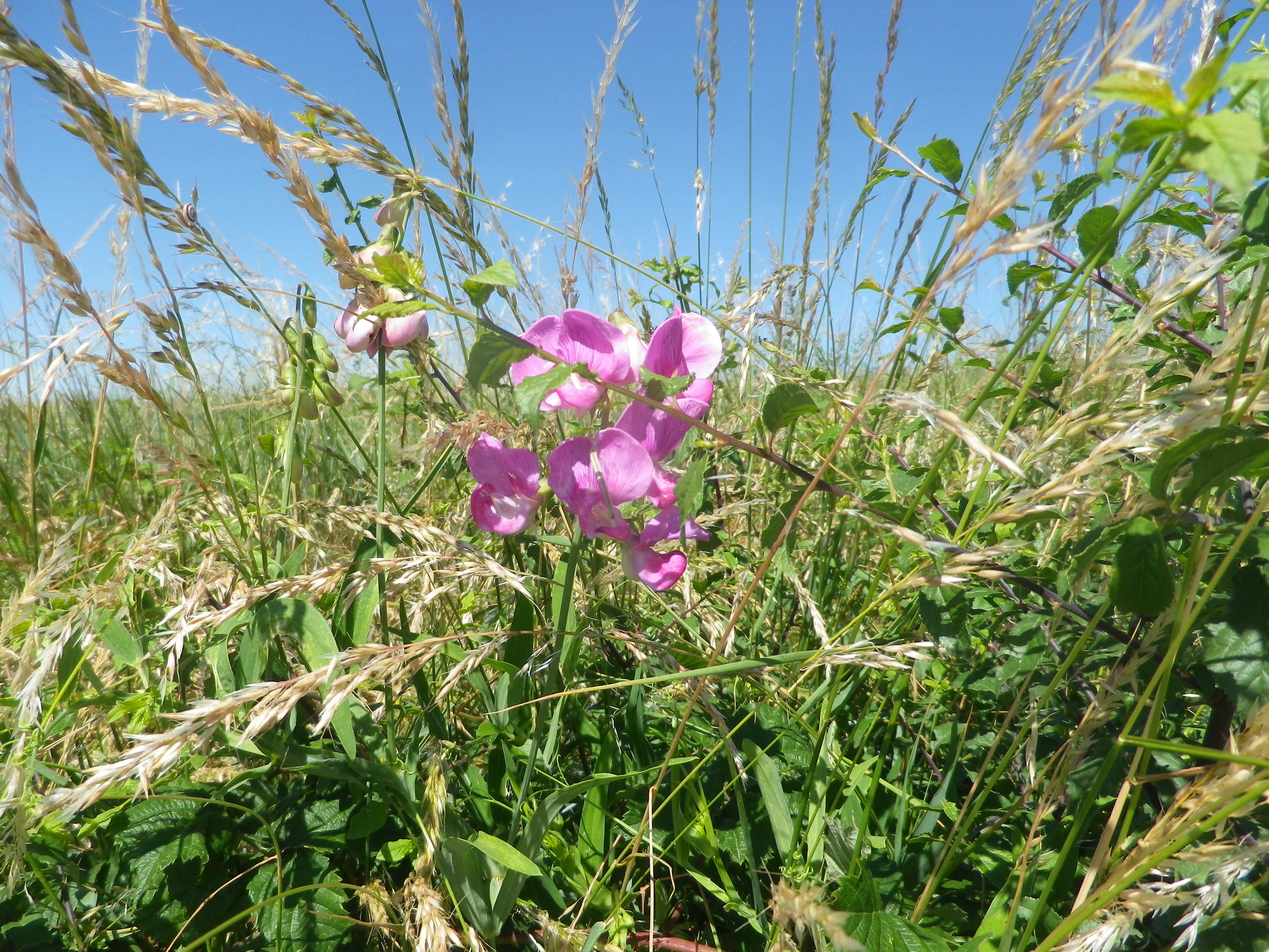
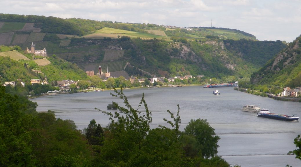
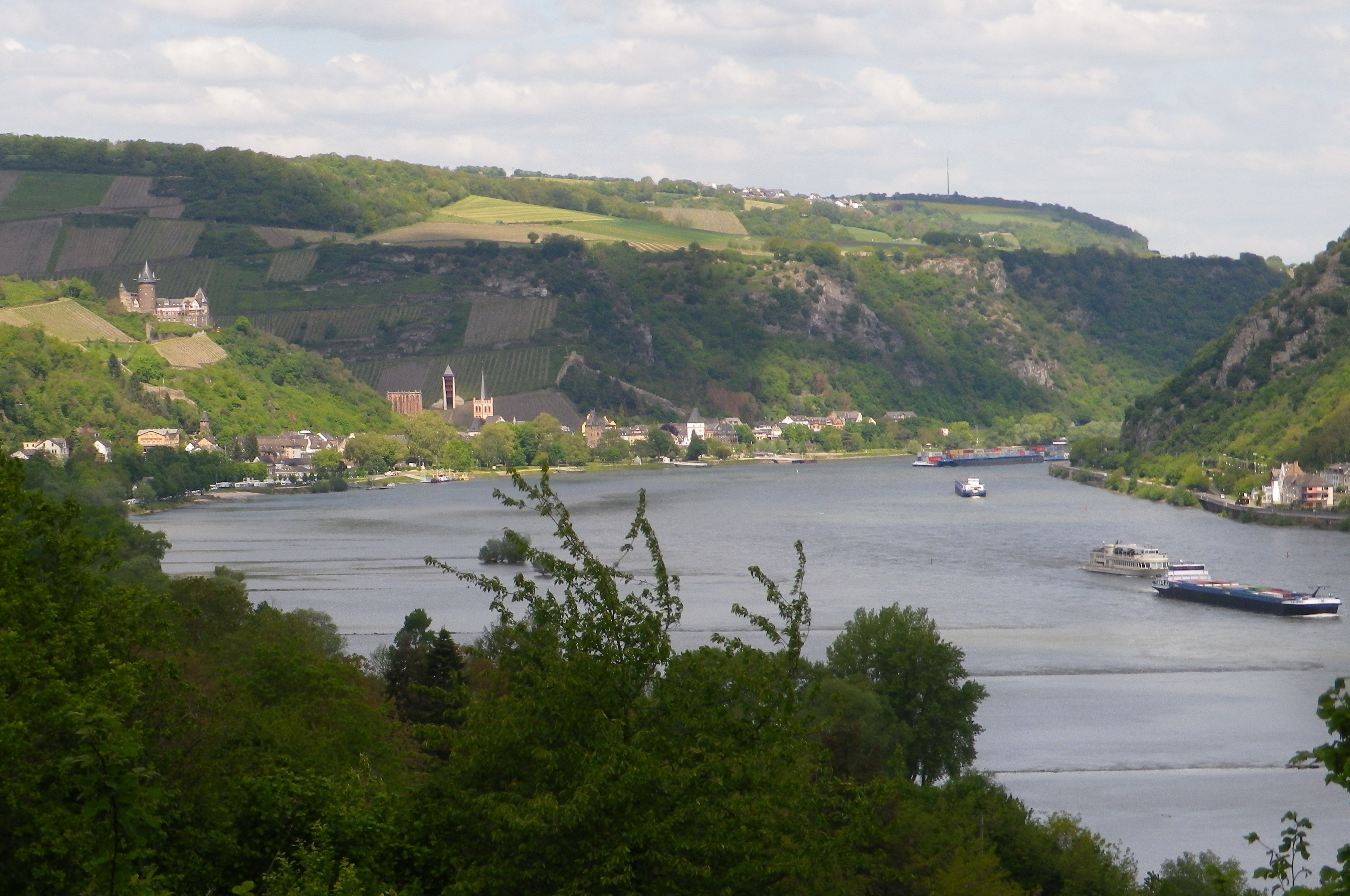
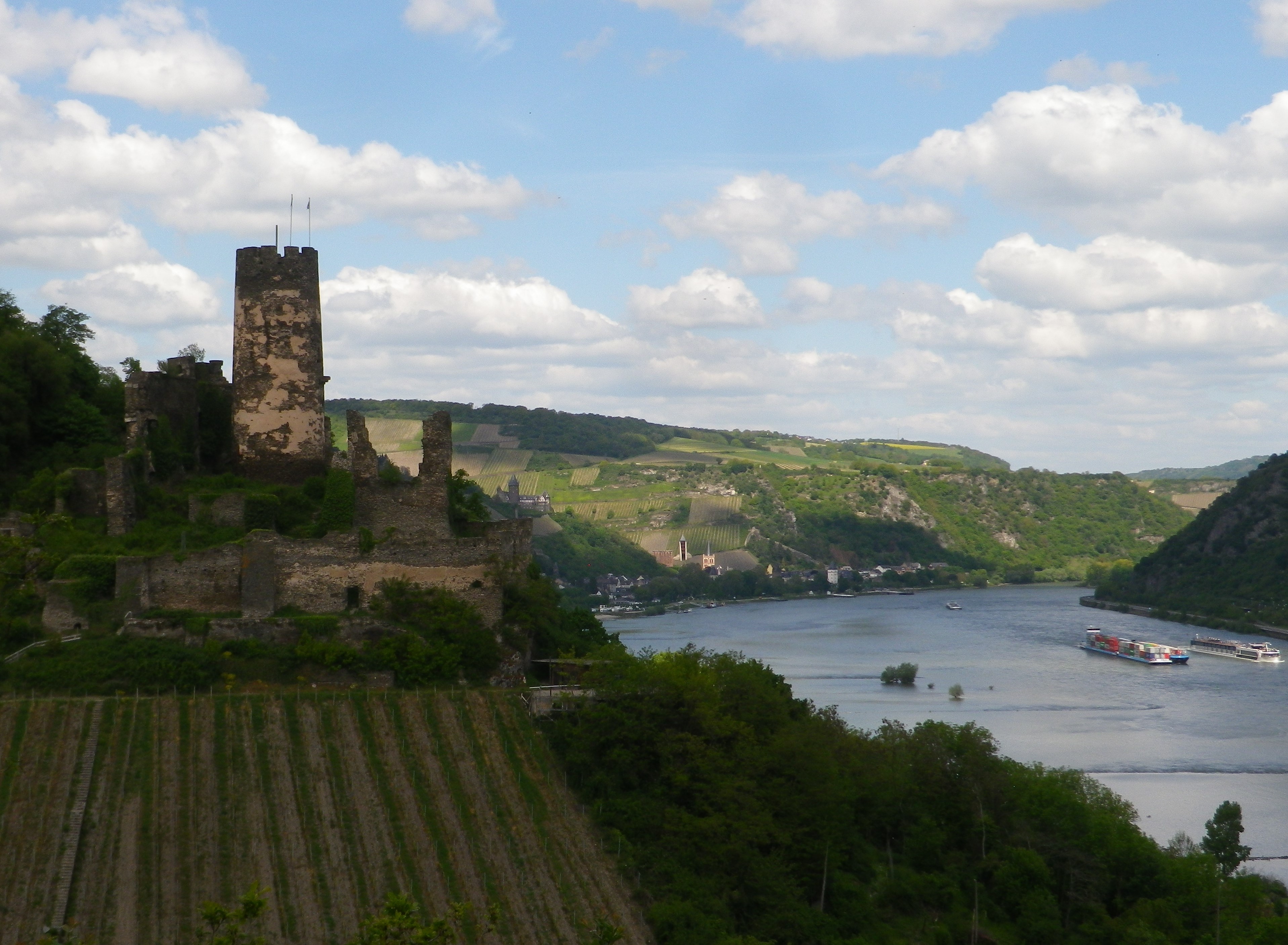
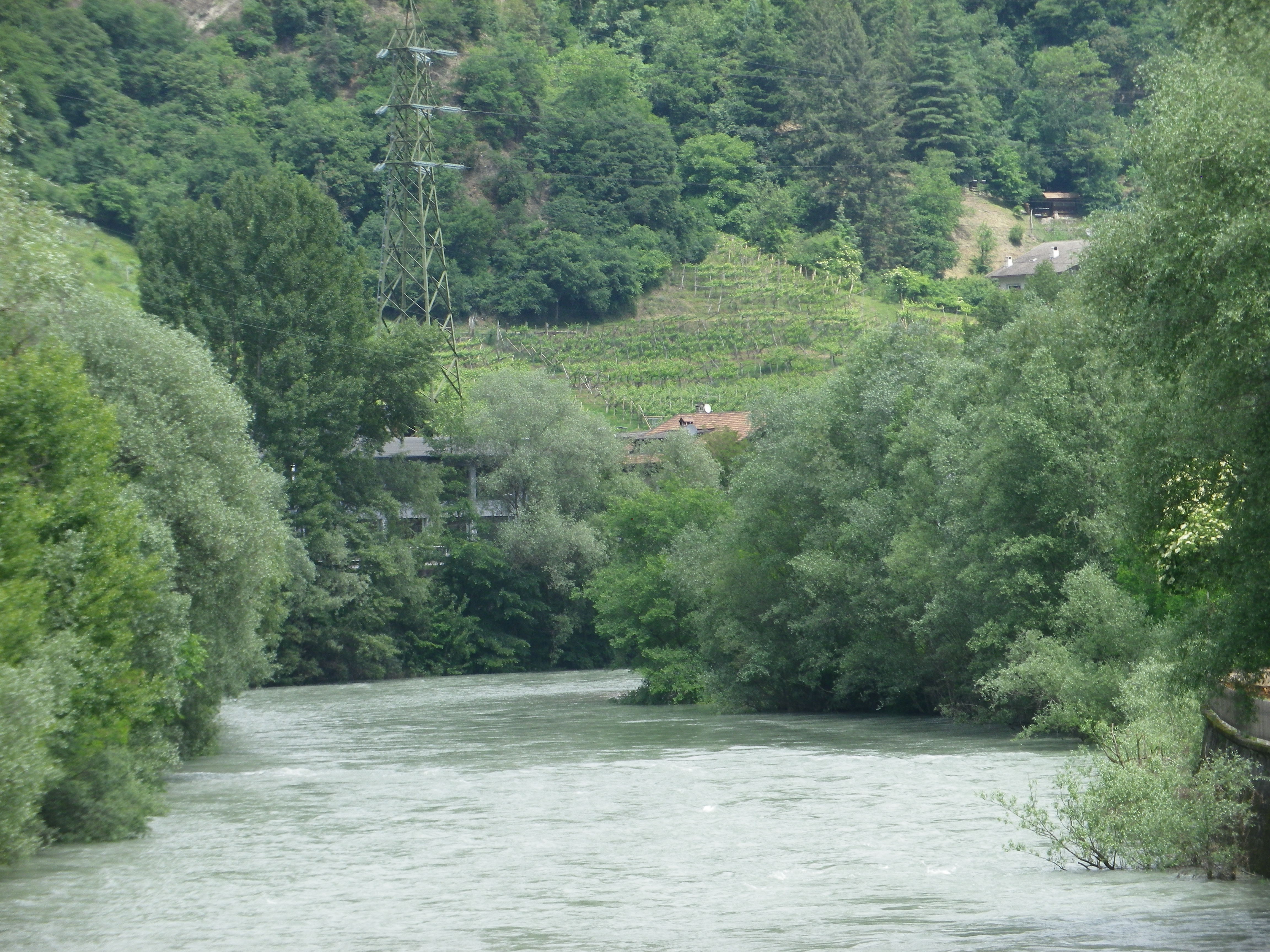
Mainly though, this area is known for the Steigerwald Nature Park, which covers about 431 square miles, in the Franconian/Bavarian border area west of Nuremberg. The hills are heavily forested and popular with some hikers for their unspoiled nature. My hike though, on the southwest corner of the park, lay right at the junction of the trees and vines. Not only could I enjoy both vineyards and forest, I could do so in peace and quiet.

And then There Were None: Clear Vine/Tree Delineation

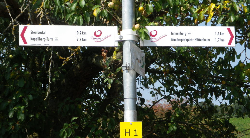
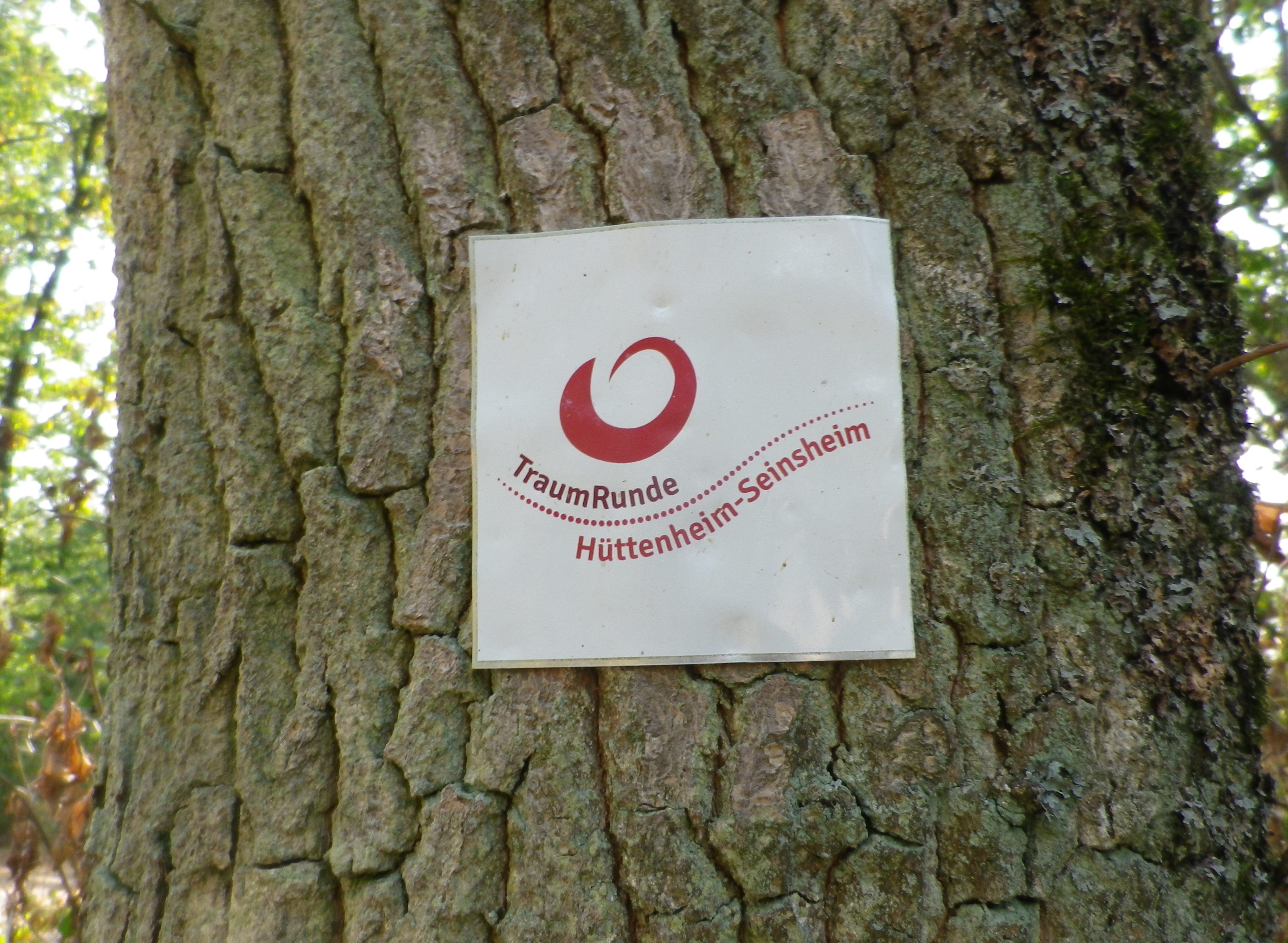
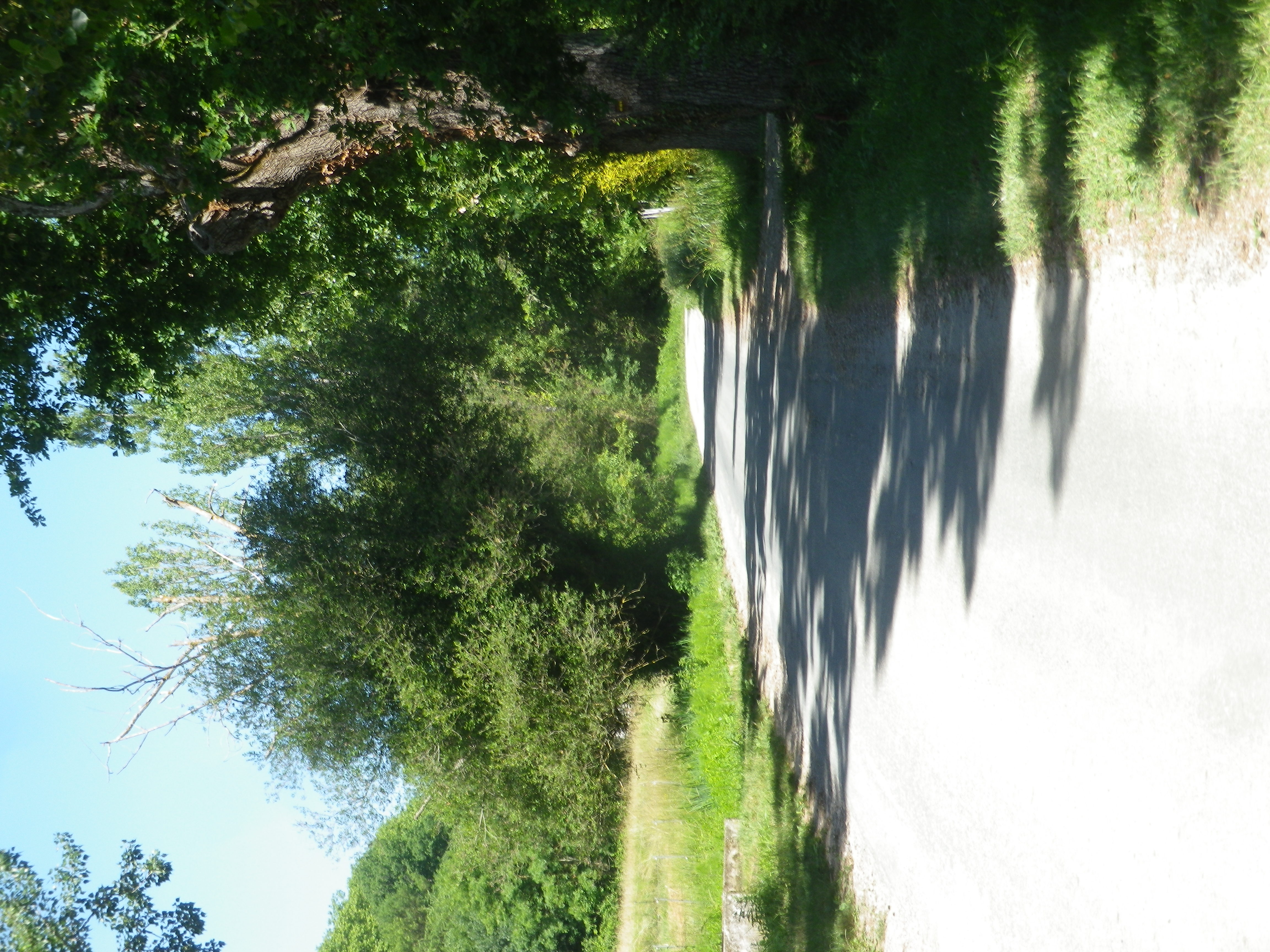
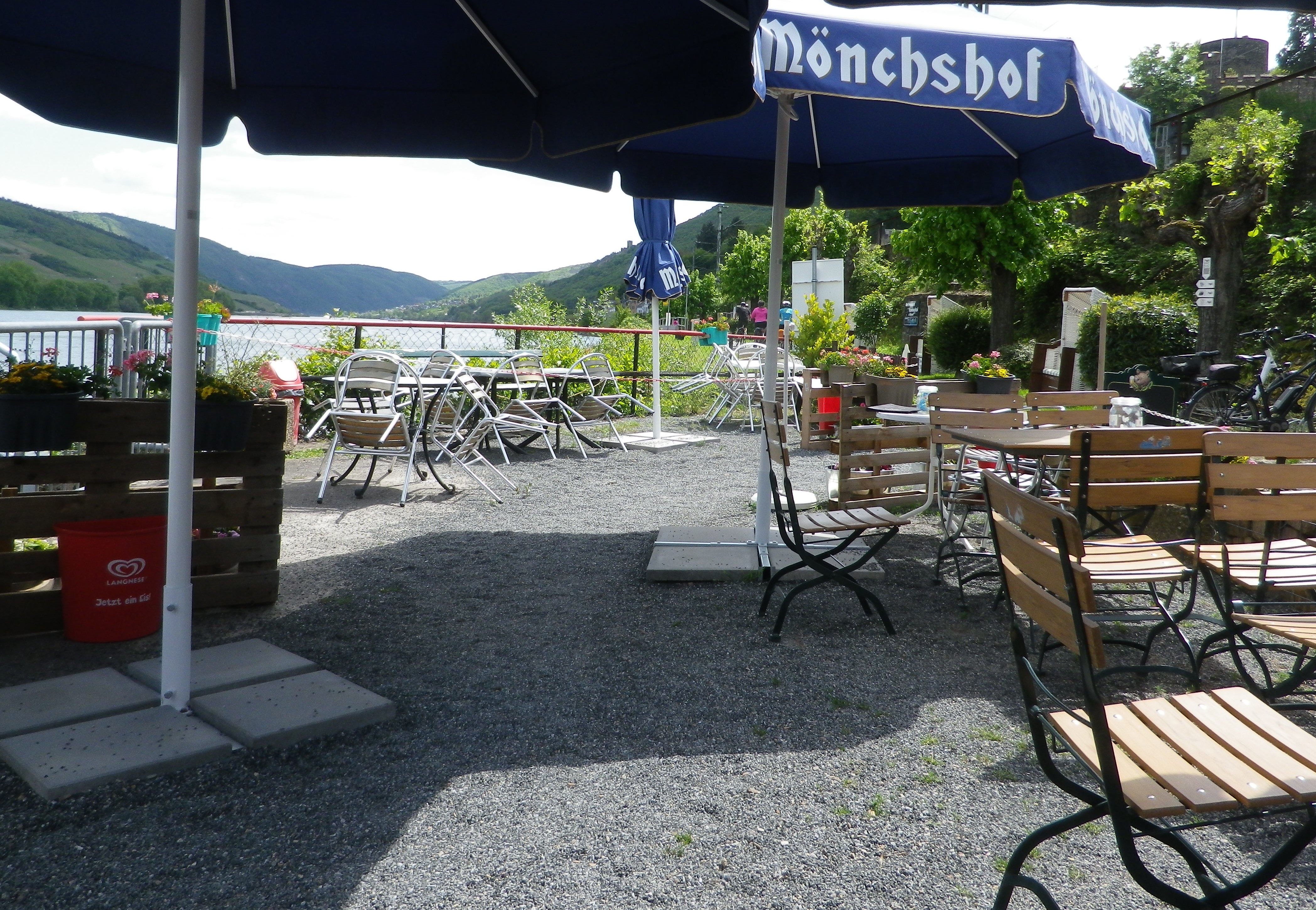
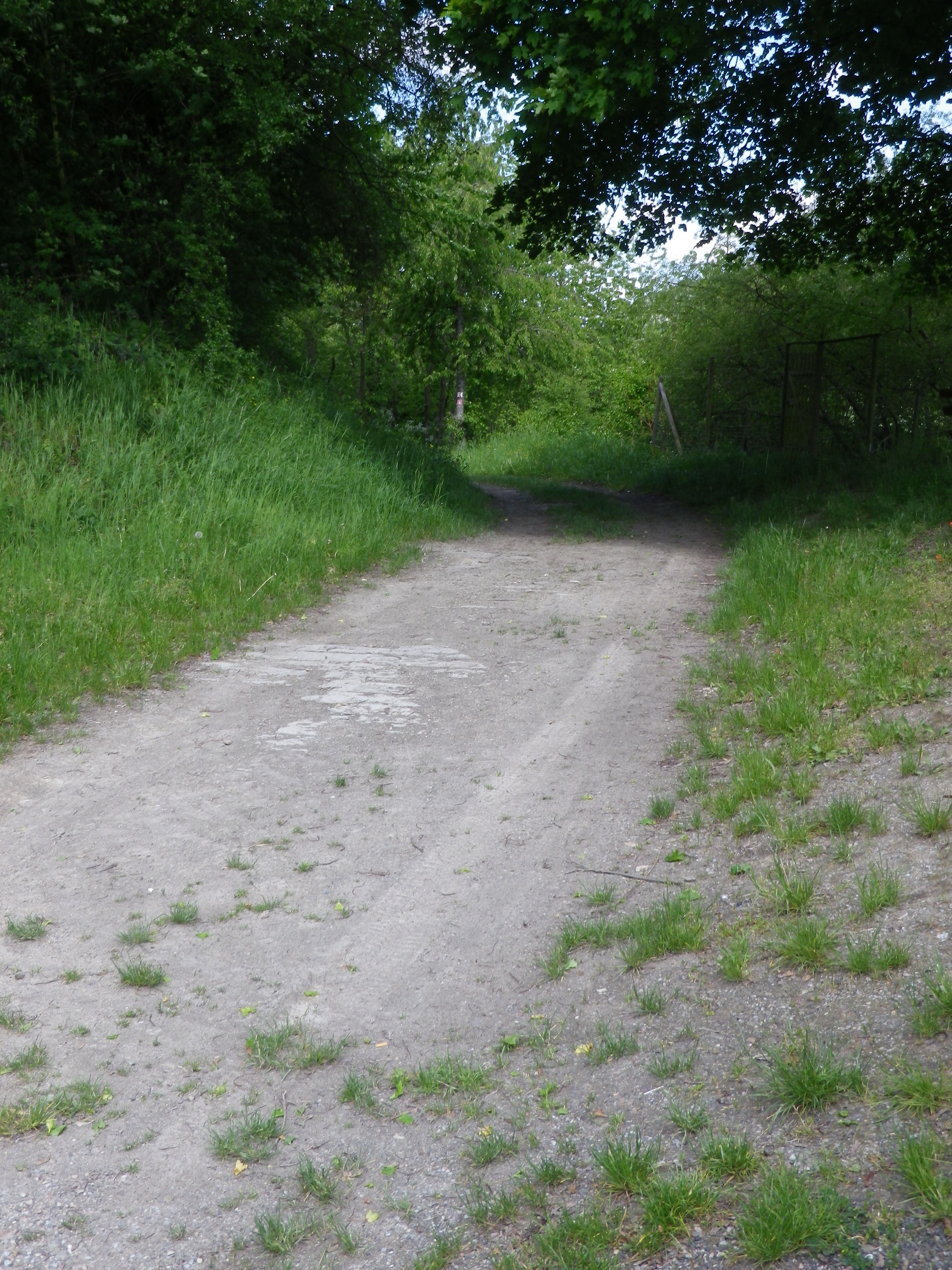
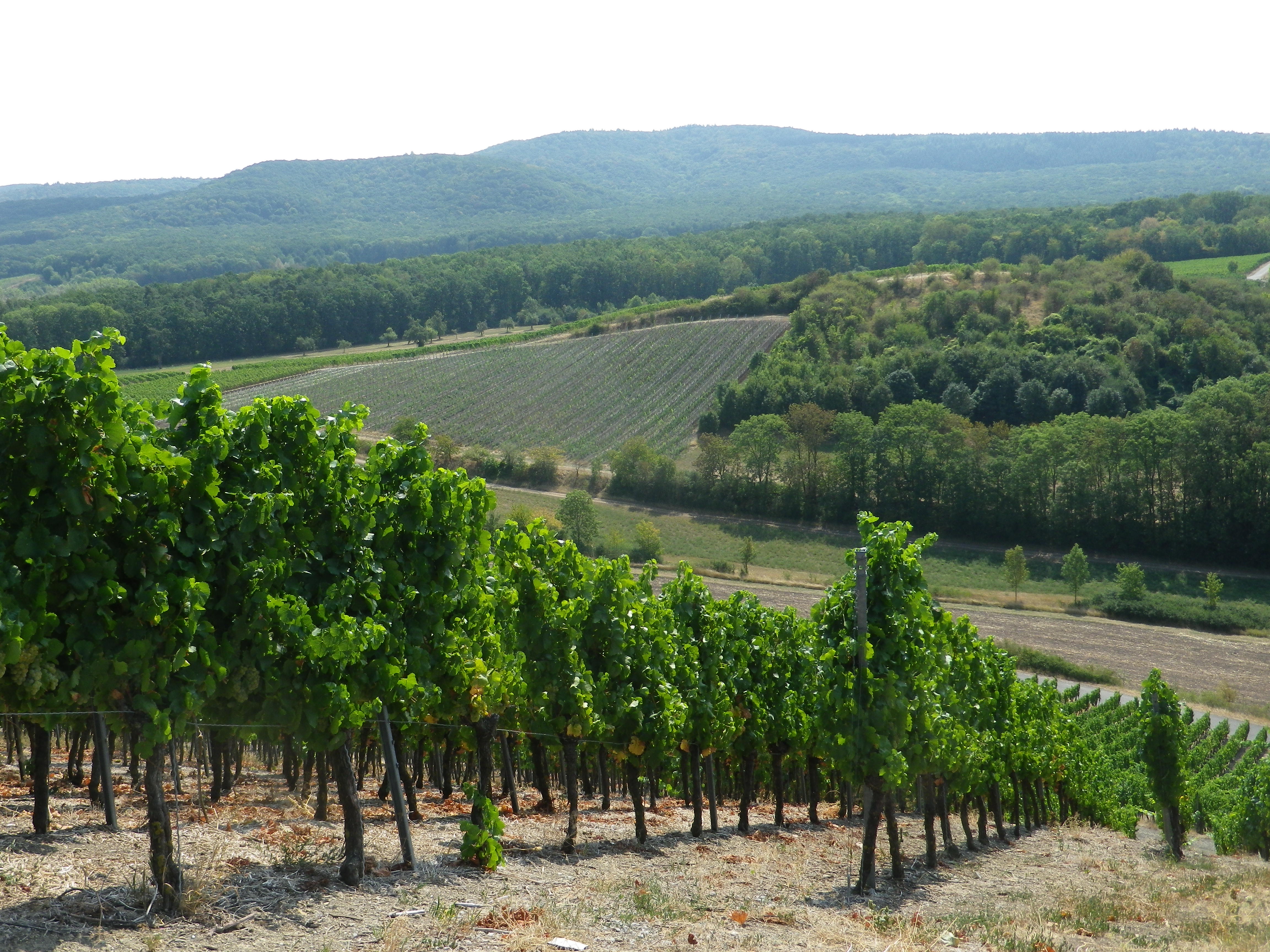
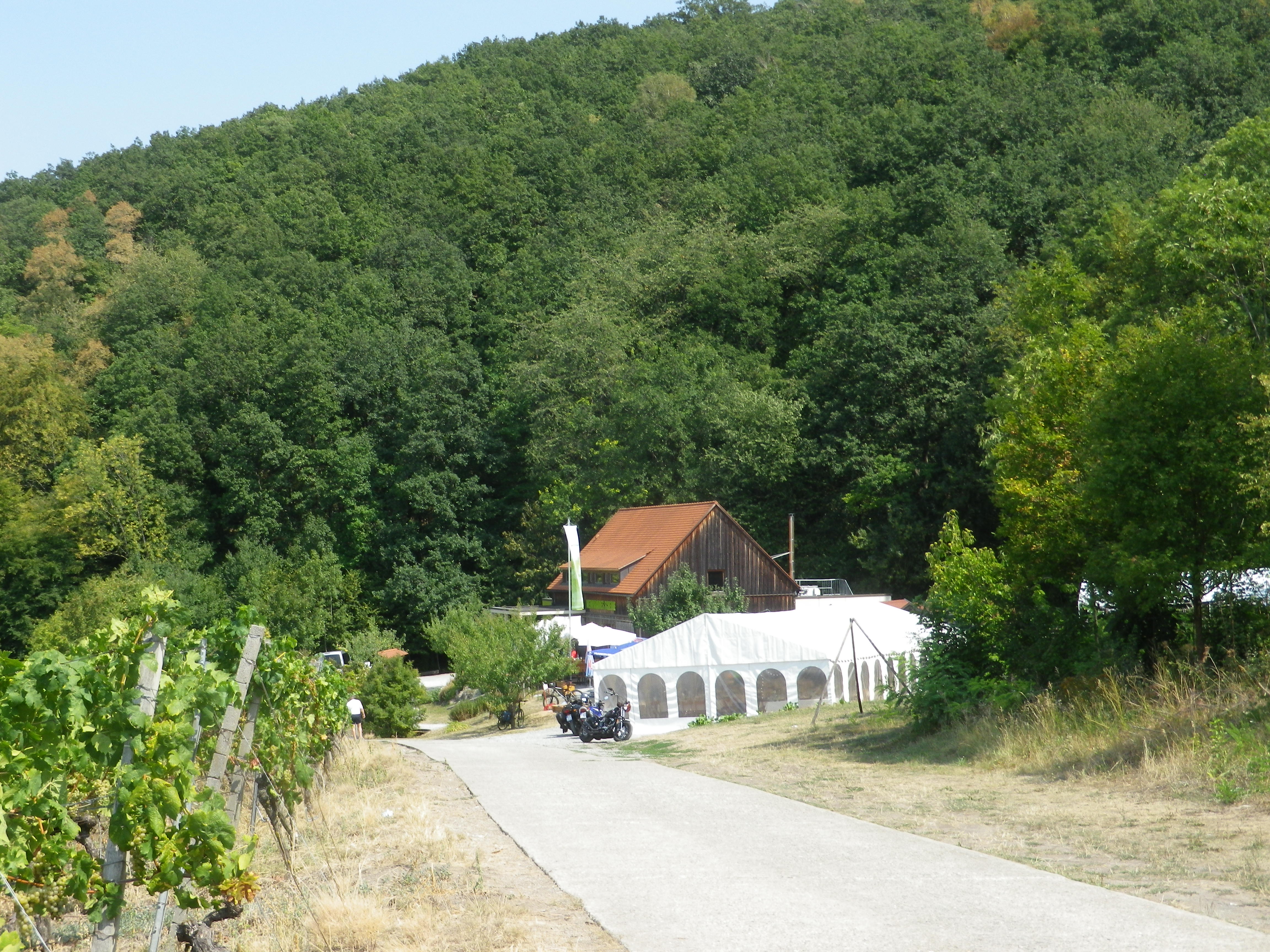
I began just below the Weinparadiesscheune, a popular wine-bar with local wine (and food) on offer. Early morning patrons, on that warm, sunny late August day, began to fill up the outdoor seats. This part of the hike remained on asphalt as it went up the western side of the hill, along the upper reaches of vines facing the villages of Bullenheim, Seinsheim and Huettenheim.

Weinparadiesscheune – Set Between Forest and Vineyard

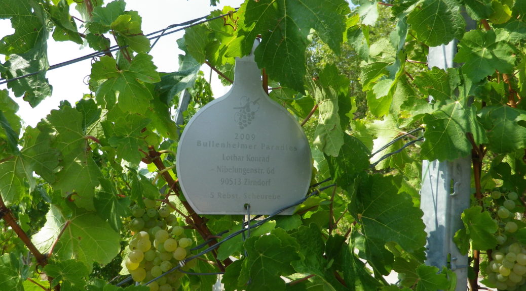
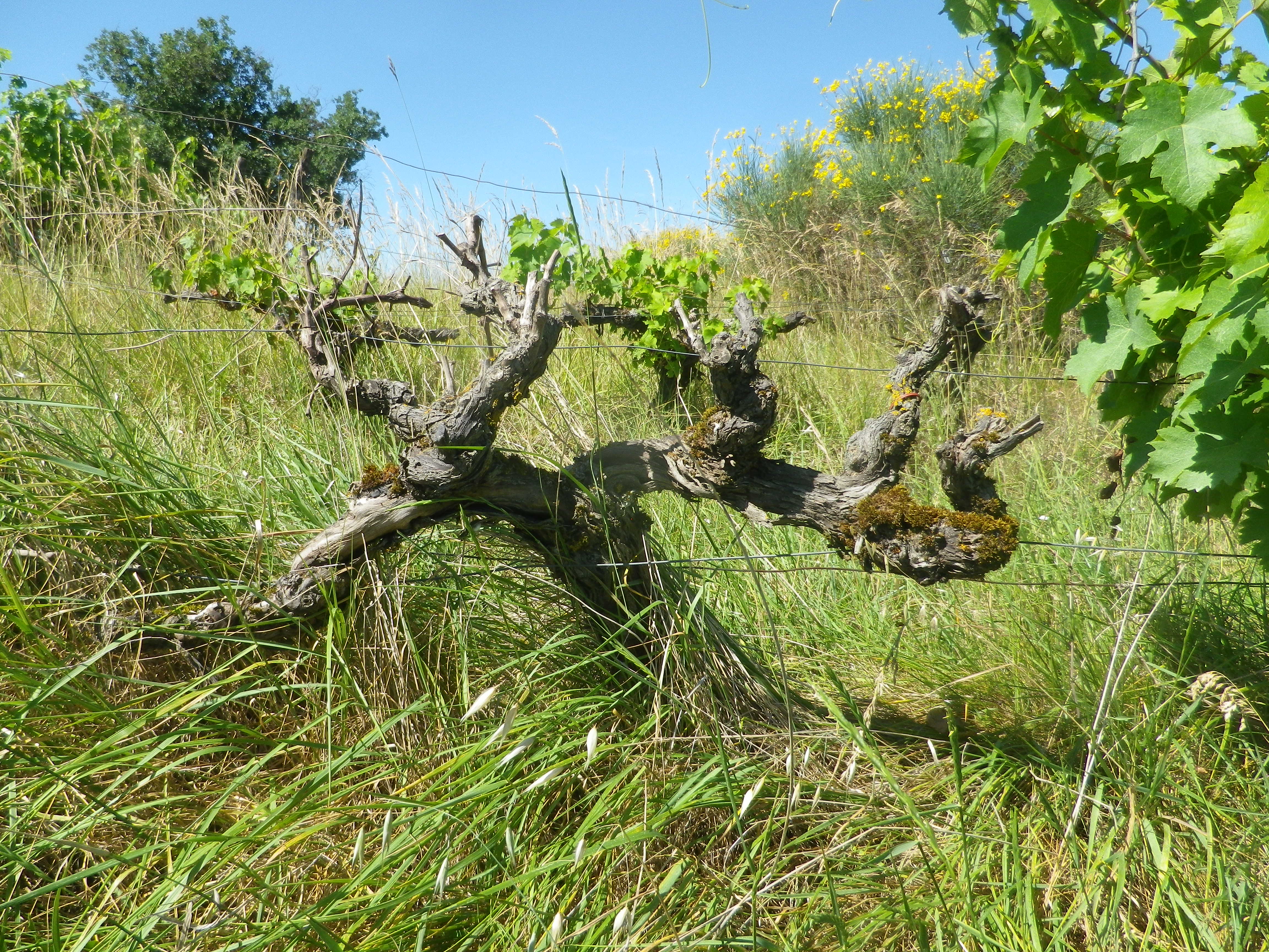
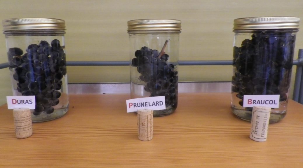
Vintners from these small villages work the vines on the short, but steep, slopes, producing Silvaner, Mueller-Thurgau and Bacchus wine, named after the Greco-Roman god of wine. The Bacchus varietal is relatively new, but it has taken hold in this region (one of the few places it may be found). Like the god, Bacchus wine is popular, and inspires (when taken in moderation, of course!)

The Tannenberg

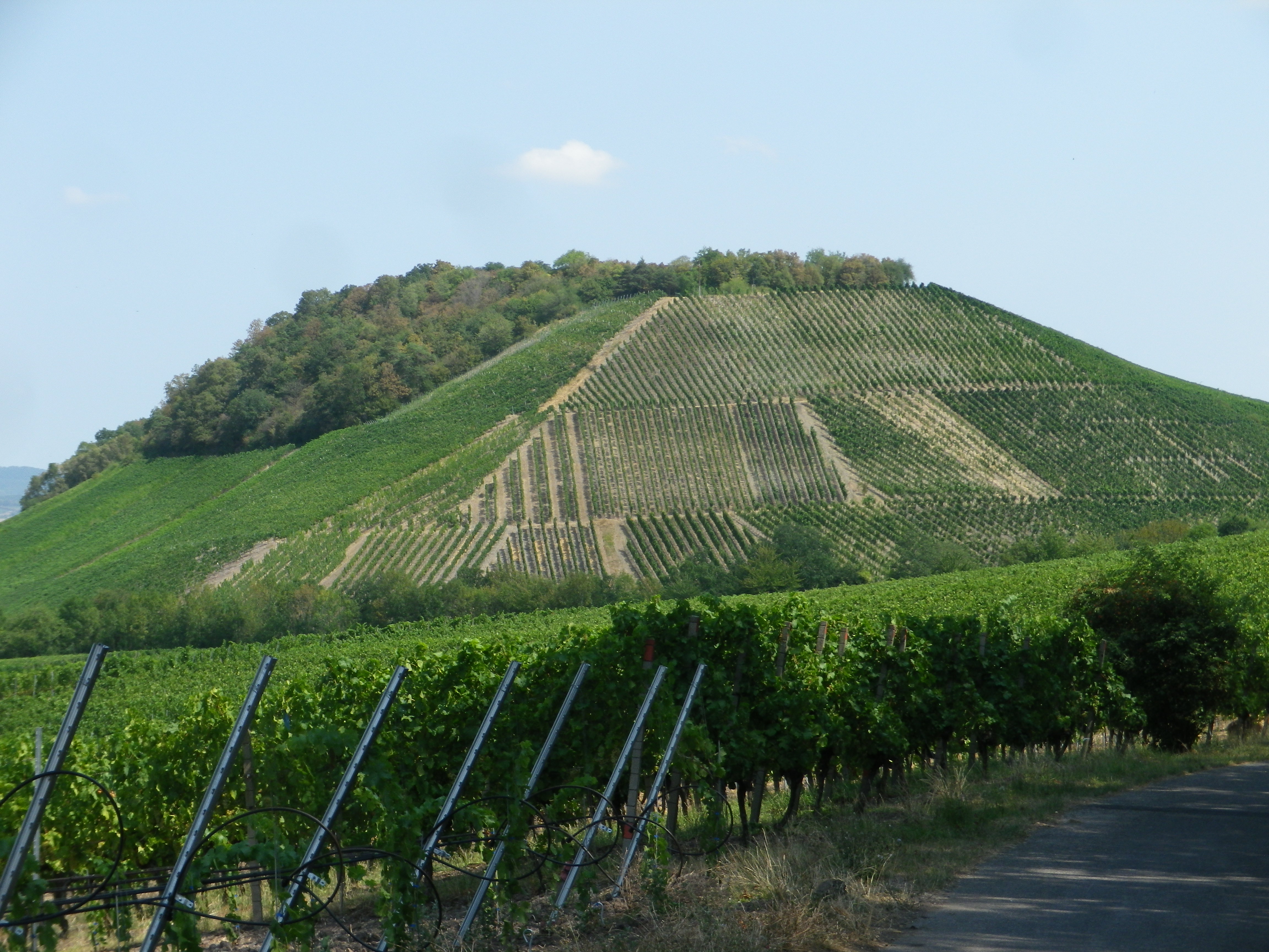
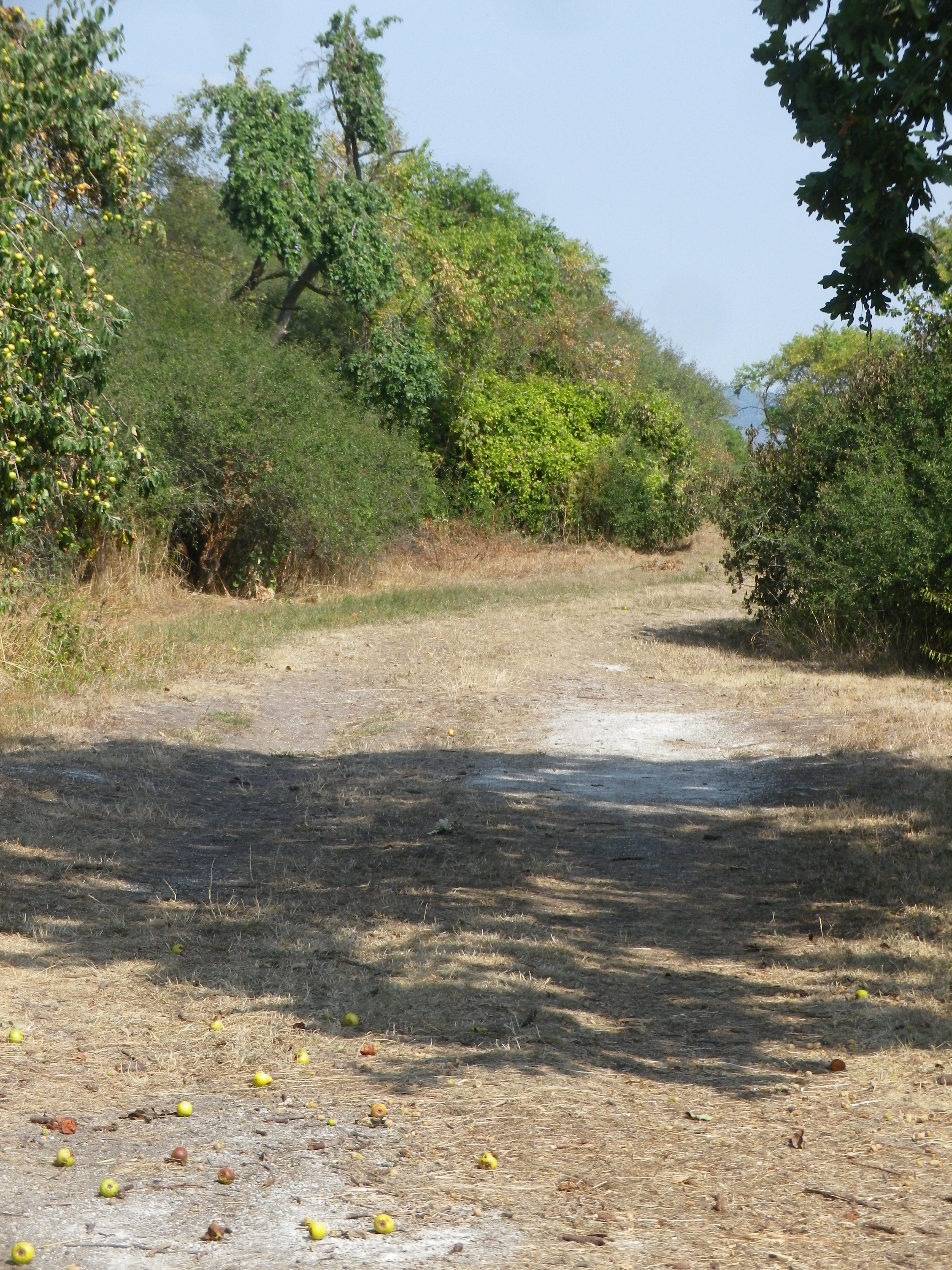
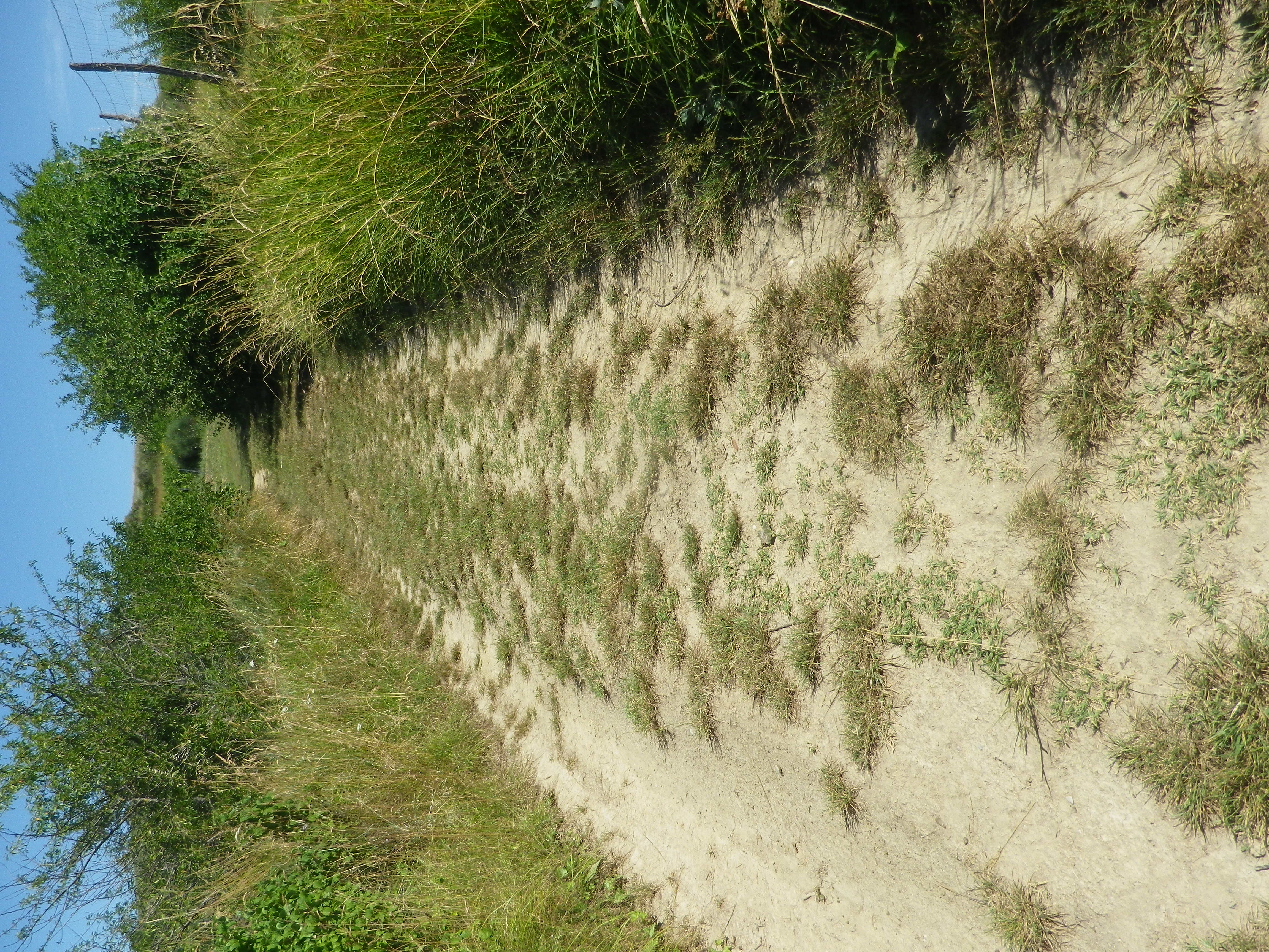
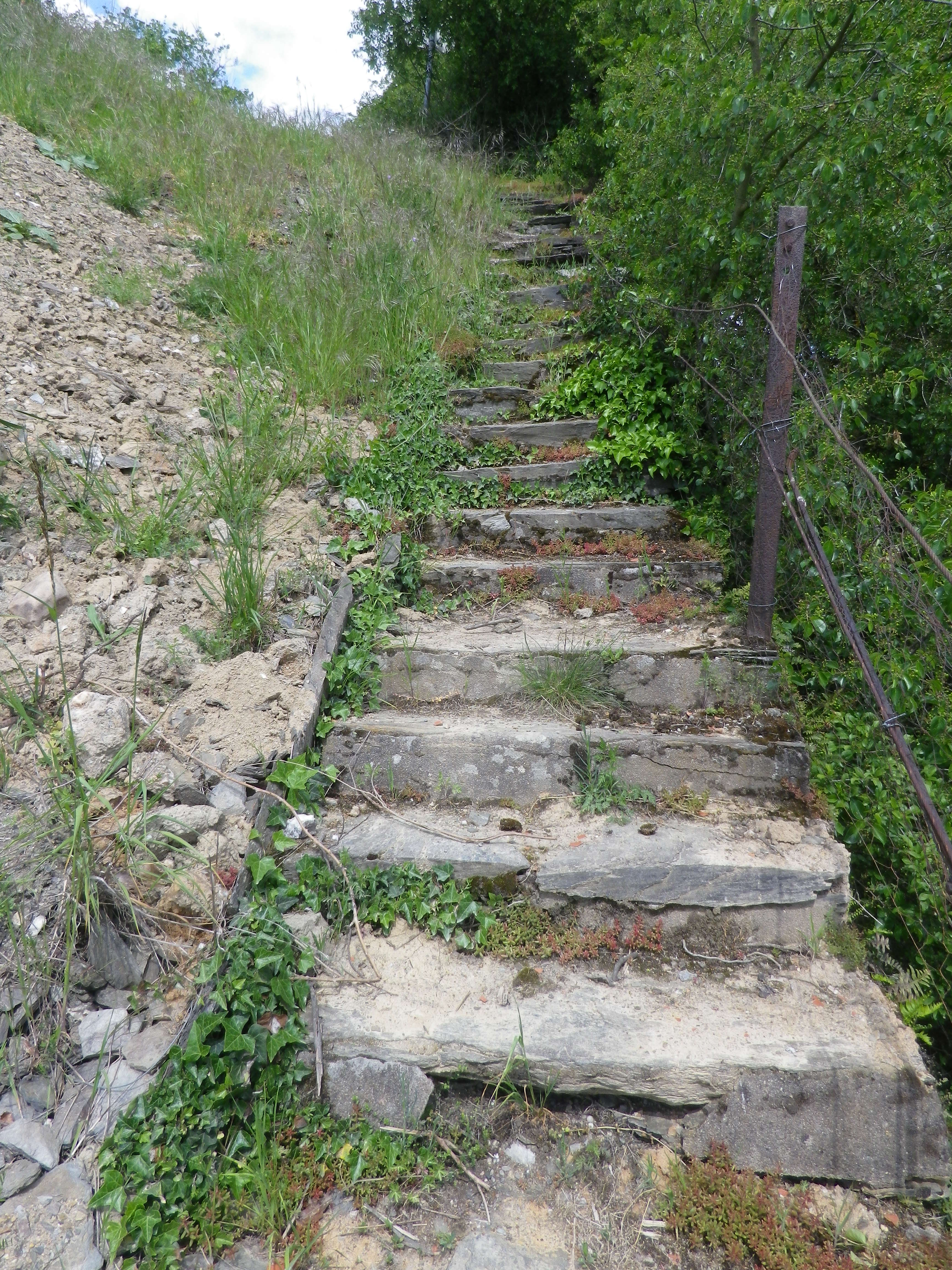
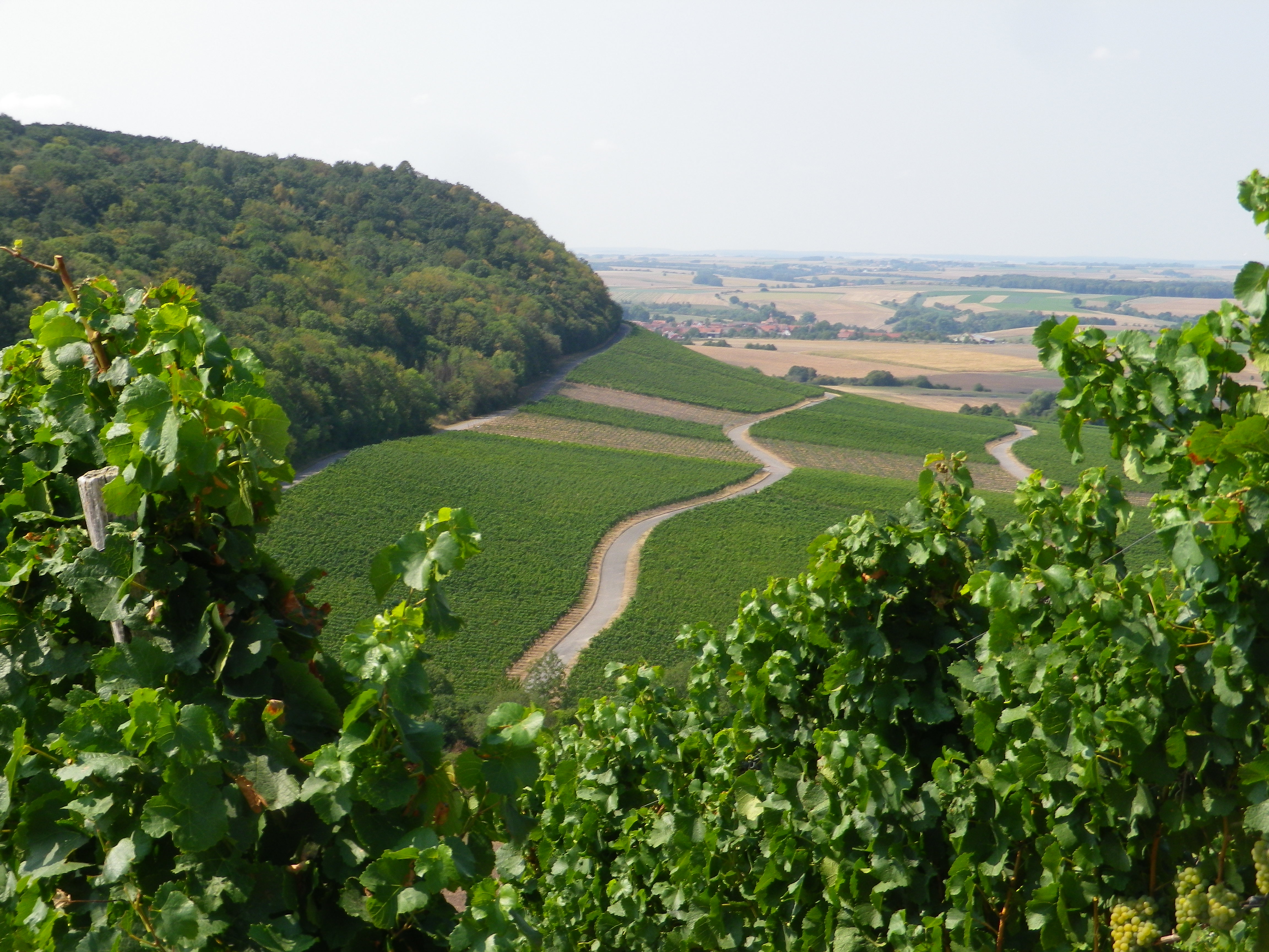
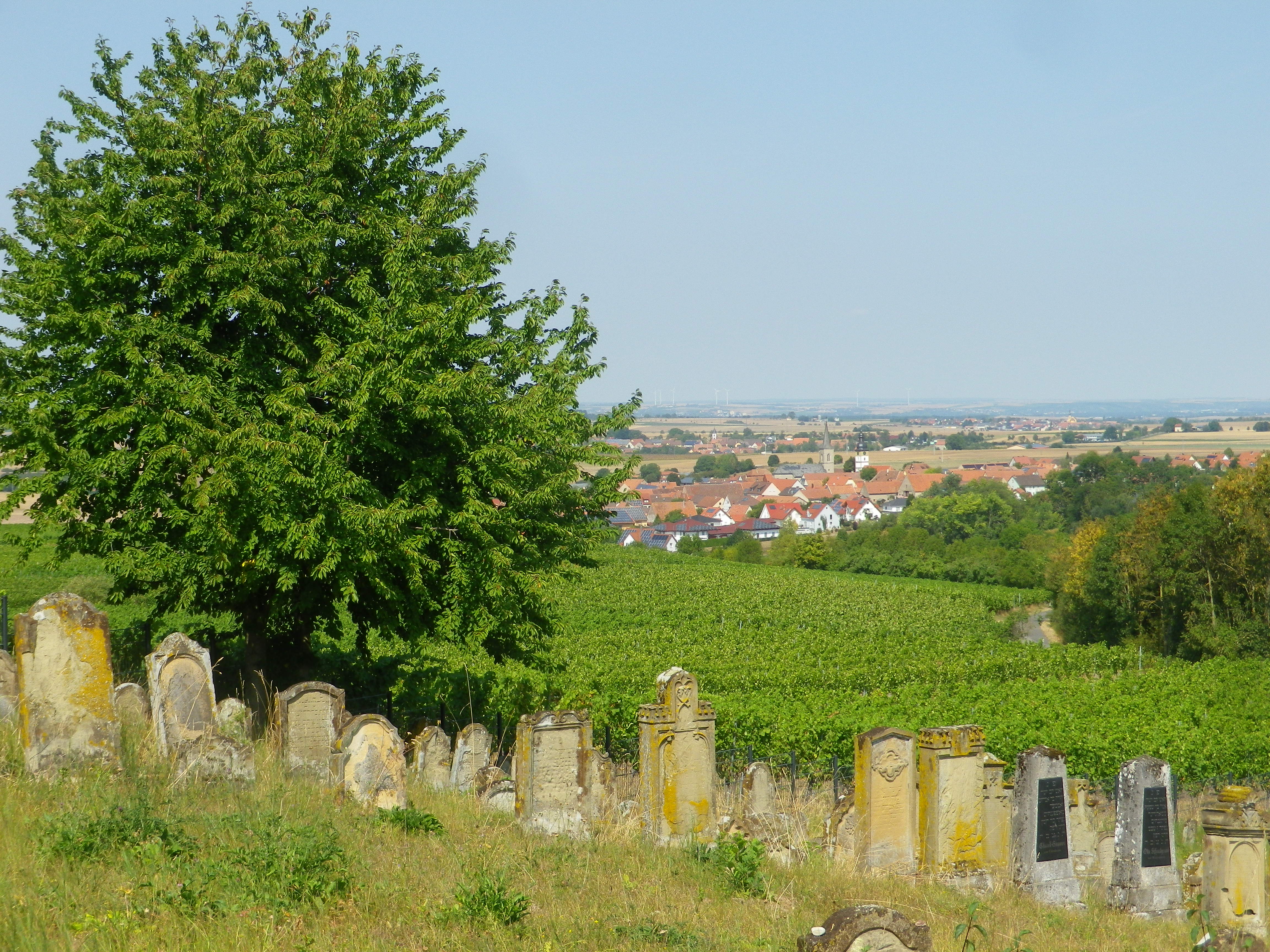
After a steep climb off the asphalt and into the woods, I was onto the Tannenberg (Pine Mountain), nowadays mostly devoid of trees and covered in vines instead. On the north side of this hill overlooking Huettenheim, there is a Jewish cemetery. In a quiet spot, well suited for contemplation, reminiscent of two similar cemeteries in remote areas of Baden I’d seen, recalling that once vibrant Jewish communities coexisted within even remote villages.

Jewish Cemetery Above Huettenheim

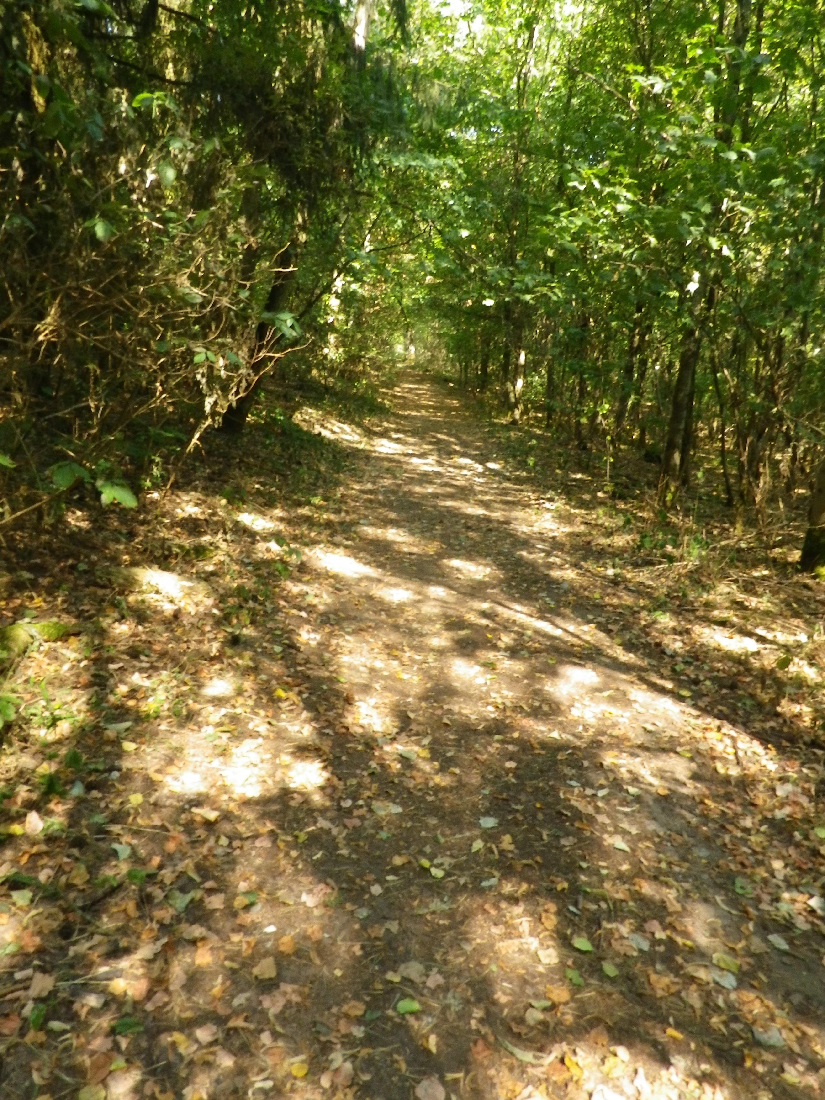
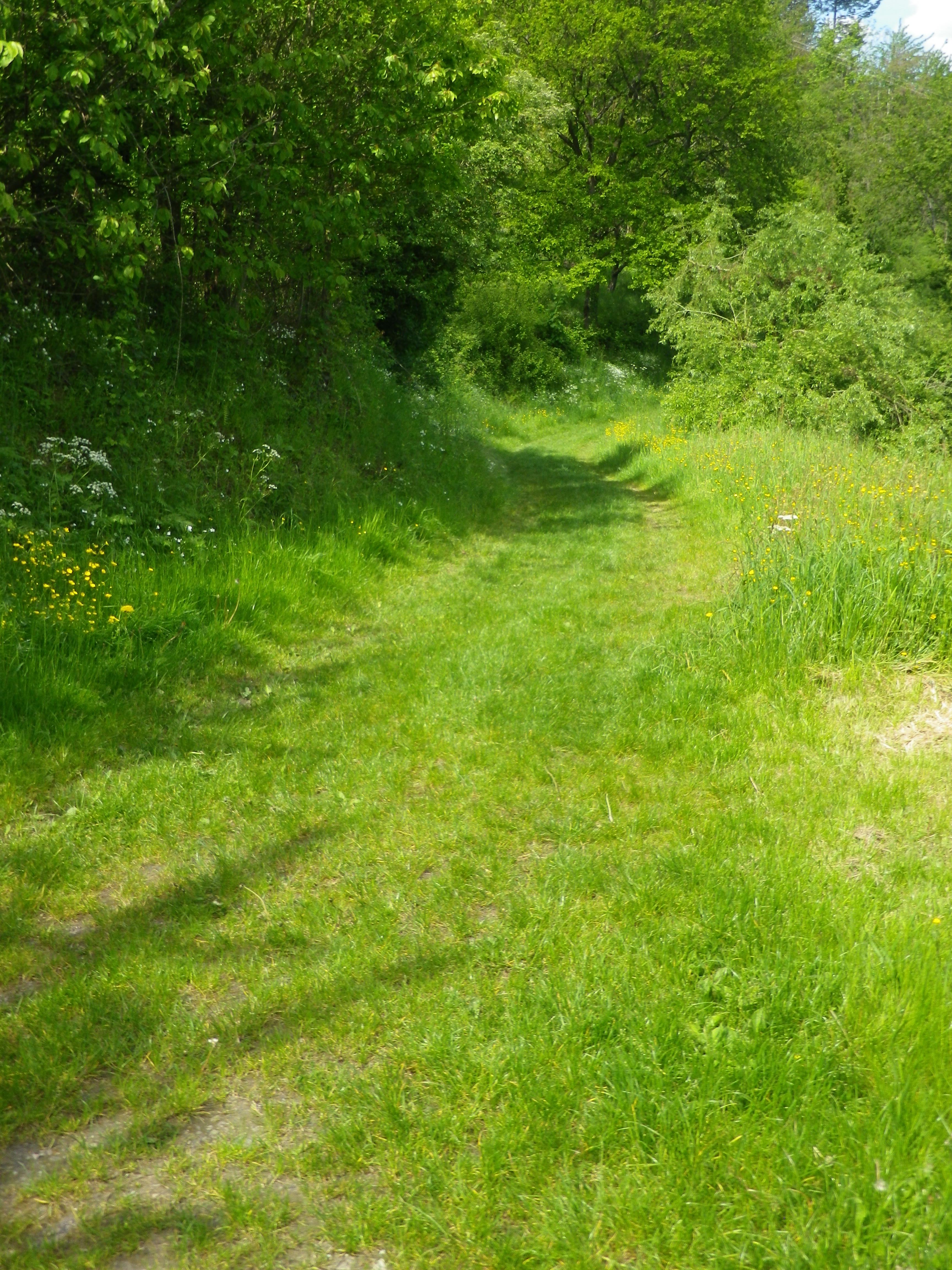
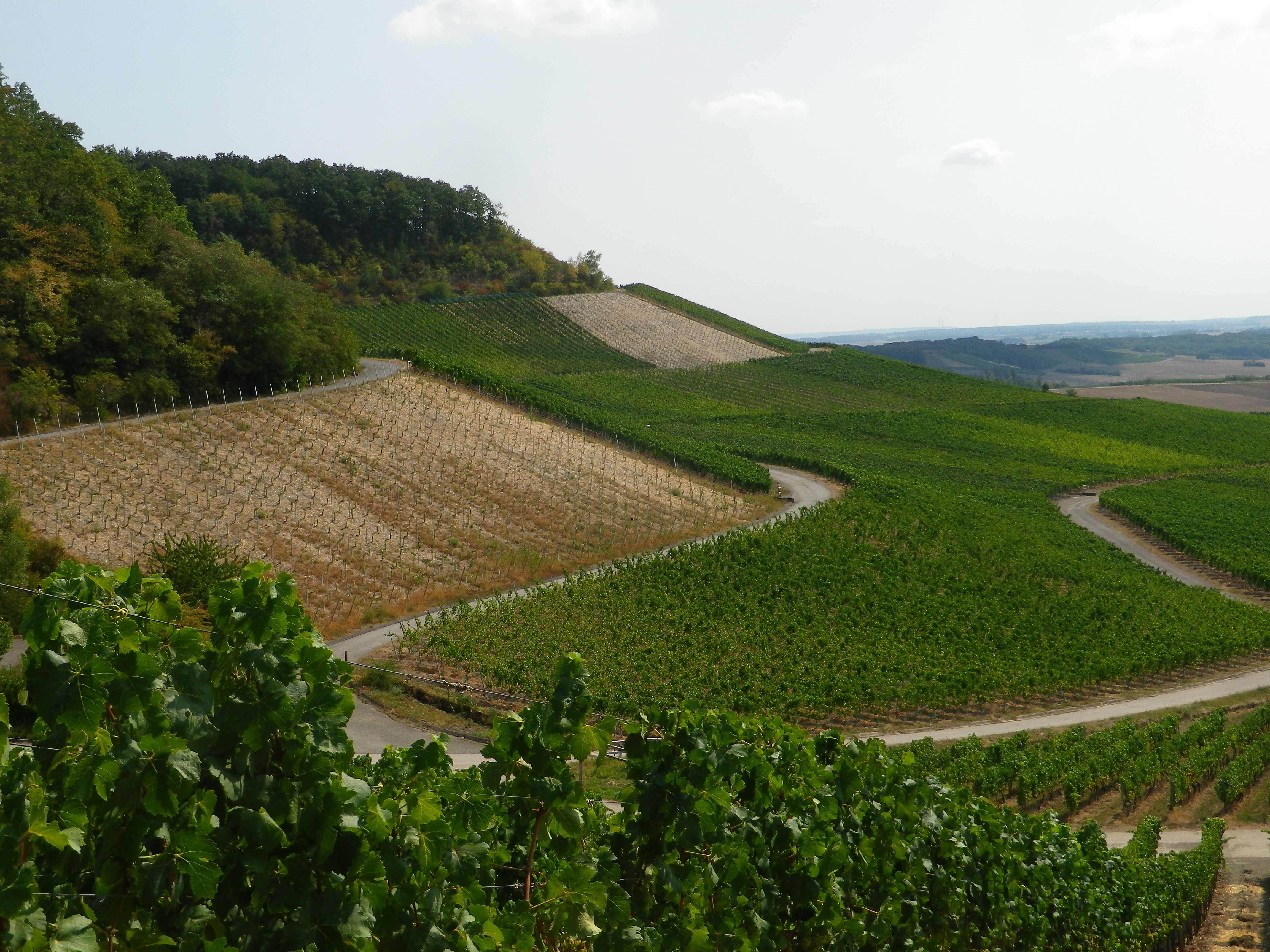
After that, the trail ran south along a shallow valley separating it from the main Steigerwald park. Once leaving the Tannenberg hill, the trail entered woodlands again. As the modest incline increased so did the heat, but fortunately now, the meandering trail was shaded by majestic trees.

Vineyards Along the Steigerwald

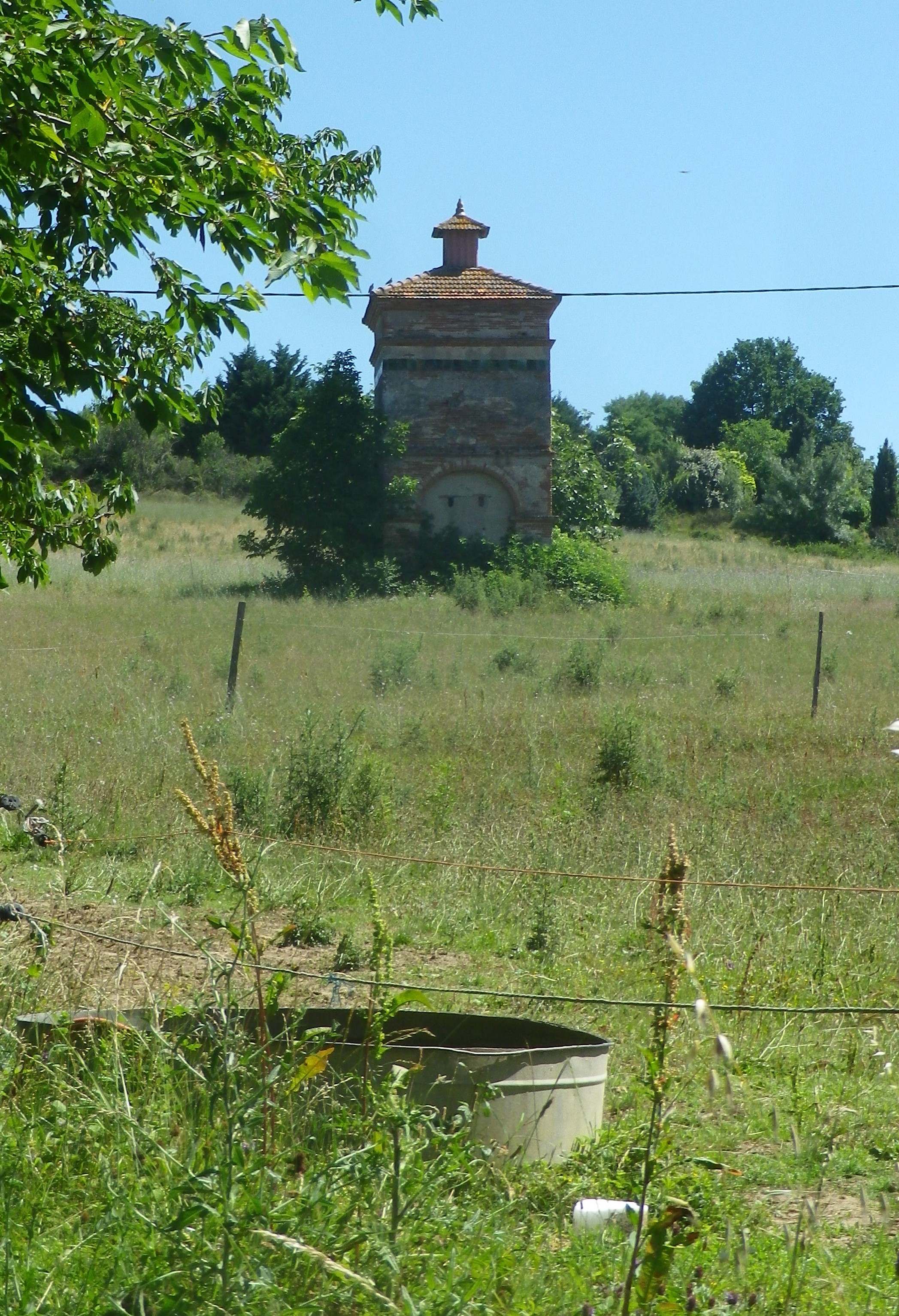
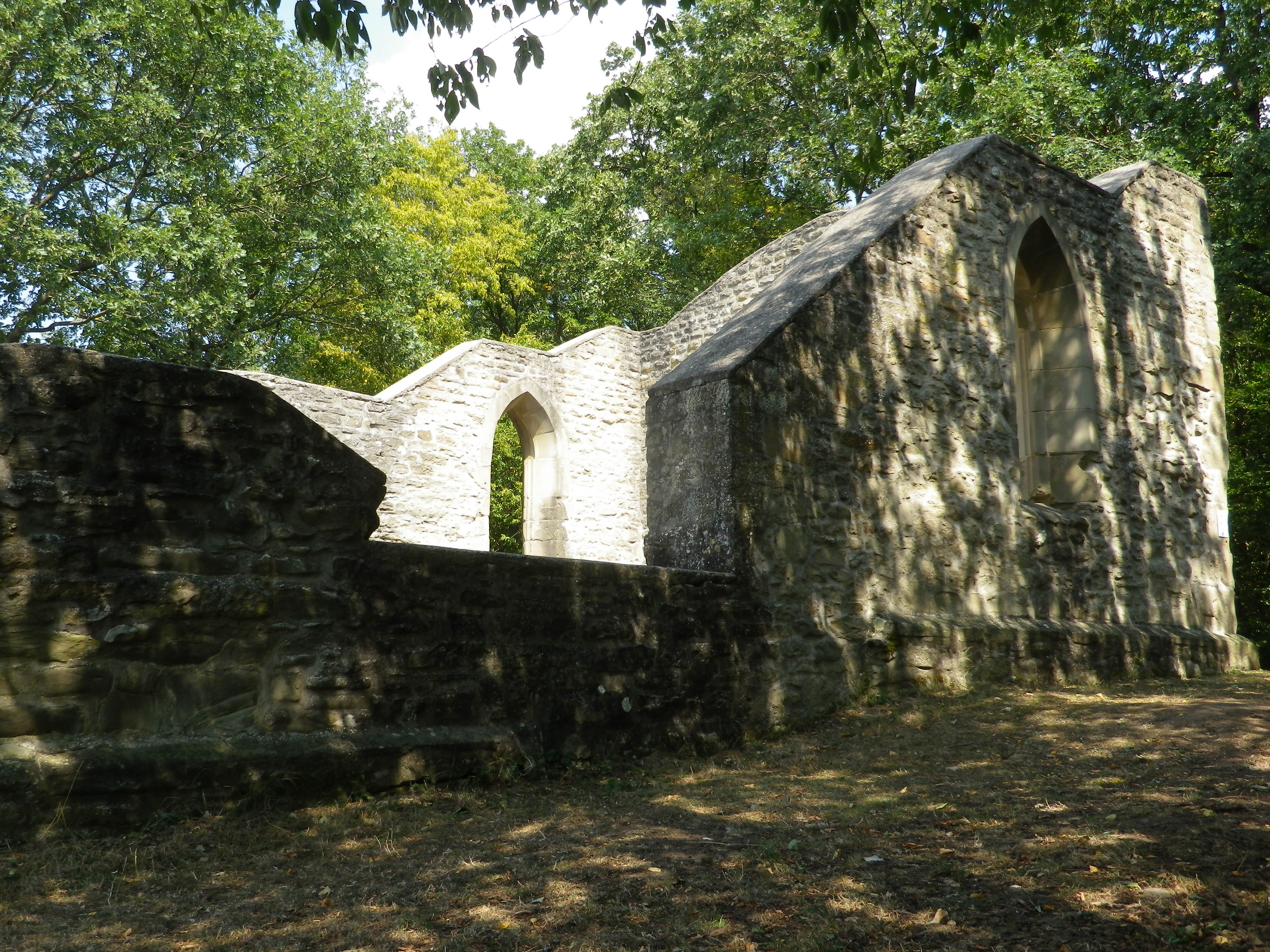
It was in this same forest, according to legend, that Empress Kunigunde, lost her way. She made an oath to God that she would found a church there, if she could find her way out of the woods. Sure enough, right off the trail lay the ruins of Kunigunde’s church. (The only problematic issue being the fact that the ruins date to about 400 years after her death in 1033.) Nonetheless, they provide a nice opportunity to relax, soak up the atmosphere of an earlier era, and enjoy the birdsong.

Ruins of Kunigunde’s Church

After my contemplations on a Greco-Roman god, a Catholic church, and a former Jewish community, I realized that like the Greco-Roman communities of old, and the Jewish and Catholic communities, all  shared an appreciation of wine that transcended their differences. Such is often the way with wine aficionados as well. Completing the circuit, I made my way back to the Weinparadiesscheune, to enjoy a glass or two of the local wine, made right here, in full communion with nature and fellow wine-lovers, as has been done for centuries.


Wine Notes: Seinsheim Bullenheim


What I Learned

Of the Franconia (Franken) wine region’s districts, the Steigerwald district is undoubtedly less well-known than the other two (the Maindreieck around Wuerzburg, and the Mainviereck), and consequently, one of the least visited. The Steigerwald is a tranquil area, focused largely on agriculture. One major attraction is the relatively large Steigerwald Nature park, with wide swathes of tree-covered hills. But on the edges of those hills are vineyards. The vineyard area is known as Frankenberger Schlossstueck, with three vineyards – the Hohenbuehl, the Tannenberg, and the Paradies, belonging to the villages of Seinsheim, Huettenheim and Bullenheim respectively.

Mueller-Thurgau, Silvaner and Bacchus are the three most common grape varieties planted here. The Bacchus varietal was created by crossing a Riesling with a Silvaner, then with a Mueller-Thurgau. The three parent varietals all do relatively well in cooler climate, which is why these, along with Bacchus, are the most planted varietals in this district. These grapes tend to produce light, fruity, white wines, a delight to drink chilled. Normally neither as acidic, nor as aromatic as Riesling, both the Silvaner and Bacchus wines are less-intense alternatives to Riesling, and are found almost only in Franconia.


What I Tasted

2017 Mueller-Thurgau, Kabinett, Trocken, Paradies Wein: A dry white wine with medium minus gold color; nose of green apple and gooseberry, with vanilla, green apple, and slight stone fruit flavors; medium plus acidity, with a tart lengthy finish.

2017 Bacchus, Kabinett, Halbtrocken, Winzerhof Klaus Markert (Weigenheim): A semi-dry white wine, with medium gold color; apricot, white peach and vanilla aromas and flavors; medium acidity.

2016 Bacchus, Bullenheimer Paradies, Kabinett, Halbtrocken, Weinbau Erich Schwemmer (Seinsheim): A semi-dry white wine, with medium minus gold color; neutral nose, with apricot, white peach and vanilla flavors; medium minus acidity.


Traumrunde Huettenheim-Seinsheim: Trail in a Nutshell


Trail Name: Traumrunde Huettenheim-Seinsheim

Trail Type:

Short-distance circuit; well-maintained and almost exclusively paved or hard-packed, marking on the trail fairly good

Length:

Total – 8.7 kilometers/ 5.4 miles

Convenient to:

Ippesheim, Franconia, Germany

Marking:

Square with white background, and red lettering reading “Traumrunde Huettenheim-Seinsheim”

Sign: TraumRunde Huettenheim-Seinsheim


Trail Description:

A meandering circuit, with moderate ascents and descents, as it circles the irregular upper contours of a vine-planted hill on the southwestern edge of the large Steigerwald Nature Park

Trailhead:

Can be anywhere on a circuit, but from a parking perspective, the parking area just below the Weinparadies Scheune is a convenient place to start.

Parking:

Bullenheim: Follow the signs to the Weinparadiesscheune, and before arriving, you will see a small area for hikers’ parking

Public Transportation Options:

Bus: Available to surrounding villages (Bullenheim, Seinsheim, Huettenheim), but not practical

Suggested Stages: (Not applicable)

Trail Itinerary-Reference Points: (Clockwise)

Huettenheim: Jewish Cemetery, Vineyards, two little ponds, forest; Kapellberg overlook, Kunigundenkapelle, scenic overlook, parking lot, Weinparadiesscheune Seinsheim; Steinbruch am Kunigundenwald, picnic area, Tannenberg Kreuz, Wanderhuette am Juedischen Friedhof

Representative Trail Photos:

Representative Trail Section in Forest Areas
Trail Surface: Unpaved

Restrooms:

(Only observed at the WeinparadiesScheune)

Attractions on or near Trail:

Some wine education tables located intermittently along the trail.

Tasting along the Trail:

Weinparadiesscheune Seinsheim, directly on the trail

Small wineries and taverns in Bullenheim, Seinsheim and Huettenheim, all slightly off the trail

Alternative Options:

Hiking: TCW 49: Durch Fraenkische Weinparadies: a 12.9 kilometer circuit, through much of the same area, but, more challenging ascents and descents, and about 2 miles longer. See https://www.outdooractive.com/de/route/wanderung/steigerwald/tcw-49-durchs-fraenkische-weinparadies/227470702/

Additional Information:

Regional: https://www.ippesheim.de/

Trail specific: https://www.outdooractive.com/de/route/wanderung/fraenkisches-weinland/traumrunde-huettenheim-seinsheim/9552201/#dm=1

Comments:

Few parking lots, per se, just parking on the edges of lanes. So please be conscientious and respectful when parking road-side in the villages or vineyards.


Ramblings in Rabastens


Rabastens, and the Gaillac wine region that it forms a part of, is an unexpected delight. My first time in this southwestern wine region, one of France’s oldest, left me charmed. Toulouse is the regional hub, fascinating in its own right, as is nearby Albi. Rabastens, though, in spite of its proximity to both, retains its quiet rural quality. Not that the town wasn’t hopping on a very crowded market day last June!  Local fruit and veg, as well as bottles or cases of local wines, from in the Rive Droite district of the Gaillac wine region, were on offer direct from vintners. That, of course, is why  I was there.

The Old Vine Yet Lives

The trail I rambled (hike is an overly energetic word for this easy, short itinerary), began on the outskirts of town, at the local wine cooperative. Fortunately, given the crowds at the market, I found plenty of parking options on that end of town. Like the cooperative, this trail focused on vintners and their wines: Amedee, being a former vintner. Shortly after parking, I (and Marco, my hiking buddy for this trip), were passing along vines, enjoying the song of the birds and the buzz of cicadas, brought out by the heat.

Vines in the Gaillac Wine Region

Making a turn uphill, we followed a grassy trail devoid of vines on one side. Instead, splashes of color from myriad wild flowers, all in full bloom that day, popped out against the grasses. The variety of flowers and their abundance were amazing. Focused on photographing the flowers, (and Marco, a hunter, on wildlife tracks) we had little notice of much else. It wasn’t until near the top of the hill that we turned to admire the rest of the scenery.

Hot Pink on a Hot Day

There, to the south, were snow-capped Pyrenees! They didn’t photograph well, due to haze. Haze likely caused by the multitude of rivers that pass between the trail in Rabastens and the mountains. Rabastens lies along the Tarn, which with the Hers and Ariege flow into the Garonne not far to the west, making this area a real watershed. Additionally, it is easy to see why grapes do well here: gentle ridges rise and fall from here to the mountains, and the south-facing slopes are great for vine-planting.

Snow-capped Mountains in Haze

Once on top, the trail turned almost 180 degrees, and headed downhill, through a little draw created by a break in the ridgeline. A stable, then finally an old farm house appeared. After a few more meters, a dovecote appeared. These famed dovecotes, some hundreds of years old and lovingly maintained, show an amazing breadth of style and architecture! Centuries ago, vintners used pigeon droppings to ameliorate the soil around the vines. We walked under a canopy of trees, enjoying the architecture and a respite from sun. In no time, we’d returned to the cooperative for a wine-tasting, and Rabastens, for a well-earned lunch!


Wine Notes: Gaillac


What I Learned

The Gaillac tradition of wine-making is one of the oldest in France. But well before that, there is documented evidence of the local population drinking wine imported from Greece, and even Asia Minor. Suffice it to say, wine produced here today has a lot of savoir-faire, or know-how, behind it !

The Appellation Gaillac territory lies east of Toulouse, and is subject to both Atlantic and Mediterranean climatic influences. Situated in the rolling hills between the Aveyron River, and both banks of the Tarn River, this fertile area has ideal conditions for vineyards. There are three main growth areas

-The Rive Gauche, known also as the Terrasses de la Rive Gauche, which indicates a generally flatter area

-The Rive Droite (around Gaillac, Lisle sur Tarn and Rabastens), known also, and appropriately so, as Coteaux de la Rive Droite, indicating an area of hills, where vines grow on the south-facing slopes

-The Plateau Cordais, north of the Rive Droit, in an area of higher elevation, which includes the impressive town of Cordes sur Ciel

The dry white wines received appellation status in 1938. Gaillac white wines include some unique varietals such as Loin de l’œil. It is rather perfumed, and is often blended with another unusual varietal Mauzac. Ondenc is yet another appellation varietal, and unusually, it is often harvested and bottled as a later harvest wine.

The red wines, however, only obtained appellation status in 1970.  The main red varietal is Braucol, with notes of raspberry and cassis. Duras and Prunelart, both of which were practically extinct by the end of the phylloxera crisis, are usually blended with Braucol, or the another main red varietal in this area, Syrah.


What I Tasted

2021 Loin de l’Oeil, Appellation d’Origine Protegee (AOP) Gaillac, Vinovalie (Saint Sulpice): A dry white wine with very pale, almost white gold color, with a citrus and tropical fruits nose, and citrus and mineral flavors; fairly well-balanced with medium plus acidity

2021 Le Perle, Appellation d’Origine Protegee (AOP) Gaillac, Vinovalie: A dry white cuvee with pale, white gold color; a peach and mineral nose; flavors of green apple, peach, and pineapple; a slight fizz, with mild acidity.

2021 Le Perle, Appellation d’Origine Protegee (AOP) Gaillac, Vinovalie: A dry rose cuvee with pale rose color; red berry nose and flavors, with hints of spice

2020  Loin de l’Oeil, Sans Culotte, Appellation d’Origine Protegee (AOP) Gaillac, Vinovalie (Saint Sulpice): A dry white wine with very pale, almost white gold color; floral nose, with floral and white stone fruits flavors, well balanced with medium acidity, and no sulfites added!

2021 Cuvee, AOP Gaillac, Domaine Les Grezels (Gaillac); A dry white wine cuvee (Muscadelle (20%), Loin de l’œil (40%), and  Mauzac (40%)), with pale gold color; citrus nose, with flavors of citrus, and ripe pear; very mild acidity.

2021 Rose cuvee, Appellation d’Origine Controlee (AOC) Gaillac, Chateau de Saurs (Lisle s/Tarn):  A dry, salmon pink cuvee of Duras and Syrah, red berry fruits, medium acidity and medium length finish.

2021 Les Cedres, Appellation d’Origine Protegee (AOP) Gaillac, Chateau Tauzies, (bottled by Vinovalie): A dry rose cuvee with pale rose color; bright red berries nose, slightly herbal notes, with flavors of the same.

Les Pas d’Amédée le Vigneron: Trail in a Nutshell


Trail Name: Dans les Pas d’Amédée le Vigneron

Trail Type: Short-distance circuit; well-maintained with hard (paved or packed earth) surfaces; marking for this itinerary is pretty good, but not always present.

Length:

Total – 7 kilometers/4.3 miles

Convenient to: Toulouse, Albi, Montauban, or Gaillac, Occitanie, France

Marking:

Signs specific to the trail (see above and below), as well as the ubiquitous French yellow bar markings

Marking for the Trail


Trail Description: This mostly gentle walk through vineyards and fields in and around Rabastens, a town  in the Gaillac wine region, provided lovely views, and several opportunities to sample the wines.

Trailhead:

Official: Rabastens, Vinovalle, Ave de l’Hermitage

Mine : Rabastens, Rue de la Croix Blanche (where the tail leading to the circuit begins)

Parking:

Rabastens: on the shoulder along Avenue de l’Hermitage, and along wider sections of the Chemin de l’Hermitage,

Rabastens: near the school – Ave de la Croix Blanche, (usually full, but empty during school vacations)

Rabastens:  Rue des Abreuvoirs, a large central official parking lot, mostly closed during market days, and a kilometer from the trail

Public Transportation Options:

SNCF, the national train system, has a station in Rabastens connecting it with Toulouse and beyond

Suggested Stages:

Not applicable

Trail Itinerary-Reference Points: (Counterclockwise)

Rabastens: Cave, Ave de l’Hermitage, Chemin de l’Hermitage, R. des Ormes, R. des Clarisses, cross Rte de Saurs right to Chemin de la Tremege (Alternatively id’d: Ave de la Croix Blanche), path (La Dressiere) behind school back onto Chemin de la Tremege ; left onto path (250 m before the “t” insection) through vines, onto Las Bordes, stay right at y (350m past plant); sharp turn south/left, Fourtet: almost to Rte 2/Rte de Salvagnac, but just before it, turn left onto narrow Tremege Basse/Cote de la Tremege (by dumpsters); at school, retrace steps to Cave.

Representative Trail Photos:

Sample Section of Trail
Representative Trail Surface

Restrooms:

None observed

Attractions on or near Trail:

(See below)

Tasting along the Trail:

Vinovalle/Vignerons de Rabastens, a local cooperative

Domaine in Ventis, Les Fontaines de Cavalade, both are just off the trail and sell directly at local markets

Alternative Options:

Hiking: Vignes et Clochers, an eight kilometer long circuit trail, starting north of the center of Lisle-sur-Tarn (about five miles northeast of Rabastens), on D18/Camin de Tolze, Alternatively, Lisle-sur-Tarn also has the 11 kilometer Le Vignoble Lislois circuit trail, beginning right on the northern outskirts of the old town

Car: Circuit du Vignoble Gaillacois, Route des Vins de Gaillac, ask local travel offices for help mapping your route

Additional Information:

Regional: https://www.la-toscane-occitane.com/

Trail specific:  https://www.france-randos.com/randonnee/rabastens/tarn-81/dans-les-pas-damedee-le-vigneron

Comments:

A very easy walk in a quiet corner of rural France, albeit only 30 kilometers from Toulouse!


Heights Above the Heimbach


The name of the trail, the Fuerstenbergblick, in this instance, is a subtle reference to who owned the vineyards on the hills overlooking the Rhine. Not only did the trail lead through the refined vineyards of the Middle Rhine, but it also included views of several castles that the Fuersten, or princes, owned on this lucrative section of the Rhine.

This hike had a lot going for it, beginning with its location. It is about in the center of the UNESCO world-heritage site. Bacharach, and its famous wines, lie just to the north of Niederheimbach, and the well-known wine village of Lorch, with its highly acclaimed wines, faces it from across the river. (It is connected to it by a convenient ferry, making travel between the left and right banks quite convenient.)

The Heimbach in Niederheimbach

I began in town, and headed inland, up a narrow valley. Soon afterwards, the trail did a 180 degree turn, and I was facing the river, and the delightfully intimate (in size) Hohneck Castle, perched on a riverside promontory on the other side of the little valley.

Burg Hohneck, Niederheimbach

Heading toward the river, but this time on the heights above the little village, I had plenty of opportunity to study the vineyards of Lorch, across the river. I had hiked these vineyards on the magnificent long distance trail, the Riesling Pfad. (See the Nutshell here.) This time, I could see where I had been, and pat myself on the back for the multiple ascents and descents, some rather steep, I made back then.

Lorch and Castle Nollig

This trail, while neither as long (it is quite short in fact), nor as technically varying or challenging, was a pleasant hike for an afternoon in a quiet, beautiful section of the Middle Rhine. As it continued fairly high above the Rhine, it was easy to enjoy the expansive views while walking along a mostly flat plateau. Views extended downriver to Bacharach, over to Burg Nollig above Lorch, and up river. Photographers and castle-lovers are truly spoiled for choice here!

Downriver to Bacharach

The short descent into and across the Gailsbach valley, was followed by a quick ascent up to the ruined Fuerstenberg Castle. Another castle ruin overlooking the Rhine. You would think I would get tired of them. Crooked ivy-covered walls, where small lizards hide when frightened from their sunny perches, dilapidated masonry, and door lintels to nowhere, pretty much sums up many a ruin. But I never miss an opportunity to explore them.

Castle Fuerstenberg and its Vineyards

The trail soon turned south to return to Niederheimbach, to complete the circuit. At this point, there is the opportunity to walk along the edge of the Rhine. The trail, which also serves as a bike trail here (so be mindful), was a quiet, flat, nicely tarmacked section, well away from the road. Walking to the sound of lapping water, I soon came to a waterside café-bar, just before the village of Niederheimbach. Miracle of miracles, it was actually open on this non-season afternoon. I stopped, naturally. As I sipped a glass of local wine, and enjoyed the water views, I realized there is no better way to enjoy the Rhine and its wines than hiking along it!

Bar Cafe Along the Rhine

Wine Notes: Mittelrhein Reichenstein


What I Learned

The Mittelrhein (Middle Rhine) is famous for its castle ruins, towering cliffs, and dramatic oxbow bends along the river through this section of it. The Upper Middle Rhine is now a UNESCO World Heritage site. It begins in Koblenz, and continues to Bingen.

This also defines the wine region known as the Mittelrhein. Unlike other wine regions on the Rhine, this region covers both banks of the river (beginning north of Lorchhausen, which joins the Rheingau region). Many areas of the Upper Middle Rhine do not produce wine: the topography and geology just aren’t suitable or practicable, even for growing other crops. That just makes the vineyards along this section of the Rhine even more esteemed.

On the left bank, dark slate begins to predominate in the soil around Boppard, and continues upriver until just outside Trechtingshausen. This hard rock shapes the river as well, and its many twists and turns provide optimal sun exposure for some slopes, like the famous vineyard of Bopparder Hamm, while depriving others of much sun at all just around the next bend.

Because of the different geological conditions, the Mittelrhein region is divided into different “Grosslage,” or growing areas, each containing some specifically named vineyards. This hike covered the area around mostly Oberheimbach, which falls with the Grosslage of Schloss Reichenstein, the name of a brooding castle ruin located about three miles upriver in Trechtingshausen. Well-known Nieder/Ober -heimbach vineyards include Niederheimbacher Froher Weingarten, Oberheimbacher Sonne, Oberheimbacher Klosterberg, and my personal favorite: the Oberheimbacher Wahrheit (it means “Truth”), which says all you need to know about the true expression of the terroir in the wines from here.


What I Tasted

2017 Riesling Weinberg Schloesschen, Spaetlese, Trocken, Deutscher Qualitaetswein, Weingut Juergen Stassen (Oberheimbach): A dry white wine with medium gold color, a mineral and slightly fruity nose, with green gooseberry and mineral flavors; medium plus acidity with a tart finish.

2015 Riesling, Classic, Trocken, Deutscher Qualitaetswein, Weingut Eisenbach-Korn (Oberheimbach): A dry white wine with medium plus gold color, a spicy, nose with hints of turpentine and lipstick; with spicy and fruity flavors, medium acidity with a smooth, but tart finish; very well balanced overall.

2013 Weisser Riesling, Niederheimbacher Froher Weingarten, Qualitaetswein, trocken, Fendel: A dry white wine with a medium gold color: a well-balanced, slightly floral and fruity tasting wine with a pleasant minerality to it.


Fuerstenbergblick: Trail in a Nutshell


Trail Name:  Nr 22 – Fuerstenbergblick

Trail Type: Short distance circuit trail; well-maintained and mostly paved or hard-packed earthen trail, marking on the trail is mostly good, but not always exclusively specific to this trail as other trails follow along it as well.

Length:

Total – 7 kilometers/4.3 miles

Convenient to: Bingen, or Koblenz, Germany

Marking: Nr 22, or follow signs to next itinerary point

Trail Description: This is an easy trail through a little visited area of the famous Middle Rhine. It passes through a couple of wooded areas, but mostly vineyards, with clear views of the vineyards and castles on the opposite (and more visited) side of the Rhine, and a lovely riverside walk to close the circuit.

Trailhead:

Niederheimbach, Rheinstrasse riverside walking path

Parking:

Niederheimbach: A few street-side places where parking is not prohibited along the Rheinstrasse or Heimbachtal streets

Public Transportation Options:

Rail: Very frequent train service (DeutscheBahn (DB) regional train RB26) connects Niederheimbach with Mainz to the south, or Cologne to the north with stops all along the Mittel Rhein including Bingen, Boppard, St Goar, Koblenz, amongst others.

Bus: See the Rhein-Naehe Nahverkehrsverbund (RNN) website for details of bus travel through this area

Suggested Stages: Not applicable

Trail Itinerary-Reference Points: (Clockwise)

Niederheimbach: Heimbachtal, then turn up to Rheinblick, vineyards, lookout point “Tempelchen”, woods, Rheindiebach: Cross Rheingoldstrasse/K27, vineyards, to and past Burg Fuerstenberg ruins, pass above the cemetery, Rheingoldstr, Mainzerstr, pass under B9 and train tracks, continue on the waterside path back to Niederheimbach

Representative Trail Photos:

Sample Trail Section Through Woods


Grassy Trail Surfaces in Places


Stairs to the Castle

Restrooms:

Rheindiebach: along the river, just north of the pedestrian underpass

Attractions on or near Trail:

Just lots of iconic Rhine River scenery!

Tasting along the Trail:

Niederheimbach and Oberheimbach both have guesthouses and restaurants that serve local wines. Niederheimbach even has one right along the river!

Alternative Options:

Hiking: Reblausweg (Nr 13) / Route 1 Panoramaweg, an 8 kilometer circuit trail beginning/ending at Niederheimbach. See the Nutshell here.

Biking: Rheinradweg, is a multi-day tour following the Rhine, but an easy day trip, with lots of stops for photos, is from Koblenz to Bingen am Rhein, or vice versus. It passes through Niederheimbach, which is one of the trains stops along the river route. See the Nutshell here.

Additional Information:

Regional: https://www.romantischer-rhein.de/ and https://niederheimbach.welterbe-mittelrheintal.de/

Trail specific: https://www.outdooractive.com/de/route/wanderung/romantischer-rhein/nhb-nr.-22-fuerstenbergblick-rundwanderweg/116090787/  or https://www.niederheimbach.info/media/files/nhb-wanderweg_022_k-2022-07.pdf

Comments:

Short, easy, but lovely.


From Vineyards to the Heavens


The town of Klausen, known as Chiusa in Italian, lies at the bottom of a river valley. The Eisack River runs from near the Austrian border to Bozen, where it joins the Etsch River. During its southward flow, it runs along the west bank of Klausen, surrounded by some of the most impressive Dolomite peaks in this area.  But, key in this description is the “bottom of the Eisack river valley.” Therefore, most hikes in this area will experience some serious ascents at some point.

The Eisack River

Continue reading From Vineyards to the Heavens