
Colors of Gaillac

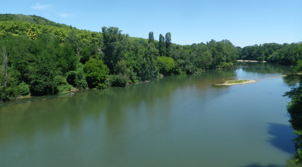
The Tarn – Rive Droite

Old Cabane Near Vineyards

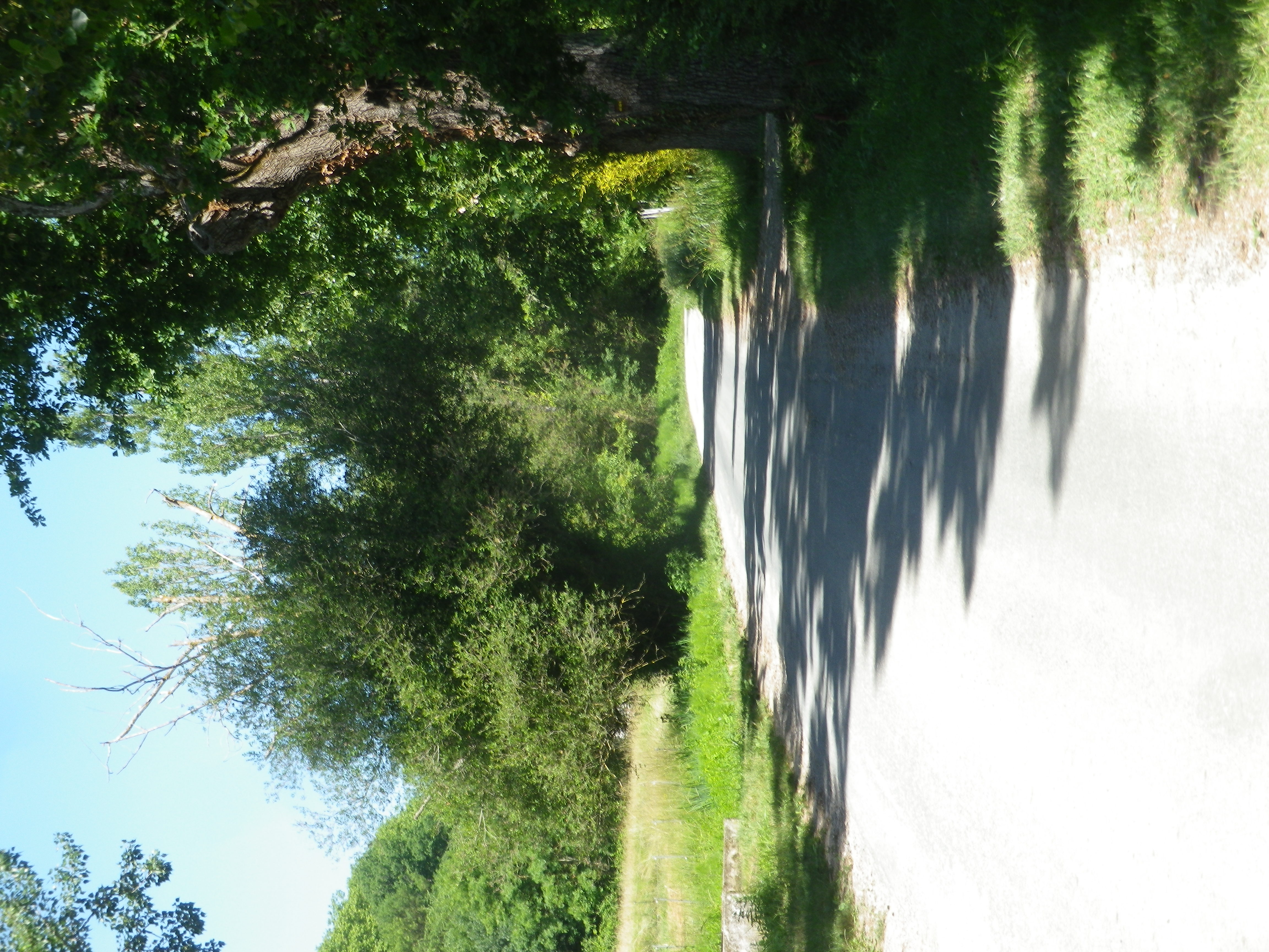
Quiet Lane by Rabastens

Not Only Vineyards

Old Farm House on the Trail
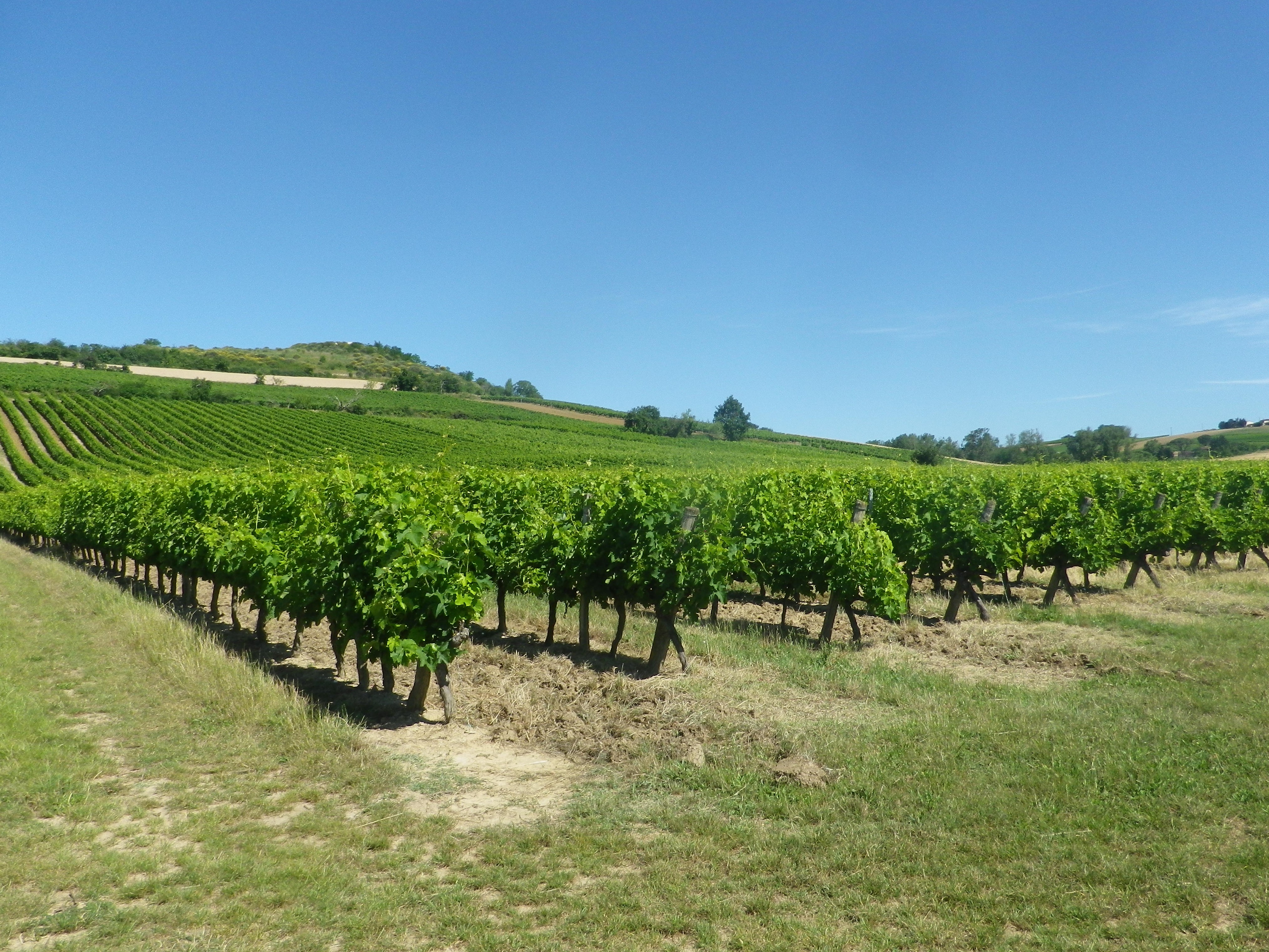
Rabastens, and the Gaillac wine region that it forms a part of, is an unexpected delight. My first time in this southwestern wine region, one of France’s oldest, left me charmed. Toulouse is the regional hub, fascinating in its own right, as is nearby Albi. Rabastens, though, in spite of its proximity to both, retains its quiet rural quality. Not that the town wasn’t hopping on a very crowded market day last June! Local fruit and veg, as well as bottles or cases of local wines, from in the Rive Droite district of the Gaillac wine region, were on offer direct from vintners. That, of course, is why I was there.
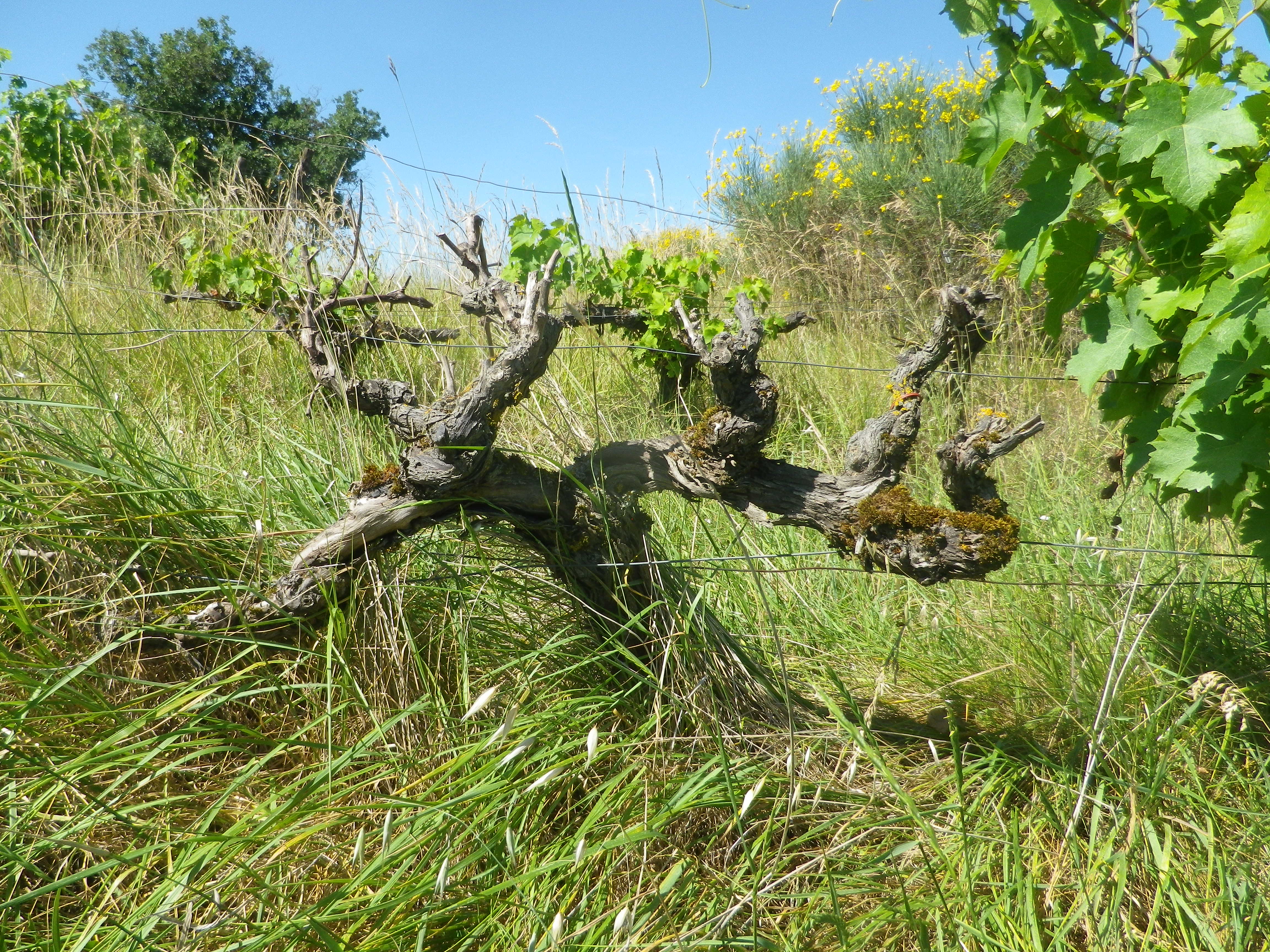
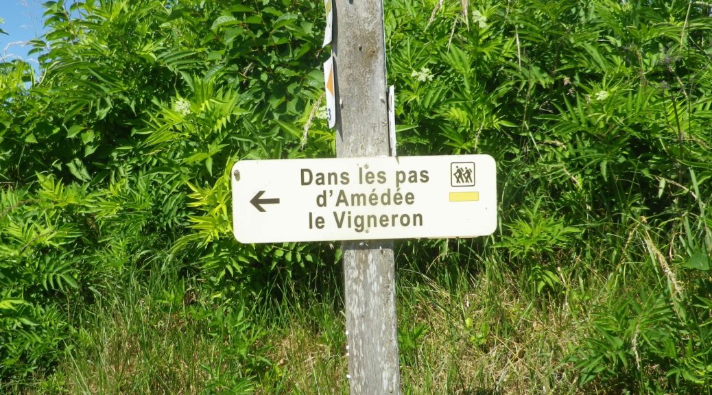
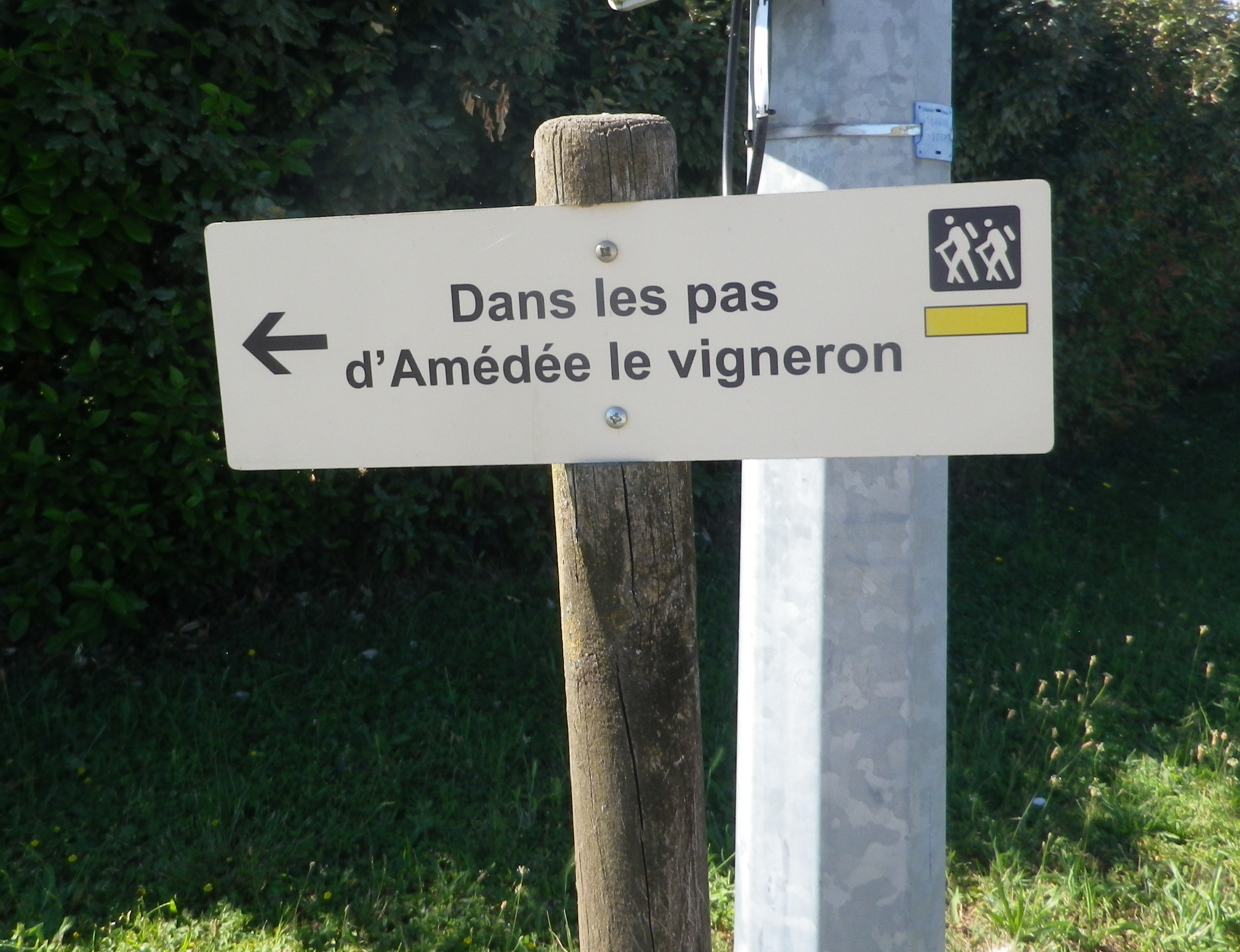
The trail I rambled (hike is an overly energetic word for this easy, short itinerary), began on the outskirts of town, at the local wine cooperative. Fortunately, given the crowds at the market, I found plenty of parking options on that end of town. Like the cooperative, this trail focused on vintners and their wines: Amedee, being a former vintner. Shortly after parking, I (and Marco, my hiking buddy for this trip), were passing along vines, enjoying the song of the birds and the buzz of cicadas, brought out by the heat.
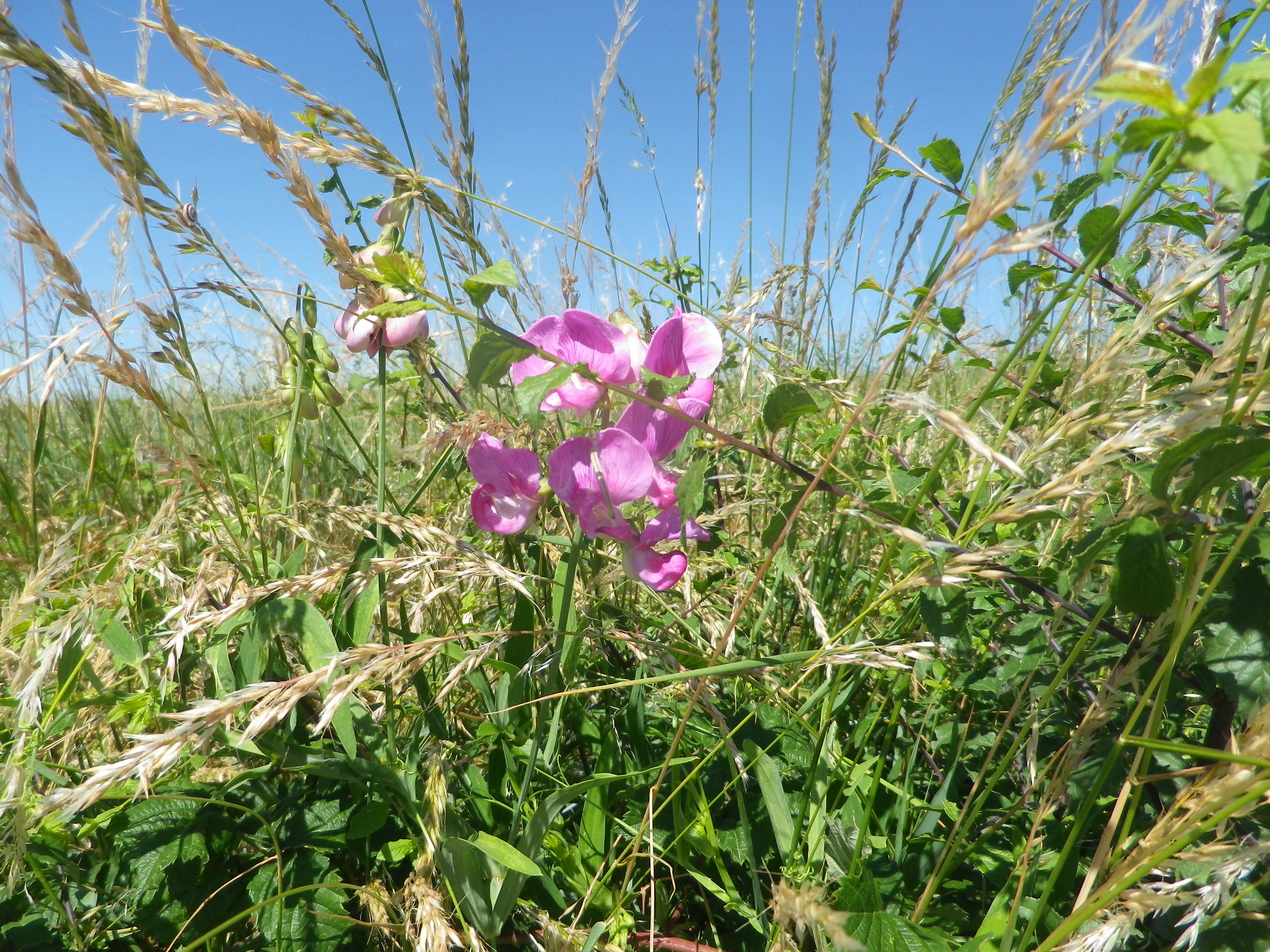
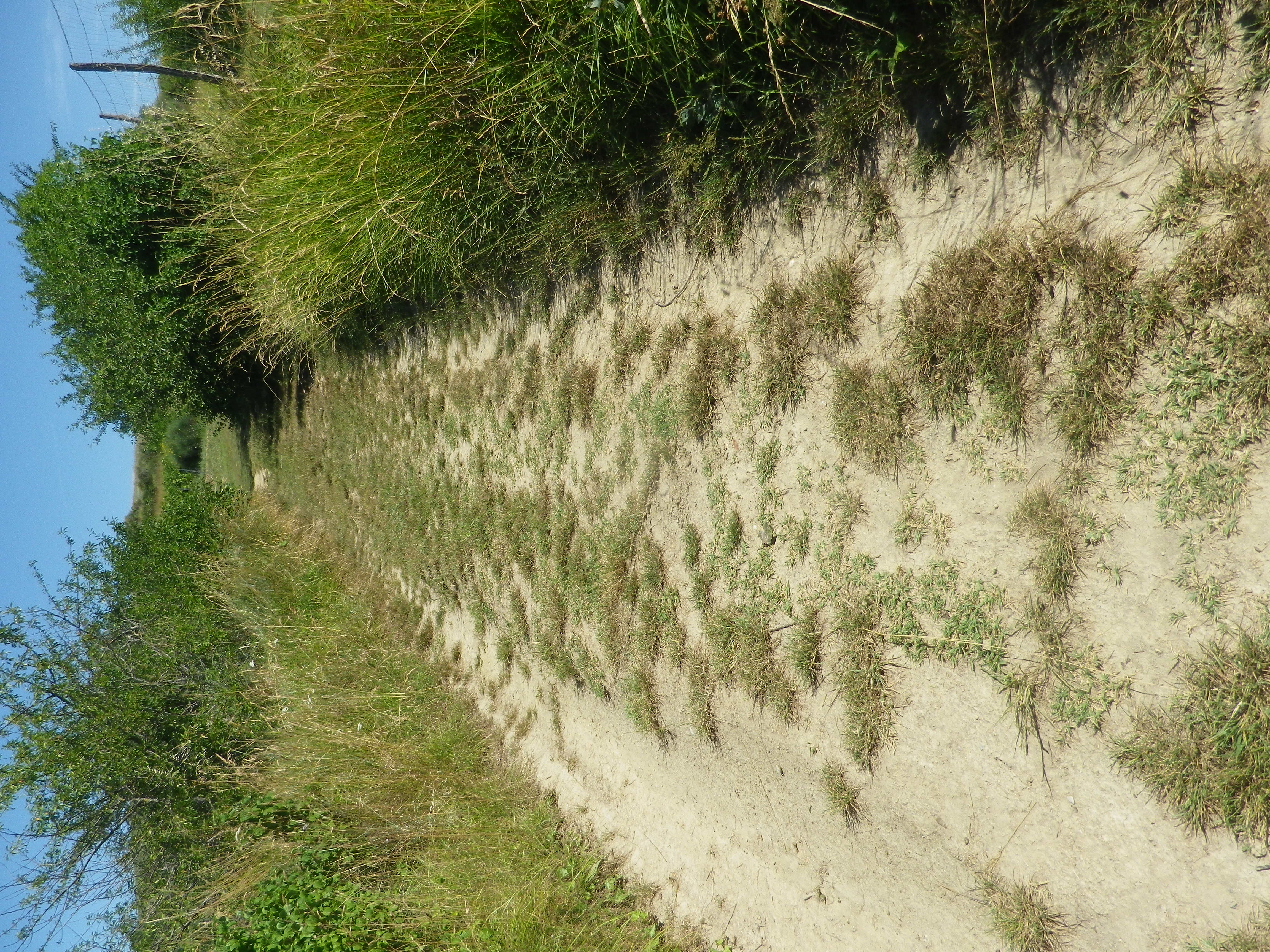
Making a turn uphill, we followed a grassy trail devoid of vines on one side. Instead, splashes of color from myriad wild flowers, all in full bloom that day, popped out against the grasses. The variety of flowers and their abundance were amazing. Focused on photographing the flowers, (and Marco, a hunter, on wildlife tracks) we had little notice of much else. It wasn’t until near the top of the hill that we turned to admire the rest of the scenery.
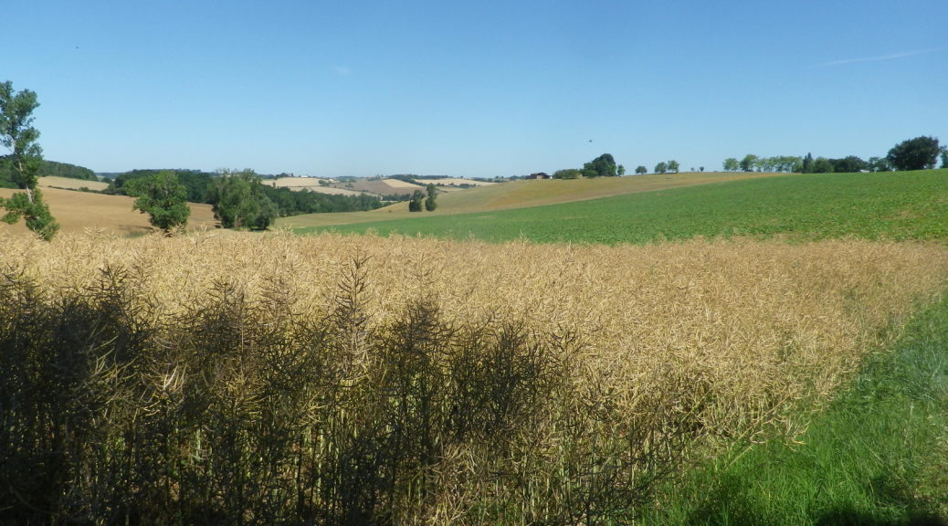
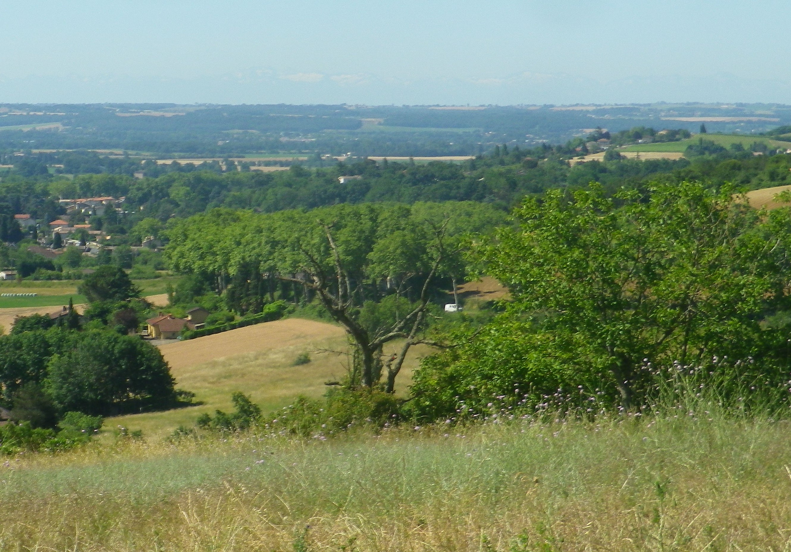
There, to the south, were snow-capped Pyrenees! They didn’t photograph well, due to haze. Haze likely caused by the multitude of rivers that pass between the trail in Rabastens and the mountains. Rabastens lies along the Tarn, which with the Hers and Ariege flow into the Garonne not far to the west, making this area a real watershed. Additionally, it is easy to see why grapes do well here: gentle ridges rise and fall from here to the mountains, and the south-facing slopes are great for vine-planting.
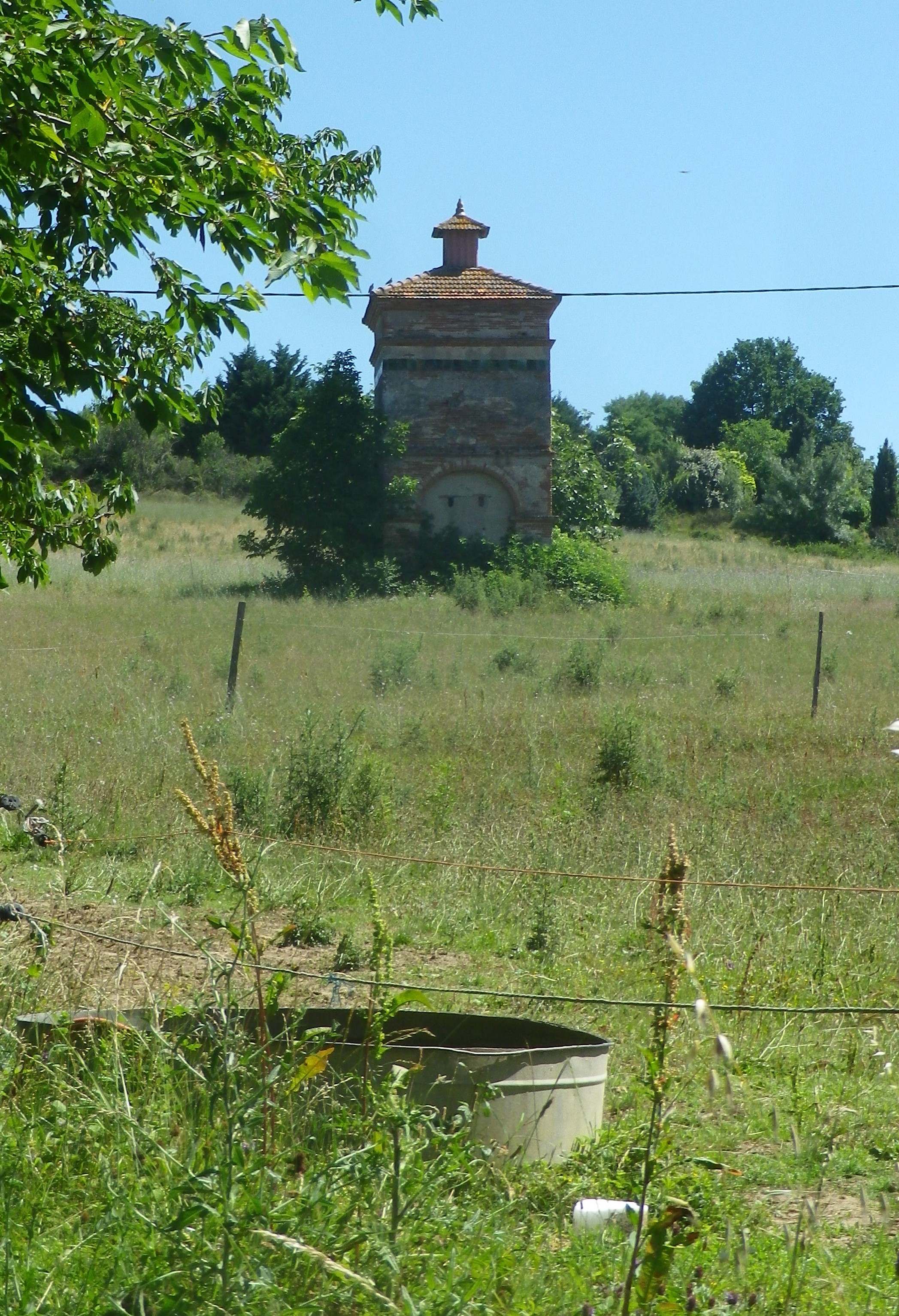
Once on top, the trail turned almost 180 degrees, and headed downhill, through a little draw created by a break in the ridgeline. A stable, then finally an old farm house appeared. After a few more meters, a dovecote appeared. These famed dovecotes, some hundreds of years old and lovingly maintained, show an amazing breadth of style and architecture! Centuries ago, vintners used pigeon droppings to ameliorate the soil around the vines. We walked under a canopy of trees, enjoying the architecture and a respite from sun. In no time, we’d returned to the cooperative for a wine-tasting, and Rabastens, for a well-earned lunch!
Trail Name: Dans les Pas d’Amédée le Vigneron
Trail Type: Short-distance circuit; well-maintained with hard (paved or packed earth) surfaces; marking for this itinerary is pretty good, but not always present.
Length:
Total – 7 kilometers/4.3 miles
Convenient to: Toulouse, Albi, Montauban, or Gaillac, Occitanie, France
Marking:
Signs specific to the trail (see above and below), as well as the ubiquitous French yellow bar markings
Trail Description: This mostly gentle walk through vineyards and fields in and around Rabastens, a town in the Gaillac wine region, provided lovely views, and several opportunities to sample the wines.
Trailhead:
Official: Rabastens, Vinovalle, Ave de l’Hermitage
Mine : Rabastens, Rue de la Croix Blanche (where the tail leading to the circuit begins)
Parking:
Rabastens: on the shoulder along Avenue de l’Hermitage, and along wider sections of the Chemin de l’Hermitage,
Rabastens: near the school – Ave de la Croix Blanche, (usually full, but empty during school vacations)
Rabastens: Rue des Abreuvoirs, a large central official parking lot, mostly closed during market days, and a kilometer from the trail
Public Transportation Options:
SNCF, the national train system, has a station in Rabastens connecting it with Toulouse and beyond
Suggested Stages:
Not applicable
Trail Itinerary-Reference Points: (Counterclockwise)
Rabastens: Cave, Ave de l’Hermitage, Chemin de l’Hermitage, R. des Ormes, R. des Clarisses, cross Rte de Saurs right to Chemin de la Tremege (Alternatively id’d: Ave de la Croix Blanche), path (La Dressiere) behind school back onto Chemin de la Tremege ; left onto path (250 m before the “t” insection) through vines, onto Las Bordes, stay right at y (350m past plant); sharp turn south/left, Fourtet: almost to Rte 2/Rte de Salvagnac, but just before it, turn left onto narrow Tremege Basse/Cote de la Tremege (by dumpsters); at school, retrace steps to Cave.
Representative Trail Photos:
Restrooms:
None observed
Attractions on or near Trail:
(See below)
Tasting along the Trail:
Vinovalle/Vignerons de Rabastens, a local cooperative
Domaine in Ventis, Les Fontaines de Cavalade, both are just off the trail and sell directly at local markets
Alternative Options:
Hiking: Vignes et Clochers, an eight kilometer long circuit trail, starting north of the center of Lisle-sur-Tarn (about five miles northeast of Rabastens), on D18/Camin de Tolze, Alternatively, Lisle-sur-Tarn also has the 11 kilometer Le Vignoble Lislois circuit trail, beginning right on the northern outskirts of the old town
Car: Circuit du Vignoble Gaillacois, Route des Vins de Gaillac, ask local travel offices for help mapping your route
Additional Information:
Regional: https://www.la-toscane-occitane.com/
Trail specific: https://www.france-randos.com/randonnee/rabastens/tarn-81/dans-les-pas-damedee-le-vigneron
Comments:
A very easy walk in a quiet corner of rural France, albeit only 30 kilometers from Toulouse!