Category Archives: Biking

Bubbles!


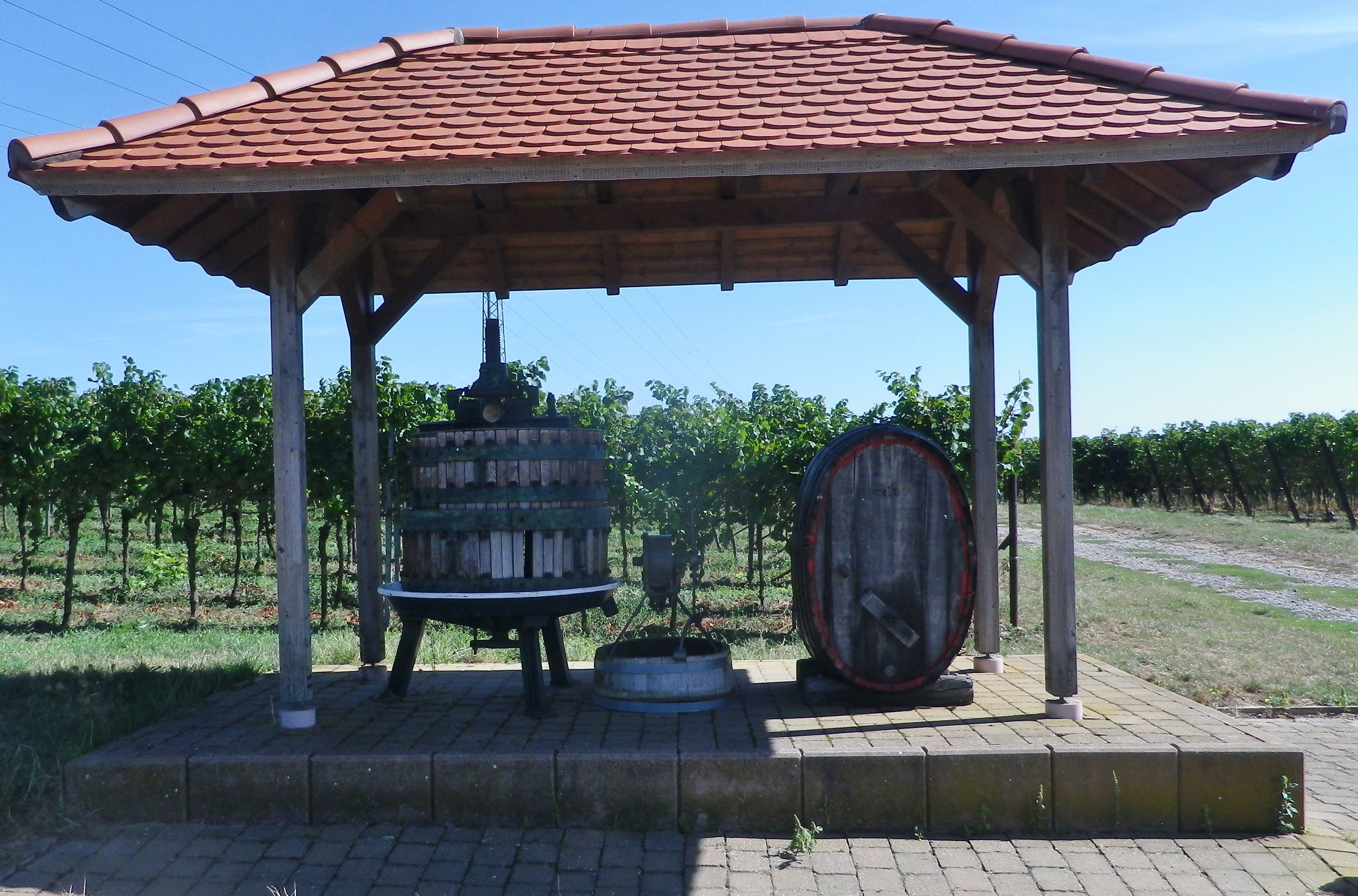
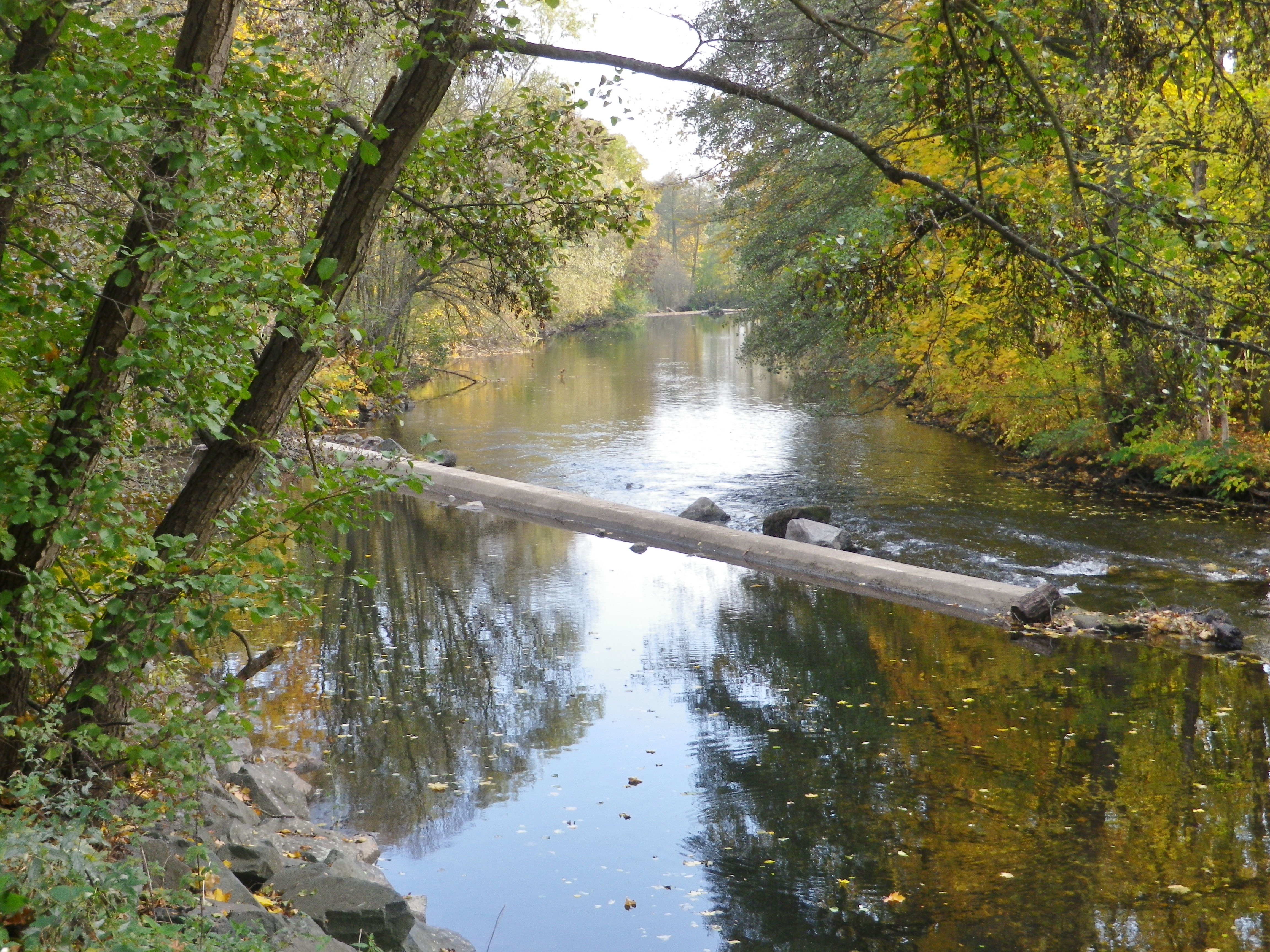
The Alsatians call their sparkling wines Cremant. But these were not the only bubbles (“bulles”) that I found along this “Bulles et Bugatti” cycling itinerary. There were wineries and taverns offering the Cremant of Alsace, of course. But equally enjoyable were the bubbling creeks along much of the way, from the Dachsteinerbach, the Bruche and its canal, the Mossig, Frankenbach and Kehlbach, finally, the Stillbach, (it wasn’t), a melodious stream bubbling its way to the Bruche.

Confluence: Stillbach, Muehlbach and the Bruche


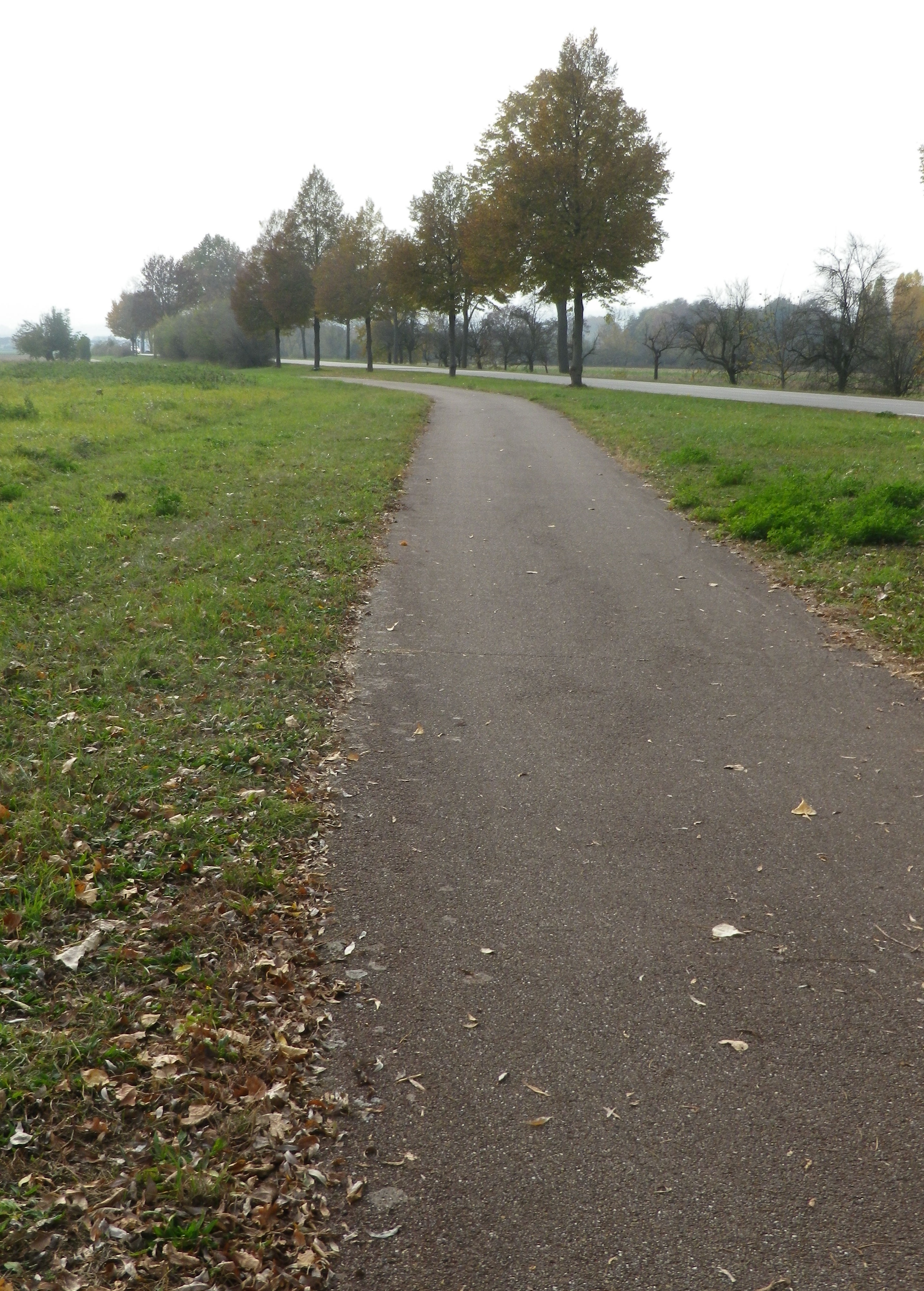
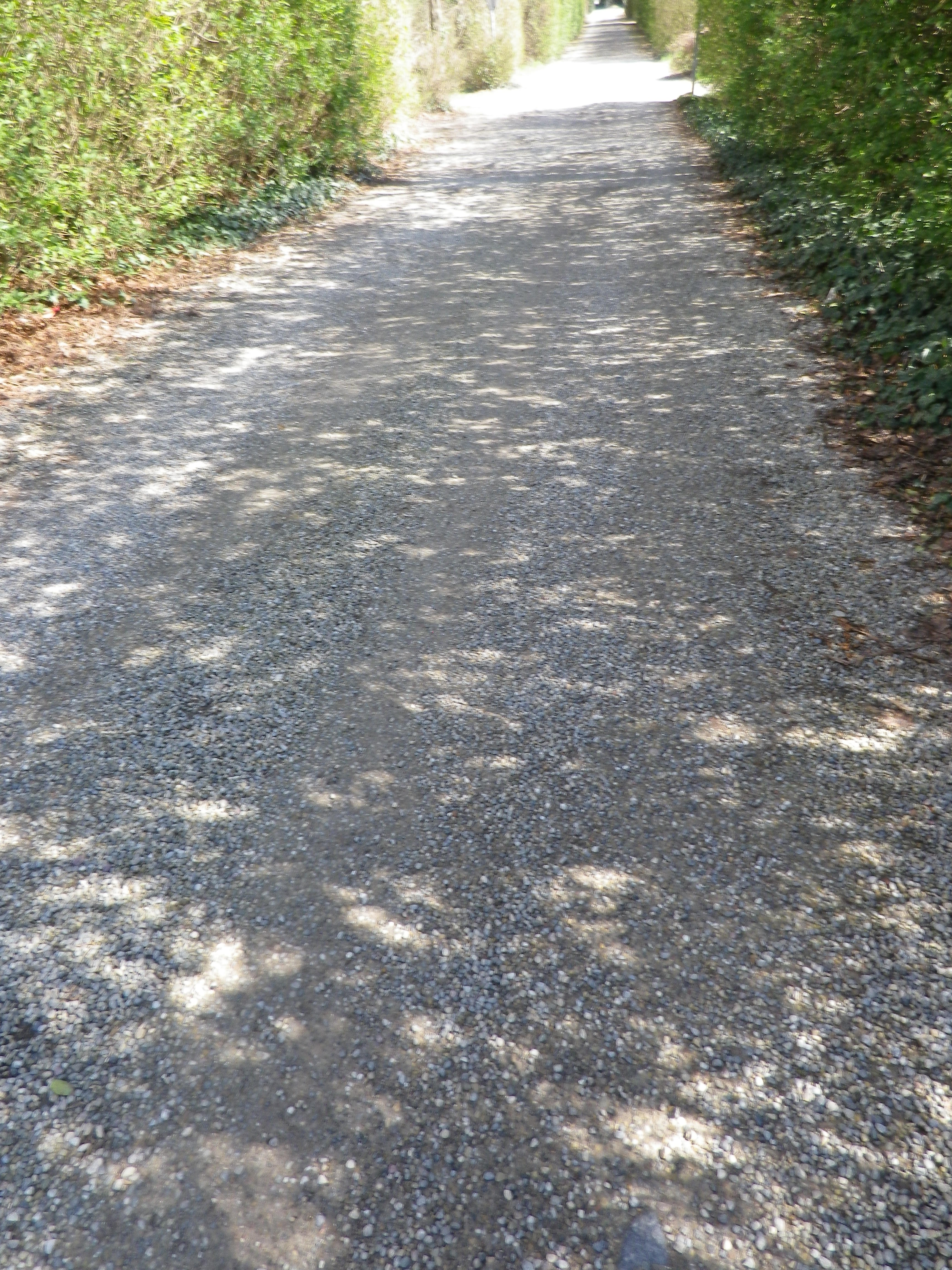
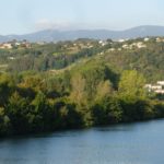
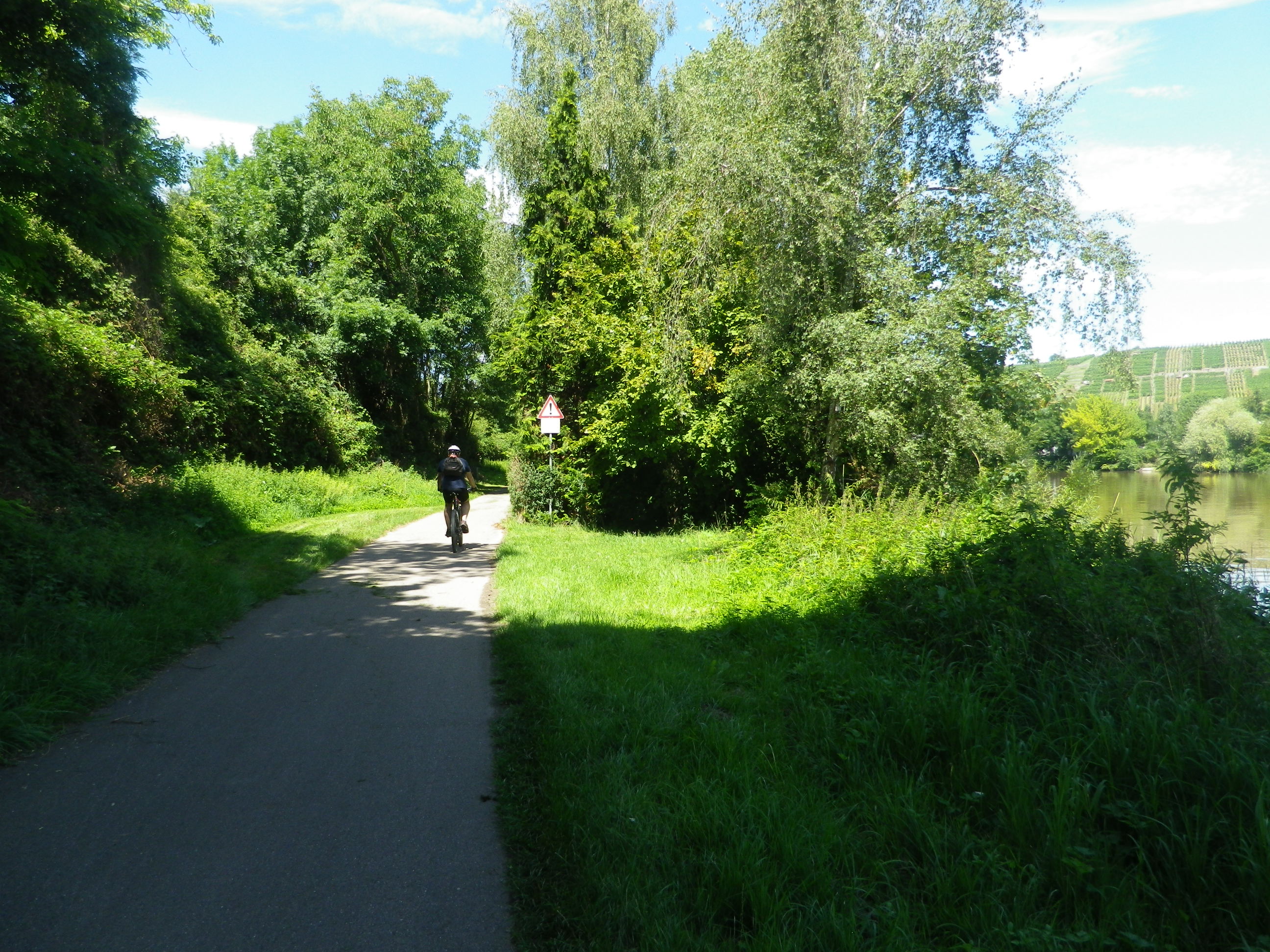
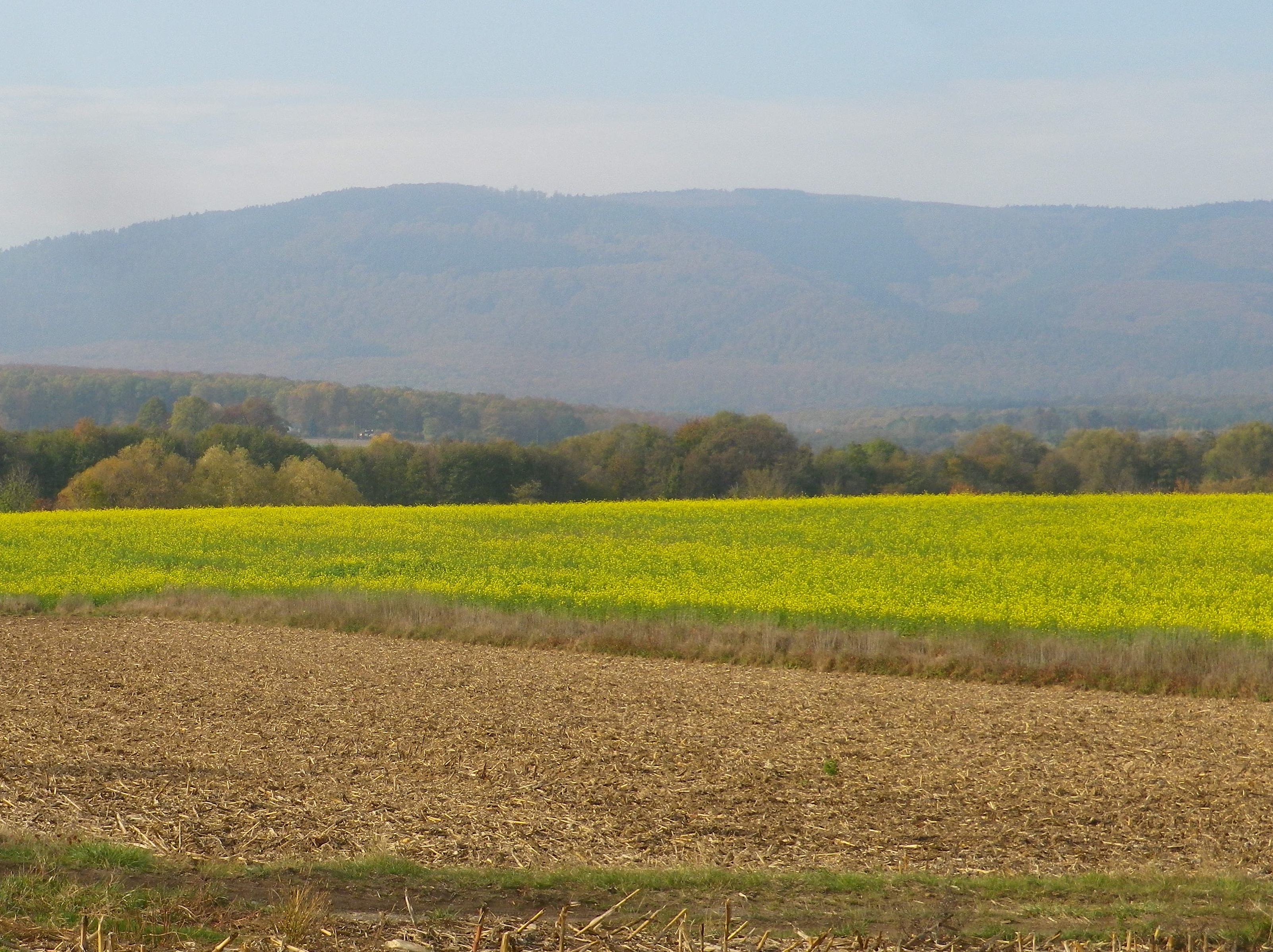
The Bruche empties into the Ill, a tributary to the Rhine, by Strasbourg. Starting in the Vosges mountains, it ultimately flows by the vineyards in the foothills of the Vosges, before entering the flat fields surrounding Strasbourg. This geography lesson just to let you know that the itinerary did have some hills, but also some very flat stretches. Especially memorable for its peaceful, rural aspect was the section riding along the Bruche Canal, a paved and beautifully maintained bike path. It is even possible to follow this trail all the way to the heart of Strasbourg!

Along the Bruche Canal


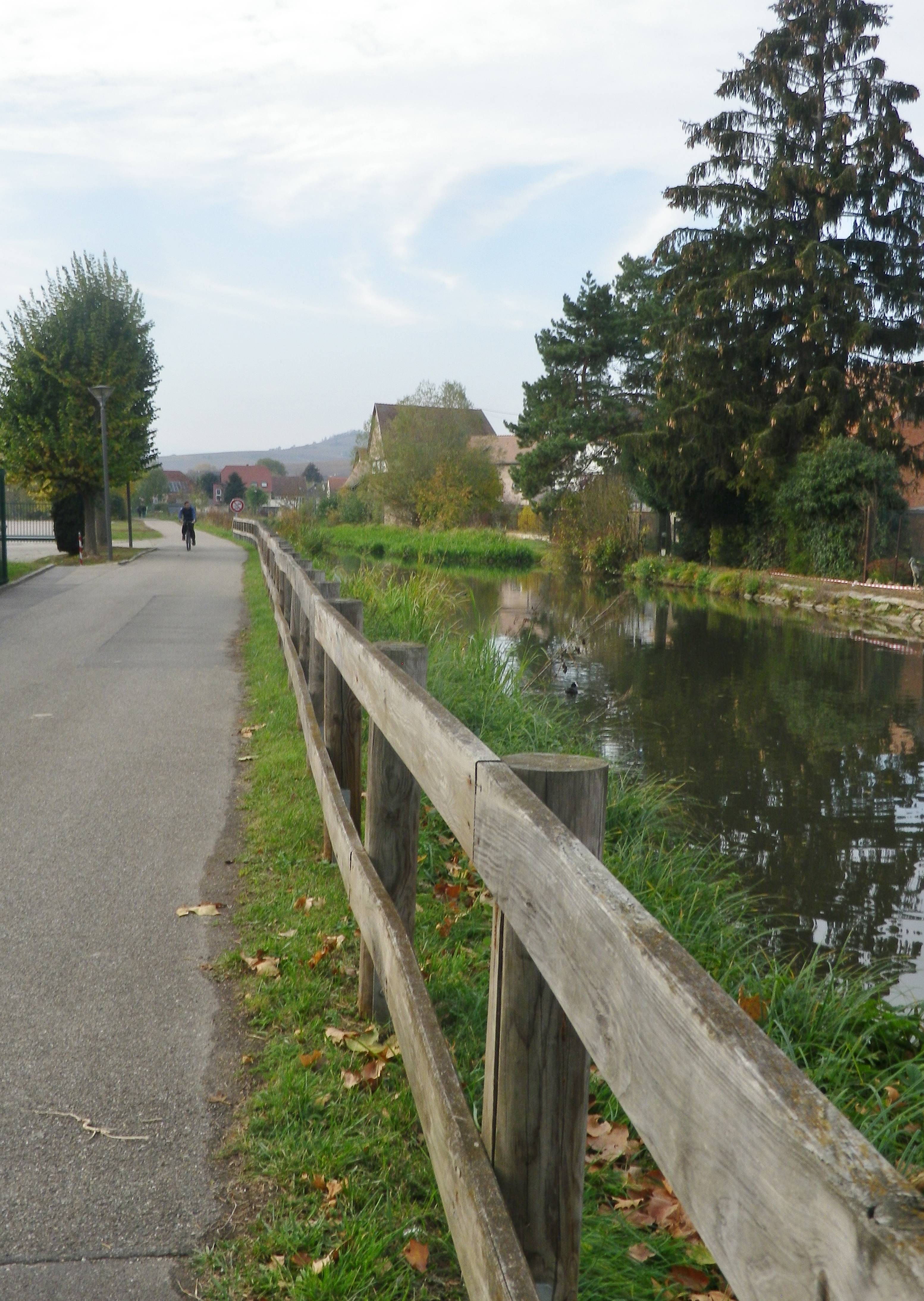
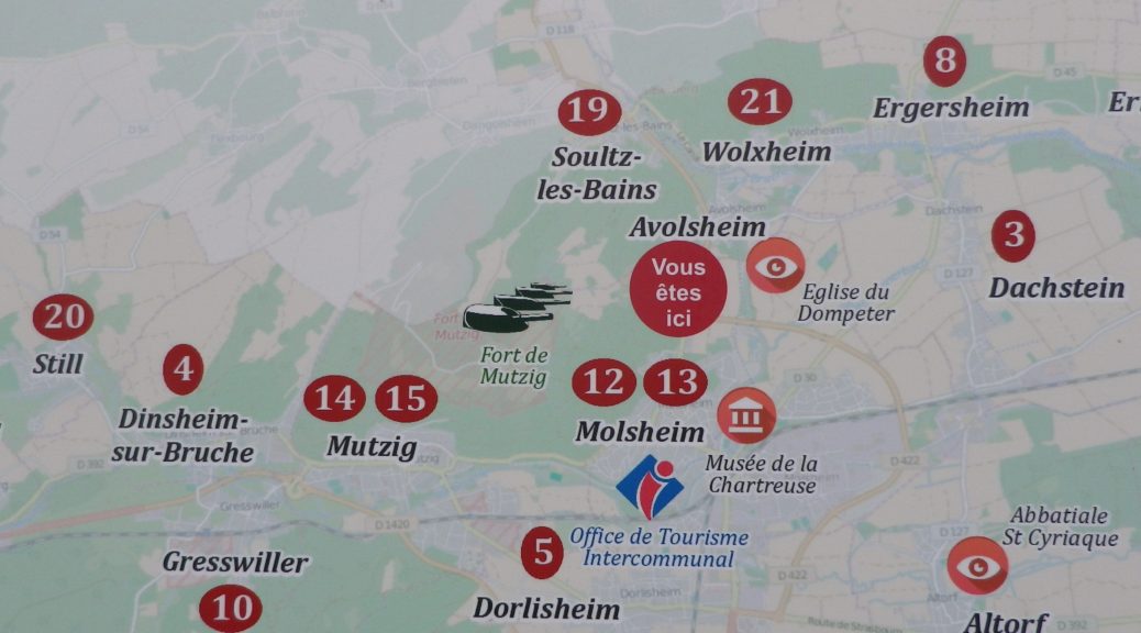
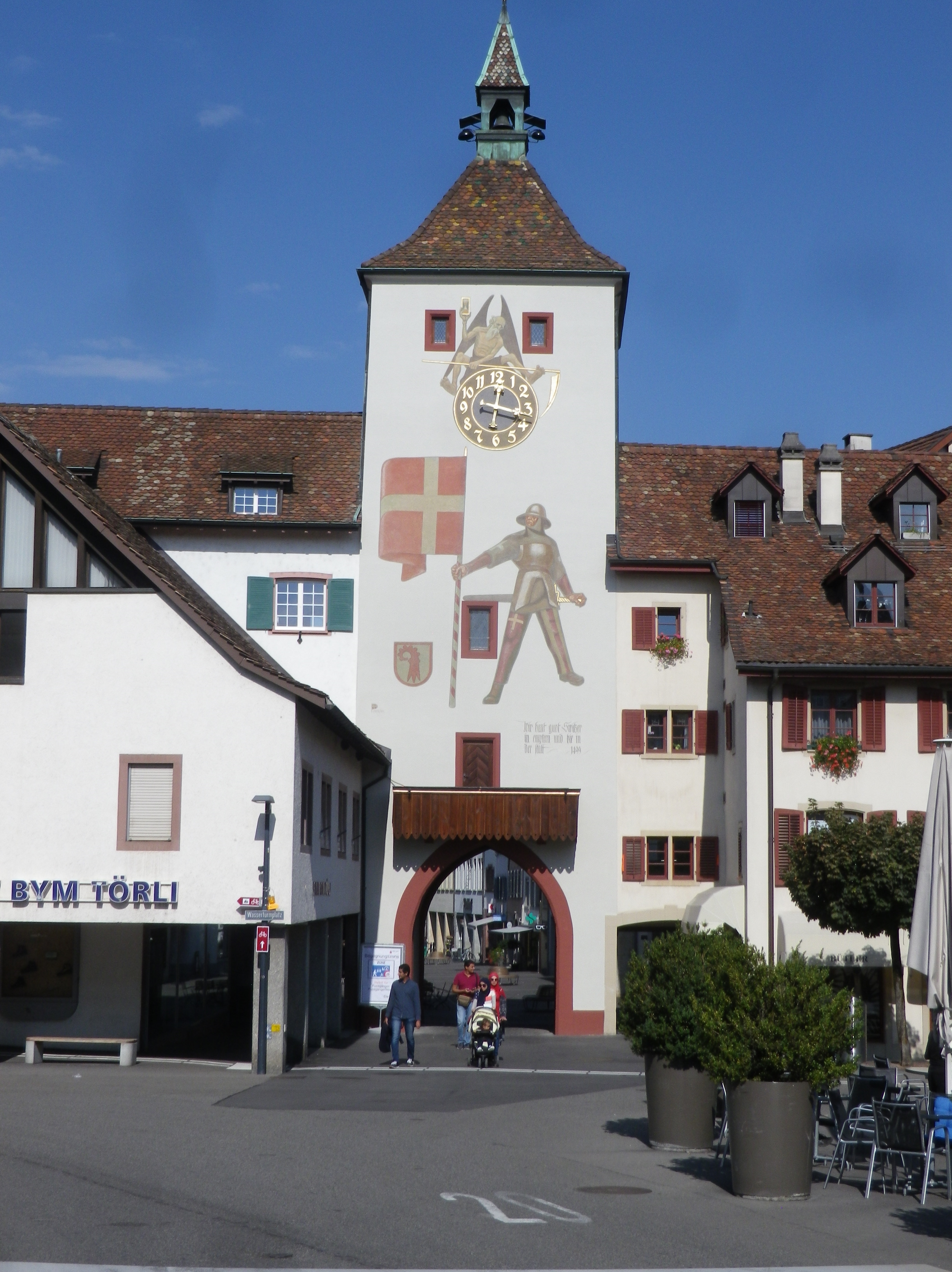
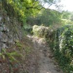
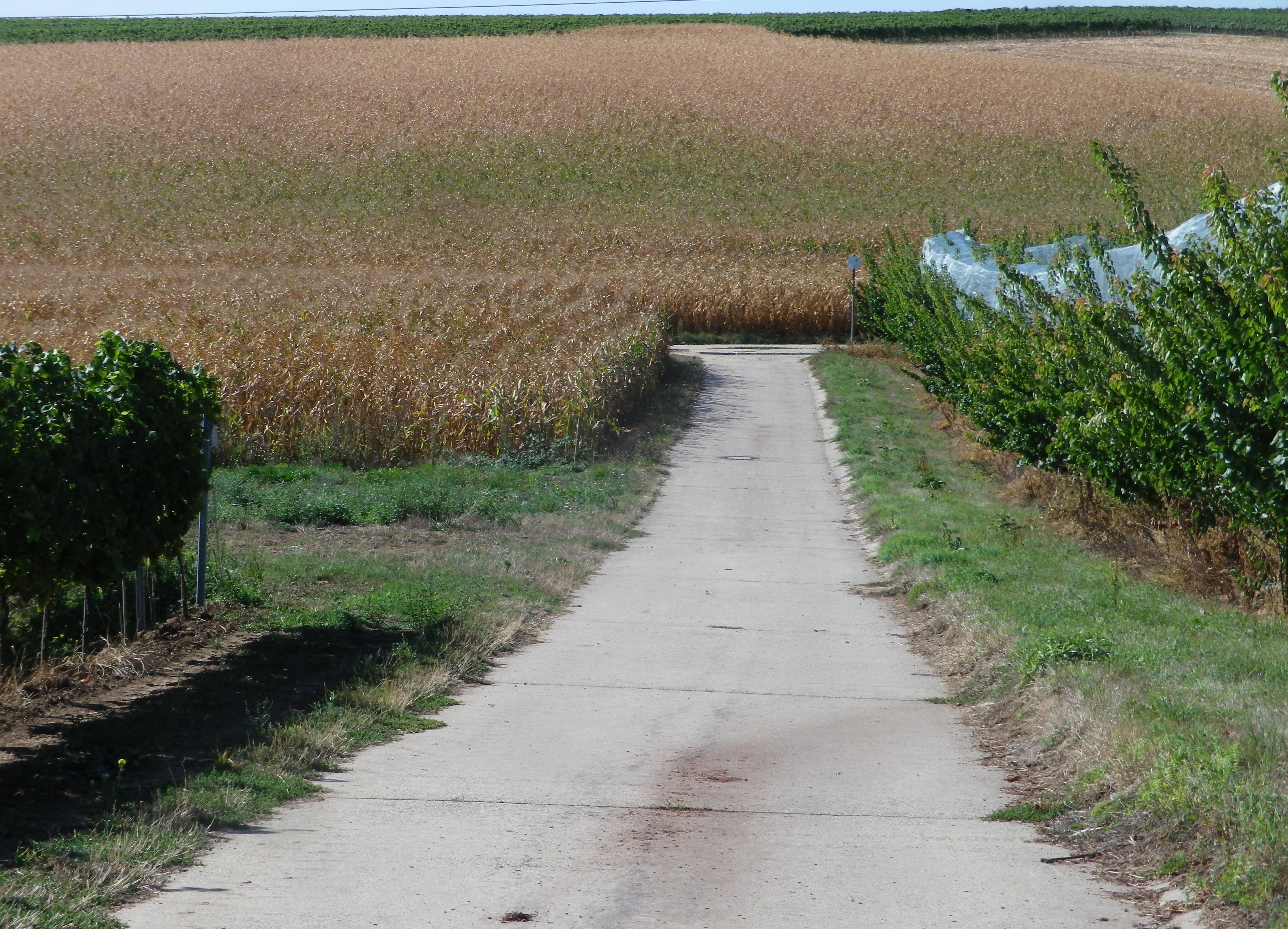
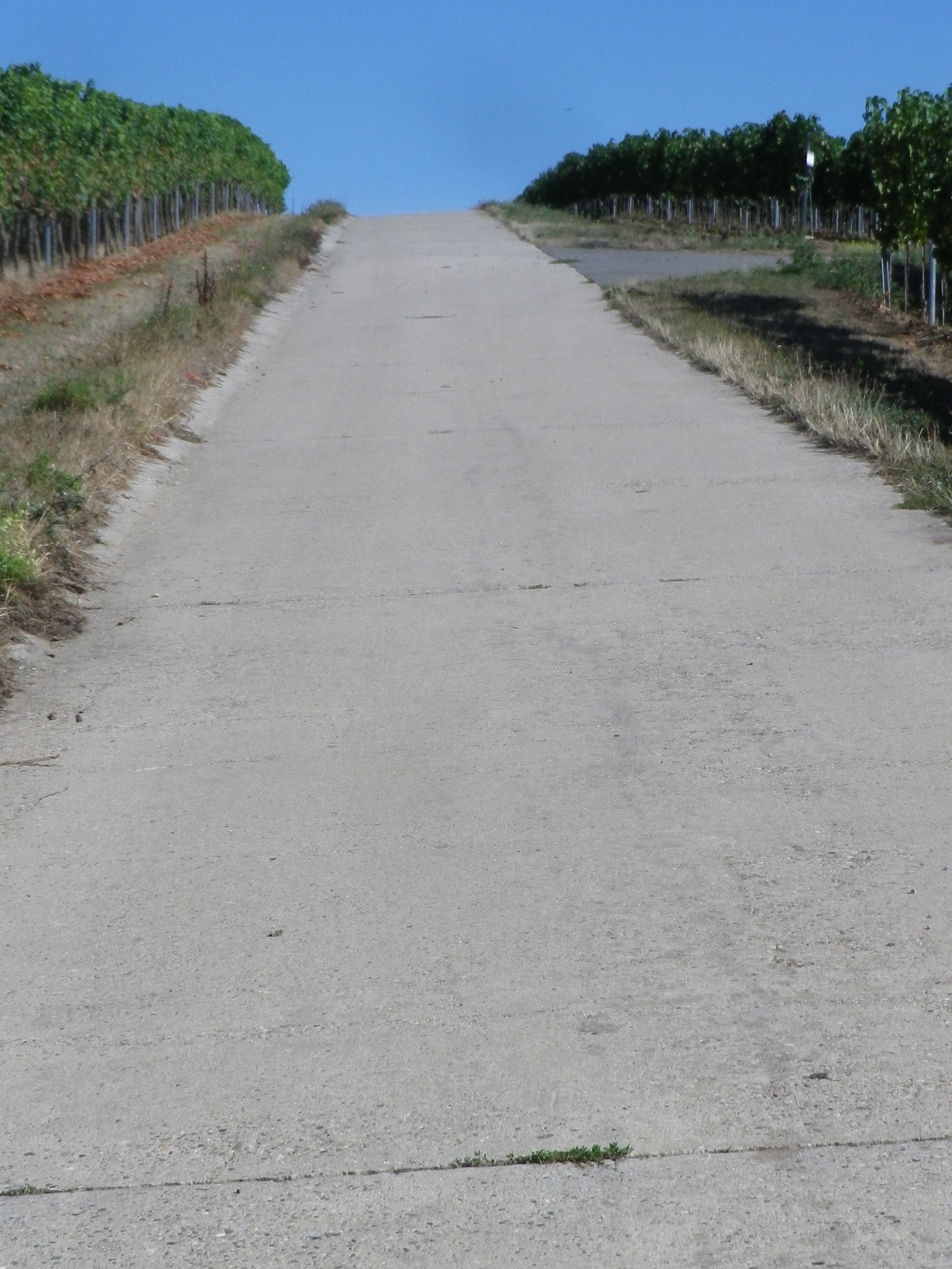
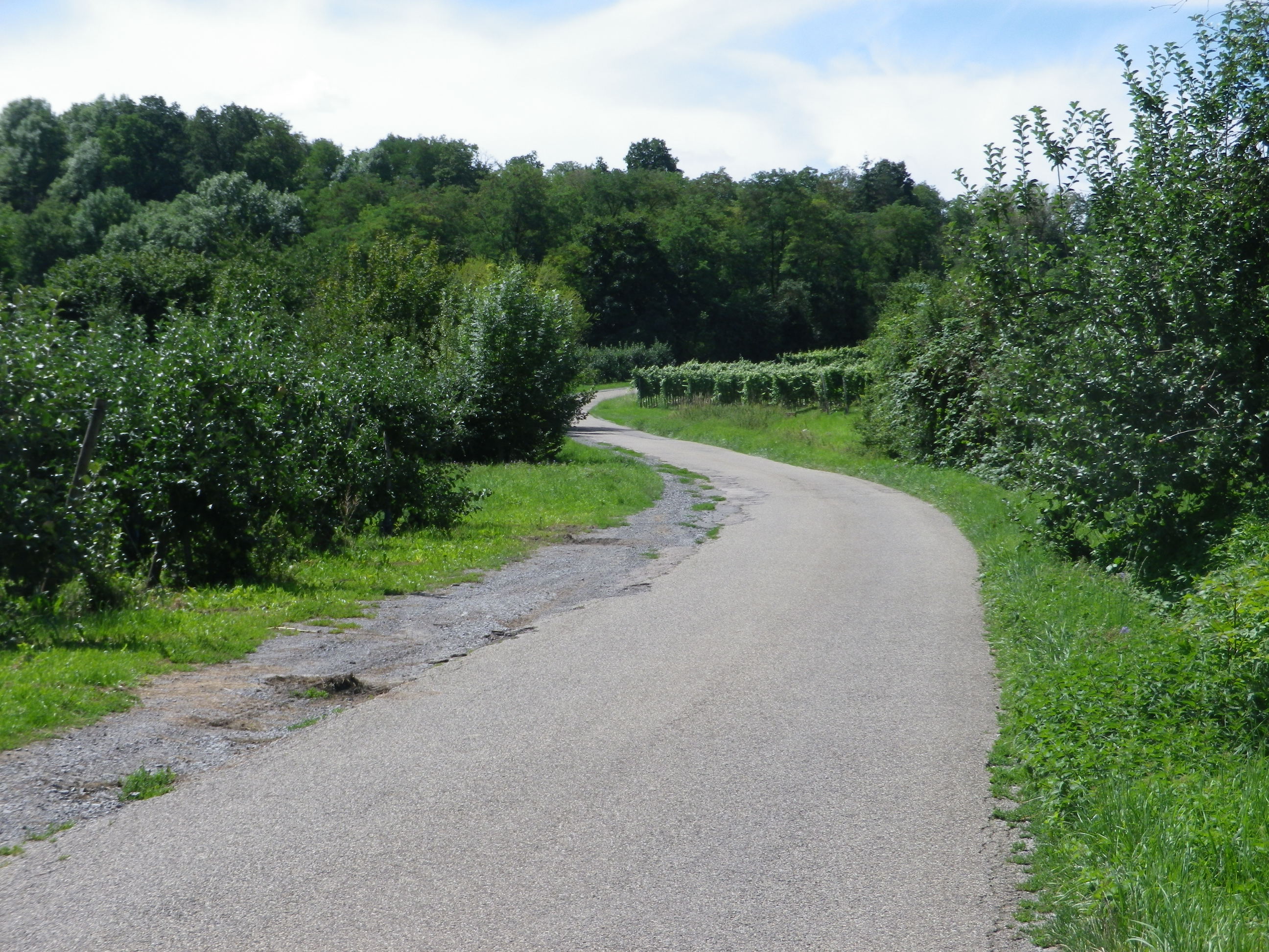
But this itinerary also included the hills and dales in the heart of the Bas Rhin vineyards. Departing Molsheim, and passing Dachstein, a medieval walled and effectively moated village, the ride proceeds mostly on a flat bike path, which is a delight, to the canal. The hills begin where the canal ends, at Soulz-les Bains.

Dachstein: Manmade Walls, Natural Moat


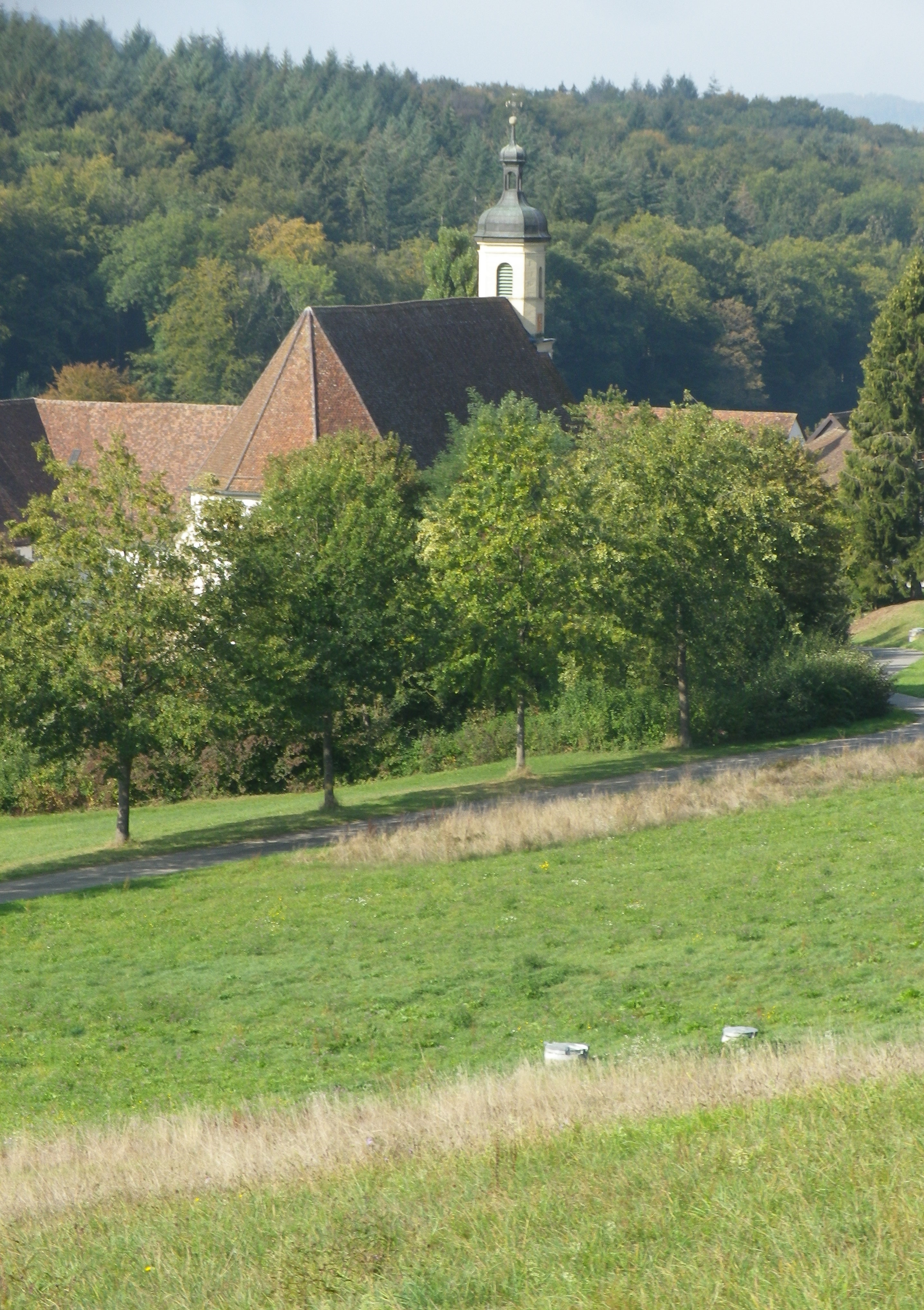
As the name implies, there is a spa in Soulz, a small village with a wonderful bakery, and Lucien Doriath’s excellent restaurant dedicated to foie gras. (Don’t worry, you can work it all off while on the numerous hiking and cycling trails passing through the village.) In addition to the Bruche and its canal, the Mossig also runs through this area. In fact, this whole itinerary sits in a watershed, and water is impossible to avoid.

Sunlit Vineyards by Soulz-les-Bains


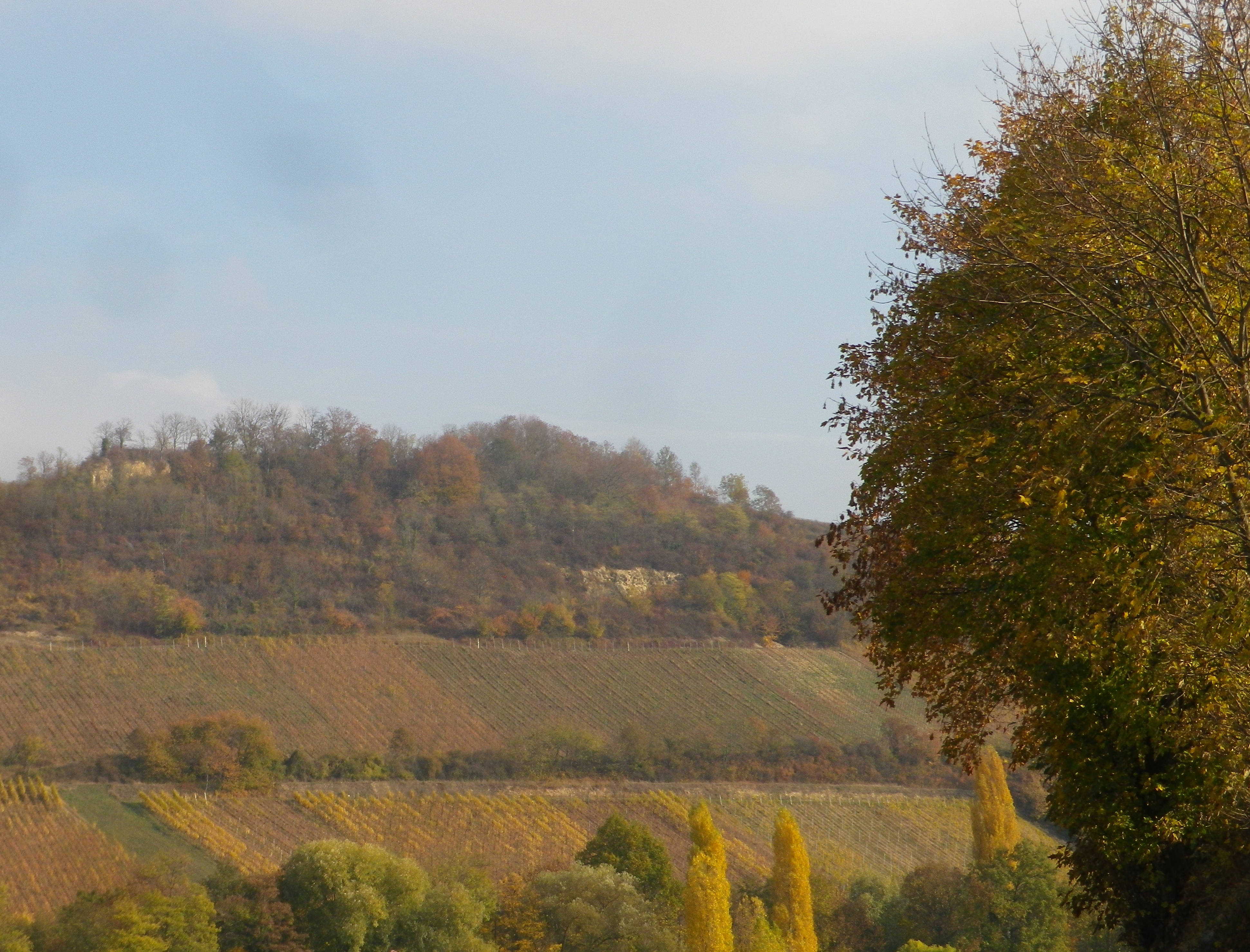
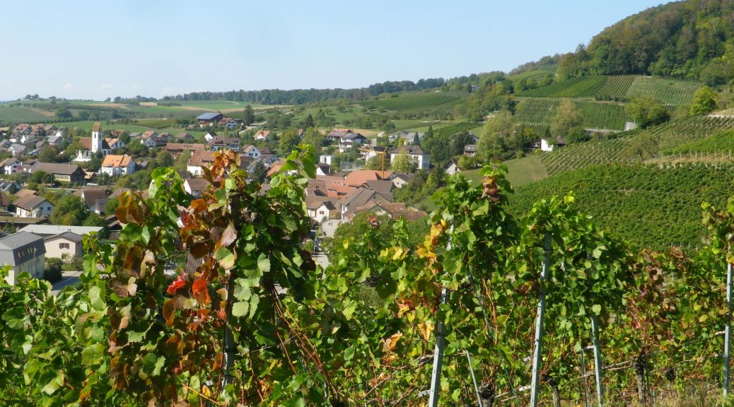
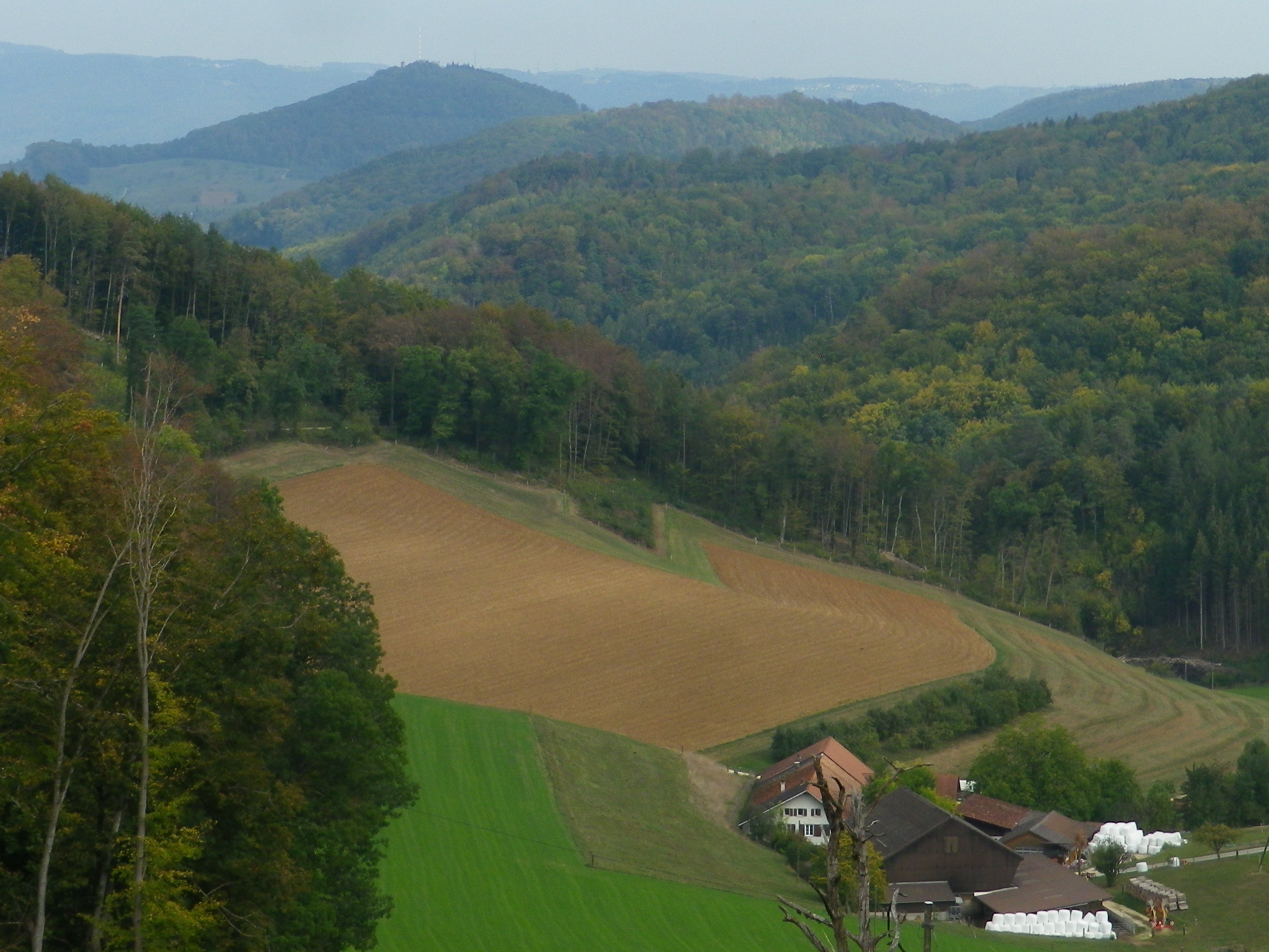
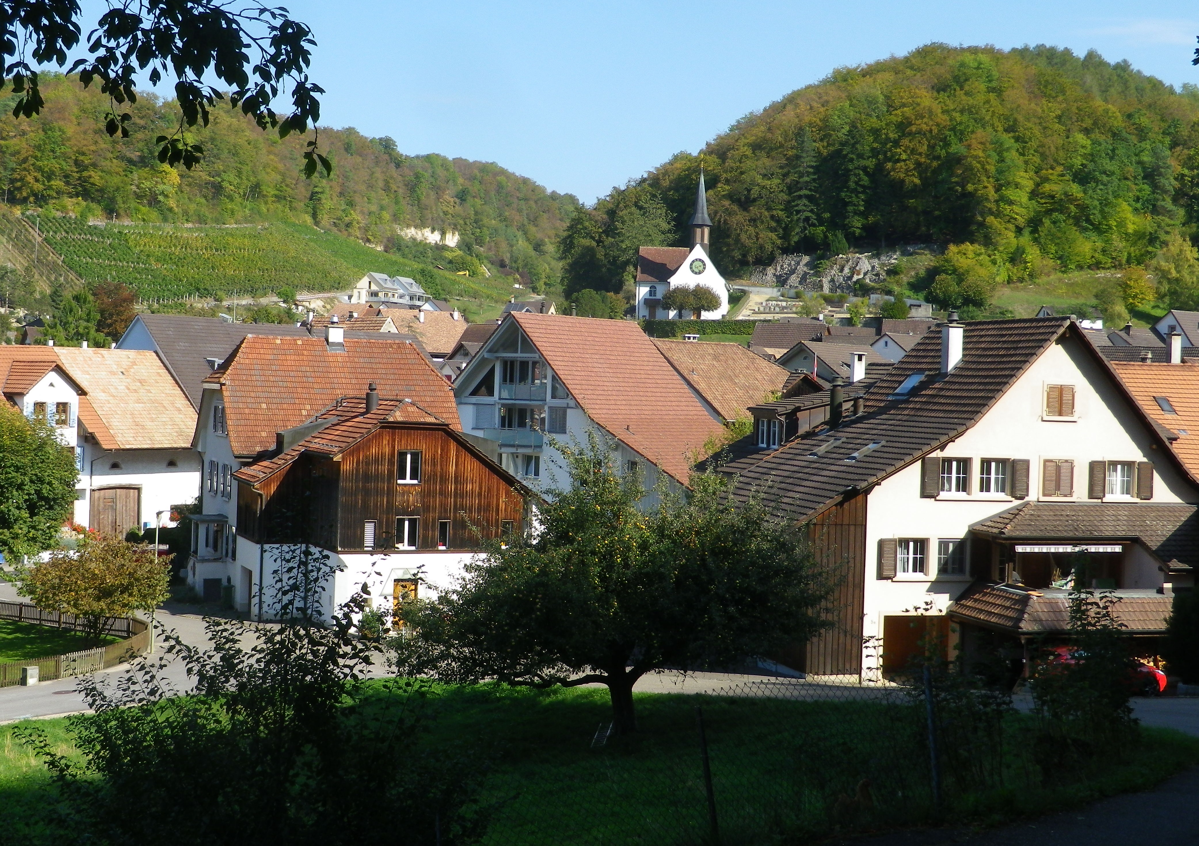
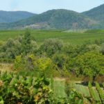
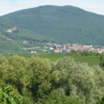
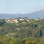
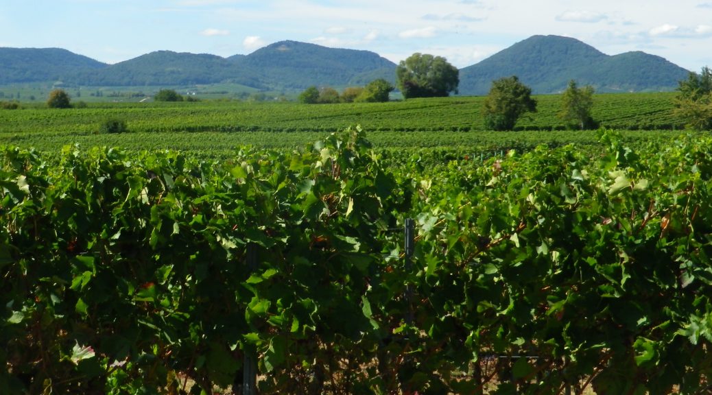
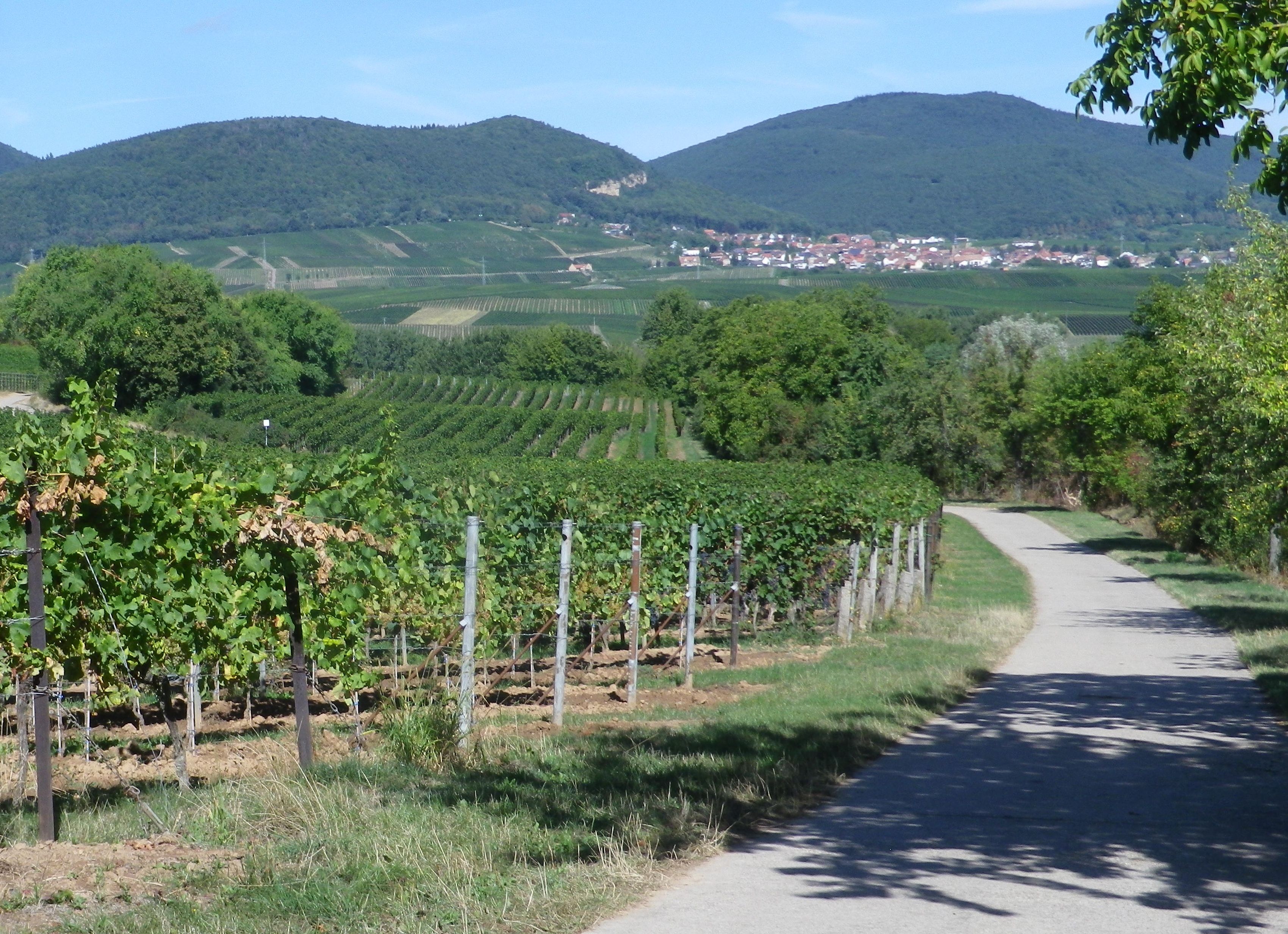
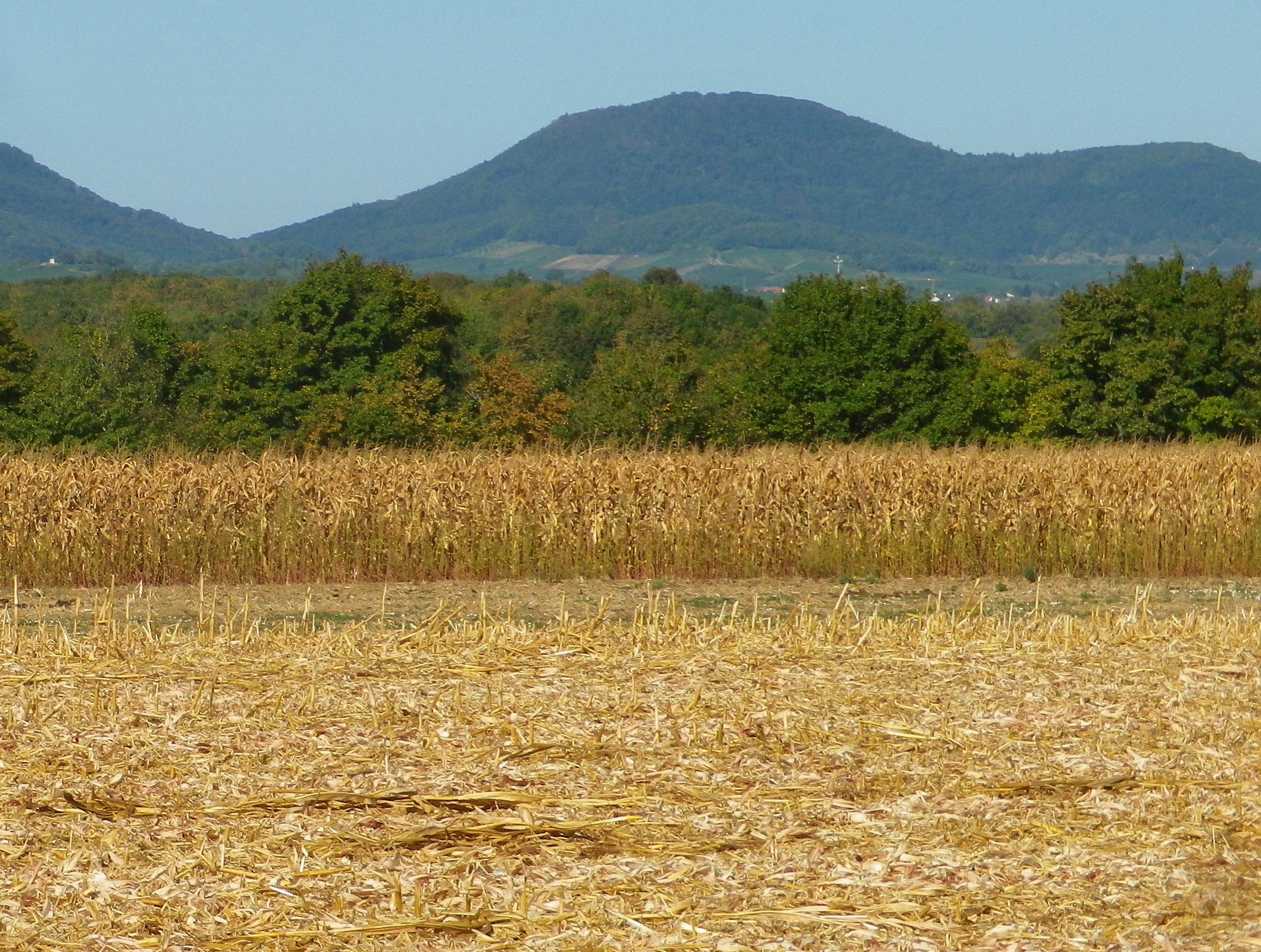
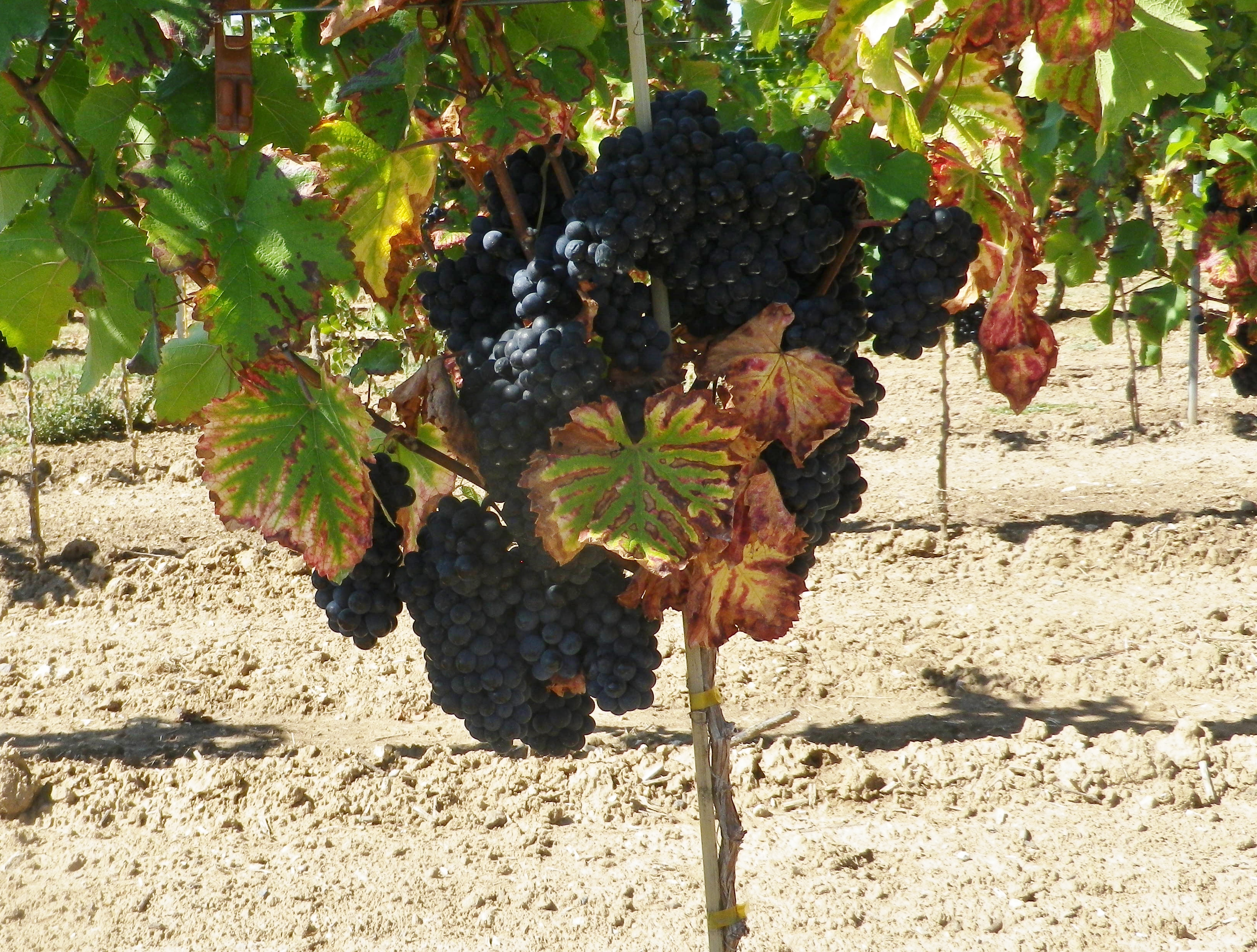
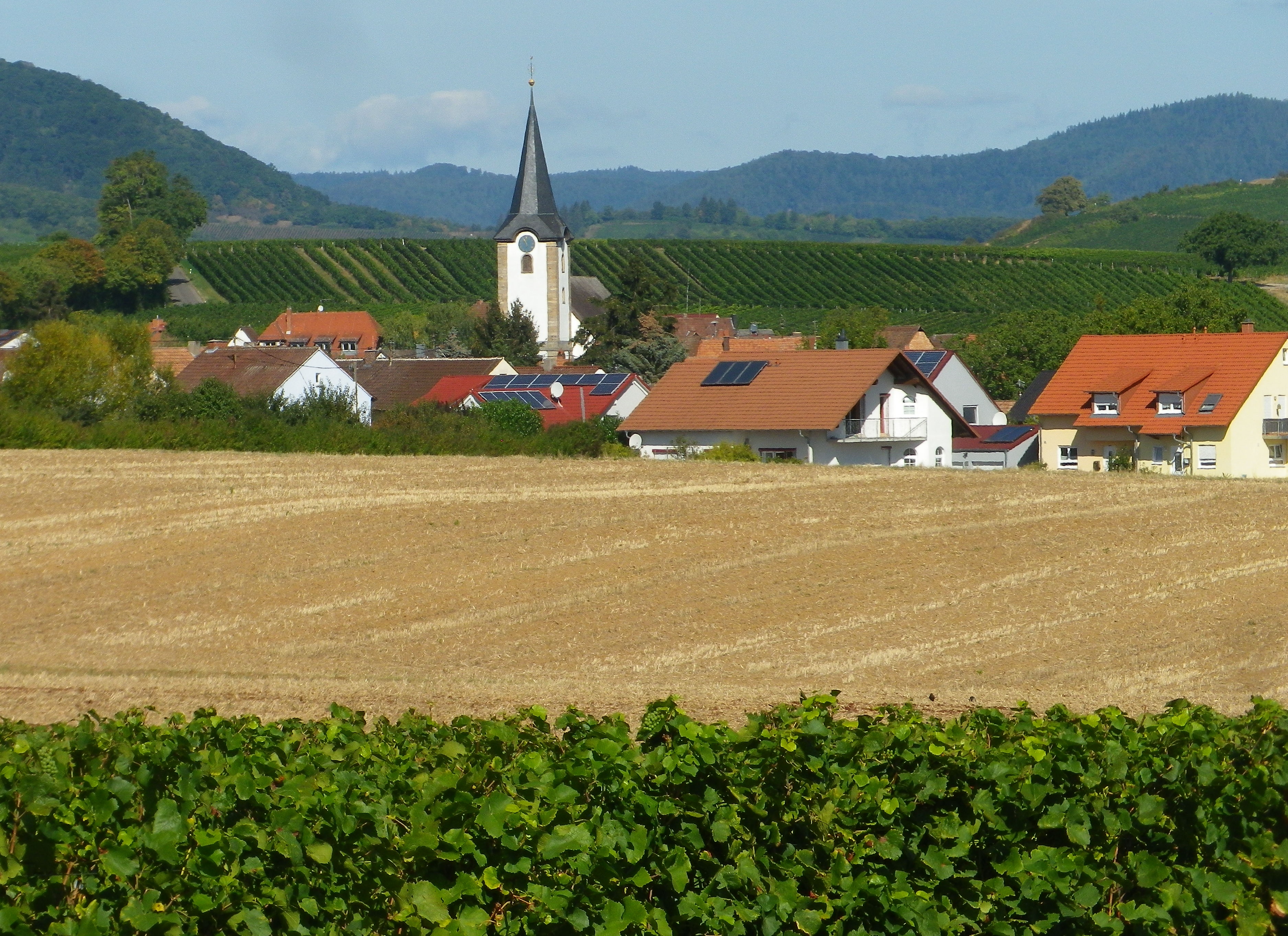
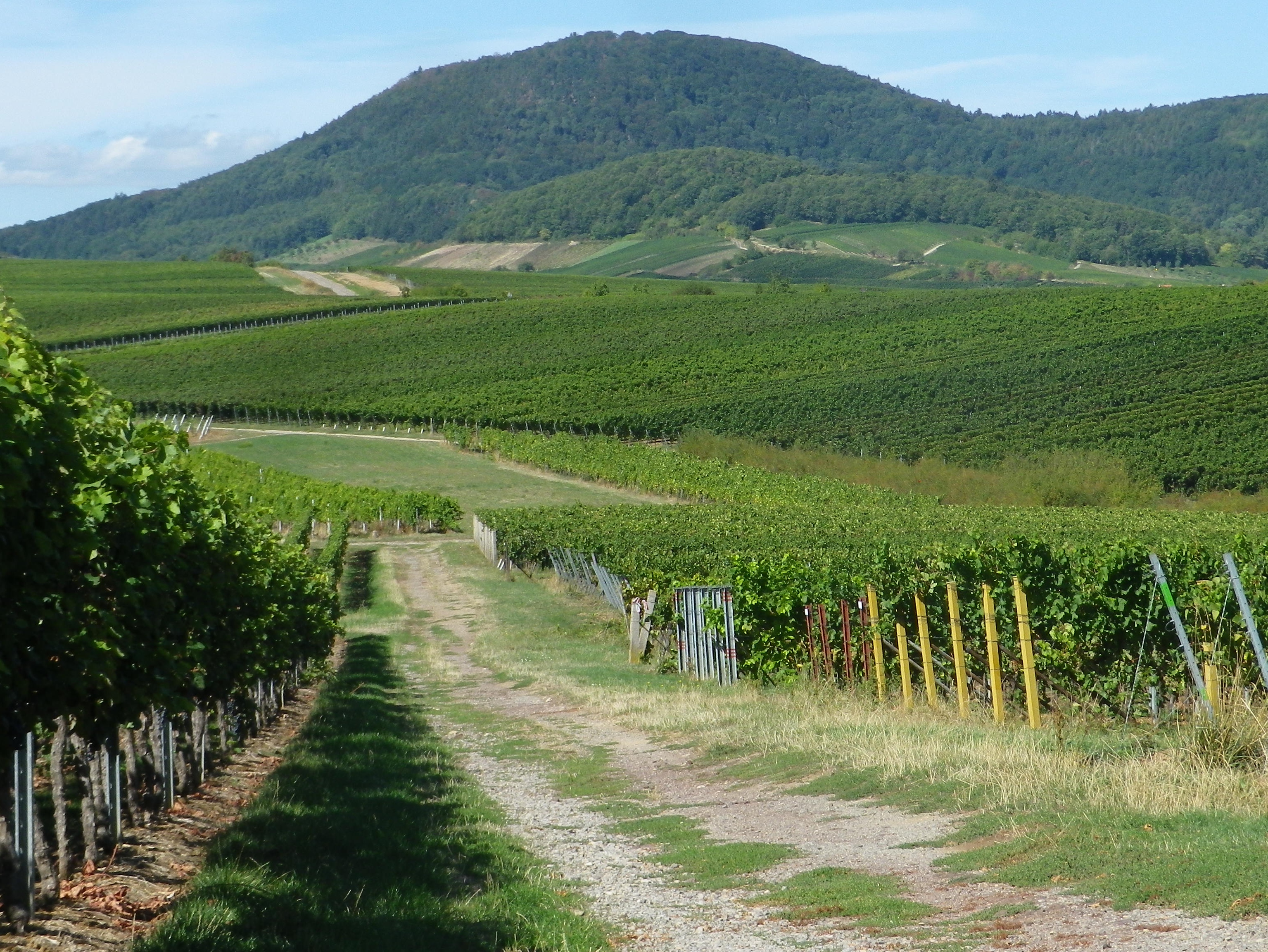
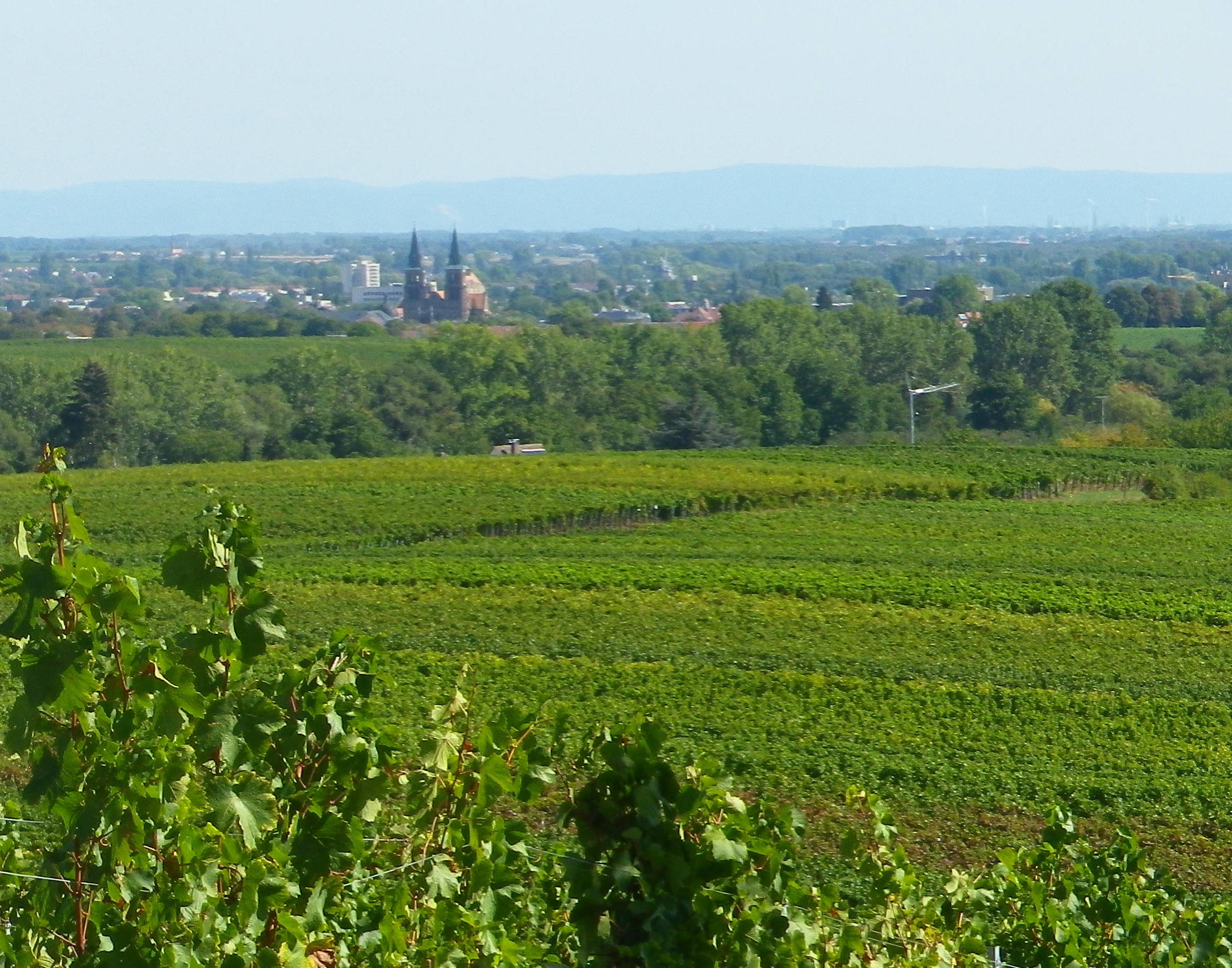
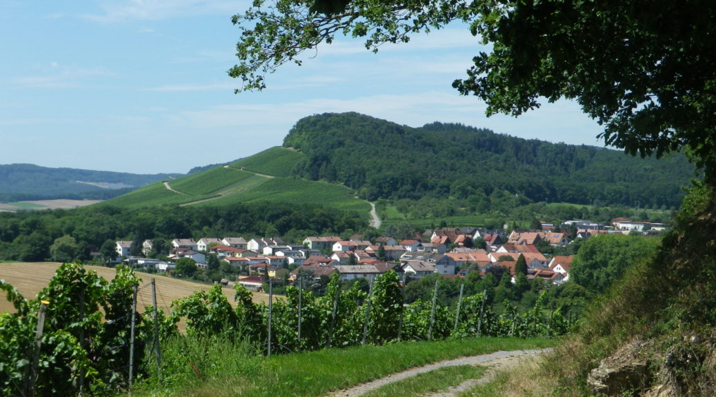
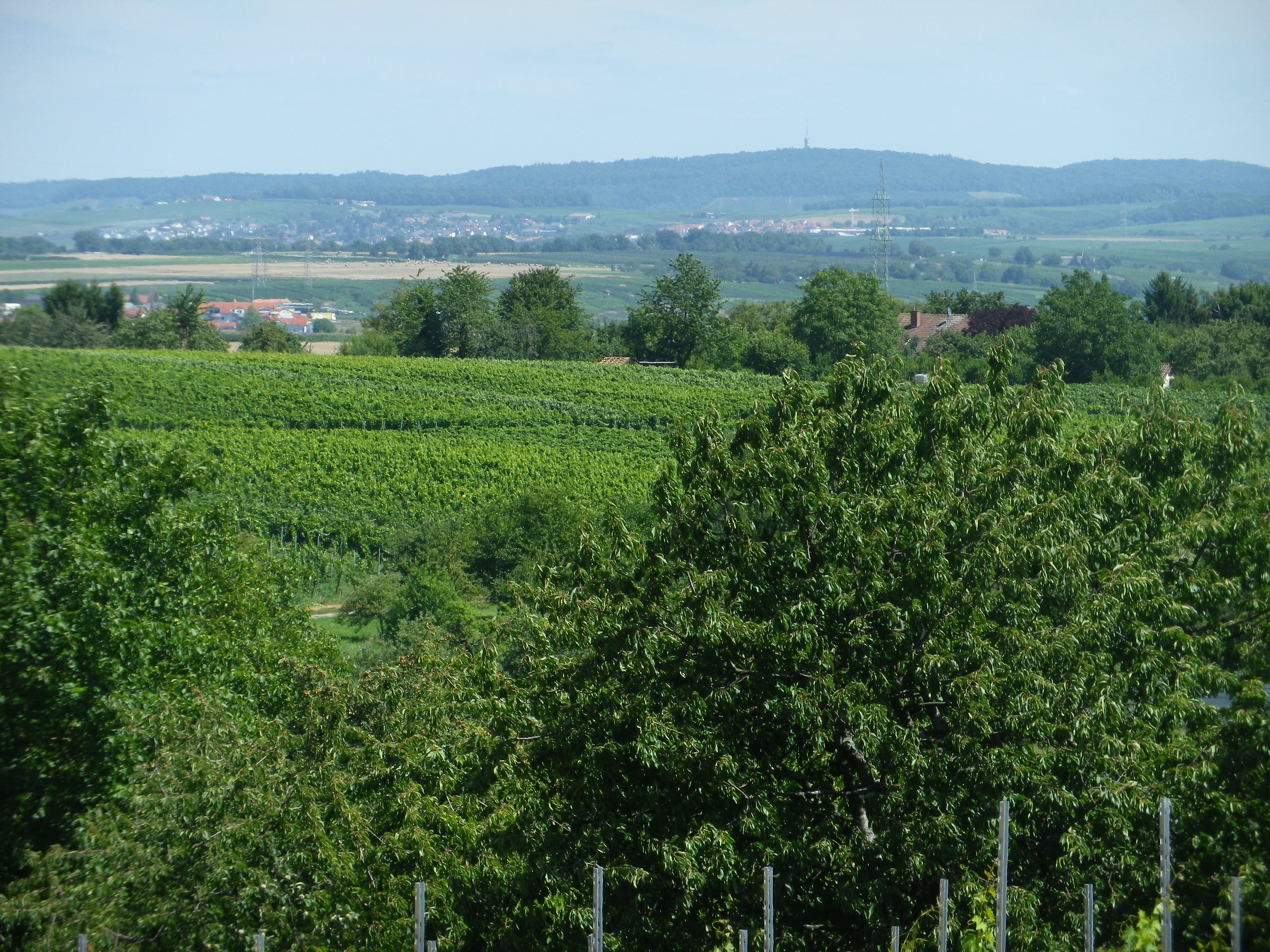
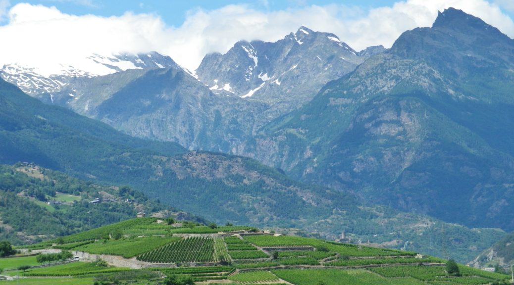
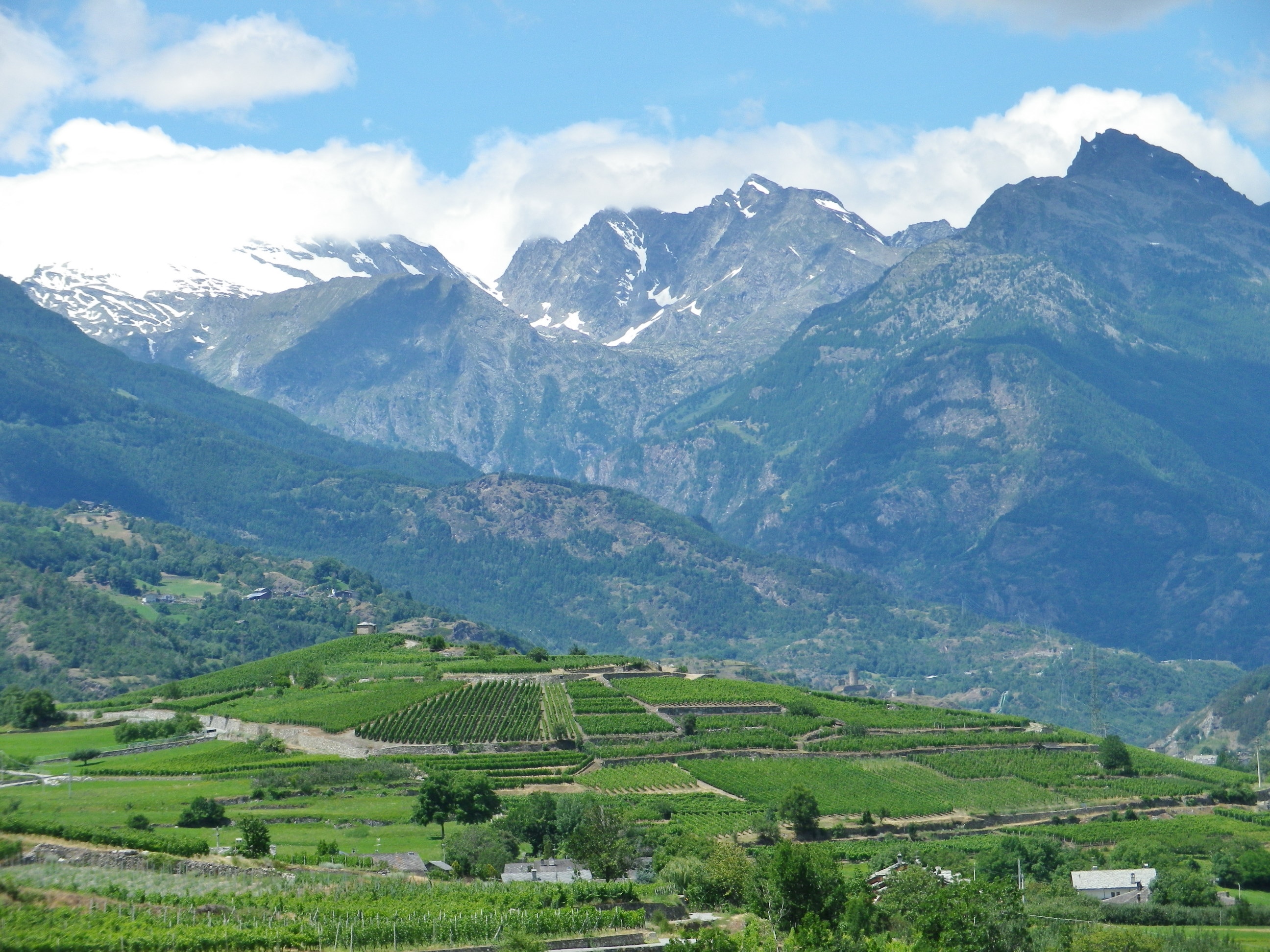
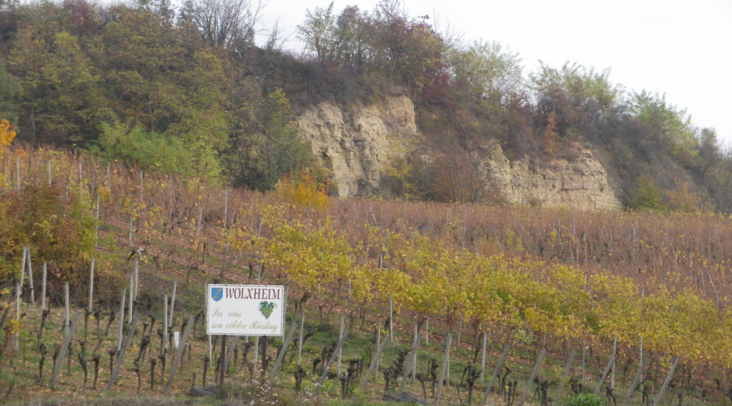
From Soulz, the itinerary climbs. As it does, vineyards replace fields, and the wine village of Bergbieten with its Grand Cru vineyard appears. Balbronn, another well-known wine village, is picturesquely surrounded by vineyards. Between there and Flexbourg, the higher elevations of the Vosges mountains come into view providing magnificent photo opportunities.

Beyond the Vines: Fields and Vosges


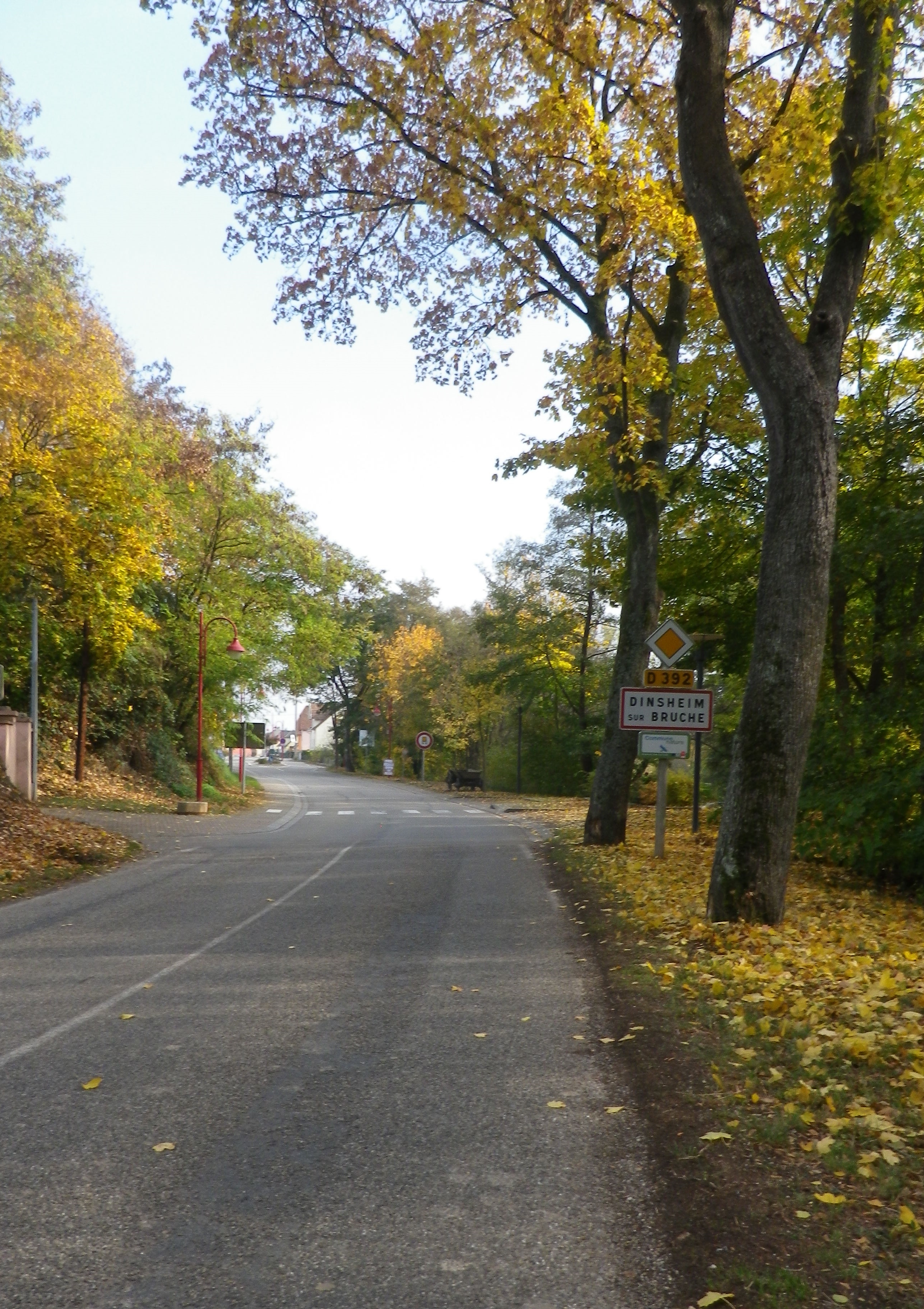
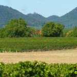
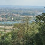
Once out of the hills, more rivers and streams appear. A marvelous confluence of several of these appear on the approach to Dinsheim sur Bruche. I cycled along the Stillbach, to where it joins the Bruche, then over the Muhlbach to cross the Bruche once again just before re-entering Molsheim. On the outskirts is the Bugatti factory. Bugatti was founded in Molsheim, and it still produces fantastic cars of distinction there. I must confess though, I saw few cars, much less Bugatti ones (the least expensive model starts at over two million dollars), while cycling, making this a relatively car free itinerary overall.

Molsheim: Bugatti Plant


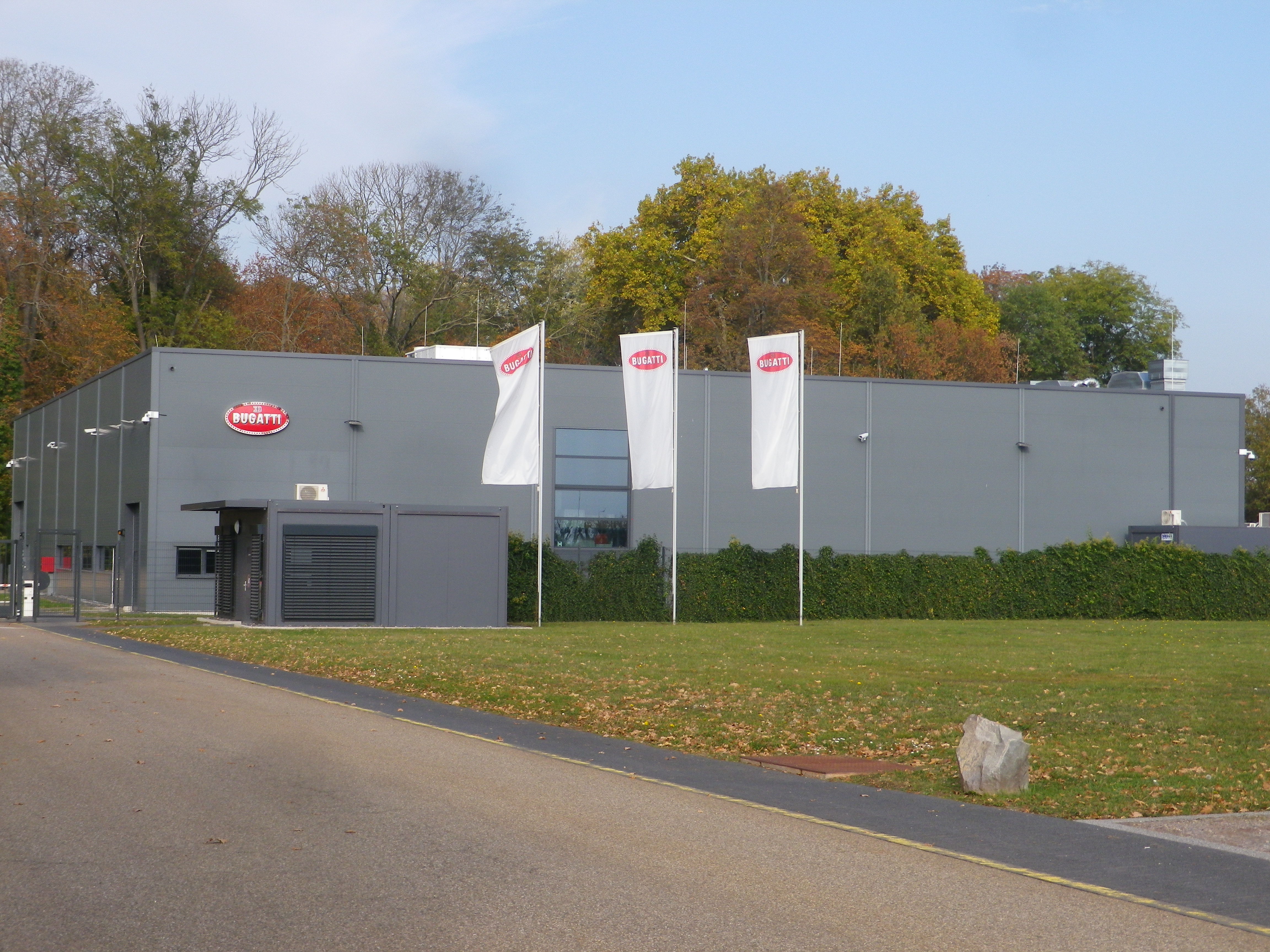
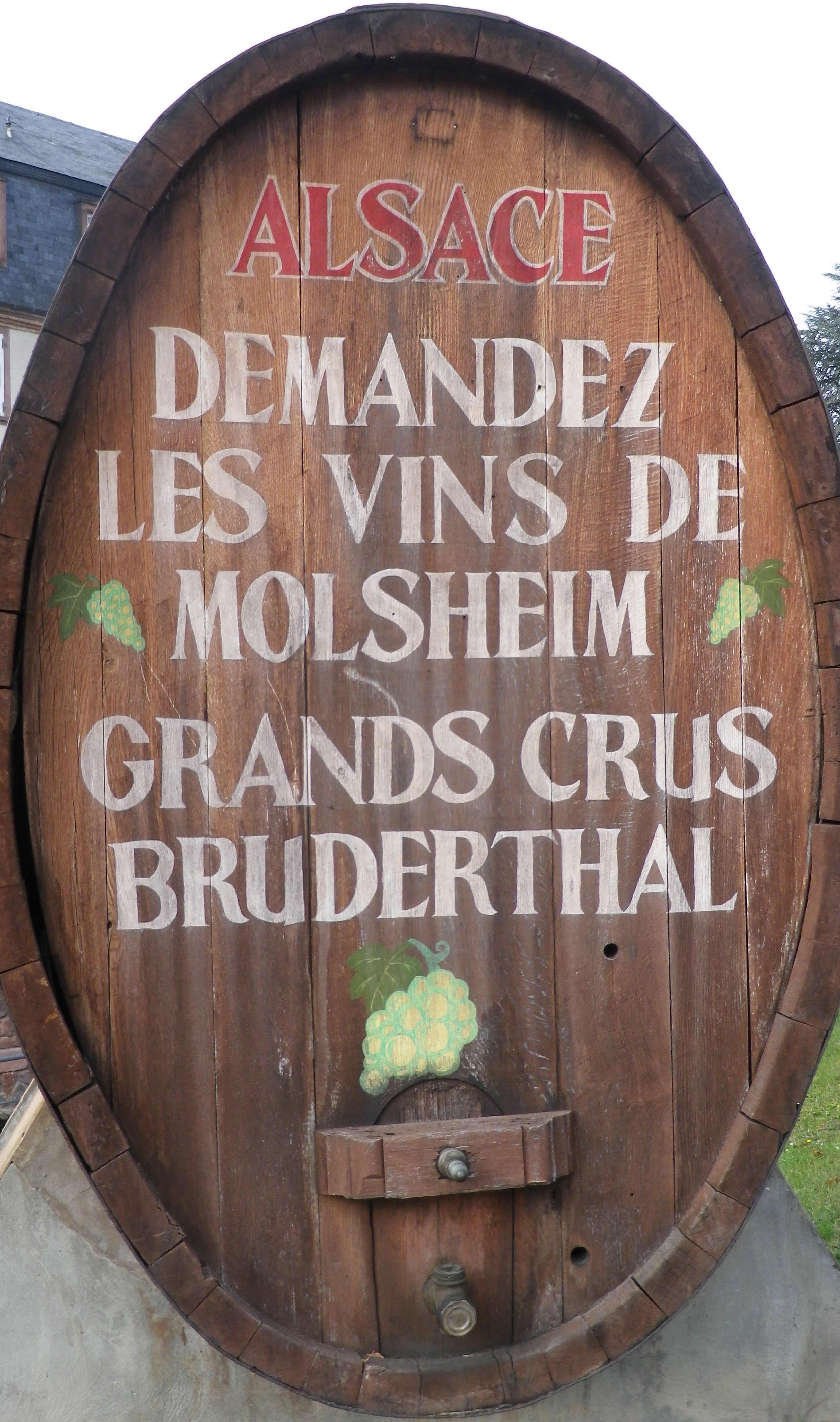
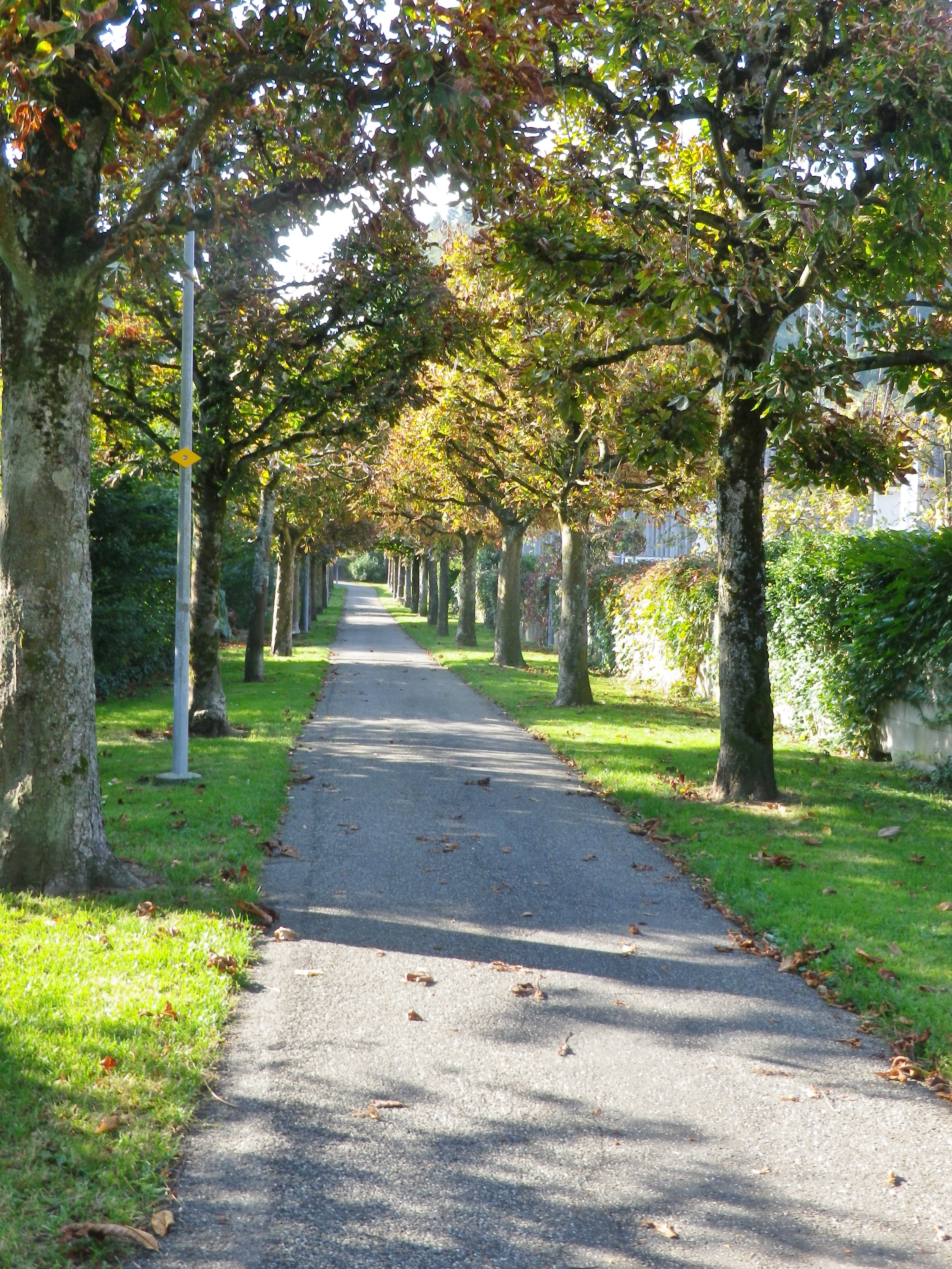
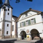
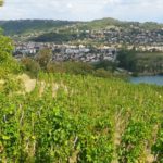
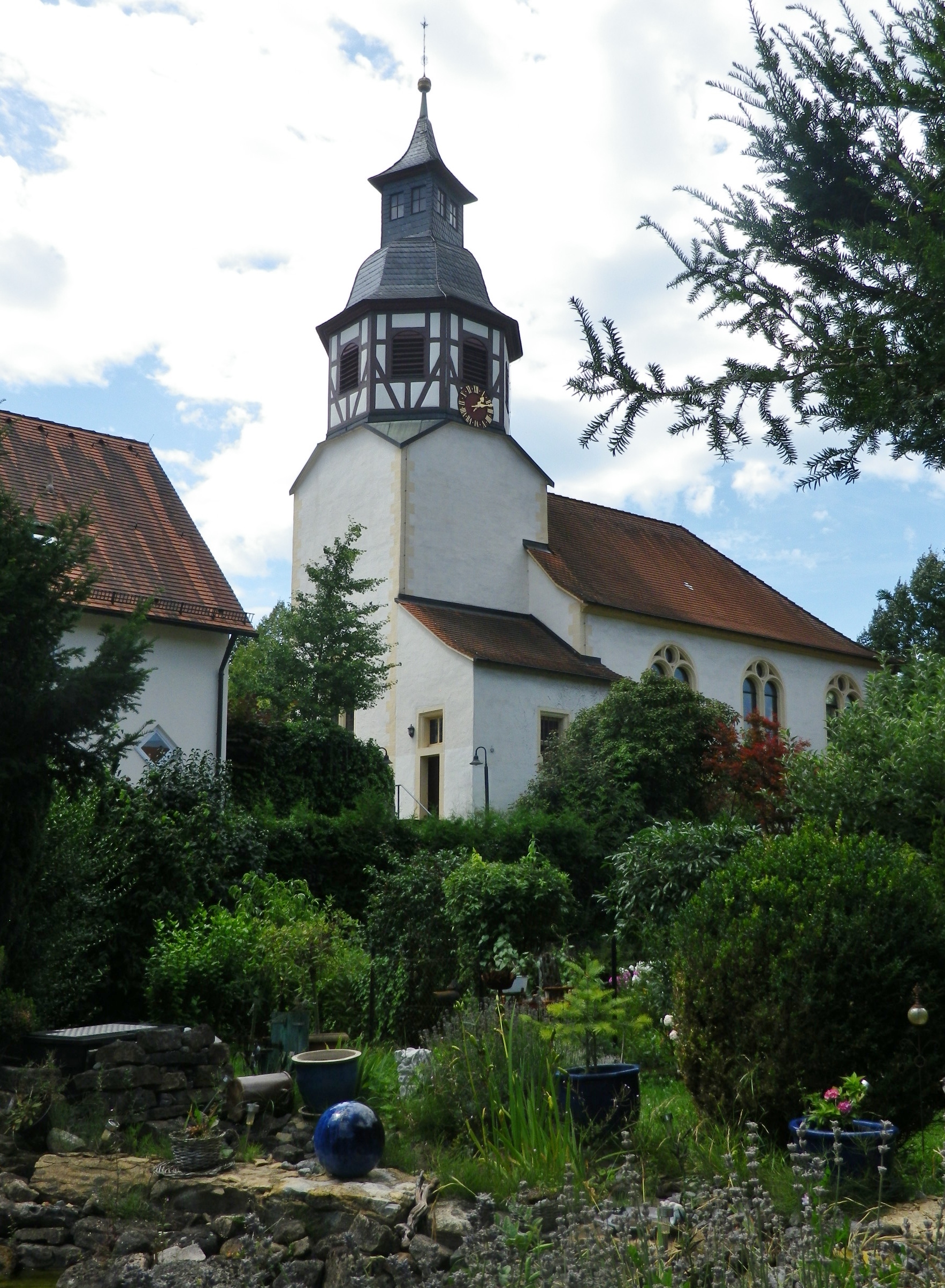
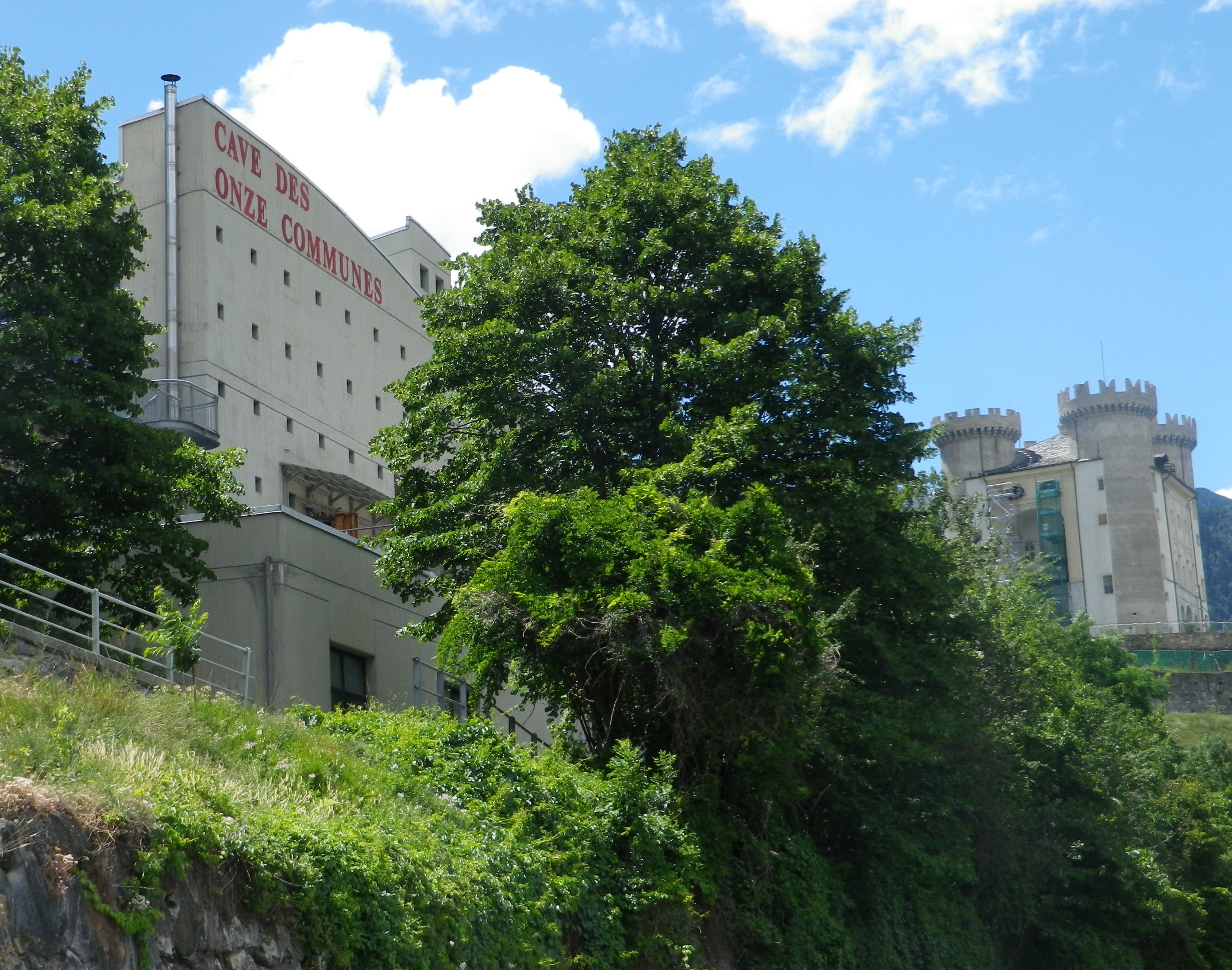
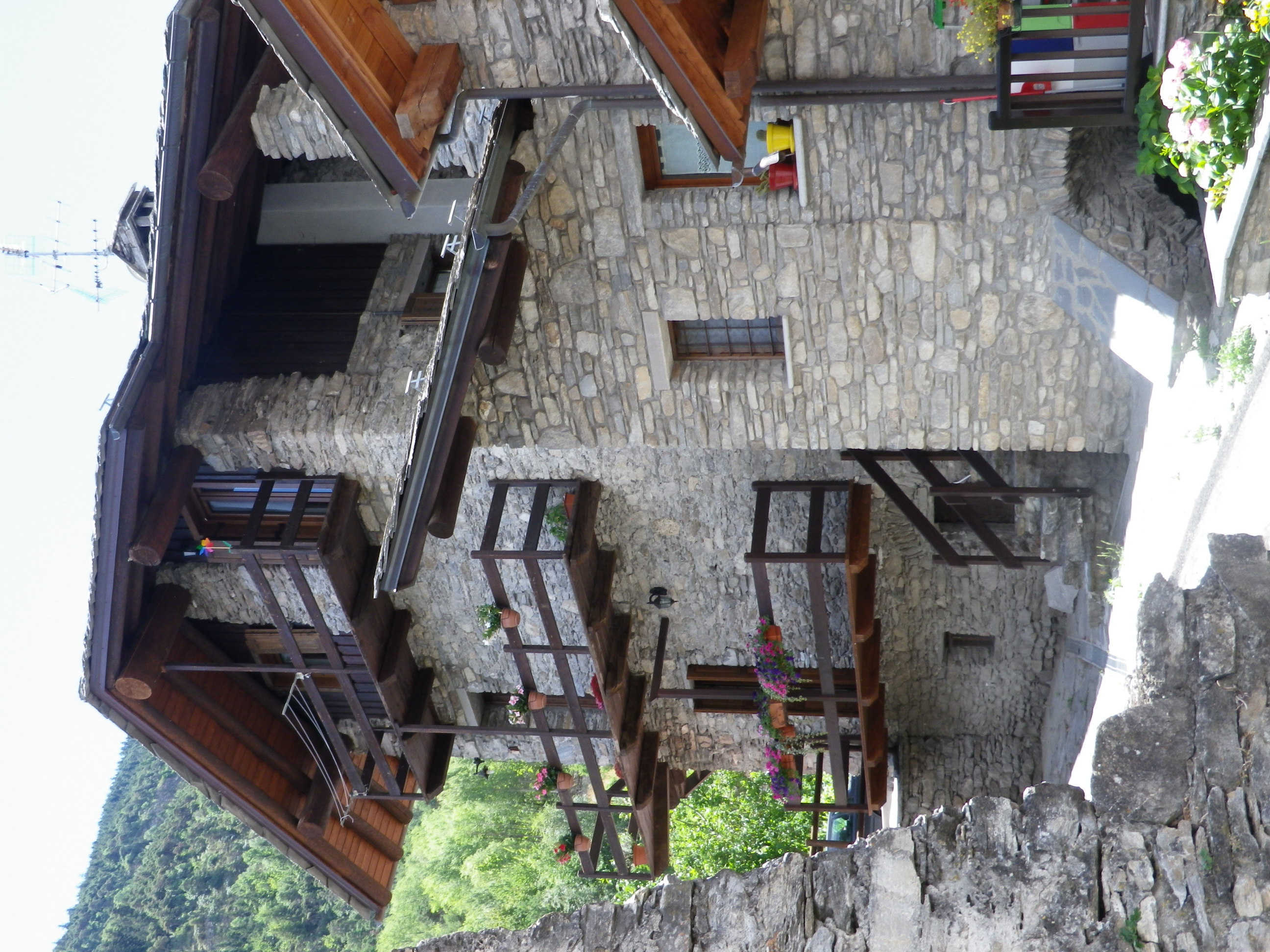
Molsheim is a small town, but the largest in this area. It is known to the wine world as the site of the Grand Cru Bruderthal, a “production” site as much esteemed locally as the Bugatti plant. The town itself boasts a couple of charming squares, fronted by historic and attractive half-timbered buildings. It is a nice place to base, if spending some time in the area. It has several restaurants serving good food and local wines, as well as a couple of wineries. Fortunately, all food and wine offerings, even the Cremant d’Alsace wines,  cost only miniscule fractions of the cost of a Bugatti, hence may be happily enjoyed by all!

Bulles et Bugatti: Trail in a Nutshell


Trail Name: Bulles et Bugatti; AKA BL 312

Trail Type: A mid-distance circuit bicycle itinerary; well-maintained surfaces, much of it paved, however no trail specific marking throughout the itinerary.

Length:

Total – 33 kilometers/ 20.5 miles

Convenient to: Molsheim, Strasbourg, Bas Rhin, Alsace, France

Marking: None specific to the itinerary. Some sections do have the typical green and white cyclist markings for a bicycle path to serve as a guide.

Trail Description: A well thought out itinerary through mostly rural landscapes with a variety of flat and hilly sections, vineyard, field and urban terrain, some on minimally trafficked road sectors, and some on fairly long stretches of vehicle-free bicycle path or dedicated bicycle lane.

Trailhead: Molsheim, Rue de Strasbourg, Porte des Forgerons

Parking:

Molsheim: R de la Commanderie x R Ernest Friedrich (closest to trailhead); Rue des Sports, by the open-air pool

Dorlisheim: Chemin des Moissons, Rue Mercure, north and south, in a mall area

Mutzig: Place de la Gare, Rue du Dr Schweitzer,

Balbronn: R du Fronhof (at the upper/higher end)

Public Transportation Options:

Rail: Frequent regional trains (TER) connect Strasbourg and Molsheim

Bus: Numbers 234 and 236 connect Molsheim with surrounding villages

See the comment below

Suggested Stages: Not applicable

Trail Itinerary-Reference Points: (Counterclockwise)

Molsheim: R. de Strasbourg x Avenue de la Gare, R. Charles Mistler, past Camping Municipal, over Bruche, along D93/D30; Dachstein: D30; Egerstein: Along Canal de la Bruche to Wolxheim; Wolxheim : R de Molsheim; Avolsheim: cycle path to Grotte d’Avolsheim, R. du Dompeter, R. de la Gare, Impasse de la Roseliere, cycle path; Soultz les Bains: R. de Molsheim/D422, D275: Dangolsheim: D275/Rte du Vin (past the Lavoir, or laundry basin); Bergbieten: D275/Rue des Vosges; Balbronn: D275/R. du Château, R. de la Foret, Rte de Flexbourg; Flexbourg: Rte de Flexbourg-R. des Acacias, R. de la Paix, R. des Seigneurs/D118; Still: D118/Rte de Flexbourg, Grande Rue; Dinsheim: D118, D392/ R. du General De Gaulle, past the Chapel of St Wendelin; Mutzig: Blvd Clemenceau; cross the Bruche, still on D392, past the Gare de Mutzig, Rte de Strasbourg; Faubourg des Vosges; Dorlisheim: Grand Rue, Avenue de la Gare/D392; Molsheim: D392; Altdorf: Chemin de la Blieth, R. des Romains, R. des Pres, R. Principale; Molsheim: R. Jean Mermoz, cycle path paralleling Rte Ecospace, D2422/R. de la Commanderie, past the Gare de Molsheim

Representative Trail Photos:

Dedicated Bike Path Along a Road


Representative Segment: Road Riding


Sample: Section of Unpaved Surface


Restrooms:

Molsheim: Passage de la Post x Avenue de la Gare, about 50 meters west of the chapel in the parking lot by the old town gate “Tour des Forgerons”

Attractions on or near Trail:

Molsheim: Musee de la Chartreuse, focuses on millennia of history and traditions of the Bruche Valley, while another section covers the history of Bugatti (the other half of the name of this route), its cars and its connection to Molsheim.

Tasting along the Trail:

Wolxheim, Avolsheim, Soulz-les-Bains, Balbronn and Bergbieten are well-known wine villages with several wineries in each. Additionally, Molsheim is the largest town in the area, with several taverns and restaurants serving local wines.

Alternative Options:

Hiking: The circuit hike called Trotele, one of the Circuits of Bacchus, is a 13.6 kilometers hike through several of the same villages. See the Nutshell here.

Biking: The long distance Veloroute du Vignoble d’Alsace begins about 15 miles north in Marlenheim, and passes through Soulz-les-Bains, Molsheim and Dorlisheim, then proceeds south through other villages and towns in the Bas Rhin department. See the Nutshell here.

Additional Information:

Regional: http://www.ot-molsheim-mutzig.com/

Trail specific: https://www.alsaceavelo.fr/itineraires/boucles-locales/bl312-bulles-et-bugatti-118.html

Comments:

Although the bus and train network is good here, the 20.75 kilometer cycling path Veloroute du Canal de la Bruche (https://www.alsaceavelo.fr/itineraires/veloroutes-des-canaux-et-vignoble/veloroute-du-canal-de-la-bruche-23.html) is a fantastic and easy way for visitors in nearby downtown Strasbourg to reach this particular itinerary and this little visited vineyard area.


Mountains… with Vines


Anspruchsvoll – demanding, as in challenging, the one word I did not know in the German language online description of this trail. Everything else in the description was comprehensible, and seemed ideal – rural, mostly on trails, two Swiss cantons/wine districts- so what difference could the final word make?

The Basel-Land vineyard area is found high above the Rhine River. To get there from Rheinfelden required a two-mile-long uphill climb. But while I felt like celebrating by the time I looked down on Olsberg and its famous former convent, looking toward the horizon, I realized that this would be a climbing itinerary.

Above the Olsberg Cloister


By the third hill, I wondered about that one word. Being lazy (I had read it online, too lazy even to google translate!), I would not have ordinarily attempted this itinerary, as there were indeed mountains (albeit not the Alps) to cycle up – starting with the first one, the slog from the Rhine River, past the train station and along the lovely allee up to the official start point, and then some.

Top of the Allee


But being very determined, I also wouldn’t stop. So, continuing to follow the itinerary over hill and dale, I cycled past miles of pristine working farms, orchards and fields, all the way to Liestal, the only real town on the route. It lays in a narrow valley along the river Ergolz, a tributary to the Rhine. Its old town center still has a part of medieval wall with a tower. It would have been a good place to walk a bit to enjoy the sights at a snail’s pace, and to relax my thigh muscles.


Liestal: Old Gate Tower


Instead, I found myself walking when halfway up the Brunneberg, as I risked rolling backwards downhill pedaling so slowly. While it was only about three-quarters of a mile to the Edleten Hut, this part of the itinerary was rather steep. The hut itself was typical of the hiking huts found in the German-speaking hiking world, with a nice overhang to protect against rain, a picnic table, and in a cool clearing in the middle of the woods. Almost at the very top, it was a great place to stop for a water break.

Waldhuette Edleten


From this point on, the hills were easier. To reach Wintersingen, then Buus and the first vines I would encounter, I had to pass through Hersberg and Nusshof (uphill, again). Nuss means nut, the name giving an indication of what its claim to fame had been. Passing the village hall, the village flag on display showed three nuts, which turned out to be red hazelnuts. Maybe a lack of oxygen at this point caused me to hallucinate about the Piedmont, in Italy, where hazelnuts likewise grow in close proximity to vines, on similarly steep hillsides.

From Hersberg


There is a climb out of Wintersingen, but rewardingly, it led to Buus, a village set quite attractively against tree-topped hills and vines in the sun.  For the next few miles, vines predominated in this overwhelmingly agricultural landscape. And Maisprach seemed to be the center of viticulture for this part of the Basel-Landschaft wine district. The lush vineyards looked down from their lofty positions above the village.  The little village was compact, and proverbially tidy. It even had a couple of eateries featuring local wines.

Buus, Switzerland


On leaving Maisprach, the itinerary leaves the Basel-Land canton. I was back in the Aargau, about to close the circuit, first going through Magden, then along a great shaded trail at the edge of the woods to the start point. But the best part for this lazy cyclist was the downhill gradient all the way to the Rhine, and my hotel!

Reben Tour: Trail in a Nutshell


Trail Name:  Reben Tour

Trail Type: Mid-distance circuit bicycling itinerary; well-maintained with hard (paved or packed earth) surfaces; no marking for this itinerary.

Length:

Total – 40.7 kilometers/25 miles

Convenient to: Basel or  Rheinfelden, Switzerland

Marking: None specific to the itinerary

Trail Description: While starting in a small city, this trail leads uphill to the hinterlands above the Rhine, through a variety of agricultural landscapes (orchards, fields, vineyards), as well as through forests and riverlands. No doubt the hills will be challenging to many, given the numbers of them, (even though the gradients never got above the 8-10 percent range), due to the length of some of them.

Trailhead:

Official: Rheinfelden: Olsbergerstr/Rueschelenhaldenweg x Bergweg

Mine: Train station to Alleeweg to the official start

Parking:

Rheinfelden center: None free, but parking garages and lots, one of each on Schutzenweg, closest to the trail;

Rheinfelden outskirts (Riburgerstr): Park and Pool (at the traffic circle) (24-hour restriction), Sportanlagen Schiffacker

Arisdorf: Parking Kaenelmatt on Kaenelmattstr

Public Transportation Options:

Information for both rail (Basel to Rheinfelden or Liestal), and bus services from these towns to the villages listed below, may be found at the Tarifverbund Nordwestschweiz (TNW) website at tnw.ch/fahrplan-liniennetz/online-fahrplan (as of October 2020)

Suggested Stages: Not applicable

Trail Itinerary-Reference Points: (Counterclockwise)

Rheinfelden: Forest trail, Rheinfelderweg, Rheinfelderstr; Olsberg: downhill through fields and vineyards, Hofgutweid, through Chloster grounds (formerly Olsberg Cloister), Hagachermatt, Hauptstr; Arisdorf: Arisdorferstr, Olsbergerstr, Hauptstr, Winkel, Kaenelmattstr, underpass beneath highway, fields, Arisdorferstr; Fuellinsdorf: Obererhofackerstr, down a flight of stairs at Obererhofackerstr x Huempelweg, Liestalerstr; Uetental: Uetentalweg, Suttenbergweg, Oberer Burghaldenweg, Erzenbergstr; Liestal: Gaststr, Rheinstr, path to Kasernenstr, Militaerstr, Kasinostr, over highway, Heidenlochstr; Lausen: Gartenstr, Weiherhofstr, Ringstr, Apfelhurststr-Edletenweg, up the mountain to Waldhuette Edleten, through woods for a while; Hersberg: Hersbergerstr, Hauptstr; Nusshof: Hauptstr, left onto Sissacherstr, Breitenhof path to Wintersingen; Wintersingen: Im Graben, Hauptstr, Buelweg, Dorfmattstr, fields, Rickenbacherstr briefly, then fields along the ridge overlooking town; Buus: Wiebentalweg, Hauptstr, Laigweg, path paralleling Hauptstr; Maisprach: Buuserstr, Magdenerstr, Hauptstr; Magden: bike path to Salzackerweg paralleling Hauptstr, Buenn-Sonnenplatz, Hauptstr, Bruelstr, Waldweg, Mooshaldenweg

Representative Trail Photos:

Representative Hard-Packed Surface


Representative Unpaved Trail Segment


Restrooms:

Rheinfelden: Froeschweid, a pay toilet by the parking garage (Only one seen, and not on the trail!)

Attractions on or near Trail:

Nothing wine-themed, other than the tranquil scenes of vineyards!

Tasting along the Trail:

Magden, Maisprach Buus and Wintersingen all have taverns serving local wine, although hours are limited. Olsberg also has a tavern, the Weinresidenz, in the village center. The larger towns, Rheinfelden and Liestal both have lots of cafes and restaurants that sell wine by the glass, although they might not be local. Liestal has the Siebe Dupf Kellerei, which is a cellar vinifying grapes from local farmers, and has a shop open Monday through Saturdays all day!

Alternative Options:

Hiking: The 13-kilometer long Syydebaendel & Rebenweg, trail (not a circuit!) from Maisprach to Wintersingen, through mostly vineyards and fields.

Additional Information:

Regional: https://www.baselland-tourismus.ch/

Trail specific: https://www.baselland-tourismus.ch/erleben/velofahren-mountainbiken/ausgesuchte-velotouren/reben-tour

Comments:

A delightful, even if somewhat challenging, itinerary through this little-known wine area of Switzerland, with its peaceful, rural landscape.


Vintners and Their Vines


As anyone who earns their living by the soil will tell you, the fields are important. As those who make their living by grapes know, each individual parcel of the vineyards is very important and rather unique. Like most vintners, those of Suedliche Weinstasse feel a deep connection with the land, and attempt to maximize the potential of the terroir and microclimate for each parcel, and carefully match that with each varietal planted. Parcels may be adjoining, or separated by a couple of kilometers. To access these, vintners use agricultural lanes, most of them as well tended as the vineyards they serve.

This bicycling itinerary led mostly along these lanes, through acres of vineyards, both in prime condition. The itinerary was called the Winzerradrundweg, or Vintner Bicycle Circuit Trail. Previously, vintners and vineyard workers, usually family, may have ridden bicycles to access distant parcels. Today though, they use cars, and compact trucks, and cyclists use these quiet lanes to explore this beautiful countryside.

Suedliche Weinstrasse to Siebeldingen


However, starting in the city of Landau in der Pfalz, the first two or three miles pass through wheat, corn and cabbage fields. There, I had my first encounter ever with a (John Deere!) farm combine. Curving upward from a steep gully, lined by high hedgerows, I first heard it, then only saw it, as it barreled down toward me on a lane rather narrow for it, let alone me and it. This thing was huge, about two stories tall! Happily, it suddenly veered to the right to begin harvesting the corn in an expansive golden field. Sadly, I didn’t get a photo. Shortly thereafter, I entered vine country, where such large machines are not used, not in Germany at least.

Before Vines: Corn Combine-Land


Two things to notice on this itinerary: the terrain for vines is distinctly different than the terrain for fruits and vegetables. The vineyards started where the flat fields left off, and hills or ridgelines began. The other noticeable difference was in the composition of the villages: the vintner family houses and businesses tended to be set in the villages, whereas the farmers tended to live on the edge of town.

Vines, Corn, and Fruit


Going through the first vineyards, I noticed that harvest had yet to begin. The vegetation, last cut back weeks ago, while trim, was lush and now filled out. The grape bunches hung heavily on the vines. These vineyards while full of grapes, were empty of people. Presumably, the vintners were at the wineries, busy preparing the equipment and cellars for the harvest soon to come.

Ripe Grape Bunches


At first, the vineyards were interspersed with corn or vegetable fields in the flat areas in between. This area is one of the “garden” spots of Germany, so there is a diverse agricultural scene here. This was especially true around the villages of Insheim, Knoeringen and Dammheim. But that began to change as the trail approached the base of the Haardt mountains.

Approaching Moerzheim


The vineyards predominate once west of the village of Moerzheim. Kilometers of vineyards, each sited with precision, arrayed magnificently along the vintner lanes, which were proving ideal for cycling. The lush green vegetation looked gorgeous under a brilliant sun and a clear blue sky. They were interrupted only by the neat and compact winemaking villages of Wollmesheim, Ilbesheim and Arzheim. Once I reached Siebeldingen, I was at the home of German grape varietal development, the Institut fuer Rebenzuechtung, where experimental new varietals are scientifically engineered, cultivated and tested every year.

Suedliche Weinstrasse: A Sea of Vines


The itinerary followed up and over ridgeline after ridgeline. On top of each ridgeline, the views were tremendous. The flat lands of the Rhine River Valley stretched east to Baden-Wuerttemburg, where the base of its tree-lined ridges stood out well on this crystal-clear day. Seemingly near enough to touch, stood the Haardt mountains to the west. Some of its beloved red sandstone landmarks clearly stood out against its dark pines. There could not have been a better day for cycling this trail.

View: Landau to Baden-Wuerttemberg


The occasional village provided opportunities for something to eat or drink. But the village of Nussdorf really stood out. Set in a sea of vines, this little village which once sheltered Roman-era vintners, really celebrated its viticultural heritage. Nussdorf’s unique wine education trail (Weinerlebnispfad), complete with picnic benches, a wading pool for aching feet (Kneipp), and a rest area, also partly  served as the itinerary for this section of the Winzer Radrundweg. There were several sculptures celebrating the life of the vine, and chimes lined the trail, awaiting the inspirational touch of passersby to bring sound to the vineyard. Flowers, usually roses, marked the end of rows of vines. (Historically, vintners used flowers to lure insects away from the vines, thus protecting them.) Speaking of celebrating, in addition to hosting several wine festivals throughout the year, some enterprising local vintner also had what looked like a large prairie schooner (Planwagen), apparently rented by a group of partygoers, enjoying the local wines as they were drawn along the wine trail.

Nussdorf: On the Weinerlebnispfad


A good time on the trail was had by all that day, especially by me. This trail provided a wealth of sights and sounds, a variety of landscapes, and above all, a variety of wines to sample and enjoy!


Winzer Radrundweg: Trail in a Nutshell


Trail Name: Winzer Radrundweg

Trail Type: Medium distance circuit cycling itinerary; well-maintained and mostly paved trail surfaces, albeit with a couple of grass paths, and a few hard-packed earth surface sections, marking on the trail for the specific itinerary is sporadic.

Length:

Total – 44 kilometers/27.3 miles

Convenient to: Landau in der Pfalz, Germany

Marking: A white sign with stylized circles forming a grape cluster with two stylized riders on top

Signage: Winzer Radrundweg


Trail Description: A delightful medium-length circuit primarily through vineyards, circling around the smaller, and lesser known (hence quieter and not as tourist-filled) wine villages of the southern part of Deutsche Weinstrasse.

Trailhead:

Official: Siebeldingen: Bismarckstr

Mine: Laundau: L509 Queichheim Hauptstr, at the Landau Zentrum exit off A65

Parking:

Insheim: Bahnhofstr;

Moerlheim (at exit Landau-Zentrum): P+R (just east of exit)

Landau: parking in and around the Freizeitbad (a water park) and the nearby Stettiner Str

Public Transportation Options:

Rail: Deutsche Bahn has frequent rail service connecting Landau with the main Rhine Valley cities via Karlsruhe.

Bus: VRN (Verkehrsverbund Rhein-Neckar) has bus lines connecting Landau and/or Bad Bergzabern (both with frequent train service) to the smaller towns and villages on this itinerary.

Suggested Stages: Not applicable

Trail Itinerary-Reference Points: (Counterclockwise)

Landau: Horststr, Horstring, Am Kugelfang; Dammheim: Am Bahnhofstr, Alte Bahnhofstr, Dorfstr, Schmiedstr; through fields, along A65; Knoeringen: Bahnhofstr, Hauptstr, Kirchstr; Walsheim: Hauptstr; through fields; Nussdorf: Kirchstr, Lindenbergstr, Am Heimlichen Eck, Kaiserberg, along Weinerlebnis Pfad; Godramstein: Unterer Steinweg, Bornergasse (P), Frankweilerstr, Kapellenweg, L511; Siebeldingen: Jahnstr, along Queich creek, outskirts; Arzheim: Hauptstr-Kalmitstr, Kapellenstr, Erzabt-Josef-Koch-Str, Ilbesheim bei Landau: Arzheimerstr, Hauptstr, Moerzheimer Str; Wollmesheim: Wollmesheimer Hauptstr, L510/Moerzheimerstr; Moerzheim: cross K6 (or turn left) Goecklinger Weg, Zum Kirchweg, Herrenstr, Unterstr, Bruehlstr, Augartenweg, fields; Impflingen: Obergasse-Bruchgasse, In der Kuhweide, fields; Insheim: Sportplatzstr, Kettelerstr, Kandeler Str-Sandweg, past train station (P), Bodelschwingstr, Offenbacherstr; Along, then over A65; Moerlheim: Moerlheimer Str; Queichheim-Landau: Queichheimer Hauptstr (P); Landau: Hauptbahnhof (P)

Representative Trail Photos:

Sample of Surface Type


Most Degraded Surface of the Itinerary


Restrooms:

Nussdorf: On the Weinerlebnispfad, in the vineyards is a small restroom set in a nice rest area.

Landau: Off the trail (but closest and pay) toilets at Am Kronwerk x Fortstr (make sure you have coins)

Attractions on or near Trail:

Seasonal local wine festivals (see below), and wine education paths Nussdorf and Siebeldingen

Tasting along the Trail:

Many wineries along the trail, most notably in Siebeldingen, Nussdorf, Ilbesheim and Godramstein; whereas Landau has a couple of wine taverns/vinoteks. Additionally, Ilbesheim, Heuchelheim-Klingen, Siebeldingen have wine festivals in September

Alternative Options:

Hiking: In Heuchelheim-Klingen, the Weinrundwanderweg, a 13.6-kilometer-long easy circuit hike through the two villages surrounded by a sea of vines. Ilbesheim, by contrast has a number of wine-themed short (2-3 kilometer) circuits. Last but not least is Nussdorf’s Weinerlebnispfad, a unique combination of visual and audio art set in the vineyards along a two-kilometer trail through the vineyards overlooking the mountains and valleys of the Pfalz.

Car: Deutsche Weinstrasse, a thematic car route itinerary of about 100 kilometers, much of it on secondary roads, past vineyards and through charming wine villages, from Bockenheim to the border town of Schweigen-Rechtenbach.)

Additional Information:

Regional: https://landauland.suedlicheweinstrasse.de/

Trail specific: https://www.outdooractive.com/de/route/radtour/pfalz/winzer-radrundweg/3201806/ or

https://vis-a-vis-pamina.eu/en/activities/

Comments:

Not a lot of shade, so perhaps best in cooler weather.

A couple of short, but steep inclines. However, overall, this is an easy to medium difficulty trail.

I included the earthen trail surface photo above to show that even the most degraded surface on this itinerary is quite suitable for most bicycles, except perhaps directly after a very heavy or prolonged rain.


A Fruitful Journey


In the Swabian hinterlands, both fruits of the vine and tree are made into alcoholic beverages. Both traditions have impressive roots, sometimes literally, dating back centuries, if not millennia. So, it was with great enthusiasm that I set off to explore this area on the Wein und Obst (Wine and Fruit) Tour.

Famed for both its orchards and vineyards, this idyllic Swabian interlude is located between Heilbronn and Stuttgart, two major cities in Swabia, both set along the Neckar River. Walheim, where the Wein und Obst Tour circuit officially begins, and neighboring Kirchheim am Neckar, where I began the circuit, are both small riverside towns. The trail connecting them followed the Neckar downstream, through shady copses, along the green embankment. It provided an easy warm-up for the rest of this trail.

On the Banks of the Neckar


In the gently rising flatlands behind Kirchheim, the first of many orchards came into view. Some of this fruit would be made into “Schnaps” an alcoholic drink with fruit must or flavor. Apple schnapps, pear schnapps, plum schnapps, apricot schnapps, cherry schnapps, and I am sure that is not all. (If it is a fruit, somebody has undoubtedly made it into an adult beverage at some point.) So devoted are the Swabians to these local specialties, that nearby Boennigheim is home to the Swabian Schnaps museum.

From Orchards to Vineyards


But the other passion in Swabia is wine. As the hills rose higher, I began to cycle through vineyards. The trail meandered along slopes with views of distant mountains crowned by forests, and fields of grain on lower terrain. Up hills, and down, all along accompanied by the delightful scent of fruit and pine trees.

Landscape in the Swabian Heartland


Almost not a car in sight until I reached the village of Freudental. The name literally means Joy Valley, and I can see why, surrounded as it is by orchards and vineyards, in a tranquil nook where even the king of Wuerttemberg enjoyed summers here in a “small” getaway palace. A village wine festival was in full swing as I cycled through, spreading more joy as time and wine flowed on.

Freudental


Once through Loechgau, the trail finally led downhill, along a trail as well-maintained as it was aesthetically pleasing, passing through vineyards, woods, and orchards along a quiet stream, all the way back to Walheim, where sampling the local beverages is more easily said than done! (Tip: Take your own to the Schoenste Weinsicht Besigheim, at Auf der Burg in Walheim.) While no wine or schnapps was to be had on this August Sunday afternoon, I certainly had my fill of vines and orchards on this delightful local trail.

The Schnaps Museum, Boennigheim


Wein und Obst Tour: Trail in a Nutshell


Trail Name: Wein und Obst Tour (Wine and Fruit Tour)

Trail Type: Medium distance cycling circuit; much of it paved, well maintained in all but a couple of very small sections, good trail signage along most of the way.

Length: Total: 25.5 kilometers/16 miles

Convenient to: Ludwigsburg, or Heilbronn, Germany

Marking: Blue lettering “Wein und Obst Tour”

Trail Description: A well laid-out cycling itinerary up and away from the Neckar River, while mostly on dedicated bike paths (or farming access lanes) through a variety of agricultural landscapes, as well as towns and villages. While not difficult, there are some hills, and a couple of long, unshaded stretches of trail, as well as the schnapps to watch out for!

Trailhead:

Official: Walheim: Intersection of Besigheimerstrasse and Hauptstrasse

Mine:  Kirchheim am Neckar: Hohensteinerstr (by the sports fields)

Parking:

Kirchheim am Neckar: Ludwig-Jahn-Str x Brunnenstr (Gemeindehalle) (Check for hours) or Ludwig-Jahn-Str x Hohensteinerstr (Sports field)

Erligheim: Schulstr (sports field)

Public Transportation Options:

Bus: Some towns are served by the Stuttgart RegioBus line, with regular service to Loechgau or Kirchheim am Neckar.

Rail: DeutscheBahn regional trains (Stuttgart to Heilbronn and vice versus) serve both Kirchheim and Walheim with several convenient options every day.

Suggested Stages:  Not applicable

Trail Itinerary-Reference Points:

Walheim: Haupstr-Heilbronnerstr, path along west side, then a specific crossing point to east side of tracks; follow along the river; Kirchheim am Neckar: Am Neckar, underpass, Hauptstr-Rathausstr, Bachmuehlweg-Talstr-path through fields; Hohenstein: Feldbrueckenstr-Kirchwiesenstr-Muehlstr-Mittlerestr, path to Hoffen: Neubergstr-Gutenbergstr, Sonnenhalde; Erligheim: Schulstr-Friedhofstr-Hauptstr-Talstr, Kuhaeckerstr, path (past Ferienwohnung am Weinberg, Habertsaustr (path), through woods; Freudental: Wolfsbergweg, Seestr, Kirchstr, Bietigheimerstr, path to Loechgau: Friedhofstr-Mauerstr-Grabenstr, Nonnengasse-Hauptstr, past the church, Neuestr-Kelterstr; fields and orchard paths past Baumbachhof, path along Baumbach creek; Walheim: Im der Eichhalde-Weinstr, Im Haiglen-Karlstr, rail underpass

Representative Trail Photos:

Representative Paved Trail Section


Sample of Unpaved Trail Section


Small Section of Unimproved trail


Restrooms:

None observed!

Attractions on or near Trail:

Museum in der Stiftsscheuer, in nearby Mundelsheim, provides information about local viticulture, as well as other topics.

Several viewing areas are set up throughout the region to provide great scenic panoramas over the vines, and distant countryside, the closest to the trail being the Schoenste Weinsicht Besigheim, in Walheim.

While not wine related, the Schnaps Museum in Boennigheim, displays information about the alcoholic fruit beverage of schnapps.

Tasting along the Trail:

The WG Strombg Zabergau regional winery has an outlet in Boennigheim, and is a good place to obtain bottles of some of the regionally renowned named vineyard parcels such as Kirch-, Sonnen-, Lerchen- berg. While Erligheim has several individual family wineries such as Weinbau Reichert; Weingut Baehr; Weingut Schifferer and Weingut Mayer.

Alternative Options:

Hiking: From nearby Besigheim, hikers may choose one of a couple of half-day circuits developed by the Felsengartenkellerei (a local winery), with downloadable maps at https://www.felsengartenkellerei.de/credo.html . See a Nutshell of one of them here.

Biking:

The 96.4 kilometers (64 miles) Wuerttemberger Weinradweg Variante Stromberg im HeilbronnerLand circuit tour is a much longer, and more challenging tour through the towns and nature park area of Stromberg-Heuchelberg.

The 29 kilometer Land-Wein tour is a circuit tour beginning just south of Walheim in the picturesque town of Besigheim, follwong along and crossing the Neckar River a couple of times. It shares some of the Wein und Obst Tour itinerary in the flatter areas. (See the Marking photo above.)

Car: The Wuerttembergische Weinstrasse car touring itinerary covers this territory, and more. The shorter Kraichgau-Stromberg Weinstrasse car touring itinerary covers a smaller district, heading primarily west from Erligheim. See featured photo above.

Additional Information:

Regional: https://www.3b-tourismus.de/  (The 3B stands for the three regional centers of Boennigheim, Besigheim and Bietigheim-Bissingen.)

Trail (segment) specific:

https://www.tourismus-bw.de/Media/Touren/Kraichgau-Stromberg-Wein-Obst-Tour

Comments:

A pleasant, half-day excursion, if you find yourself in the Stuttgart region and want to experience unspoilt Swabian countryside!


Days of Discovery in Aosta


Recently, I visited a quiet corner of Italy. That is almost a contradiction of terms nowadays, and rather difficult to find in the summer. Seeking a refuge from mass tourism, I came across a bike ride through vineyards in Aosta Valley. Since I had never been there, I decided to make the trip. What a trove of new discoveries of all sorts!

City of Aosta


In the first place, the culture is an intriguing mix of French and Italian. Secondly, nature puts on an incredible display of the compelling and pristine: from dramatic Alpine peaks, to well-preserved meadows, to clear, roaring streams. Then, there was the food, and of course the wines.

Personally, I had never seen, or seen offered, a bottle of Aostan wine. But this bike trail was designed to rectify that. There was a clear nexus between the trail design and promotion of the local wine. The trail was designed and promoted by the local wine cooperative, the Cave des Onze Communes, in the heart of Aymavilles, a small Aostan town clinging to a mountainside, dominated by a castle and surrounded by vines.

Aymavilles: Cave and Castle


The trail, mostly on low-density/lightly-trafficked roads, either starts at the winery, or near it, or goes around it. There are actually six short segments of trail, three of which radiate from or near the winery. From there, where, and how far to go, is up to the rider.

To lengthen the ride, follow any or all of three other trails which extend from the original three. Circuits and loops may be created, and backtracking to the start is always possible, and in fact mandatory in places. However, at most there are only six miles or so of itinerary to follow, making this ideal for a quick ride.

Vineyards and Mount Blanc


A lovely feature of this trail is the view. Mont Blanc, still topped with snow in July, is visible along part of the way, as is Aosta, the main city, in the opposite direction, further down the valley. The trail passes through vineyards, but also affords views of the vineyards on the other side of the valley. A seeming mirror image of the vineyards through which I cycled, these began low, and rose in a very irregular patchwork of vines to surprising heights on the mountains opposite. Above the vineyards were (mostly) pines, and above the tree line, rocky crags pierced the sky, in a brilliant blue on white contrast. Alternatively, those peaks would occasionally snag a cloud, and remained wreathed for a while in a soft white puff.

Castles were visible now and again, barely registering against the backdrop of such massive mountains. This area was conquered and held by many, from Romans to the House of Savoy, before joining the newly formed Italy in the mid-nineteenth century. However the old churches and houses, with steep rooves and deep overhangs, recall that the worst enemy in this part was, and still can be, the weather.

Deep and Steep Eaves


Once back at the winery though, I learned that this area boasts a fair number of local grape varieties, which do well in cold weather, and are more frost-resistant than most. What is more, the varietal wines from the cooperative are delicious, smooth, and quite reasonably priced. Unique grapes and different delicious wines: the best discovery of all!