Trail Name: Veloroute du Vignoble d’Alsace
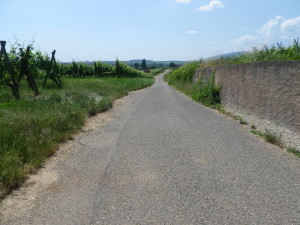
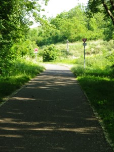
Trail Type: Long distance; almost exclusively paved, well maintained, but the route itself is not marked.
Length: Total: 138 kilometers / 85.75 miles
North segment (this post): 62 kilometers / 38.5 miles
South segment: 76 kilometers / 47.25 miles
Convenient to: Strasbourg, Colmar, Mulhouse
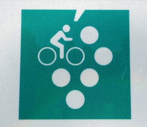
Marking: White, stylized grapes with a white bicycle and bicyclist superimposed on a green square background.
Trail Description (Northern half only): A long distance, almost exclusively paved, mostly motor-vehicle free, trail that has some gradual but long ascents and descents.
Trailhead:
North Marlenheim – Rue du Pensionnat x D2004
South Orschwiller – On a bike trail about 500 meters east of Hofrebenweg
Parking Possibilities:
Below is a select list of parking lots very close to the trail. At the time of travel, these lots were cost- and time limit- free.
Marlenheim: Medium-sized lot by Rue de l’Usine x Rue du Fosse
Molsheim: Lots by Rue des Sports, and Rue Sainte Odile
Rosheim: Rue Braun
Obernai: Large lot off Rue Poincare (by the Salle des Fetes), medium lot at Place des Fines Herbes
Barr: Medium-sized lot off Rue Saint Marc, (by Rue des Jardins)
Mittelbergheim: Medium lot by the cemetery on R. Ziegelscheuer
Andlau: Medium-sized off Rue Marechal Foch
Itterswiller: D35, bottom of the hill, large lot with picnic and sports area
Kintzheim: Large lot, Rue du Stade
Public Transportation Options:
Bus: Reseau 67 (Transportation Net 67) serves this area and more towns in the Bas Rhin department. See the Reseau 67 website for more information.
Rail: TER Alsace, a regional rail network, Line 7 serves: Strasbourg (not on the trail, but a hub for all regional public transportation), Molsheim, Dorlisheim, Rosheim, Obernai, Goxwiller, Gertwiller, Barr, Epfig, Dambach, Scherwiller, Selestat (the end of this line; not on the trail but close to Orschwiller).
Suggested Stages:
North: 62 kilometers Marlenheim to Orschwiller
South: 76 kilometers, Saint Hippolyte to Thann
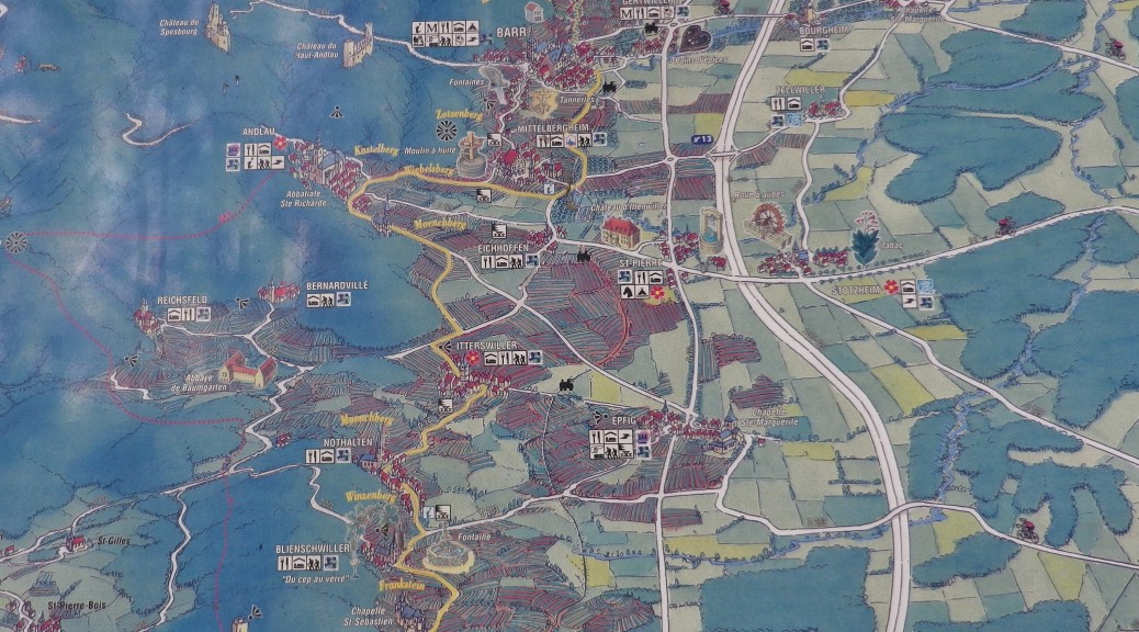
Trail Itinerary-Reference Points: (Northern half only)
Marlenheim: tourist office (D2004 x Rue du Pensionnat), Rue de l’Usine, underpass, slight left, then follow the bike trail signs; Kirchheim (outskirts), Odratzheim (outskirts), Scharrachbergheim (outskirts), Irmstett (outskirts); Soultz-les-Bains: Rue des Vergers, Rue des Jardins; Molsheim: Rue des Sports, Rue Sainte Odile, Rue Henri Meck, cross river, cross train tracks; Dorlisheim Avenue General de Gaulle, Rue des Remparts (past Chateau de Brosse), Chemin du Stufrain, overpass, vineyards; Rosheim: Rue de Molsheim, Rue Braun, Rue General de Gaulle/d207, Bischoffsheim; Obernai – Rue de la Montagne, Rempart Mgr Freppel, Rue Poincare; Bernardswiller (outskirts), Gertwiller (outskirts); Barr: Rue du Dr Sultzer, Place de l’Hotel de Ville, Rue des Marechaux or des Bouchers, Rue Taufflieb-R. Saint Marc; Mittelbergheim – Rue Principale; Andlau: D253/R. General de Gaulle-R. Marechal Foch, past Saint Andre church; Itterswiller: Viehweg-Route du Vin/D35, to picnic and sports area with large parking lot; Nothalten (outskirts only), shaded picnic area!; Blienschwiller (along D35 to, through and beyond village); Dambach-la-Ville: Route de Blienschwiller; Dieffenthal, (Roman borne); Scherwiller (outskirts); Kintzheim: Rue de la Legion-R du Stade; Orschwiller
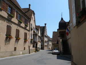
Representative Trail Photos:
Restrooms:
Obernai: By the Salle des Fetes, off Rue Poincare; and off Place des Fines Herbes
Barr: Near the Tourist Office, Rue des Bouchers
Mittelbergheim: Rue des Vosges and Rue Principale (handicapped-pay)
Andlau: By the Mairie, Rue Dr Stoltz
Itterswiller: D35, by the bus stop in the center of the village
Dambach: Rue des Jardins
Attractions on or near Trail:
Museums/Educational – Barr: Musee de la Folie Marco displays Alsatian pottery and tin artwork; Kintzheim: Volerie des Aigles (Bird of Prey Exhibitions)
Medieval Walls and Towers: Rosheim, Obernai, Dambach, Chatenois
Wine Learning Circuits (5 kilometers or less): Molsheim: Sentier Viticole du Bruderthal; Rosheim: Sentier Viticole Parcours du Vigneron (2 conjoined circuits); Obernai: Sentier Viticole du Schenkenberg; Mittelbergheim: Sentier Viticole de Mittelbergheim; Blienschwiller: Sentier du Cep au Verre.
Mittelbergheim: The “prettiest village in France” winner for the Bas Rhin Department.
Tasting along the Trail:
Dozens of wineries along the trail, most with very liberal hours (except lunch-time).
Wine bars (winstub) are in most of the larger villages or towns.
Alternative Options:
Hiking: See the Wine Educational Trails above. Rosheim’s two conjoined circuits total 13.5 kilometers, and passes through varied terrain.
Running: All of this route is suitable for running.
Car: Route des Vins d’Alsace, a 170 kilometer-long (105 miles) wine tourism route passing through many of the region’s wine villages and along the vineyards.
Additional Information:
Regional: http://www.alsace-wine-route.com/en
Trail (segment) specific: http://www.cyclinginalsace.com/en/cycle-trails/waterways-and-vineyard-cycle-routes/alsace-wine-road-cycle-route-36.html
Comments:
This is post focuses on the northern part of the 138 kilometer-long (85 miles) Veloroute du Vignoble D’Alsace, the bicyclist’s version of the car tourism Route des Vins d’Alsace. It describes the entire part of the Veloroute within the department of Bas-Rhin, from Marlenheim, south to the border of Haut Rhin/Bas Rhin between Orschwiller and St Hippolyte.
This northern section (especially from Marlenheim to Molsheim) had significant stretches on dedicated bike path, far removed from motorized vehicles, and other many stretches open only to bicycles and agricultural vehicles. Significant stretches on roads (albeit with a lane marking for bicycles) were between Andlau and Itterswiller (about 2 kilometers), and Blienschwiller and Dambach. Where the trail passed through the old villages centers, cars and bikes shared the streets, but at safe, low speeds. In places where the bike trail crossed roads, there was plenty of warning both for motorists and bicyclists. Bottom line: Very bike friendly overall.
Beginning around Molsheim, this trail joins the EuroVelo 5 (Via Romea Francigena) Route for much of the way to Orschwiller.
Finally, it is worth emphasizing that Alsace rocks when it comes to bicycle trails. All routes I saw were clean, well-maintained, and well-marked. This trail was also well-suited, logistically, to do as an 8 hour daytrip from Strasbourg. While the trail begins officially in Marlenheim, a direct local train from Strasbourg brings bikers in 20 minutes to Molsheim, the next biggest town on the trail, about ten kilometers south of Marlenheim. Return to Strasbourg on the same line from Scherwiller, about 10 kilometers north of Orschwiller, or the town of Selestat (about 5 kilometers off the trail).