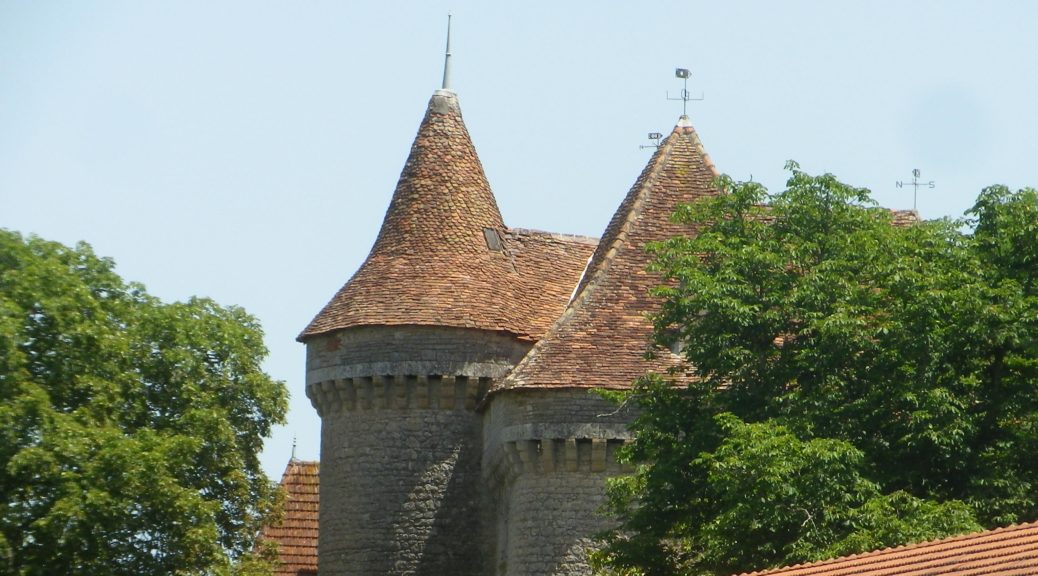

Anglars: Wall Belltower

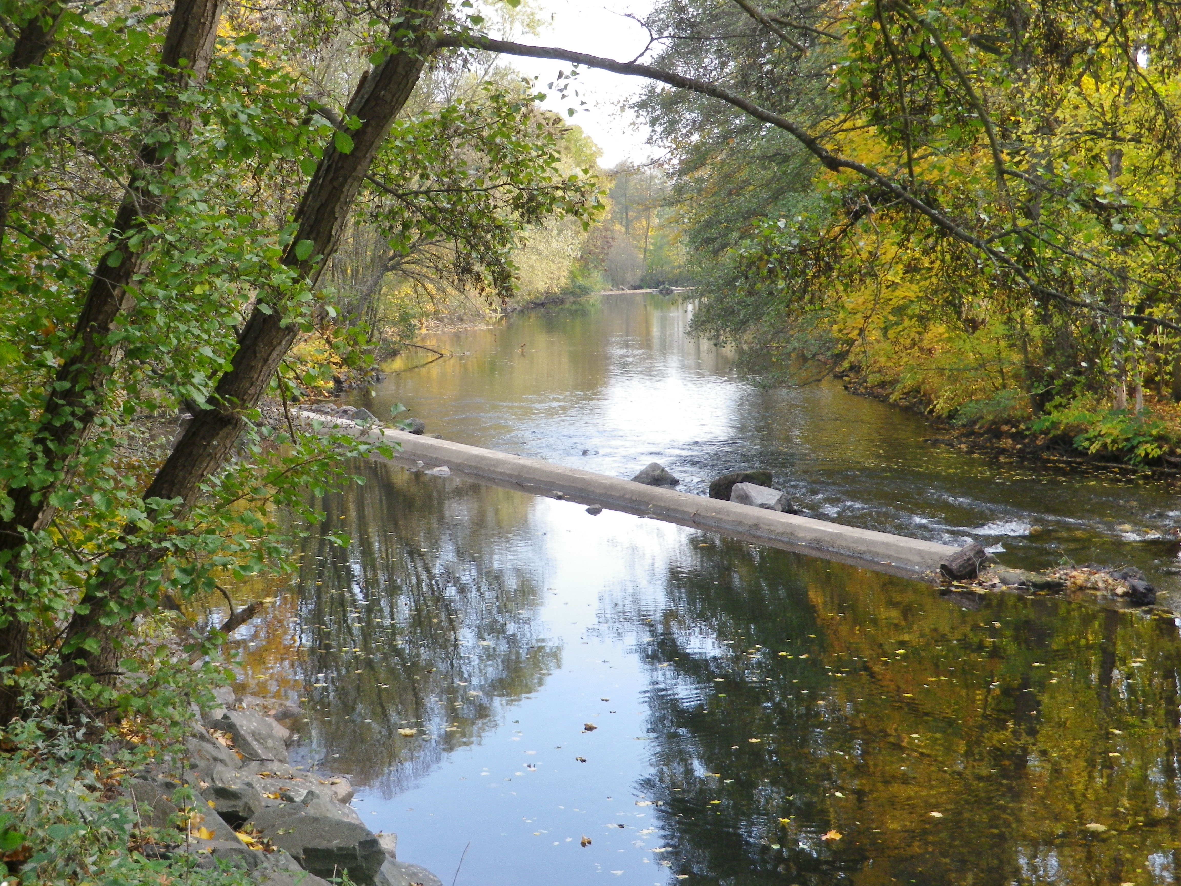
The Lot by Cahors

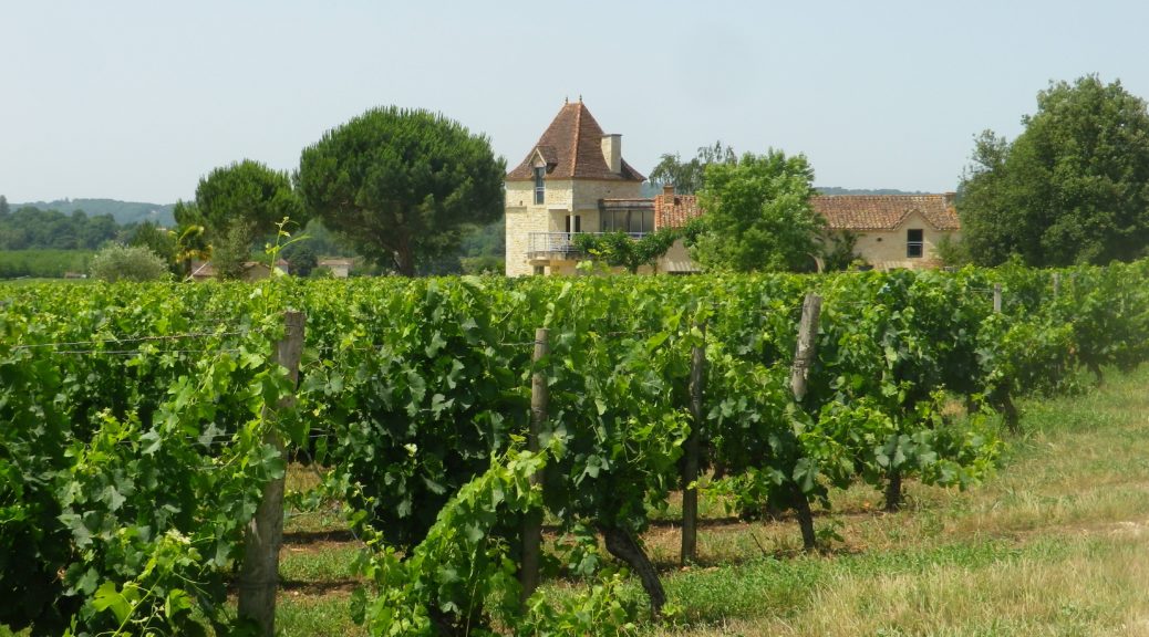
Vineyards by Anglars

Colors of Southwest France

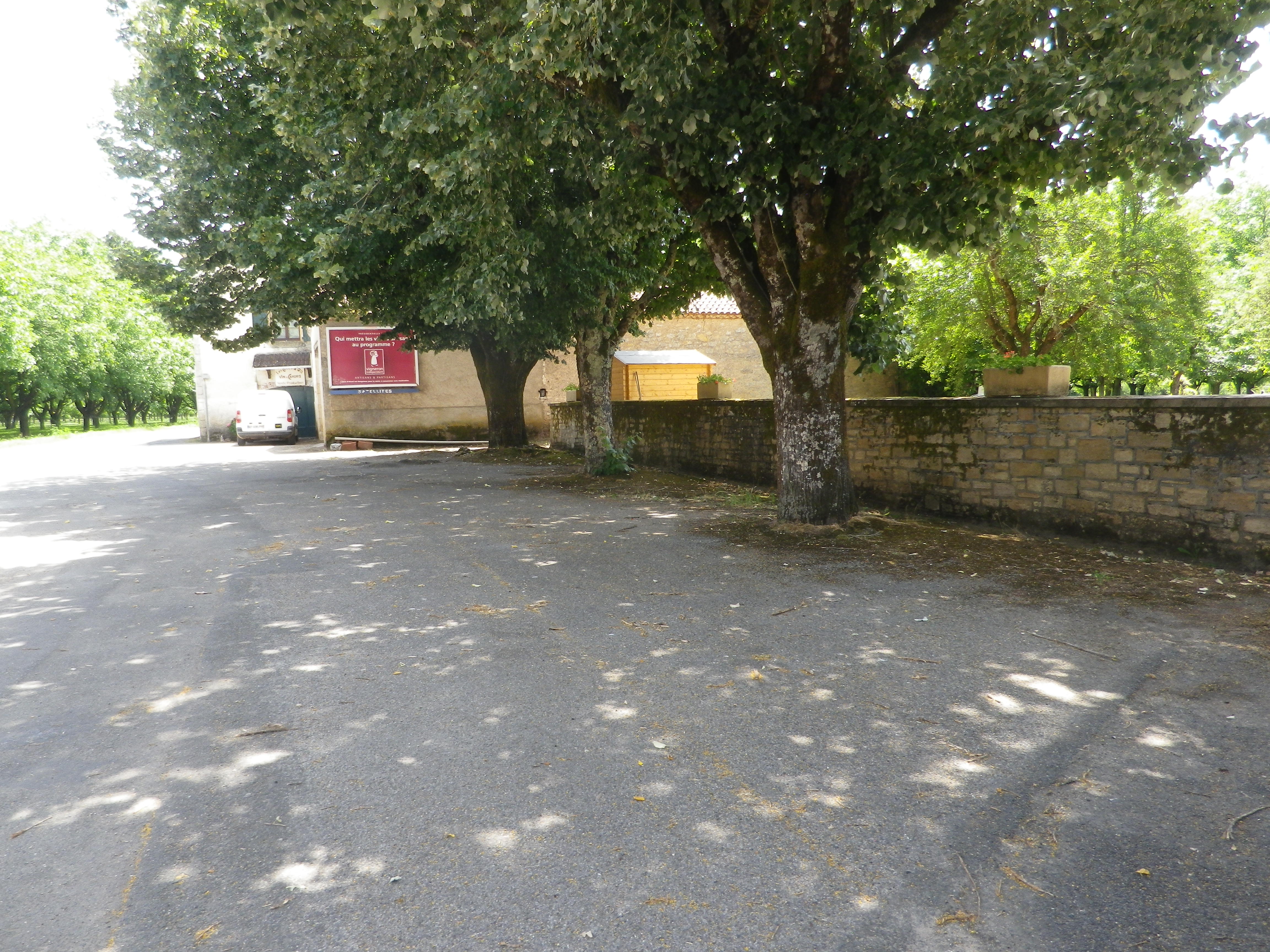
Anglars

Vineyards and Orchards
It should have been a bike ride with family. But we couldn’t find nearby bikes to rent. Then due to time and impending weather constraints, it had to be right then and there. So, in the end, it had to be a hike of the trail we intended to bike. And as we went along, I realized this circuit trail truly was ideal for bicycling as a family with young children (tweens, at the oldest), or with family members out of shape (or practice) biking.
From the shady parking area at the trailhead, which provided a great spot for a group preparing to embark on an adventure, the trail went along D8, the main road following the around the peninsula that is Anglars-Juillac, as defined by one of many loops created by the Lot River. The Lot River is famous for its sinuous course on its way to the Garonne, and its many twists and turns offer countless perspectives on the river and its landscapes. (If you want to make an easy half-mile detour to see the river, it is best to do so within a half mile of the trail’s start, following D67, before heading away from the water, and into the vineyards covering more than half of this peninsula.)
The Alsatians call their sparkling wines Cremant. But these were not the only bubbles (“bulles”) that I found along this “Bulles et Bugatti” cycling itinerary. There were wineries and taverns offering the Cremant of Alsace, of course. But equally enjoyable were the bubbling creeks along much of the way, from the Dachsteinerbach, the Bruche and its canal, the Mossig, Frankenbach and Kehlbach, finally, the Stillbach, (it wasn’t), a melodious stream bubbling its way to the Bruche.
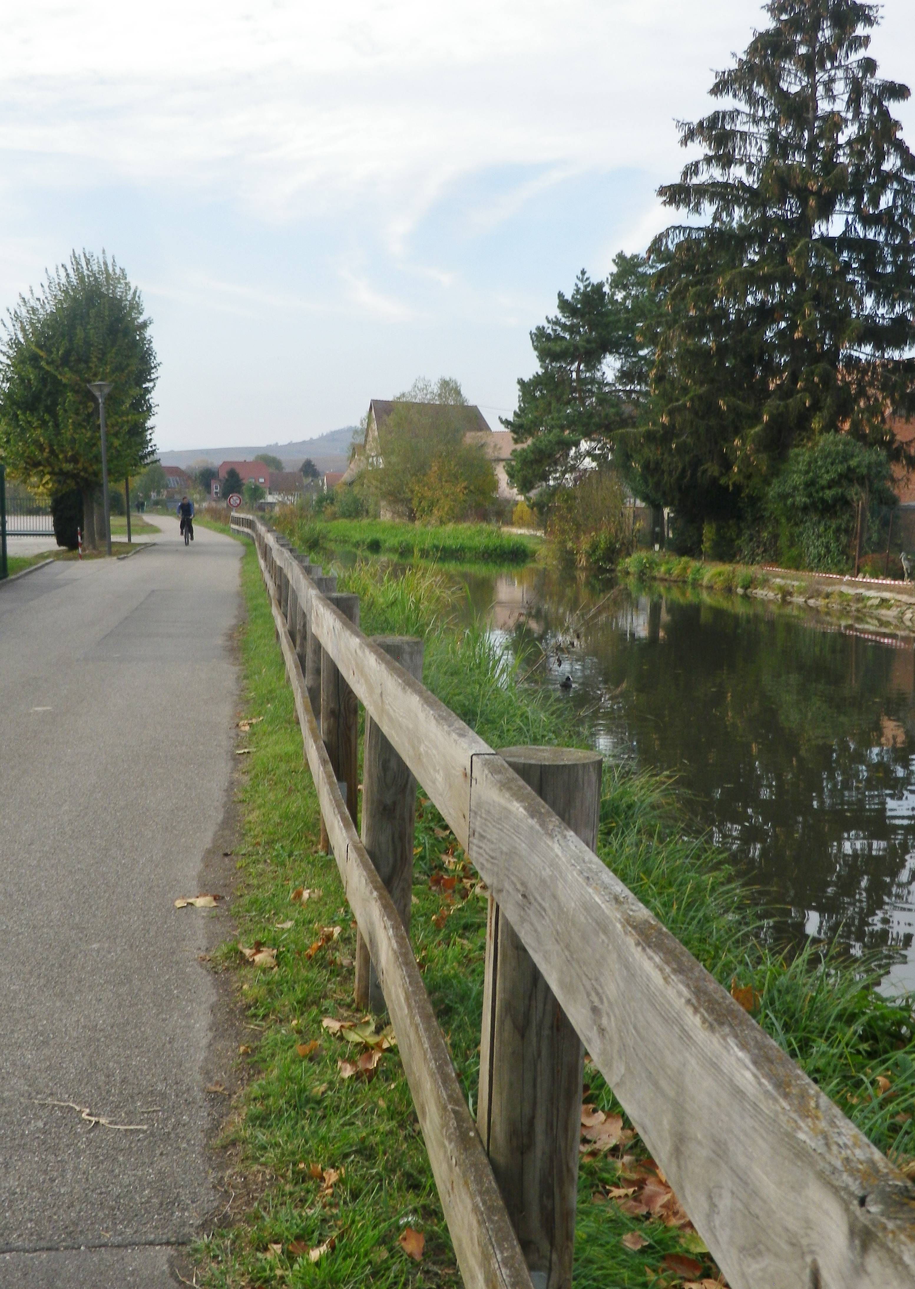
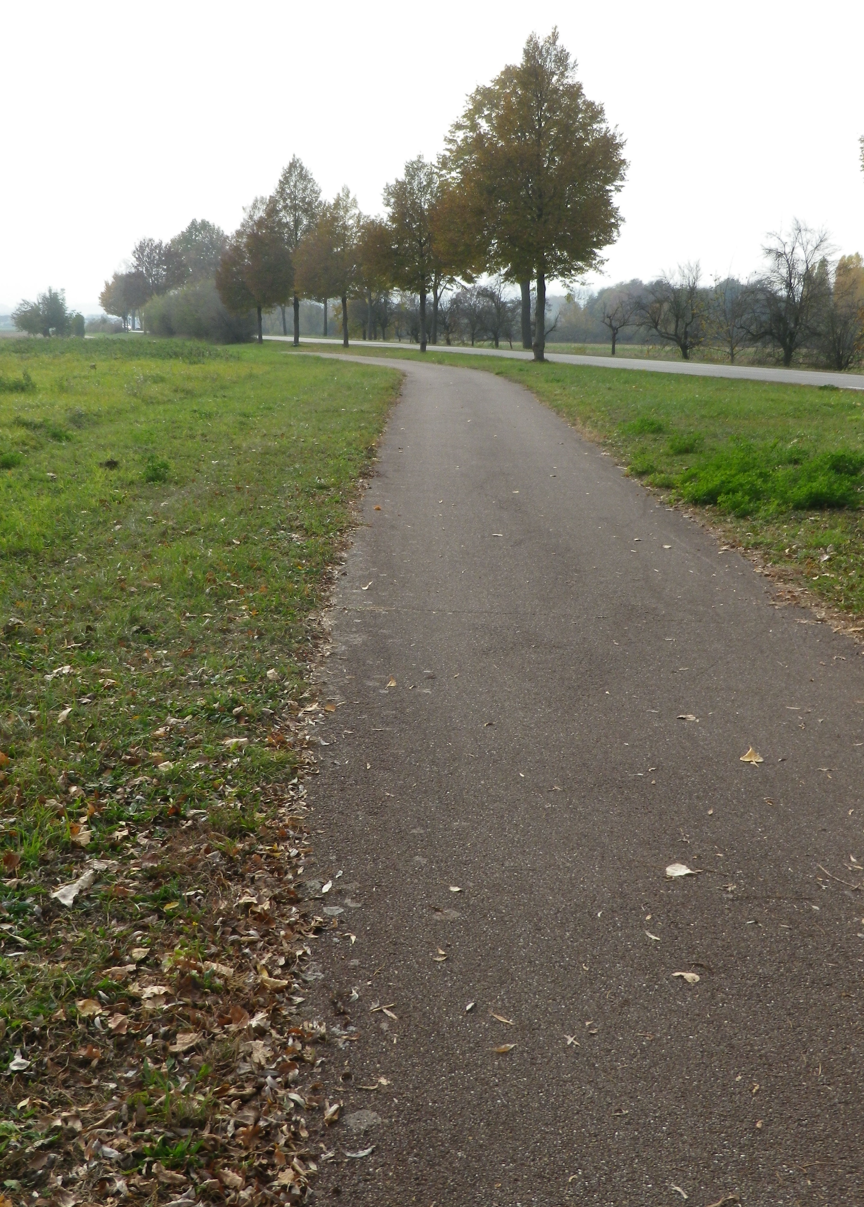
The Bruche empties into the Ill, a tributary to the Rhine, by Strasbourg. Starting in the Vosges mountains, it ultimately flows by the vineyards in the foothills of the Vosges, before entering the flat fields surrounding Strasbourg. This geography lesson just to let you know that the itinerary did have some hills, but also some very flat stretches. Especially memorable for its peaceful, rural aspect was the section riding along the Bruche Canal, a paved and beautifully maintained bike path. It is even possible to follow this trail all the way to the heart of Strasbourg!
But this itinerary also included the hills and dales in the heart of the Bas Rhin vineyards. Departing Molsheim, and passing Dachstein, a medieval walled and effectively moated village, the ride proceeds mostly on a flat bike path, which is a delight, to the canal. The hills begin where the canal ends, at Soulz-les Bains.

As the name implies, there is a spa in Soulz, a small village with a wonderful bakery, and Lucien Doriath’s excellent restaurant dedicated to foie gras. (Don’t worry, you can work it all off while on the numerous hiking and cycling trails passing through the village.) In addition to the Bruche and its canal, the Mossig also runs through this area. In fact, this whole itinerary sits in a watershed, and water is impossible to avoid.
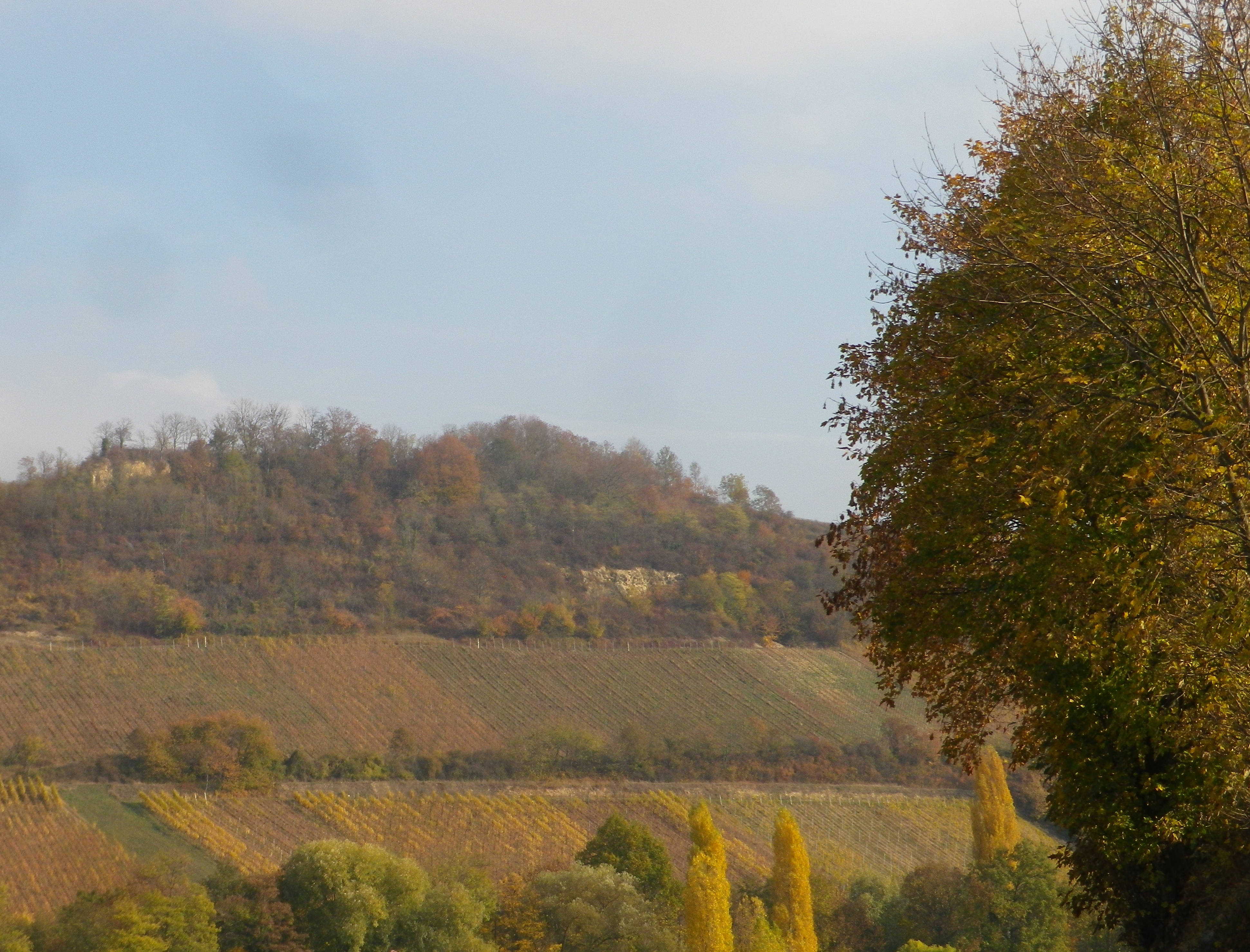
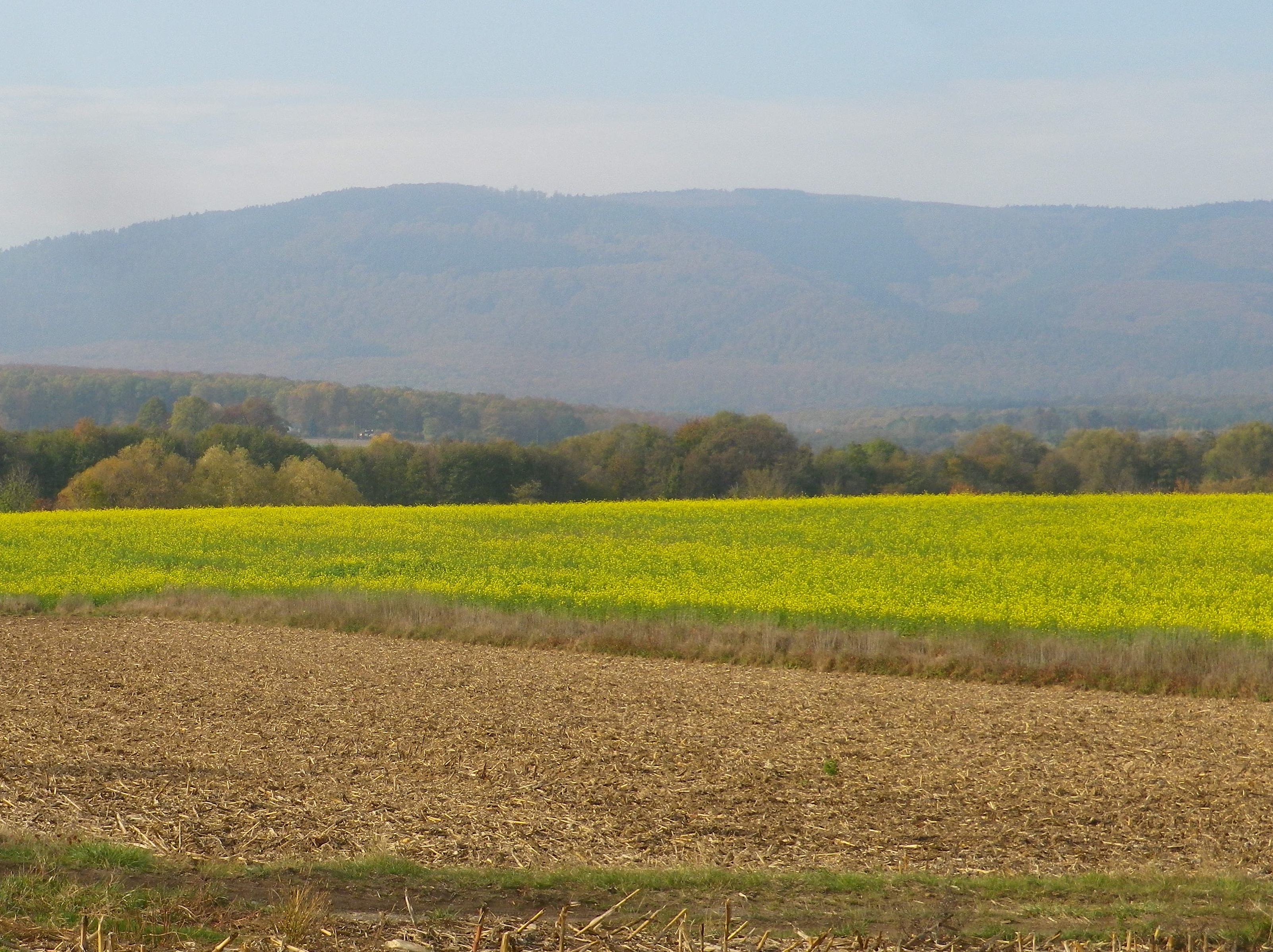
From Soulz, the itinerary climbs. As it does, vineyards replace fields, and the wine village of Bergbieten with its Grand Cru vineyard appears. Balbronn, another well-known wine village, is picturesquely surrounded by vineyards. Between there and Flexbourg, the higher elevations of the Vosges mountains come into view providing magnificent photo opportunities.
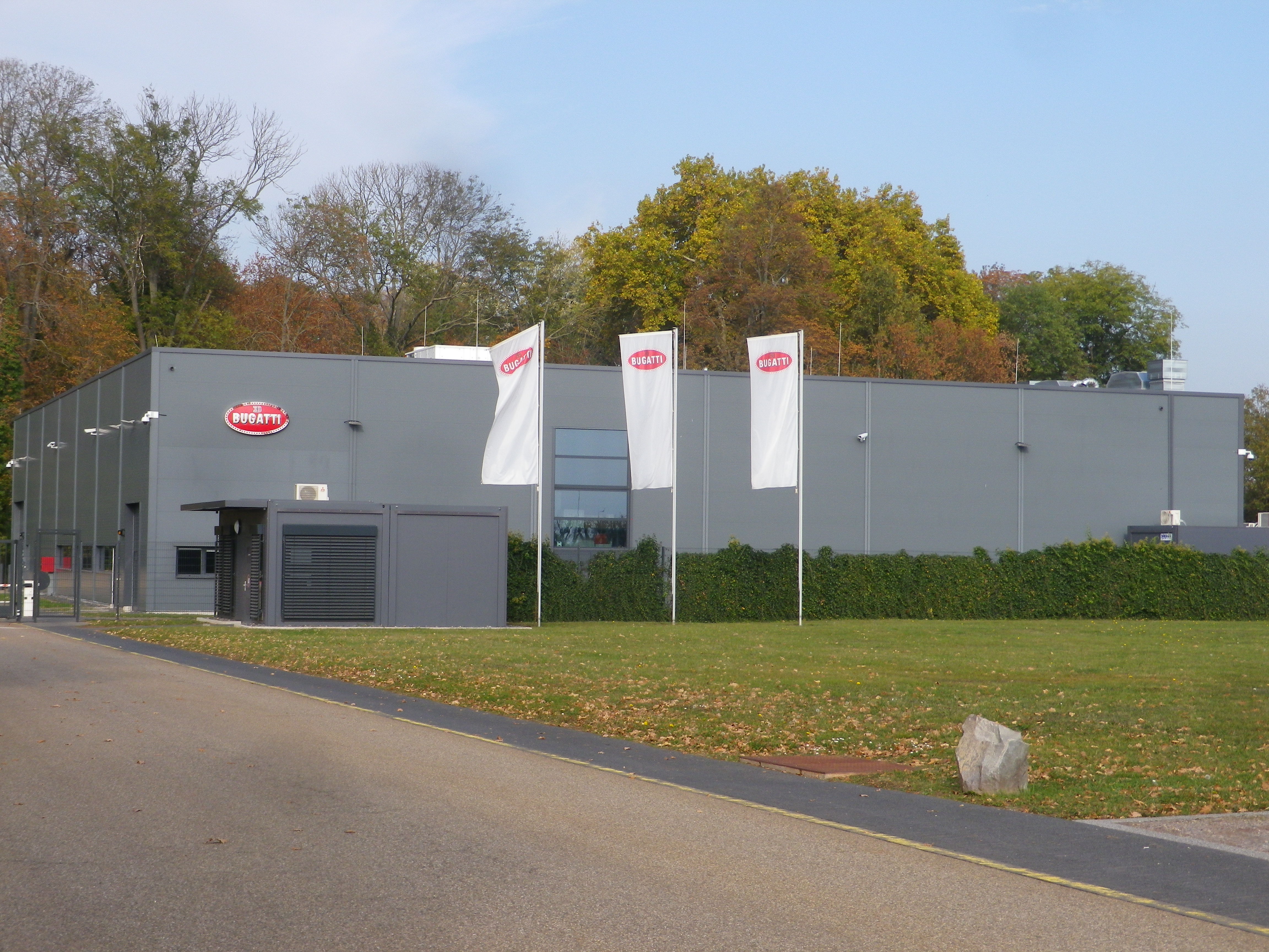
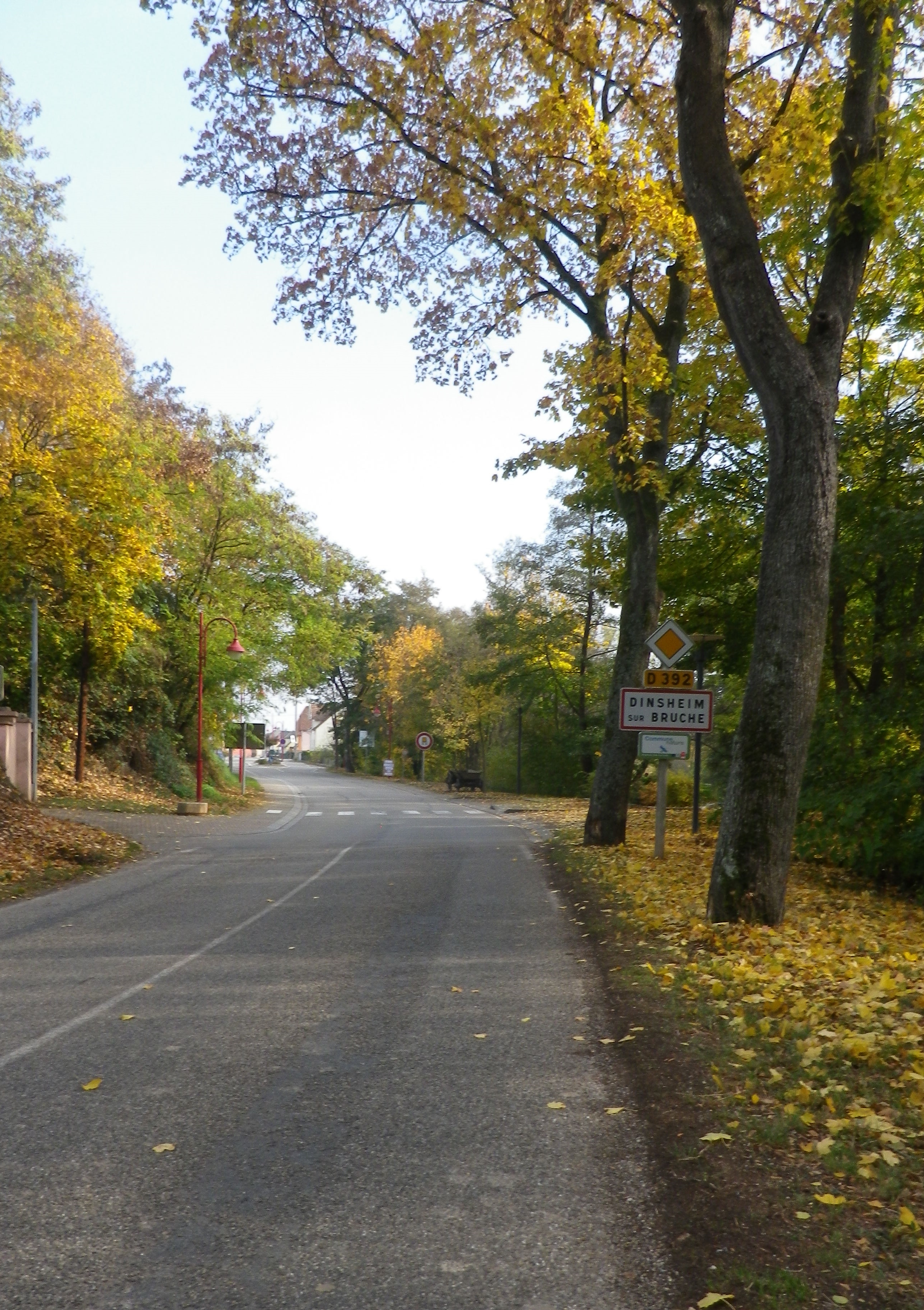
Once out of the hills, more rivers and streams appear. A marvelous confluence of several of these appear on the approach to Dinsheim sur Bruche. I cycled along the Stillbach, to where it joins the Bruche, then over the Muhlbach to cross the Bruche once again just before re-entering Molsheim. On the outskirts is the Bugatti factory. Bugatti was founded in Molsheim, and it still produces fantastic cars of distinction there. I must confess though, I saw few cars, much less Bugatti ones (the least expensive model starts at over two million dollars), while cycling, making this a relatively car free itinerary overall.
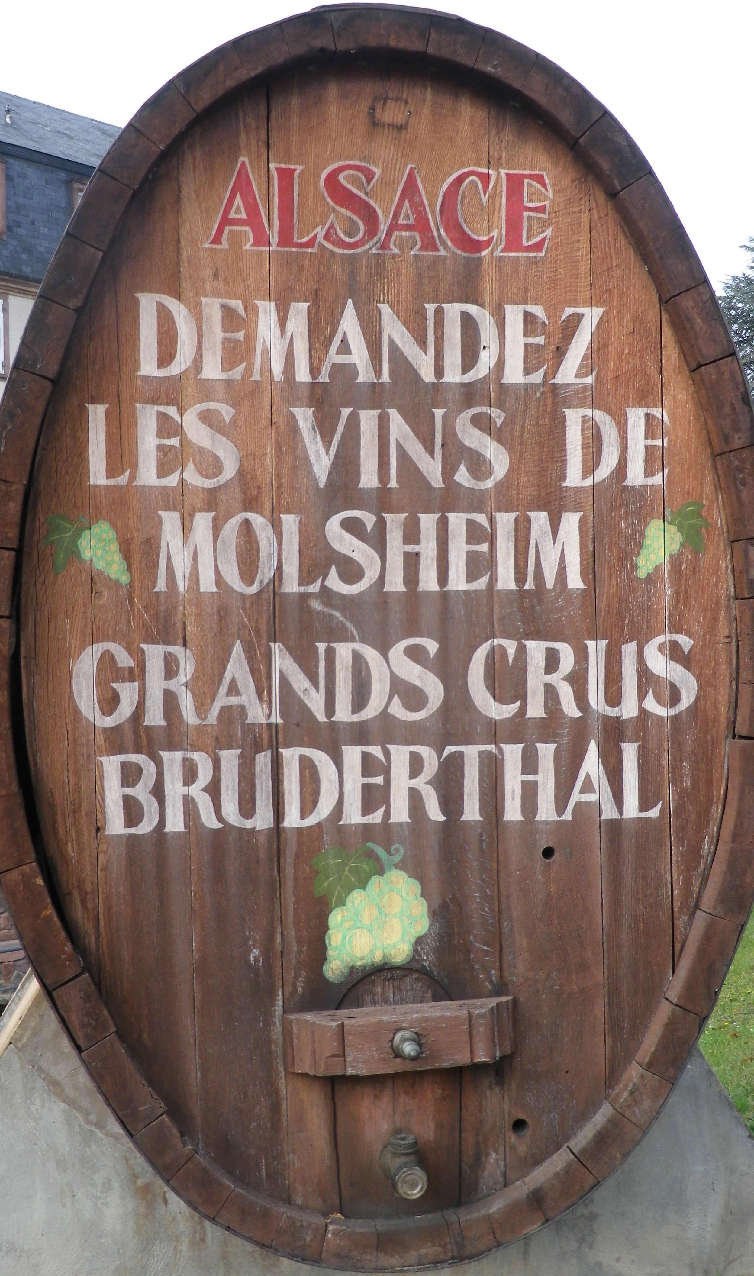
Molsheim is a small town, but the largest in this area. It is known to the wine world as the site of the Grand Cru Bruderthal, a “production” site as much esteemed locally as the Bugatti plant. The town itself boasts a couple of charming squares, fronted by historic and attractive half-timbered buildings. It is a nice place to base, if spending some time in the area. It has several restaurants serving good food and local wines, as well as a couple of wineries. Fortunately, all food and wine offerings, even the Cremant d’Alsace wines, cost only miniscule fractions of the cost of a Bugatti, hence may be happily enjoyed by all!
Trail Name: Bulles et Bugatti; AKA BL 312
Trail Type: A mid-distance circuit bicycle itinerary; well-maintained surfaces, much of it paved, however no trail specific marking throughout the itinerary.
Length:
Total – 33 kilometers/ 20.5 miles
Convenient to: Molsheim, Strasbourg, Bas Rhin, Alsace, France
Marking: None specific to the itinerary. Some sections do have the typical green and white cyclist markings for a bicycle path to serve as a guide.
Trail Description: A well thought out itinerary through mostly rural landscapes with a variety of flat and hilly sections, vineyard, field and urban terrain, some on minimally trafficked road sectors, and some on fairly long stretches of vehicle-free bicycle path or dedicated bicycle lane.
Trailhead: Molsheim, Rue de Strasbourg, Porte des Forgerons
Parking:
Molsheim: R de la Commanderie x R Ernest Friedrich (closest to trailhead); Rue des Sports, by the open-air pool
Dorlisheim: Chemin des Moissons, Rue Mercure, north and south, in a mall area
Mutzig: Place de la Gare, Rue du Dr Schweitzer,
Balbronn: R du Fronhof (at the upper/higher end)
Public Transportation Options:
Rail: Frequent regional trains (TER) connect Strasbourg and Molsheim
Bus: Numbers 234 and 236 connect Molsheim with surrounding villages
See the comment below
Suggested Stages: Not applicable
Trail Itinerary-Reference Points: (Counterclockwise)
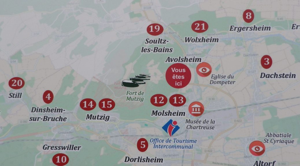
Molsheim: R. de Strasbourg x Avenue de la Gare, R. Charles Mistler, past Camping Municipal, over Bruche, along D93/D30; Dachstein: D30; Egerstein: Along Canal de la Bruche to Wolxheim; Wolxheim : R de Molsheim; Avolsheim: cycle path to Grotte d’Avolsheim, R. du Dompeter, R. de la Gare, Impasse de la Roseliere, cycle path; Soultz les Bains: R. de Molsheim/D422, D275: Dangolsheim: D275/Rte du Vin (past the Lavoir, or laundry basin); Bergbieten: D275/Rue des Vosges; Balbronn: D275/R. du Château, R. de la Foret, Rte de Flexbourg; Flexbourg: Rte de Flexbourg-R. des Acacias, R. de la Paix, R. des Seigneurs/D118; Still: D118/Rte de Flexbourg, Grande Rue; Dinsheim: D118, D392/ R. du General De Gaulle, past the Chapel of St Wendelin; Mutzig: Blvd Clemenceau; cross the Bruche, still on D392, past the Gare de Mutzig, Rte de Strasbourg; Faubourg des Vosges; Dorlisheim: Grand Rue, Avenue de la Gare/D392; Molsheim: D392; Altdorf: Chemin de la Blieth, R. des Romains, R. des Pres, R. Principale; Molsheim: R. Jean Mermoz, cycle path paralleling Rte Ecospace, D2422/R. de la Commanderie, past the Gare de Molsheim
Representative Trail Photos:
Restrooms:
Molsheim: Passage de la Post x Avenue de la Gare, about 50 meters west of the chapel in the parking lot by the old town gate “Tour des Forgerons”
Attractions on or near Trail:
Molsheim: Musee de la Chartreuse, focuses on millennia of history and traditions of the Bruche Valley, while another section covers the history of Bugatti (the other half of the name of this route), its cars and its connection to Molsheim.
Tasting along the Trail:
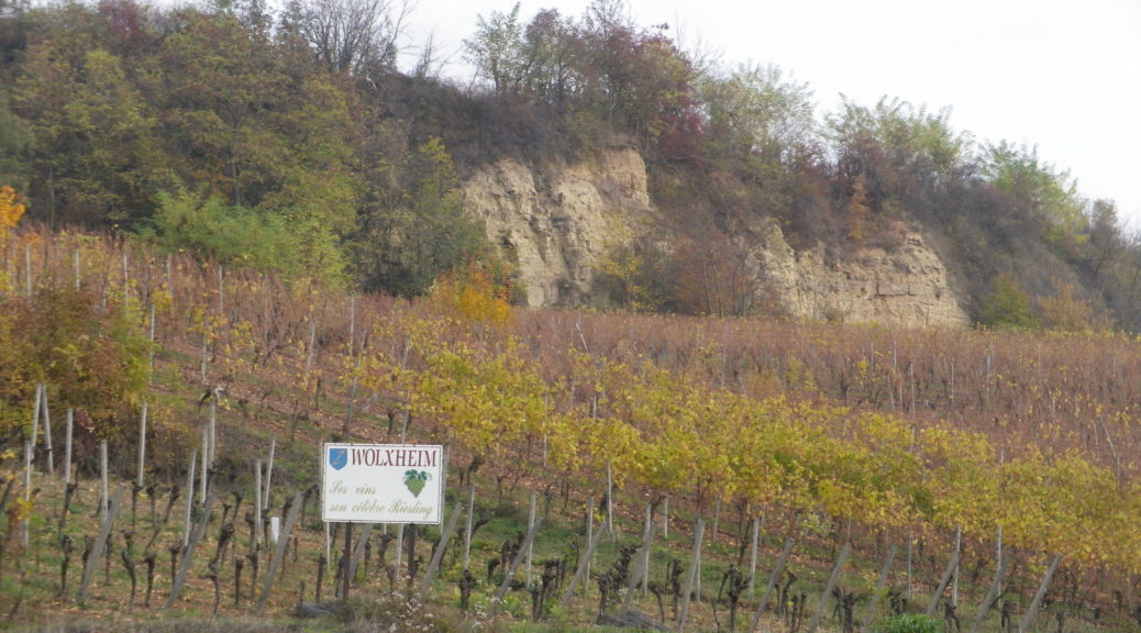
Wolxheim, Avolsheim, Soulz-les-Bains, Balbronn and Bergbieten are well-known wine villages with several wineries in each. Additionally, Molsheim is the largest town in the area, with several taverns and restaurants serving local wines.
Alternative Options:
Hiking: The circuit hike called Trotele, one of the Circuits of Bacchus, is a 13.6 kilometers hike through several of the same villages. See the Nutshell here.
Biking: The long distance Veloroute du Vignoble d’Alsace begins about 15 miles north in Marlenheim, and passes through Soulz-les-Bains, Molsheim and Dorlisheim, then proceeds south through other villages and towns in the Bas Rhin department. See the Nutshell here.
Additional Information:
Regional: http://www.ot-molsheim-mutzig.com/
Trail specific: https://www.alsaceavelo.fr/itineraires/boucles-locales/bl312-bulles-et-bugatti-118.html
Comments:
Although the bus and train network is good here, the 20.75 kilometer cycling path Veloroute du Canal de la Bruche (https://www.alsaceavelo.fr/itineraires/veloroutes-des-canaux-et-vignoble/veloroute-du-canal-de-la-bruche-23.html) is a fantastic and easy way for visitors in nearby downtown Strasbourg to reach this particular itinerary and this little visited vineyard area.