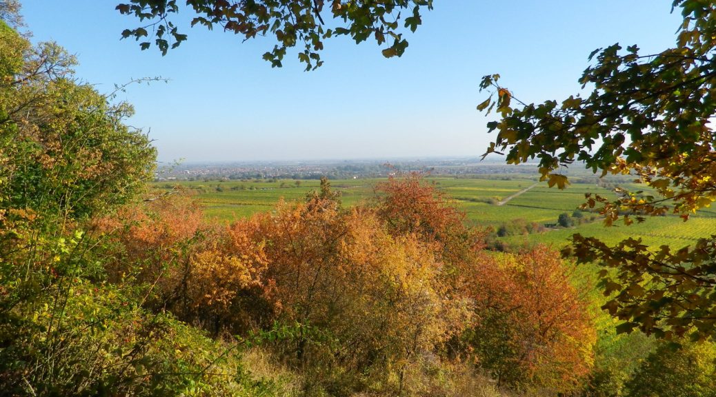
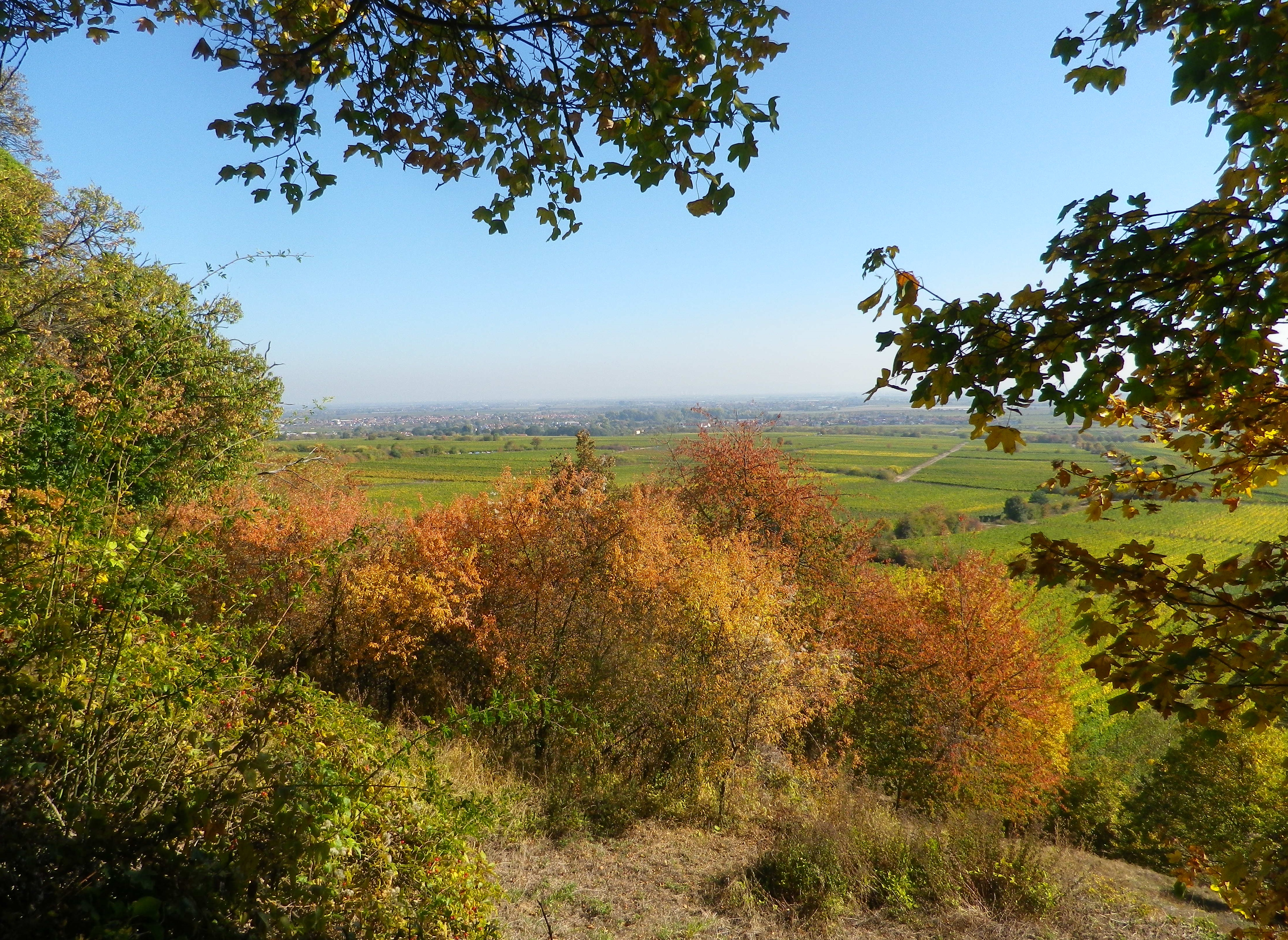
The climbs were steep, but the views were very rewarding. With more time, I would have done more climbs. In fact, in my castle hiking days, I had already hiked to several highpoints and castles on this trail: the Neuleiningen, the Wachtenburg, Hambacher Schloss, the Kalmit lookout, and that is just in the Mittelhaardt district. But at 185 kilometers, I didn’t have enough vacation days left! So perhaps on some other trip to Germany, I will be able to complete the Pfaelzer Weinsteig Trail.
For hikers looking for an intimate experience of the Pfalz wine region, this trail covers much of the region, as does the Wanderweg (Hiking Trail) Deutsche Weinstrasse (see the Nutshells here and here). The similarities between the two is that each pass through famous wine towns and villages, where there are countless opportunities to sample the wines and visit wineries. They both also cover a variety of landscapes from urban, to vineyard to forest. The big difference is the level of difficulty. The Wanderweg Deutsche Weinstrasse is rather easy, with only a few steep climbs into woodlands. On the other hand, the Pfaelzer Weinsteig climbs from the villages, often located at the base of the hills, far into the hills of the Pfalzer Wald forest. In that sense, the trail is physically more challenging, and more diverse.
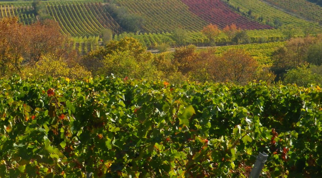
Germany’s Pfalz wine region is divided into two parts, the northern district of Mittelhaardt/Deutsche Weinstrasse, and the Suedliche Weinstrasse which is located south of Neustadt an der Weinstrasse. This entire region produces both red and white wines, with white wines making up approximately two-thirds of the overall annual production.
The Mittelhaardt/Deutsche Weinstrasse district runs along the Haardt mountains, facing east on gentle slopes in the optimal rain and wind shadow formed by the mountains covered by the majestic trees of the Pfaelzer Wald forest. This district, which begins in Bockenheim and continues to south of Neustadt, is in one of the warmest and sunniest regions of Germany. It contains towns and villages famous for their wines, as well as their lively wine festivals. Bad Duerkheim, with its Wurstmarkt in September, Neustadt with its Weinlese festival, in October, are two of the most famous wine festivals in Germany.
Long distance trail; well-maintained albeit with some rougher stretches along the segments through the forest and hills, naturally, marking on the trail very good overall
Length:
Total – 185 Kilometers/114 miles
Stage 4: 20 kilometers/12.5 miles (Deidesheim to Neustadt an der Weinstrasse)
My segment*- 7.5 kilometers/ miles (Train station, Deidesheim to Gimmeldingen)
Convenient to:
Bad Duerkheim or Neustadt an der Weinstrasse, Rheinland-Pfalz, Germany
Marking:
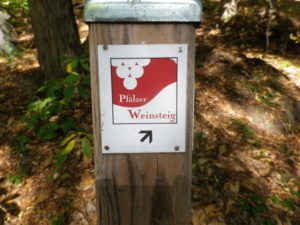
Red and white square, with white grapes on red background, trail name in red and white letters, alternatively simply red over white stripes
The Pfalz wine region in the southern Rhineland Palatinate (Rheinland Pfalz, in German) has two divisions: Suedliche Weinstrasse and Mittelhaardt. The Mittelhaardt has some of the best-known vineyards. While the official German quality system does not necessarily recognize particular sites as being better than others, many vineyards, and even sections of vineyards, have names. Some of these named parcels, at least among the vintners, have better reputations than others. Thus, even though the official quality system does not focus on particular sites as superior, the VDP (Verband Deutscher Praedikats- und Qualitaetsweinguter) association members will name particular sites on their wine bottle labels as an Erste Lage (loosely equivalent to a Premier Cru site in France), or as a Grosse Lage, identified on the label as GG (for Grosses Gewaechs) (again, in VDP terms, loosely equivalent to a Grand Cru site in France). Some of the sites designated by VDP vintners as Grosse Lage in the Mittelhaardt around Bad Duerkheim include Bad Duerkheim’s Michelsberg parcel, and Ungstein’s Weilberg and Herrenberg parcels. Although Freinsheim does not have any Grosse Lage, it does have the Erste Lage of Schwarzes Kreuz, and the named parcel of Musikantenbuckel. The names can date from a long way back, and often have an interesting history associated with them. For example, the Musikantenbuckel received its name from the practice of itinerant musicians of yore travelling to Freinsheim, and beginning to play their instruments, once they reached that spot. (Being on the downside of a slope – good for vines, by the way – from that point apparently, townspeople could both see and hear the music men approaching through the vines.)
Trail Type: Short distance circuit; well-maintained and almost exclusively paved with tarmac or concrete, marking on the trail good throughout
Length:
Total – 7.5 kilometers/ miles
Convenient to: Bad Durkheim, Germany
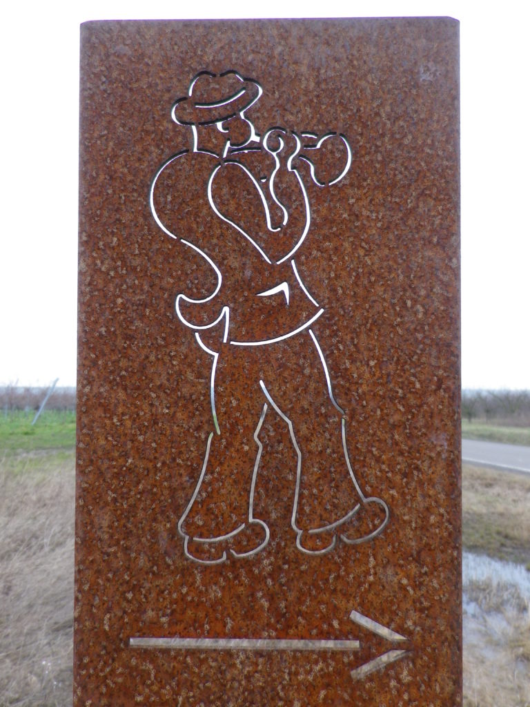
Marking: Musician playing a horn.
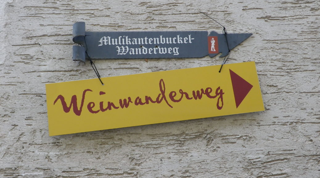
Musikantenbuckel Signage
Trail Description:
A family-friendly, short circuit passes up and along a gentle slope, through the village and vineyards, (meaning it is almost completely unshaded), with views over the village and valley, and out to hills. This trail is paved for almost all of it, and where not, there are paved alternatives.
Trailhead:
Freinsheim – Hauptstrasse, at the old Rathaus
Parking:
Freinsheim – Parkplatz P3, Weisenheimerstr
Freinsheim – festival parking area along L522/Talweide. Note: only during the festival weekend!
Public Transportation Options:
Rail: Deutsche Bahn regional trains provide frequent regional train service to Freinsheim, from Gruenstadt to the north, and points south, including Neustadt an der Weinstrasse and Bad Duerkheim.
Bus: Buses connect Freinsheim with Bad Durkheim, and other towns in the area. Check VRN.de for schedules to and from Freinsheim.
Suggested Stages: Not applicable
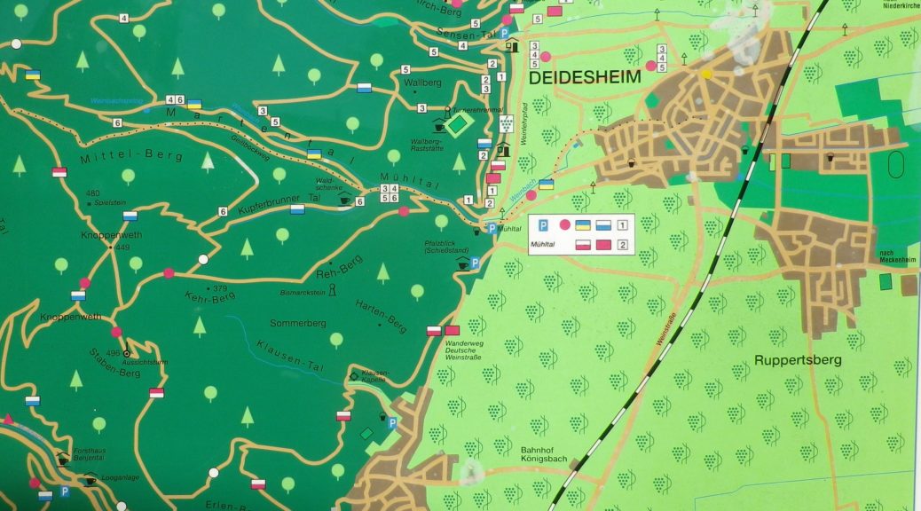
Trail Itinerary-Reference Points: (Clockwise)
Freinsheim: by the old Rathaus, Korngasse-Wallstrasse-2 Querstr-Wenjenstr, Schubertstr-Franz-Liszt-Str, path straight across, the left along L522, past Sportplatz (soccer field), Orchards and vineyards, and the Weinbergsgarten (rest area with benches and picnic table), cross L455, parallel L455, then cross it again, vineyards, cross path across L522/Talweide
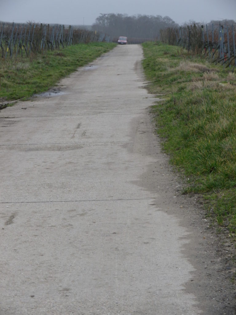
Representative Trail Photo:
Trail Surface: 98% of the Way
Restrooms:
Freinsheim, off Baerengasse
Musikantenbuckel, porta-potties on the trail. Note: only during the festival weekend.
Attractions on or near Trail:
While Freinsheim has no wine-themed museums or exhibits, there are several architectural features of historical interest in the old part of the village.
Tasting along the Trail:
The village of Freinsheim has many wineries (Weingut); and on the day of the Rotweinwanderung, there are half a dozen or so vintners with huts along the trail
Alternative Options:
Hiking: While the Deutsche Weinstrasse Wanderweg, the 96 kilometer-long (almost 60 miles) hiking trail from Bockenheim to the border town of Schweigen-Rechtenbach, passes near Freinsheim, it does not pass through it. Instead, Freinsheim offers a series of short, mostly family-friendly circuits, such as the Wanderweg “Schwarzes Kreuz”, through a named vineyard area.
Biking: Radweg Deutsche Weinstrasse, the 95 kilometer-long (almost 60 miles) cycling trail from Bockenheim to the border town of Schweigen-Rechtenbach), passes through Freinsheim.
Car: Deutsche Weinstrasse, the thematic car route from Bockenheim to the border town of Schweigen-Rechtenbach, passes near Freinsheim.
End of January each year, the Musikantenbuckel area is the venue for the Rotweinwanderung, a walking wine and culinary festival. During this weekend, the Rotweinwanderung Weinwanderweg generally follows the same itinerary as the Musikantenbuckel Wanderweg, but is a bit shorter.
Musikantenbuckel refers to a named vineyard parcel. Freinsheim also has two others: Schwarzes Kreuz and Oschelskopf, with a hiking trail through them, the Schwarzes Kreuz trail. Combining this trail with the Musikantenbuckel would cover all of Freinsheim’s named vineyards, and provide a longer (about 14 kilometer) easy hike.
Arriving by train will add about 900 meters. From there follow: Bahnhofstr-Hauptstr, to arrive at the Rathaus, the official start.