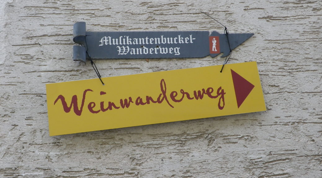
Trail Name: Musikantenbuckel Wanderweg
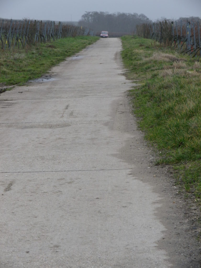
Trail Type: Short distance circuit; well-maintained and almost exclusively paved with tarmac or concrete, marking on the trail good throughout
Length:
Total – 7.5 kilometers/ miles
Convenient to: Bad Durkheim, Germany
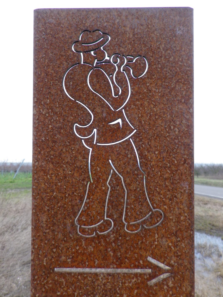
Marking: Musician playing a horn.
Trail Description:
A family-friendly, short circuit passes up and along a gentle slope, through the village and vineyards, (meaning it is almost completely unshaded), with views over the village and valley, and out to hills. This trail is paved for almost all of it, and where not, there are paved alternatives.
Trailhead:
Freinsheim – Hauptstrasse, at the old Rathaus
Parking:
Freinsheim – Parkplatz P3, Weisenheimerstr
Freinsheim – festival parking area along L522/Talweide. Note: only during the festival weekend!
Public Transportation Options:
Rail: Deutsche Bahn regional trains provide frequent regional train service to Freinsheim, from Gruenstadt to the north, and points south, including Neustadt an der Weinstrasse and Bad Duerkheim.
Bus: Buses connect Freinsheim with Bad Durkheim, and other towns in the area. Check VRN.de for schedules to and from Freinsheim.
Suggested Stages: Not applicable
Trail Itinerary-Reference Points: (Clockwise)
Freinsheim: by the old Rathaus, Korngasse-Wallstrasse-2 Querstr-Wenjenstr, Schubertstr-Franz-Liszt-Str, path straight across, the left along L522, past Sportplatz (soccer field), Orchards and vineyards, and the Weinbergsgarten (rest area with benches and picnic table), cross L455, parallel L455, then cross it again, vineyards, cross path across L522/Talweide
Representative Trail Photo:
Restrooms:
Freinsheim, off Baerengasse
Musikantenbuckel, porta-potties on the trail. Note: only during the festival weekend.
Attractions on or near Trail:
While Freinsheim has no wine-themed museums or exhibits, there are several architectural features of historical interest in the old part of the village.
Tasting along the Trail:
The village of Freinsheim has many wineries (Weingut); and on the day of the Rotweinwanderung, there are half a dozen or so vintners with huts along the trail
Alternative Options:
Hiking: While the Deutsche Weinstrasse Wanderweg, the 96 kilometer-long (almost 60 miles) hiking trail from Bockenheim to the border town of Schweigen-Rechtenbach, passes near Freinsheim, it does not pass through it. Instead, Freinsheim offers a series of short, mostly family-friendly circuits, such as the Wanderweg “Schwarzes Kreuz”, through a named vineyard area.
Biking: Radweg Deutsche Weinstrasse, the 95 kilometer-long (almost 60 miles) cycling trail from Bockenheim to the border town of Schweigen-Rechtenbach), passes through Freinsheim.
Car: Deutsche Weinstrasse, the thematic car route from Bockenheim to the border town of Schweigen-Rechtenbach, passes near Freinsheim.
Additional Information:
Regional: http://www.freinsheim.de/tourismus_wein_und_kultur/uebernachten.html
Trail specific: https://www.outdooractive.com/de/wanderung/pfalz/freinsheim–musikantenbuckelrundweg-durch-die-weinreben/3321889/#dm=1
Comments:
End of January each year, the Musikantenbuckel area is the venue for the Rotweinwanderung, a walking wine and culinary festival. During this weekend, the Rotweinwanderung Weinwanderweg generally follows the same itinerary as the Musikantenbuckel Wanderweg, but is a bit shorter.
Musikantenbuckel refers to a named vineyard parcel. Freinsheim also has two others: Schwarzes Kreuz and Oschelskopf, with a hiking trail through them, the Schwarzes Kreuz trail. Combining this trail with the Musikantenbuckel would cover all of Freinsheim’s named vineyards, and provide a longer (about 14 kilometer) easy hike.
Arriving by train will add about 900 meters. From there follow: Bahnhofstr-Hauptstr, to arrive at the Rathaus, the official start.