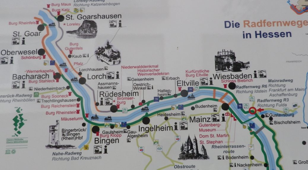
Trail Name: Rheingauer Riesling Route
Trail Type: Long distance trail; almost exclusively paved, well maintained; the route itself is marked in part with the wine glass marking (see below), and other parts are marked with an R3.
Length:
Total: 62 kilometers/38.5 miles (Kaub to Floersheim)
Segment: 49 kilometers/30.5 miles (Ruedesheim to Floersheim)
Convenient to: Wiesbaden, or Mainz, Germany
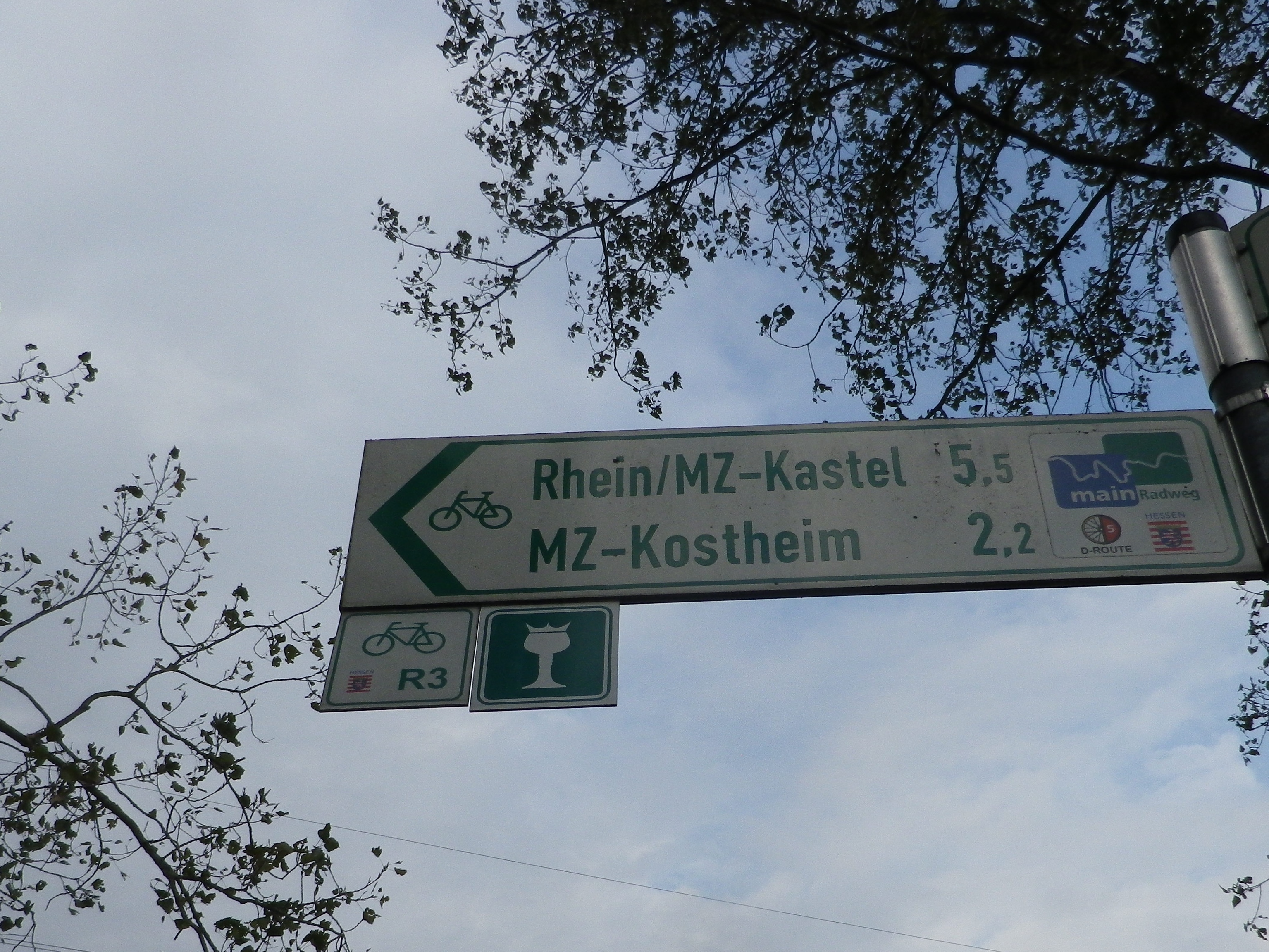
Marking:
White wine glass with a crown on a green background; Alternatively: R3 and R3a (variant to Kloster Eberbach). Where the icon marking is not easily found, follow the R3 or R3a signs.
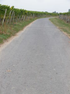
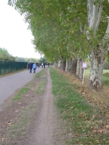
Trail Description: A moderately easy itinerary (the only challenge being the way up to Kloster Eberbach), cyclists will initially enjoy winding paths through vineyards, followed by a long segment along the banks of the river. The passage through small towns, such as Eltville or Walluf, and then through Wiesbaden, means that there are plenty of lodging opportunities to choose from, even though the full (62 kilometer) itinerary may be done in one, albeit long, day.
Trailheads:
Ruedesheim: Burgstrasse x Oberstrasse
Floersheim am Main: Stadtgarten, Konrad Adenauer Ufer (See comments)
Parking:
Ruedesheim: From Rheinstrasse, along the river, up Oberstrasse and down Burgstrasse, an improved lot, and dozens of pull-in parking spots lining both the last two streets, and along neighboring Niederstrasse.
Biebrich: Wilhelm Kopp Str (parking at end), park nearby;
Walluf: Werftstr x Johannisfeld, large improved lot by the sports fields
Floersheim am Main: Konrad Adenauer Ufer, huge parking area
Public Transportation Options:
The Rhein-Main-Verkehrsverbund coordinates both bus and rail services in this area, with the bus serving the hinterlands, and rail serving the riverside towns. See http://www.rmv.de/de/Fahrplanauskunft/
Ferries are also in service in some places along the route.
Suggested Stages: Not applicable
Trail Itinerary-Reference Points:
Ruedesheim: Am Niederwald Denkmal, Eibingerstr-Hugo-Asbach-Str, vineyards-Eibingerweg; Geisenheim: Falterstr-Am Nordring-Behlstr, Am Hohen Pech, vineyards; Grund: Chapel, Maerzackerweg; Winkel: Theodor-Heuss-Strasse, Greiffenclaustr, Kirchstr; Vollrader Allee; uphill through vineyards; Hallgarten: Sterzelpfad, Hattenheimerstr; vineyards, past the big domaine Neuhof, left onto L3320; Kloster Eberbach (main gate); Kloster-Eberbach-Strasse past Eichberg; Kiedrich: Bingerpfortenstr, Sonnenlandstr, Eltviller Str/L3035; Eltville: Bertholdstr, Feldstr, Weinhohle, Wallufer Str/K638; Niederwalluf: Kirchgasse, Rheinallee; past sports field and Yacht harbor; Schierstein/Lindenviertel: follow path along the river/water to Biebrich palace; Wiesbaden: Rheingaustr/Biebricherstr (busy street riding until the train bridge); Eleonorenstr, bike path to Mainz-Kastel (past the castle/fort); Mainz-Kastel: cross pedestrian bridge to the island, follow along the Rhein to Main side of the island, cross bridge, Mainufer, past the look-out tower, path through fields, woods; Hochheim am Main: under A671, Mainweg, along river and vineyards on Hochheimerweg; Floersheim: big U (inland) around huge industrial area, then Hochgewann, Hafenstr path along the river, under B519, Konrad Adenauer Ufer (See comments)
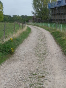
Representative Trail Photos:
Restrooms:
Ruedesheim: Marktstrasse
Eltville: at the end of Burgstr (off the trail), opposite corner from the castle’s white tower.
Walluf: Rheinallee, not far from the Weinprobierstand (a giant cask)
Attractions on or near Trail:
Ruedesheim: Rheingauer Wein Museum (Rhinegau Wine Museum) housed in the Broemserburg Castle is small, but provides fairly comprehensive coverage of local wine making.
Geisenheim: Schloss Johannisberg, birthplace of Spaetlese Riesling
Schloss Vollrads offers visitors a chance to wander around part of the grounds to admire the buildings, and around the vineyards.
Kloster Eberbach: The monastery compound is open to the public, and for a small fee, there are both self and tour -guided visits, which include its wine cellar, and a shop with wines under its label.
Hochheim: Weinbaumuseum, focusing on the local history and practice of viticulture and viniculture.
Tasting along the Trail:
There are many, many wineries along the way. Be sure to visit the famous Schloss Vollrads whose tasting room is open daily to the public, and the Schloss Johannisberg shop, also open daily.
Alternative Options:
Hiking: The Rheingauer Rieslingpfad, a 92-kilometer long trail following a similar, but higher, route, is another great way to experience this area. See the Nutshell here for details.
Car: Rheingauer Riesling Route. Again, same wine glass signage as above, just larger and on road signs.
Additional Information:
Regional: https://www.rheingau.de/
Trail (segment) specific: https://www.rheingau.com/rheingau-riesling-routen/
Comments:
Online sites describing this route varied. Some called for it ending outside Floersheim, in Wicker, other maps or descriptions ended in Floersheim proper. I chose the latter because the parking situation was more convenient there.
The marking for R3 is for a trail called Auf den Spuren des Spaetlesereiters, a 215-kilometer trail from Fulda to Johannisberg, following the trail of the rider carrying the abbot’s message giving permission to harvest the grapes.