Trail Name: Chemin du Vignoble (French); OR Rebenweg (German)
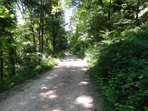
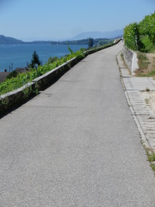
Trail Type: Mid-distance; almost exclusively paved, well maintained, and well-marked.
Length: Total: 12.9 kilometers/ 8 miles
Convenient to: Biel, Switzerland
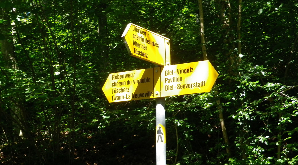
Marking: Marking is the name of the route itself (in German or French) at some intersections; otherwise a gold diamond (with or without a stylized figure of a hiker in black superimposed) indicate you are on a hiking trail. (See featured photograph above.)
Trail Description: This is truly a family-friendly trail through peaceful countryside with spectacular views! It is an easy trail (see comment below) with moderate inclines and declines. Although perhaps long for children, it may be shortened upon arrival at any village, where efficient trains or buses will take you to your start point. It is entirely on hard surfaces, suitable for baby strollers, adult walkers, or even motorized wheel chairs. It offers benches, picnic tables and shade in places, (although no bathrooms were in sight).
Trailheads:
North: Burgunderweg x Tessenbergstr (aka Route Montaigne de Diesse), Vingelz/Biel
South: La Neuveville, Train station (Gare)
Parking: (All parking must be paid for in this area of Switzerland!)
Biel: Bahnhof parking lot; parallel parking on Route 5, close to Route Montaigne de Diesse
Biel: Route Montaigne de Diesse, parking lot at the very top, at the trailhead
La Neuveville: Place de la Gare
Public Transportation Options:
Bus: Verkehrsbetriebe Bus 11 runs from the main Biel train station to the Biel trailhead, at the top of the Montaigne de Diesse street, at the Rebweg/Chemin des Vignes stop.
Rail: CFS/SBB trains frequently run to, from and between Biel and La Neuveville. Stations are also in Tuescherz, Twann and Ligerz.
Ferries: BSG Bielersee Schifffahrt ferries also provide transportation to and between Biel and La Neuveville, with stops in Tuescherz, Twann and Ligerz.
Suggested Stages: Not applicable; but to shorten the hike, consider breaking off at Tuescherz or Twann.
Trail Itinerary-Reference Points:
Vingelz/Biel: Burgunderweg x Tessenbergstr (aka Route Montagne de Diesse), woods; Alfermee: vineyards, Gruebmattweg-Oberdorf Tuescherz; Tuescherz: Pulverweg; Twann-Tuescherz: Rebweg; Twann: Rebweg; Kleintwann: Neuweg; Ligerz: Neuweg-Charriere, Schafisweg, under the funicular tracks, by old watch tower (Stand de Tir)-Chemin de la Roche au Cros; La Neuveville: Route du Vignoble-Chemin des Guetins-Rue du Faubourg-Route du Chateau, pass through the Red Tower to R du Marche-Place du Marche/Place de la Gare
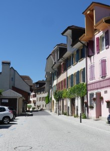
Representative Trail Photos:
Restrooms:
La Neuveville: Rue du Port, under the train tracks
Attractions on or near Trail:
Ligerz: Rebbaumuseum, focusing on viniculture and viticulture in this area.
La Neuville: Musee Histoire; Partial wall and towers encompass a quaint historic center.
Tasting along the Trail: (all on the trail)
Twann – Im Vogelsang
La Neuveville -Rolf Clenin; Cave/Domaine de la Ville de Bern; several taverns once in the historic district
Alternative Options: None observed
Additional Information:
Regional: http://www.myswitzerland.com/fr-fr/destinations/regions/jura-trois-lacs.html
Trail (segment) specific: http://www.myswitzerland.com/fr-fr/destinations/regions/jura-trois-lacs.html
http://www.myswitzerland.com/fr-fr/les-vignobles-du-lac-de-bienne.html
http://www.outdooractive.com/de/wanderung/schweizer-mittelland/rebberge-am-bielersee/1515147/#dm=1
Comments:
In researching this trail, I found different sites. Be aware that slightly different names, different distances and start points are given for this trail with each site.
Completely accessible to all. Two notes on accessibility though.
Start at the official trailhead, by the Montagne de Diesse/Tessenberg bus stop, at the top of the massive hill, not from Biel’s train station.
Just after the pilgrimage church in Ligerz, a Rebenweg sign could lead you right, up a narrower path leading to a gate, steps and a steep embankment at the funicular tracks. (It rejoins the main path on Chemin de la Roche Au Cros.) This is not accessible to everyone. But avoiding this route, and continuing downhill, then to Chemin de la Roche Au Cros via Schafisweg, the trail remains accessible to all.