Trail Name: Wii Wegli
Trail Type: Long distance hiking trail; very well-maintained and almost exclusively paved or hard-pack, marking on the trail is consistent, and pretty good throughout (although maps are necessary).
Length: 81.6 kilometers/50.5 miles (See comment below)
Convenient to: Freiburg, or Weil am Rhein, Germany, Basel, Switzerland
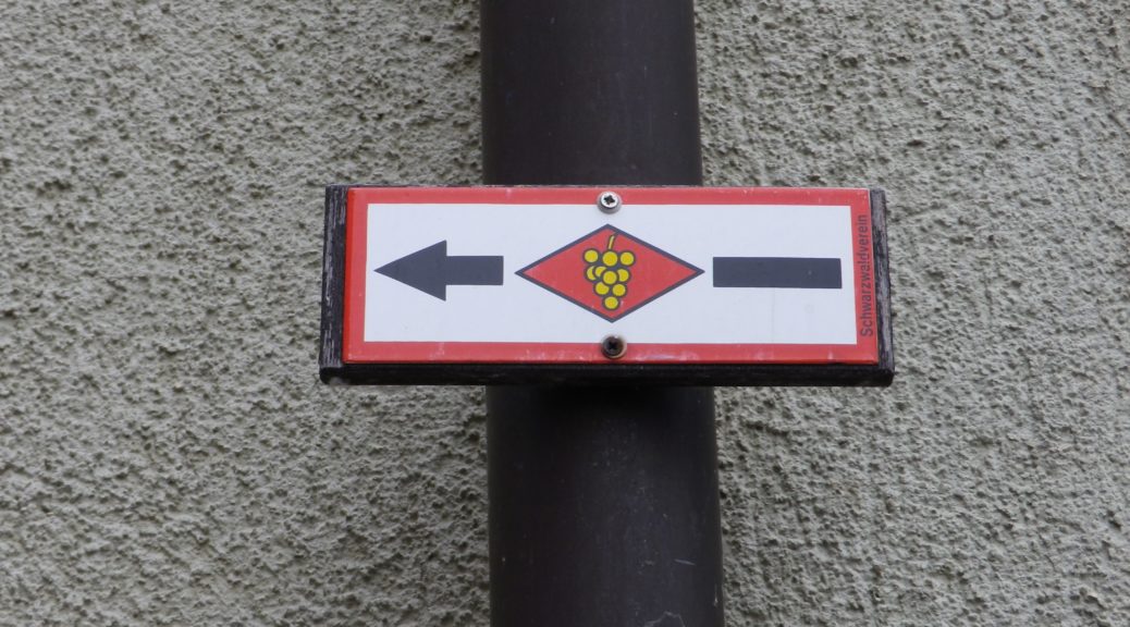
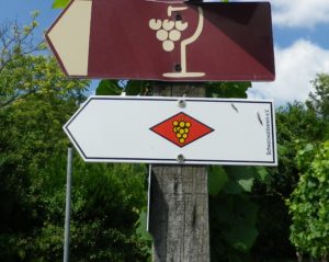
Marking: Yellow grape cluster on a red diamond on a white background (Note: many times, the red has faded to white. Another note: In the final segment, the trail often follows the Jacobusweg: yellow cockleshell on blue background)
Trail Description: A trail through a variety of magnificent landscapes and villages, all connected with wine production. While some sections were more challenging than others, due to the inclines, for the most part, this trail is easy, and alternates between sun and shade, urban and rural, and fields, vineyards and forests.
Trailheads:
Overall: (south) Weil am Rhein – Hauptstr x Loerracherstr; (north) Freiburg/Sankt Georgen – Andrea-Hofer-Strasse
Midpoint: Muellheim to Niederweiler, on Wolfackerweg
Parking: (Southern half only)
Binzen: Am Sportplatz
Bad Bellingen (just north of Blansingen), Untere Roemerstrasse; Hertingerstr x Kirschenhof (Wanderparkplatz Pfaffenacker)
Restrooms: (Southern half only)
Bad Bellingen: (about a kilometer off the trail), Rheinstrasse (behind the small grassy area)
Binzen: Rathaus, Hauptstrasse
Public Transportation Options:
Rail – Deutsche Bahn covers some towns between Freiburg and Weil am Rhein Hauptbahnhof (main station). Rail service does not reach all villages though. (See the bus information below.) From the main station in Weil am Rhein, use the SBB line to Weil Ost station in order to access the trailhead.
Bus – RVL (Regio-Verhehrsverbund Loerrach), commuter rail and bus lines throughout the region from Loerrach/Weil to Bad Bellingen; and SWEG (Suedwestdeutsche Verkehrs-Aktiengesellschaft) bus lines.
Suggested Stages:
Weil am Rhein – Blansingen (21 km)
Blansingen – Muellheim (19 km)
Muellheim – Staufen (19 km)
Staufen – Freiburg/Sankt Georgen (23 km)
Trail Itinerary-Reference Points: (Southern half only)
Weil am Rhein: Blaesiring, Efringerstr, vineyards; Oetlingen: Im Storchen-Dorfstr-Binzenerstr, cross A98; Binzen: Fischingerstr, Im Berg, vineyards; Trail above Fischingen, forest between Wintersweiler and Efringen-Kirchen, between Kleinkems and Blansingen, above Bamlach and Bad Bellingen, crossing Hertingerstr, Kirschenhof, vineyards, orchards and forests; Schliengen: Bellingerstr-Eisenbahnstr-Freiburgerstr-Am Sonnenstueck, vineyard; Auggen: Blauenblickstr, Dietrich-Kroger-Strasse, Oberdorfstr, vineyard; Muellheim: Auggener Weg, Ostliche Allee, Gaellelegaessle, Ziegleweg, Im Kalchen, Brunnmattstr, Wolfackerweg;
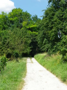
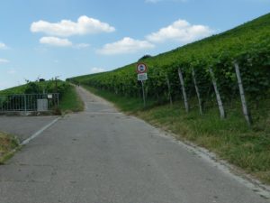
Representative Trail Photos:
Restrooms: (Southern half only)
Bad Bellingen: Rheinstrasse (behind the small grassy area)
Schliengen: Eisenbahnstrasse
Attractions on or near Trail: (Southern half only)
Oetlingen: Dorfstube Oetlingen, shows the history of wine-making and fruit processing among other displays of regional country life.
Auggen: Auggener Schaef, famous vineyards
Tasting along the Trail: (Southern half only)
Winzergenossenschaft Schliengen-Muellheim (also seen as: Erste Markgraefler Winzergenossenschaft Schliengen-Muellheim): The first cooperative in the Markgraefler region, has its headquarters (and tasting rooms and shop), literally on the trail.
Weil, Oetlingen, Binzen, and Bad Bellingen, all have either pubs or wineries on or near the trail.
Alternative Options:
Hiking: Several villages have short wine education trails – the Weiler Weinweg, a trail along a 4 kilometer stretch of the vineyards above Weil, from Oetlingen to the Swiss border (following the Wii Wegli in part); the Efringen-Kirchen Weinlehrpfad, 3.5 kilometers-long; the Ballrechten-Dottingen Historischer Weinberg Castellberg, 5.5 kilometers of panoramas and history of the terraced hill covered with vines; and the Auggener Weunlehrpfad, routes between 2.3 and 7.9 kilometers long.
Car: Badische Weinstrasse, a car itinerary from Weil am Rhein to Baden-Baden.
Additional Information:
Regional: http://www.markgraefler-land.com/Erlebnisse/Wandern/Markgraefler-Wiiwegli
Trail specific: https://www.outdooractive.com/de/fernwanderweg/suedlicher-schwarzwald/markgraefler-wiiwegli/3322947/
Comments:
A six-kilometer extension was recently added south of Weil am Rhein. Now, the Wii Wegli begins at the German village of Grenzach-Whylen, on the Rhine River, passes through a Swiss suburb of Basel (Riehen), and then re-enters Germany at the city limits of Weil am Rhein. It rejoins the original trail in the vineyards above Efringerstrasse.
While all uphill and about 2 kilometers from the trail in Niederweiler, Badenweiler is worth a side trip to see the well-preserved Roman bath ruins, the extensive castle ruins, the magnificent spa park, with a great variety of wonderful, old trees, and fantastic views of the Rhine River Valley north, south and west. Take the frequent 5-minute bus ride up, if necessary!