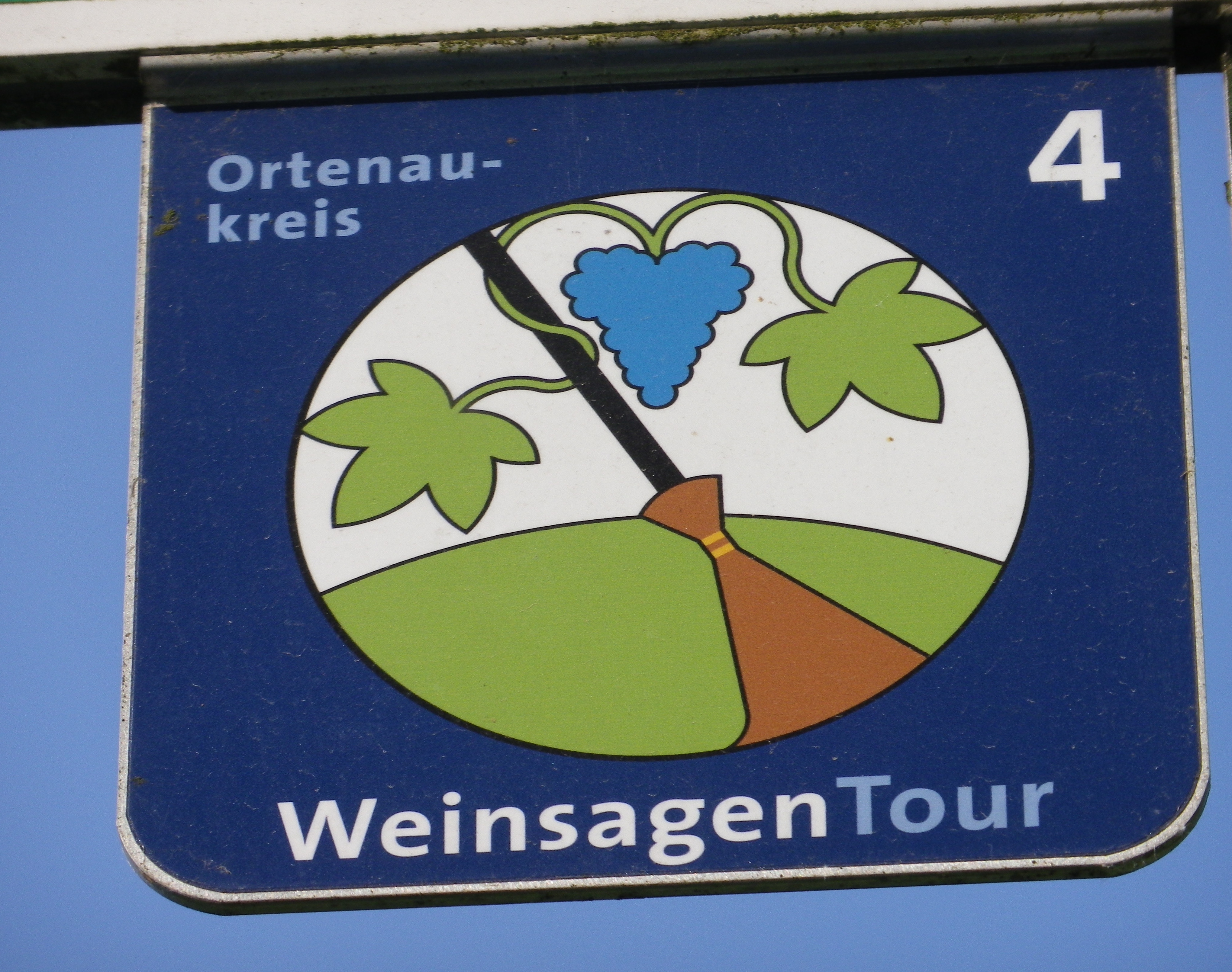
Trail Name: Weinsagen Tour
Trail type: A medium-distance cycling circuit; mostly paved, some hard packed earth, well maintained and marked, albeit with only standard bike route indicators in some places.
Length: Total: 40.5 km/25 miles
Convenient to:
Baden-Baden, Baden-Wuertemberg, Germany
Strasbourg, Alsace, France
Marking: Blue grapes/green grape leaves on a half green-half white circle on a dark blue background. A number 4 in white on the blue square background.
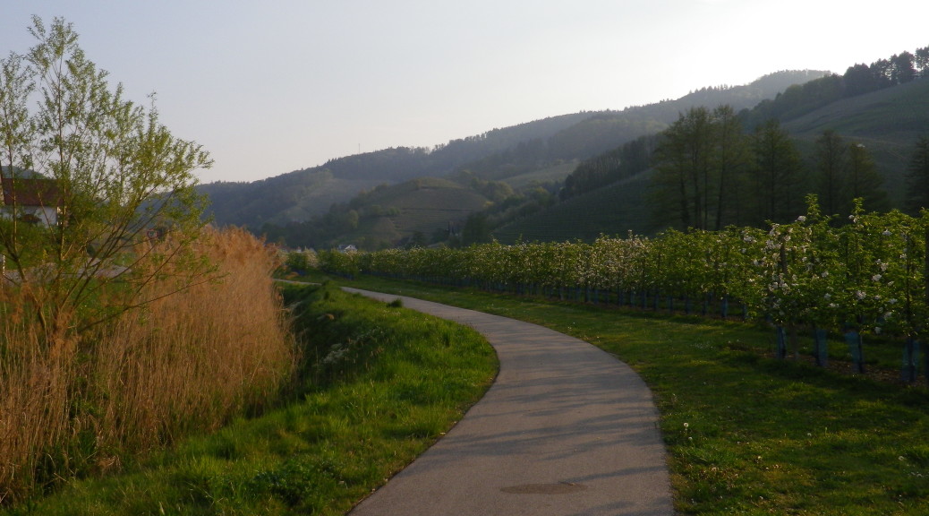
Trail Description: A bike trail in the southern German state of Baden, Ortenau County, in the hills between the Rhine River and the Black Forest, designed for potential E-Bike usage. It has a couple of steep climbs, flowed by relatively flat riding along a river. This trail covers both town and country, through fields, vineyards and orchards.
Trailhead(s):
Kappelrodeck: Binzigstr x Hauptstr
Oberkirch: Renchtalallee, at the bridge over the river (a convenient alternative)
Parking Possibilities:
Kappelrodeck: Jahnstr, 2 lots: one next to, one opposite Acherntal Halle; Waldulm, lot off Weinstr, by the sports field
Oberkirch: Large lot off Renchtalallee, by Renchtal Stadion; Large lot off Appenweiererstr, by the bridge
Public Transportation Options:
Bus: http://www.3-loewen-takt.de/wir-ueber-uns/ connects many small villages from towns with rail systems.
Rail: http://www.ortenaulinie.de/pb/Ortenaulinie,Lde/Startseite/Fahrplan.html is the rail/bus system that connects towns via hubs like Appenweier or Achern, serving Oberkirch or Kappelrodeck.
Suggested Stages: Not applicable
Reference Points on Trail Itinerary:
Kappelrodeck: Binzigstr-Hauptstr-Waldulmerstr-Weinstrasse (L86a); Waldulm; Ringelbacher Kreuz (Einkehr Gasthaus); Ringelbach; Oberkirch: Wolfhag-Gaisbachstr-Renchallee to access path along the river; Stadelhofen: Erlacherstr-Stadelhofenerstr; Erlach: Erlacherstr-Kirchstr; Renchen: Teichmattstr-Hauptstr-Kappelstr; fields and orchards; Oensbach; Achern/Oberachern: Oberkirchstr-Zur Friedrichshoehe-Am Waldsee; Obersasbach: Klammbosch-Sasbachwaldenerstr; Sasbachwalden: Talstr-Auf der Eck; vineyards; Kappelrodeck: Bernardshof-Binzigstr
Restrooms:
Kappelrodeck: Rathaus, Hauptstr
Oberkirch: Kiosk next to train station, on Eisenbahnstr
Attractions (along the trail):
Beautiful scenery
Tasting along the Trail:
Winzerkellerei Hex vom Dasenstein, Waldulmerstr, Kappelrodeck
Weingut Siegbert Bimmerle, Kirchstr, Renchen-Erlach
Alternative options:
Hiking: Ortenauer Weinpfad (Part IV), covers some of this route
Car: The Badische Weinstrasse, a 160 kilometer route through many of Baden’s wine producing villages and towns
Additional information:
Regional:
Overall: http://www.ortenau-tourismus.de/
Weinstrasse: http://www.blackforest-tourism.com/Black-Forest/tourist-routes/badische-weinstrasse