Trail Name: Durbacher Weinpanorama Weg
Trail Type: Medium distance circuit; tarmac or hard-packed (albeit some loose gravel here and there), well maintained, fairly well-marked, albeit not always easy to see. (Also see comments below.)
Length: total: 16 kilometers / 10 miles
Convenient to: Offenburg, Germany; Strasbourg, France
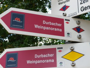
Marking: Signs with white letters spelling “Durbacher Weinpanorama”
Trail Description:
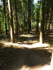
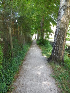
This hike widely circles the village of Durbach, in an amazing landscape that consists of small, steep hills, and deep secluded draws and valleys. It passes through vineyards and forests, providing a variety of landscapes as you hike, and ultimately ends by following a small creek into and through the heart of the compact, picturesque village.
Trailhead: Durbach: Almstrasse, by the tennis courts
Parking Possibilities:
Durbach: parking lots on Laubengasse (near the fire station/Feuerwehr), Almstrasse (some spots for campers), by the public pool (crowded in summer).
Outside Durbach: small lot by the Brandstetter Chapel on K5369/Weintalstrasse.
Public Transportation Options: Information on bus and rail connections throughout the Ortenau area may be found on the TGO, Ortenaulinie website.
Rail: None
Bus: Lines 7137 and 7142 Regionalbusverkehr Suedwest (RVS) serve Durbach from Offenburg
Suggested Stages: Not applicable
Trail Itinerary-Reference Points:
Durbach: Festplatz, along stream, Am Buhl, Weingut Andreas Laible, Above Am Buhl through vineyards, Plauelrainer Koepfle (with rest area), vineyards, woods, St. Anton, Hilsbacher Hoehe, Staufenberg Castle, Stollenwald Holzle, crosses 5369 at Brandstetter Chapel, toward Hummelswald (also on Renchtalsteig); Bildeich (highest point); woods and vineyards; Immersbach (hamlet and road); Duenberg: trail follows a creek, paralleling Obertal (street) to Oberweiler, Sawmill (Saegewerk), trail along stream past Halbguetle to Durbach: Public swimming pool, Durbacher Winzergenossenschaft, Lindenplatz-Talstrasse-Almstrasse
Representative Trail Photos:
Restrooms: Festplatz (by the tennis/sports fields off Almstrasse)
Attractions on or near Trail:
Wine Museum, with other local historical and cultural exhibits, on Talstrasse
Schloss Staufenberg, food, wine and wonderful lookout points in a shaded park area
Tasting along the Trail:
Durbacher Winzergenossenschaft (cooperative), and individual Weinguter (wineries): Schwoerer, Graf Wolff Metternich, Andreas Laible, and Schloss Staufenberg (Durbach, all on the trail)
Alternative Options:
Hiking: The 6 kilometer Weinpfad zum Schloss Staufenburg path, essentially a shortened version of the Weinpanorama hike, covers much of the first part of this hike. The Weinkeller zum Weinkeller trail, 19.25 kilometers covers a wider area, and is more challenging.
Running: This entire trail is suitable for running. (Caveat: Some rough(er) spots and loose gravel spots, especially after the chapel, until the stretch along the creek.)
Biking: Durbach Weinberg Tour, a 20 kilometer trail designed for MTB.
Car: The Badische Weinstrasse (Tourist Wine Route), runs through this town, and others in this appellation, and through many other towns and villages in other, nearby appellations.
Additional Information:
Regional: http://www.durbach.de/
Trail (segment) specific: http://alpregio.outdooractive.com/ar-durbach/de/alpregio.jsp#i=3940303&tab=TourTab
Comments:
Above Am Buhl, in the vineyards, there were a couple of minor discrepancies between the signage and the gpx route.
Gorgeous scenery, with spectacular views over the Rhine River valley and onto the Black Forest to the east and south.