Trail Name: Vignes et Vallees (Aka : Au Fil des Vignes et Vallees)
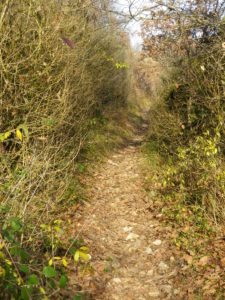
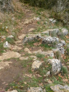
Trail Type: Mid-distance circuit; well-maintained, surfaces vary from road, to grass, to dirt paths, to rock rib, marking on the trail rather good
Length: 13.25 kilometers/8.25 miles
Convenient to: Chalon-sur-Saone, Santenay, France
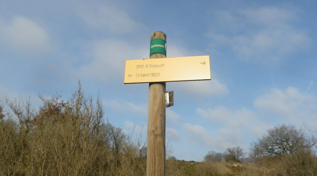
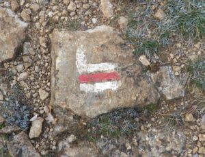
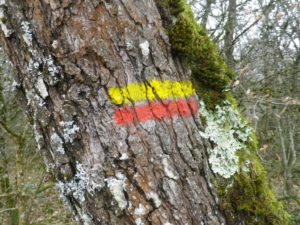
Marking: Two types, long distance and more local (red and white bars, or red and yellow bars, respectively), as well locational and directional signposts. (See featured photograph above)
Trail Description: A moderately challenging trail due to multiple inclines and descents, as well as narrow, steep and slippery trail surfaces in a few places, this trail has its rewards as well. The landscape is dramatic, quite rural and unspoiled, and affords unique and beautiful sights along the way. Going from woods to fields to vineyards to scrubland, the breadth and variety of flora and fauna on display is impressive, and worth a half-day hike.
Trailhead:
Bouzeron – R. Camille Sailly,
Parking:
Bouzeron – R. Camille Sailly
Valotte – Rest area parking at the foot of the village, just off D109
Public Transportation Options:
None observed!
Suggested Stages:
Trail Itinerary-Reference Points: (Clockwise)
Bouzeron: R. Camille Sailly; R. des Corcelles, right onto path just after the parking spots, small path through woods, then scrub to pass road to tower (En Varaut), through woods to cliffs/grottes to road below following GR 76 on a route called Agneux, through La Combotte forest, toward Nantoux; Nantoux: D219, through Nantoux, turn left at the church, through fields, then scrub, then forest; Bercully: around village, into forest (See comment); Chassey le Camp: following GR 76 again uphill through forest and fields/pastures above the village; Valotte: downhill through the hamlet, cross D109, uphill along vines and wall, past old washhouse ruins, uphill on a narrower, unimproved track; scenic outlook point, head (east) toward powerlines, then follow a narrow track downhill paralleling them, then turning under them; old washhouse; Bouzeron: R. de la Fontaine (and yet another washhouse) and D219, R. de la Mairie x R des Dames and R. des Dames x R des Corcelles
Representative Trail Photos:
Restrooms:
None observed
Attractions on or near Trail:
Just amazing geology and geography
Tasting along the Trail:
In Bouzeron and Valotte, there are a few wineries along, or not far from, the trail.
Alternative Options:
Hiking: Several trails, albeit not necessarily wine-themed one, including Grande Randonnee (GR) 76, are in the area.
Car: Route des Grands Vins, a 100-kilometer long car route passing through 40 wine-producing communes (including Bouzeron) in the Cote Chalonnaise area, beginning at Chagny, about 5 kilometers north of the hiking start point.
Additional Information:
Regional: https://www.achalon.com/decouverte/oenotourisme/la-route-des-grands-vins-de-la-cote-chalonnaise
Trail specific: https://www.visorando.com/randonnee-vigne-et-vallee/
Comments:
To shorten the trail about two kilometers, as I did, follow GR 76 to Chassey-le-Camp, skipping the hamlet of Bercully.
This trail is a Grande Randonnee de Pays (GRP) trail, that follows the red and yellow marking shown above. However, part of this trail overlaps with the Grande Randonnee (GR) 76 trail, and GR trails follow the red and white markings shown above. (That was from Bouzeron, to where the GRP trail headed to Bercully, and the GR trail headed to Chassey le Camp.)