Trail Name: Chemin des Grands Crus
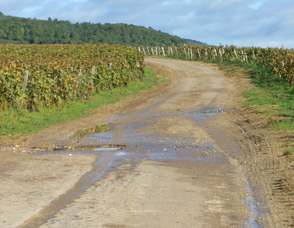
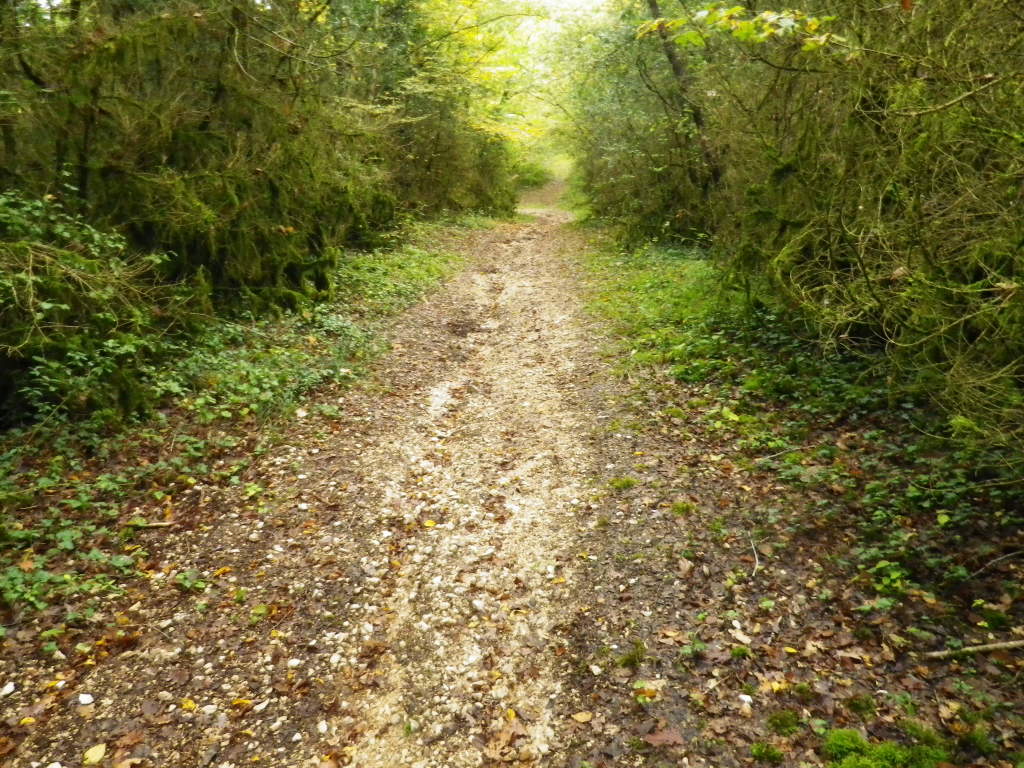
Trail Type: Long distance hiking trail, wine-themed; with a widely varying trail surface from paved road to grass track, somewhat maintained, and signposted or marked at many intersections, but not all.
Length:
- Total: 82 km/51 miles
- Segment (Northern half): roughly 34 km/22 miles (Chenove to Villars la Faye)
Convenient to: Dijon, Burgundy, France
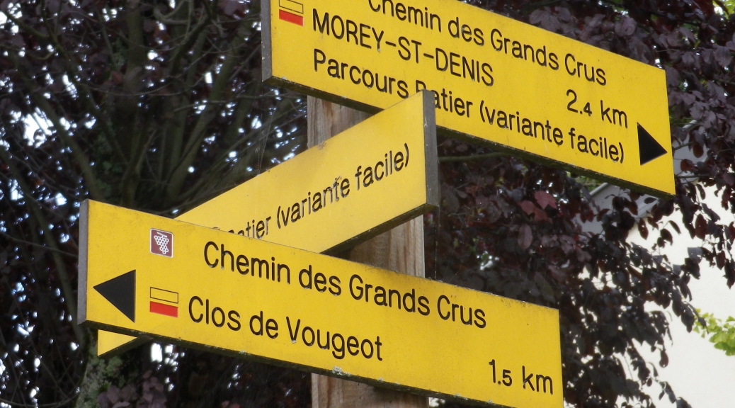
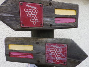
Marking: Red and yellow horizontal rectangles, white circles indicating grapes on red square background, or signs.
Trail Description: Often passing through vineyards, some of the most famous in the world, this occasionally challenging trail follows along the slopes of Burgundy’s Cote D’Or, sometimes over hill and dale, through the occasional forest, as well as through the occasional community. While some sections are flat and paved, other sections have steep inclines and rough surfaces.
Trailhead(s):
Chenove: Pressoir des Ducs de Bourgogne (Rue Roger Salengo)
Fixin: Parc Noisot (upper end of Rue de la Perriere)
Gevrey-Chambertin: Chemin de l’Argilliere
Clos de Vougeot
Nuits St Georges: Rue Saint Symphorien
Villers-la-Faye: Place de la Mairie
Parking Possibilities:
Chenove:
Rue Paul Bert: a few small parking areas at spots along the street, all the way up to the Maison du Plateau (follow signs for Centre de Loisirs), where there is a large parking lot.
Rue Jules Blaizet: small lot for about 16 vehicles, opposite the church. (Possibly crowded on Sundays)
Fixin: Large lot at Parc Noisot, at the end of Rue de la Perriere.
Gevrey-Chambertin:
Medium sized lot off Rue Gaston Roupnel (D122);
Large lot off Place du Monument;
Otherwise a few spaces just north of the Place du Chateau, along the street, directly on the trail.
Nuits-Saint-Georges: Medium sized lot on Rue Caumont Breon, by the cemetery. (Town center, by Place de Verdun, and Impasse Sainte Anne, has only paid and time limited parking during days from Monday to Saturday.)
Premeaux-Prissey: several spots along the trail at the town forest park off Chemin des Argillieres
Villers-la-Faye: Small lot along Route de Magny, by the intersection with Grande Rue
Public Transportation Options:
Bus: Buses marked Transco, in particular Buses marked 44, serve most of the villages along this trail, but primarily during school hours. Ask the helpful tourist offices in Gevrey-Chambertin and Nuits-Saint-Georges for advice.
Rail: Possible, but much less convenient for this section of the longer trail as the stations are often far from the trail, and trains do not serve many villages. See http://www.divia.fr/ for planning all greater Dijon public transportation routes.
Suggested Stages:
- Leisurely: Chenove to Gevrey-Chambertin, to Nuits Saint Georges, to Villars la Faye.
- Fast-paced: Chenove to Chambolle-Musigny to Villars la Faye.
Trail Itinerary-Reference Points:
Chenove: Pressiors des Ducs de Bourgogne (Rue Paul Bert x Rue Roger Salengo), Chemin du Bas du Clos du Roy, vineyards; Marsannay-la-Cote: Chemin des Longeroies-Chemin des Ouzeloy-Rue des Vignes Rue du Carre-Rue des Vignes; Couchy: Rue Jean XXIII; Fixey: Rue des Champs Perdrix-Rue de Docteur Laguesse-Rue des Hervelets; Fixin: Rue de la Perriere, Parc Noisot, woods; Gevrey-Chambertin: Chemin de l’Argilliere-Rue Yves de Poisey-Place-du Chateau-Rue de l’Eglise-Rue de Meixvelle-Rue de Curley, to picnic area along treeline on Mont Charmot, the Foret Communale); Morey-Saint-Denis: Rue aux Loups-Rue de la Montagne-Rue de la Bidaude; Chambolle-Musigny: woodland, Chemin du Pied du Four-Rue de Vergy, toward Clos de Vougeot; Clos de Vougeot; Vosne Romanee: VINEYARDS, Rue des Grands Crus-Rue de la Tache; Nuits-Saint-Georges: VINEYARDS, Rue St. Symphorien-Rue Caumont Breon-Rue de l’ Egalite-Rue de Chamois-Rue de l’Ermitage, Parcours de Sante panel, massive power lines (heard before seen), scenic outlook picnic spot (with parking), D8 (for 50 yards), vineyards; Premeaux-Prissey: town forest park, Chemin des Argillieres; Outside Comblanchien: Through forest, along a road, through tunnel, along a mining operation; Villars-la-Faye: Rue de Chaux, tree-covered hilltop, church and cemetery, Place de la Mairie (Rue de l’Ecole x Grande Rue)
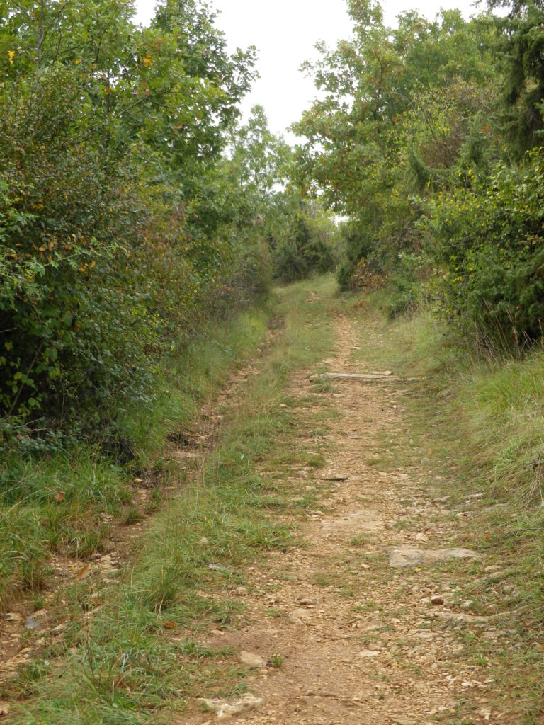
Representative Trail Photos:
Restrooms:
Chenove: Maison du Plateau (by parking, but a good half mile from trail)
Gevrey-Chambertin: Place du Monument
Nuits-Saint-Georges: Rue Sonoys, by Tourist Information Office
Attractions on or near Trail:
Chenove: Pressoirs des Ducs de Bourgogne, are the ancient wine presses made for the former Dukes of Burgundy. (Available for viewing only in the summer months, sadly.)
Fixin: Musee (Museum) Noisot: monument to and association with Napoleon explored.
Gevrey-Chambertin: attractive and lively village center.
Clos de Vougeot: open to the public for tours.
Nuits-Saint-Georges: lively town center; museum showcasing early (Roman) to medieval local archeological finds; L’Imaginarium, a large wine store and wine-related gift shop with very convenient hours. It also houses a museum with a sound and light program showcasing the old (and new) tools and techniques used in wine-making, as well as an exhibit on the region’s sparkling wines. The entry price for the museum includes tasting at the end of the visit. Additionally, there is an automated dispenser for various wines in the shop lobby.
Tasting along the Trail:
Many Domaines along the route, conveniently so in Fixin, Gevrey-Chambertin, Chambolle-Musigny and Vosne-Romanee, but most prefer appointments be made ahead of time. Wine bars may conveniently be found in Fixin, Gevrey-Chambertin, and Nuits-Saint-Georges.
Alternative Options:
Walking: The Tourism Office in Nuits-Saint-Georges has maps for circuit hikes ranging from 1 to 15 kilometers (9 miles), in and around the county. Several of them cover vineyards, in addition to other areas of interest. Any stage of this trail can be broken down further for less (or more) distance per day.
Running: The trail surface between Clos de Vougeot and Nuits-Saint-Georges is suited for street runners, whereas cross-country runners would find the surfaces and elevations between Fixin and Chambolle-Musigny particularly challenging.
Biking: Sections between Chenove and Fixin, and Clos de Vougeot and Nuits-Saint-Georges (completely car-free) could easily be biked.
Car: Route des Grands Crus, a wine-themed, mostly signposted car itinerary, covers most of the villages mentioned above.
Additional Information:
Regional: http://www.cotedor-tourisme.com/ , http://www.ot-nuits-st-georges.fr/ , http://www.ot-gevreychambertin.fr/
Trail (segment) specific: http://www.bouger-nature-en-bourgogne.com/chemin-des-grands-crus-1er-tronçon-de-dijon-à-villers-la-faye
Comments:
This is the definitive trail covering the Cote D’Or, starting with the vineyards just outside Chenove, from the Cote de Nuits continuing to Santenay in the Cote de Beaune region. This post covers the first, or northern segment, covering the Cote de Nuits, north to south. (Other references cite the official trail head as being in Dijon, at Esplanade des Marcs d’Or, for an additional 4 or 5 kilometers)
This is a wonderful trail for active Burgundy wine enthusiasts, as it gives ample opportunity to walk by some of the most famous “climats” (Burgundian for “terroir”) in the world: Romanee-Conti, Richebourg, Clos de Vougeot, Clos des Lambrays, etc.
There is just enough variety in terrain to keep this trail from being monotonous. In fact, some wooded sections might be a welcome challenge for some hikers.
Be prepared for changeable weather, and bring boots if hiking before or after periods of steady rain, as the trail will be puddle-covered or muddy in places.
Route markings south of Nuits-Saint-Georges can be hard to find sometimes (faded, or covered by overgrowth, or in unusual places), and the plotted GPS coordinates between Nuits-Saint-Georges to Villars-la-Faye were off by about 20 yards, making the trail challenging to follow sometimes, even with a navigator. But between them, and a map, the trail is track-able.