Trail Name: Tra Valli e Cascine (AKA Sentiero 732)
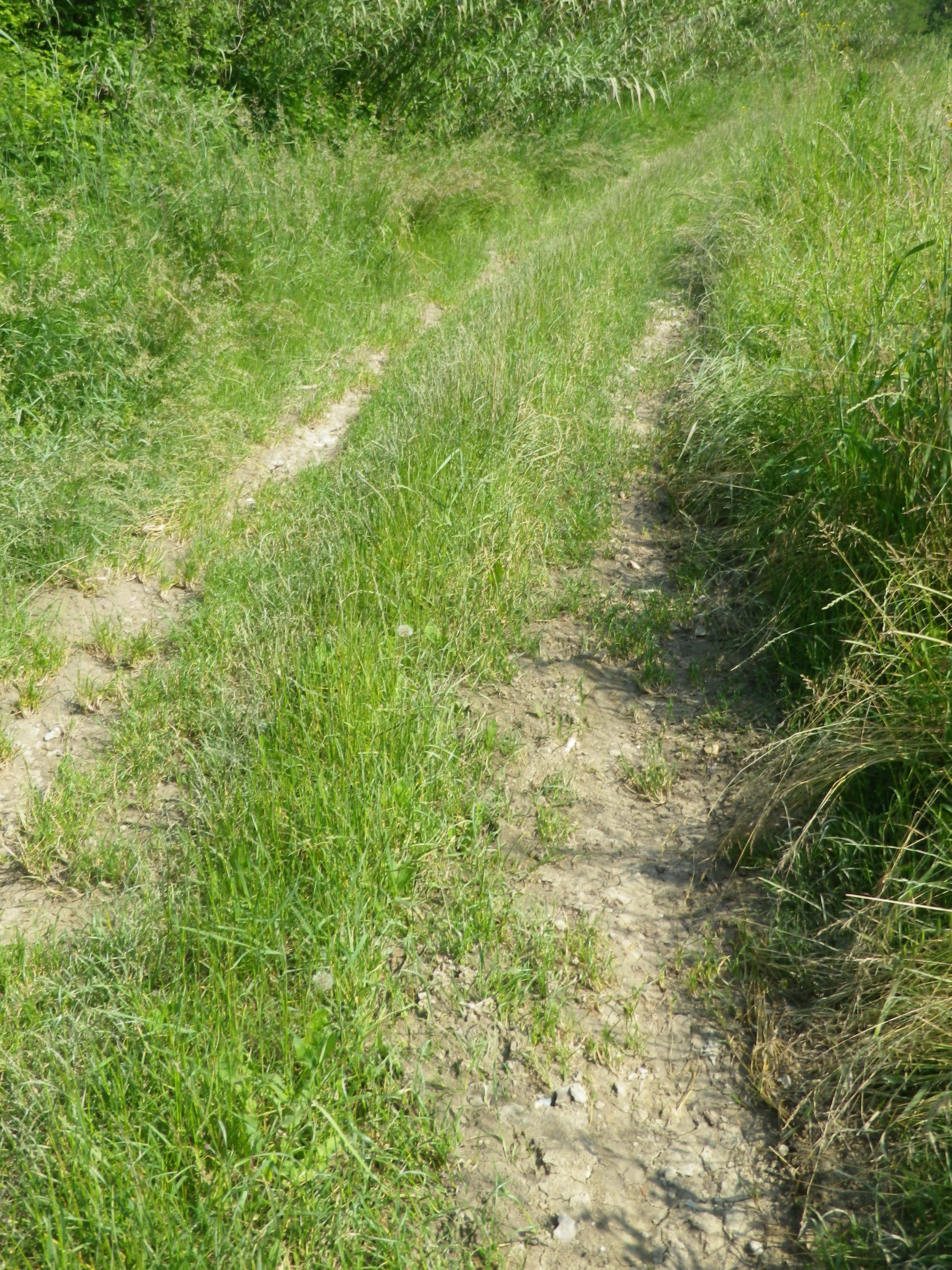
Trail Type: short-distance hiking circuit; marking on the trail is fairly good, and consistent; once out of town, the trail surface is mostly gravel over hard packed earth, with a grassy stretch for about two kilometers/a bit over a mile.
Length:
Total – 9.7 kilometers/6 miles
Convenient to: Casale Monferrato, Alessandria, Piedmont, Italy
Marking:
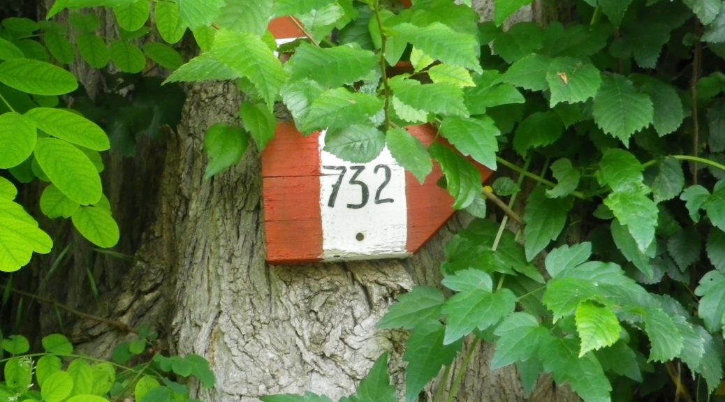
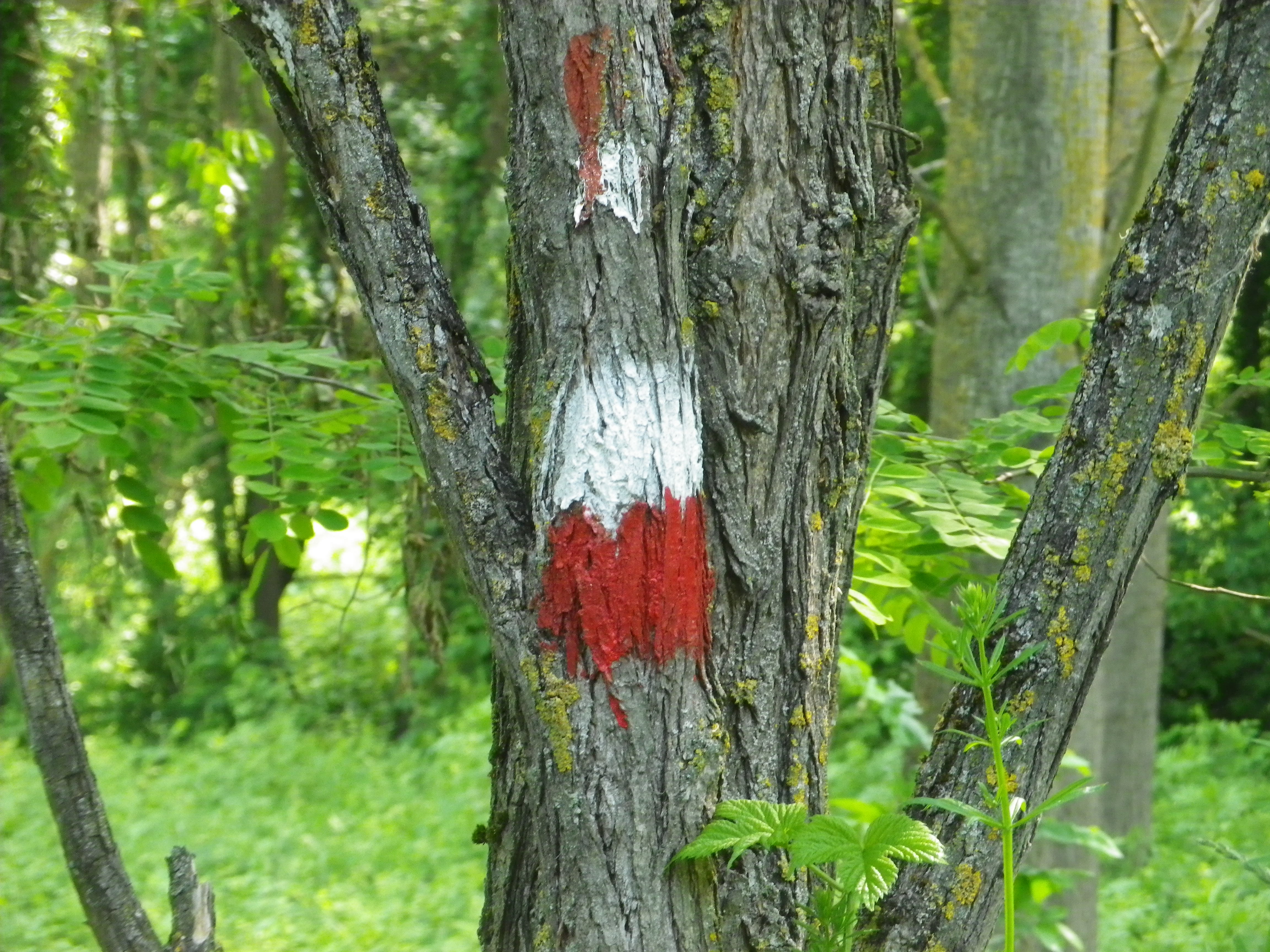
Trail signage: Vertical red-white-red bars imprinted with the number 732 in black; alternatively, trail markers are red and white horizontal bars.
Trail Signage photos: See featured photo above, and trail marking photo below:
Trail Description: An easy and pleasant hike starting in the picturesque hilltop village of Vignale Monferrato, this trail circles south and east of the village, over hills and through dales, along fields, vineyards and woodlands, in a quiet rural corner of this province.
Trailhead:
Vignale Monferrato: Piazza Del Popolo, on Via Roma, in front of the Callori Palace
Parking:
Vignale: Piazza Mezzadra, medium sized lot with no time limits (except market day); in Piazza del Popolo, in front of the Municipio (town hall); Piazza Federico Callori, in front of the San Bartolomeo Church
Public Transportation Options:
Rail: None
Bus: Not suggested
Suggested Stages: Not applicable
Trail Itinerary-Reference Points: (Counterclockwise)
Vignale Monferrato: V Roma, V Regina Elena/SP68, just before V. San Rocco (and just after the excellent B&B Anticoborgo) proceed down an incline and along the treeline, onto V Ca Intersegna and past the eponymous agriturismo and winery, to Strada Comunale Coste (aka V Ca Molino Vecchio), past the large old mill complex, path along pines and vines, V Ca Boschetto, toward Monfra Winery and agriturismo and once there turn left to continue uphill to Strada Ca San Siro; San Lorenzo: right onto SP72, turn onto V Ca Pomera, follow a path passing by the La Pomera Agriturismo, along woods edge to a T intersection, go left, follow this narrow valley floor back toward Vignale Monferrato; turn left at the T intersection to parallel SP68; Vignale Monferrato: continue toward/past the Cantina Sociale Vignale tower.
Representative Trail Photos:

Restrooms:
Vignale: Piazza Mezzadra, next to the cafe; and in Piazza Federico Callori, in the building at the lowest point of the square.
Attractions on or near Trail:
Vignale Monferrato: Palazzo Collori, home of the Enoteca Regionale del Monferrato, offers group wine tasting classes, upon reservation.
Tasting along the Trail:
Vignale Monferrato has several restaurants/taverns and bar-cafes selling local wines
On the trail, the Agriturismos Intersenga, and Monfra, will sell their own wines, when open
Alternative Options:
Hiking: Nearby Casorzo had a short circuit trail focused on the Malvasia grape. See the Nutshell here.
Biking:
This trail is also suitable for mountain or cross-country biking.
A trail named Colline degli Infernot, a moderately difficult 27 kilometer long cycle circuit from Vignale Monferrato, follows mostly on fairly well-travelled roads past the vineyards and fields of this area; https://www.piemontebike.eu/en/cycle-paths/le-colline-degli-infernot/6d255d8569c0b68ee1c673a6a94f7b46/
Additional Information:
Regional: http://www.monferrato.org/eng/
Trail specific: http://www.provincia.alessandria.gov.it/sentieri/index.php?whattodo=sentieri&file=singola&id=65
Comments:
In places during the late spring and early summer, the grass can become quite tall, and obscure the trail.