Trail Name: Le Loejele (part of the trail series “Circuits de Bacchus”)
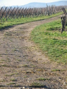
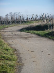
Trail Type: Medium distance circuit; partly paved, partly packed earthen trail surface; mostly well maintained; the route itself is marked very well.
Length: total: 14.6 kilometers/9 miles
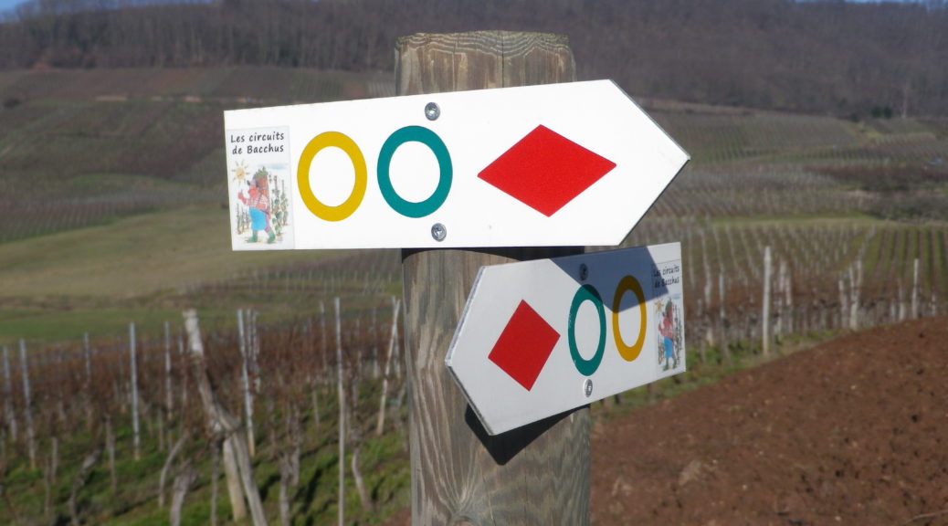
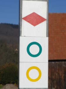
Marking: Trace of a ring in yellow, with a white interior
Trail Description: This relatively easy circuit is a circuit of the Circuits de Bacchus (Circuits of Bacchus) series in the northern part of the Alsatian vineyard area. The circuit crosses a valley twice, and ranges up and along ridgelines twice, offering nice views, and spectacular ones as it circles around the top of the Geierstein. It passes not only through vineyards and forests, but also through four villages, each with interesting historical and picturesque monuments.
Trailheads:
Wangen: D842 x R des Vignes
Westhoffen: R Nueve x R de l’Eglise
Balbronn: R de l’Eglise
Parking Possibilities:
Wangen: Salle des Fetes, R des Vignes
Balbronn: Place du Fronhof (at the upper end of R du Fronhof)
Westhoffen: R Nueve x R de l’Eglise
Public Transportation Options:
Bus: The CTBR, Compagnie des Transports du Bas-Rhin, (other keyword: Reseau 67), connects Strasbourg with Marlenheim (biggest town in this area), and then Bus 233 connects Marlenheim with Wangen and Westhoffen; or Bus 234 connecting Marlenheim and Balbronn.
Rail: None
Suggested Stages:
Trail Itinerary-Reference Points: (Clockwise)
Wangen: D842/R de Westhoffen, past cemetery, cross D142, Vineyard access road, Cross D220; Traenheim: Rue du Moulin-R. de Lieland-R. de Molsheim, vineyards, picnic area; Balbronn: Cross D654, R des Hirondelles-D75/Route de Westhoffen-R de l’Eglise, vineyards; Westhoffen: R de Buehlweg-R Nueve-R de l’Eglise-R de l’Eau, R Westerend-R des Vignes, vineyards to woods, past a hut on Geierberg; building and fields, along D75, then left on narrow vineyard access road, vineyards; Wangen: past a rest area, R des Lilas.
Representative Trail Photos:
Restrooms: None observed
Attractions on or near Trail:
Balbronn: Vestiges of Romanesque details in the Protestant church; and an old synagogue
Westhoffen: Remparts and St Martin Church, and another synagogue near the Mairie
Traenheim: A wonderfully preserved 18th century farm building (now housing a very good restaurant)
Wangen: Remnants of the old village walls and towers.
Tasting along the Trail:
Several family wineries, and the wine cooperative Cave du Roi Dagobert
Alternative Options:
Hiking: This stage is incorporated in part in the full, (circa) 35-kilometer circuit, which can be hiked over a couple of days.
Biking: Part of this circuit crosses the Veloroute du Vignoble d’Alsace, which starts in Marlenheim, a couple kilometers east of Wangen.
Car: Route des Vin d’Alsace, over 170 kilometers/105 miles of car route passing through some of the most famous wine villages.
Additional Information:
Regional: http://www.tourisme67.com/en/
Trail (segment) specific: For this smaller circuit see http://www.lescircuitsdebacchus-alsace.com/circuit/circuit-loejele.htm. For the entire circuit, or other smaller circuits, see http://www.lescircuitsdebacchus-alsace.com/circuit/circuit-grande-boucle.htm
Comments:
This is one of four medium distance circuits. Each shares a border with another (Hence in the photograph above, the yellow ring indicates the Loejele circuit and a green ring indicates the Riewerle circuit). Combined, the four make a large fifth circuit, which would take two days to complete.