Trail Name: Sur les Pas de Gambert
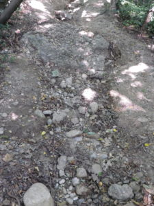
Trail Type: Short distance circuit; surfaces vary from paved to rutted dirt to pebble on stone, mostly maintained, and fairly well marked.
Length: 4 kilometers/ 2.5 miles
Convenient to: Vienne or Lyon, France
Marking:
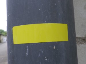
Yellow rectangles indicating direction of travel
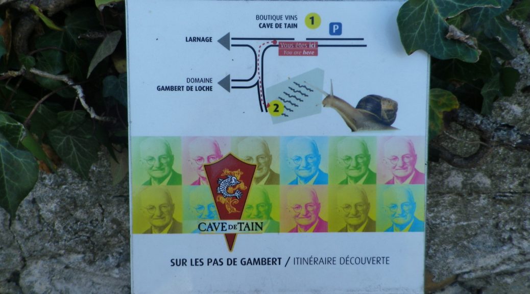
White panels, with a large black colored number, QR code and photo collage of Louis Gambert
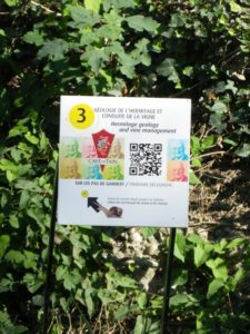
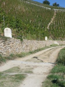
Trail Description: This well-laid out trail celebrates the work of Louis Gambert de Loche, who founded the Cave de Tain, and worked tirelessly to help the Appellation Hermitage Controlee wines gain (some would say regain) international renown. It is a mostly easy educational trail with 11 educational panels. As the trail ascends and descends the hills behind Tain, it passes along or through the famous vineyards, and provides awesome views of the Rhone River Valley as well as the mountains of the Drome and the Ardeche in the distance.
Trailhead: Cave de Tain, Route de Larnage, Tain-l’Hermitage
Parking: (Tain)
Two small parking lots by the Train station, at the end of Avenue Paul Durand
A large parking lot, Rue du Bois de l’Europe (cars/low mini-vans only)
A medium-sized lot, R de la Ciboise – Note the time restrictions though!
Public Transportation Options:
Bus: Local bus information may be found at https://www.ecovoiturage0726.covoitoura.eu/
Rail: SNCF services Tain as part of its Lyon-Avignon route
Suggested Stages:
Trail Itinerary-Reference Points: (Counterclockwise)
Tain: Chemin de l’Hermitage- Route de Larnage/D241, past the Cave de Tain, follow road to the left (at Sign “1”), continue straight where D241 turns right, enter vineyards, drop down slightly to the right (at Sign “3”) then enter woods and continue uphill, slight turn left at vineyards and continue onto road, Chemin des Grandes Vignes, at intersection by Sign Post L’Hermite, take left-most road, Chemin de la Chapelle, following “Tain-l’Hermitage 1.4 km”, Through vineyards, (optional: take fork right, out and back, past Signs 8 and 9, to the famous chapel), take turn right shortly after starting downhill (onto a rutted and rough trail surface), Sign “10”, rejoin hard-pack trail at a gated house property in the vineyards to R. de l’Hermitage, back to start.
Representative Trail Photos:
Restrooms: None observed
Attractions on or near Trail:
Cave de Tain offers winery visits, tastings, guided walks, and various special events throughout the year
Cite du Chocolat Valrhona: Avenue du President Roosevelt, 12, a multi-sensory experience showing how Valrhona chocolates are created and produced; also includes a shop and restaurant featuring chocolate!
Tournon: old town on the Rhone that still preserves some of its walls and towers.
Tasting along the Trail:
Cave de Tain l’Hermitage: Route de Larnage
Maison Chapoutier: Avenue Dr. Paul Durand, 18
Vineum Jaboulet: Ave Jean Jaures
Alternative Options:
Car: Route des Vins des Cotes du Rhone, the northern section called “Vignobles Septentrionaux”
Additional Information:
Regional: http://www.ville-tain.fr/
Trail (segment) specific: http://www.explore-hermitage.com/content/attention/
Comments:
To take advantage of the educational aspects of the trail, you will need a mobile device with a QR code reader app. Otherwise, the Cave de Tain may have a hard-copy pamphlet and schematic of the location and information on the panels.
Standard French trail signage can be hard to spot in some places on this trail.
The iconic chapel is not on the trail, but a slight detour, out and back, which adds about 1 kilometer/.6 miles to the hike, is worth the extensive views and memories.