Trail Name: Sentiero del Malvasia
Trail Type:
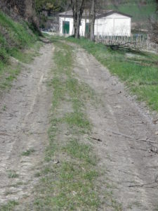
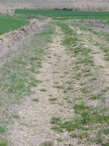
Mid-distance; paved in the urban area, dirt, loam or grass in other parts; somewhat maintained, but the route itself is not well marked.
Length: Total – 10 kilometers/ 6 miles
Convenient to: Asti, or Casale Monferrato, Italy
Marking:
Rectangular sign with red and white stripes overwritten “2” (or not)
Trail Description:
Winding over gentle hill and dale, this trail follows lanes, or rough traces through open countryside, (hence no shade anywhere), with wide ranging views from the hilltops.
Trailhead: Casorzo: Cantina Sociale (V. S. Ludovico)
Parking:
V. Giuseppe Mazzini/SP 38 x V della Vittoria/SP 38, large lot
Public Transportation Options:
Bus: ARFEA Autolinee company services Casorzo, and other towns and villages nearby. The stop is right on the trail at V. Giuseppe Mazzini x SP 38
Rail: Closest rail service is to Casale Monferrato, or Asti.
Suggested Stages: Not applicable
Trail Itinerary-Reference Points: (Clockwise)
Casorzo: V. Giuseppe Mazzini/Cantina Sociale di Casorzo; at fork in vineyards, go uphill, Cascina Gara; across fields and into treeline, bearing uphill to 3 trees and a flat metal sculpture of grapes, then SP38/Arrivederci sign, take track (not driveway) to C. Nova/Azienda Faunistico; stay left at T – then right at the 4-way intersection; passes below cemetery; right track through vineyards, then past a large rusted sign for Campo sportive; Casorzo: V. IV Novembre, V. Cottolengo to the Church of San Vincenzo, retrace steps to V. Giuseppe Mazzini, Cantina Sociale di Casorzo.
Representative Trail Photos:
Restrooms:
Casrzo: At the bus stop/parking lot, V. Giuseppe Mazzini x SP 38!
Attractions on or near Trail: Lots of vineyards, fields and nature!
Tasting along the Trail:
Casorzo: Cantina Sociale di Casorzo
Alternative Options: None observed
Additional Information:
Regional: http://www.monferrato.org/eng/
Trail (segment) specific: http://www.parcocrea.it/camminare/002.pdf
Comments:
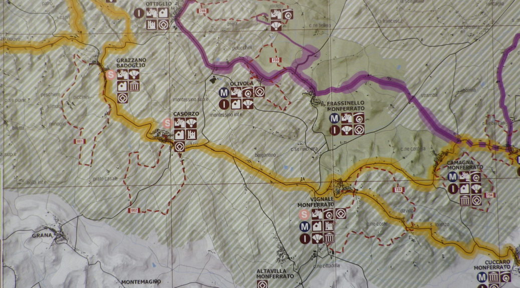
A detailed map or navigation device is necessary because of no marking in places. But due to the openness of the terrain, the major landmarks of Casorzo are within sight (once on top of a hill).
For additional information on nearby trails (hiking and cycling), see here
Plan ahead. This is a rural, agricultural area, so lunch time shop closures are not unusual, and dining opportunities are limited.