Trail Name: Ortenauer Weinpfad
Trail Type: Long distance; almost exclusively paved or hard-packed earth, well maintained, mostly very well-marked, (but bring a map anyway).
Length:
Total: 101 kilometers/ 62.75 miles
Northern half: approximately 51 kilometers/31.7 miles
Convenient to: Baden-Baden and Offenburg, Germany
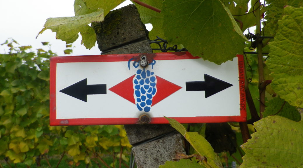
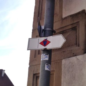
Marking: Blue grapes on a red diamond on a white background
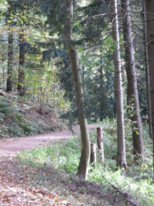
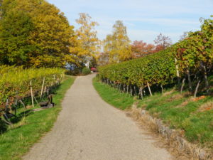
Trail Description: This is a long distance multi-stage trail that usually follows along the higher elevations of the vineyards in the Ortenau wine region. It just as often passes through forests, thus providing cool shade, and quiet moments in the beautiful Black Forest. It drops down hillsides to pass through villages on occasion, making it easy (with some planning) to hike this trail using public transportation.
Trailheads:
Start: Gernsbach, Altes Rathaus
(Mid-point is around Sasbachwalden)
End: Diersburg, Rathaus
Parking: (Northern part of the trail only)
Gernsbach: Train Station, (Gottlieb Klumpp Strasse); Faerbertorstrasse parking lot, some restrictions
Baden-Baden: Beuttenmuellerstr, off street lot with about 8-10 spaces. Otherwise, many paid parking garages in town center
Buehlertal: Friedhof (cemetery), Buehlertalstr, overflow parking lot is the best bet. Options in town mostly have time limits
Varnhalt: Nellenbergstr, at the very top, by the rest area, a dozen spots
Burg Alt-Windeck: large, but popular lot outside the castle grounds
Neusatz: Sportplatz parking area (end of Otto-Stemmler-Strasse); Im Schlosswinkel, spots for cars
Sasbachwalden: Kirchstrasse, several spots between the church and community building (Gemeindeverwaltung)
Kappelrodeck: Jahnstr, 2 lots: one next to, one opposite Acherntal Halle; Waldulm, lot off Weinstr, by the sports stadium
Public Transportation Options: (Northern part of the trail only)
Bus: Bus lines include the Baden-Baden Linie, and the Citylinie Buehl, as well as the Ortenaulinie (TGO, Tarifverbund Ortenau) further south
Rail: In addition to Deutsche Bahn regional trains, the Karlsruher Verkehrsverband (kvv.de) commuter trains (S-4) run from Karlsruhe through Baden-Baden as far south as Buehl. S-31 runs to Gernsbach (the northern trailhead)
Suggested Stages: (All-Official)
Gernsbach – Baden-Baden: 14.5 km
Baden-Baden – Neusatz: 23 km
Neusatz – Kappelrodeck: 11.5 km
Kappelrodeck – Oberkirch: 11.5 km
Oberkirch – Offenburg/Zell: 14 km
Offenburg/Zell – Gengenbach: 18 km
Gengenbach – Diersburg: 10.5 km
Trail Itinerary-Reference Points: (Northern part of the trail only)
Gernsbach: Altes Rathaus-Schlossstr, woods, Schloss Eberstein, woods, Restaurant and Hotel Nachtigal/Badenerstr/L78; Honiggrabenbrunnen; Drei Eiche Hutte; Wildgehege (Wild animal enclosure); Eckhoefe; Eckberg Chapel; Baden-Baden: Tony Marshall Weg-Falkenhaldeweg-lichtentalerstr-Falkenstr, Maria-Victoria-Strasse-Lichtentaler Allee,Trinkhalle, Solmstr, Stourdza Chapel, Waldsee, Fremersbergstr-Golf course, woods, Gruenbachtal, Varnhalt: Nellenberg Hutte, Josefskapelle, Kastanienhalde, vineyards; Neuweier: Bockbeutelstr, Sankt Michel-Str, Weinstr-Losenbergstr-Heiligensteinstr, vineyards; Altschweier: Ruschbergstr, vineyards; Buhlertal: La Sallette memorial, Sternenberg-Sessgasse, past church, Klotzberg-underpass, Hauptstr/L83-Klotzberg-Matthaeuserstr, Klotzberg, vineyards, woods, Burg Windeck; Neusatz: Sportplatz, Otto Stemmler Str, Rathaus (on Schwarzwaldstr), Bitterstweg-Gerbersbergstrasse; Lauf-Matzenhof: Laufbachstr-Neuwindeckstr, Neuwindeck Castle, Lochhof-Grimmes; Vineyards; Sasbachwalden: Am Werth, Im Winkel, Auf der Eck; Vineyards and woods; Kappelrodeck: Klaus-Venedig;
Representative Trail Photos:
Restrooms: (Northern part of the trail only)
Gernsbach: Faerbertorstrasse parking lot
Baden-Baden: Augustaplatz, Trinkhalle (small fee)
Varnhalt: Nellele Rest Area in the woods
Sasbachwalden: Kirchstrasse, community building (Gemeindeverwaltung)
Kappelrodeck: Rathaus, Hauptstr (by the garage)
Attractions on or near Trail: (Northern part of the trail only)
Baden-Baden: Art museums: Museum of 19th Century Art, Staatliche Kunsthalle, and Frieder Burda; Casino; and Roman bath ruins
Tasting along the Trail: (Northern part of the trail only)
In addition to many small family run wineries, the following are on or less than 500 meters from the trail:
Gernsbach: Weingut Iselin in the Altes Rathaus
Baden-Baden (outskirts): Weinstube Eckberg
Sasbachwalden: Alde Gott, known for its brandies as well
Kappelrodeck: Hex vom Dasenstein
Alternative Options:
Hiking: A short circuit following part of this trail is the 6-mile-long Alde Gott Panoramaweg
Cycling: A medium distance cycling circuit through Sasbachwalden, Kappelrodeck and Oberkirch, the Weinsagen Tour
Car: Badische Weinstrasse, a 200 kilometer/124-mile car route for wine enthusiasts, begins in Baden-Baden and ends at Weil Am Rhein (on the Swiss border). It roughly follows Highway 3 from north to south.
Additional Information:
Regional: http://www.ortenau-tourismus.de/ and http://www.baden-baden.de/en/tourist-information/
Trail (segment) specific: http://www.schwarzwald-tourismus.info/Media/Touren/Ortenauer-Weinpfad
Comment:
My stages 2 and 3 were slightly different: Baden-Baden to Buehlertal (about 16 km), Buehlertal to Kappelrodeck (about 18 km).