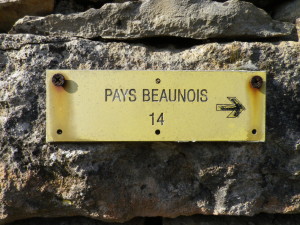
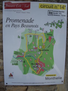
Trail Name: Promenade en Pays Beaunois Circuit 14, Monthelie; aka Sentier des Buis. (“PR n 14” is seen also on signs)
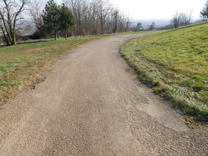
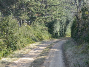
Trail Type: mid-distance circuit; surfaces vary from asphalt, to hard-packed earth, to rough trails; the route is fairly well-marked, but a map is definitely handy.
Length: total: 12 kilometers/7.5 miles
Convenient to: Beaune, France
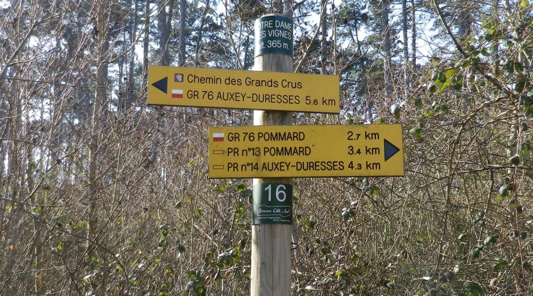
Marking: Small yellow rectangular signs “Pays Beaunois 14”, then painted rectangles or arrows (on a variety of surfaces (rocks, trees, posts) indicating the direction to follow. Signs, as in the featured image above, also indicate a specific location and direction to continue.
Trail Description: An easy trail up and along the gentle hills behind Meursault. This trail passes through the town of Meursault, the villages of Monthelie and Auxey-Duresses; as well as through forests, fields and vineyards, affording magnificent views of the southern Cote de Beaune wine-producing villages.
Trailhead:
Official: Monthelie, Grande Rue
Mine: Meursault, Place de l’Hotel de Ville
Parking Possibilities:
Meursault: R. de Citeaux, large parking lot
Auxey-Duresses: R. de la Mairie, by the church. (Spaces are scarce during church services.)
Public Transportation Options:
Rail: Meursault is serviced by SNCF TER (Trains Regionaux) trains, from Beaune and Dijon. Check http://www.sncf.com/fr/trains/ter
Bus: “Beaune Cote et Sud” Ligne 20, links Monthelie, Auxey-Duresses and Meursault, daytimes, during the school year only.
Suggested Stages: Not applicable
Trail Itinerary-Reference Points: (counterclockwise)
Meursault: Place de l’Hotel de Ville, Place du Murger, R. du 11 Novembre, Route de Volnay; Monthelie; R. de Beaune-R. du Chateau Gaillard-Grand Rue-R. du Chagnot; Les Creaux des Caves, Notre Dame des Vignes, Puits des Chaux; large, elevated field; (see photos); Auxey-Duresses: R. du Val-D973/Route de Beaune, Rue du Meix-R. des Autets; vineyards; Meursault: Chaumes des Narvaux, R. du Clos de Mazeray-R. des Ecoles.
Representative Trail Photos:
Restrooms: No public facilities observed
Attractions on or near Trail:
Meursault: Tour through the old caves beneath the Chateau de Meursault
Tasting along the Trail:
Many options exist, but the most flexible visiting/tasting hours are found in the Chateau above, at Auxey-Duresses vintners Prunier, and in wine-bars/cafes in Meursault.
Alternative Options:
Walking: Meursault-Blagny circuit is smaller (7 kilometer), and entirely in the countryside.
Hiking: Promenade en Pays Beaunois Circuit 16, Auxey-Duresses
Biking: Voie des Vignes, a 23 kilometer bike trail from Santenay north to Beaune, (passing through Meursault), is an easy ride, mostly on dedicated bike trail.
Car: Route des Grands Crus
Additional Information:
Regional: http://www.beaune-tourism.com/
Trail Specific:
Comments:
Maps and further information on this circuit (and Circuit 16, mentioned above), must be purchased from local tourism offices. (See the photo above for a bit more of a visual on the route.) But, this trail follows part of the GR 76 trail, and part of the southern section of the Chemin des Grands Crus trail (For details on the northern section see http://www.winecountrywandering.com/trail-of-the-grands-crus-trail-in-a-nutshell/), for which free downloads are available.