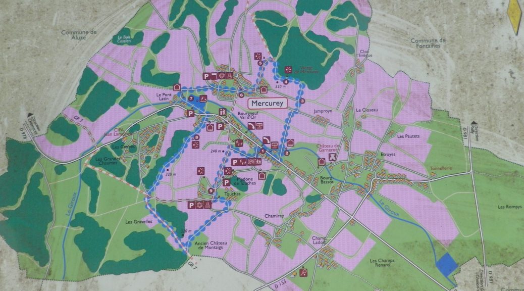
Trail Name: Mercurey; AKA: Circuit des Vignes (Circuit of the Vignes), Petite Boucle de Mercurey (Small Circuit of Mercurey), and M1 (on signs)
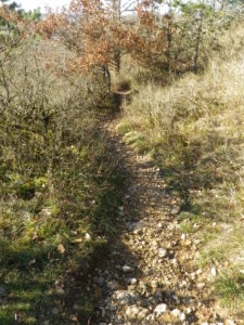
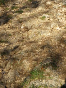
Trail Type: Short distance circuit through various landscapes, but half of it vineyards; fairly well-maintained with a variety of surfaces, including some naturally rough (rock) surfaces in places; some climbing; marking on the trail very good overall.
Length:
Total – 7.75 kilometers/4.8 miles
Convenient to: Chalon sur Saone, or Macon, France
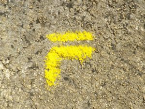
Marking: Yellow lines; as well as posts indicating positional and directional references
Trail Description: A short circuit through the villages of Mercurey and Touches, highlighting attractions of this small appellation. This mostly easy trail gently climbs or descends a few times through vineyards and forests, past historic buildings and monuments, and begins and ends in the center of Mercurey. It is a fantastic introduction to the land of this AOC.
Trailhead:
Mercurey: Mairie, off the Grande Rue/D978
Parking:
Mercurey: Mairie, off the Grande Rue/D978, by the soccer field; along R. des Jamproyes, by the pond
Touches: Rue du Caudroyes
Public Transportation Options:
Rail: Closest rail service (SCNF) is in Chalon sur Saone, about 14 kilometers distant.
Bus: The Buscephale transportation company serves the Department of Saone et Loire, with a bus line running from Chalon sur Saone to Autun, stopping twice a day at Mercurey.
Suggested Stages: Not applicable
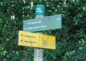
Trail Itinerary-Reference Points: (Counterclockwise)
Mercurey: R. des Byots, turn right to briefly follow R. des Jamproyes, take trail to the left up through vineyards toward the point marked Croix de Chaumeu (a stone cross marks the point), continue uphill to the point Vierge de Mercurey (Statue of the Virgin), continue uphill, then downhill to panel 5; R. du Reu, R. des Jamproyes, R. du Pont Latin, past pond and old laundry wash hut (Point Lavoir du Pont Latin) along Chemin de l’Etang, cross and briefly follow Grande Rue/D978, Rue/Place de la Croix Rousse, woods, toward point Pas de Cible, follow GR7 toward point Chateau Montaigu, turn downhill through vines and past old castle walls, apss along Le Meix Foulot-R. du Clos du Roy; Touches: past the church of St Symphorien, R. de Touches, vineyards, R. de Touche, Grand Rue.
Representative Trail Photos:
Restrooms:
None observed
Attractions on or near Trail:
Explanation panels are on parts of the trail, providing details on not only the wines of Mercurey, but also its other flora and fauna, its geology, and its history.
Tasting along the Trail:
Mercurey and Touches have more than a dozen wineries. Those directly on the trail include the Wineries Raquillet, Chamerose, Le Meix Foulot, Domaine Suremain, and Domaine Michel Juillot.
Alternative Options:
Car: Route des Grands Vins, a 100-kilometer long car route passing through 40 wine-producing communes (including Mercurey) in the Cote Chalonnaise area, beginning at Chagny, about 15 kilometers north of the hiking start point.
Additional Information:
Regional: https://www.achalon.com/decouverte/oenotourisme/la-route-des-grands-vins-de-la-cote-chalonnaise
Trail specific:
http://www.mercurey.fr/les-sentiers-de-randonnee
Comments:
In places, this trail passes along rock surfaces, both even and uneven, so good hiking shoes are recommended.
This trail would provide some shade in the summer.