Trail Name: Itinerari Tra I Vigneti 3
Trail Type: medium distance circuit; mostly paved, some path, mostly well maintained, and marked in some places.
Length: total – 16.8 kilometers/10.45 miles
Convenient to: Chiasso or Lugano, Switzerland; or Varese or Como, Italy
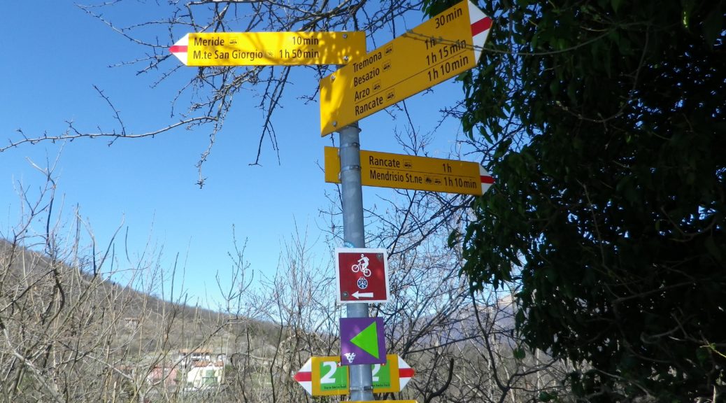
Marking: Purple stylized grapes on a light background. (May be seen in conjunction with white stylized grapes on a purple background – the marking for mountain bikes.)
Trail Description: This is a medium distance circuit that explores the village vineyards west of Mendrisio. While one spot requires some effort and dexterity, it mostly meanders gently up and down the hillsides, through forest, meadows and a couple of villages, before returning to the largest of them, Rancate.
Trailhead: Rancate, Via Grazioso Rusca, near the church
Parking Possibilities:
Rancate: Large lot off Via ai Grotti (some spots reserved)
Clivio: Spots along Via Trentini (but some time limitations)
Meride: A large unimproved lot off V. al Tiro
San Pietro: Some spots along Via Dogana, east and west of the intersection with V. Viriana
Public Transportation Options:
Bus: Bus 513 has a Chiasso-Mendrisio run, which takes about 30 minutes. Then take AutoPostale Bus 524 to Rancate (10 minutes). This bus also passes through Arzo and Meride, if you need to shorten your hike.
Rail: S10 (Lugano-Paradiso – Mendrisio – Chiasso) about 20 minutes, then Bus 524 to Rancate (10 minutes).
Suggested Stages: Not applicable
Trail Itinerary-Reference Points (counterclockwise):
Rancate: V. Grazioso Rusca-V. Giuseppe Belloni-V. Barozzo; Besazio: V. Besazio, V. alla Cava; Tremona: V. al Ronco, V. Antonio Rinaldi, church, V. ai Grotti; Meride: V. ai Grotti, Alle Cantine or V. al Tiro-V. Cave di Marmo (road to Gaggiolo, Arzo); Arzo: V. al Federale; path; Clivio: V. Ca’ Bella (Cabella on Google maps)-V. G. Verdi-V. Monte Generoso (border crossing); San Pietro: V. Dogana; fields, V. Ronchi-V. Montalbano-V. Campagnola-V.Dogana x V. Lucilla-V. Peritt, approach but don’t cross border, across fields; Ligornetto: V. Cantinetta, across fields to V. Boscaccio; Rancate: V. Barozzo-V. G. Belloni, downhill to start point.
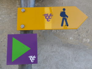
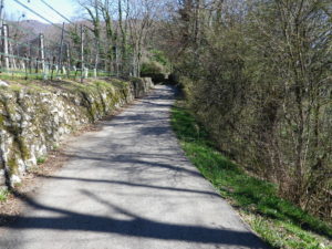
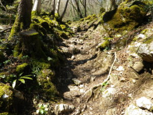
Representative Trail Photos:
Restrooms: None observed
Attractions on or near Trail:
Meride: Museo di Fossili del Monte San Giorgio – museum of marine fossils (and recreations of the animals they once were), found near this mountain village. A visit gives insight into the ancient geology of the region’s terroir.
Stabio: Museo della Civilta Contadina, with exhibits of agricultural (and viticultural) tools and practices in the Ticino.
Tasting along the Trail:
Meride: A local vintner’s winery is just off the trail
Clivio: A wine bar is on the trail
San Pietro/Stabio: A winery is on the trail, but slightly off the trail are additional wineries, and the local cooperative is a bit further away, on the main road to Mendrisio.
Alternative Options:
Walking: For a shorter trail, albeit through a different area a few kilometers away, try Itinerari Tra I Vigneti 1 (See Nutshell)
Running: With the exception of the rough terrain by the old quarries, this entire route is suitable for running.
Biking: This trail is also in large part a mountain bike trail. The hiking and biking trails do diverge in some places, but otherwise cover much the same territory.
Additional Information:
Regional: http://www.mendrisiottoturismo.ch/en/discover-the-region.html
Trail (segment) specific: http://www.mendrisiottoturismo.ch/it/esplora/attivita/itinerary/itineraries/details/Itinerari-tra-i-vigneti-del-Mendrisiotto—3/138307.html
Comments:
Remember to bring your passport during the hike, as the trail leads literally through a manned border patrol station.