Trail Name: German Wine Route Hiking Trail/Wanderweg Deutsche Weinstrasse
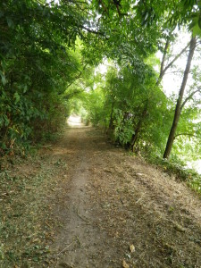
Trail Type: Long distance hiking trail; pavement or hard-packed trail surface throughout, well maintained, and fairly well-marked.
Length:
Total: 96 km/60 miles of the complete trail
First segment of the Mittelhaardt district: 18.5 km/11.5 miles
Second segment of the Mittelhaardt district: 24 km/15 miles
Convenient to: Ludwigshafen, Rheinland-Pfalz, Germany
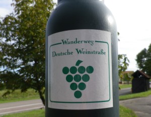
Marking: Marking: Green grape cluster on white background
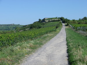
Trail Description: A classic wine trail offering many different terrains: cityscape, villas, villages, forest, and vineyards, it begins in Neustadt with steps and an incline, but becomes an easy, almost level stroll once up to Haardt and until Bad Duerkheim, where steep inclines seem to predominate until almost the end of the trail.
Trailheads:
Neustadt an der Weinstrasse: Strohmarkt (by the steps)
Bad Duerkheim: Tourist office, Festplatz, or the Duerkheimer Cask (Riesenfass)
Bockenheim an der Weinstrasse: Haus der Deutschen Weinstrasse
Parking Possibilities:
Neustadt: Parking lot at Festplatzstrasse/Wiesenstrasse, over 1 km from the start point, but free and no time limits.
Bad Duerkheim: Festplatz, off Grosse Allee, free and no limits
Bockenheim: large parking lot opposite the Haus der Deutschen Wein
Note: These are areas for fests tents and rides, so not available during fest times (September and October, check for specific dates)
Public Transportation Options:
Bus: No direct buses between Bad Duerkheim and Bockenheim.
Rail: No direct connections between Bad Duerkheim and Bockenheim. Transfer at Gruenstadt. See Deutsche Bahn link here
Suggested Stages: Not applicable. If you must shorten the hike, consider stopping at Gruenstadt for the best public transportation connections and multiple lodging options.
Trail Itinerary-Reference Points:
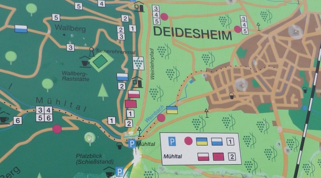
Neustadt: Strohmarkt/Neustadt-Haardter Treppenweg; Haardt: Haardter Winzer, Mandelring, (Weingut Mueller Catoir), (Guenther Mattern); Gimmeldingen, Landhaus Rebenmeer, Furstenweg; Konigsbach: Erika-Koeth Str; Konigsbach; Forest, Pfalzblick Gasthaus; Deidesheim: Forest and vineyards; Wachenheim: Am Hauenstein, Bornweg; Bad Duerkheim: Schenkenbuehlstr, Amtsplatz, Sankt Michaels Allee, Festplatz; Bad Duerkheim: Sankt Michaels Allee-Sachsenmutterstr, intersection L517/K3; Leistadt: Hauptstrasse, Rathaus; Weisenheim am Berg: Neuweg-Waldstr; Bobenheim am Berg: Bergpfad-Jahnstr; fields and vineyards; Neuleiningen: cross Talstr into woods and fields opposite, Mittelgasse-Obergasse-Berghohl, under A6, past signal station, vineyards; Gruenstadt: (outskirts) Ebertsheimerweg x Am Mertesheimer Weg; woods, vineyards, fields, over the Eisbach (stream) and cross L395 into more vineyards; Asselheim: (outskirts) Ziegelhutte x Langgasse, cemetery; more vineyards; Bockenheim: Raiffeisenstr x Am Muehlweg, path to Weinstrasse/B271.
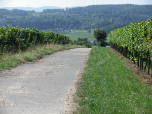
Representative Trail Photo:
Restrooms:
Neustadt: On Klemmhof, directly off the Hauptstrasse
Bad Duerkheim: Near Riesenfass, on a small footway southeast of it, between Sankt Michaels Allee and Kurbrunnenstrasse.
Bockenheim: On a path a few yards northwest of the Haus der Deutschen Weinstrasse, a little, free-standing building.
Attractions on or near Trail:
Some wineries (right along the trail, especially in Haardt and Gimmeldingen) for wine enthusiasts, but additionally:
Neustadt: historic center
Wachenheim: Wachtenburg castle, with café/restaurant, reduced opening times in winter
Bad Duerkheim: Kurpark, Riesenfass (Giant wine barrel with a gasthaus inside) on Festplatz
Neuleiningen: Castle, picnic area in scenic overlook, wineries on main street
Weinstube Zur Herberge: oldest in Neustadt, in historic center//Haardt: Mueller Catoir (directly on the trail) //Bad Duerkheim: Weinstube Michaelishof and the WeinDom (both on the trail). Additionally, many gasthaus are along the trail, and offer food and water as well.
Alternative Options:
Walking: Any stage can be broken down further for less (or more) distance per day.
Biking: Deutsche Weinstrasse Radweg (German Wine Route Bike Trail)
Car: Deutsche Weinstrasse (German Wine Route), passes through the centers of the main towns, and many villages.
Additional Information:
Regional:
http://www.deutsche-weinstrasse.de/de/die-pfalz-entdecken/deutsche-weinstrasse/
Trail (segment) specific:
http://alpregio.outdooractive.com/ar-dt-weinstrasse/de/alpregio.jsp#i=514580716139202714&tab=TourTab
http://www.deutsche-weinstrasse.de/de/die-pfalz-entdecken/deutsche-weinstrasse/
Comments:
The links to specifics on the hiking trails are only in German.
The hill profile for the trail indicates it might be easier heading north to south.
Read about the first half of the hike along the German Wine Route Hiking Trail in the Suedliche Weinstrasse Wine District. Click here get an overview of the entire trail.