Trail Name: Entre Vignes et Cadoles (au Depart des Riceys)
Trail Type:
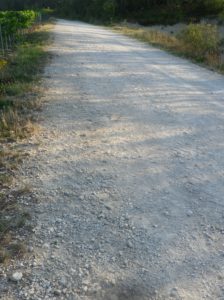
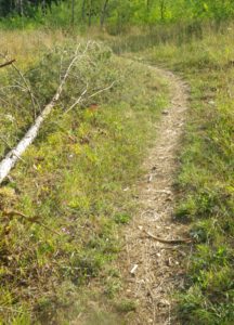
A short-distance circuit; mostly well-maintained and with mostly hard surfaces (hard packed or paved), marking on the trail only occasional.
Length:
Total – 6.6 kilometers/4 miles
Convenient to: Troyes, France
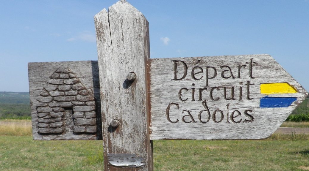
Marking:
Yellow horizontal bars, or blue horizontal bars, sometimes together. (See the sign above.)
Trail Description:
This is one of three well-thought-out trails of differing lengths leading through vineyards to cadoles (old, dry stone built, round huts formerly used by vintners for shelter in the fields). This short one was an easy, family-friendly, trail which included several picnic benches along the way, a good third of it shaded, easy inclines, and mostly undemanding trail surfaces.
Trailhead:
Ricey Haut: a parking lot (unimproved) off D17
Parking:
Ricey Haut: a parking lot (unimproved, but large) off D17, as you head up, south and east out of the village.
Public Transportation Options:
Unfortunately, from Troyes’ train station, a bus will only take you as far as Bar sur Aube or Montieramey. Then you will need a car/taxi to arrive at Les Riceys.
Suggested Stages: Not applicable
Trail Itinerary-Reference Points: (CLOCKWISE*)
Ricey Haut: From the parking lot on D17, cross D17 heading east, then a left, shortly thereafter onto an unimproved path, keeping the antennas on the right, head downhill onto an agricultural lane, left at the T, intersection, then a quick right close by the so-called Fontaine du Pre Bouchon, head east along a valley, (past a cadole on the right) almost one kilometer, then left into a forested area, and then about 180 degrees around a cadole, continue through forest and field straight to pass across GR 703; continue toward the area known as Tirefort, another cadole, then right, through vineyards. Follow a slight rise toward the antennas (on your right this time). The trail crosses D17 again, and follows south along a ridge, above the vineyards and left around a copse of wood; at the area called Le Replat Blanc, at the intersection like a Y on the map, take the arm heading north, back to the parking lot on D17.
Representative Trail Photos:
Restrooms: None observed
Attractions on or near Trail:
Within the three hamlets of Les Riceys visitors may find lovely churches, chateaux and gardens, but aside from the wine cellars, no attraction devoted specifically to wine.
Tasting along the Trail:
Over a dozen wine houses and wine cellars are spread throughout the three hamlets of Les Riceys.
Alternative Options:
Hiking: Longer Entre Vignes et Cadoles trails (2) also existed when I was there (2019), but you would have to ask at the Tourism Office, as information about them is no longer online.
Biking (All Terrain Bikes): Circuit 28, 14 kilometers, also known as Les Riceys, Coteaux, is a somewhat difficult trail through the vineyards on the hillsides south and west of Ricey Haut, and is approximately 15 kilometers
Additional Information:
Regional:
Cote des Bars: https://www.tourisme-cotedesbar.com/
Les Riceys specific: https://www.les-riceys.fr/# look under “Tourisme” drop down menu
Trail specific:
https://www.visorando.com/randonnee-entre-vignes-et-cadoles-au-depart-des-ri/
Comments:
*The trail officially runs counterclockwise, but I did it clockwise because the first (and even some later) signs I saw from the parking area, pointed that way.
From the sign above, it appears that Circuit des Cadoles is the trail’s alternative name .
A memorable hike through truly bucolic landscape, with nice views, and delicious Champagne found in the nearby village.