Trail Name: Fleurie – Entre Vignes et Bois
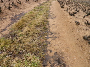
Trail Type(s): A series of four circuits, short, medium and long distances, circling out from Fleurie (in the Beaujolais district); trail surfaces partly paved, partly hard-packed, otherwise grass or earthen surfaces (sandy or compacted); Route(s) mostly marked.
Length(s):
Total: 4, 12, 16 and 25 kilometers/2.5, 7.5, 10, and 15.5 miles respectively
Convenient to: Lyon, France
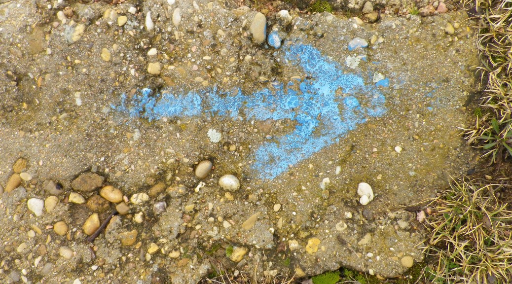
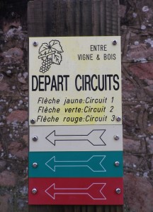
Marking: Colored rectangles (blue, for the four kilometer circuit; red for the 12 kilometer circuit, green for the 16 kilometer circuit, and yellow for the 25 kilometer circuit.), some with arrow to indicate direction; and sometimes a square placard with the words “Entre Vignes et Bois” and a bunch of grapes and a grape leaf.
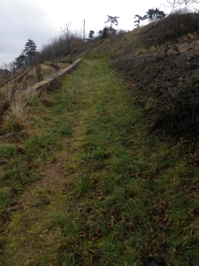
Trail Description: These trails meander through vineyards and woods, ascending some inclines as it reaches its highlight (and highest spot), the lookout point atop the heights of Remont. They either go directly through or around the village of Fleurie and its renowned Beaujolais vineyards. Other than this little community, this circuit traverses rural areas exclusively.
Trailhead:
Official: Fleurie, Place de l’Eglise
Note: Only the short blue circuit and the long distance yellow circuit actually pass through the Place de l’Eglise. All four circuits intersect about 250 meters/275 yards north, along D68.
Parking Possibilities:
Fleurie: Rue de la Mairie, a medium-sized parking lot behind the town hall (Mairie)
Public Transportation Options:
Rail: The Dijon-Macon-Lyon lines serves the Romaneche-Thorins stop, about a mile from the trail. See http://www.sncf.com/fr/gare-de-romaneche-thorins-FRHGX
Suggested Stages: Not applicable
Trail Itinerary-Reference Points (for the blue circuit only): (clockwise: for the blue circuit only)
Fleurie: Place de l’Eglise-R des Labeurons, left onto an unnamed road just after the Gendarmerie/police station at “Le Tari”; “La Madone”, through vineyards below the chapel to cross D32, and enter more vineyards at “Les Vaux”. The trail meanders behind, then over the hill “Montgenas” through the tiny woods, head towards “Les Rocheaux”, then “Le Ruisseau” along D68, past a sign for a town recycling point (point proper), continue into town and the start point.
Representative Trail Photo:
Restrooms:
Fleurie: Rue de la Mairie, in the parking lot behind the town hall
Attractions on or near Trail:
Romaneche-Thorins: Hameau DuBoeuf (of the Duboeuf Beaujolais wine family), a vinicultural, viticultural and historical museum, café, and gift shop. A popular stop in this area, it is open for long hours every day of the year except Christmas.
Tasting along the Trail:
Fleurie: Cave du Producteurs/de Fleurie, Domaine de la Madone are the closest to the trail and have good hours.
Alternative Options:
Hiking: The circuit described in the itinerary is the shortest, but the other three are also available and are longer.
Running: Possible along all, but short, unstable or rough terrain exists along segments of this circuit.
Car: Two car routes explore this area, and more. They are the long (140 km) Route des Vins du Beaujolais, and the shorter Circuit Maconnais-Beaujolais, part of the Routes des Vins de Bourgogne system.
Additional Information:
Regional: For regional wine tourism ideas, see http://www.beaujolaisvignoble.com/ and http://beaujolais.com/cartographie.php?page=DT1222852935&lang=fr&codej=france&time=20120327103222
Trail (segment) specific: See http://www.beaujolaisvignoble.com/randonnees-communales.html and select “Circuits pedestres Fleurie”
Comments:
This circuit is one of four circuits of the Entre Vignes et Bois (Along Vines and Woods) series, laid out by the village of Fleurie.
Follow this circuit clockwise to maximize identifying and following the signage markings! For maximum orienteering, print out and carry the free, downloadable map of the circuit (from the trail link above) which identifies the key terrain points.
The train to/from Lyon takes about 45 minutes, stopping in Romaneche-Thorins, the closest, and largest town in the area, about 3 times a day on average, so plan ahead to avoid delays or lengthy transfers.