Trail Name: De Tour en Grotte (southern half only)
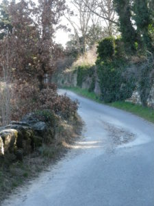
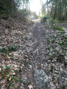
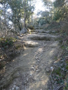
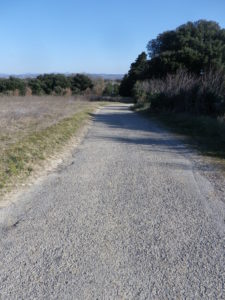
Trail Type: Short distance circuit trail; well-maintained and almost exclusively hard-surfaced, either tarmac, earthen or rock surfaces, marking on the trail rather good throughout the southern half. (See comments below)
Length:
Total – 20 kilometers
My segment – @9 kilometers
Convenient to: Grignan, France
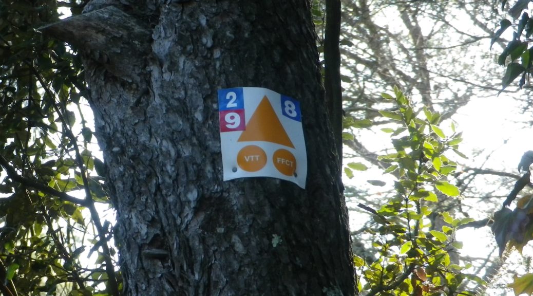
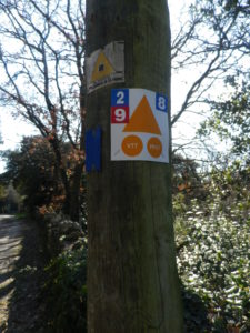
Marking: A white 2 on a blue background, accompanied by the VTT (mountain bike) symbol: a triangle (orange) with two same-colored circles.
Trail Description: A mostly easy and usually flat trail past lavender fields and vineyards, through woods and villages, in quiet, little trafficked countryside.
Trailhead:
Official: See comments.
Mine: Chamaret, intersection of D71 x D471
Parking:
Chamaret: D71, by the Mairie, or behind the school opposite the Mairie.
Public Transportation Options:
Bus: Cars Region, Auvergne-Rhone-Alpes, services the area between Grignan and Nyons, and the outlying villages around each. As of March 2019, see https://www.auvergnerhonealpes.fr/91-cars-region.htm for schedules.
Suggested Stages:
Since this circuit pinches in on itself at Chamaret, mountain bikers could elect to do either the southern half of this circuit (about 9 kilometers) or the slightly longer northern half (about 11 kilometers).
Trail Itinerary-Reference Points: (Clockwise) (Southern half only)
D471/Ave de la Gare, right onto lane just before traffic calming bumps, Chemin de la Rouselle (just to the side of surmounted iron cross), past lavender field on left, following same road, known as Les Puits; at bend, go left onto Le Clos des Serrieres, cross Saint Martin, follow around a copse, onto Les Gravieres, Le Lez-Les Souteras; Les Souteras-Les Evrabes; cross a narrow wooden bridge, climb uphill; Mont-Segur sur Lauzon: Les Chamblas, right at signpost Les Chamblas x Chemin de Chomelle; Chamaret: Les Chamblas et Everrunes; woods, Les Eyrieux, left at intersection Les Eyrieux x Fontaine Jeugne, continue left following Les Eyrieux, go straight across D71, Les Basses Buisses, left onto Les Puits to enter town (on lane named Rue de la Grando Font), just west of D71/Grande Rue.
Representative Trail Photos:
Restrooms:
None observed
Attractions on or near Trail:
None wine related, but great scenery, and quiet villages and castles to explore.
Tasting along the Trail:
Chamaret : Domaine Guiton
Grignan (a few kilometers away, but close to the northern half of the trail): Cave des Vignerons de Grignan les Adhemar, Domaine Passion d’une Femme.
Alternative Options:
Biking: Lots of trails, to include the wine-themed, extremely family-friendly, Des Vignes et des Cabanons, a 10-kilometer circuit trail around the fields and vineyards of Grignan. See the links below to find this and other trails in “Drome Provencale”.
Car: Route des Vins de la Drome Provencale, an itinerary of over 75 kilometers focusing on the vineyards, as well as olives and lavender, in the region. https://www.routes-touristiques.com/medias/files/carte-et-vigneron-sur-la-route-des-vins-cotes-du-rhone-drome-provencale.pdf
Additional Information:
Regional: https://www.grignanvalreas-tourisme.com/
Trail specific: https://www.ladrome.fr/nos-actions/sports/sports-de-nature/bons-plans-sports-de-nature (Below the interactive map, scroll down to find detailed trail information (around #274).)
Comments:
The De Tour en Grotte is a 20 kilometer/12 mile mountain-bike circuit trail. Unfortunately, I had no bike that day, so I had to hike instead, and completed only the southern half of the trail, starting where the circuit pinches in on itself in Chamaret. The full trail begins and ends in nearby Grignan, at the municipal outdoor swimming pool on Route de Montelimar/D 541. See the trail link above for full trail details.
The information above on the itinerary and trail conditions pertain only to the southern half of the trail.