Trail Name: Anello del Prosecco (Prosecco Circuit)
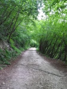
Trail Type: A short to medium distance circuit; very diverse surfaces (asphalt, trackless, cart trail, dirt), somewhat maintained; the route itself is marked diversely, and sometimes not at all.
Length:
Total – 15 kilometers/9.33 miles
Segment – 8.5 kilometers/5.25 miles
Convenient to: Valdobbiadene, Italy
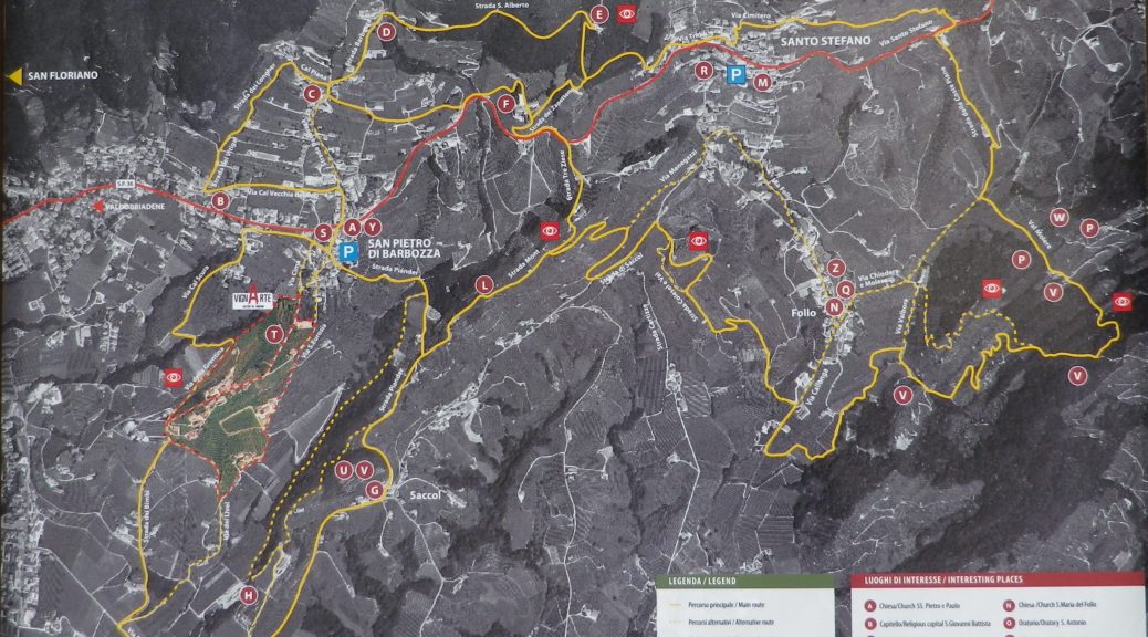
Marking: Varies, sometimes following different CAI numbered paths (1019, 1014), and the occasional large iron stands with yellow and white signs waxing poetic on the wines and vines of the area.
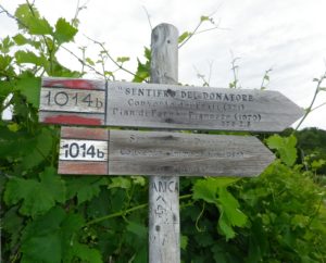
Trail Description: This hilly trail meandered from village to forests to vineyards to abandoned old fields, while providing outstanding distant views of the Veneto, and close-up views of the Cartizze, a geologically fascinating bowl of mounds, home to some great Prosecco vintages.
Trailhead: San Pietro di Barbozza, eponymous Piazza
Parking: Piazza San Pietro di Barbozza
Public Transportation Options:
NO train service to San Pietro, and no bus service observed. However, Mobilita di Marca services the general area.
Suggested Stages:
A hundred meters/yards below the church of Sant’Alberto, this trail may be cut in almost half, by continuing downhill on Path 1014b. (Look closely for the 1014b path signboard to Convento Immacolata.) To complete the full path though, continue into Santo Stefano.
Trail Itinerary-Reference Points:
San Pietro di Barbozza, eponymous Piazza, town center, V S. Pietro-V. Cal Vecchia del Col; Strada di Vitigal, Strada di Longhe, Via Cal Piana, Strada Volpere; Path 1019, Oratorio S. Antonio, Monte Cesen path; Church/Hermitage Sant’Alberto; Path 1014 (descending); Monastery Frati Minori Conventuali, Immacolata di Lourdes convent church; SP 36 (Zanetton/S. Pietro) toward Combai; Right onto Via Treziese, hostelry; Strada Mont (along the crest); sign for path 1019, vineyards, Strada Piander (descending to/through Saccol); Saccol: past Orario di S. Gottardo on Via Roccat et Ferrari; Via dei Bimbi- Via della Cima
Representative Trail Photos:
Restrooms: None observed
Attractions on or near Trail: None observed
Tasting along the Trail:
Hikers will encounter several wineries along the trail where tastings are possible.
Alternative Options:
Car: The tourist route Strada del Prosecco covers many small towns and villages between Valdobbiadene and Conegliano, where most of the Prosecco wines are produced, and is roughly 90 kilometers in length.
Additional Information:
Regional: https://www.marcadoc.com/strada-del-prosecco/
Trail (segment) specific: https://www.coneglianovaldobbiadene.it/turismo/anello-del-prosecco-superiore/18/2
Comments:
An area remote from the most popular tourist destinations in the Veneto, (Treviso, Venice, or Asolo), it is best visited by car.
This circuit proceeds through a pleasant mix of forest, vineyard and urban (albeit village-urban).
The short version of this circuit is suitable for just about any weather, excepting extremes of cold, heat and very heavy rain. (Parts of it would wash out in a downpour, as we discovered shortly after completing it.)