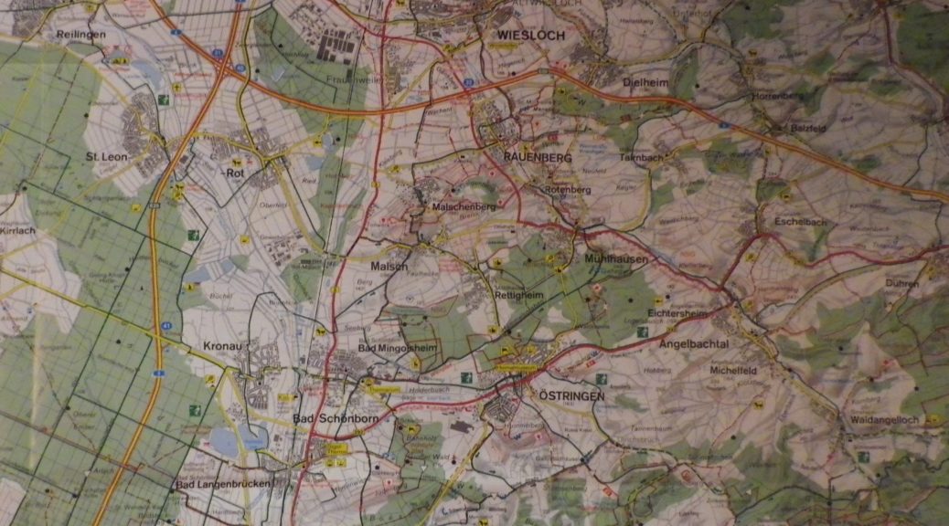
Trail Name: Weisses Gold und Traubensaft
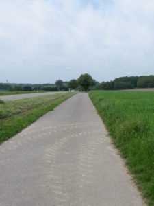
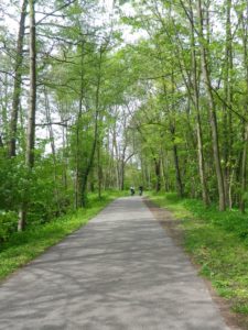
Trail Type: A medium-distance, themed bicycle circuit; almost exclusively paved, well maintained, but the route itself is not marked.
Length: Total: 49 kilometers/ 31 miles
Convenient to: Heidelberg, or Karlsruhe, Germany
Marking: None
Trail Description: This trail covers the agricultural fields and vineyards of this northern-most district of Baden’s wine region, the Kraichgau, following mostly on agricultural service roads, or bicycle paths. With only a small bit of incline, and mostly vehicle-free, this trail is ideal for a full-day family outing. While the trail passes through several towns, these are small, and don’t have much in the way of traffic, or tourism infrastructure.
Trailhead:
Wiesloch-Walldorf: Bahnhof/Impexstr
Oestringen: Industriestr (Freibad) (Exit 41/Kronau off A5)
Parking:
Muehlhausen: K4271 x Hauptstr
Public Transportation Options:
Bus: The VRN network services most of the town along the trail
Rail: Trains, both regional and strassenbahn (wide-ranging street cars) service Wiesloch, Waldorf, and St Leon-Rot/Malsch, from Heidelberg and Karlsruhe.
Suggested Stages: Not applicable
Trail Itinerary-Reference Points: (Counterclockwise)
Oestringen: Hauptstr (between Goethestr and Kraichgauer Weinstrasse/(292); Angelbachtal: B292/Bruchsalerstr-Hauptstr, along Schloss Eichtersheim Park-Friedrich-Hecker Str, bike path along Waldangelbach/or along Sportplatz, cross B39 below Penny Markt; along a bike path off Muehlstr; Muehlhausen: cross K4271 , on path, Hurstwiesenweg, bike path through much of town-Almenweg, Hauptstr, Untere Muehlstr; Rotenberg: Hofaecker-Weiherstr-Heiligenwiesen (still roughly parallels the Waldangelbach (creek)), Weinbergstr; Rauenberg: Weinstr-Dielheimerstr-Dammstr, bike trail, Dielheimerstr-Stockswiesen, traffic circle, Dielheimer Str-Stockswiesen, pass under A6, bike path; Wiesloch: Bognerweg-Johann-Philipp-Bronner-Str, Hauptstr, cross Ringstr, follow path west along Leimbach (creek), Gartenstr, Kurpfalzstr, Alte Heerstr, Walldorferstr, to train station; Walldorf: Wieslocherstr, Bahnhoferstr-Hauptstr-Hochholzerstr, bike path to Hasso-Plattner-Ring, under/over highways A5 and A6, bike path; Reilingen: Walldorferstr-Hauptstr, bike path through woods to Lusshardtsee, past Hofladen Kastel, Bruchhoefe, past the Angling Club, on Mingolsheimerweg trail to Goethestr.
Representative Trail Photos:
Restrooms:
Wiesloch-Walldorf, Staatsbahnhofstr, by the train station between the two towns.
Attractions on or near Trail:
Winzermuseum Rauenberg: A museum detailing the story of wine with an impressive collection in an impressive old building. Open only the first Sunday of the month though.
Tasting along the Trail:
Angelbachtal: Schloss Eichtersheim Heckerstuben im Wasserschloss,
Rauenberg: Hotel Weinstube Gutshof
Wiesloch: Winzerkeller Wiesloch
Reilingen: Besenwirtschaft Schell
Alternative Options:
Hiking: The 21-kilometer-long Weinwanderweg Mannaberg covers a wide circuit around Rauenberg, Rottenberg and Malsch. (See the nutshell here.)
Car: The Badische Weinstrasse covers some of these towns, and more
Additional Information:
Regional: https://www.badische-weinstrasse.de/Entdecken/Regionen-Orte/Kraichgau
Trail (segment) specific: http://biker-harry.de/2017/fototour2017.html?gpx=WeissesGoldUndTraubensaft.gpx&aid=WeissesGoldUndTraubensaft.json or http://www.gpsies.com/map.do?fileId=reewyyvyuplrqswp
Comments:
Very easy trail to cycle overall