Trail Name: Weinwanderweg Mannaberg
Trail Type: Long distance; well-maintained and almost exclusively paved or hard surface throughout, marking on the trail good in places, and missing altogether in others
Length:
Total – 21 kilometers/ 13 miles
Convenient to: Heidelberg, or Wiesloch, Germany
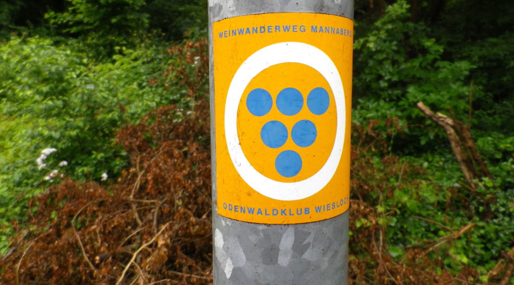
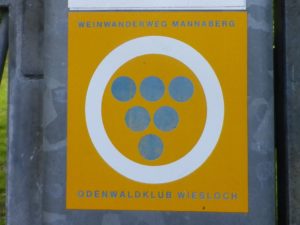
Marking: Blue grapes in a white circle on an orange background
Trail Description: This trail across the rolling ridges of the area, avoids most of the associated villages, and proceeds primarily through vineyards, although there are some wooded areas. It is fairly easy, in spite of the hills, and its well maintained, hard surfaces make it easy to traverse fairly quickly and comfortably.
Trailhead:
Official: Wiesloch: Bognerweg, by Winzerkeller Wiesloch
Mine: Rauenberg: Stockswiesen x Suttenweg, at the traffic circle
By Train: Malsch: near the high point of Letzenbergstr, at the Letzenberg Kapelle
Parking:
Rauenberg: Park and Ride lot, intersection of B39 and Wieslocher Strasse; otherwise, along the streets.
Malsch: Oberer Jagstweg, a limited number of spots along the street by the sports fields
Public Transportation Options:
Rail: Deutsche Bahn (DB) and Karlsruhe Verkehrsverbund (KVV) and Heidelberg local networks have trains servicing this area. The stop closest to the trail is Rot-Malsch.
Suggested Stages: Not applicable
Trail Itinerary-Reference Points: (Clockwise)
Rauenberg: Stockswiesen, under A6, follow the path to Winzerkeller Wiesloch; Wiesloch: circle around Winzerkeller Wiesloch, Im Grassenberg, Vineyards; Dielheim: Follow Hauptstrasse under A6; Rauenberg: Weinstraße (pass upper end), vineyards and fields; Rotenberg: Obere Schloßstraße; Mühlhausen outskirts: Untere Muehlstrasse (end of GPX tracks and marking). (I went along Hauptstr/B39 and where it becomes Mühlhaeuserstr, turned into a path along the Altenbach stream, through woods and vineyards, and into Malsch); Malsch: Oberer Jagdweg, Sonnenweg-Letzenbergstr, Letzenberg Kapelle; Malschenberg: Cross Letzenbergstr, heading through vineyards to – Rauenberg: Malschenbergerstr (end of GPX tracks); I suggest Hauptstraße – Dielheimerstr to close the route, or alternatively, follow the path along the Waldangelbach creek to Eckertswiesen to Dieheimerstr.
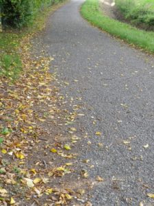
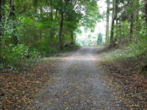
Representative Trail Photos:
Restrooms: None observed!
Attractions on or near Trail:
Rauenberg: Winzermuseum, housed in the buildings of the former palace of the bishops of Speyer, focuses on the lives and businesses of former inhabitants of the area, vintners and non-vintners alike.
Tasting along the Trail:
Several small wineries in the villages, especially Rauenberg and Malsch; as well as the Winzerkeller Wiesloch, a local cooperative, with generous opening hours.
Alternative Options:
Hiking: Weinpfad Kraichgau, a 65 kilometer-long trail from Wiesloch, in the north, to Weingarten in the south. The Weinwanderweg Mannaberg follows the northern-most portion of this trail.
Biking: Weisses Gold and Trauben Saft (White Gold and Grape Juice), a 45 kilometer/31 mile-long cycling circuit, covering this area and more. See details in the Nutshell here.
Car: Weinstrasse Kraichau-Stromberg is a 272 kilometer-long automobile route leading to or near to some of the area’s top producing villages and towns, as well as cultural attractions such as Cloister Maulbronn (a UNESCO site), Bruchsal’s baroque palace and church, and a Schnapsmuseum in Boennigheim.
Additional Information:
Regional:
Trail specific: http://www.wandermap.net/en/official/274599-weinwanderweg-mannaberg/#/z15/49.2761628,8.7058926/terrain
Comments:
The trail link above provides GPX coordinates for about 14 of the 21 kilometers of this trail. This leaves hikers to make their own way through Malsch and Rauenberg; as well as close the loop from Muehlhausen to Malsch, going through the intervening forest.
Parking was a bit tricky. It was available along the streets of the towns, but public parking lots seemed in short supply.