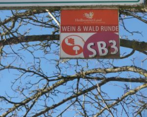
Trail Name: Wein & Wald Runde (Wine and Woods Circuit) (AKA: SB3)
Trail Type: Mid-distance cycling itinerary circuit; well-maintained, with much of it paved, and well-marked, along most of the itinerary route
Length:
Total – 28 kilometers/17.4 miles
Convenient to: Heilbronn, Germany
Marking: SB3 and trail name letters in white on a colorful square metal sign
Trail Description:
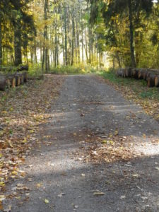
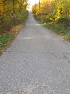
A middle difficulty, half-day tour cycling itinerary (if including a couple of stops), this circuit has hills and dales, villages and vines, and almost half of it traverses forests, providing shade and constantly changing scenery to admire along the (largely) car-free way!
Trailhead:
Abstatt: Sportplatzstrasse x Beilsteinerstrasse
Parking:
Abstatt: Sportplatzstr, by the city park, a few dozen parking spaces, but it is a popular spot for parking
Abstatt: Im Mitteltal, and by the intersection with Schozachstr (not far from Zur Kirschenwiese Restaurant), several unimproved parking areas, such as small lots and parallel street-side parking
Public Transportation Options :
Rail: Deutsche Bahn serves Heilbronn, the closest city to the itinerary route. From there, use the HVN buses, details below.
Bus: HVN (Heilbronn – Hohenloher – Haller Nahverkehr) buses 645, 646 and 648 serve this area.
Suggested Stages: Not applicable
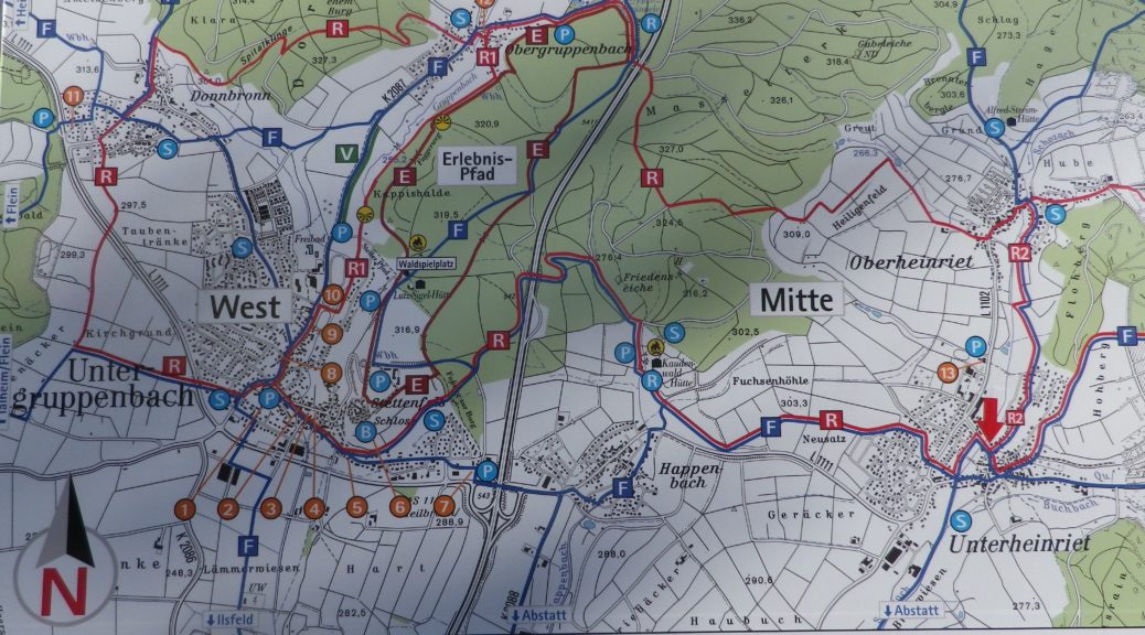
Trail Itinerary-Reference Points: (Clockwise)
Abstatt: Sportplatzstr. Schrebergarten, Tummelwiesen, path past pond, through fields; Unterheinriet: playground, (cross Abstatter Str), Kernerstr, Oberheinrieter Str, Nordstr, Heumadenstr to path; Oberheinriet: Schwalbenstr, Am Lerchenberg, Lehrensteinsfelder Str; Path through vines and woods to Hagelsberg, (cross L1102/Heinrieter Str); Roemerweg path through woods; Reisbergbruecke (over A81), through woods toward but not to Grillplatz Waldheide, then follow the path along the Donnbronner stream; Donnbronn: Jaegerhausstr, Kelteraeckerstr, Rieslingstr, Fleiner Str; path between woods and vines, then fields, past Leberbrunnensee; Flein: Erlachstr, sharp turn onto Ochsenbergweg (toward Ilsfeld, Eselsberg and vineyards); Cross K2155, Erich Mueller Weg, Engelsberghoefe; Ilsfeld: Landturm; Wuestenhausen: Roemerstr, Stettenfelserstr; circle around through fields and woods to the A81 underpass; Abstatt: fields, cemetery, Birkenweg, Benzengasse, Untere Drittelgasse
Representative Trail Photos:
Restrooms:
Abstatt: Townhall (Rathaus), open during workday open hours
Attractions on or near Trail:
Abstatt: Heimatmuseum Abstatt, has a collection of items from daily life in earlier times, to include displays on local viti and vini-culture.
Unterheinriet: While cycling past, take a look at the old press-house (now a town library and community house), where 3 wine presses once served, opposite the church, on Kirchenstrasse.
Tasting along the Trail:
Although plenty of taverns and pubs may be found on the way, Abstatt and Flein have the most opportunities for purchasing bottles and glasses of local wine.
Alternative Options:
Hiking: The SB1, Schozachtaler Burgen-Wein Wandern circuit trail, is a 54 kilometer/33.5 mile, multiday itinerary passing along or near much of this itinerary.
Car: The Wuerttembergische Weinstrasse, a self-drive, wine-themed route, drives past some of these towns, and many others in this corner of Wuerttemberg.
Additional Information:
Regional: https://www.heilbronnerland.de/de
Trail Specific: https://www.heilbronnerland.de/de/radfahren/radtouren/rundtouren/sb3-wein-wald-runde
Comments:
Forested areas/trails can be closed (especially during late fall), when tree-cutting occurs.