Trail Name: Wein-Barock
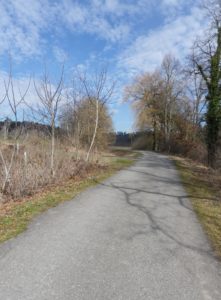
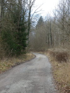
Trail Type: Mid-distance circuit trail; almost exclusively paved, well maintained, but the marking along the route, while excellent, is not trail specific. (See the Itinerary below for specific itinerary points.)
Length: total: 10 kilometers/ 6 miles
Convenient to: Konstanz, and Friedrichshafen, Germany
Marking:
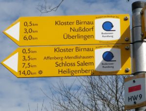
Yellow rectangular signs with black lettering, indicating direction to major itinerary points. (Not trail specific)
Trail Description: A circuit designed for families, with very gentle inclines, and mostly even, hardened surfaces, that weaves through diverse landscapes, such as woods, fields, shoreline, villages, and of course, vineyards. Hikers are rewarded by far-reaching views of the lake, and distant mountaintops in Switzerland, on clear days.
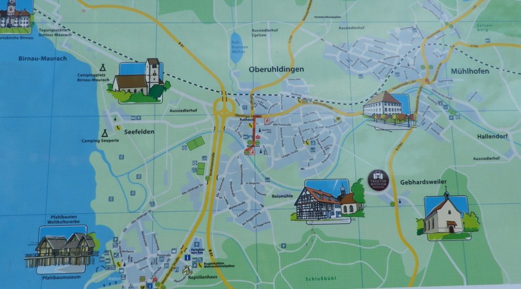
Trailhead: (Ober)uhldingen: Aachstr x Linzgaustr (AKA: Marktplatz)
Parking:
In the Oberuhldingen locality: Aachstr x Linzgaustr (AKA: Marktplatz) (Small section closed off on Thursdays for the market)
At the Birnau locality: fee parking
At the Seefelden locality: cemetery
Public Transportation Options:
Bus: The Deutsche Bahn (DB) Regio Alb-Bodensee bus line runs regularly scheduled buses to connect Unter- and Ober- uhldingen with Meersburg and Friedrichshafen.
Rail: Regional trains link Uhldingen-Muehlhofen (Oberuhldingen locality) with the major town of Friedrichshafen to the east and Radolfzell to the west.
Ferry: Ferries are a major source of transportation in this area, linking Konstanz with Lindau, as well as linking with Bregenz, Austria, and the Swiss shore opposite. See the websites for Stadtwerke Konstanz (https://www.stadtwerke-konstanz.de/schifffahrt/faehre-konstanz-meersburg/fahrplan/?no_cache=1), and for the Bodensee Schiffsbetriebe (BSB) (http://www.bsb.de/en/timetable-one.html), among other, seasonal lines.
Suggested Stages:
Trail Itinerary-Reference Points: (Counterclockwise)
Oberuhldingen: Aachstr to Rathaus, Tuefingerstr, railroad underpass, toward Kloster Birnau, passing Egelsee pond; Praelatenweg, Birnauer Oberhof, Narrow way under B31, passing Kloster Birnau, downhill toward Schloss Maurach; toward Seefelden, passing a campground and St Martin’s church and cemetery, follow toward Meersburg/Unter-, Ober- Uhldingen, following along the Aach back toward village, road underpass, Im Oschle.
Representative Trail Photos:
Restrooms:
Kloster Birnau: (east of the church (small fee))
Oberuhldingen: Aachstrasse x Im Oschle
Attractions on or near Trail:
Salem: This nearby town has the Schloss Salem Winery set in a compound with a splendid Baroque abbey and palace.
Tasting along the Trail:
Uhldingen-Muehlhofen: Bauernhof Moeking (Closed in winter)
Uhldingen-Muehlhofen: Birnauer Oberhof (Closed in winter)
Salem: Weingut Schloss Salem. (Not on the trail, but relatively close by car, and source of the Birnauer Oberhof wines referenced above.)
Alternative Options:
Running: Entire trail may be run easily
Additional Information:
Regional: https://www.bodenseekreis.de/landkreis-tourismus/
Trail (segment) specific: http://www.outdooractive.com/de/wanderung/oberschwaben-allgaeu/aussichtsreiche-wein-barock-wanderung-zur-basilika-birnau/1532869/#dm=1
Comments:
Baby carriage accessible throughout!