Trail Name: Vignoble de Collioure
Trail Type: Short distance circuit; well-maintained and mostly hard surfaces (paved or hard-packed), with some rocky areas, good marking on the trail
Length: Total – 9.6 kilometers/ just short of 6 miles
Convenient to: Collioure, Perpignan, France
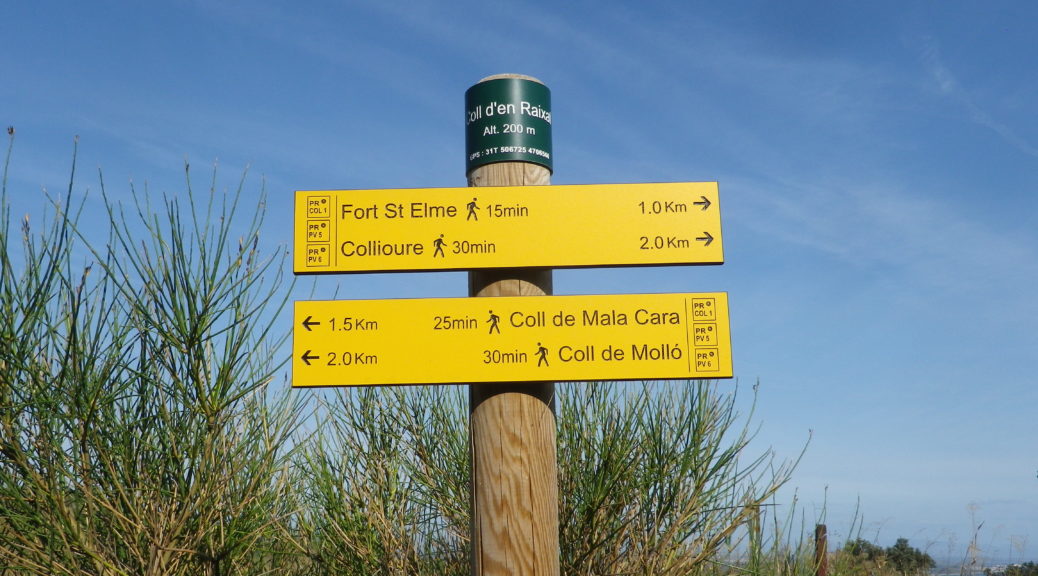
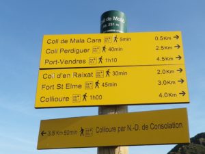
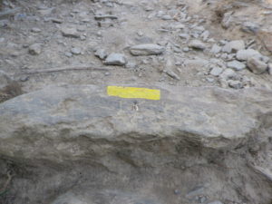
Marking: Yellow rectangles on the trail, reinforced with signposts identifying the exact location. (See the white lettering on top of the post.)
Trail Description:
A circuit best done in the early hours, or cooler seasons, this relatively easy trail provides lots of impressive scenery of mountains, sea and vines, and takes hikers past Collioure’s port and castle.
Trailhead: Train Station to Place General Leclerc, Collioure
Parking:
R. de la Democratie, medium sized lot;
Place du 8 Mai 1945, Quai de l’Amiraute;
Port Plaisance
Public Transportation Options:
Rail: SNCF provides rail service from Perpignan
Bus: Not applicable
Suggested Stages: Not applicable
Trail Itinerary-Reference Points:
Collioure: R. de la Republique, R. du Temple-R. de la Galere-Chemin de Consolacio-Route de Consolation, pass under D914; vineyards and scrub to Col de Mollo, Coll d’en Raixat, Fort du Gommier, heading toward Fort Saint Elme, onto Cami du Fort de Saint Elme, past the Moulin de Collioure (old wind mill); Collioure: down steps by hotel de Trois Mas to seaside walk, D114/R. de la Democratie, around Chateau Royal de Collioure, Avenue Camille Pelleton
Representative Trail Photos:
Restrooms: Collioure – Place du 8 Mai 1945
Attractions on or near Trail:
Tasting along the Trail:
As the trail meanders through town, there are many bars, and a couple of wineries not far off it.
Alternative Options:
Hiking: Four short balades (strolls) within the town, one focusing on a “Gourmet” food and wine experience. See the city tourism office for the map.
Biking: Much of this trail also served as a mountain bike trail.
Car: Routes des Vins de Roussillon, one of which passes through Collioure and nearby Banyuls
Additional Information:
Regional: http://www.collioure.com/
Trail (segment) specific: http://www.randogps.net/randonnee-pedestre-gps-po-66.php?num=45&meta=VIGNOBLE%20DE%20COLLIOURE
Comments:
Parking fills quickly in Collioure, especially in the summer I would imagine. Also, beware that some lots have time limits, and others require payment.
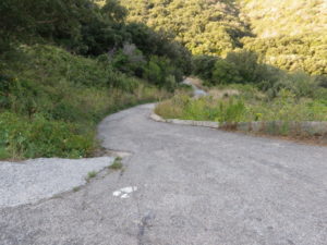
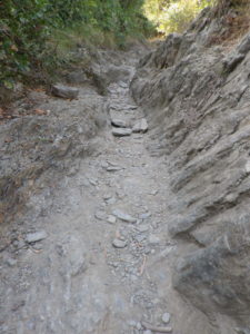
The final section, on Cami del Sant Elme, above the windmill, can be challenging in all but robust shoes. See the photo.
There is virtually no shade along the trail unless hiking very early, or very late in the day.