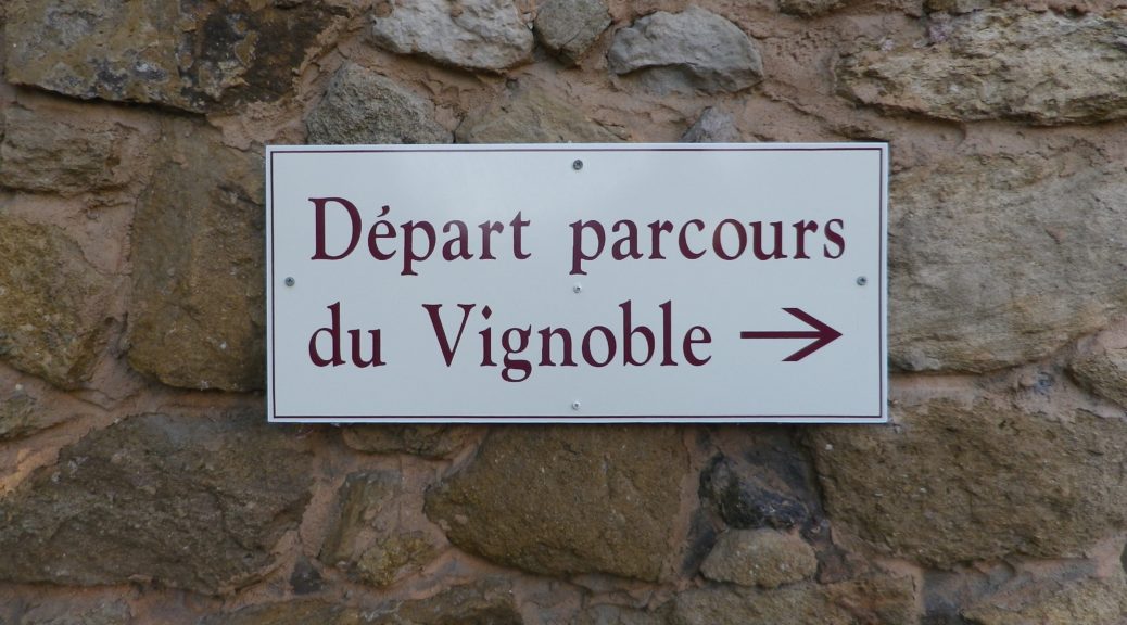
Trail Name: Parcours du Vignoble de Vacqueyras
Trail Type: Short distance; surface is mostly paved, with some grassy stretches; fairly well maintained, and fairly well marked.
Length: 8 kilometers/5 miles
Convenient to: Orange or Carpentras, Vaucluse, France
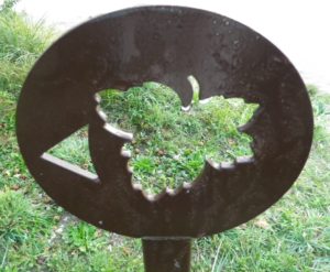
Marking: Grape leaf cut-out on a square rust-brown sign; 17 panels
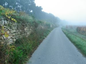
Trail Description: A very gentle wine-education circuit walk through the vineyards of the famous wine village of Vacqueyras. The terrain is mostly flat, and the vineyard area all-encompassing. Nonetheless, areas of field and woods, and the charming old town provide variety, as you learn about Vacqueyras wine along the trail. (The signboards are in French and English.)
Trailhead:
Vacqueyras: Place Pousterle x Cours Stassart x Chemin Neuf
Parking:
Vacqueyras: Chemin Neuf (Two separate lots near La Poste.); Place Pousterle; Chemin du Moulin x Montee de Bellevue.
Public Transportation Options: None Convenient (School bus connects Seguret, Gigondas, Vacqueyras, Beaumes de Venise and Carpentras: www.transcove.com)
Suggested Stages: Not Applicable
Trail Itinerary-Reference Points: (Counterclockwise)
Vacqueyras: Place Pousterle x Cours Stassart x Chemin Neuf, right onto unnamed street at the wash hut, La Riaille, large gated villa, vineyards, Domaine Maitre Curnier, Chemin des Abreuvoirs, La Ponche complex, Chemin de Fontbonne, Font Bonne hamlet; vineyards, Orientation Table, vineyards, Chemin des Aires, Chemin du Moulin, (Additional segment: Chemin de la Blouvarde, Descente des Leques – to the Espace Botanique), Montee de Bellevue.
Additionally, the educational signboards are numbered 1 – 17 as you go (counterclockwise) along the trail.
Representative Trail Photo:
Restrooms:
Vacqueyras: Chemin Neuf (in the parking lot)
Attractions on or near Trail:
City walls, old churches, wells and fountains, old Vaucluse is on view here.
Tasting along the Trail:
Caveau du Vacqueyras, Cours Stassart
Clos des Cazaux, Chemin de la Blouvarde
Arnoux et Fils, Place Pousterle x Montee de Bellevue
Cave de Vignerons de Caractere, R. de Vaison: While not directly on the trail, this large cave has open tours and tasting opportunities
Alternative Options:
Running: This entire trail is easy to run.
Car: Route des Vins des Cotes du Rhone, covers this village and more.
Additional Information:
Regional: http://www.vacqueyras.tm.fr/
Trail (segment) specific: https://www.provenceguide.com/equipements/cote-rhone/circuit-pedestre—parcours-du-vignoble-de-vacqueyras/provence-4610381-1.html
Comments:
Not much shade on the trail, which can get warm, even in November! I suggest hiking this trail before noon in any event.
While fairly well-marked, the signs can be hard to see, as they blend in well with the terrain. However, there are two places where marking is noticeably absent, and one place where it varies from the map (by La Ponche). Photograph the trail map at Place Pousterle to aid navigation along the trail.