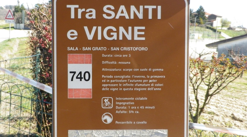
Trail Name: Tra Santi e Vigne (Amid Saints and Vineyards)
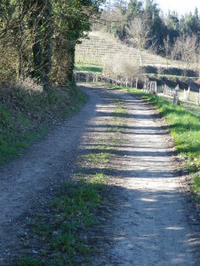
Trail Type: Short distance trail, in the Piedmont region of Italy; varied trail surfaces from paved, to hard-pack, to grass, to soft sand or mud, somewhat maintained, but the route itself is not sufficiently marked to follow without a map or GPX coordinates.
Length: total – approximately 9 kilometers/ 5.5 miles
Convenient to: Asti, or Casale Monferrato, Italy
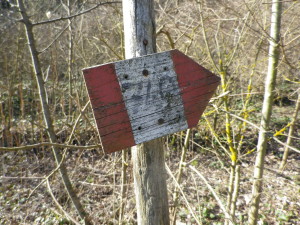
Marking: Both a trailhead sign and rectangular signs with red and white stripes overwritten “740”
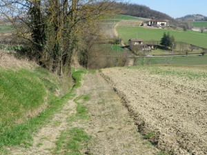
Trail Description: This trail climbs up and down the gentle hills surrounding the village of Sala Monferrato. It passes through fields and vineyards, by old farmhouses (Cascina), and chapels and shrines. It also passes through the occasional wood, or along a tree line, thus providing some shade. The views of the gentle foothills, often capped by a castle or hilltop village, and the views of the distant Alps predominate.
Trailheads:
Depart: Sala Monferrato. SP 41 x Via Ca de Franchi
Arrive: Sala Monferrato, SP 35
Parking: Sports fields, by Via Ca de Franchi
Public Transportation Options:
Bus: The Autoticino Autobus company serves Sala Monferrato from Casale Monferrato mostly daily, and on a regular basis throughout the day.
Suggested Stages: Not Applicable
Trail Itinerary-Reference Points: (Clockwise)
Sala Monferrato: SP 41 (to Cella Monte) x V. Ca de Franchi; downhill across fields-along tree line; turn left on asphalt road uphill to Ca Bonelli; follow to S. Gregorio (farmhouse); in treeline to SP 37, (cross at) Ottiglio: Cascina Zonchi/Rampino (on map), follow to, then left at, chapel S. Grato; Cascina Crosia, Cascina and oratory of S Cristoforo; pass farmhouse Colonia; head down steep hill; cross SP 35, then stream, continue uphill, turn right onto a grassy embankment just before the first intersection; at sharp turn left signs, turn right and uphill on a shrub-lined country path into the village; V. Roma-SP 35, Sagrato (churchyard) of San Francesco (the highest point in the village); (To complete a circuit, follow SP 35 downhill from V. Roma to SP 37/V. Ozzone to either V. Cella Monte/SP 41 or V. Ca de Franchi (fewer cars).)
Representative Trail Photos:
Restrooms: None observed
Attractions on or near Trail:
Cella Monte: Ecomuseo Pietra da Cantoni, Piazza Vallino: a museum on the wine caves carved into the special, underlying bedrock of the area, known locally as Infernot. (Check for hours!); and three Infernot: Casaccia, Ca Nova, and Satti.
Tasting along the Trail:
Marco Botto Winery: Great wines and enthusiastic owners right at the trailhead in Sala Monferrato
Alternative Options:
Running: Doable, but very uneven footing in places.
Biking: Terre di Vino e Pietra da Cantoni, a 49-kilometer trail, over a third of which is on very lightly trafficked trails.
Additional Information:
Regional: http://www.astigiando.it/ www.mymonferrato.it
Trail (segment) specific: (Includes a map)
http://www.parcocrea.it/camminare/002.pdf
Comments:
Technically, this is not a circuit, as the start is about three/quarters of a kilometer/less than half a mile from the end of the trail. But it is easy enough to follow from Via Roma x SP 35 down to V. Ozzone/P 37 to return to the start on V. Ca de Franchi.
This trail offers a nice variety of terrain, and amazing views of the distant Alps.
Definitely need the map (and strongly suggest google-earth recce if relying solely on the map). Otherwise, use GPX coordinates. While the trail is marked in places, there are definitely junctions that require either superior map-reading skills, or GPX coordinates.
Kudos to the hiker who uploaded the wikiloc GPX coordinates I downloaded: They were spot-on!