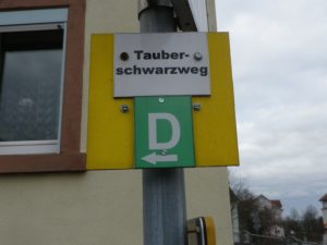
Trail Name: Tauberschwarzweg
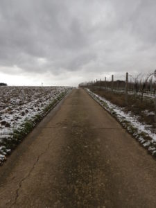
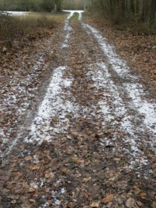
Trail Type: Mid-distance circuit trail; well-maintained and about half is paved, the other surfaces are grass and earthen; marking on the trail is somewhat good, but a map is strongly advised.
Length: circa13 kilometers/8 miles (See comments below)
Convenient to: Wertheim, or Wuerzburg, Germany
Marking: The capital letter “D”
Trail Description: A moderately easy trail through urban, woodland and vineyard landscapes, with diverse surfaces and views throughout this rural area of the middle Taubertal.
Trailhead:
Official: Beckstein: Geisbergstrasse
Mine: Lauda-Koenigshofen: Badstrasse, (accessing the trail via a short uphill trek through fields)
Parking:
Lauda-Koenigshofen: Badstrasse
Beckstein: Weinstrasse (follow the street uphill to the plateau), a Wanderparkplatz (hiking parking), in the tree line at the top.
Public Transportation Options:
Rail: Deutsche Bahn Regio serves Lauda-Koenigshofen, with the stop in Lauda (on Bahnhofstrasse), being the closest to the trail.
Bus: VGMT (VerkehrsGesellschaft Main-Tauber) serves this area with frequently scheduled buses, connecting Beckstein with Oberlauda and Koenigshofen
Suggested Stages: Not applicable
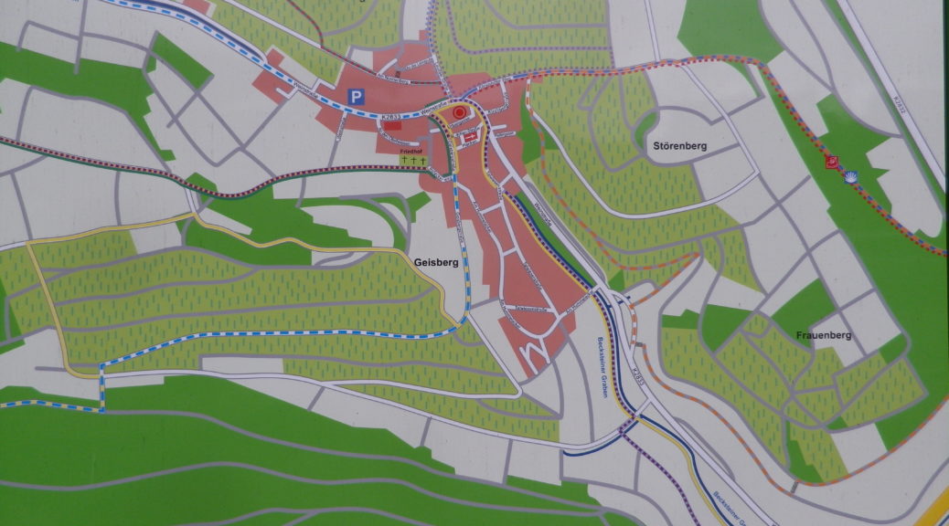
Trail Itinerary-Reference Points: (Counterclockwise)
Beckstein: Geisbergstr, Weinstr, Am Nonnenberg, through fields, then woods; Lauda: through fields just above the end of Eichweg, Eichwaldstr, Oberlaudastr, Weinbergsweg, Altenbergstr, Vineyards above Oberlauda; Oberlauda: Rosenbergweg, Schulstr, Vorstadtstr, along creek; into woods, uphill to plateau; Beckstein: a wanderparkplatz (hiking parking), cross Weinstrasse, fields, past a large water basin, Hofackerweg
Representative Trail Photos:
Restrooms: No public ones observed along the trail
Attractions on or near Trail:
Becksteiner Winzer, in addition to wine has events, and informative displays about the viniculture and viticulture of the area.
Becksteiner Weinlehrpfad (Beckstein Wine Nature Trail), a short, 1.5 kilometers trail with informative panels about Beckstein’s vinicultural and viticultural practices
Tasting along the Trail:
Weinhaus Ruthardt, Josef Schmitt Strasse 15, Lauda-Koenigshofen; and Weingut Benz, Am Nonnenberg, and Becksteiner Winzer, both in Beckstein
Alternative Options:
Hiking: Beckstein has the Suedliche Weinbergsrunde/Wanderweg 3 (Southern Vineyards Circuit), at 3.1 kilometers. A longer trail (6.8 kilometers) covering some of the same area, plus the village’s northern vineyards, is the Becksteiner Hohenweg/Wanderweg 4.
Additional Information:
Regional:
https://www.lauda-koenigshofen.de/tourismus
https://www.weinort-beckstein.de/
Trail specific:
Comments:
Difficult to find information on this trail. Marked as D on the trail. Listed as 15 kilometers, but the downloaded gpx from the temperamental trail link above, which followed the markings, had only 12.83 kilometers of trail.